
Iwo Jima, a member of the Volcano Island group, lies about a hundred nautical miles southwest of the mid-point of the direct air route between Saipan, in the Mariana Islands, and Tokyo. It is about seven-hundred miles from the Japanese islands of Kyushu and Shikoku, as well as the southern half of Honshu. Based on Iwo Jima, P-51 fighters and B-24 bombers could conduct useful combat missions over a large fraction of Japan, while the larger B-29 bombers could reach targets throughout the country. Iwo Jima is also the only island in the region with sufficient flat land for the airfields required to support a meaningful quantity of such aircraft.
In American hands, Iwo Jima could contribute significantly to an air campaign against Japan, and make possible emergency landings by damaged or malfunctioning bombers. In Japanese posession, it facilitated fighter interception of B-29s en route from the Marianas to Japan, thus forcing the bombers to fly a longer route for their own safety. In addition, it supported counter-raids on the Americans' Marianas airfields. General Henry H. Arnold, the U.S. Army Air Forces' commander, was an early advocate of capturing Iwo Jima and, by the beginning of October 1944, the island was targeted for invasion early in the following year.
This useful, geologically active (its name means "Sulfur Island" in Japanese) speck of land is just under five nautical miles long, measured along a north-northeasterly axis, and about two-and-a-half nautical miles broad in its northern part, with a total area of some eight square miles. Its most prominent terrain feature is the volcanic cone of Mount Suribachi (labeled "Hot Rocks" in the Iwo Jima operation plan), rising some 550 feet above the sea at the southern end. At Suribachi's base, Iwo Jima is about 800 yards across, and is relatively flat and smooth for a few miles to the northward. Weather permitting, the beaches on both shores in this vicinity can be used by beaching craft and amphibious vehicles, though the shoreline and inland area is covered with loose volcanic ash -- too soft and yielding for convenient human and vehicular traffic. The island's northern area is rocky and rugged, with a shoreline unsuitable for landings and an interior of hills, ravines and other broken ground. Iwo Jima's surface rock, both in the north and at Mount Suribachi, is soft enough to facilitate tunneling.
By late 1944, the Japanese had completed two airfields and had begun a third. They were vigorously fortifying the island, preparing an interlocking network of tunnels, trenches and deep caverns. Covered gun positions were carved into Suribachi's slopes and the northern area and, where the native rock was inadequate for such works, reinforced concrete blockhouses were erected. Artillery, mortars and machine guns dominated all potential landing beaches. More than twenty-thousand troops manned these formidable defenses. With good reason, Japanese Army Lieutenant General Tadamichi Kuribayshi, Iwo Jima's commander, considered that his well-protected and highly-motivated men could defeat an invasion attempt by superior ground forces, even when the latter were supported by seemingly overwhelming air and sea power.
This page features, and provides links to, all the World War II era maps we have of Iwo Jima, plus selected wartime aerial photographs showing all or a large portion of that island.
Note: Many of the images presented here are also featured in other pages of the Online Library's Iwo Jima Operation series.
For more wide-area aerial photographs of Iwo Jima, see:
For other pictures concerning the Iwo Jima Operation, see:
| If you want higher resolution reproductions than the Online Library's digital images, see: "How to Obtain Photographic Reproductions." |
Click on the small photograph to prompt a larger view of the same image.
|
Photo #: NH 104135 Iwo Jima Operation, February-March 1945 "Relief Map of Iwo Jima --- U.S. Navy carrier pilots were briefed for their strikes against Iwo Jima through the use of detailed relief maps such as this one". Quoted from the original photo caption, filed 6 April 1945. Mount Suribachi, at the island's southern end, is in the lower right. The original photograph came from Rear Admiral Samuel Eliot Morison's World War II history project working files. It was provided to Morison by E.J. Long. Official U.S. Navy Photograph, from the collections of the Naval Historical Center. Online Image: 133KB; 740 x 630 pixels |
 |
|
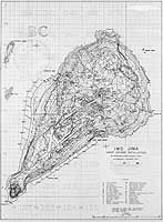
Photo #: NH 104136 Iwo Jima Operation, February-March 1945 Contour map of Iwo Jima, showing Japanese defense installations as observed from ground study during the period 19 February - 19 March 1945. The original chart was prepared by Joint Intelligence Center, Pacific Ocean Area (JICPOA). The original print came from Rear Admiral Samuel Eliot Morison's World War II history project working files. Official U.S. Navy Photograph, from the collections of the Naval Historical Center. Online Image: 665KB; 1465 x 2000 pixels |
 |
|
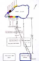
Photo #: NH 104377-KN (color) Iwo Jima Operation, 1945 Diagram of the island's invasion beaches, identified by colors green, red, yellow and blue; the alternate beaches on the other side of Iwo Jima, identified by colors purple, brown, white and orange; the landing ship and transport areas offshore; and the lines of approach used by boats from USS Sanborn (APA-93) to Beaches Blue One and Two. Original 35mm color transparency of a dragram probably prepared by Howard W. Whalen after World War II. Note that the arrow pointing "North" actually points about fifteen degrees west of north. Collection of Lieutenant Commander Howard W. Whalen, USNR. Donated by Mrs. Nadine Whalen, 1997. U.S. Naval Historical Center Photograph. Online Image: 128KB; 775 x 1225 pixels |
 |
|
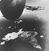
Photo #: NH 65318 "Liberators over Iwo Jima", 15 December 1944 B-24 "Liberators of the Strategic Air Force send their bombs crashing down on Iwo Jima, Japanese air base in the Volcanoes. Smoke and dust belching up from the island show that one of its two airstrips have been hit. This raid of December 15 was one of a series of bombings of the vital Jap fields. The dark oval at the upper left of the photo is the aerilon (sic -- actually the port stabilizer and rudder) of the Liberator from which the picture was snapped. Note the volcano at the lower tip of the island. Some idea of the distances involved: Iwo Jima is 656 miles from Tokyo and 5500 miles from San Francisco, California." Quoted from the original picture caption released for publication on 21 December 1944 by Commander in Chief, Pacific. The original photograph came from the illustrations package for Rear Admiral Samuel Eliot Morison's "History of United States Naval Operations in World War II", volume XIV: "Victory in the Pacific". Official U.S. Army Photograph, from the collections of the Naval Historical Center. Online Image: 55KB; 625 x 675 pixels |
 |
|
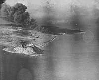
Photo #: NH 104141 Iwo Jima, Volcano Islands "Navy Planes Set Off New 'Volcano" on Iwo Jima -- A trailing cloud of black smoke hovers over strategic Iwo Jima in the Pacific, not far from the cratered Mount Suribachi, source of many volcanic clouds in the past. This was one of the many Army and Navy blows loosed on the island in a long series of attacks climaxed by the Marine landings announced today." Quoted from the original caption, released with this photograph on 19 February 1945. The view looks northeastward, with Mount Suribachi and Tobiishi Point in the foreground. Smoke is coming from fires at the East Boat Basin. Airfield Number Two is in the distance, with Airfield Number One between it and Mt. Suribachi. The shoreline running from just beyond Mt. Suribachi northeast to the Boat Basin was the scene of Beaches Green, Red (1 & 2), Yellow (1 & 2) and Blue (1 & 2), which were used during the initial landings and the follow-on phases of the invasion. The original print came from Rear Admiral Samuel Eliot Morison's World War II history project working files. It was provided to Morison by E.J. Long. Official U.S. Navy Photograph, from the collections of the Naval Historical Center. Online Image: 67KB; 740 x 625 pixels |
 |
|
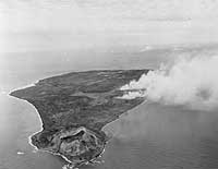
Photo #: 80-G-310939 Iwo Jima Operation, 1945 Iwo Jima during the pre-invasion bombardment, 17 February 1945, looking north with Mount Suribachi in the foreground. Photographed from an airplane based on USS Makin Island (CVE-93). Official U.S. Navy Photograph, now in the collections of the National Archives. Online Image: 62KB; 740 x 600 pixels Reproductions of this image may also be available through the National Archives photographic reproduction system. |
 |
|
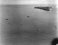
Photo #: 80-G-310938 Iwo Jima Operation, 1945 Pre-invasion bombardment of Iwo Jima, photographed from a USS Makin Island (CVE-93) plane on 17 February 1945. A battleship, a heavy cruiser and several minesweepers are in the foreground. The cruiser, at left, appears to be USS Tuscaloosa (CA-37). The view looks northeastward, showing the entire island in the upper right. Mount Suribachi on its closer end. Official U.S. Navy Photograph, now in the collections of the National Archives. Online Image: 57KB; 740 x 605 pixels Reproductions of this image may also be available through the National Archives photographic reproduction system. |
 |
|
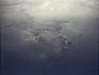
Photo #: 80-G-K-2968 (Color) Iwo Jima Operation, 1945 Iwo Jima under fire during the pre-landing bombardment, circa 17-19 February 1945. View looks northeastward, with Mount Suribachi and Tobiishi Point in the foreground. Official U.S. Navy Photograph, now in the collections of the National Archives. Online Image: 30KB; 740 x 590 pixels Reproductions of this image may also be available through the National Archives photographic reproduction system. |
 |
|
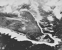
Photo #: NH 104139 Iwo Jima, Volcano Islands "'Tip' The Marines will Take: Southwest Promontory of Iwo Jima -- Taken during an earlier aerial strike by Navy carrier-based planes, this aerial photograph of strategic Iwo Jima reveals the southwest tip of the island, with the cratered height of Mount Suribachi at the far end of Tobiishi Point. Announcement was made today that members of the Marines' Fifth Amphibious Corps have swarmed ashore and opened the battle for the base following an obliterating preliminary barrage by hundreds of Navy ships and planes." Quoted from the original caption, released with this photograph on 19 February 1945. The view looks approximately east, with Mount Suribachi in the lower right. Bombs are bursting at the southern end of Airfield Number One, in the left center. Note the agricultural fields between the camera and the airfield. Heavy surf all around the island indicates particularly bad weather on this day. The original print came from Rear Admiral Samuel Eliot Morison's World War II history project working files. Official U.S. Navy Photograph, from the collections of the Naval Historical Center. Online Image: 89KB; 740 x 625 pixels |
 |
|
Photo #: 80-G-412474 Iwo Jima, Volcano Islands A TBM "Avenger" bomber flies near the Mount Suribachi (south) end of Iwo Jima, March 1945. Note the shipping off the island's southwestern shore. Photographed by a member of the Steichen unit. Official U.S. Navy Photograph, now in the collections of the National Archives. Online Image: 59KB; 740 x 545 pixels Reproductions of this image may also be available through the National Archives photographic reproduction system. |
 |
|
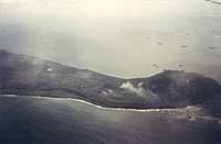
Photo #: 80-G-K-2972 (Color) Iwo Jima Operation, 1945 View of the southern part of the island, with Mount Suribachi at right, soon after the initial landings, 19 February 1945. Note ships firing from off Iwo Jima's eastern shore, and landing craft moving away from the landing beach area. Official U.S. Navy Photograph, now in the collections of the National Archives. Online Image: 37KB; 740 x 510 pixels Reproductions of this image may also be available through the National Archives photographic reproduction system. |
 |
For more wide-area aerial photographs of Iwo Jima, see:
For other pictures concerning the Iwo Jima Operation, see:
| If you want higher resolution reproductions than the Online Library's digital images, see: "How to Obtain Photographic Reproductions." |
Page made 22 December 2006
Captions corrected 29 December 2006