Lighthouses of Germany: North Frisia

The Federal Republic of Germany (Bundesrepublik Deutschland in German) occupies a central location in northern Europe with two coastlines, one facing northwest on the North Sea and the other facing northeast on the Baltic Sea. The country's history is long and complex. The large number of historically independent German regions came together in 1871 to form the German Empire. The Empire became a republic after World War I (1914-18). After World War II (1939-45) Germany was divided into two countries, the German Federal Republic in the west, usually called West Germany, and the Communist-led German Democratic Republic in the east, usually called East Germany. After the Communist government collapsed the Federal Republic reunified the nation in October 1990.

This page lists lighthouses of North Frisia, the northern part of the North Sea coast. This coast faces westward on the North Sea between the Elbe estuary and the Danish border.

Germany is a federal republic with 16 member states called Bundesländer. North Frisia is part of Schleswig-Holstein, Germany's northernmost state. Schleswig, including what is now the Nordfriesland district of Schleswig-Holstein, was ruled by Denmark until 1864. There are three surviving Danish lighthouses on the island of Sylt and several other light stations in Schleswig-Holstein were established under Danish rule. The Duchy of Holstein included the coastal region between the Elbe and Eider Rivers, now part of the Dithmarschen District.

Interest in lighthouses is strong in Germany and most of the towers are in good condition. A federal law provides blanket protection to historic lighthouses. There is concern, however, that many of the lights may be deactivated in the coming years as navigators depend less and less on them.

In German a lighthouse is a Leuchtturm ("light tower"), plural Leuchttürme. The front light of a range is the Unterfeuer and the rear light is the Oberfeuer. There are many modern range lighthouses and most of these towers are crowned by a topmark: a large, distinctive structure that serves to mark the range clearly in the daytime. Some topmarks are conical, others are funnel-shaped, and some consist of one or more gallery-like rings around the tower.

In German Insel is an island, Riff is a reef, Kap is a cape, Bucht is a bay, Fluss is a river, Mündung is a river mouth or estuary, and Hafen is a harbor. The word Straße ("street") is also used for a waterway or strait.

Lighthouses in Germany are operated by the regional harbor authority, called the WSA (Wasserstraßen- und Schiffahrtsamt). Most of the lights on this page are in the jurisdiction of WSA Elbe-Nordsee. The WSA's are linked to and regulated by a federal agency, the Wasserstraßen- und Schifffahrtsverwaltung des Bundes (WSV).

ARLHS numbers are from the ARLHS World List of Lights. DE numbers are the German light list (Leuchtfeuerverzeichnis) numbers as noted on Erich Hartmann's website. Admiralty numbers are from volume B of the Admiralty List of Lights & Fog Signals. U.S. NGA List numbers are from NGA Publication 114.

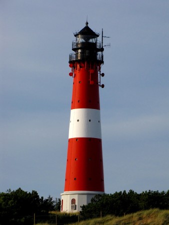
Westerheversand Light
  Westerheversand Light, Westerhever, October 2013
Wikimedia Creative Commons photo by Richard Bartz
General Sources
Leuchttürme und Leuchtfeuer an der Ostsee
Photos and information posted by Erich Hartmann, a contributor to the Online List of Lights.
Online List of Lights - Deutschland Nordsee
Photos by various photographers posted by Alexander Trabas. Some of the photos are by Hartmann, Rainer Arndt, or Capt. Peter Mosselberger ("Capt. Peter").
Leuchtturm-Atlas
A large site with excellent photos and information on nearly all German lighthouses, maintained by Frank and Birgit Toussaint.
Leuchttürme.net - Deutschland
Outstanding photos by Malte Werning.
Deutsche Leuchttürme an der Nordsee
Photos by Bernd Claußen.
Lighthouses in Germany
Aerial photos posted by Marinas.com.
Lighthouses in Schleswig-Holstein
Photos by various photographers available from Wikimedia.
World of Lighthouses - Germany
Photos by various photographers available from Lightphotos.net.
Leuchtturmseiten von Anke und Jens - Germany
This site has photos and information on many of the lights.
Deutsche Leuchttürme/Feuerschiffe
Photos posted by Klause Huelse. Huelse also has a large collection of historic postcard views.
Interessengemeinschaft Seezeichen e.V.
Germany's national lighthouse preservation organization.
GPSNavigationCharts
Navigational chart information for North Frisia.
Navionics Charts
Navigational chart for North Frisia.
Leuchtturm Hörnum
Hörnum Light, Sylt, October 2009
Flickr Creative Commons photo by toastbrot81

Helgoland Lighthouses

The territory of Helgoland (sometimes spelled Heligoland in English) includes a pair of small islands, Hauptinsel Helgoland and Düne, located in the North Sea about 50 km (30 mi) west of St. Peter, a similar distance north of Wangerooge, and 70 km (45 mi) northwest of Cuxhaven. Controlled at various times by the Duchy of Schleswig or by Hamburg, the islands were seized by Denmark in 1714 and then by Britain in 1807. The British remained in control until 1890, when they ceded Helgoland to Germany in return for a favorable settlement of colonial claims in Africa. Helgoland has a permanent population of about 1200. It is a popular tourist attraction accessible by ferry from Hamburg, Wedel, and Cuxhaven daily all year. For administrative purposes Helgoland is attached to the Pinneberg District, a district on the north side of the Elbe just below Hamburg. The lighthouses of the mainland portion of Pinneberg are listed on the Hamburg Area page.
* Helgoland (3)
1952 (station established by Britain in 1811). Active; focal plane 82 m (269 ft); white flash every 5 s. 35 m (115 ft) square 9-story steel and concrete building with brick veneer, lantern and gallery. The top of the building is also crowded with communications and radar antennas. Alexander Savin's photo is at right, Leuchtturm-Atlas has a photo, Trabas has a good photo by Capt. Peter, Werning has a page for the lighthouse, Wikimedia has numerous photos, Theo Hofmann has a 2021 photo, Holger von Neuhoff has a street view, and Google has a satellite view. The British lighthouse agency Trinity House built the first lighthouse here in 1811, an 18 m (59 ft) stone tower. In 1870 Trinity House installed a new first-order lantern and lens. In 1901 Germany replaced the British lighthouse with a 36 m (118 ft) round stone tower and transferred the 1870 lantern and lens to the Staberhuk lighthouse on the island of Fehmarn in the Baltic, where they are still in service today. Unfortunately the 1901 lighthouse was destroyed during a World War II bombing raid in 1945. The present lighthouse was actually built in 1941 as an antiaircraft observation tower; somehow it escaped the bombing and survived to be converted into a lighthouse in 1952. The brick veneer was added in 1965 during a renovation of the building. The building serves as a ship traffic control center for WSA Elbe-Nordsee. Huelse has postcard views of the first and second lighthouses. Located on Leuchtturmstraße on the western side of Hauptinsel Helgoland. Site open, tower closed. Operator: WSA Elbe-Nordsee. . ARLHS FED-101; DE 308000; Admiralty B1312; NGA 10136.
* Düne (2) Oberfeuer
1936 (station established 1899). Active; focal plane 17 m (56 ft); white, red, or green light, depending on direction, 2 s on, 2 s off, synchronized with the front light. 15 m (49 ft) round cylindrical steel tower with lantern, mounted on a circular concrete base. Lighthouse painted with red and white horizontal bands. Leuchtturm-Atlas has a good closeup photo, Trabas has a photo by Joke Reijnen, Werning has a page for the lighthouse, Nils Scharfenberg has a 2020 photo, and Google has a street view and a satellite view. The lighthouse was built from prefabricated segments. The range light is shown to the south southwest, and a directional light is also shown to the northeast; both lines guide ships bound for the harbor on the Hauptinsel. The range front light is on a simple post. Located 120 m (130 yd) behind the front light, on the beach on the south side of Düne. Site open, tower closed. Operator: WSA Elbe-Nordsee. . ARLHS FED-103; DE 308051; Admiralty B1326.1; NGA 10152.

Helgoland Light, Hauptinsel Helgoland, July 2016
Wikimedia Creative Commons photo
by Alexander Savin

Dithmarschen District Lighthouses

Brunsbüttel Lighthouses
Brunsbüttel, a town on the north side of the Elbe estuary, is the southwestern terminus of the Nord-Ostsee Kanal (often called the Kiel Canal). Since 1895 this 98.7 km (61.3 mi) canal has provided a shortcut from the North Sea to the Baltic Sea via Kiel. The canal has a depth of 9.5 m (31 ft) and is the most used canal in the world. In 2014 the entrance from the Elbe was shifted slightly west by the construction of new and larger entrance locks, but the older locks also remain in service. A special WSA, WSA Nord-Ostsee Kanal, operates the canal.

*
Brunsbüttel Oberfeuer (2)
1975 (station established 1913). Active; focal plane 46 m (151 ft); white light 1.5 s on, 1.5 s off, synchronized with the front light. 49 m (160 ft) round cylindrical tower with lantern and gallery forming a funnel-shaped topmark, painted with red and white horizontal bands. Werning has a good photo, Trabas has a closeup by Capt. Peter, Larry Myhre has a 2008 photo, and Google has a street view and a satellite view. Huelse has a postcard view of the original lighthouse, which was a hexagonal skeletal tower of the Grünendeich class (see the Hamburg Area page). This is the rear light of the range guiding ships to the canal entrance. Located off the Fährstraße in a residential area 1.6 km (1 mi) northeast of the canal entrance. Site open, tower closed. Operator: WSA Elbe-Nordsee. ARLHS FED-052; DE 310001; Admiralty B1416.1; NGA 10532.
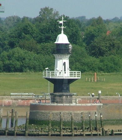
* Brunsbüttel Mole 1
1895. Active; focal plane 14 m (46 ft); continuous light, white or green depending on direction. 11 m (36 ft) octagonal cast iron tower with lantern and upper and lower galleries, mounted on an octagonal stone base. Upper 2/3 (above the lower gallery) painted white with a large black numeral "1", lower 1/3 painted black. Werning has a view from the land side, Trabas has a closeup by Capt. Peter, Larry Myhre has a 2008 photo (also seen at right), Nils Junge has a closeup, Knut Böttcher has a street view, and Google has a satellite view. In 1993 the head of the mole collapsed; the lighthouse had to be removed. It was reassembled and reinstalled in 1995. There are plans to repaint it green. (Thanks to Manfred Schmidt for reporting on the status of these mole lights as of May 2019.) Located on the south mole at the original canal entrance. Accessible by walking the pier. Site open, tower closed. Operator: WSA Nord-Ostsee Kanal. DE 310110; ARLHS FED-054; Admiralty B1444; NGA 10569.
Brunsbüttel Unterfeuer (Schleuseninsel)
1975. Active; focal plane 24 m (79 ft); white light 1.5 s on, 1.5 s off, synchronized with the rear light. 23 m (76 ft) round cylindrical tower with lantern and gallery forming a funnel-shaped topmark, painted with red and white horizontal bands. Werning has a good photo, Trabas has a fine photo by Capt. Peter, Larry Myhre has a 2008 photo, Michael Blaszak has a 2022 street view from Mole 1, and Google has a satellite view. The lighthouse was under restoration in Knut Böttcher's October 2014 street view. Located on the Schleuseninsel, the island between the old and new locks. Site and tower closed. Operator: WSA Elbe-Nordsee. ARLHS FED-053; DE 310000; Admiralty B1416; NGA 10528.
Brunsbüttel Mole 2 (2)
2013 (station established 1895). Active; focal plane 14 m (46 ft); continuous red light; the lighthouse is also floodlit at night. 13 m (43 ft) round cylindrical tower with lantern and upper and lower galleries. Lighthouse painted red with a large white numeral "2"; lantern dome painted white. Trabas has a photo by Capt. Peter, Hans-Jürgen Hapke has a 2023 photo, and Google has a satellite view. The mole was extended by 50 m (164 ft) in 2012-13 and the new lighthouse was placed on the extension. Larry Myhre has a 2008 photo of the original lighthouse and Werning also has a good photo. The original tower is in storage and is scheduled for reinstallation on mole 4. The new lighthouse is to be repainted with red and green horizontal bands. Located on the north mole at the original canal entrance. Site and tower closed, but the lighthouse is easily viewed from shore. Operator: WSA Nord-Ostsee Kanal. DE 310100; ARLHS FED-055; Admiralty B1442; NGA 10568.

Mole 1 Light, Brunsbüttel, June 2008
Flickr Creative Commons photo by Larry Myhre
#Brunsbüttel Mole 3 (2)
1993 (station established 1914). Removed in 2015. This was a 14 m (46 ft) round cylindrical tower with a 2-story lantern and double gallery. Lighthouse painted white with one black horizontal band bearing a large white numeral "3"; lantern roof painted black. Werning also has a photo, Larry Myhre has a 2008 photo, and Google has a satellite view. The original lighthouse was destroyed whena ship colllided with the mole in 1992 and its 1993 replacement was similarly destroyed by collision with the auto transporter Asian Breeze in 2015. Mole 3 has since been removed to provide for construction of a larger lock; it will not be replaced. Trabas has a photo of a temporary light near the original location; it has also been removed. Formerly located on the south mole at the newer canal entrance. Operator: WSA Nord-Ostsee Kanal. ARLHS FED-056; ex-DE 310090; ex-Admiralty B1436; NGA 10564.
* Brunsbüttel Mole 4 (2)
1977 (station established 1913). Active; focal plane 13 m (43 ft); two continuous red lights, one above the other. 13 m (43 ft) round cylindrical fiberglass tower with 2-story lantern and double gallery, painted with red and white horizontal bands. Larry Myhre has a 2008 photo, Werning also has a good photo, Trabas has another closeup, Tommy Müller has a 2019 photo, Wolfgang Woischnig has a 2022 photo, Wikimedia has Joachim Müllerchen's 2006 panoramic view of mole lights 2, 3, and 4, Uli König has a street view, and Google has a satellite view. Mole 4 is scheduled for reconstruction; upon completion the historic Mole 2 lighthouse will be installed. Located on the north mole at the newer canal entrance. Accessible by walking the pier. Site open, tower closed. Operator: WSA Nord-Ostsee Kanal. ARLHS FED-057; DE 310080; Admiralty B1438; NGA 10552.

Büsum Lighthouses
Büsum is a fishing port and resort town about 5 km (3 mi) north of the mouth of the Elbe.
* Büsum Ostmole (Südmole) (2)
1986 (station established 1929). Active; focal plane 10 m (33 ft); green light, occulting three times every 12 s. 9 m (30 ft) round cylindrical tower with lantern and gallery, painted green. Trabas has a closeup photo by Manfred Schüler, Werning has a photo, Günther Preuschoff has a 2019 photo, and Google has a satellite view and a street view from the west mole. The lantern of the original lighthouse is on display on the town waterfront (see below). Located on the end of the east mole of Büsum harbor. Accessible by walking the mole. Site open, tower closed. Operator: WSA Elbe-Nordsee. ARLHS FED-060; DE 307740; Admiralty B1610; NGA 10592.
* Büsum Westmole (Nordmole) (2)
1986 (station established 1929). Active; focal plane 10 m (33 ft); red light, occulting three times every 12 s. 9 m (30 ft) round cylindrical tower with lantern and gallery, painted red. Werning has an excellent closeup photo, Trabas also has a closeup, a 2021 photo is available, Dennis Schütt has a street view, and Google has a satellite view. Located on the end of the west mole of Büsum harbor. Accessible by walking the mole. Site open, tower closed. Operator:WSA Elbe-Nordsee. ARLHS FED-061; DE 307750; Admiralty B1609; NGA 10584.
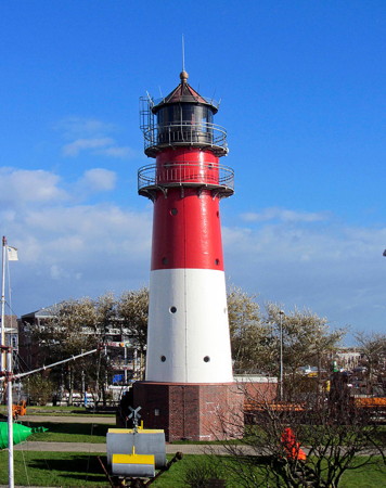
* Büsum (2)
1913 (station established 1878). Active; focal plane 22 m (72 ft); white, red, or green light, depending on direction, 3 s on, 3 s off. 22 m (72 ft) round cast iron tower with lantern and double gallery. Lower half of tower painted white, upper half red, lantern black. A photo is at right, Werning has a lovely photo, Trabas has a closeup, Wikimedia has several photos, Rainer Huesmann has a 2021 photo, Marinas.com has aerial photos, Jörg Spieler has a street view, and Google has a satellite view. The light guides ships toward Büsum in two channels, one from the west and one from the south. The present red and white pattern was applied in 1952; previously the lighthouse was painted black. The 100th anniversary of the lighthouse was celebrated in 2013. In 2007 a replica of the original light, a kerosene lantern hanging from a wood post, was installed near the Musuem am Meer; a photo (bottom of the page) is available. Located onshore near the foot of the west mole. Site open, tower closed. Operator:WSA Elbe-Nordsee. . ARLHS FED-271; DE 307700; Admiralty B1606; NGA 10580.
* [Büsum Ostmole (Südmole) (1) (lantern)]
1929. Inactive. 4 m (13 ft) round cast iron lantern mounted on a round stone foundation. Lantern painted white with a green band around the window. Jörg Spieler has a street view and Google has a satellite view. Located on a plaza at the west end of the Fischerkai in Büsum. Site open, tower closed. Owner/site manager: Museum am Meer.
Büsum Light
Büsum Light, Büsum, October 2013
Wikimedia Creative Commons photo by Radler59

Nordfriesland District Lighthouses

Westerhever and Husum Area Lighthouses

Eidersperrwerk (Eiderdamm) Südmole
1973. Active; focal plane 8 m (26 ft); green light occulting once every 6 s. 5 m (17 ft) square tower carrying an octagonal control room; a mast on the roof carries weather instruments. Trabas has Klaus Potschien's closeup photo, Peter Altnow has a street view from the north mole, and Google has a satellite view. This light marks the entry to a lock allowing smaller vessels to bypass the tidal dam at the mouth of the Eider River and reach the town of Tönning; other canal connections link the Eider to the Nord-Ostsee Kanal providing an alternate route to the Baltic Sea. Located on the south mole of the lock entrance. Site status unknown but the light is easy to see from nearby. DE 307550; Admiralty B1635.
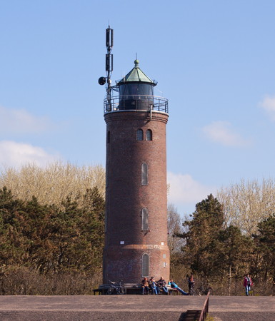
* St. Peter-Böhl
1892 (unlit until 1914). Active; focal plane 23 m (75 ft); two long (2 s) flashes every 15 s, white or red depending on direction. 18 m (60 ft) round brick tower with lantern and gallery. Tower is unpainted dark red-brown brick; lantern painted black. Fresnel lens in use. A photo is at right, Werning has a good photo, Trabas has a photo by Joke Reijnen, Kerstin Staudacher has a 2021 photo, Larry Myhre has a 2008 photo, Marinas.com has aerial photos, Huelse has a historic postcard view, Martin Zencke has a street view, and Google has a satellite view. The lantern was added to this tower in 1914. In 2001 Anke and Jens found the tower being restored. The lighthouse stands at the southwestern corner of the Eiderstedt peninsula marking the entrance to the Eider estuary. Located about 3 km (2 mi) southeast of Sankt Peter-Ording and about 30 km (19 mi) west of Tönning. Site open, tower closed. Operator: WSA Elbe-Nordsee. . ARLHS FED-231; DE 307180; Admiralty B1624; NGA 10596.
** Westerheversand
1908. Active; focal plane 41 m (135 ft); white, red, or green light, depending on direction, occulting three times every 15 s. 40 m (131 ft) round cast iron tower with lantern and double gallery, mounted on a 1-story concrete base and flanked to either side by two 1-1/2 story keeper's cottages. Lighthouse painted with red and white horizontal bands; lantern, watch room, and galleries painted black. A large Fresnel lens is on display. Richard Bartz's photo is at the top of the page, Werning has an excellent photo, Trabas has a photo by Rainer Arndt, Wikimedia has many photos, Annette Sieggroen has a 2021 photo, Marinas.com has aerial photos, Huelse has a historic postcard view, Richard Hovorka has a street view, and Google has a satellite view. This beautiful tower is one of the best-known lighthouses of the German North Sea coast. It is such a popular site for weddings that one of the keeper's cottages is a registrar's office; the other is a national park office. Located near the beach at the northwestern corner of the Eiderstedt peninsula, west of Osterhever. Accessible by a short walk from the dike. Site open; tower open for climbing Mondays and Wednesdays during the summer season. Operator: WSA Elbe-Nordsee. Site manager: Nationalpark Schleswig-Holsteinisches Wattenmeer. . ARLHS FED-260; DE 307140; Admiralty B1652; NGA 10600.
* Hörnum Unterfeuer (2) (lantern)
1924 (station established 1907). Inactive since 1979. Originally a 7 m (23 ft) round cylindrical tower, painted red with one white horizontal band. Andreas Köhler has a photo showing that only the top of the tower has been preserved. This was a front range lighthouse built at Hörnum in the southern part of Sylt. The original lighthouse was replaced in 1924 but it was overthrown by beach erosion during a storm in March 1979. The lantern was salvaged for display outside the maritime museum in Husum, the capital of the district of Nordfriesland. Google has a 2022 street view and a satellite view. The museum is located on the Zingel Damm in downtown Husum, at the head of the harbor. Site open, museum open daily, tower closed. Site manager: Schifffahrtsmuseum Nordfriesland. ARLHS FED-117.
St. Peter-Böhl Light
St. Peter-Böhl Light, Sankt Peter-Ording, April 2014
Wikimedia Creative Commons photo by Unokorno

Pellworm Area Lighthouses
Pellworm is a roughly elliptical island off the Nordstrand peninsula west of Husum. The island has a permanent population of about 1200 and it is accessible by ferry from Nordstrand.
Süderoogsand (2)
1985 (station established 1891). Active; focal plane 18 m (59 ft); white, red, or green light, depending on direction, 3 s on, 3 s off. 19 m (62 ft) square pyramidal wood framework tower with lantern. Tower unpainted, lantern painted black. Trabas has a photo and Google has a satellite view. This unusual light tower replaced the original wood frame tower; the original location was about 2.5 km (1.5 mi) south southwest. The lighthouse provides a directional light for ships entering the Hever, the channel north of the Eiderstedt peninsula. Keepers formerly reached the light using a horse-drawn cart at low tide. Located at the south end of the Süderoogsand (a broad area of shallows and sandbars) about 7 km (4.5 mi) northwest of Westerheversand. Accessible only by boat. Site and tower closed. Operator: WSA Elbe-Nordsee. Site manager: Nationalpark Schleswig-Holsteinisches Wattenmeer. ARLHS FED-235; DE 307100; Admiralty B1672; NGA 10604.
Pellworm Unterfeuer
1907. Inactive since 2002. 17 m (56 ft) square pyramidal cast iron skeletal tower with lantern and gallery, mounted on a small circular crib. Tower painted white, lantern red with a gray roof. Claußen has a photo (last photo on the page), a 2022 closeup photo is available, and Google has a satellite view. In August 2002 he range line was discontinued and replaced with a directional light on the rear lighthouse (next entry). It appears to be maintained, at least as a daybeacon. Located about 1.5 km (0.9 mi) southwest of the rear light. Accessible only by boat. Site and tower closed. Operator: WSA Elbe-Nordsee. ARLHS FED-273; ex-DE 307300; ex-Admiralty B1676; ex-NGA 10608.
** Pellworm (Oberfeuer)
1907. Active; focal plane 38 m (125 ft); white or red light, depending on direction, occulting once every 5 s. 41 m (135 ft) round cast iron tower with lantern and double gallery, mounted on a 1-story concrete base. Lighthouse painted red with one white horizontal band; lantern, watch room, and galleries painted black. Fresnel lens in use. The 2-story keeper's house is used as a registrar's office; this lighthouse, like Westerheversand, is popular for weddings. A 2022 photo is at right, Trabas has a closeup photo, Martin Böttcher has a 2022 photo, Wikimedia has photos, Ruth Esseln has a 2021 photo, Marinas.com has aerial photos, Huelse has a historic postcard view, and Google has a sea view, a satellite view, and a distant street view. The lighthouse is practically identical to the Hörnum and Westerheversand lighthouses. Located on the south side of the island of Pellworm, guiding ships into the harbor. Site open, tower open for climbing Monday through Wednesday during the summer season. Operator: WSA Elbe-Nordsee. . ARLHS FED-187; DE 307301; Admiralty B1676.1; NGA 10612.

Pellworm Oberfeuer, Pellworm, May 2022
Wikimedia Creative Commons photo by Mensch01

Dagebüll Area Lighthouses
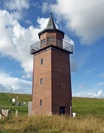
* Dagebüll (2) (Unterfeuer)
1929 (station established by Denmark, 1845). Inactive since 1988. 15 m (49 ft) square brick tower with octagonal brick lantern room and an unusual "witch's hat" roof. Lighthouse is unpainted; roof is black. Juri Becker's 2017 photo shows that the tower has been covered with red siding. A photo is at right, Werning has a good photo, Wikimedia has several photos, René Rau has a 2020 closeup, and Google has a fuzzy satellite view. The small port of Dagebüll is important as the point of embarkation for ferries to Amrun and the other North Frisian islands. This lighthouse was the front light of a range guiding the ferries; the rear tower has been demolished. Anke and Jens visited this site in 2001 and reported the lighthouse seemed abandoned and "without function." In 2012 the tower was restored and made available for over accommodations for two. Located about 1 km (0.6 mi) southeast of the ferry terminal in Dagebüll. Site open, tower closed. Owner/site manager: Leuchturm Dagebüll. . ARLHS FED-068.
Oland
1929. Active; focal plane 7 m (23 ft); continuous white, red, or green light, depending on direction. 7 m (23 ft) square brick tower with a thatched roof; lantern with a small Fresnel lens mounted near the top of the front face of the tower. Trabas has a photo and Google has a satellite view. Yes, this is probably the world's only lighthouse with a thatched roof. Oland is a small island about 11 km (7 mi) south of Dagebüll; its population is about 50. The island is joined tenuously to the mainland by a causeway crossed by a historic railroad line. Located on the village wharf, on the northwest side of the island. Site open, tower closed. Operator: WSA Elbe-Nordsee. ARLHS FED-174; DE 306900; Admiralty B1714; NGA 10652.
* Nordmarsch
1902. Active; focal plane 13 m (43 ft); three long white flashes every 20 s, white or red depending on direction. 11 m (36 ft) round cylindrical brick tower with lantern and gallery. Lighthouse is unpainted brown brick; lantern is white with a black roof. Fresnel lens in use. Trabas has a great closeup photo by Klaus Potschien, Hans Jürgen Groß has good photo, Marinas.com has aerial photos, and Google has a satellite view. The lighthouse marks the western end of Langeneß, a long island that stretches southwestward from near Oland. The island is accessible by ferry from Schlüttsiel; the lighthouse is about 3 km (2 mi) northwest of the ferry terminal at Rixwarft. Site open, tower closed. Operator: WSA Elbe-Nordsee. . ARLHS FED-344; DE 306700; Admiralty B1700; NGA 10640.
Dagabüll Light
Dagebüll Light, Dagebüll, August 2014
Wikimedia Creative Commons photo by Oberlausitzerin64

Föhr Lighthouses
Föhr is a roughly circular island lying between Amrun and the mainland, southeast of Sylt. It has a population of about 8500 and is accessible by ferry from Dagebüll.

*
Olhörn (Wyk)
1952. Active; focal plane 10 m (33 ft); white or red light, depending on direction, occulting four times every 15 s. 8 m (26 ft) square cylindrical brick tower with lantern and gallery. Lighthouse is unpainted red-brown brick; lantern and gallery painted white. Trabas has a closeup, Norbert Friedemann has a 2015 photo, a 2021 photo is available, and Google has a street view and a satellite view. The lighthouse replaced an 1892 daybeacon. Located on the southeastern corner of Föhr, about 2 km (1.2 mi) south of the ferry terminal at Wyk. Site open, tower closed. Operator: WSA Elbe-Nordsee. . ARLHS FED-175; DE 306880; Admiralty B1704; NGA 10644.
* Nieblum (Föhr)
1981. Active; focal plane 11 m (36 ft); white, red, or green light, depending on direction, occulting twice every 10 s. 10 m (33 ft) round cylindrical aluminum tower with lantern and gallery, painted red with one white horizontal band. Trabas has a closeup photo, Petra Föhr has a 2018 photo, and Google has a satellite view. Sibling of the Wittdün lighthouse (next entry). Located on the coastal road on the south side of Föhr about 10 km (6 mi) west of the Olhörn lighthouse. Site open, tower closed. Operator: WSA Elbe-Nordsee. . ARLHS FED-167; DE 306840; Admiralty B1702.

Amrum Lighthouses
Amrum is a small, boomerang-shaped barrier island located south of Sylt; it is a popular tourist destination readily accessible by ferry from Dagebüll. The permanent population is about 2300.
* Wittdün
1978. Inactive since 1988. 10 m (33 ft) round cylindrical aluminum tower with lantern and gallery, painted red with one white horizontal band. Henning Bulka has a 2008 photo, Mareike Eggers also has a photo, and Google has a satellite view. This light replaced a light shone from a window of a health clinic (since demolished). Located on the waterfront of Wittdün, at the south end of Amrum, near the ferry terminal. Site open, tower closed. Owner/site manager: unknown. ARLHS FED-264.
*** Amrum
1875. Active; focal plane 63 m (207 ft); white flash every 7.5 s. 41 m (135 ft) round granite tower with lantern and gallery, painted red with two white horizontal bands. The original rotating 16-sided 1st order Fresnel lens remains in use. ; it has a range of 46 km (26 mi). A 2015 photo is at right, Trabas has a photo by Rainer Arndt, Sascha Kremer has a 2020 closeup, Karsten Bechstedt has a 2009 photo, Huelse has a historic postcard view, Matthias Kühn has a street view, Martin Bongard has a street view, and Google has a satellite view. A handsome and historic lighthouse, the first built by Germany on the North Frisian coastline. For northbound ships, this is the first long-range light seen north of Helgoland. Until 2015 the lighthouse accompanied the rear light of a range; the front light was on an 11 m (36 ft) mast on the waterfront of Wittdün harbor and the rear light (since removed) was on a mast beside the tower seen in Arndt and Bechstedt photos. . The lighthouse is built on a high dune northwest of the harbor of Wittdün, the ferry terminal at the south end of the island. Site open, tower open for climbing Monday through Friday mornings during the summer season. Operator: WSA Elbe-Nordsee. . ARLHS FED-032; DE 306540; Admiralty B1686 (formerly B1685.1); NGA 10620.
* Wriakhörn (?)
1955. Inactive since 2016.and probably removed. 17 m (56 ft) slender square skeletal tower. Wikimedia has several photos but the tower is not seen in Google's indistinct satellite view. If not removed the rusted and abandoned tower is endangered. Located in dunes 550 m (0.34 mi) southwest of the Amrun lighthouse. Site open, tower closed. ARLHS FED-318; ex-DE 306580; ex-Admiralty B1688; NGA 10628.
* Nebel
1981. Active; focal plane 16 m (52 ft); white, red, or green light, depending on direction, occulting once every 5 s. 10 m (33 ft) round cylindrical aluminum tower with lantern and gallery, painted red with one white horizontal band. Trabas has a closeup by Manfred Schüler, Alexander Fröstl has a good photo, and Google has a satellite view. and a distant street view. Another sibling of the Wittdün lighthouse (see above). Located on the east side of Amrum near the center of the island, about 5 km (3 mi) north of Wittdün. Site open, tower closed. Operator: WSA Elbe-Nordsee. ARLHS FED-160; DE 306600; Admiralty B1691.

Amrum Light, Amrum, July 2015
Wikimedia Creative Commons photo by Itti
Norddorf
1906. Active; focal plane 22 m (72 ft); white, red, or green light, depending on direction, 4.5 s on, 1.5 s off. 8 m (26 ft) round cylindrical cast iron tower with lantern and gallery. The lantern and gallery are painted red and the short tower white. Jörg Braukmann's photo is at right, Mathias Köttig has a 2023 photo, Thore Siebrands has a good photo, Trabas has a closeup, Günther Hofmann also has a closeup, Udo Dőhler has a 2020 photo, Huelse has a historic postcard view, and Google has a satellite view. Prefabricated by Julius Pintsch, Berlin, as the prototype for a series of small cast iron towers. This little lighthouse is an important sector light for ships approaching the Hörnum pass between Amrum and Sylt. Located in the dunes on the northwest coast of Amrum about 7 km (4.3 mi) southwest of Norddorf village. Accessible by a hike of about 1.2 km (3/4 mi) through the dunefield. Site open, tower closed. Operator: WSA Elbe-Nordsee. ARLHS FED-168; DE 306500; Admiralty B1728; NGA 10636.

Sylt Lighthouses
Sylt is a barrier island about 40 km (25 mi) long facing due west on the North Sea. Since 1927 the island has been connected to the mainland by a causeway called the Hindenburgdamm. The causeway carries a rail line, which is popular way to reach the island's many beach resorts; ferry service is also available. The permanent population of the island is about 21,000.

Hörnum Unterfeuer (3) (relocated)
1980 (station established 1907). Inactive since 1995. 11 m (36 ft) round cylindrical tower with lantern and gallery, painted red with one white horizontal band. Manfred Kroger has a closeup photo. The original lighthouse, built on piles, was demolished in 1939 when channel changes left it in the wrong position. The second lighthouse was overturned by a winter storm in 1979; its lantern was salvaged for display in Husum (see above). The present light, located on the oceanfront about 800 m (1/2 mi) north of the south end of the island of Sylt, was deactivated (along with the range) in 1995 because further changes in the channels made it useless. The tower was scheduled for demolition in 2002 but this project was cancelled; in May 2003 the light tower was transferred to a science institute, which installed a radar antenna on the tower to study wave action offshore. In 2013 the tower was dismantled and stored for possible reuse elsewhere and in 2018 it was relocated in the town of Hornum. A 2022 closeup photo is available and Google has a street view and a satellite view. Located on a hillside above Rantumer Straße in Hornum. Site open, tower closed. ARLHS FED-117.

Norddorf Light, Amrum, July 2018
Wikimedia Creative Commons photo by Jörg Braukmann
*** Hörnum
1907. Active; focal plane 48 m (157 ft); two white flashes, separated by 2.6 s, every 9 s. 34 m (112 ft) round cast iron tower with lantern and double gallery, mounted on a 1-story concrete base. Lighthouse painted red with one white horizontal band; lantern, watch room, and galleries painted black. Adjacent keeper's house now used as a registrar's office. A photo is near the top of this page, Trabas has Klaus Potschien's closeup photo, Sven Süss has a 2021 photo, Werning also has a page, Robert Schellmann has a photo, Marinas.com has aerial photos, Huelse has a historic postcard view, Christian P. Schlichte has a street view, and Google has a good satellite view and a street view from the beach walkway. A beautiful and popular lighthouse, sibling of the Pellworm and Westerheversand lighthouses (see above). Until 1930 the lighthouse served as the local school, with classes on the upper floors. Today the lighthouse is a popular tourist destination and site for weddings. Located atop a dune on the southeast side of Sylt in the village of Hörnum. Island accessible by causeway from the mainland. Site open, tower open for guided tours Mondays, Wednesdays, Thursdays, and Fridays during the summer season. Operator: WSA Elbe-Nordsee. . ARLHS FED-118; DE 306080; Admiralty B1735; NGA 10676.
* Kampen (Rotes Kliff)
1856 (Danish). Active; focal plane 62 m (203 ft); white light, 3 s on, 7 s off; a red sector is shown near the shore to the north. 40 m (131 ft) round stone tower with lantern and gallery, painted white with one black horizontal band in the center of the tower. 1st order Fresnel lens in use. A photo is at right, Werning has an excellent page for the lighthouse, Trabas has Klaus Potschien's fine closeup, Susanne Koch has a 2021 photo, Huelse has a historic postcard view, Michael Hallen has a street view, and Google has a satellite view. This great and famous lighthouse was built by the Danish government using stone from the island of Bornholm in the Baltic Sea; the tower still bears the royal crest of Frederick VII of Denmark. The lighthouse was called by its Danish name Rotes Kliff (red cliff) until 1975, when the name was changed to Kampen, the name of the nearby village. (Unfortunately, this risks confusion with the Campen lighthouse near Emden.) Several iron rings were placed around the tower in 1875 when cracks were discovered in the stonework. The current black and white pattern was applied in 1953. Located atop a bluff (the red cliff) at Kampen in the northern third of Sylt. Site open, tower closed. Operator: WSA Elbe-Nordsee. . ARLHS FED-124; DE 305840; Admiralty B1740; NGA 10700.
* Rotes Kliff (Quermarkenfeuer)
1913. Inactive since 1974 (the tower is floodlit at night). 11 m (36 ft) octagonal brick tower with lantern and gallery. Tower unpainted; lantern is white with an unpainted green copper roof. Werning also has a good page, Steffen Joeres has a 2023 photo, Huelse has a historic postcard view, Marinas.com has aerial photos (misidentified as Kampen), and Google has a closeup street view and a satellite view. This tower carried a sector light (Quermarkenfeuer). In 1978 the lighthouse was transferred to the town of Kampen. The town carried out a restoration of the lighthouse in 1993-94. Located in a dunefield about 1.5 km (1 mi) north of Kampen. Site open, tower closed. Owner/site manager: Amt Landschaft Sylt. . ARLHS FED-200; ex-Admiralty B1742.

Kampen Light, Sylt, August 2014
Wikimedia Creative Commons photo by Oberlausitzerin64
* List West
1858 (Danish). Active; focal plane 19 m (56 ft); white, red, or green light, depending on direction, 4.5 s on, 1.5 s off. 11 m (36 ft) round cast iron tower with lantern and gallery, painted white; lantern and gallery painted red. Fresnel lens in use. Werning has a page with a good photo, Trabas has Klaus Potschien's closeup, a 2021 photo is available, Marinas.com has aerial photos, Huelse has a historic postcard view, Remo Brauer has a street view, and Google has a satellite view. This, Germany's northernmost lighthouse, is one of two lighthouses built by the Danish government to guide ships through the channel between Sylt and the adjacent (and still Danish) island of Rømø. Both lighthouses are on the Ellenbogen ("elbow"), a 10 km (6 mi) long sand spit which is a protected natural area. Located at the northwest corner of Sylt, about 10 km (6 mi) by road from the town of List. Site open, tower closed. Operator: WSA Elbe-Nordsee. . ARLHS FED-148; DE 305800; Admiralty B1746; NGA 10704.
* List Ost
1858 (Danish). Active; focal plane 22 m (72 ft); white, red, or green light, depending on direction, occulting once every 6 s. 13 m (43 ft) round cast iron tower with lantern and gallery, painted with red and white horizontal bands. Fresnel lens in use. Alexandra Liebel's 2023 photo is at right, Werning has a good page for the lighthouse, Trabas has a good photo by Klaus Potschien, Torben Berger has a photo, Alexander Forer has a 2021 photo, Marinas.com has aerial photos, Huelse has a historic postcard view, and Google has a satellite view. This is one of two lighthouses built by the Danish government on the sand spit at the north end of Sylt to guide ships through the channel between Sylt and the adjacent (and still Danish) island of Rømø. The lighthouse is close to the beach and may be endangered in the future by beach erosion. Located near the east end of the Ellenbogen about 18 km (11 mi) by road from the town of List. Site open, tower closed. Operator: WSA Elbe-Nordsee. . ARLHS FED-147; DE 305880; Admiralty B1748; NGA 10708.

List Ost Light, Sylt, August 2023
Instagram photo by Alexandra Liebel

Information available on lost lighthouses:

Notable faux lighthouses:

Adjoining pages: North: Denmark West Coast | Southeast: Hamburg Area | South: Cuxhaven and Stade

Return to the Lighthouse Directory index | Ratings key

Posted March 30, 2005. Checked and revised January 29, 2024. Lighthouses: 34. Site copyright 2024 Russ Rowlett and the University of North Carolina at Chapel Hill.