Lighthouses of Northern Croatia

The Republic of Croatia (Republika Hrvatska in Croatian) is located on the east side of the Adriatic Sea and includes most of the coastline of the former Yugoslav federation. Including the historic provinces of Istria and Dalmatia, this coastal region has a very long history. In recent times it was part of the Austrian Empire for several centuries until that empire was dissolved in 1918, at the end of World War I. Most of the Croatian coast then became part of Yugoslavia, but the peninsula of Istria, in the northwestern corner, was annexed by Italy. After the end of World War II in 1945 the northwestern corner of Istria was part of the UN-administered Free Territory of Trieste until 1954, when the entire peninsula was reunited with Yugoslavia (the city of Trieste remained in Italy). Croatia became independent in 1991 when the Yugoslav federation fell apart.

The country is divided into 21 counties, 7 of which touch the coast. The principal ports are Rijeka in the north, Split on the central coast, and Dubrovnik in the far south. This page covers lighthouses of the northern third of the Croatian coastline including the counties of Istria and Primorje-Gorski Kotar; the latter includes the islands of the Kvarner Gulf.

The Croatian word for a lighthouse is svjetionik. The word rt is a cape or promontory, otok is an island, otočić is an islet, hrid (plural hridi) is a rock, plićak or pličina is a shoal, zaljev is a bay, rijeka is a river, and luka is a port or harbor.

Istria county was part of Italy from 1918 through 1945 and both Italian and Croatian are spoken. The Italian place names are shown in brackets{}.

Aids to navigation in Croatia are managed by Plovput, a state-owned corporation. Plovput has developed fourteen of the light stations for vacation rental.

ARLHS numbers are from the ARLHS World List of Lights. PS numbers are the numbers, if known, from the Croatian light list Popis Svjetala i Signala za Maglu. Admiralty numbers are from volume E of the Admiralty List of Lights & Fog Signals. U.S. NGA List numbers are from Publication 113.

General Sources
Plovput - Aids to Navigation - Lighthouses
Information and photos posted by Plovput. There is also an Other Aids to Navigation page with photos of typical smaller beacons.
Online List of Lights - Croatia
Photos by various photographers posted by Alexander Trabas.
World of Lighthouses - Croatia
Photos by various photographers available from Lightphotos.net.
Lighthouses in Croatia
Aerial photos posted by Marinas.com.
Leuchttürme an der kroatischen Küste
Photos by Olaf Riesenberg posted by Bernd Claußen.
Lighthouses in Croatia
Photos by various photographers available from Wikimedia.
Weitere europäische Leuchttürme auf historischen Postkarten
Historic postcard views posted by Klaus Huelse.
GPSNavigationCharts
Navigation chart information for northern Croatia.
Navionics Charts
Navigation chart for northern Croatia.
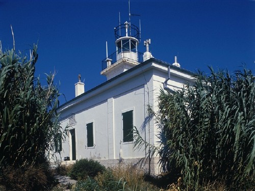
 

Susak Light
Susak Light, Susak
Plovput photo

Hrid Zaglav Light
Hrid Zaglav Light, Cres
Plovput photo
Primorje-Gorski Kotar County Lighthouses

Otok Krk Lighthouses
Croatia's second largest island, Krk (called Veglia in Italian) is roughly triangular in shape. Located northeast of Cres and close to the mainland, it is accessible by a bridge at Voz, about 13 km (8 mi) southeast of Rijeka. Krk is the most populous of the Adriatic islands, with a population of about 20,000.
Vošćica
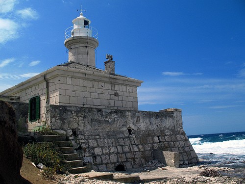
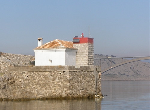
1875. Active; focal plane 12 m (39 ft); red flash every 3 s. 8 m (26 ft) square cylindrical stone tower with gallery, attached to the seaward side of a stone keeper's house. Lantern removed. Lighthouse painted white with a red horizontal band around the top of the tower; the house is white with a red tile roof. A Plovput photo is at right, Trabas has a photo by Eckhard Meyer, Dalibor Jud has a photo, Robert Zdarilek has a view from the sea, and Google has a satellite view. This lighthouse marks the Velibitski Kanal, the narrow channel between the island of Krk and the mainland. The original light was on an "iron stand." Located adjacent to the historic Maltempo fortress ruins on a promontory at the northern point of Krk, about 1.5 km (1 mi) east of the bridge joining the island and the mainland. Site probably open, tower closed. ARLHS CRO-193; PS-271; Admiralty E2894; NGA 12376.
* [Soline (Rt Glavati)]
Date unknown (station established 1902). Active; focal plane 9 m (30 ft); red flash every 5 s. 6 m (20 ft) octagonal cylindrical stone tower with gallery. The tower is unpainted white stone; the gallery is painted red. Trabas has a photo, Stefan Bock has a 2021 photo, Elekfalvi Zsolt has a 2023 photo, and Google has a satellite view. The light marks the south side of the narrow entrance to the bay of Soline, on the northeast side of Otok Krk about 3 km (2 mi) east northeast of the town of Soline. Site open, tower closed. Admiralty E2898; NGA 12392.
Rt Šilo (Dobrinj) {Dobrigno} (2)
Date unknown (station established 1909). Active; focal plane 14 m (46 ft); white flash every 3 s. 9 m (30 ft) octagonal cylindrical stone tower with gallery. The lighthouse is unpainted white stone. Trabas has a photo, Bohuslav Vitu has a 2018 photo, Nicola Gutu has a 2016 street view, and Google has an indistinct satellite view. Rt Šilo is a long, very narrow promontory sheltering the harbor of Šilo on the north side of Otok Krk. Located at the tip of the promontory. Site open, but it's a rough walk over broken stones to the lighthouse; tower closed. Admiralty E2901; NGA 12408.
Vošćica Light
Vošćica Light, Otok Krk
Plovput photo
* Baška Mole (1)
1892. Replaced around 2022. 8 m (26 ft) square cylindrical white concrete tower with gallery; no lantern. A distant 2005 view from the sea is available, Andreas Köhler has a 2019 photo, Balázs Gaál has a street view, and Bing has an indistinct satellite view. The Admiralty reported this light temporarily extinguished in 2021 and a 2022 photo shows the breakwater being extended. Trabas has Eckhard Meyer's photo of the new light (focal plane 10 m (33 ft); green flash every 2 s) and Philipe Koko has a 2023 photo showing both lights. Baška is a picturesque village at the southeastern end of Krk. Located at the end of the breakwater mole at Baška. Accessible by walking the mole. Site open, tower closed. PS-296; Admiralty E2904; NGA 12476.
Stražica (1) {Pervicchio}
1878. Reactivated; focal plane 21 m (69 ft); white flash every 6 s. Approx. 8 m (26 ft) square cylindrical stone tower with lantern and gallery, rising from the seaward side of 1-story stone keeper's house. Light tower painted white; the house is unpainted. Anna Jenšíková's photo is at right, Dariusz Montrymowicz has a 2021 photo, a 2022 closeup is available, and Google has a satellite view. The active light was moved for a number of years to a post mounted on a stone wall in front of the historic lighthouse, but by 2016 the lighthouse was restored and the light returned to the lantern. Monika Fahrnberger has a 2006 photo showing the temporary light and Trabas has Hans de Graaf's view from the sea. Located on Rt Stražica, the northwestern point of Otok Prvić (Pervicchio in Italian), marking the narrow channel between that island and the southeastern tip of Otok Krk. Accessible only by boat. Site open, tower closed. ARLHS CRO-147; PS-240; Admiralty E2887; NGA 12460.
Otočić Galun
Date unknown. Active; focal plane 12 m (39 ft); three white flashes every 10 s. 8 m (26 ft) square cylindrical unpainted stone tower. Trabas has Hans de Graaf's photo, a 2017 photo is available, and Google has an indistinct satellite view. Located on the northeast point of a small island about 1 km (0.6 mi) off the south coast of Otok Krk. Accessible only by boat. Site open, tower closed. ARLHS CRO-049; Admiralty E2886; NGA 12468.
* Rt Negrit (1) {Punta Negritto}
1874. Inactive for many years. 2-story stone keeper's house; the light was shown through a window. The active light (focal plane 14 m (46 ft); green flash every 3 s) is on a 5 m (17 ft) green post in front of the house. Trabas has a good photo by Hans de Graaf, another photo is available, and Google has a satellite view. The house is abandoned and in poor condition. Located on a promontory about 7 km (4 mi) southeast of Krk town. Site open, tower closed. ARLHS CRO-106. Active light: Admiralty E2884; NGA 12484.

Stražica Light, Otok Prvić, summer 2016
photo copyright Anna Jenšíková; used by permission
* Krk Mole {Porto Veglia}
1877. Active; focal plane 8 m (26 ft); red flash every 4 s. 8 m (26 ft) square cylindrical stone tower. Upper 2/3 of the lighthouse painted red; the base is painted white. Trabas has Arno Siering's photo, another closeup photo is available, and Google has a street view and a distant satellite view. Krk is the best harbor and largest town on the island of the same name; it is located midway on the south coast. Located at the end of the west mole at Krk. Accessible by walking the mole. Site open, tower closed. Admiralty E2874; NGA 12496.

Otok Cres East Side and Otok Lošinj Area Lighthouses
Cres (Cherso in Italian), located to the east of the Istrian peninsula, is the largest of the Croatia's many islands. Long and narrow, it stretches over 60 km (40 mi) from north to south. At the southern end it was formerly connected to Lošinj, but a channel (crossed by a bridge) has been cut to separate the two islands. A popular resort island, Cres is readily accessible by ferries from Brestova on the Istrian peninsula or from Valbiska on the island of Krk.

Plavnik (Rt Veli Pin) (2)
Date unknown (station established 1890). Active; focal plane 20 m (66 ft); white flash every 6 s. 12 m octagonal tower, painted white. Trabas has a photo by Ulrich Knapp, Nikola Derežić has a photo, and Google has a satellite view. The first lighthouse was a cast iron tower. Plavnik is an island off the east coast of Cres. A narrow channel separating the islands, the Kanal Krusija, is the shortest route from the Adriatic through the islands to Rijeka. Located at the northwestern point of Plavnik, marking the east side of the narrowest opening of the channel. Probably accessible only by boat, but there should be a distant view from the ferries linking Krk and Cres. Site status unknown. ARLHS CRO-182; PS-237; Admiralty E2872; NGA 12472.
Trstenik (Otočić Trstenik)
1873. Active; focal plane 26 m (85 ft); white or red light, depending on direction, 2 s on, 8 s off. 12 m (39 ft) octagonal stone tower with lantern and gallery, attached to a 2-story stone keeper's house. The lighthouse is unpainted; lantern painted white. A Plovput photo is at right, Trabas has a closeup photo by Ulrich Knapp, Vladimír Paško has a good drone view, Filip Bipe has a street view, and Google has a satellite view. Located on an island off the east side of Cres, about 5 km (3 mi) northeast of Punta Kriza. Accessible only by boat. Site and tower closed (the island is privately owned). PS-259; Admiralty E3002; NGA 12332.
Rt Madona (2) {Porto Cigale}
Date unknown. Active; focal plane 12 m (39 ft); green flash every 3 s. 7 m (23 ft) white stone tower with a green band at the top. Trabas has a photo by Ulrich Knapp, Anton Kučić has a 2022 photo, and Google has a street view and a satellite view. Located on a promontory on the west side of Otok Lošinj, about 3 km (2 mi) west of Mali Lošinj. Site open, tower closed. ARLHS CRO-090; Admiralty E3019; NGA 12304.
Koludarac (Rt Križ) (2) {Koludarz}
Date unknown (station established 1876). Active; focal plane 10 m (33 ft); green flash every 3 s. 7 m (23 ft) square stone tower with gallery; lantern removed. Entire lighthouse painted green. A short bridge connects the lighthouse to a 1-1/2 story stone keeper's house. Trabas has a photo by Eckhard Meyer, Daniel Macek has a 2022 photo, and Google has a satellite view and a very distant street view. The original light was on an iron post. Located on an island, marking the south side of the entrance to the harbor of Mali Lošinj. Accessible only by boat. Site and tower closed, but there's a good view from ferries from Mali Lošinj to Susak or Unije. Admiralty E3024; NGA 12288.
* Murtar (2) {Isola Mortar}
Date unknown (station established 1867). Inactive. 7 m (23 ft) octagonal stone tower with lantern and gallery, attached to the seaward end of a 1-story stone keeper's cottage. The lighthouse is unpainted white stone. The active light (focal plane 9 m (30 ft); white light, 2 s on, 6 s off) is on a 5 m (16 ft) white concrete post in front of the historic lighthouse. Trabas has a good photo by Ulrich Knapp, Alessio Zappa has a closeup, and Google has a satellite view. Endangered: Marin Cerić's 2021 photo shows the original lighthouse crumbling into ruins. The first light was described as being on an iron column. Located on the small island of Murtar in the southern entrance to the channel separating Cres and Lošinj, marking the approach to the ferry port of Mali Lošinj. Accessible only by boat. Site and tower closed, but there's a good view from ferries from Mali Lošinj to Susak or Unije. ARLHS CRO-104; Admiralty E3022; NGA 12280.

Trstenik Light, Otočić Trstenik
Plovput photo

Susak and Unije Area Lighthouses
* Susak {Isola Sansego}
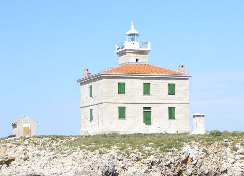
1881. Active; focal plane 100 m (328 ft); two long (2 s) white flashes every 10 s. 12 m (39 ft) square cylindrical stone tower with lantern and gallery, centered on the roof of a 2-story stone keeper's house. The lighthouse is unpainted white stone with a white roof; light tower and lantern are also painted white. A Plovput photo is at the top of the page, Nikola Bicanic has a closeup photo, Erazem Dolžan has a photo, Trabas has Hans de Graaf's distant view, Marinas.com has distant aerial photos, Nikola Derežić has a street view, and Google has a satellite view. This is a staffed station; the house is occupied by resident keepers. Susak is a high island south of Unije and about 7 km (4.5 mi) south of the channel separating Cres from Lošinj. Boat transportation from Mali Lošinj is available. Located on the highest point of the island; accessible by a stiff hike from the village of Susak. Site open, tower closed. ARLHS CRO-050; PS-166; Admiralty E3036; NGA 12260.
Hrid Šilo (Male Srakane)
Date unknown. Active; focal plane 11 m (36 ft); red flash every 5 s. 9 m (30 ft) octagonal stone tower with gallery, mounted on a concrete base. No lantern; the light is displayed from a short post. Trabas has a photo by Ulrich Knapp, Nikola Derežić has a closeup photo, Marinas.com has aerial photos, and Google has an indistinct satellite view. The Srakane islands are a chain of rocks and islets, the tops of an underwater ridge connecting Unije to the the south end of Cres. Located on the islet closest to Cres. Accessible only by boat, but there's a good view from the ferries between Mali Lošinj and Unije. Site and tower closed. ARLHS CRO-139; PS-165; Admiralty E3034; NGA 12268.
* Vnetak (Rt Vnetak, Unije) {Isola Unie}
1873. Active; focal plane 17 m (56 ft); three flashes every 10 s, white or red depending on direction. 13 m (43 ft) round masonry tower with lantern and gallery, attached to the front of a 1-story masonry keeper's house. The lighthouse is unpainted white stone with a white roof; light tower and lantern are also painted white. Darko Višek's closeup photo is at right, Trabas has a photo by Hans de Graaf, another photo taken from the land is available, Alen Milde has a 2022 closeup, and Google has a satellite view. Unije is an island lying off the southwest coast of Cres at the entrance to the west channel of the Kvarner from the Adriatic Sea. There is ferry transportation from Mali Lošinj. The lighthouse is located on the southwestern tip of the island. Site open, tower closed. ARLHS CRO-190; PS-164; Admiralty E2752; NGA 12120.
Galiola (Hrid Galiola) (2)
1890 (station established 1870). Active; focal plane 21 m (69 ft); white flash every 5 s. 18 m (59 ft) octagonal cylindrical stone tower with lantern and gallery, mounted on a square stone base. The lighthouse is unpainted stone; lantern painted white. Trabas has a photo by Capt. Theo Hinrichs, Sven Teich has a photo, a closeup is available, Marinas.com has aerial photos, and Bing has a satellite view. The original lighthouse was an octagonal cast iron tower of about the same height. Located on an isolated islet in the Kvarner Gulf about 12 km (7.5 mi) west of Cres and 8 km (5 mi) northwest of Unije. Accessible only by boat. Site and tower closed. ARLHS CRO-046; PS-129; Admiralty E2744; NGA 12116.

Vnetak Light, July 2007
Flickr Creative Commons photo
by Darko Višek

Otok Cres West Side Lighthouses
* Kurila (Rt Kurila)
Date unknown. Active; focal plane 11 m (36 ft); flash every 5 s, white or red depending on direction. 8 m (26 ft) octagonal cylindrical stone tower with gallery; lantern removed. The lighthouse is unpainted white stone. Trabas has a photo by Ulrich Knapp, Vilson Berisha has a photo, Nithin Pulumati has a 2022 photo, Alberto De Zottis has a street view, and Google has a satellite view. Located on a prominent cape near the southern point of the island of Cres, about 4 km (2.5 mi) southwest of Cunski. Site open, tower closed. ARLHS CRO-080; PS-168; Admiralty E3032; NGA 12276.
Otočić Visoki
Date unknown. Active; focal plane 13 m (43 ft); white flash every 3 s. 8 m (26 ft) octagonal cylindrical stone tower. Trabas has Hans de Graaf's photo, a 2018 photo is available, and Google has a satellite view. Visoki is a small, round island off the west coast of Cres about 5 km (3 mi) south of Martinšćica. From the photo it appears that the island is used as a sheep pasture. Located on the west side of the island. Site status unknown. ARLHS CRO-189; Admiralty E2761; NGA 12136.
* Rt Križice {Punta Molino}
Date unknown (station established 1888). Active; focal plane 9 m (29 ft); green flash every 3 s. 6 m (20 ft) octagonal stone tower, painted green. Trabas has Hans de Graaf's photo, a closeup photo is available, Miran Lesjak has a 2023 photo, Miha Planinšek has a street view, and Google has an indistinct satellite view. Located on the south side of the entrance to the harbor of Cres. Site open, tower closed. Admiralty E2792; NGA 12160.
* Kovačine (Rt Kovačine, Cres) {Punta Covacino}
Date unknown (station established 1871). Active; focal plane 9 m (29 ft); two white flashes every 6 s. 6 m (20 ft) round stone tower with gallery; lantern removed. Entire lighthouse painted red. Nicholas Barrett has a closeup photo, Trabas has a photo by Hans de Graaf, and Google has a street view and a satellite view. The lighthouse marks the entrance to the harbor of Cres. The point of land, Rt Kovačine, is the site of a popular campground. Located on the north side of the entrance, about 1.5 km (1 mi) west of the Cres waterfront. Site open, at least to customers of the campground; tower closed. Site manager: Kamp Kovačine. PS-152; Admiralty E2784; NGA 12156.
Zaglav (Hrid Zaglav)
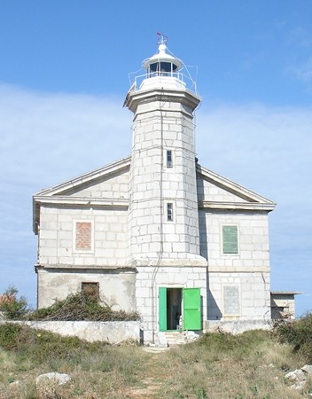
1876. Active; focal plane 20 m (66 ft); three white flashes every 15 s. 15 m (49 ft) square tower with lantern and gallery, centered on the roof of a 2-story masonry keeper's house. The lighthouse is unpainted white stone with a red tile roof; light tower and lantern are painted white. A photo is at the top of this page, Trabas has a photo by Werner Seiler, Werner Schug has a 2020 drone view, a view from the sea is available, Marinas.com has aerial photos, and Google has a satellite view. Located on a small island off the west coast of Cres near Pernat. Accessible only by boat. Site and tower closed. ARLHS CRO-020; PS-156; Admiralty E2764; NGA 12152.
Prestinice (Rt Prestinice) {Punta Prestenizze}
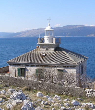
1872. Active; focal plane 17 m (56 ft); white light, 2 s on, 8 s off. 13 m (43 ft) square tower with lantern and gallery, rising from a 2-story keeper's house. The house is unpainted; lantern painted white. A Plovput photo is at right, Trabas has a photo by Werner Seiler, Dragutin Curk has a view from the sea, and Google has a satellite view. This lighthouse marks the narrowest section of the passage between Istria and Cres, known as the Vela Vrata (Vela Strait). Located on a promontory about 1.5 km (1 mi) south of Porozina. The site appears to be closed, but there's a distant view from the ferry from Brestova to Porozina. ARLHS CRO-120; PS-151; Admiralty E2802; NGA 12172.
Prestinice Light
Prestinice Light overlooking Vela Strait; Istria in the distance
Plovput photo

Rijeka Area (Mainland) Lighthouses
* Rt Tokal
Date unknown (1920s?). Active; focal plane 20 m (66 ft); white flash every 6 s. 7 m (23 ft) octagonal stone tower, painted white. A closeup photo is available, Trabas has Eckhard Meyer's closeup photo, Dalibor Jud has a view from the sea, a 2022 street view is available, and Google has a distant satellite view. Located on a promontory about 5 km (3 mi) southeast of Selce. Site open, tower closed. ARLHS CRO-175; Admiralty E2910; NGA 12416.
* Rt Ertak {Punta Ertac} (4?)
Date unknown (station established 1875). Active; focal plane 9 m (30 ft); white flash every 2 s. 5 m (17 ft) round cylindrical masonry tower with gallery, adjoining a 1-story square concrete equipment building. Lighthouse painted white. Trabas has Eckhard Meyer's photo, Milos Zuffa has a street view, a closeup is available, and Google has a satellite view. Located on a promontory on the mainland side of the Velebitski Channel, about 2.5 km (1.5 mi) southeast of the highway 102 bridge to Otok Krk. Site open, tower closed. ARLHS CRO-042; Admiralty E2896; NGA 12384.
* Rt Oštro (Kraljevica) {Porto Re}
1872. Reactivated (inactive prior to 2006); focal plane 15 m (49 ft); white light, 2 s on, 2 s off. 15 m (49 ft) round cylindrical masonry tower with lantern and gallery, rising through the center of a 1-story keeper's house. Lighthouse painted with red and white horizontal bands; lantern painted white. A Plovput photo is at right, Trabas has Arno Siering's excellent closeup, Milica Miljan has a 2023 photo, Marinas.com has aerial photos, Michel Forand has a historic photo, and Google has a street view and a satellite view. It isn't known how long the light was out of service before Plovput reactivated it in 2006. The red and white bands (unusual for Croatia) are traditional; a 1904 light list has this daymark for the tower. Located on the east side of the entrance to Kraljevica, about 10 km (6 mi) southeast of Rijeka. Site open, tower closed. PS-199; Admiralty E2854.1; NGA 12342.

Rt Oštro Light, Kraljevica
Plovput photo
* Gen. Petra Drapsina Breakwater {Maria Theresa Breakwater} (4?)
Date unknown (station established 1884). Active; focal plane 15 m (49 ft); three quick green flashes every 5 s. 14 m (46 ft) square cylindrical steel skeletal tower with gallery, painted green, mounted on a square 1-story masonry equipment shelter. Equipment shelter painted white. Trabas has a photo by Hans de Graaf, Elvis Kukuljan has a 2018 photo, Martin Klappacher has a 2017 street view, and Google has a satellite view. The original light was described as an iron column. Located at the end of the main breakwater of Rijeka. Accessible by walking the pier, and there should be a good view from ferries arriving or departing in Rijeka. Site and tower open. PS-187; Admiralty E2824; NGA 12240.
* Mlaka (Luka Rijeka) {Fiume} (3)
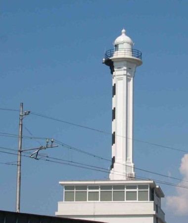
1920s (?) (station established 1878). Active; focal plane 39 m (128 ft); white flash every 10 s. 38 m (125 ft) hexagonal cylindrical concrete tower with lantern and gallery, standing atop a square 5-story building. Entire building painted white, except that the seaward side of the light tower is painted in black and white horizontal bands. Egidio Ferrighi's photo is at right, Trabas has Capt. Peter Mosselberger's photo, a 2019 photo is available, Ronald Pavletić has a 2023 photo, and Google has a street view and a satellite view. The building has apartments leased to retired Plovput employees. Michel Forand has a historic photo of the original light, which was closer to the sea; it had a focal plane of 12 m (39 ft). In 1898 the 1884 breakwater lighthouse was relocated onshore to replace the 1878 light; this made the focal plane 31 m (102 ft). Located on the Milutina Barača near the west end of the waterfront of Rijeka. Site open, tower closed. ARLHS CRO-206; PS-183; Admiralty E2822; NGA 12228.

Istria County (Istrian Peninsula) Lighthouses

East Coast (Kvarner) Lighthouses
The Kvarner Gulf (Kvarnerski Zaljev in Croatian, Golfo del Quarnaro in Italian) is the sound on the east side of the Istrian peninsula. The westernmost of several ship channels leading to Rijeka passes through the Kvarner between Istria and the island of Cres.

*
[Rt Sveti Andrija {Porto Rabaz, Porto Albona} (3)]
Date unknown (station established 1886). Active; focal plane 9 m (30 ft); three white flashes every 8 s. 4 m (13 ft) square stone tower, unpainted. Trabas has a closeup photo, Nicolas Bock has a beach view, Sasha Gostev has a street view, and Google has a satellite view. Huelse has a historic postcard view of the original lighthouse. It was rebuilt in 1907 and destroyed in 1945. A blogger has images of the historic lighthouse at various times in its history. Located on a promontory at the entrance to the harbor of Rabac. Site open, tower closed. PS-144; Admiralty E2794; NGA 12104.
Rijeka Light
Rijeka Light, Rijeka
photo copyright Egidio Ferrighi; used by permission
* Crna Punta {Punta Nera} (1)
1873. Inactive. Lantern mounted on the second floor, south corner, of a 2-story masonry keeper's house. The lighthouse is unpainted white stone; lantern painted white. The active light (focal plane 15 m (49 ft); two white flashes every 10 s) is on a 9 m (30 ft) white concrete post in front of the historic lighthouse. A Plovput photo is at right, Trabas has a photo by Hans de Graaf, Marijan Nikic has a closeup, and Bing has a satellite view. This house is privately owned and apparently available for vacation rental. "Crna Punta" means "Black Point." Located on a prominent cape about 12 km (7.5 mi) south of Labin. Site closed (private property), but apparently the lighthouse can be seen from the beach nearby. ARLHS CRO-035. Active light: PS-143; Admiralty E2782; NGA 12100.
[Rt Ubac (2)] {Punta Ubas}
Date unknown (station established 1887). Active; focal plane 16 m (52 ft); white flash every 4 s. 5 m (17 ft) post on a small cylinder, painted white. This beacon replaced a historic light station. The original lighthouse, a 14 m (46 ft) stone tower attached to a keeper's house, was blown up by German troops in 1944. Trabas has Eckhard Meyer's photo and Bing has an indistinct satellite view. Located on a prominent cape on the east side of Zaljev Rasa, a fjord-like inlet (uvala) near Trget. May be accessible only by boat. Site open, tower closed. PS-135; Admiralty E2768; NGA 12068.
Rt Rtac (Uvala Teplica)
Date unknown. Active; focal plane 9 m (30 ft); green flash every 2 s. 6 m (20 ft) octagonal concrete tower mounted on a large square concrete base. Tower painted green. Trabas has a closeup photo and Google has a satellite view. Located on the east side of Zaljev Rasa. Being at the base of a very steep slope, the light is accessible only by boat. Site open, tower closed. Admiralty E2776; NGA 12092.
Crna Punta Light
Crna Punta Light, Koromačno
Plovput photo
* Rt Sveti Mikula
Date unknown. Active; focal plane 9 m (30 ft); red flash every 2 s. 6 m (20 ft) octagonal concrete tower mounted on a large square concrete base. Tower painted red. Trabas has a photo by Capt. Peter Mosselberger, Tilo Steinmüller has a 2019 photo, and Google has a satellite view. Located on a promontory on the west side of Zaljev Rasa near Rakalj. Accessible by road. Site open, tower closed. Admiralty E2772; NGA 12080.
* Marlera (1)
1883. Reactivated; focal plane 21 m (69 ft); white flash every 9 s. Approx. 9 m (30 ft) square cylindrical stone tower with lantern and gallery, attached to the front of a 1-story stone keeper's house. Lighthouse painted white. The light was previously on a 9 m (30 ft) white concrete post in front of the historic lighthouse. Johann Tausch's 2023 photo is at right, Trabas has Eckhard Meyer's photo of the station, Pula Online has a nice photo, Marinas.com has aerial photos, Kornél Dulácska has a 2017 street view, and Google has a satellite view. For a long time the historic lighthouse was in poor condition and clearly endangered, but Plovput's photos show that it has been restored and the light has been returned to the lantern. A 2018 photo by Szymon Czarkowski shows that the post has been removed. Maria Linz has a 2018 photo that also shows a sign "Lighthouse for rent" (in English). In Findlay's 1879 list there is a note that a light was proposed for this location. Located on Rt Marlera, an east-pointing promontory about 5 km (3 mi) by sea northeast of Rt Kamenjak and 13 km (8 mi) east southeast of Pula. Site open, tower closed. ARLHS CRO-094; PS-131; Admiralty E2750; NGA 12060.

West Coast (Adriatic Sea) Lighthouses
Pličina Albanež
1910. Active; focal plane 15 m (49 ft); two flashes every 8 s, white or red depending on direction. 15 m (49 ft) round concrete tower with lantern and gallery, mounted on a conical pier. The tower is unpainted white concrete. Trabas has a photo by Hans de Graaf and Bing has a satellite view. Located on an isolated and very dangerous reef in the Adriatic about 2.8 km (1.75 mi) southeast of the Porer lighthouse and in the center of the approach to the Kvarner Gulf. Accessible only by boat. Site open, tower closed. ARLHS CRO-208; Admiralty E2742; NGA 12048.
 

Marlera Light, Pula, May 2023
Google Maps photo by Johann Tausch
 
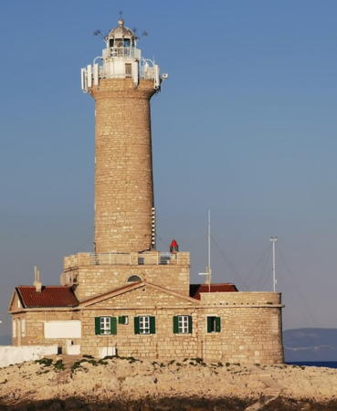
Porer (Hrid Porer) {Isola Pora, Capo Promontore}
1833. Active; focal plane 35 m (115 ft); three white flashes every 15 s. 31 m (102 ft) round cylindrical masonry tower, centered on a 1-story keeper's house. The lighthouse is unpainted cream-colored stone; the lantern is white with a gray metallic roof. Fog siren (two 4 s blasts every 42 s). Staffed weather station. M. Prinke's photo is at right, Trabas has a good photo by Tom Chisholm, Vlado Privrat has a 2020 photo, Dániel Fafula has a 2021 photo, Marinas.com has aerial photos, Huelse has a historic postcard view, and Google has a satellite view. This lighthouse marks the southern tip of the Istrian Peninsula. Although it is located on a tiny scrap of land, it has two apartments available for vacation rental. Plovput provides boat transportation for guests from Pula, but only in the morning; it's difficult to land at the lighthouse during the west winds that usually blow in the afternoon. Located on an islet about 2.5 km southwest of Rt Kamenjak, the tip of the peninsula, and about 10 km (6 mi) south of Pula. Accessible only by boat. Site and tower closed except to paying guests. . ARLHS CRO-014; PS-125; Admiralty E2738; NGA 12040.
* Verudica (Rt Verudica) {Verudella} (2)
Date unknown (station established 1877). Active; focal plane 11 m (36 ft); red flash every 3 s. 8 m (26 ft) octagonal cylindrical tower with gallery, attached to one corner of a modern L-shaped keeper's house. Lighthouse painted white with a red horizontal band at the top. Trabas has Eckhard Meyer's closeup photo, Peter Goulding also has a photo, and Google has a street view and a satellite view. The original light here was described as an "iron stand." Located at the tip of a peninsula at Verudica, about 4 km (2.5 mi) south of Pula. Site open, tower closed. ARLHS CRO-187; PS-124; Admiralty E2734; NGA 12036.
* Rt Peneda (Otok Brijuni) {Rt Pinida, Punta Peneda (Isola Brioni)}
1877. Active; focal plane 20 m (66 ft); white light, 2 s on, 2 s off. 15 m (49 ft) square cylindrical masonry tower with lantern and gallery, rising from the seaward side of a 2-story keeper's house. Peter Goulding has a photo, a sunset photo is available, Trabas has Tom Chisholm's closeup photo, Vito Cecchetto has a good photo, Jan Ťopek has a closeup, Huelse has a historic postcard view, and Google has a satellite view. Brijuni (Brioni in Italian) is a popular resort island off the southwest tip of Istria; most of the island is set aside as a national park. Brijuni is readily accessible by ferry from Fazana. Located at the southern tip of the island, about 7 km (4.5 mi) west of Pula. Site probably open, tower closed. ARLHS CRO-210; PS-113; Admiralty E2710; NGA 11996.

Porer Light, Pula, June 2022
Google Maps photo by A Kiss
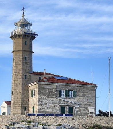
Sveti Ivan na Pučini {San Giovanni di Pelago}
1853. Active; focal plane 23 m (75 ft); two white flashes every 10 s. 15 m (49 ft) octagonal cylindrical stone tower with lantern and gallery, attached to a 2-story stone keeper's house. The lighthouse is unpainted cream-colored stone; the lantern is white with a gray metallic roof. Fog siren (one blast every 30 s). Staffed weather station. A photo is at right, Elena Aderenti has a 2017 closeup photo, Trabas has Darlene Chisholm's photo, Alberto Deck has a 2022 photo, Marinas.com has aerial photos, and Google has a satellite view. The history of the station is unclear: between 1912 and World War II the tower height was listed as 21 m (69 ft), and we don't know if this means that the tower was first raised and then lowered in height or if the building was rebuilt completely. This lighthouse marks the end of a dangerous reef extending southwestward from Rovinj. It is available for vacation rental -- which is unusual for such an exposed light station. Plovput provides boat transportation for guests from Rovinj, but only in the morning; it's difficult to land at the lighthouse during the west winds that usually blow in the afternoon. Located on a rocky islet about 2.5 km (1.5 mi) offshore and about 4 km (2.5 mi) southwest of Rovinj. Accessible only by boat. Site and tower closed except to paying guests. ARLHS CRO-017; PS-104; Admiralty E2690; NGA 11960.
* Rovinj (Rt Sveta Eufemija) {Rovigno (Punta Santa Eufemia)} (2)
1903 (station establsihed 1883). Active; focal plane 19 m (62 ft); white flash every 4 s. 7 m (23 ft) square cylindrical stone tower with a square lantern and gallery. The lantern is not in use; the light is displayed from the gallery rail. The lighthouse is unpainted; gallery rail painted black. A good photo is available, Trabas has Capt. Peter Mosselberger's closeup, another photo is available, Jonathan Hilton has a closeup street view, and Google has a satellite view. A mole light was established in Rovigno in 1865. Located at the tip of Rt Sveta Eufemija, a sharp-pointed peninsula sheltering the harbor of Rovinj. Site open, tower closed. ARLHS CRO-155; Admiralty E2680; NGA 11944.
* Sveti Nikola (St. Nicholas)
About 1403. Inactive since the mid 1800s. Approx. 15 m (49 ft) round cylindrical stone tower, now in ruins. Markus Haselböck has a closeup photo, Ivan Leskovar also has a closeup, and Google has a satellite view. This tower, one of the oldest lighthouses of the eastern Mediterranean, was built by Venice. It displayed an open fire until a lantern was added sometime in the 17th century. The old lighthouse is preserved in the grounds of a resort. Located at the western tip of Otok Sv. Nikola (St. Nicholas Island), sheltering the harbor of Poreč. Accessible only by boat. Site open, tower closed. Site manager: Isabella Island Resort. ARLHS CRO-166.

Sv. Ivan na Pučini Light, Rovinj, August 2006
Wikimedia public domain photo by Ivana
Poreč (Otok Sveti Nikola) {Parenzo (Isola San Nicola)} (2)
Date unknown (station established 1903?). Active; focal plane 7 m (23 ft); green flash every 3 s. 6 m (20 ft) round concrete tower topped by a dome; the light is displayed atop the dome. Tower painted white, dome green. Trabas has a closeup, Ron Dirken has a photo, and Google has a distant street view, and a satellite view. The original light was on an iron post. According to Findlay's 1879 list, there was a light at Parenzo from 1866. Located at the end of a mole extending from the northern tip of Otok Sv. Nikola (St. Nicholas Island), sheltering the harbor of Poreč. Accessible only by boat. Site open, tower closed. Admiralty E2663; NGA 11912.
* Rt Zub {Porto Quieto}
1872. Active; focal plane 11 m (36 ft); three flashes every 10 s, white or red depending on direction. Lantern and gallery mounted on a concrete post in front of a 2-story rectangular stone keeper's house. The light was formerly displayed through a second-story window of the house. A Plovput photo is at right, Trabas has Arno Siering's closeup photo, Volker Matthies has a street view, and Google has a satellite view. The house is unpainted stone with a red tile roof. Rt Zub (Cape Tooth) shelters the south side of the bay of Novigrad; its odd name comes from a legend about a woman whose teeth were miraculously restored there. The house is available for vacation rental. Located at the tip of the Lanterna (lighthouse) peninsula, about 13 km (8 mi) north of Poreč. Site open, building open to paying guests. ARLHS CRO-157; PS-087; Admiralty E2658; NGA 11904.

Rt Zub Light, Novigrad
Plovput photo
* Novigrad Breakwater (Umag) {Cittanova, Porto Umago}
1875. Active; focal plane 7 m (23 ft); white, red or green light depending on direction, 2 s on, 3 s off. 6 m (20 ft) octagonal white concrete tower. Trabas has a closeup photo, Marijan Kelava has a photo, a 2022 photo and another photo is available, and Google has a distant satellite view. Novigrad is a small port now used almost entirely by pleasure craft. Located at the end of the breakwater. Accessible by walking the pier. Site open, tower closed. PS-084; Admiralty E2654; NGA 11892.
Pličina Paklena {Secca Pegolotta}
1912. Active; focal plane 10 m (33 ft); two flashes every 8 s, red or white depending on direction. 10 m (33 ft) round strongly conical concrete tower, painted white, topped by a metal beacon painted red and mounted on a round concrete pier. Trabas has Capt. Peter Mosselnerger's photo and Bing has a satellite view. Located on a shoal off the entrance to Umag harbor. Accessible only by boat. Site open, tower closed. PS-076; Admiralty E2644; NGA 11872.
* Savudrija (Rt Savudrija) {Punta Salvore, Bassania} (2)
1818 (Pietro Nobile). Active; focal plane 36 m (118 ft); three white flashes every 15 s. 29 m (95 ft) round cylindrical stone tower with lantern and double gallery, rising from a 1- and 2-story keeper's complex. Fog siren (two blasts every 42 s). The lighthouse is unpainted cream-colored stone; the lantern is white with a gray metallic roof. This is a staffed station. A Plovput photo is at right, Trabas has Arno Siering's closeup, Ann Abulf has posted a good closeup photo, Roger Wirz has a 2021 closeup, Matic Kremžar has a 2023 drone view, Klaus Huelse has a historic postcard view, Marinas.com has aerial photos, Google has a street view, and Google has a satellite view. This is the oldest lighthouse in Croatia and is claimed to be the oldest lighthouse of the Adriatic (this is uncertain; the old lighthouse at Barletta, Italy, is said to have been built in 1807). According to Findlay's 1879 list the tower originally had a height of 19 m (62 ft), and the change in height seems to have occurred in the late 1890s. The 200th anniversary of the lighthouse was celebrated in April 2018. The light marks the southern entrance to the Gulf of Trieste. Before World War II the lighthouse was usually known by its Italian name, Punta Salvore. The 2-story principal keeper's house has two large apartments available for vacation rental. The lighthouse stands on the westernmost point of Croatia, near the village of Savudrija and within 5 km (3 mi) of the Slovenian border. Site open, tower closed. . ARLHS CRO-134; PS-075; Admiralty E2642; NGA 11868.
* Stara Savudrija Breakwater
Date unknown. Active; focal plane 7 m (23 ft); two red flashes every 5 s. 5 m (17 ft) round tapered concrete block tower, painted white. An external stairway winds around the tower. A photo is available, Trabas has Capt. Peter Mosselberger's photo, Csaba Gajáry has a 2022 photo, and Google has a street view and a satellite view. Located at the end of the breakwater of Stara (Old) Savudrija. Accessible by walking the pier. Site open, and anyone can claim the stairway. PS-075.2; Admiralty E2643; NGA 11870.
Savudrija Light
Savudrija Light, Savudrija
Plovput photo

Information available on lost lighthouses:

Notable faux lighthouses:

Adjoining pages: North: Slovenia | South: Central Croatia

Return to the Lighthouse Directory index | Ratings key

Posted October 9, 2006. Checked and revised December 14, 2023. Lighthouses: 44. Site copyright 2023 Russ Rowlett and the University of North Carolina at Chapel Hill.