Lighthouses of Southern Croatia

The Republic of Croatia (Republika Hrvatska in Croatian) is located on the east side of the Adriatic Sea and includes most of the coastline of the former federation of Yugoslavia. Including the historic regions of Istria, Croatia Proper, and Dalmatia, this coastal region has a very long history. Southern Croatia was the independent Republic of Ragusa for several centuries until it was captured by Napoleon in 1808. (Ragusa is the Italian name for Dubrovnik.) After the Napoleonic Wars the former Ragusa was part of the Kingdom of Dalmatia within the Austrian Empire until that empire was dissolved in 1918, at the end of World War I. The area was then incorporated into the state of Croatia within the federation of Yugoslavia. Croatia became independent in 1991 when the Yugoslav federation fell apart.

Croatia is divided into 21 counties, 7 of which touch the coast. The principal ports are Rijeka in the north, Split on the central coast, and Dubrovnik in the far south. This page covers the southern third of the Croatian coastline including the counties of Dubrovnik-Neretva and Split-Dalmatia.

Many places in Croatia were better known in the past by their Italian names. The Italian names of lighthouses, when known, are shown in curved brackets {}.

The Croatian word for a lighthouse is svjetionik. The word rt is a cape or promontory, otok is an island, otočić is an islet, hrid (plural hridi) is a rock, plićak or pličina is a shoal, zaljev is a bay, rijeka is a river, and luka is a port or harbor.

Aids to navigation in Croatia are managed by Plovput, a state-owned corporation. Plovput has developed fourteen of its light stations for vacation rental. Plovput has three regional offices in southern Croatia, at Dubrovnik, Korčula, and Split.

ARLHS numbers are from the ARLHS World List of Lights. PS numbers are the numbers, if known, from the Croatian light list Popis Svjetala i Signala za Maglu. Admiralty numbers are from volume E of the Admiralty List of Lights & Fog Signals. U.S. NGA List numbers are from Publication 113.

General Sources
Plovput - Aids to Navigation - Lighthouses
Information and photos posted by Plovput. There is also an Other Aids to Navigation page with photos of typical smaller beacons.
Online List of Lights - Croatia
Photos by various photographers posted by Alexander Trabas. Some of the Croatia photos are by Capt. Peter Mosselberger ("Capt. Peter"), Uli Knapp, Hans de Graaf, or Rainer Arndt.
World of Lighthouses - Croatia
Photos by various photographers available from Lightphotos.net.
Croatia Lighthouses
Aerial photos posted by Marinas.com.
Leuchttürme an der kroatischen Küste
Photos by Olaf Riesenberg posted by Bernd Claußen.
Lighthouses in Croatia
Photos by various photographers available from Wikimedia.
Weitere europäische Leuchttürme auf historischen Postkarten
Historic postcard views posted by Klaus Huelse.
GPSNavigationCharts
Navigation chart information for Croatia.
Navionics Charts
Navigation chart for Croatia.

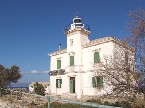
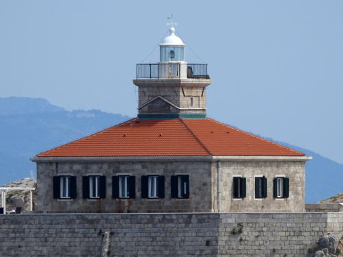
Pločica Light
Pločica Light, Korčula
Plovput photo

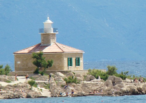
Sveti Petar LIght
Sveti Petar Light, Makarska, June 2008
Flickr Creative Commons photo by Wesley Bowler
Dubrovnik-Neretva County Lighthouses

Prevlaka Peninsula Lighthouse
* Oštra (Rt Oštra, Prevlaka) {Punta d'Ostro} (2)
Date unknown (station established 1854). Active; focal plane 73 m (240 ft); white light, 2 s on, 2 s off, 2 s on, 4 s off. The light is displayed from a red post atop a 1-story masonry building. Andreas Köhler has a closeup photo, Trabas has Eckhard Meyer's photo, Wikimedia's photo shows the light above the historic Prevlaka fortress, and Google has a satellite view. Originally this was the site of a 17 m (56 ft) lighthouse attached to a keeper's house; we don't know the fate of this building. This light marks the entrance to Herceg-Novi Bay, a deep fjord that extends into northwestern Montenegro. The Prevlaka Peninsula has been the subject of a long-running dispute between Croatia and Montenegro. The area was occupied by UN forces from 1996 to 2002, when it was returned to Croatian control under an agreement providing for its demilitarization. The question of sovereignty was to be referred to the International Court of Justice, but it has not been submitted to the Court. Located on a bluff at the end of a sharp promontory at Prevlaka, about 35 km (22 mi) southeast of Dubrovnik (this is the southernmost point of Croatia). Site open, tower closed. ARLHS CRO-111; PS-742; Admiralty E3620; NGA 14100.

Dubrovnik Area Lighthouses
Dubrovnik (originally Ragusa) is the county seat and a historic seaport with a population of about 50,000. The city occupies a narrow strip of Croatian territory along the coast, with Bosnian territory barely 5 km (3 mi) to the north. The city was heavily damaged by a seven-month siege duing the 1991 civil wars accompanying the breakup of Yugoslavia, but it has been very largely rebuilt.

Cavtat (Pličina Seka Velika)
Date unknown. Active; focal plane 8 m (26 ft); two white flashes every 10 s. 8 m (26 ft) concrete post rising from a round, tapered concrete base. Lighthouse painted with red and black horizontal bands. Trabas has Capt. Peter's photo, and Bing has a satellite view. Located on a reef in the entrance to the harbor of Cavtat, a popular resort town 15 km (9 mi) south of Dubrovnik. Accessible only by boat. Site open, tower closed. PS-738; Admiralty E3614.5; NGA 14084.
Grebeni {Pettini}
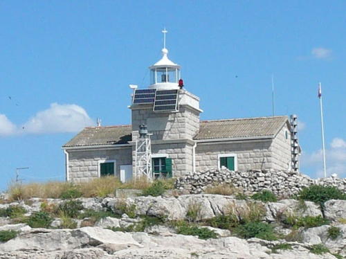
1872. Active; focal plane 27 m (89 ft); three white flashes every 10 s. 13 m (43 ft) square cylindrical stone tower with lantern and gallery centered on a 1-story stone keeper's house. Lighthouse is unpainted white stone, lantern painted white. Trabas has a good photo by Capt. Peter (also seen at right), Bernhard Bodlos has a 2018 photo, Marinas.com has aerial photos, and Google has a satellite view. A photo taken in 2005 (no longer online) showed the lighthouse to be in very poor condition with large holes in the roof, damage probably caused by shelling during the siege of Dubrovnik by Yugoslav (Serbian) forces in 1991-92. However, Intiaz Rahim's 2009 photo shows the lighthouse repaired with a bright new roof. Located on Hrid Grebeni, a small island about 800 m (1/2 mi) offshore on the west side of Dubrovnik. Accessible only by boat, but there are distant views from the mainland. Site and tower closed. . ARLHS CRO-054; PS-710; Admiralty E3598; NGA 14040.

Grebeni Light, Dubrovnik
photo copyright Capt. Peter Mosselberger; used by permission
Daksa (Daxa)
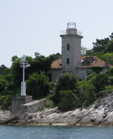
1876. Inactive. 13 m (43 ft) octagonal cylindrical stone tower with lantern and gallery, attached to one end of a 1-story stone keeper's house. The lighthouse is unpainted white stone. Active light (focal plane 7 m (23 ft); white flash every 6 s) on a 4 m (13 ft) steel post. Karen Rustad Tölva's photo is at right, another photo is available, and the lighthouse emerges from trees in a Google satellite view. Trabas has Arndt's photo of the modern light on a white 5 m (16 ft) tower (focal plane 7 m (23 ft); white flash every 6 s). The historic lighthouse was active as late as the 1960s, at least. Located at the northern tip of Otočić Daksa, an island protecting the entrance to Dubrovnik harbor. Accessible only by boat. Site status unknown, but there are good views from all ships entering or leaving the harbor. ARLHS CRO-037. Active light: PS-724; Admiralty E3600; NGA 14044.
Rt Bezdanj (Rt Gornji)
Date unknown. Active; focal plane 18 m (59 ft); two white flashes every 8 s. 6 m (20 ft) round strongly conical white stone tower. Trabas has Capt. Peter's photo, Gary Merrett has a 2019 photo, a 2020 view from the sea is available, and Google has an indistinct satellite view. Located on the southern tip of the island of Koločep marking the north side of the entrance to Dubrovnik. Probably accessible only by boat. Site status unknown. Admiralty E3595; NGA 14032.
Sveti Andrija {Donzella} (2)
1873. Active; focal plane 69 m (226 ft); white flash every 15 s. 17 m (56 ft) square cylindrical stone tower with lantern and gallery centered on a 2-story stone keeper's house. Clamshell Fresnel lens in use. Lighthouse is unpainted white stone, lantern painted white. Trabas has Arndt's view, Petra Schumacher has a 2021 photo, Marinas.com has aerial photos, and Google has a satellite view. The lighthouse has been renovated for vacation accommodations; it was apparently under renovation in 2017 but was available again as of 2019. This is a landfall light for Dubrovnik. Located on Otočić Sveti Andrija, a small island about 13 km (8 mi) west of Dubrovnik. Accessible only by boat. Site status unknown. ARLHS CRO-001; PS-708; Admiralty E3590; NGA 14024.
[Rt Donji (Slano)]
1875. Active; focal plane 16 m (52 ft); red flash every 4 s. 4 m (13 ft) post; post painted red. The 1-story keeper's cottage is abandoned and in ruins. A 2021 photo and a view from the sea are available, Trabas has Knapp's photo, and Google has a distant satellite view. This light marks the entrance to the protected bay of Slano. Located on a promontory of the mainland about 50 km (30 mi) northwest of Dubrovnik. Site status unknown. ARLHS CRO-039; PS-720; Admiralty E3580; NGA 14004.

Daksa Light, Dubrovnik, June 2007
Flickr Creative Commons photo
by Karen Rustad Tölva
Olipa (3?)
1878 (station established 1842?). Active; focal plane 31 m (102 ft); three white flashes every 10 s. 11 m (36 ft) square cylindrical stone tower with lantern and gallery, attached to a small stone keeper's house. The lighthouse is unpainted white stone; lantern painted white. Trabas has Knapp's photo, Marga van Rijssel has a photo, Huelse has a postage stamp image, and Google has an indistinct satellite view. The 1842 date comes from the postage stamp but the light did not appear on international lists until 1872. According to Findlay's 1879 list, a new lighthouse was built in 1878 306 yards (280 m) west of the 1872 lighthouse. Olipa is the westernmost of the Elaphiti islands, an archipelago of small islands stretching along the mainland coast between the base of the Pelješac Peninsula and Dubrovnik. The lighthouse guards the entrance to the Kolocepski Kanal (channel), the protected passage between the islands and the mainland. Located on the southeastern point of Otočić Olipa. Site status unknown. ARLHS CRO-008; PS-703; Admiralty E3561; NGA 13984.

Mljet and Lastovo Lighthouses

Southernmost of the major Dalmatian islands, Mljet (known in Roman times as Melita, "honey") is located south of the Pelješac Peninsula and east of Lastovo. Mljet is 37 km (23 mi) long and has a permanent population of about 1100. Like the other inhabited islands, it is accessible by ferry. Lastovo is a resort island south of Korčula and west of Mljet.
Sobra (Rt Pusti) {Meleda} (4?)
Date unknown (station established 1885). Active; focal plane 14 m (46 ft); white flash every 3 s. 10 m (33 ft) octagonal cylindrical masonry tower, painted white. Trabas has Knapp's photo, another photo is available, and Google has a satellite view. There were at least two and probably three earlier lights at this station. Located on the tip of the peninsula sheltering the harbor of Sobra, on the north coast of Mljet. Site status unknown, but there must be good views from ferries arriving from Korčula or Dubrovnik. ARLHS CRO-211; PS-700; Admiralty E3537; NGA 13952.
Glavat {Isolotti Lagostini}
1884. Active; focal plane 45 m (148 ft); five white flashes every 30 s. 26 m (85 ft) round cylindrical stone tower with lantern and gallery, centered on the roof of a large 2-story stone keeper's house. Lighthouse is unpainted white stone, lantern painted white. Trabas has an excellent photo, Tadej Tuma has a closeup, Tibor M. Kovacs has a photo, Brian Domander has a good view from the sea, amateur radio operators report on a 2002 visit to the station, and Google has a satellite view. This important but rather poorly-known lighthouse is located on a small island midway between Lastovo and Mljet, marking the end of a dangerous reef. Accessible only by boat. Site open, tower closed. ARLHS CRO-004; PS-690; Admiralty E3554; NGA 13944.
Otočić Tajan Velji
Date unknown. Active; focal plane 20 m (66 ft); white flash every 5 s. 7 m (23 ft) square cylindrical stone tower, unpainted. Sea-seek.com has a very distant view and Bing has a distant satellite view. Located on an islet about 8 km (5 mi) northeast of Lastovo. Accessible only by boat. Site open, tower closed. ARLHS CRO-170; Admiralty E3551; NGA 13940.
* Struga {Isola Lagosta}
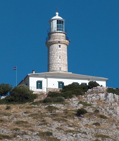
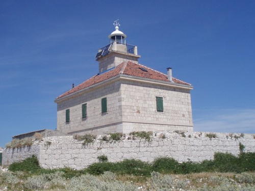
1851 (station established 1839?). Active; focal plane 105 m (344 ft); white flash every 10 s. 23 m (75 ft) round cylindrical stone tower rising from the center of a 1-story stone keeper's house. The tower is unpainted stone; lantern and house painted white. A Plovput photo is at right, a 2020 closeup photo and a 2008 closeup photo are available, Trabas has Arndt's photo, Marinas.com has aerial photos, and Google has a satellite view. Plovput has renovated the keeper's house for vacation accommodations. Although Plovput says the station was established in 1839 it did not appear on international light lists until 1851. This lighthouse is on Lastovo, an inhabited island about 10 km (6 mi) south of Korčula. Located on Rt Struga, a sharp cape on the south side of the island; accessible by a gravel road. Site open, lighthouse open to paying guests. ARLHS CRO-148; PS-692; Admiralty E3544; NGA 13912.
Struga Light
Struga Light, Lastovo
Plovput photo
Rt Kremene (Otok Prežba)
Date unknown. Active; focal plane 18 m (59 ft); flash every 5 s, white or red depending on direction. 8 m (26 ft) mast atop a white stone tower. Milan Srnec has a photo, Trabas has Arndt's distant view, and Bing has a satellite view. Located on a promontory on the south side of Otok Prežba, an island linked by a short bridge to the west end of Lastovo. Site status unknown. ARLHS CRO-074; Admiralty E3548; NGA 13920.

Sušac Lighthouse
Sušac {Isola Cazza}
1878. Active; focal plane 94 m (308 ft); two white flashes every 15 s. 20 m (66 ft) square cylindrical stone tower with lantern and gallery centered on a 2-story stone keeper's house. Lighthouse is unpainted white stone, lantern painted white. A Plovput photo is at right, Trabas has Arndt's view from the sea, Tadej Tuma has a 2022 photo, Anamarija Žeger also has a 2022 photo, and Google has a satellite view of the station. The lighthouse has been renovated with two apartments for vacation accommodations; transportation is provided from Split. Sušac (formerly called Cazza) is a rugged, uninhabited island about 20 km (13 mi) west of Lastovo and a similar distance southwest of Korčula. Located on heights at the southwestern end of the island. Accessible only by boat. Site and tower closed except to paying guests. ARLHS CRO-011; PS-693; Admiralty E3538; NGA 13904.
 

Sušac Light, Sušac
Plovput photo
 

Palagruža Lighthouse
Palagruža {Pelagosa}
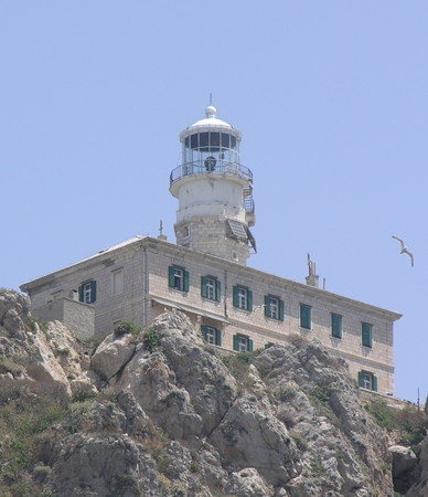
1875. Active; focal plane 110 m (361 ft); white flash every 17.5 s. 23 m (75 ft) round cylindrical stone tower with lantern and gallery, centered on the roof of a large 2-story stone keeper's house. This is a staffed weather station. Lighthouse is unpainted white stone, lantern painted white. A Plovput photo is at right, another closeup is available, Trabas has a view from the sea by Capt. Theo Hinrichs, Cecilia Balint has a nice 2007 photo, a 2004 photo is available, and Google has a satellite view. An infamous hazard to navigation in the Adriatic, Palagruža is an isolated island in the middle of the Adriatic Sea, 48 km (30 mi) south of Lastovo. The island is a sharp ridge of rock 1400 m (7/8 mi) long and about 300 m (330 yd) wide. Formerly under Italian administration, the island was ceded to Austria-Hungary in 1873; the Austrian administration built the lighthouse immediately. Construction of the lighthouse at the highest point of this isolated island was a considerable engineering triumph. Two apartments in the large building are available for vacation accommodations, with boat transportation provided from Korčula. Accessible only by boat. Site open, tower closed. ARLHS CRO-012; PS-694; Admiralty E3586; NGA 11052.

Korčula Lighthouses
Korčula (known as Corcyra in Roman times and as Curzola in Italian) is an island south of Hvar and west of the Pelješac peninsula. The island is large, 47 km (29 mi) in length, and it has the second largest population of any Croatian island, about 16,000. It is readily accessible by ferry and is a very popular resort area.

Ražnjić (Rt Ražnjić)
Date unknown. Active; focal plane 13 m (43 ft); white flash every 6 s. 8 m (26 ft) square cylindrical unpainted stone tower with gallery. Tomasz Białek has a 2021 photo, Carole Maillefer has a photo, Trabas has Darlene Chisholm's closeup photo, Grzegorz Majchrzak has a 2022 street view, and Google has a satellite view showing the shadow of the lighthouse. Located on Rt Rašnjic, the easternmost point of Korčula. It's not clear if there is any public access by land. Site open, tower closed. ARLHS CRO-130; Admiralty E3486; NGA 13872.
* Rt Velo Dance
Date unknown. Active; focal plane 12 m (39 ft); three white flashes every 10 s. 6 m (20 ft) octagonal cylindrical stone tower with gallery. The lighthouse is unpainted white stone. Trabas has Knapp's photo and the shadow of the lighthouse is seen in Google's distant satellite view. Located on the southwestern tip of Korčula, about 7 km (4.5 mi) southwest of Vela Luka. Site open, tower closed. PS-625; Admiralty E3461; NGA 13884.

Palagruža Light
Palagruža Light, Otočić Palagruža
Plovput photo

Otočić Kamenjak
Date unknown. Active; focal plane 10 m (33 ft); two red flashes every 6 s. 7 m (23 ft) hexagonal cylindrical stone tower. The lighthouse is unpainted white stone. Trabas has Knapp's photo and the Google has a satellite view. Located on an islet about 5 km (3 mi) west of Vela Luka. Site open, tower closed. Accessible only by boat. ARLHS CRO-063; Admiralty E3454; NGA 13888.
Otočić Proizd
Date unknown. Active; focal plane 11 m (36 ft); white flash every 3 s. 8 m (26 ft) square stone tower, unpainted. Trabas has Knapp's photo, Robert Ferjančič has a photo, and Google has a distant satellite view. Located at the eastern end of Otočić Proizd, a small island off the northwestern tip of Korčula. Accessible only by boat. Site open, tower closed. ARLHS CRO-122; PS-630; Admiralty E3452; NGA 13900.
Pločica (Otočić Pločica) {Isola Planchetta}
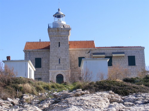
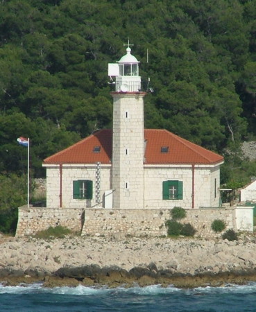
1887. Active; focal plane 25 m (82 ft); two white flashes every 10 s. 12 m (39 ft) square cylindrical stone tower with lantern and gallery, rising from the front of a 2-story stone keeper's house. Lighthouse painted white. A Plovput photo is at the top of this page, a closeup is available, Trabas has Eckhard Meyer's aerial view, Marinas.com has aerial photos, and Google has a satellite view of the station. The house is available for vacation accommodations. Pločica is a small, teardrop-shaped island in the Hvarski Kanal (Hvar Channel) about 6 km (4 mi) north of Prigradica, Korčula. Located on the highest point of the island. Site open, lighthouse open to paying guests. ARLHS CRO-013; PS-624; Admiralty E3450; NGA 13720.
Otočić Sestrice Vela (Korčula) {Due Sorelle}
1871. Active; focal plane 18 m (59 ft); four white flashes every 15 s. 12 m (39 ft) square cylindrical stone tower with lantern and gallery, rising from the front of a 2-story stone keeper's house. The lighthouse is unpainted white stone. A Plovput photo is at right, Jopy Šoda has a 2021 photo, Trabas has Eckhard Meyer's photo and Google has a satellite view. This is probably the least well known of three Croatian lighthouses called Sestrice Vela ("big sister"). Located on the larger of two small islands (the "two sisters," due sorelle in Italian) in the eastern entrance to the Pelješki Kanal (Pelješki Channel) about 2.5 km (1.5 mi) southwest of Podstub. Accessible only by boat. Site status unknown. ARLHS CRO-016; PS-643; Admiralty E3482; NGA 13864.
Sestrica Vela Light
Sestrice Vela Light, Korčula
Plovput photo

Poluotok Pelješac (Pelješac Peninsula) Lighthouses
The narrow Pelješac Peninsula (called the Sabbioncello peninsula in Italian) extends westward some 70 km (44 mi) from an isthmus at Ston. It is an odd feature of Balkan political geography (resulting from a 1699 treaty) that the mainland coast north of the Pelješac is not entire Croatian; there is a small strip of Bosnian coastline surrounding the town of Neum. The Pelješac Bridge, completed in July 2022, crosses the Bay of Mali Ston from Croatian territory west of Neum to the peninsula, providing a physical connection between the Dubrovnik area and the rest of Croatia for the first time.
Lirica (2)
Date unknown (station established 1911). Active; focal plane 34 m (112 ft); white light, 2 s on, 8 s off. 14 m (46 ft) round tower with lantern and gallery, painted white, mounted atop a round masonry tower. Lazar Badanjac has a closeup street view, Suzana Medak has a view from the sea, Trabas also has a view, and Google has a satellite view. Located on a small island off a promontory about 5 km (3 mi) southeast of Trstenik, on the south coast of the peninsula. Accessible only by boat. Site status unknown. ARLHS CRO-086; PS-697; Admiralty E3560; NGA 13980.
Osičac (Rt Osičac)
Date unknown. Active; focal plane 9 m (30 ft); white flash every 3 s. 8 m (26 ft) octagonal cylindrical stone tower with gallery, painted white. Trabas has Knapp's photo, Robert Janda has a photo, a view from the sea is available, and Google has a satellite view. Located on Rt Osičac, marking the north side of the western entrance to the Pelješki Kanal (Pelješki Channel) separating the Pelješac Peninsula from the island of Korčula. There does not appear to be any road access to the site. Site status unknown. ARLHS CRO-108; Admiralty E3486.5; NGA 13828.
Rt Lovište (Lovišće) {Capo Gomens} (1)
1874. Inactive since around 1930. 11 m (36 ft) square stone tower attached to the front of a keeper's house. Lantern removed. No photo available but Google has a satellite view. This lighthouse was in service in 1920 but the light had been moved to a new tower (next entry) by 1937. The keeper's house probably remained in service until recent years. Located on Rt Lovište at the extreme western tip of the Pelješac Peninsula. There does not appear to be any road access to the station. Site status unknown.
Rt Lovište (Lovišće) {Capo Gomens} (2)
Date unknown (station established 1874). Active; focal plane 10 m (33 ft); three white flashes every 10 s. 9 m (30 ft) square cylindrical stone tower with gallery rising from a pyramidal base, painted white. Damir Kraljević has a photo and Google has a satellite view. Located at the extreme tip of Rt Lovište. Site status unknown. ARLHS CRO-088; PS-694.5; Admiralty E3488; NGA 13820.
Rt Blanca (1)
1885. Inactive. Approx. 10 m (33 ft) square cylindrical unpainted stone tower with lantern and gallery, rising from the seaward side of a 1-story stone keeper's house. The active light (focal plane 10 m (33 ft); white flash every 5 s) is on a 7 m (23 ft) white post mounted on the boat landing of the lighthouse. M. Bagyinszky's photo is at right, Trabas has a photo, Maciej Bęcek has a 2021 closeup, and Google has a satellite view. The keeper's house is partly unroofed and falling into ruin. NGA and ARLHS misspell the name as Blaca. Located on Rt Blaca, a promontory on the north side of the peninsula, about 3 km (1.8 mi) northwest of Brijesta. Site status unknown. ARLHS CRO-032. Active light: PS-675; Admiralty E3522; NGA 13804.
Rt Blaca Light
Rt Blanca Light, Brijesta, June 2010
ex-Panoramio photo by M. Bagyinszky; permission requested

Split-Dalmatia County Lighthouses

Otok Vis Lighthouses
Vis, also known as Issa or Lissa in Italian, is an inhabited island about 15 km (9 mi) southwest of Hvar. Like Hvar and Brač, it is a popular resort accessible by ferries from Split.
Viska Luka (Host) {Porto San Giorgio}
Date unknown (station established 1873). Active; focal plane 21 m (69 ft); white flash every 4 s. 11 m (36 ft) octagonal stone tower attached to a 1-story stone keeper's house. Trabas has Darlene Chisholm's closeup photo, a 2020 photo is available, Marinas.com has aerial photos, and Google has a satellite view. The lighthouse was renovated for vacation accommodations but since 2016 it is no longer on Plovput's list of currently available properties. Located on the small island of Host in the entrance to the harbor of Vis, on the north side of the island. Accessible only by boat. Site status unknown. PS-519; Admiralty E3436; NGA 13680.
Rt Stončica {Punta Promontore}
1865. Active; focal plane 38 m (125 ft); white flash every 15 s. 28 m (92 ft) octagonal cylindrical stone tower with lantern and gallery, rising from one end of a 1-story keeper's house. Trabas has Darlene Chisholm's closeup photo (also seen at right), Tadej Tuma has a 2022 photo, a photo taken from the sea is available, Duje Matešan has a 2018 view from the sea, Marinas.com has aerial photos, and Google has a satellite view. This lighthouse functions as a landfall light for the Split region. Located on Rt Stončica, the eastern tip of Vis. Accessible by a hiking trail from the village of Stončica. There are also boat tours that visit the lighthouse. Site open, tower closed. ARLHS CRO-146; PS-517; Admiralty E3432; NGA 13672.
Rt Stupišće
Date unknown. Active; focal plane 18 m (56 ft); three white flashes every 12 s. 8 m (26 ft) square cylindrical masonry tower, unpainted. Denis Orlić has a sea view and Bing has a satellite view. Located on the southwestern tip of Otok Vis. Site open, tower closed. ARLHS CRO-150; PS-525; Admiralty E3443; NGA 13700.

Stončica Light, Vis
photo copyright Darlene Chisholm; used by permission
Mali Barjak (2)
Date unknown. Active; focal plane 13 m (43 ft); white flash every 3 s. 8 m (26 ft) square cylindrical stone tower, unpainted. Lightphotos.net has a closeup photo, Suzana Medak has a view from the sea, Marinas.com has aerial photos, and Bing has a fuzzy satellite view. The original light was on a skeletal tower. Located on Mali Barjak, a rocky islet off the northwestern tip of Otok Vis. Accessible only by boat. Site open, tower closed. ARLHS CRO-028; Admiralty E3440; NGA 13692.

Otok Hvar Lighthouses
The island of Hvar was known as Pharia in ancient times and as Lesina in Italian. The island is long and narrow, stretching some 80 km (50 mi) due east and west south of Brač. Enjoying a mild climate, it is a very popular resort.
* Sućuraj {Punta San Giorgio} (2)
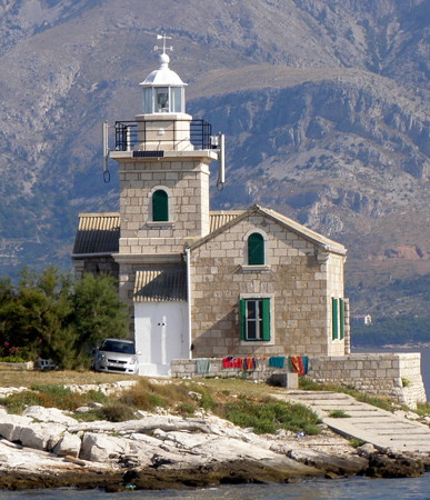
1912 (station established 1874). Active; focal plane 14 m (46 ft); white light, 2 s on, 2 s off. 14 m (46 ft) square cylindrical stone tower with lantern and gallery, rising from a 1-1/2 story stone keeper's house. The lighthouse is unpainted white stone; lantern painted white. In the photo at right, the view is from the cape to the mountains of the mainland 5 km (3 mi) to the north. A photo is at right, Trabas has Eckhard Meyer's photo, Kenan Kurtovic has a 2018 photo, Marinas.com has aerial photos, and Google has a street view and a satellite view. Located on Rt Sućuraj at the easternmost tip of Hvar. Accssible by road and there's a good view from ferries sailing between Sućuraj and Drvenik on the mainland. Site open, tower closed. . ARLHS CRO-151; PS-645; Admiralty E3490; NGA 13664.
Rt Podšćedro (Otok Šćedro)
Date unknown. Active; focal plane 21 m (69 ft); flash every 6 s, white or red depending on direction. 8 m (26 ft) square stone tower. Denis Orlić has a very distant sea view and Google has a satellite view. Located near the western tip of Otok Šćedro, an island about 8 km (5 mi) long off the south coast of Otok Hvar. Accessible only by boat. Site and tower closed. PS-622; Admiralty E3446; NGA 13712.
Hridi Lukavci
Date unknown. Active; focal plane 14 m (46 ft); red flash every 3 s. 8 m (26 ft) stone tower. Trabas has Eckhard Meyer's distant view and Google has a satellite view. Located on an islet off the south coast of Otok Hvar and about 5 km (3 mi) west of Otok Šćedro. Accessible only by boat. Site open, tower closed. PS-621; Admiralty E3445; NGA 13708.
Sućuraj Light
Sućuraj Light, Hvar, August 2008
Wikimedia Creative Commons photo by vacation2
Pokonji Dol (Hvar)
1872. Active; focal plane 20 m (66 ft); white flash every 4 s. 15 m (49 ft) square cylindrical stone tower with lantern and gallery, centered on the roof of a 2-story stone keeper's house. Trabas has a photo by Ulrich Knapp, another photo is available as well as a view from the beach on Hvar, Marinas.com has aerial photos, and Bing has a satellite view. Located on a tiny island about 4 km (2.5 mi) southeast of Hvar harbor; ships arriving in Hvar from the Adriatic must pass close to the island. Accessible only by boat. Site and tower closed. ARLHS CRO-119; PS-620; Admiralty E3410; NGA 13612.
Gališnik (Galešnik)
Date unknown (station established 1913). Active; focal plane 11 m (36 ft); green flash every 6 s. 9 m (20 ft) square masonry tower, painted white. Trabas has a closeup photo by Eckhard Meyer, Wikimedia has a view from the sea, Denis Orlić has a distant sea view, and Google has a satellite view. Located on Otočić Gališnik, a small island lying to the south of the harbor of the town of Hvar, on the southwest coast of the island. Site status unknown. ARLHS CRO-048; PS-618; Admiralty E3406; NGA 13600.
Otok Vodnjak Veli (Pakleni Otoci)
Date unknown. Active; focal plane 31 m (102 ft); white flash every 6 s. 8 m (26 ft) hexagonal cylindrical unpainted white stone tower. Trabas has a view from the sea by Ulrich Knapp, Giacomo Deperu has a distant 2021 view, and Google has a satellite view. Located on a small island, the westernmost of the Pakleni archipelago, about 10 km (6 mi) west of Hvar. Accessible only by boat. Site open, tower closed. Admiralty E3431.5; NGA 13592.
Pelegrin (Rt Pelegrin) (2)
Date unknown (station established 1909). Active; focal plane 21 m (69 ft); three white flashes every 10 s. 8.5 m (28 ft) octagonal white stone tower mounted on a masonry base. Trabas has a photo by Knapp, Damir Kraljević has a photo, Denis Orlić has a distant sea view, Marinas.com has aerial photos, and Google has a satellite view. Located on Otočić Gališnik, a small island lying to the south of the harbor of the town of Hvar. The original light was described as a red conical tower. Located on Rt Pelegrin, the western tip of Hvar, about 3 km (2 mi) west of Vira. Site status unknown. ARLHS CRO-113; PS-598; Admiralty E3404; NGA 13596.

Pokonji Dol Light, Hvar
Plovput photo
* Jelsa {Gelsa} North Mole
1871. Active; focal plane 7 m (23 ft); green flash every 3 s. 6 m (20 ft) octagonal cylindrical stone tower with a conical iron top; the light is displayed atop the cone. Tower painted white, cone green. Trabas has Eckhard Meyer's photo, Denis Orlić has a sea view, Google has a street view, and Bing has a satellite view. Located at the end of the breakwater mole at the entrance to Jelsa, a port on the north side of Hvar; there's a good view from ferries arriving from Split or from Bol or Milna on Otok Brač. Accessible by walking the mole. PS-611; Admiralty E3428; NGA 13656.
Otočić Zečevo
Date unknown. Active; focal plane 11 m (36 ft); white flash every 5 s. 6 m (20 ft) square cylindrical white stone tower. Trabas has Eckhard Meyer's photo, Jiřina Melichová has a view from the sea, Denis Orlić has a distant sea view, and Google has a satellite view. Located at the east end of Zečevo, an uninhabited islet off the north cost of Hvar near Vrboska. Accessible only by boat. Site open, tower closed. Admiralty E3426; NGA 13644.

Otok Brač Lighthouses
Brač, the third largest island of the Croatian coast, is separated from the mainland to the north by the Brač Channel and from the island of Hvar to the south by the Hvar Channel. The island was called Brattia in Roman times and Brazza in Italian. There is a permanent population of about 14,000. The island is readily accessible by ferry from Split.
* Sveti Nikola (Pučišća) {Pucisce} (2)
Date unknown (station established 1882). Active; focal plane 20 m (66 ft); white flash every 5 s. 11 m (36 ft) square cylindrical tower with lantern and gallery, rising from one corner of a 1-story keeper's house. Lighthouse painted white. A Plovput photo is at right, Jackie Hamlin Bensfield has a 2020 photo, Trabas has a closeup photo, a distant view is available, Denis Orlić has a sea view, Marinas.com has aerial photos, and Google has a satellite view. Note that this is one of several Sv. Nikola lights in Croatia. The light here was shown originally from a church tower; ruins of the church can be seen near the present lighthouse. Located on Rt Sv. Nikola, marking the west side of a narrow bay leading to Pučišća, a town on the north side of Otok Brač. The lighthouse appears to be accessible by road from the town. Site open, tower closed. ARLHS CRO-209; PS-592; Admiralty E3380; NGA 13556.
Rt Rašćatna (Lašćatna)
Date unknown. Active; focal plane 12.5 m (41 ft); four white flashes every 15 s. 8 m (26 ft) square cylindrical stone tower, painted white. A 2008 photo and another good photo are available, Trabas has a view from the sea, Denis Orlić has a sea view, Marinas.com has aerial photos, and Google has a satellite view. There does not appear to be any land access to the lighthouse. Located at the eastern tip of Otok Brač. Site status unknown. Admiralty E3392; NGA 13564.
* Sumartin {Port St. Martino}
1881. Active; focal plane 8 m (26 ft); white flash every 3 s. 6 m (20 ft) square cylindrical tower attached to a small 1-story equipment shelter. Lighthouse painted white. Trabas has a closeup photo, a 2008 closeup and a view from the sea are available, Denis Orlić has a sea view, and Google has a street view and an indistinct satellite view. Located on the east side of the entrance to the harbor of Sumartin, which faces the Hvarski Kanal (Hvar Channel) on the southeast side of Otok Brač. Accessible by road. Site open, tower closed. ARLHS CRO-153; Admiralty E3396; NGA 13568.
Sveti Nikola Light
Sveti Nikola Light, Pučišća
Plovput photo
* Bol
1882. Active; focal plane 7.5 m (25 ft); green flash every 3 s. 7 m (23 ft) square cylindrical masonry tower with a domed top; the light is mounted atop the dome. Lighthouse unpainted; dome painted green. Trabas has a closeup photo, Roni Marinkovic has a street view, Denis Orlić has a sea view, and Google has a satellite view. Located at the end of the main pier at Bol, a port on the central south coast of Otok Brač. Accessible by walking the pier. Site open, tower closed. Admiralty E3400; NGA 13576.
Rt Ražanj {Punta Speo}
1875. Active; focal plane 17 m (56 ft) white flash every 5 s. 14 m (46 ft) cylindrical stone tower with lantern and gallery, rising from the seaward side of a 1-story keeper's house. Lighthouse painted white. This is a staffed station. Larry Myhre's photo is at right, Trabas has a photo by Knapp, an excellent photo and a 2008 photo are available, Maja Vukusic has a 2022 view from the sea, Denis Orlić has a very distant sea view, Marinas.com has aerial photos, and Google has a satellite view. Located on Rt Ražanj, the southwestern tip of Otok Brač, guarding the narrow passage between the islands of Brač and Šolta about 3 km (2 mi) west of Milna. Site status unknown. ARLHS CRO-129; PS-575; Admiralty E3342; NGA 13528.
[Mrduja (Murduja)]
Date unknown. Active; focal plane 14 m (46 ft); green flash every 3 s. 6 m (20 ft) post. Larry Myhre has a good photo, Trabas has Eckhard Meyer's photo, another photo is available, and Bing has a satellite view. Ruins surrounding the light appear to be those of a former lighthouse but are actually ruins of a 19th century fort. Located on a small island, about 2 km (1.25 mi) north of Rt Ražanj, lighting the northern entrance to the narrow passage between the islands of Brač and Šolta. Accessible only by boat. Site open, tower closed. ARLHS CRO-099; PS-576; Admiralty E3340; NGA 13524.
Rt Bijaca (Milna)
1881. Active; focal plane 8 m (26 ft); red flash every 3 s. 7 m (23 ft) square cylindrical stone tower with gallery and a small lantern. The lighthouse is unpainted white stone. Trabas has a closeup photo and Google has a street view and an indistinct satellite view. Located on Rt Bijaca, a headland on the north side of the entrance to Milna, at the west end of Otok Brač. Site status unknown. ARLHS CRO-031; Admiralty E3344; NGA 13532.
* Postira
1885. Active; focal plane 7 m (23 ft); red flash every 2 s. 6 m (20 ft) square cylindrical stone tower topped by a dome; the light is displayed from atop the dome. Tower painted white, dome red. Trabas has a closeup photo, Jurica Matulić has a photo, Marcin Dzioboń has a 2023 photo, and Google has a street view and an indistinct satellite view. Located at the end of the breakwater mole at Postira, on the central north coast of Otok Brač. Accessible by walking the mole. Site open, tower closed. PS-591; Admiralty E3370; NGA 13552.
Rt Razanj Light
Rt Ražanj Light, Brač, May 2009
Flickr Creative Commons photo by Larry Myhre

Šolta Lighthouse
Rt Livka
Date unknown. Active; focal plane 11 m (36 ft); two white flashes every 5 s. 10 m (33 ft) post centered on a square 1-story concrete equipment shelter. Post painted red, building white. Trabas has a photo by Darlene Chisholm and Bing has a satellite view. Located at the eastern tip of Šolta, an island separated from Brač by the very narrow Split Strait. Site open, tower closed. ARLHS CRO-087; PS-574; Admiralty E3338; NGA 13520.

Makarska Area Lighthouse
* Sveti Petar
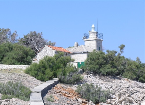
1884. Active; focal plane 16 m (52 ft); white flash every 5 s. 14 m (46 ft) square cylindrical stone tower with lantern and gallery, centered on a square 1-story stone keeper's house. The lighthouse is unpainted gray stone; lantern painted white. The keeper's house is available for vacation accommodations. Wesley Bowler's photo appears at the top of this page, Trabas has a closeup photo, Dawid Fronczyk has a 2022 photo, Marinas.com has aerial photos, Robert Kubicek has a street view, and Google has a satellite view. Makarska is a very popular resort town on the mainland coast opposite Sumartin, Otok Brač. The lighthouse is located on the tip of a forested peninsula within walking distance of the town waterfront. Site open, tower open only to paying guests. ARLHS CRO-168; PS-612; Admiralty E3388; NGA 13580.

Split Lighthouses
Split, also known by its Italian name Spalato, is the largest city of Dalmatia and the second largest city in Croatia with a metropolitan population of about 350,000.

*
Pomorac
1958. Reactivated (inactive 1991-2013); focal plane 54 m (177 ft); two white flashes every 20 s. 38 m (152 ft) square cylindrical concrete obelisk. Trabas has a photo, Lightphotos.net has a photo, Xue Dongsheng has a more distant view, and Google has a street view and a satellite view. The Yugoslav government built this monument as a memorial to the country's seamen. It carried a powerful navigational light. The tower was damaged by shelling during the fighting at the time of Yugoslavia's dissolution in 1991. Local civic groups helped repair the tower during 2003-06, and the light was relit after a more complete restoration in 2012-13. Located on the Split waterfront near the base of the breakwater. Site open, tower closed. PS-563; Admiralty E3348.2; NGA 113-13425.
* Split {Spalato} Breakwater (2)
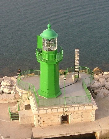
1888 (station established 1878). Active; focal plane 11 m (36 ft); green light, 2 s on, 4 s off. 10 m (33 ft) octagonal cast iron tower with lantern and gallery, rising from a 1-story stone equipment building. Lighthouse painted green. Larry Myhre's photo is at right, Trabas has a photo, Brano Papso has a closeup, Klaus Huelse has a historic postcard image, and Google has a street view and a satellite view. The keeper's house was demolished when the breakwater was reconstructed in 1999. Located at the end of the main breakwater protecting the harbor of Split. Accessible by walking the pier. Site open, tower closed. PS-565; Admiralty E3349; NGA 13408.
Split Breakwater Light
Split Breakwater Light, Split, May 2009
Flickr Creative Commons photo by Larry Myhre

Drvenik Mali Lighthouses
Pasika (Rt Pasika, Drvenik Mali) {Zirona Piccola}
Date unknown. Active; focal plane 11 m (36 ft); four white flashes every 15 s. 10 m (33 ft) octagonal stone tower on a concrete base. Jana Marusova has a closeup photo, Trabas has a photo, and Bing has a satellite view. Located on Rt Pasika, a promontory on the north side of the island of Drvenik Mali, marking the south side of the passage through the Drvenicki Kanal. Accessible only by boat. Site open, tower closed. ARLHS CRO-112; Admiralty E3295; NGA 13352.
Murvica (Velika Murvica)
1896. Active; focal plane 15 m (49 ft); red light, 2 s on, 6 s off. Approx. 12 m (39 ft) square cylindrical stone tower with lantern and gallery, attached to a 1-story stone keeper's house. Fog siren (4 s blast every 30 s). Jana Marusova has a nice photo (also seen at right), Trabas has a photo, Marinas.com has aerial photos, and Google has a satellite view. Located on a small island in the Drvenički Kanal, the channel between the island of Drvenik Mali and the mainland; this channel is the beginning of the approach to the port of Split from the west. Accessible only by boat. Site open, tower closed. ARLHS CRO-007; PS-528; Admiralty E3294; NGA 13348.

Information available on lost lighthouses:

Notable faux lighthouses:


Murvica Light, Split, June 2010
Google Maps photo by Jana Marusova

Adjoining pages: North: Central Croatia | East: Bosnia and Herzegovina | South: Montenegro

Return to the Lighthouse Directory index | Ratings key

Posted October 9, 2006. Checked and revised November 29, 2023. Lighthouses: 51. Site copyright 2023 Russ Rowlett and the University of North Carolina at Chapel Hill.