Lighthouses of Norway: Bodø Area

The Kingdom of Norway (Norge in Norwegian) is one of the world's most maritime nations. The country is long and narrow, with drowned valleys called fjords that bring the sea far inland in most regions. The mainland coast is estimated to be 2650 km (1650 mi) long and when all the islands and minor indentations are counted the total coastline approaches an astonishing 60,000 km (37,500 mi), long enough the go around the world one and a half times. With such a lengthy and rocky shore it's not surprising that Norway has a large number of lighthouses.

Norway is divided into counties (fylker) and the counties are divided into townships (kommuner). This page lists lighthouses in the Bodø area of Nordland County, including the townships of Meløy, Gildeskål, Saltdal, and Bodø. Bodø, the capital of Nordland, has a population of more than 50,000 and is one of the most important towns and ports of northern Norway. This region lies north of the Arctic Circle, with a coastline that is quite rugged and deeply indented by many fjords.

In Norwegian a lighthouse is a fyrtårn (fire tower) or simply a fyr; a fyrlykt is a beacon and a lyktehus is a lantern. Øy is an island, holmen is an islet, skjær is a skerry (a tiny island or rocky reef), sund is a strait (often between an island and the mainland), bukt is a bay, nes is a headland, and havn is a harbor.

Aids to navigation in Norway are maintained by the Kystverket (Coast Directorate), an agency of the Ministry of Transport and Communications.

ARLHS numbers are from the ARLHS World List of Lights. NF numbers are from the Norsk Fyrliste. Admiralty numbers are from volume L of the Admiralty List of Lights & Fog Signals. U.S. NGA List numbers are from Publication 115.

General Sources
Norsk Fyrhistorisk Forening
News and photos from the Norwegian Lighthouse Association.
Online List of Lights - Norway
Photos by various photographers posted by Alexander Trabas. Many of the photos for this area are by Ronald Wöhrn, Michael Boucher, Arno Siering, or Capt. Peter Mosselberger ("Capt. Peter").
Lighthouse Pages from Anke and Jens - Norway
Excellent photos of more than 60 Norwegian lighthouses.
Norway's Fjorden and Lighthouses
Photos taken by Charles W. Bash on a 2010 cruise from Bergen to North Cape.
Leuchttürme an der norwegischen Küste
Photos posted by Bernd Claußen.
Lighthouses in Nordland
Photos by various photographers available from Wikimedia.
Norwegische Leuchttürme auf historischen Postkarten
Historic postcard images posted by Klaus Huelse.
Liste over Norske Fyr
From Wikipedia, a handy list of Norwegian light stations with their dates of establishment.
Norsk Fyrliste
The official Norwegian light list can be downloaded in .pdf format.
GPSNavigationCharts
Navigation chart information for Nordland.
Navionics Charts
Navigation chart information for Nordland.

Landegode Fyr
Landegode Light, Bodø, June 2012
photo copyright Arno Siering; used by permission

Meløy Lighthouses
Kalvskjæret
Date unknown. Active; focal plane 6 m (20 ft); white, red or green light depending on direction, 3 s on, 3 s off. 6 m (20 ft) lantern and gallery mounted on a stone cairn. Lantern painted white with a red roof. Trabas has Wöhrn's photo, another photo (last photo on the page) is available, and Bing has a distant satellite view. Located on a skerry off the west end of Forøy. Accessible only by boat. Site open, tower closed. NF-678500; Admiralty L2414; NGA 10436.
Angersholmen
Date unknown. Active; focal plane 7 m (23 ft); white, red or green light depending on direction, 3 s on, 3 s off. 6 m (20 ft) octagonal lantern mounted on a square stone base. Lantern painted white with a red roof. Trabas has Siering's photo and Bing has a satellite view. Located on a skerry in the entrance to the Meløyfjord. Accessible only by boat. Site open, tower closed. NF-679500; Admiralty L2422; NGA 10456.
Kjørhaugklubben
Date unknown. Active; focal plane 17.5 m (57 ft); white, red or green light depending on direction, occulting three times every 10 s. 7 m (23 ft) concrete post with lantern and gallery. Lighthouse painted white, lantern roof red. Boucher's photo is at right, Trabas has Capt. Peter's closeup photo, and Google has an indistinct satellite view of the light. NGA misspells the name as Kjorhangklubben. Located on a headland on the south side of the entrance to the Meløyfjord. Accessible only by boat. Site open, tower closed. NF-679600; Admiralty L2423; NGA 10460.
Litlgrønholmen (Lille Gronnholmen)
Date unknown. Active; focal plane 7 m (23 ft); white, red or green light depending on direction, 3 s on, 3 s off. 6.5 m (21 ft) concrete post with lantern and gallery. Lighthouse painted white, lantern roof red. No photo available but Google has a satellite view. Located on a reef about 10 km (6 mi) west of Meløya. Accessible only by boat. Site open, tower closed. NF-682100; Admiralty L2440; NGA 10448.
Kjønskjær
Date unknown. Active; focal plane 7 m (23 ft); white, red or green light depending on direction, 3 s on, 3 s off. 9 m (30 ft) lantern and gallery mounted on tripod piles. Lantern painted white with a red roof. Trabas has Siering's photo and Bing has a distant satellite view. Located on a skerry in the passage around the west end of Meløya. Accessible only by boat. Site open, tower closed. NF-681700; Admiralty L2444; NGA 10500.
Kjørhaugklubben Fyr
Kjørhaugklubben Light, Meløy, September 2011
photo copyright Michael Boucher; used by permission
Meløysund
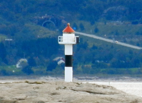
Date unknown. Active; focal plane 8.5 m (28 ft); white, red or green light depending on direction, occulting once every 6 s. 7 m (23 ft) concrete post with lantern and gallery. Lighthouse painted white with a narrow black horizontal band, lantern roof red. Trabas has Wöhrn's photo, another photo is available, and Google has an indistinct satellite view of the light. This light guides vessels arriving in Meløya or passing through the narrow passage between Meløya and Sørvika. Located at the eastern tip of the island of Gjersholmen, a short distance south of Meløya. Accessible only by boat. Site open, tower closed. NF-680000; Admiralty L2426; NGA 10472.
Meløyneset (Meløya)
Date unknown. Active; focal plane 7 m (23 ft); white, red or green light depending on direction, occulting twice every 8 s. 7 m (23 ft) concrete post with lantern and gallery. Lighthouse painted white with a narrow black horizontal band, lantern roof red. Trabas has Wöhrn's photo and Bing has a distant satellite view. Located at the eastern tip of Meløya. Accessible only by boat. Site open, tower closed. NF-680100; Admiralty L2428; NGA 10476.
Bremholmen
Date unknown. Active; focal plane 14 m (46 ft); flash every 5 s, white, red or green depending on direction. 8.5 m (28 ft) lantern mounted on a platform supported by piles. Lantern painted white with a red roof, piles painted black. No photo available but Bing has a distant satellite view. NGA misspells the name as Brenholmen. Located on a small island about 5 km (3 mi) northwest of Meløya. Accessible only by boat. Site open, tower closed. NF-682500; Admiralty L2446; NGA 10508.
Kalsholmen
1916 (lantern added in 1919). Active; focal plane 30 m (98 ft); white, red or green light depending on direction, occulting twice every 8 s. 13 m (43 ft) lantern mounted on the roof of a 1-1/2 story wood keeper's house. Lighthouse painted white, lantern red. A photo is at right, Lars Bjerke Tho has a 2022 photo, a historic photo is available, and Bing has a good satellite view. The keeper's house was originally built in 1916 on the neighboring island of Ternholmen; it was moved after the light tower there was destroyed in a storm in 1917. This is one of the less well known of Norway's traditional light stations; photos are rather rare. Located on a small island about 15 km (9 mi) northwest of Bolga. MeløyAdventure offers tours to the lighthouse. Accessible only by boat. Site open, tower closed. . ARLHS NOR-132; NF-683000; Admiralty L2448; NGA 10512.
Sørstøtt
Date unknown. Active; focal plane 12 m (39 ft); white, red or green light depending on direction, 3 s on, 3 s off. 8.5 m (28 ft) fiberglass post with lantern and gallery. Lighthouse painted white, lantern roof red. Trabas has Siering's photo and Bing has a distant satellite view. Located on a small island about 5 km (3 mi) southwest of Støtt. Accessible only by boat. Site open, tower closed. NF-683500; Admiralty L2452; NGA 10516.

Kalsholmen Light, Meløy, May 2008
Wikimedia Creative Commons photo by Raphodon
Hestholmen
Date unknown. Active; focal plane 12 m (39 ft); white, red or green light, depending on direction, 2 s on, 2 s off. 6 m (20 ft) lantern mounted on a platform supported by piles. Lantern painted white with a red roof, piles painted black. No photo available but Bing has a distant satellite view. Located on a skerry off the south side of Maøy, a small island about 4 km (2.5 mi) west southwest of Støtt. Accessible only by boat. Site open, tower closed. NF-683900; Admiralty L2456; NGA 10524.
Maøy
Date unknown. Active; focal plane 11 m (36 ft); white, red or green light, depending on direction, occulting twice every 8 s. 6 m (20 ft) lantern mounted on a platform supported by piles. Lantern painted white with a red roof, piles painted black. No photo available but Bing has a distant satellite view. Located on the north end of Maøy. Accessible only by boat. Site open, tower closed. NF-683700; Admiralty L2454; NGA 10520.
Støtt (Seiskjær) (2)
1954 (station established 1867). Active; focal plane 11.5 m (38 ft); white, red or green light depending on direction, occulting twice every 10 s. 12.5 m (41 ft) concrete post with lantern and gallery. Lighthouse painted white with one black horizontal band, lantern roof red. Trabas has Siering's photo (also seen at right) and Bing has a distant satellite view. There is a historic photo of the original lighthouse; it was on Seiskjær, a small island off the entrance to the harbor of Støtt, on the island of Husøy. According to the Lighthouse Association the buildings were fjernet (removed); Bing has a satellite view showing the foundations. The current light is located on Nordre Seiskjær, a skerry a short distance north of the historic lighthouse. Accessible only by boat. Site open, tower closed. NF-684500; Admiralty L2462; NGA 10540.

Stott Light, Meløy, June 2012
photo copyright Arno Siering; used by permission

Gildeskål Lighthouses
Digerflesa
Date unknown. Active; focal plane 12 m (39 ft); flash every 5 s, white, red or green depending on direction. 8.5 m (28 ft) concrete post with lantern and gallery. Lighthouse painted white with one black horizontal band, lantern roof painted red. Trabas has Boucher's photo (also seen at right), Bash has a very distant photo, and Bing has a distant satellite view. Located on a skerry off a promontory of the mainland about 15 km (9 mi) southwest of Fugløy. Accessible only by boat. Site open, tower closed. NF-685000; Admiralty L2466; NGA 10544.
Lyngholmen
Date unknown. Active; focal plane 20.5 m (67 ft); white, red or green light depending on direction, occulting twice every 8 s. 6 m (20 ft) square tower with lantern and gallery. Lighthouse painted white, lantern roof painted red. No photo available but Bing has a satellite view. Located on a small island about 10 km (6 mi) west of Fugløy. Accessible only by boat. Site open, tower closed. NF-690000; Admiralty L2492; NGA 10604.
Holmsundøy
Date unknown. Active; focal plane 5 m (17 ft); white, red or green light depending on direction, occulting once every 6 s. 5 m (17 ft) lantern mounted on a stone base. Lantern painted white with a red roof. Trabas has Capt. Peter's photo and Bing has a satellite view. Located on the southeastern tip of Sandhornøy, marking a narrow passage between that island and the mainland. Site status unknown. NF-687500; Admiralty L2478; NGA 10588.
Mårnesskagen
Date unknown. Active; focal plane 17.5 m (57 ft); white, red or green light depending on direction, occulting twice every 8 s. 6 m (20 ft) lantern and gallery mounted on a stone cairn. Lantern painted white with a red roof. Trabas has Wöhrn's photo and Bing has a satellite view. Located on a small island just off the northwestern tip of Sandhornøy. Accessible only by boat. Site open, tower closed. NF-689500; Admiralty L2484; NGA 10600.
Digerflesa Fyr
Digerflesa Light, Gildeskål, September 2011
photo copyright Michael Boucher; used by permission
Oterholmen
Date unknown. Active; focal plane 6 m (20 ft); white, red or green light depending on direction, occulting twice every 8 s. 5.5 m (18 ft) concrete post with lantern and gallery. Lighthouse panted white; lantern painted white with a red roof. Trabas has Siering's very distant view and Bing has a distant satellite view. Located on the west side of the northeastern peninsula of Sandhornøy. Site open, tower closed. NF-693000; Admiralty L2512; NGA 10648.
Jonskjærene
Date unknown. Active; focal plane 7.5 m (25 ft), flash every 5 s, white, red or green depending on direction. 9 m (30 ft) lantern on tripod piles. Lantern painted white with a red roof, piles painted black. Trabas has Siering's distant view and Bing has a satellite view. Located on a skerry in the passage between Fleina and Arnøy, northwest of Sandhornøy. Accessible only by boat. Site open, tower closed. NF-692000; Admiralty L2507; NGA 10576.
Tangskjær
Date unknown. Active; focal plane 6.5 m (21 ft); white, red or green light depending on direction, occulting twice every 8 s. 6 m (20 ft) square tower with lantern and gallery. Lighthouse painted white, lantern roof painted red. No photo available but Bing has a satellite view. Located on a small island of the Fleinvær group, about 15 km (9 mi) north of Fugløy. Accessible only by boat. Site open, tower closed. NF-691200; Admiralty L2504; NGA 10616.

Saltdal Lighthouse
Tangeodden
Date unknown. Active; focal plane 7 m (23 ft); white, red or green light depending on direction, occulting once every 6 s. 6 m (20 ft) concrete post with lantern and gallery. Lighthouse panted white; lantern painted white with a red roof. Trabas has Capt. Peter's closeup photo (seen at right) and Google has a satellite view. Located at the end of a slender, rocky ridge projecting dangerously into the Skjerstadfjord near Øksengård, about 50 km (30 mi) east of Bodø. Site open, tower closed. NF-695900; Admiralty L2530; NGA 10688.

Bodø Lighthouses
Seivågskagen
Date unknown. Active; focal plane 6.5 m (21 ft); white, red or green light depending on direction, occulting once every 6 s. 10 m (33 ft) concrete post with lantern and gallery. Lighthouse panted white; lantern painted white with a red roof. Trabas has Capt. Peter's photo and Google has a satellite view. Located on a shoal off the north coast of Straumøya. Accessible only by boat. Site open, tower closed. NF-693500; Admiralty L2513; NGA 10652.

Tangeodden Light, Saltdal
photo copyright Capt. Peter Mosselberger; used by permission
* Saltstraumen (1)
Date unknown. Inactive. 4 m (13 ft) octagonal lantern and gallery, painted white, mounted on a short octagonal concrete base. Simo Räsänen's photo is at right, Huelse has a historic postcard view of this little lighthouse, Jarl Pettersen has a street view, and Google has a distant satellite view. The Saltstraumen is a narrow channel between the islands of Straumøya and Knapplandsøya, southeast of Bodø. Because it is the main outlet of the Skjerstadfjord, the 150 meter (165 yd) wide channel has one of the strongest tidal currents anywhere in the world, regularly reaching a speed of 20 knots (37 km/h or 23 mi/h) or more and forming multiple maelstroms (whirlpools) up to 10 m (33 ft) in diameter. Trabas has Siering's photo of the active light (focal plane 9 m (30 ft); white, red or green light depending on direction, occulting once every 6 s) in a lantern mounted on a bracket attached to the northeast pier of the highway 17 bridge over the Saltstraumen. A photo showing both lights is available. The strait is only navigable during brief slack periods between the incoming and outgoing tides. Located near the east (Knapplandsøya) end of the highway 17 bridge over the Saltstraumen, about 10 km (6 mi) southwest of Løding. Site open, and one can climb to the gallery level of the light. ARLHS NOR-443; NF-694100; Admiralty L2516; NGA 10664.
Alvnestangen
Date unknown. Active; focal plane 7 m (23 ft); flash every 5 s, white, red or green depending on direction. 7 m (23 ft) lantern on a platform supported by piles. Lantern painted white with a red roof. Patrik Tjörnmark has a good photo (sixth photo on the page) and Google has an indistinct satellite view. Located on a skerry off the tip of Alvnestangen, a sharp promontory on the north side of the Skjerstadfjord. Accessible only by boat. Site open, tower closed. NF-695300; Admiralty L2526; NGA 10680.
Saltstraumen Light
Saltstraumen Light, Bodø, June 2011
Wikimedia Creative Commons photo by Simo Räsänen
Mefallsskjær (Løding)
Date unknown. Active; focal plane 7 m (23 ft); white, red or green light depending on direction, occulting twice every 8 s. 7 m (23 ft) octagonal solid concrete or stone tower with lantern and gallery. Tower painted black, lantern white with a red roof. Trabas has Capt. Peter's photo and Bing has a satellite view. Located on a small skerry in the Saltfjord about 400 m (1/4 mi) west of the harbor of Løding. Accessible only by boat. Site and tower closed, but there's good view from shore. ARLHS NOR-437; NF-6940; Admiralty L2514; NGA 10668.
Hernesskagen (Kvannøy)
Date unknown (station established 1896). Active; focal plane 12 m (39 ft); white, red or green light depending on direction, occulting twice every 8 s. 9 m (30 ft) lantern mounted atop a square pyramidal stone cairn. Lantern painted white with a red roof. Trabas has Siering's photo and Google has a satellite view. Located at the southwestern tip of Kvannøy, a small island off Bodø airport. Accessible only by boat. Site open, tower closed. NF-698200; Admiralty L2538; NGA 10704.
Svartoksen
Date unknown. Active; focal plane 12.5 m (41 ft); two white flashes every 5 s. 9 m (30 ft) rubblestone tower with lantern and gallery. Lantern painted white with a red roof. Trabas has Siering's photo, another photo is available, and Bing has a satellite view. Located on a skerry in the outer approach to Bodø, about 3.5 km (2.2 mi) west of the airport. Accessible only by boat. Site open, tower closed. NF-698400; Admiralty L2540; NGA 10708.
#Røsøyskjær (1)
Date unknown. Replaced. This was a 7 m (23 ft) lantern and gallery mounted on tripod piles. Lantern painted white with a red roof. Trabas has Wöhrn's photo, Bash has a distant view, and Google has a satellite view. The light has been replaced by a smaller beacon with a quick-flashing yellow light. Located on a skerry (awash at high tide) on the north side of the southern entrance to Bodø harbor. Accessible only by boat. ex-NF-698600. Active light: NF-698602; Admiralty L2542; NGA 10716.
* Bodø Molja (2)
2017. Active; focal plane 6.5 m (21 ft); continuous green light. 7 m (23 ft) round cylindrical fiberglass tower with a hexagonal lantern. Tower colored green; the lantern is colored white with a red roof. Trabas has Capt. Peter's photo (also seen at right), Anita Annfinnsen has a 2020 photo, a 2021 photo is available, and David Ananiassen has a street view. Anke and Jens have a page for the original light, Bash has a photo, another photo is available, Bane Obradovic has a 2015 street view, Victor Engmark has a nice photo that shows the Hurtigruten cruise ship Trollfjord passing the light as it entered Bodø in April 2006, and Google has a satellite view. This is one of most photographed small lights of Norway. Located at the end of the mole at the west end of Bodø harbor. Site open, tower closed. ARLHS NOR-059; NF-698503 (ex-698800); Admiralty L2544; NGA 10720.

Bodø Molja Light, Bodø
photo copyright Capt. Peter Mosselberger; used by permission
* Bodø (Nyholmen (1))
1875. Inactive since 1907. 5 m (16 ft) octagonal cylindical cast iron tower attached to a front corner of a 1-1/2 story stone keepers house. Lighthouse painted white. A photo is at right, Bernd Claußen also has a photo, Anke and Jens have a page for the lighthouse, and Google has a satellite view. After deactivation the station was occupied by the local Fyrvesen (fire service) and the building was occupied by a supervisor. In 1954 the property was taken over by the harbor service. The National Trust of Norway (Fortidsminneforeningen) took ownership in 1987 and restored the building. The buildings are not open to the public but can be rented for meetings and special events. Located on the tip of Nyholmen, a narrow island, joined to the mainland by a causeway, that protects the north side of Bodø harbor. Site open, tower closed. Owner/site manager: Fortidsminneforeningen (Nyholmen Fyr). . ARLHS NOR-173.
* Nyholmen (3)
2017 (station established 1875). Active; focal plane 7 m (23 ft); white, red or green light depending on direction, occulting once every 6 s. 7 m (23 ft) round fiberglass tower with lantern and gallery. Tower colored red; lantern is white with a red roof. Trabas has Capt. Peter's photo, Pótári János has a 2018 photo, Mark Koenig has the view from a passing ship, and Google has a satellite view and a 2022 street view past the green Bodø Molja light. Anke and Jens have a page for the previous light, Christy Olsen has a photo of the earlier lighthouse, Bash has a photo, and Bernd Claußen also has a photo. Located at the extreme southwestern tip of Nyholmen. Site open, and one can climb to the gallery of the tower. ARLHS NOR-440; NF-698000; Admiralty L2537; NGA 10724.

1875 Nyholmen Light, Bodø
Fortidsminneforeningen photo
Lille Hjartøy Sydvestpynt (2)
Date unknown. Active; focal plane 10 m (33 ft); white, red or green light depending on direction, occulting twice every 8 s. 6 m (20 ft) round cylindrical fiberglass tower with lantern and gallery. Tower colored white, lantern white with a red roof. Trabas has Capt. Peter's closeup photo and Google has a satellite view. The earlier light was a 6 m (20 ft) square tower with lantern and gallery; Bash has a 2010 photo. Located at the southwestern point of Lille Hjartøy, an island on the north side of the entrance to Bodø harbor. Accessible only by boat. Site open, tower closed. NF-699000; Admiralty L2548; NGA 10728.
Lille Hjartøy Nordøstpynt
1908. Active; focal plane 5 m (17 ft); white, red or green light depending on direction, occulting once every 6 s. 6.5 m (21 ft) lantern and gallery mounted on tripod piles. Lantern painted white with a red roof. Trabas has Boucher's photo (also seen at right) and Google has a distant satellite view. Located at the extreme northeastern tip of Lille Hjartøy. Accessible only by boat. Site open, tower closed. NF-699100; Admiralty L2550; NGA 10732.
Kvitvardholmen
Date unknown. Active; focal plane 9.5 m (31 ft); white, red or green light depending on direction, occulting once every 6 s. 8 m (26 ft) stone tower with lantern and gallery. Tower painted black, lantern white with a red roof. Per Atle Eliassen has a photo and Bing has a distant satellite view. Located on a skerry off the northeastern corner of Bliksvær, about 13 km (8 mi) west of Bodø. Accessible only by boat. Site status unknown. NF-696200; Admiralty L2532; NGA 10700.
Hjelmøy
Date unknown. Active; focal plane 14.5 m (47 ft); flash every 5 s, white, red or green depending on direction. 7 m (23 ft) concrete post with lantern and gallery. Lighthouse painted white, lantern roof red. No photo available but Google has an indistinct satellite view. Located on an island off the southern coast of Bliksvær. Accessible only by boat. Site status unknown. NF-697000; Admiralty L2535; NGA 10692.

Lille Hjartøy Nordøstpynt Light, Bodø, June 2012
photo copyright Michael Boucher; used by permission
Tennholmen (Ternholmen)
1901. Active; focal plane 27 m (89 ft); white flash every 10 s. 14 m (46 ft) lantern mounted on the roof of a 1-1/2 story wood keeper's house. Lighthouse painted white, lantern red. Victor Cook's photo is at right, a page by a visitor has photos, and Dag Hugstmyr has an aerial view, but Bing has only a distant satellite view of the area. This remote lighthouse was staffed until 2002; it is rarely visited and we need information on its current condition. Located on a small island about 32 km (20 mi) due west of Bodø. Accessible only by boat. Site status unknown. . ARLHS NOR-045; NF-700000; Admiralty L2554; NGA 10736.
Givær (Lille Kvannøy)
Date unknown. Active; focal plane 11 m (36 ft), two flashes every 5 s, white, red or green depending on direction. 6 m (20 ft) square tower with lantern and gallery. Lighthouse painted white, lantern roof red. No photo available but Bing has a satellite view. Located on Lille Kvannøy, an island about 9 km (5.5 mi) east northeast of Tennholmen. Accessible only by boat. Site status unknown. NF-700500; Admiralty L2558; NGA 10740.
Grytøy (2)
1959 (station established 1865). Active; focal plane 34 m (112 ft); two flashes every 10 s, white or red depending on direction. 10.5 m (34 ft) concrete tower with lantern. No photo available. Bing's satellite view confirms that the historic lighthouse, a square light tower attached to the front of a 2-story keeper's house, has been demolished; only the foundations remain. Located on an island at the southwest end of the Sorvær archipelago, about 25 km (15 mi) northwest of Bodø. Accessible only by boat. Site status unknown. ARLHS NOR-365; NF-701000; Admiralty L2562; NGA 10752.
Grimsholmen
Date unknown. Active; focal plane 18 m (59 ft), flash every 5 s, white, red or green depending on direction. 6.5 m (21 ft) square tower with lantern and gallery. Lighthouse painted white, lantern roof red. No photo available but Bing has a satellite view. This light and the Grytøy light bracket the entrance to a channel leading to the village of Helligvær. Located about 500 m (0.4 mi) east of the Grytøy light. Accessible only by boat. Site status unknown. NF-701200; Admiralty L2563; NGA 10756.

Tennholmen Light, Bodø, October 2016
Instagram photo by Victor Cook
Lyngesøy
Date unknown. Active; focal plane 14 m (46 ft); white, red or green light depending on direction, 2 s on, 2 s off. 11 m (36 ft) rubblestone tower with lantern and gallery. Lantern painted white with a red roof. Trabas has Siering's photo, Carl Erik Nyvold has a photo, and Google has a satellite view. This light is mounted on a historic daybeacon. Located on a skerry about 7 km (4.5 mi) northeast of Grytøy. Accessible only by boat. Site open, tower closed. NF-702200; Admiralty L2565; NGA 10776.
Fenesodden
Date unknown. Active; focal plane 13 m (43 ft); white, red or green light depending on direction, 3 s on, 3 s off. 7 m (23 ft) lantern on a platform supported by piles. Lantern painted white with a red roof. Trabas has Siering's photo and Bing has a distant satellite view. Located on an islet off the southwestern tip of Landegode. Accessible only by boat. Site open, tower closed. NF-703000; Admiralty L2568; NGA 10784.
Landegode (Landego)
1902. Active; focal plane 41 m (134 ft); three white flashes every 40 s; also, at 26 m (85 ft), a red light, occulting twice every 8 s (NF-7045.1), shown over reefs to the northeast. 29 m (95 ft) round cast iron tower with lantern and gallery, painted red with two white horizontal bands. Two 1-1/2 story wood keeper's houses, boathouse, and other station buildings. Trabas has Arno Siering's photo seen at the top of this page, Claußen has a photo, Wikimedia has Magnus Wiik's photo, Bash has a view from the sea, another good photo is available, and Google has a satellite view of the station. Automated in 1993, the station was sold to Skagen Hotels of Bodø in 1994 and is operated as an inn and conference center. Located on a small islet just off the northeast tip of the island of Landegode about 8 km (5 mi) north of Bodø. Transportation from Bodø is available. Site open, tower status unknown. Site manager: Skagen Hotel. . ARLHS NOR-148; NF-704500; Admiralty L2578; NGA 10808.
Bjørnøy (1)
1890. Inactive since 1972. Lantern and gallery mounted on a stone base and attached to the seaward end of a 1-1/2 story keeper's house. Arno Siering's photo is at right, another good photo showing both lights is available, and Google has a satellite view of the station. After deactivation the island and light station were managed by the Norwegian Environment Agency (Miljødirektoratet). For a time Bodø Kommune was interested in acquiring the lighthouse; it organized a friends group in 2014. However in 2020 the Kommune announced it was no longer interested in taking ownership. The Environment Agency has begun the process of divesting the property and it could be sold in the future. Located on a small island at the east end of the island of Landegode about 8 km (5 mi) east northeast of Bodø. Site and tower closed. ARLHS NOR-058.
Bjørnøy (2)
1972 (station established 1890). Active; focal plane 41 m (135 ft); white, red or green light depending on direction, occulting once every 6 s. 9 m (30 ft) concrete post with lantern and gallery. Lighthouse painted white, lantern roof red. A good photo showing both lights is available, Trabas has Boucher's photo, Bash has a photo, and Google has a distant satellite view. Located just below the historic lighthouse. Site and tower closed. ARLHS NOR-426; NF-704000; Admiralty L2574; NGA 10804.
Kvannholmen
Date unknown. Active; focal plane 11 m (36 ft); white, red or green light depending on direction, occulting twice every 8 s. 6 m (20 ft) lantern on a platform supported by piles. Lantern painted white with a red roof. No photo available but Bing has a satellite view. Located on a small island on the south side of the entrance to the Mistfjord, about 30 km (19 mi) northeast of Bodø. Accessible only by boat. Site open, tower closed. NF-704200; Admiralty L2576; NGA 10812.
* Kjerringøy
Date unknown (station established 1902). Active; focal plane 5 m (16 ft); white, red or green light depending on direction, occulting once every 6 s. 5 m (16 ft) lantern mounted on a round rubblestone base. Lantern painted white with a red roof. Christy Olsen has a distant view and Bing has a satellite view. Located on a skerry at the entrance to the harbor of Kerringøy. Accessible only by boat, but there are excellent views from nearby. Site open, and one could climb on the gallery. NF-705500; Admiralty L2582; NGA 10820.
Helløyskjær
Date unknown. Active; focal plane 8 m (26 ft); flash every 5 s, white, red or green depending on direction. 6 m (20 ft) lantern on a platform supported by piles. Lantern painted white with a red roof. No photo available but Google has a satellite view. Located on a skerry about 1 km (0.6 mi) northeast of Helløy and 8 km (5 mi) off the mainland coast.. Accessible only by boat. Site open, tower closed. NF-705600; Admiralty L2584; NGA 10824.

Bjørnøy Light, Bodø, June 2012
ex-Panoramio photo copyright Arno Siering; used by permission

Information available on lost lighthouses:

Notable faux lighthouses:

Adjoining pages: North: Narvik Area | South: Northern Helgeland | West: Inner Lofoten | Northwest: Vesterålen

Return to the Lighthouse Directory index | Ratings key

Posted August 3, 2006. Checked and revised August 8, 2023. Lighthouses: 48. Site copyright 2023 Russ Rowlett and the University of North Carolina at Chapel Hill.