Lighthouses of Sweden: Halland

The Kingdom of Sweden (Sverige in Swedish) is the largest country of northern Europe, occupying the entire west coast of the Baltic Sea. Along with its lengthy coast Sweden has a distinguished lighthouse history and a good record of preserving its historic lights. The Swedish Lighthouse Society (Svenska Fyrsällskapet) works actively for the preservation of the lighthouses.

Sweden is divided into 21 counties (län) and the counties are subdivided into townships and municipalities (kommuner). This page covers lighthouses of southern Sweden in the county of Halland (Hallands Län). Halland lies between the major cities of Göteborg and Helsingborg; it faces west on the Kattegat, the shallow sea separating Sweden and Denmark. Varberg and Halmstad are the largest coastal towns in the county.

The Swedish word for a lighthouse is fyr. The front light of a range is the nedrefyr (lower light) and the rear light is the övrefyr (upper light). Ö is an island, holme is an islet, skär is a skerry (a tiny island or rocky reef), sund is a strait (often between an island and the mainland), vik is a bay, hav is a sea, udde is a headland, and hamn is a harbor.

Aids to navigation in Sweden are maintained by the Swedish Maritime Administration (Sjöfartsverket).

ARLHS numbers are from the ARLHS World List of Lights. SV numbers are from the Sjöfarsverket light list (Svenska Fyrlista) as reported by the Swedish Lighthouse Society. Admiralty numbers are from volume C of the Admiralty List of Lights & Fog Signals. U.S. NGA List numbers are from Publication 116.

General Sources
Swedish Lighthouse Society (Svenska Fyrsällskapet, SFA)
The Society is active in promoting the preservation of Swedish lighthouses.
Svenskt Fyrväsende
From the SFA web site, data and photos for many of the lighthouses.
Online List of Lights - Sweden
Photos by various photographers posted by Alexander Trabas.
Leuchttürme und Leuchtfeuer in Schweden - Svenska Fyrar
A large collection of photos and data posted by Erich Hartmann; text in German.
Lighthouses in Sweden
Aerial photos posted by Marinas.com.
Lighthouse Pages from Anke and Jens - Sweden
Photos and brief accounts (in English) by two German lighthouse fans.
Lighthouses in Sweden
Photos by various photographers available from Wikimedia.
World of Lighthouses - Sweden
Photos by various photographers available from Lightphotos.net.
Schwedische Leuchttürme auf historischen Postkarten
Historic postcard views posted by Klaus Huelse.
Navionics Charts
Navigational chart information for Halland.


Morups Tånge Light, Falkenberg, June 2023
Instagram photo by Morups Tånge Fyrsällskap
Halmstad Lighthouses
Halmstad, a city of about 100,000 residents, is the capital of Hallands Län.
Halmstad Vågbrytare (Breakwater)
Date unknown (station established 1902). Active; focal plane 14 m (46 ft); two white flashes every 6 s. 10 m (33 ft) triangular skeletal tower with lantern and gallery, painted white; lantern roof painted red. The tower also carries a vertically slatted daymark painted with red and white horizontal bands. SFA has a page for the lighthouse, Trabas has a good photo, Thair Alkishik has a closeup street view, and Google has a satellite view and a distant street view across the harbor. Located at the end of the long breakwater of Halmstad. Accessible only by boat. Site and tower closed. SV-7313; Admiralty C0738; NGA 1416.
Halmstad Hamn
1872. Inactive but charted as a daybeacon. Approx. 9 m (30 ft) round pyramidal tower with lantern. Entire structure (even the lantern glass) painted white. SFA has a photo and Google has a satellite view. Located on a breakwater on the west side of the entrance to the old harbor of Halmstad. Site status unknown but the breakwater appears to be walkable.
Tylögrund
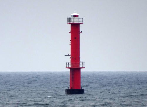
1968. Active; focal plane 22 m (72 ft); three long (3 s) white flashes every 30 s. 23 m (75 ft) round cylindrical concrete tower with upper and lower galleries. Lighthouse painted red, lantern and galleries white. This light replaced the Tylön lighthouse (next entry). SFA has a page for the lighthouse, Trabas has Andreas Köhler's closeup photo seen at right, Johan Sölve has a photo, and Google has a satellite view. The helipad added to the lighthouse in 1982 has been removed. Located in the Kattegat about 1 km (0.6 mi) southwest of the Tylön lighthouse. Accessible only by boat. Site open, tower closed. ARLHS SWE-398; SV-7308; Admiralty C0735; NGA 1404.

Tylögrund Light, Halmstad
photo copyright Andreas Köhler; used by permission
* Tylön (Tylö, Tylösand)
1870 (Gustav von Heidenstam). Inactive since 1968 but charted as a daybeacon. Approx. 13 m (43 ft) octagonal cast iron tower with lantern and gallery, painted red. 1-1/2 story wood keeper's house, painted red with white trim; the lantern is gray metallic. A photo is at right, Hartmann has a page for the lighthouse, SFA also has a page for the lighthouse, Sofia Nilsson has a 2007 photo, Andreas Köhler has a 2017 photo, Bjarne Karlsson has a 2023 view from the sea, Marinas.com has aerial photos, Huelse has a historic postcard view, and Google has a satellite view. The lighthouse was replaced by the offshore Tylögrund lighthouse (previous entry). By 2008 the lighthouse (then painted white) was in a precarious condition, swaying in strong winds. In 2011 the State Property Board (Statens Fastighetsverk) carried out a complete restoration of the structure, repainting the tower in its historic red. Tylön is an island just off a cape at Tylösand, about 10 km (6 mi) west of Halmstad. The island has been a nature reserve since 1927; most of it is closed during the bird nesting season, April 1 through July 15. Accessible only by boat. Site open, tower closed. Site manager: Statens Fastighetsverk. . ARLHS SWE-399; ex-SV-7307.

Falkenberg Lighthouses
Falkenbergs Hamn (Falkenberg West Breakwater)
1964 (station established 1926). Active; focal plane 11 m (36 ft) (?); light 2 s on, 6 s off, white, red or green, depending on direction. Approx. 13 m (49 ft) round cylindrical tower with lantern and gallery, painted white with a narrow red horizontal band, topped by a square skeletal tower. Trabas has Hartmann's photo and Google has a satellite view. The skeletal tower has been added recently, and it appears that the focal plane is now at least 15 m (49 ft). Located at the end of the north breakwater at the entrance to Falkenberg. The pier does not appear to be walkable. Site and tower closed. SV-7352; Admiralty C0722; NGA 1368.

Tylön Light, Halmstad, 2021
Statens Fastighetsverk photo
* Morups Tånge
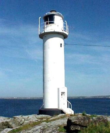
1843 (J.T. Bystrom). Active; focal plane 29 m (95 ft); white, red or green light, depending on direction, occulting once every 8 s. 28 m (92 ft) round stone tower with lantern and gallery. Lighthouse painted white with two narrow black horizontal bands. The original 2nd order Fresnel lens remains in use; it is the oldest active Fresnel lens in Sweden and one of the oldest in the world. A 2023 photo is at the top of this page, Larry Myhre has a photo, SFA has a page for the lighthouse, Hartmann also has a page, Steffen Ramsaier has a good photo, Trabas has a fine photo, Håkan Dahlströhm has a 2008 photo, Marinas.com has aerial photos, Huelse has a historic postcard view, Christian Dahlqvist has a closeup street view, and Google has a fine satellite view. A preservation group, Morups Tånge Fyrsällskap, was organized in 2012; with a license from the Sjöfarsverket members are able to volunteer on projects to restore and maintain the lighthouse. Morups Tånge is a low peninsula projecting into the Kattegat about 8 km (5 mi) west of Falkenberg. The area is a nature reserve known as one of the best birding locations in southern Sweden. The historic lighthouse was restored in 1975. Accessible by road; parking provided. Site open, tower may be open for guided tours in season, but no schedule is available. Site manager: Morups Tånge Fyrsällska . ARLHS SWE-048; SV-7343; Admiralty C0716; NGA 1360.
* Glommen
1918. Active; focal plane 9.5 m (31 ft); flash every 3 s, white, red or green depending on direction. 10 m (33 ft) round cylindrical tower mounted on a round 1-story concrete base. Lighthouse painted white. SFA has a page for the lighthouse, Trabas has a photo, Mikael Lundgren has a closeup street view, and Bing has a satellite view. Located at the end of the breakwater at Glommen. This is not a walkable pier. Site and tower closed. SV-7375; Admiralty C0714; NGA 1356.

Varberg Lighthouses
* Subbeberget (Varberg (2))
1934. Active; focal plane 26 m (85 ft); white light, 5 s on, 5 s off, 5 s on, 15 s off. 14 m (46 ft) round cylindrical concrete tower with lantern and gallery, painted white. A photo is at right, Trabas has a closeup photo, Anett Moberg has a 2021 photo, Petter Duvander has a photo, a distant view from Varberg's beach is available, SFA has a page for the lighthouse, Marinas.com has aerial photos, Huelse has a historic photo, Lars Sjoland has a street view, and Google has a satellite view. Located on a promontory at the south side of the entrance to Varberg. Accessible by a short hike. Site open, tower closed. . ARLHS SWE-381; SV-7394; Admiralty C0704; NGA 1340.

Subbeberget Light, Varberg, December 2016
SFA Creative Commons photo by C L
[Skrivareklippen (Varberg(1))]
1871. Inactive since 1934. The lighthouse, a cast iron tower seen on SFA's Varberg page and in Huelse's postcard view, was replaced by Subbeberget (previous entry) and has been demolished. The 1-1/2 story wood keeper's house and other station buildings survive in private ownership. Google has a satellite view. Located on an island in the entrance to Varberg harbor, about 1.5 km (1 mi) northwest of the Subbeberget Fyr. Accessible only by boat. Site and tower closed.
Klåback (2?)
Date unknown (station established 1917). Active; focal plane 14 m (46 ft); two flashes every 6 s, white, red or green depending on direction. 4 m (13 ft) round lantern mounted on a concrete base. Lantern painted white. Google has a satellite view. Located on a small island about 2.5 km (1.5 mi) west of the island of Balgö and 9 km (5.5 mi) northwest of Varberg. Accessible only by boat. Site open, tower closed. SV-7414; Admiralty C0684; NGA 1300.
* Krogstadsudde (Bua) (2)
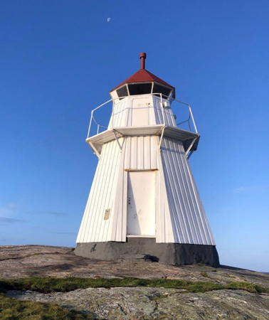
1928 (station established 1888). Active; focal plane 15 m (49 ft); four flashes every 12 s, white, red or green depending on direction. 7 m (23 ft) octagonal pyramidal wood tower with lantern and gallery. Lighthouse painted white, lantern roof red. Ann-Louise Gustavsson's photo is at right, SFA has a page for the lighthouse, Trabas has a photo, Sana Filipovic has a 2020 sunset photo, and Google has a satellite view. Andreas Köhler's 2017 closeup photo shows the lighthouse freshly repainted and restored. Located on Krogstadsudde, the promontory on the north side of the entrance to the Båtfjord, opposite Bua. Located in the Biskopshagens Naturreservat, the light is accessible by a short walk from the nature reserve's parking area. Site open, tower closed. . SV-7428; Admiralty C0682; NGA 1268.
Fladen
1969 (lightship station established 1892). Active; focal plane 24 m (79 ft); one long white flash every 8 s. 26 m (85 ft) round cylindrical concrete tower with upper and lower galleries and a helipad on top. Upper half of the lighthouse painted red, lower half black. SFA has a page for the lighthouse but the light is not shown in Google's satellite view. This tower, a sibling of the Trubaduren lighthouse off Göteborg, replaced the lightship Fladen (Fyrskepp 29) now on display at Göteborg. In addition, Fyrskepp 10B Fladen, which served this station from 1892 to 1965, is in private ownership in Stockholm. Located on a shoal in the open Kattegat about 10 km (6 mi) south southwest of Nidingen. Accessible only by boat. Site open, tower closed. . ARLHS SWE-135; SV-7419; Admiralty C0671; NGA 1296.

Krogstadsudde Light, Bua, 2019
SFA Creative Commons photo by Ann-Louise Gustavsson

Kungsbacka Lighthouses
* Bråten (Bråtenviken)
Date unknown (2000s). Active (privately maintained); focal plane about 10 m (33 ft); white flash every 3 s. 7.5 m (25 ft) round tower with a small lantern, painted white with one red horizontal band. Trabas has Andreas Köhler's photo and Google has a satellite view. Located on the breakwater of a small boat harbor in Åsa. Owner/site manager: Bråtavikens Båtsällskap. Admiralty C0678.
Fjordskär (3)
Date unknown (station established 1882). Active; focal plane 10 m (33 ft); flash every 3 s, white, red or green depending on direction. 10 m (33 ft) round lantern mounted on a large stone wall. Lantern painted white. Trabas has a photo and Google has a satellite view. The SFA page for this light has a historic photo of the original lighthouse, which included a small keeper's cottage; the wall protected the cottage and the light was shown through a attic window. The house was removed in 1908; Huelse has a historic photo that shows the octagonal lantern installed at that time. Located on a skerry on the west side of the entrance to the bay known as the Kungsbackafjord, about 3 km (2 mi) south of Gottskär. Accessible only by boat. Site open, tower closed. SV-7457; Admiralty C0674; NGA 1244.
Malö Hamn (Skalla)
1917. Reactivated (inactive 1991-2002, now privately maintained); focal plane 5 m (16 ft); two flashes every 6 s, white, red or green depending on direction. 4 m (13 ft) octagonal lantern mounted on a concrete base. Lantern painted white. SFA has a page for the lighthouse, Trabas has a photo, and Google has a satellite view. This light is not on the island of Malö but on the mainland, on the east side of the entrance of Skallanas harbor. The light was reactivated through the efforts of a preservation group, the Onsala Fyrförening. Accessible only by boat. Site open, tower closed. Owner/operator: Onsala Fyrförening. . SV-7469; Admiralty C0664; NGA 1240.
Malö (3)
1968 (station established 1891 but inactive 1911-1935). Active; focal plane 10 m (33 ft); three flashes every 9 s, white, red or green depending on direction. 9 m (30 ft) round cylindrical concrete tower with lantern and gallery, painted white. Marie Selfors has a distant view and Google has a satellite view. The original lighthouse, with the light tower shown from a 1-story wood keeper's house, was demolished after being deactivated in 1911. A lantern on a short concrete base was installed in 1935 and replaced in 1968 by the present lighthouse. Located on the southern point of the island of Malö, about 6 km (3.5 mi) southwest of Gottskär. Accessible only by boat. Site open, tower closed. ARLHS SWE-446; SV-7452; Admiralty C0673; NGA 1236.
Lilleland Rev
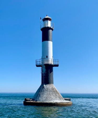
1945. Active; focal plane 19 m (62 ft); white, red or green light, depending on direction, 1.5 s on, 1.5 s off. 21 m (69 ft) round cylindrical concrete tower with lantern and three galleries, painted with black and white horizontal bands. Tomas Flodin's photo is at right, Fredrik Streiffert has a 2011 closeup photo, Jan-Erik Äng has a 2023 photo, and Google has a satellite view. Located on a reef in the water about 1.9 km (1.2 mi) northeast of the Nidingen lighthouses. Accessible only by boat. Site open, tower closed. ARLHS SWE-258; SV-7449; Admiralty C0666; NGA 1232.

Lilleland Rev Light, Kungsbacka, September 2020
Google Maps photo by Tomas Flodin
** Nidingen (3) Southwest
1834. Inactive since 1946. 19 m (62 ft) hexagonal cylindrical rubblestone tower with lantern and gallery. The lighthouse is unpainted; the lantern dome is gray metallic. Tomas Flodin's photo of the two towers is at right, Jonas Karlsson has a closeup photo and a photo of both towers, Huelse has a historic postcard view of this station, and Google has a satellite view. This is the southwesternmost of the pair of twin lighthouses built in 1832-34. Nidingen is a low island about 1 km (0.6 mi) long, located dangerously in the Kattegat about 6 km (3.5 mi) off the nearest point of the Swedish coast. Open fires were displayed here as early as 1624, and a light tower was built in the 1740s. A new lighthouse in 1766 was provided with a fog bell, believed to be the world's first fog signal station. The present pair of twin lighthouses was raised in height in 1846. These were the last both-active double lighthouses in the world when they were deactivated in 1946. The 3rd order Fresnel lens (1890) was transferred to the new lighthouse. The station is now managed by the Gottskär Hotell. Three 1-story keeper's houses are available for overnight accommodations, and another building of the station is available for meetings and conferences. Transportation for both day and overnight visitors is available from Gottskär on the mainland. Located in the Kattegat about 10 km (6 mi) southwest of Gottskär; accessible only by boat. Site open, tower open to guided tours. Site manager: Gottskär Hotell. . ARLHS SWE-288.
** Nidingen (3) Northeast
1834. Inactive since 1946. 19 m (62 ft) hexagonal cylindrical rubblestone tower with lantern and gallery. The lighthouse is unpainted; the lantern dome is gray metallic. Tomas Flodin's photo of the two towers is at right, Jonas Karlsson has a photo of both towers, and Google has a satellite view. This is the northeasternmost of the Nidingen twin towers. Site open, tower open to guided tours. ARLHS SWE-428.
* Nidingen (4)
1946 (station established 1832). Active; focal plane 25.5 m (83 ft); three flashes in a 2+1 pattern, white or red depending on direction, every 27 s. 23.5 m (77 ft) round cylindrical concrete tower with lantern and two galleries, painted white with one black horizontal band. 3rd order Fresnel lens transferred from the original southwest tower. Peter Brylde has a 2021 photo, Jonas Karlsson has a 2008 photo, and Google has a satellite view. Site open, tower closed. ARLHS SWE-289; SV-7443; Admiralty C0670; NGA 1228.
Hallands Svartskär
Date unknown. Active; focal plane 10 m (33 ft); flash every 3 s, white, red or green depending on direction. 7.5 m (25 ft) round cylindrical concrete tower with lantern and gallery, painted white. Tomas Flodin has a 2021 photo and Google has a satellite view. Located on an islet in the Kattegat about 10 km (6 mi) southwest of Lerkil. Accessible only by boat. Site open, tower closed. ARLHS SWE-169; SV-7474; Admiralty C0660; NGA 1172.

Nidingen Northeast (left) and Southwest Lights, Kungsbacka, August 2020
Google Maps photo by Tomas Flodin
#Kungen (1)
Date unknown. Replaced in 2021, according to SFA; listed with focal plane 12 m (39 ft); three flashes every 9 s, white, red or green depending on direction. This was a 7.5 m (25 ft) round cylindrical concrete tower with lantern and gallery, painted white with one black horizontal band. SFA has a page for the lighthouse, Trabas has Hartmann's very distant view, and Google has a satellite view. SFA has a photo of the new light. Located on an islet in a rocky reef in the Kattegat about 5 km (3 mi) west of Lerkil. Accessible only by boat. Site open, tower closed. ARLHS SWE-038. Active light: SV-7479; Admiralty C0658; NGA 1168.

Information available on lost lighthouses:

Notable faux lighthouses:

Adjoining pages: North: Göteborg Area | South: Scania

Return to the Lighthouse Directory index | Ratings key

Posted April 9, 2007. Checked and revised February 14, 2024. Lighthouses: 19. Site copyright 2024 Russ Rowlett and the University of North Carolina at Chapel Hill.