Crimea is a peninsula on the north side of the Black Sea, attached to the mainland by a narrow isthmus. The territory has a long and complicated history. It was annexed to the Russian Empire in 1783. In the Soviet Union it was at first an autonomous republic and later an oblast (province) within the Russian Federation. In 1954 Crimea was transferred from the Russian Federation to the Ukrainian Soviet Socialist Republic. When the Soviet Union collapsed in 1991 Crimea became part of the newly-independent nation of Ukraine. However, Russia continued to occupy several important military bases in the territory, including the home port of the Black Sea Fleet in Sevastopol'.
Crimea is a peninsula on the north side of the Black Sea, attached to the mainland by a narrow isthmus. The territory has a long and complicated history. It was annexed to the Russian Empire in 1783. In the Soviet Union it was at first an autonomous republic and later an oblast (province) within the Russian Federation. In 1954 Crimea was transferred from the Russian Federation to the Ukrainian Soviet Socialist Republic. When the Soviet Union collapsed in 1991 Crimea became part of the newly-independent nation of Ukraine. However, Russia continued to occupy several important military bases in the territory including the home port of the Black Sea Fleet in Sevastopol'.
In March 2014 Russia invaded and annexed Crimea, leaving the Ukrainian coast in two sections: the Bight of Odessa in the west and the northwestern side of the Sea of Azov in the east. In February 2022 Russian troops invaded eastern Ukraine, beginning a war that continues to the present. Since the end of 2022 Russia has occupied about 20% of Ukraine but a much larger percentage, more thn 80%, of Ukraine's coastline. Russia controls all of Crimea and the Azov Sea coast as well as the western Kherson region south of the Dnipro (Dnieper) River.
This page includes lighthouses of the City of Sevastopol' region in the southwestrn section of the Crimean Peninsula.
The members of the Russian Federation are called federal subjects (sub'yekty federatsii, Субъекты федерации). Sevastopol' was admitted to the Russian Federation as a federal city (gorod federalnogo znacheniya, город федерального значения): the same status held by Moscow and by St. Petersburg. The rest of Crimea was admitted as the Republic of Crimea (Respublika Krym, Республика Крым).
Lighthouses in war zones are typically inactive, their lights extinguished for the duration of the war. The descriptions on this page rely heavily on pre-war (Ukrainian) information. Information on possible damage to lighthouses is not available.
The Russian word for a lighthouse is mayak (маяк); ostrov is an island, poluostrov is a peninsula, kosa is a sandy spit, rif is a reef, mys is a cape, bukhta is a bay, zaliv is a larger bay or gulf, proliv is a strait, reka is a river, and gavan' is a harbor.
ARLHS numbers are from the ARLHS World List of Lights. Admiralty numbers are from volume N of the Admiralty List of Lights & Fog Signals. U.S. NGA List numbers are from Publication 113.

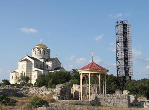
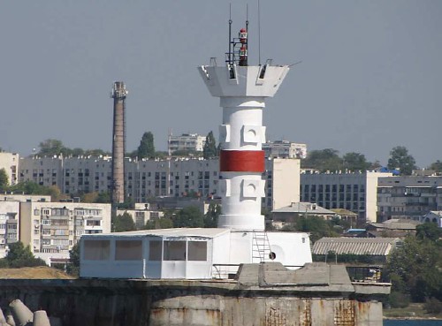
Khersonesskiy Light, Sevastopol', August 2021
Google Maps photo by Ruslan Kanaev


