Return to Naval Historical
Center home page.  Return
to Online Library listing

DEPARTMENT OF THE NAVY -- NAVAL HISTORICAL CENTER
805 KIDDER BREESE SE -- WASHINGTON NAVY YARD
WASHINGTON DC 20374-5060
Online Library of Selected Images:
-- EVENTS -- The 1920s -- 1923
Honda Point Disaster, 8 September 1923
The Navy's greatest navigational tragedy took place in September
1923 at an isolated California coastal headland locally known
as Honda Point. Officially called Point Pedernales, Honda is a
few miles from the northern entrance of the heavily-traveled Santa
Barbara Channel. Completely exposed to wind and wave, and often
obscured by fog, this rocky shore has claimed many vessels, but
never more at one stroke than at about 9 PM on the dark evening
of 8 September 1923, when seven nearly new U.S. Navy destroyers
and twenty-three lives were lost there.
Just over twelve hours earlier Destroyer Squadron ELEVEN left
San Francisco Bay and formed up for a morning of combat maneuvers.
In an important test of engineering efficiency, this was followed
by a twenty-knot run south, including a night passage through
the Santa Barbara Channel. In late afternoon the fourteen destroyers
fell into column formation, led by their flagship, USS
Delphy. Poor visibility ensured that squadron commander
Captain Edward
H. Watson and two other experienced navigators on board Delphy
had to work largely by the time-honored, if imprecise, technique
of dead reckoning. Soundings could not be taken at twenty knots,
but they checked their chartwork against bearings obtained from
the radio direction finding (RDF) station at Point Arguello, a
few miles south of Honda. At the time they expected to turn into
the Channel, the Point Arguello station reported they were still
to the northward. However, RDF was still new and not completely
trusted, so this information was discounted, and DesRon 11 was
ordered to turn eastward, with each ship following Delphy.
However, the Squadron was actually several miles north, and
further east, than Delphy's navigators believed. It was
very dark, and almost immediately the ships entered a dense fog.
About five minutes after making her turn, Delphy slammed
into the Honda shore and stuck fast. A few hundred yards astern,
USS S.P. Lee
saw the flagship's sudden stop and turned sharply to port, but
quickly struck the hidden coast to the north of Delphy.
Following her, USS
Young had no time to turn before she ripped her hull
open on submerged rocks, came to a stop just south of Delphy
and rapidly turned over on her starboard side. The next two destroyers
in line, Woodbury
and Nicholas,
turned right and left respectively, but also hit the rocks. Steaming
behind them, USS Farragut
backed away with relatively minor damage, USS
Fuller piled up near Woodbury, USS
Percival and Somers
both narrowly evaded the catastrophe, but USS
Chauncey tried to rescue the men clinging to the capsized
Young and herself went aground nearby. The last four destroyers,
Kennedy,
Paul Hamilton,
Stoddert
and Thompson
successfully turned clear of the coast and were unharmed. In the
darkness and fog enveloping the seven stranded ships, several
hundred crewmen were suddenly thrown into a battle for survival
against crashing waves and a hostile shore.
This page features all the aerial views we have related
to the 8 September 1923 destroyer groundings at Honda Point, California,
and provides links to other relevant images.
For more images related to the September 1923 Honda Point
Disaster, see:
Honda Point Disaster -- Surface
Views of the Southern Wrecks;
Honda Point Disaster -- Surface
Views of the Northern Wrecks;
Honda Point Disaster -- Later Views
of the Wrecks.
For additional information concerning the September 1923
Honda Point Disaster, see the Navy Department Library presentation:
Honda
(Pedernales) Point, California, Disaster, 8 September 1923
Click on the small photograph to prompt
a larger view of the same image.
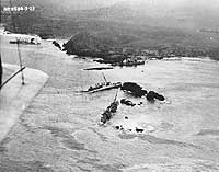
Photo #: NH 66724
Honda Point Disaster, September 1923
Aerial view taken from a plane assigned to USS Aroostook
(CM-3), soon after seven ships of Destroyer Squadron Eleven ran
aground on Honda Point, California, during the night of 8 September
1923.
Point Arguello and its lighthouse are in the foreground. Some
of the stranded ships are visible in the distance. Those identifiable
are:
USS Fuller (DD-297) in the upper right, just to left of
a small rock island;
and USS Young (DD-312), capsized between Fuller
and the mainland, in upper right.
Two salvage ships are standing by, to the left of Fuller.
Courtesy of the Naval Historical Foundation. Collection of Admiral
William V. Pratt.
U.S. Naval Historical Center Photograph.
Online Image: 89KB; 740 x 570 pixels |
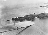 |
Photo #: NH 69587
Honda Point Disaster, September 1923
Aerial view of the disaster area, looking northward, seen from
a plane assigned to USS Aroostook (CM-3). Visible are
six of the seven destroyers that ran aground on Honda Point during
the night of 8 September 1923. They are:
USS Fuller (DD-297), at left;
USS Woodbury (DD-309), just ahead of Fuller;
USS Young (DD-312), capsized in the center of the view;
USS Chauncey (DD-296), upright just ahead of Young;
USS Nicholas (DD-311), beyond the rocks in the center;
and USS Delphy (DD-261), capsized in the small cove between
Chauncey and Nicholas.
The remaining ship, USS S.P. Lee (DD-310), is out of sight
behind the rocky point, astern of Nicholas.
Courtesy of the Naval Historical Foundation. Collection of Admiral
William V. Pratt.
U.S. Naval Historical Center Photograph.
Online Image: 76KB; 740 x 560 pixels |
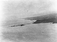 |
Photo #: NH 66723
Honda Point Disaster, September 1923
Aerial view of the disaster area, showing the seven destroyers
that ran aground in a fog during the night of 8 September 1923.
Photographed from a plane assigned to USS Aroostook (CM-3).
Ships are: USS Nicholas (DD-311), in the left center;
USS S.P. Lee (DD-310), astern of Nicholas;
USS Delphy (DD-261), capsized in small cove (center);
USS Young (DD-312), capsized in the center of the view;
USS Chauncey (DD-296), upright ahead of Young;
USS Woodbury (DD-309) on the rocks in the center;
and USS Fuller (DD-297), closest to the camera.
Courtesy of the Naval Historical Foundation. Collection of Admiral
William V. Pratt.
U.S. Naval Historical Center Photograph.
Online Image: 99KB; 740 x 610 pixels |
 |
Photo #: NH 66721
Honda Point Disaster, September 1923
Aerial view of the disaster area, showing all seven destroyers
that ran aground on Honda Point during the night of 8 September
1923. Photographed from a plane assigned to USS Aroostook
(CM-3).
Ships are: USS Nicholas (DD-311), in the upper left;
USS S.P. Lee (DD-310), astern of Nicholas;
USS Delphy (DD-261), capsized in the left center;
USS Young (DD-312), capsized in the center of the view;
USS Chauncey (DD-296), upright ahead of Young;
USS Woodbury (DD-309) on the rocks in the center;
and USS Fuller (DD-297), in the lower center.
The Southern Pacific Railway's Honda Station is in the upper
left.
Courtesy of the Naval Historical Foundation. Collection of Admiral
William V. Pratt.
U.S. Naval Historical Center Photograph.
Online Image: 113KB; 740 x 605 pixels |
 |
Photo #: NH 66722
Honda Point Disaster, September 1923
Aerial view of the southern part of the disaster area, showing
five of the seven destroyers that ran aground on Honda Point
during the night of 8 September 1923. Photographed from a plane
assigned to USS Aroostook (CM-3). Ships visible are:
USS Delphy (DD-261), capsized in the small cove at left;
USS Young (DD-312), capsized in left center;
USS Chauncey (DD-296), upright ahead of Young;
USS Woodbury (DD-309) on the rocks in the right center;
and USS Fuller (DD-297) on the rocks at right.
The Southern Pacific Railway's Honda Station is in the upper
middle.
Courtesy of the Naval Historical Foundation. Collection of Admiral
William V. Pratt.
U.S. Naval Historical Center Photograph.
Online Image: 83KB; 740 x 605 pixels |
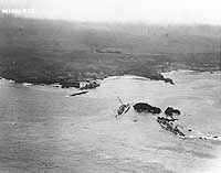 |
Photo #: NH 66720
Honda Point Disaster, September 1923
Aerial view of the southern part of the disaster area, showing
four of the seven destroyers that ran aground on Honda Point
during the night of 8 September 1923. Photographed from a plane
assigned to USS Aroostook (CM-3).
Ships visible are USS Delphy (DD-261), capsized in the
lower left; USS Chauncey (DD-296), upright beyond Delphy;
USS Young (DD-312), capsized aft of Chauncey; and
USS Woodbury (DD-309) at right.
Point Arguello lighthouse is in the center distance.
Courtesy of the Naval Historical Foundation. Collection of Admiral
William V. Pratt.
U.S. Naval Historical Center Photograph.
Online Image: 102KB; 740 x 575 pixels |
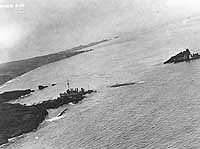 |
Photo #: NH 69585
Honda Point Disaster, September 1923
Aerial view of the disaster area, looking westward, seen from
a plane assigned to USS Aroostook (CM-3). Visible are
five of the seven destroyers that ran aground on Honda Point
during the night of 8 September 1923. They are:
USS Fuller (DD-297), beyond the small rock island in the
center;
USS Woodbury (DD-309), just ahead of Fuller;
USS Chauncey (DD-296), closest to the camera;
USS Young (DD-312), capsized astern of Chauncey;
and USS Delphy (DD-261), barely visible, capsized just
beyond the coast at right.
Courtesy of the Naval Historical Foundation. Collection of Admiral
William V. Pratt.
U.S. Naval Historical Center Photograph.
Online Image: 75KB; 740 x 570 pixels |
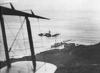 |
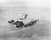
Photo #: NH 69586
Honda Point Disaster, September 1923
Aerial view of the disaster area, looking westward, seen from
a plane assigned to USS Aroostook (CM-3). USS Fuller
(DD-297) is in the center, with her bow toward the camera.
Nearer, and listing to port, is USS Woodbury (DD-309).
Note the oil in the water from these two ships, and from others
that were wrecked at the same time.
Courtesy of the Naval Historical Foundation. Collection of Admiral
William V. Pratt.
U.S. Naval Historical Center Photograph.
Online Image: 106KB; 740 x 605 pixels |
 |
For more images related to the September 1923 Honda Point
Disaster, see:
Honda Point Disaster -- Surface
Views of the Southern Wrecks;
Honda Point Disaster -- Surface
Views of the Northern Wrecks;
Honda Point Disaster -- Later Views
of the Wrecks.
 Return to Naval
Historical Center home page.
Page made 14 July 2002
Link added 27 October 2005
