This page features more wartime aerial photographs showing
all or a large portion of Iwo Jima.
Note: Some of the images presented here are also featured
in other pages of the Online Library's Iwo Jima Operation
series.
For maps and other aerial photographs of Iwo Jima, see:
| If you want higher resolution reproductions than the Online Library's digital images, see: "How to Obtain Photographic Reproductions." |
Click on the small photograph to prompt a larger view of the same image.
|
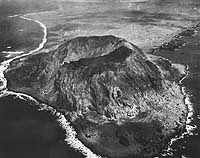
Photo #: 80-G-412503 Iwo Jima Operation, February 1945 View looking northward over Mount Suribachi, circa late February 1945. Several LSTs are landing supplies and equipment on the beach in the right background. Photographed by a member of the Steichen unit. Official U.S. Navy Photograph, now in the collections of the National Archives. Online Image: 111KB; 740 x 610 pixels Reproductions of this image may also be available through the National Archives photographic reproduction system. |
 |
|
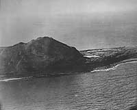
Photo #: NH 104138 Iwo Jima, Volcano Islands "High Point of Iwo Jima -- 'Close-up' of Mount Suribachi on Tobiishi Point, snapped from a Navy plane during a carrier strike that preceded the Marine landings on Iwo Jima announced today. The strategic island has been battered by Navy aerial and surface barrages, interspersed between Army bombings, for many months prior to the amphibious invasion now in progress by the Marines' Fifth Amphibious Corps." Quoted from the original caption, released with this photograph on 19 February 1945. The view shows the eastern side of Mount Suribachi and a small portion of the lowlands to its north. The original print came from Rear Admiral Samuel Eliot Morison's World War II history project working files. Official U.S. Navy Photograph, from the collections of the Naval Historical Center. Online Image: 68KB; 740 x 620 pixels |
 |
|
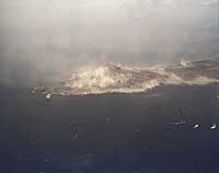
Photo #: 80-G-K-2965 (Color) Iwo Jima Operation, 1945 Pre-landing bombardment of the southern part of Iwo Jima, with Mount Suribachi in the center, circa 17-19 February 1945. Photograph looks toward the west. Official U.S. Navy Photograph, now in the collections of the National Archives. Online Image: 33KB; 740 x 610 pixels Reproductions of this image may also be available through the National Archives photographic reproduction system. |
 |
|
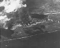
Photo #: NH 104145 Iwo Jima, Volcano Islands Fires and explosions on Iwo Jima's Airfield # 1, resulting from a bombardment delivered by heavy cruisers of Cruiser Division Ten, 2 July 1944. Note the tightly grouped aircraft parked in the center of the image. Airfield # 2 is in the upper right of the photograph. Taken from a USS Boston (CA-69) aircraft. Official U.S. Navy Photograph, from the collections of the Naval Historical Center. Online Image: 61KB; 740 x 615 pixels |
 |
|
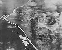
Photo #: NH 104140 Iwo Jima, Volcano Islands "Target for Today: Iwo Jima -- Typical expanse of shore line on the volcanic island of Iwo, where today members of the U.S. Marines' Fifth Amphibious Corps are smashing at Japan defenders in another vital battle in World War 2. Thunderous and obliterating barrages by Navy ships and planes preceded the invasion assault." Quoted from the original caption, released with this photograph on 19 February 1945. The view, taken during an air raid prior to the invasion operation, looks northeastward over Iwo Jima's southwestern shore. Bombs are bursting at the southern end of Airfield Number One, at the right. Note the agricultural fields between the camera and the airfield, and roads serving the airfield and settlements. This shoreline, running from the lower center of the image northwards to beyond the point at left, was the scene of Beaches Purple 1, Brown (1 & 2), White (1 & 2) and Orange (1 & 2), which were used during the follow-on phases of the invasion. The original print came from Rear Admiral Samuel Eliot Morison's World War II history project working files. Official U.S. Navy Photograph, from the collections of the Naval Historical Center. Online Image: 87KB; 740 x 625 pixels |
 |
|
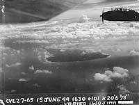
Photo #: NH 104137 Iwo Jima, Volcano Islands Photographed during the afternoon of 15 June 1944 from a plane based on USS Langley (CVL-27), during raids on Iwo Jima, Chichi Jima and Haha Jima in support of the Marianas operation. The view, taken from off Iwo Jima's northeastern side, looks southwesterly. A TBM "Avenger" bomber is in the upper right. The original print came from Rear Admiral Samuel Eliot Morison's World War II history project working files. Official U.S. Navy Photograph, from the collections of the Naval Historical Center. Online Image: 74KB; 740 x 585 pixels |
 |
|
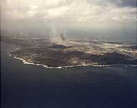
Photo #: 80-G-K-2966 (Color) Iwo Jima Operation, 1945 Aerial photograph of the northeastern part of Iwo Jima, looking to the westward, during the pre-landing bombardment, 19 February 1945. Tachiiwa Point is in the left center foreground. Official U.S. Navy Photograph, now in the collections of the National Archives. Online Image: 45KB; 740 x 605 pixels Reproductions of this image may also be available through the National Archives photographic reproduction system. |
 |
|
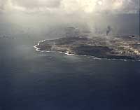
Photo #: 80-G-K-2973 (Color) Iwo Jima Operation, 1945 View looking southwestward down the length of the island from off its northeastern coast, during the initial landings on 19 February 1945. Mount Suribachi is in the distance, in the upper center. Official U.S. Navy Photograph, now in the collections of the National Archives. Online Image: 38KB; 740 x 605 pixels Reproductions of this image may also be available through the National Archives photographic reproduction system. |
 |
|
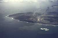
Photo #: 80-G-K-2970 (Color) Iwo Jima Operation, 1945 View looking southwestward down the length of the island from beyond Iwo Jima's northeastern shore, at about "H-Hour" on the morning of 19 February 1945. Hanare Rock is in the lower right. Tachiiwa Point is at left. Note the armada at left, including several battleships. Official U.S. Navy Photograph, now in the collections of the National Archives. Online Image: 37KB; 740 x 510 pixels Reproductions of this image may also be available through the National Archives photographic reproduction system. |
 |
|
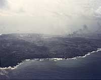
Photo #: 80-G-K-2971 (Color) Iwo Jima Operation, 1945 View looking southeastward across the island's northern part, at about "H-Hour" on the morning of 19 February 1945. Kitano Point is at left. Official U.S. Navy Photograph, now in the collections of the National Archives. Online Image: 41KB; 740 x 610 pixels Reproductions of this image may also be available through the National Archives photographic reproduction system. |
 |
For maps and other aerial photographs of Iwo Jima, see:
| If you want higher resolution reproductions than the Online Library's digital images, see: "How to Obtain Photographic Reproductions." |
Page made 22 December 2006
Captions corrected 29 December 2006