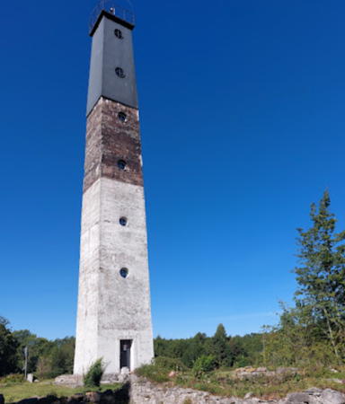
The Republic of Estonia (Eesti in Estonian) is a small country with a surprisingly long coastline. Surrounded on 2-1/2 sides by water, it faces the Gulf of Riga (Liivi Laht) on the southwest, the Baltic Sea (Läänemere) on the west, and the Gulf of Finland (Soome Lahe) on the north. The country includes two large islands in the Baltic, Saaremaa and Hiiumaa, and countless small islands. To guard these coasts, Estonia has more than 100 lighthouses and a well-developed lighthouse administration.
Estonia's independence is recent. The country was part of the Swedish Empire from 1625 to 1710 and then part of the Russian Empire from 1710 until the end of World War I in 1918. After two decades of independence it was incorporated into the Soviet Union from 1940 to 1990. Thus the older lighthouses are from the Russian Imperial period and some of the newer ones are of Soviet construction. An example from the imperial period appears at right: the Vilsandi lighthouse built in 1809.
Estonia is divided administratively into fifteen counties (maakonnad, singular maakon), and the counties are subdivided for local government into urban municipalities and rural municipalities called parishes (vallad). This page includes lighthouses of the southwestern coast including Pärnu and Saare counties.
Names in curly brackets {} are non-Estonian former names (Swedish or German).
In Estonian a lighthouse is a tuletorn (fire tower), a tulepaak (fire beacon), or a majakas (borrowed from the Finnish word majaka for a lighthouse). A daybeacon is called a päevamärk, saar is an island, poolsaar is a peninsula, parv is shoal, kari is a reef, neem is a cape or headland, väin is a strait, jõgi is a river, and sadam is a port or harbor.
Lighthouses in Estonia were operated previously by the Estonian Maritime Administration (Veeteede Amet, or VTA). In 2021 the functions of VTA were folded into the Estonian Transport Administration (Transpordiamet).
ARLHS numbers are from the ARLHS World List of Lights. VTA numbers are from the List of Lights - Estonia published by VTA. Admiralty numbers are from volume C of the Admiralty List of Lights & Fog Signals. U.S. NGA List numbers are from Publication 116.
- General Sources
- Navigatsioonimärkide andmekogu (Database of Navigation Signs)
- Copied from the former VTA web site, photos and data for all the VTA beacons.
- Transpordiamet - Tuletornid
- Lighthouse information from the Transport Administration, including the Database of Navigation Signs and information on lighthouses open to visitors.
- Eesti Tuletorni Selts
- Web site of the Estonian Lighthouse Society (in Estonian)..
- Online List of Lights - Estonia
- Photos by various photographers posted by Alexander Trabas. Most of the photos for Estonia are by VTA.
- Leuchttürme in Estland
- Photos by Andreas Köhler taken in the summer of 2016.
- Lighthouses in Estonia
- Photos by various photographers available from Wikimedia.
- World of Lighthouses - Estonia
- Photos by various photographers available from Lightphotos.net.
- Leuchttürme an der estländischen Ostseeküste
- Photos of Estonian lighthouses posted by Bernd Claußen.
- Lighthouses Estonia
- Photos posted on Flickr.com by Joke Reijnen.
- Six Remarkable Estonian Lighthouses
- Information posted by Cybernetica AS, an Estonian manufacturer of aids to navigation.
- Vintage postcards and photos depicting lighthouses of Estonia
- Historic postcard images posted by Michel Forand.
- Leuchttürme...auf historischen Postkarten
- This page, posted by Klaus Huelse, has 18 historic postcard views of Estonian lighthouses.
- List of Lights - Estonia
- The official light list for Estonia, with text in both Estonian and English.
- GPSNauticalCharts
- Navigational chart for Estonia.
- Navionics Charts
- Navigational chart for Estonia.

Vilsandi Light, Kihelkonna, August 2023
Google Maps photo by Elys K

Virtsu Light, Virtsu, May 2021
Instagram photo by Maige Õunpuu


