Most of Italy (officially the Italian Republic, Repubblica Italiana in Italian) occupies a long peninsula in the Mediterranean Sea, with the Adriatic and Ionian Seas on the east and the Ligurian and Tyrrhenian Seas to the west; the country also includes the Mediterranean's two largest islands, Sicily and Sardinia, and many smaller islands. With this geography Italy has a very long coastline reckoned by geographers at about 7600 km (4722 mi). Guarding this coast are many lighthouses; the Directory lists more than 400.
Italy is divided into 20 regions (regioni), many of them well known outside the country in their own right. This page includes the lighthouses of the two regions of Friuli Venezia Giulia and Veneto, which together encircle the northwestern end of the Adriatic Sea. This area includes the important ports of Trieste and Venezia (Venice).
The history of this area is lengthy and complex but a few recent dates are important for understanding lighthouse history. The Republic of Venice, which had controlled much of the Adriatic Sea for many centuries, fell to Napoleon in 1796. At the end of the Napoleonic Wars in 1814 Friuli Venezia Giulia continued as part of the Austrian Empire, while Veneto (Venice) was placed under Austrian rule as part of the Kingdom of Lombardy-Venetia. Lombardy-Venetia was incorporated into Italy following the brief Third Italian War of Independence in 1866. Trieste continued under Austrian control until the Austrian Empire was dissolved following World War I; it was annexed to Italy in 1920. After World War II the city of Trieste and part of the adjoining peninsula of Istria became the Free Territory of Trieste under United Nations supervision. In 1954 the free territory was dissolved and the city of Trieste was returned to Italian sovereignty; Istria was incorporated into Yugoslavia and now forms parts of Slovenia and Croatia.
The Italian word for a lighthouse is faro, plural fari. This name is usually reserved for the larger coastal lights; smaller beacons are called fanali. In Italian isola is an island, isolotto is an islet, secca is a shoal, cabo is a cape, punta is a point of land, baia is a bay, stretto is a strait, fiume is a river, and porto is a harbor.
Aids to navigation in Italy are operated and maintained by the Italian Navy's Servizio dei Fari e del Segnalamento Marittimo (Lighthouse and Maritime Signal Service). Lighthouse properties are naval reservations, generally fenced and closed to the public.
ARLHS numbers are from the ARLHS World List of Lights. EF numbers are from the Italian Navy's light list, Elenco Fari. Admiralty numbers are from volume E of the Admiralty List of Lights & Fog Signals. U.S. NGA List numbers are from Publication 113.
- General Sources
- Fari e Segnalamenti
- Lighthouse information from the Italian Navy's Servizio dei Fari.
- Online List of Lights - Italy - Adriatic Sea
- Photos by various photographers posted by Alexander Trabas. Many photos are by Capt. Peter Mosselberger ("Capt. Peter").
- Fari in Italia
- Index to lighthouse articles in the Italian edition of Wikipedia; nearly all have photos.
- Lighthouses in Italy
- Photos by various photographers available in Wikimedia Commons.
- World of Lighthouses - Italy
- Photos by various photographers available from Lightphotos.net.
- Phares d'Europe
- Photos posted by Alain Guyomard and Robert Carceller; many Italian lighthouses are included.
- Italy Lighthouses
- Aerial photos posted by Marinas.com.
- Leuchttürme Italiens und Maltas auf Historischen Postkarten
- Historic postcard images posted by Klaus Huelse.
- GPSNavigationCharts
- Navigation chart information for northeastern Italy.
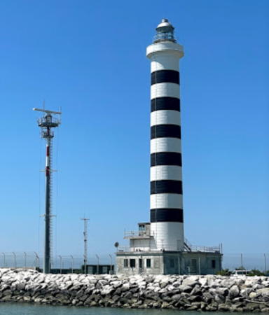
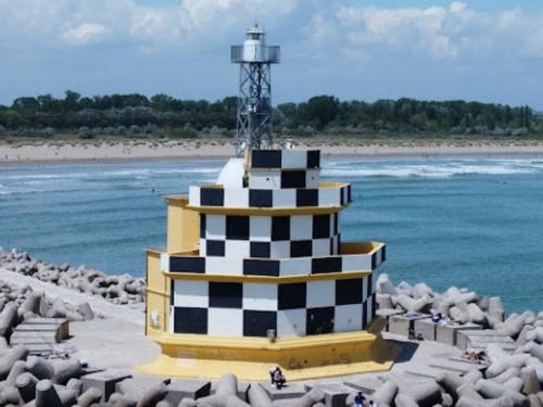
Porto Piave Vecchia Light, Jesolo, June 2021
Google Maps photo
by Wandern Leo
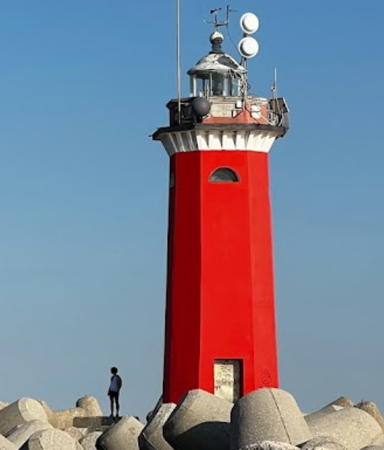
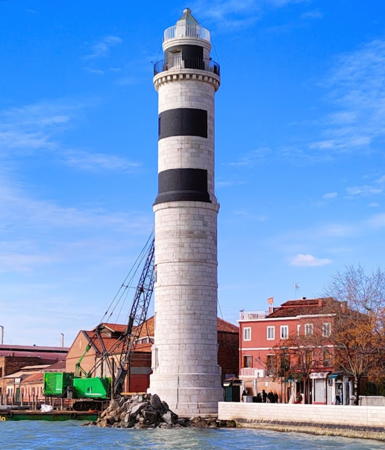
Lido Molo Sud Light (Faro di San Nicolò), Venice, June 2022
Google Maps photo by Facce DA Merenda

