Lighthouses of the United States: Michigan's Southeastern Lower Peninsula

The United States of America is a federal union of 50 states and a capital district. The Great Lakes state of Michigan comes in two parts: the Lower Peninsula (between Lakes Huron and Michigan) and the Upper Peninsula (between Lakes Michigan and Superior). Putting the two together the state has an astonishingly long coastline, so it is not surprising that Michigan has more lighthouses than any other U.S. state, by quite a large margin. The Directory has information on more than 130 sites.

This lighthouse heritage is well recognized. Michigan is the only state that supports lighthouse preservation with a program of annual grants from the state to local preservation groups. All over the state volunteers are working hard to save and restore lighthouses. There is a state preservation society, the Michigan Lighthouse Conservancy, and the Great Lakes Lighthouse Keepers Association is also based in the state.

This page lists lighthouses on the southeast coast of the Lower Peninsula, including the Thumb region, the St. Clair and Detroit Rivers, and Lake St. Clair. There's another page for the northeastern coast.

Aids to navigation in southeastern Lower Michigan are maintained by the U.S. Coast Guard Sector Detroit; Aids to Navigation (ANT) teams are based at Saginaw River and Detroit. Ownership (and sometimes operation) of historic lighthouses has been transferred to local authorities and preservation organizations in many cases.

ARLHS numbers are from the ARLHS World List of Lights. Along the Canadian border, CCG numbers are from the List of Lights, Buoys, and Fog Signals of Fisheries and Oceans Canada. USCG numbers are from Volume VII of the United States Coast Guard Light List.

General Sources
Michigan Lighthouses
Excellent photos and information posted by Kraig Anderson.
Seeing the Lights: The Lighthouses of Michigan
This site by Terry Pepper also has fine photos and extensive historical information.
Lighthouses in Michigan, United States
Aerial photos posted by Marinas.com.
Lighthouses in Lake Huron
Photos by C.W. Bash.
Lighthouses of the Great Lakes
Photos by various photographers available from Wikimedia.
Detroit River Cruise
Photos of light beacons taken in August 2007 and posted by Noah Greenia.
Leuchttürme USA auf historischen Postkarten
Historic postcard images posted by Klaus Huelse.
Great Lakes Lighthouse Keepers Association
GLLKA encourages lighthouse preservation throughout the Great Lakes states, but it is best known for its work preserving the Round Island and St. Helena Island Lights in the Straits of Mackinac area. The association has an excellent blog.
Michigan Lighthouse Conservancy
This organization is dedicated to the preservation of lighthouses and life saving stations throughout the state.
Michigan Lighthouse Assistance Program
This state program provides grants annually for lighthouse preservation.
U.S. Coast Guard Navigation Center: Light Lists
The USCG Light List can be downloaded in pdf format.
NOAA Nautical Charts
Official nautical charts for the coast can be viewed online.
Navionics Charts
Navigation chart for southeast Michigan.

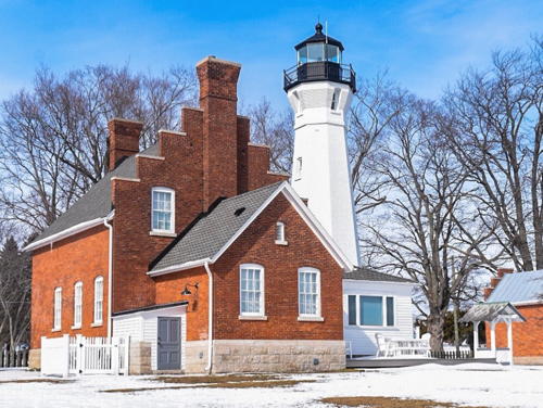
Detroit River Light
Detroit River Light, Lake Erie, September 2008
Flickr Creative Commons photo by James Marvin Phelps


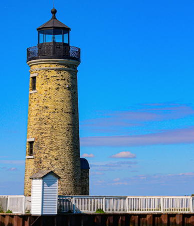
Livingstone Memorial Light, Detroit, June 2012
Flickr Creative Commons photo by C.M. Hanchey

Huron County (Thumb) Lighthouses
The Thumb of Michigan is the broad, rounded peninsula between Saginaw Bay and the main body of Lake Huron. The coast of the Thumb is in Huron and Sanilac Counties.
** Caseville Harbor
2001. Active (privately maintained); focal plane about 65 ft (20 m); white flash every 10 s. 38 ft (11.5 m) square cylindrical wood tower mounted at one end of a 3-story wood condo building. Buildings painted white with red roofs. A photo is available and Google has a street view and a satellite view. Located on the south side of the Pigeon River and on the east side of Main Street (MI-25) in Caseville. Site open, tower open to tours by appointment. Owner/site manager: Caseville Harbor Light Condos. ARLHS USA-1258; USCG 7-10373.
Port Austin Reef (2)
1899 (station established 1878). Active; focal plane 76 ft (23 m); white flash every 6 s. 60 ft (18 m) square cylindrical brick tower attached to 1-story brick keeper's house, mounted on octagonal pier; solar-powered 300 mm lens (1985). The buildings are unpainted brick; the lantern and gallery are painted black; the roofs are red. An additional 2-story brick keeper's house (1878) onshore is now a private residence. A September 2023 photo is at right, Anderson has a page with several photos, Pepper has a fine page for the lighthouse, J. Cole has a 2020 photo, Jaesung Edward Lee has a closeup, Bash has a distant view, the Coast Guard has a historic photo, and Bing has a satellite view. The lighthouse has been restored through intensive local efforts beginning in 1988. In 1990 the preservation group obtained a 30-year lease from the Coast Guard. A $14,000 state grant was used in 2001 to rebuild the station's dock for future public access. Exterior restoration is mostly complete and work continues in the interior. The lighthouse became available for transfer under NHLPA in June 2011. In July 2012 the Secretary of the Interior announced that ownership of the lighthouse would be transferred to the preservation group, and the transfer was carried out in February 2013. In 2014 the state awarded $40,000 toward repairs and upgrades to the station's dock to improve public access. In 2022 a $480,000 grant from the Michigan Department of Transportation funded most of a planned $610,000 project to restore the exterior of the lighthouse. Work began in September. and will continue through 2024; the lighthouse will reopen in summer 2025. Another project will restore the interior, and there are plans to offer overnight stays in the future. Located about 2 miles (3 km) offshore at the tip of Michigan's "thumb," near Port Austin. Accessible only by boat (navigation is dangerous near the reef). Site open, tower closed for restoration in 2024; normally open to guided tours (reservations required) offered May through September. Owner/site manager: Port Austin Reef Light Association . ARLHS USA-648; USCG 7-10275.

Port Austin Reef Light, Port Austin, September 2023
Instagram photo by Port Austin Reef Light
*** Pointe aux Barques (2)
1858 (station established 1848). Active; focal plane 93 ft (28 m); 2 white flashes every 20 s, the flashes separated by 5 s. 89 ft (27 m) round brick tower attached to a 1-1/2 story brick keeper's house (1908). Twin DCB-224 aerobeacons. Lighthouse painted white; lantern roof is red. Brick assistant keeper's house (1933) and iron oil house. James Hatcher's photo is at right, Anderson has an excellent page for the light station, Pepper also has a good page, a 2021 photo is available, Marinas.com has aerial photos, the Coast Guard has a historic photo, and Google has a satellite view. The keeper's house is a museum, or actually two museums, one covering the light station and former lifesaving station and the other for the neighboring Thumb Underwater Preserve. The original 3rd order Fresnel lens and fog bell, formerly displayed and then stored at the Huron City Museum in Huron City, was removed by the Coast Guard in June 2013, restored, and placed on display at the light station in September. Most of the light station was conveyed to Huron County in 1935 and 1958; the lighthouse itself was transferred to county ownership in June 2003. The Pointe aux Barques Lighthouse Society was formed in 2001 to support restoration of the light station. In late 2003 a state grant of $70,000 provided funds for exterior repairs and restoration. Also in 2003 archaeologists located the foundations of the 1848 lighthouse. In October 2005 the Comcast company organized a volunteer day during which the keeper's house was painted inside and out. In 2014 the state granted $26,633 for improvements at the station. Located in Lighthouse County Park, off MI 25 about 6 miles (10 km) northwest of Port Hope (and 7 miles (11 km) southeast of the actual point); the park includes a large campground and 6 vacation cabins. Site open, museum open daily except Tuesdays Memorial Day weekend (late May) through mid October, tower open during occasional tower climb days; consult the lighthouse hours page for dates. Owner: Huron County (Lighthouse County Park). Site manager: Pointe aux Barques Lighthouse Society . ARLHS USA-615; USCG 7-10210.

Pointe aux Barques Light, Port Hope, June 2012
Flickr Creative Commons photo by James Hatcher
** Harbor Beach (Sand Beach) (2)
1885 (station established 1875). Reactivated (inactive 2014-15); focal plane 54 ft (16.5 m); red flash every 6 s. 45 ft (14 m) round cast iron sparkplug tower with lantern and gallery incorporating 2-story keeper's house; replica 4th order Fresnel lens. The original 4th order Fresnel lens is on display at the Grice House Museum near the marina at the north end of town. Lighthouse painted white; the lantern roof is red. Fog horn (blast every 30 s) when needed. Aaron Linville's photo is at right, Pepper has a good page for the lighthouse, Anderson also has a fine page, an excellent photo is available, the Coast Guard has a historic photo, and Bing has a satellite view. The Harbor Beach Lighthouse Preservation Society has worked since 1984 for the preservation and restoration of the light. The Society replaced the windows with copies of the originals, painted, and built a dock and steps for access. The Coast Guard restored the crib foundation in 1999. In 2004 the lighthouse became available for transfer under NHLPA. The city and the preservation society submitted an application for ownership, but controversy arose over Coast Guard plans to convert the light to solar power; the preservation society wanted the cable connection to the mainland repaired instead. This and other difficulties delayed the transfer of the lighthouse to city ownership until June 2010. The 2014 USCG list described the light as being "on navigation pole." In that year the HBLPS was raising funds to purchase an acrylic replica of the 4th order lens. The lens was dedicated in June 2015. In 2017 the fog signal building was rebuilt. Located on a crib off the end of a detached breakwater protecting the artificial harbor at Harbor Beach. Accessible only by boat; there are good views from public beach parking areas at the foot of Trescott Street, off MI 25. Site open, and guided tours are available on Saturdays mid June through the end of September (reservations required). Owner: City of Harbor Beach. Site manager: Harbor Beach Lighthouse Preservation Society . ARLHS USA-365; USCG 7-10130.

Harbor Beach Light, Harbor Beach, August 2014
Wikimedia Creative Commons photo by Aaron Linville

Sanilac County Lighthouse
** Port Sanilac
1886. Active; focal plane 69 ft (21 m); 3 white flashes every 10 s. 59 ft (18 m) octagonal hourglass-style brick tower with lantern and gallery attached to 2-story brick keeper's house. The original 4th order Fresnel lens, replaced by an LED system in 2016, remains at the lighthouse. Lighthouse painted white; lantern roof is red. Brick oil house. Jasinda Scoviac's photo is at right, Anderson has a fine page for the lighthouse, Pepper's page has several photos, Doerthe Manahan has a good photo, a fine 2007 photo is available, Larry Myhre has a fine 2004 photo, C.M. Hanchey has a good photo, Marinas.com has aerial photos, the Coast Guard has a historic photo, and Google has a satellite view. A handsome lighthouse; there is only one other of this design (Ile au Galets, Lake Michigan). The keeper's house has been a private summer residence, owned by the Rosenfield family since 1928. In 2000 the Coast Guard also transferred ownership of the tower to the residents. In July 2012, the family put the property for sale for $1,599,000; as of December 2013 the price had been lowered to $999,800. In 2014 the Coast Guard announced plans to replace the 4th order lens with a modern LED light. In December 2014 the lighthouse was sold for $855,000 to lighthouse enthusiast Jeff Shook, who also owns the St. Clair Flats Range Front Light (see below). In 2017 Shook announced that the lighthouse would be open on Fridays in July and August with guides from the Sanilac County Historical Society. Located at Lake and Cherry Streets, off MI 25 in Port Sanilac; the lighthouse can be seen easily from the breakwater at the end of Cherry Street. Public parking provided. Site and tower generally closed, but guided tours conducted by the Sanilac County Historical Society are available between 11 am and 2 pm on Fridays in July and August; check the Facebook page for details. Owner/site manager: Port Sanilac Lighthouse . ARLHS USA-651; USCG 7-10115.

Port Sanilac Light, Port Sanilac, March 2022
Instagram photo by Jasinda Scoviac

St. Clair County (St. Clair River) Lighthouses
Lake Huron drains toward Lake Erie through the St. Clair River. The river is about 40 mi (65 km) long and has no locks; it loses only 5 ft (1.5 m) of elevation before reaching Lake St. Clair. The river has formed an extensive delta at its mouth.

Lake Huron Cut (Light 7)
Date unknown. Active; focal plane 47 ft (14 m); quick-flashing green light. 47 ft (14 m) round cylindrical tower rising from a round equipment building on a concrete pier. Lighthouse painted white with one green horizontal band. A photo is available but the light does not appear in Google's satellite view. This light guides vessels into the dredged channel leading to the St. Clair River, the same role formerly played by the lightship Huron. Located in Lake Huron about 3.75 mi (6 km) north of the Fort Gratiot lighthouse. Accessible only by boat. Site open, tower closed. USCG 7-10065.
*** Fort Gratiot (Port Huron) (2)
1829 (Lucius Lyon) (station established 1825). Active; focal plane 86 ft (26 m); green flash every 6 s, day and night. 82 ft (25 m) round old-style brick tower with lantern and gallery; DCB-24 aerobeacon (1933). Lighthouse painted white; lantern roof is red. This is a complete light station. The 2-story duplex brick keeper's house (1874) and assistant keeper's house (1932) were formerly used as Coast Guard housing. Brick fog signal building (1901), Coast Guard station building (1932), and several supporting buildings all survive. The modern Port Huron Coast Guard Station is adjacent to the lighthouse. A 2021 photo is at right, Pepper has the station's history on his excellent web page, Anderson's page has photos, Marinas.com has aerial photos, Kimberly Crawford-Clifton has a 2021 photo, Huelse has a historic postcard view, the Coast Guard has a historic photo, and Google has a street view and a satellite view. The original lighthouse was so poorly constructed it collapsed in November 1828. The present lighthouse was extended from 65 ft (20 m) in 1861. The oldest light station in Michigan and the first on Lake Huron, Fort Gratiot was saved from deactivation by public protests in 1996. In 2004 Port Huron City Council sought ownership of the light under NHLPA and in October 2005 this request was approved by the National Park Service. The transfer of ownership was suspended pending cleanup of hazardous materials by the Coast Guard. In 2005 Congress appropriated $400,000 and in summer 2006 the museum hired architects to plan the restoration. In 2008 the lighthouse was closed to tours due to crumbling brickwork. Architects reported that it needed almost $4 million for a complete restoration. These plans were endangered in 2009 when city council rejected a deed offered by the federal government because it found the financial requirements too heavy. In April 2010 the commissioners of St. Clair County agreed to accept ownership, creating the Port Gratiot Light Station County Park. In May 2010 the Port Huron Museum received a $40,000 grant from the Michigan Lighthouse Assistance Program for repairs to the lighthouse; a $370,000 federal grant was available and the city of Port Huron also put up $370,000. The transfer of ownership was made on 2 September 2010. In July 2011 city council voted unanimously to award a $333,000 contract for restoration. The restored lighthouse reopened for climbing on 19 May 2012. In 2019 it was decided that the state's Great Lake-to-Lake Bicycle Trail will end at the lighthouse. In 2021 the Michigan Lighthouse Assistance Program granted $16,667 to assist with repairs to the lantern. Restoration of the lantern and watch room was completed in early 2023. Located at the foot of Garfield Street in Port Huron, near the entrance to the St. Clair River. Site open, tower open to tours on weekends April through December and also Friday and Monday during the summer (reservations advised). Group tours of the lighthouse are available year round, and groups of 20-40 can book the light station for overnight stays. Owner: St. Clair County. Site manager: Port Huron Museum . ARLHS USA-291; USCG 7-10015.

Fort Gratiot Light, Port Huron, April 2021
Instagram photo by Sherry Lynne
* Fort Gratiot Range Front (2)
Date unknown (2003?). Active; focal plane 11 m (36 ft); continuous green light shown by a 12 ft (3.7 m) long vertical bar light. 9 m (30 ft) hexagonal cylindrical brick tower. The tower also carries as a daymark two red vertical stripes on either side of the white bar; in addition a continuous green passing light is mounted at the top of the tower. Bash has a photo, a 2019 closeup is available, and Google has a street view and a satellite view. The range guides ships entering the St. Clair River under the Blue Water Bridge. Developers of the riverfront Edison Shores Condominiums reached an agreement in early 2003 with the city and Coast Guard to replace the previous light (a standard "D9" tower) with a tower matching the style of the rear light. Located on the riverfront in Thomas Edison Park, 458 ft (140 m) north northeast of the rear light. Site open, parking provided, tower closed. CCG I-0766.4; USCG 7-9990 (range light) and 9995 (passing light).
* Fort Gratiot Range Rear (2)
Date unknown (late 1990s?). Active; focal plane 52 ft (16 m); continuous green light shown at the top of the tower and also by a 12 ft (3.7 m) long vertical bar light; there is also a continuous green passing light intensified for ships approaching from the south. The tower also carries as a daymark two red vertical stripes on either side of the white bar. 58 ft (19 m) hexagonal brick tower. Bash has a photo and Google has a street view and a satellite view. This lighthouse was built by developers of the riverfront Edison Shores Condominiums in an architectural style matching that of the condos. Located on the west side of Thomas Edison Parkway at Edison Shores, less than 1/4 mile (about 300 m) north of the lightship Huron. Site open, tower closed. CCG I-0766.5; USCG 7-10000.
**** Lightship 103 Huron
1921. Decommissioned 1970 (a decorative white light is displayed). 340 ton single-masted steel lightship, length 97 ft (30 m), beam 24 ft (7 m). The hull of the Huron is painted black and the superstructure white, instead of the usual lightship red. A photo is at right, Pepper's page has the ship's history and photos from his visit, David Crawford has a 2021 photo, a 2009 photo is available, Anderson also has a good page for the lightship, and Google has a street view and a satellite view. After 14 years on Lake Michigan this ship served on the Corsica Shoals north of Port Huron from 1935 to 1970. This is the only surviving Great Lakes lightship and also one of the best preserved of all U.S. lightships, fully equipped and with an operational lamp and fog signal. In July 2020 a storm surge damaged the foundation under the ship and disrupted its utility connections. The ship was closed the rest of the 2020 season but reopened after repairs were completed in September 2021. Dry berthed at Pine Grove Park on Prospect Street in downtown Port Huron. Site open, ship open (admission fee) daily late May through early September, also Friday through Monday in early to late May. Owner/site manager: Port Huron Museum. . ARLHS USA-394.

Lightship Huron, Port Huron, April 2012
Wikimedia Creative Commons photo by Notorious4life
* Peche (Peach) Island Range Rear (4) (relocated to Marine City)
1908 (station established 1898). Inactive officially since 1982, but a continuous white light is displayed and the lighthouse is charted as a landmark. 66 ft (20 m) round cast iron tower, painted white with black trim. Original 6th order Fresnel lens in place. Roberta Peek's photo is at right, Anderson has an excellent page for the lighthouse, a 2022 photo is available, James Martin has a 2018 photo, and Google has a street view and a satellite view. This lighthouse was originally located on a crib off Peche Island in the entrance to the Detroit River from Lake St. Clair; the Coast Guard has a historic photo. Prior to relocation the crib had failed and the lighthouse was leaning at a dizzy angle. A contract to scrap the lighthouse was awarded in 1983, but a Marine City bank intervened to purchase the tower and relocate it to Marine City. In 2013 the state denied an application for funds to restore the lighthouse but the city proceeded with exterior restoration using the intended matching funds. Repainting and repairs were completed in 2014. In 2019 a local contractor donated colored floodlights to illuminate the tower for special events. Located in River Park on the St. Clair River in Marine City; the lighthouse is next door to City Hall on Water Street between Jefferson and Washington Streets. Site open, tower closed. Owner/site manager: City of Marine City (Peche Island Rear Range Light). . ARLHS USA-586.
St. Clair Flats Canal Range Rear (2)
1935 (station established 1871). Active; focal plane 112 ft (34 m); continuous green light. 100 ft (30 m) square cylindrical steel skeletal tower with flared top; upper 2/5 of tower enclosed by white steel panels. Google has an indistinct satellite view. The original lighthouse was an octagonal brick tower attached to a keeper's house. This is the entrance range for the St. Clair Flats channel, formerly the main entrance to the river from Lake St. Clair but now replaced by the dredged St. Clair Cutoff to the south. Located north of South Channel Drive, 4000 ft (1220 m) northeast of the front light. Site status unknown. Owner/site manager: U.S. Coast Guard. ARLHS USA-1333; CCG I-0709.4; USCG 7-8540.
St. Clair Flats Canal Range Front (2)
1935 (station established 1871). Active; focal plane 44 ft (13.5 m); continuous green light. 39 ft (12 m) square cylindrical steel skeletal tower with flared top, enclosed by white steel panels. Original 1-1/2 story wood keepers quarters; also 1-1/2 story wood assistant keeper's house (1938) and a modern ranch-style house. An active Coast Guard station until 1985, this site was sold at auction in 2002. The new owner, Jeff Shook, is working to restore the buildings. Anderson has a good page for the range lights, Clark Van Halsema has a closeup 2021 photo, and Google has a satellite view. Michel Forand provided Anderson's historic photo of the original lighthouse. Located on South Channel Drive (extension of MI 154) south of Clay's Landing on Harsens Island. Site and tower closed. Owner/site manager: private. ARLHS USA-1332; CCG I-0709.3; USCG 7-8535.

Peche Island Light, Marine City, August 2022
Google Maps photo by Roberta Peek
St. Clair Flats Old Channel (St. Clair Flats South Channel Range Front)
1859 (dismantled and rebuilt in 1875). Reactivated (inactive 1907-1915 and 1934 -?); focal plane 28 ft (8.5 m); white flash every 4 s. 23 ft (7 m) round brick tower on a wooden and stone crib. Lantern removed. Anderson has a good page for the range lights, Jeremy D'Entremont wrote an excellent report on the two range lights for the April 2006 Lighthouse Digest, Kelley Neal has a 2023 photo, a 2020 photo is available, and Google has a satellite view. Endangered by its age, the tower listed noticeably. Preservationists took control of the light in 1996 and installed a temporary seawall to protect it from further damage. In 2000 an anonymous donation of $100,000 provided funds for restoration, and in 2003 the state granted $450,000. The two range lighthouses were transferred to the preservation group on 15 November 2004. In 2005 the front light was straightened and restored. In 2013 the state granted $60,000 to rebuild the foundation and complete this restoration. Located southwest of Harsen's Island marking a channel from Lake St. Clair into the St. Clair River (but not the channel now used). Accessible only by boat; visible from the end of South Channel Drive (extension of MI 154) south of Clay's Landing. Site and tower closed. Owner/site manager: Save Our South Channel Lights . ARLHS USA-790; USCG 7-9550.
St. Clair Flats South Channel Range Rear
1859. Inactive 1907-1915 and since 1934 (a decorative white light is shown on special occasions). 40 ft (12 m) round brick tower with lantern and gallery mounted on a timber crib; original 6th order Fresnel lens. The keeper's house, formerly attached, was demolished in the 1930s. Dawn Carlson's photo is at right, Anderson has a good page for the range lights, Dawn Carlson has a 2020 photo, Britt Burton has a 2020 closeup, Corey Seeman has a photo, a 2008 photo is available, the Coast Guard has a historic photo showing the former keeper's house (demolished after deactivation in 1934), and Google has a satellite view. Jeremy D'Entremont wrote an excellent report on the two range lights for the April 2006 Lighthouse Digest. Long endangered by age and years of neglect before a preservation group took control of the light in 1999. The 2003 state grant provided funds for a thorough restoration of the rear light, which was underway in late 2005. By the end of the year the lantern had been removed, restored and replaced; work to construct a seawall was in progress, and repairs to the masonry and interior were completed in 2006. Ownership of the two range lighthouses was transferred to the preservation group on 15 November 2004. Located southwest of Harsen's Island marking a channel from Lake St. Clair into the St. Clair River (but not the channel now used). Accessible only by boat; visible from the end of South Channel Drive (extension of MI 154) south of Clay's Landing. Site and tower closed. Owner/site manager: Save Our South Channel Lights . ARLHS USA-791.

St. Clair Flats Range Rear Light, July 2020
Google Maps photo by Dawn Carlson

Macomb County (Lake St. Clair) Lighthouses
Lake St. Clair is a shallow, roughly circular lake about 25 mi (40 km) in diameter. Shipping crosses the lake by a dredged channel extending northeast to southwest, from the mouth of the St. Clair River to the lake's outflow into the Detroit River.
* Macomb County Sheriff Lookout Tower
Date unknown. Active (privately maintained); focal plane 14 m (46 ft); yellow flash every 4 s. Approx. 12 m (39 ft) square cylindrical lookout tower, painted white. Andreas Köhler has contributed a photo and Bing has a satellite view. This tower is near the location of the historic Clinton River lighthouse, which was destroyed by fire in 1908. We need additional information on this light. Located in Harley Ensign Memorial Park, a boating access area attached to the south breakwater at the mouth of Clinton River in Harrison Township. Site open, tower status unknown. Owner: Macomb County. Site manager: Macomb County Sheriff Marine Division. USCG 7-9030.
Miller Memorial
Date unknown. Active (privately maintained); focal plane 260 ft (79 m); flash every 5 s, alternating red and white. Visible from all over Lake St. Clair, this light is displayed from the top of a 20-story apartment building at the end of Shore Club Drive in St. Clair Shores. Andreas Köhler has contributed a photo and Google has a street view and a satellite view. Owner/site manager: Gear Bolt Lakeside Tower. USCG 7-8875.
Lake St. Clair
1941 (lightship station established 1878). Active; focal plane 52 ft (16 m); green light, 3 s on, 3 s off. Approx. 40 ft (12 m) round cylindrical tower centered on an octagonal 1-story work building, mounted on a steel and concrete caisson; solar-powered lens. Lighthouse is white with a single broad green band. No active fog signal. The tower formerly carried an array of NOAA weather instruments. NOAA's photo is at right and Robert Kane has a 2021 photo and Bing has a satellite view. Located in the middle of Lake St. Clair, about 10 km (6 mi) east of Grosse Pointe. Accessible only by boat. Site and tower closed. Owner/site manager: U.S. Coast Guard. ARLHS USA-426; CCG I-0709; USCG 7-8525.
Lake St. Clair Light
Lake St. Clair Light, undated
NOAA National Data Buoy Center photo

Wayne County (Detroit River) Lighthouses
The Detroit River is 28 mi (44 km) long. Discharging the waters of the upper Great Lakes into Lake Erie, the river descends only 3 ft (1 m), making it more of a strait than a river. And indeed, the river's original French name Détroit simply means "strait."

*
Grosse Pointe Yacht Club
Date unknown. Active (privately maintained); focal plane 65 ft (20 m); green flash every 2.5 s. This light must be shown from somewhere on the 187 ft (57 m) square tower of the clubhouse. Hamza Ahmed has a photo, Alex Dimitrijeski has another photo, and Google has a satellite view. The clubhouse was designed by the architect Guy Lowell and completed in 1929 (just in time for the Depression); it is now regarded as a historic building. Located at the club in Grosse Pointe Shores. Site and tower closed (private club) but the tower can be seen from many locations nearby. Owner/site manager: Grosse Point Yacht Club. USCG 7-8755.
Peche Island Range Front (7)
Date unknown (station established 1898). Active; focal plane 35 ft (11 m); continuous white light seen only on the range line; there is also a continuous white passing light. 35 ft (11 m) square cylindrical skeletal tower mounted on a round 1-story concrete base. Lighthouse painted white. The tower also carries a rectangular daymark painted white with a red vertical stripe on the range line. Andreas Köhler has a photo and Bing has a satellite view. This is the main southbound range guiding vessels across Lake St. Clair. Located in Lake St. Clair about 0.7 mi (1.1 km) northeast of the rear light. Accessible only by boat. Site open, tower closed. Owner/site manager: U.S. Coast Guard. USCG 7-8400.
Peche Island Range Rear (5)
Date unknown (station established 1898). Active; focal plane 115 ft (35 m); continuous white light seen only on the range line. 115 ft (35 m) square cylindrical skeletal tower mounted on a round 1-story concrete base. Lighthouse painted white. Andreas Köhler has a photo, Google has a distant street view from Windmill Point, and Bing has a satellite view. The 1908 lighthouse survives; it was relocated to Marine City (see above). Located in Lake St. Clair about 0.7 mi (1.1 km) east of Windmill Point. Accessible only by boat, although there is a good view from the Windmill Point Light. Site open, tower closed. Owner/site manager: U.S. Coast Guard. USCG 7-8410.
* Windmill Point (3)
1933 (station established 1838). Active; focal plane 42 ft (13 m ); white light, 3 s on, 3 s off. Approx. 40 ft (12 m) round steel plate tower with a small lantern and gallery, mounted on a 1-story octagonal concrete base. Tower painted white, lantern and gallery black. The lighthouse and a small equipment shelter are built on a short steel and concrete pier projecting into the river. Karen Fox's 2022 photo is at right, a good 2007 closeup is available, Marinas.com has aerial photos, and Google has a street view and a satellite view. The original stone lighthouse was replaced by a brick tower in 1875. The Coast Guard has a historic photo of the 1875 lighthouse. A nearby range light, discontinued in 1931, was relocated to the Lower Nicolet West Range on the St. Mary's River (see Eastern Upper Peninsula). Located in Mariner Park at the end of Alter Road in Grosse Pointe; this is at the Detroit River entrance from Lake St. Clair, a little over a mile (2 km) east of Belle Isle. Site open, tower closed. Owner: U.S. Coast Guard. Site manager: Detroit Parks and Recreation Department (Mariner Park). ARLHS USA-896; USCG 7-8260.
* William Livingstone Memorial
1930 (Gaza Moroti). Active; focal plane 58 ft (17.5 m); white light occulting every 4 s, day and night. 50 ft (15 m) square fluted white marble tower, unpainted, with black lantern but no gallery. C.M. Hanchey's photo is at the top of this page, Jim Garrett has a good 2007 photo, a 2021 drone view is available, Marinas.com has aerial photos, Huelse has a historic postcard view, Tracie Michelle has a 2016 street view, and Google has a satellite view. The only marble lighthouse in the U.S., this tower was built with private funds as a memorial to William Livingstone, president of the Lakes Carriers Association from 1902 until his death in 1925. Although it is not officially a leading light this light is aligned with the entrance to the Detroit River for southbound ships. Located in Belle Isle Park at the eastern tip of Belle Isle in the Detroit River; the location is said to be poorly marked. Formerly a Detroit city park, Belle Isle became a state park in 2014. Site open, tower closed. Owner/operator/site manager: Michigan Department of Natural Resources (Belle Isle State Park). . ARLHS USA-978; USCG 7-8240.

Windmill Point Light, Grosse Pointe, October 2022
Google Maps photo by Karen Fox
Detroit Waterworks Intake Crib
Date unknown. Active (maintained by the city); focal plane 40 ft (12 m); white flash every 5 s. 13 m (43 ft) round masonry structure with an open cupola centered on the conical metal roof. The building is unpainted brown stone, roof and cupola metallic gray. A 2012 photo is available, Andreas Köhler has a closeup photo, Joe Gleason also has a closeup, Brendan Gutenschwager has a street view, and Google has a satellite view. Located in the channel between Belle Isle and the city, opposite the Harbor Hill Marina on Freud Street. Accessible only by boat. Site and tower closed. USCG 7-8350.
* Tricentennial State Park
2003. Active (privately maintained); red flash every 4 s. 58 ft (18 m ) round brick tower with lantern and gallery, painted white; lantern roof is red. An unofficial decorative white light is shown from the lantern and the official red navigation light is mounted on the side of the tower. Joy VanBuhler's photo is at right, Steve Burt has a 2012 photo, the Michigan Municipal League has a photo, Andreas Köhler has a photo, and Google has a street view and a satellite view. The park, part of a riverfront redevelopment project, was built to commemorate the 300th anniversary of Detroit in 2001; the lighthouse was built in 2003 when a marina was added to the park. Located at the marina entrance in the park, at Atwater and St. Aubins Streets a short distance east of downtown Detroit. Site open, tower closed. Owner/operator/site manager: Michigan Department of Natural Resources (William G. Millikan State Park and Harbor). . USCG 7-8202.
* River Rouge Mariners Memorial
2004. Active (maintained by the city); focal plane 43 ft (13 m); continuous white light. 41 ft (12.5 m) hexagonal wood tower with lantern and gallery, mounted on a stone base. Lighthouse painted white with red trim. Andreas Köhler has a closeup photo, Marie Turner has a 2020 closeup, a drone view (also seen at the bottom of this page) is available, and Google has a satellite view. Built as a civic project in 2003-2004, the lighthouse was dedicated in May 2004. Located in Belanger Park on the Detroit River in River Rouge, about 5 miles (8 km) southeast of downtown Detroit. Site open, tower closed. Owner/operator/site manager: City of River Rouge (Belanger Park). . ARLHS USA-1223; USCG 7-8147.

Tricentennial State Park Light, Detroit, April 2017
Flickr Creative Commons photo by Joy VanBuhler
Grassy Island North Channel Range Rear (2)
1933 (station established 1897). Inactive for many years. Approx. 15 m (49 ft) square skeletal tower, now in ruins and leaning precariously. Greenia has a photo, a very distant street view is available, and Google has a satellite view. The range guided ships southbound past the north end of Canada's Fighting Island. Located at the end of a mostly submerged pier off the west side of Grassy Island; there's a distant view from the Seaway Boat Club at the end of Perry Place. Accessible only by boat. Site open, tower closed. ARLHS USA-1262.
Grosse Ile South Range Rear
Date unknown. Active; focal plane 55 ft (17 m); continuous green light. Approx. 52 ft (16 m) square skeletal tower carrying a rectangular daymark colored red with a white vertical stripe. A photo of the range lights is available and Google has a satellite view. The range guides ships northbound in the main (Ballards Reef) channel passing Grosse Ile. The front light is on a similar but shorter tower. Located on the uninhabited northern extension of Grosse Ile. Site status unknown. Owner/site manager: U.S. Coast Guard. USCG 7-7170.
Grosse Ile (North Channel Range Front) (2)
1906 (station established 1894). Reactivated (inactive 1963-2013; maintained by the township); focal plane 45 ft (14 m); white light, 1 s on, 1 s off. 50 ft (15 m) octagonal wood tower with lantern and gallery, painted white; the lantern roof is green. The 2-1/2 story Victorian keeper's house, nearby on Parke Lane, survives as a private residence. Chris Ammons's photo is at right, Clark Van Halsema has a 2021 photo, Khristi Miller has a 2016 photo, Marinas.com has aerial photos, and Google has a satellite view. The township purchased the lighthouse from the federal government in 1965 for $350. The crib was restored in 1984 and the lighthouse has been repaired and repainted several times. The tower was relighted in 2013 as a minor aid to navigation. In February 2019 the foundation of the lighthouse was damaged by ice blown in from the river by a winter storm. In the same month the Michigan Lighthouse Assistance Program granted $40,000 to restore and repaint the exterior of the tower. Located at Lighthouse Point on the northeastern side of the island, on a concrete foundation connected to the island by a wood walkway. Site and tower generally closed; open to occasional guided tours. Owner: Grosse Ile Township. Site manager: Grosse Ile Historical Society. . ARLHS USA-357; USCG 7-7231.

North Channel Range Front Light, Grosse Ile, September 2016
Instagram photo by Chris Ammons

Monroe County (Lake Erie) Lighthouse
Detroit River (Bar Point Shoal)
1885. Active; focal plane 55 ft (17 m); two white flashes every 6 s. 49 ft (15 m) round cast iron sparkplug tower with lantern and two galleries, incorporating a 2-story keeper's house and attached to a 1-story wood fog signal building. The original 4th order Fresnel lens, recently removed, is on display at the Michigan Maritime Museum in South Haven. The upper half of the lighthouse is painted black, lower half white; the roof of the fog signal building is red. Fog horn (one 3 s blast every 30 s). James Phelps's photo is at the top of this page, Carie Lee has a closeup 2019 photo, Bridget Gruich has a 2023 photo, an October 2007 photo is available, Marinas.com has aerial photos, Lighthouse Digest has a 1998 article on the history of the lighthouse, the Coast Guard has a 1885 photo, and Bing has a satellite view. The lighthouse is built on a stone crib with pointed ends to split ice floes. In May 2015 the lighthouse became available through NHLPA. No organization came forward to request it, and in July 2017 the station was placed on auction sale by the General Services Administration. It sold in October for $188,500; the new owner is not known. Located south of the entrance to the Detroit River from Lake Erie. Accessible only by boat. Site and tower closed. Owner/site manager: private. ARLHS USA-227; CCG I-0636; USCG 7-6885.
Monroe Harbor Range Front
Date unknown. Active; focal plane 51 ft (16 m); white light, 3 s on, 3 s off. Approx. 49 ft (15 m) square cylindrical skeletal tower. No photo available but Google has an indistinct satellite view. Located on the south bank of the River Raisin in Monroe. Site and tower closed. Owner: U.S. Coast Guard. Site manager: City of Monroe. USCG 7-6560.
Monroe Harbor Range Rear
Date unknown. Active; focal plane 91 ft (28 m); continuous white light. Approx. 85 ft (26 m) tapered square skeletal tower. Google has a street view and a satellite view. Located at the City of Monroe's wastewater treatment facility on East Front Street in Monroe. Site and tower closed but the tower can be seen from the street. Owner: U.S. Coast Guard. Site manager: City of Monroe. USCG 7-6565.

Information available on lost lighthouses:

  • Belle Isle (1882-1941), Wayne County, Detroit River. Also see Anderson's William Livingstone Memorial page. The lighthouse was demolished to make way for a new Coast Guard station. Google has a street view of the current station. In 2016 the Coast Guard sued to recover a Fresnel lens believed stolen from this lighthouse and now held by a Michigan collector; in April 2017 a judge ruled that the lens must be returned to the government. The modern Belle Isle Light (USCG 6-8210) is on piles just off the river bank. ARLHS USA-049.
  • Clinton River (1847-1908), Macomb County, Lake St. Clair. The lighthouse was not replaced after being destroyed by fire. No photo available. ARLHS USA-1259.
  • Ecorse (Range Front) (1895-1940s), Wayne County, Detroit River. Lighthouse Digest also has a historic photo. The lighthouse apparently was demolished in the 1940s. The keeper's house was relocated in 1922 to the Tawas Point Lighthouse (see above), where it was (unwisely) demolished in 2002. Missing from the ARLHS list.
  • Ecorse Range Rear (1894-1918), Wayne County, Detroit River. No photo available. ARLHS USA-1260.
  • Gibraltar (1838-1887), Wayne County, mouth of Detroit River. The lighthouse was replaced in 1873, deactivate in 1887, and sold in 1895. The lantern was removed when the building was sold in 1895; it was later used at the South Bass Island Lighthouse in Ohio. The dwelling portion of the keeper's house survives as a private residence on Grandview Avenue at Munro Street in Gibraltar; Google has a street view and a satellite view. ARLHS USA-1076.
  • Grassy Island North Channel Range Front (1897-?), Wayne County, Detroit River. The rear light survives in very poor condition (see above). ARLHS USA-1261.
  • Grassy Island South Channel Range (1896-1918), Wayne County, Detroit River. ARLHS USA-1263 (front) and 1264 (rear).
  • Grosse Ile North Channel Range Rear (1894-1930s), Wayne County, Detroit River. See Anderson's Gross Ile page. This lighthouse was demolished. ARLHS USA-1278.
  • Grosse Ile South Channel Range (1891-?), Wayne County, Detroit River. See Anderson's Gross Ile page. These lighthouses were demolished. The modern light (see above) is at a different location. ARLHS USA-1279 (front) and 358 (rear).
  • Mamajuda (1849-1921), Wayne County, Detroit River. Lighthouse Digest has photos of the second (1866) and third (1910) lighthouses. Google's satellite view formerly showed submerged pilings of the former lighthouse. The lighthouse has been replaced by a lightbuoy (USCG 7-7755). ARLHS USA-1267.
  • Mamajuda Range Front (1894-1918), Wayne County, Detroit River. The Mamajuda lighthouse was the rear light of this range. No photo available.
  • Monroe Pier (1829-1922), Monroe County, Lake Erie at the mouth of Raisin River. Lighthouse Digest has a Coast Guard photo of the third (1884) lighthouse. Demolished in 1922, the lighthouse has been replaced by modern range lights (see above). ARLHS USA-511.
  • Sand Beach North Entrance East (1875-?), Harbor Beach, Huron County, Lake Huron. Nothing is known about the fate of this light. No photo available.
  • St. Clair Flats Ship Canal Lower Entrance (1871-1930s), St. Clair County. See also Anderson's St. Clair Flats page. The lighthouse was demolished. ARLHS USA-1331.
  • St. Clair Flats Ship Canal Upper Entrance (1871-1930s), St. Clair County. See also Anderson's St. Clair Flats page. The lighthouse was demolished. ARLHS USA-1334.
  • White Rock (1856-1871), Huron County 9 mi (15 km) south of Harbor Beach. The lighthouse was lost in a fire that destroyed the entire village of White Rock. A memorial faux lighthouse built in 1996 is attached to a private residence close to the original location; Jessica Trail has a 2021 photo, Lightphotos.net has a photo, and Google has a street view and a satellite view.
  • Windmill Point Range Front and Rear (1907-1931), Wayne County, Detroit River. The second rear light survives on Neebish Island in the St. Mary's River (see Eastern Upper Peninsula).

Mariners Memorial Light, River Rouge, September 2020
Google Maps photo by SSKUNKRACING

Notable faux lighthouses:

Adjoining pages: North: Northeastern Lower Peninsula | East: Southwestern Ontario | South: Ohio | West: Western Lower Peninsula

Return to the Lighthouse Directory index | Ratings key

Checked and revised December 24, 2023. Lighthouses: 31. Lightships: 1. Site copyright 2023 Russ Rowlett and the University of North Carolina at Chapel Hill.