Lighthouses of Mexico: West Coast

Mexico, officially the United Mexican States (Estados Unidos Mexicanos or EUM), is the second largest country of Latin America and the largest Spanish-speaking nation in the world. With an east coast on the Gulf of Mexico and Caribbean Sea and a long west coast on the Pacific Ocean it has by far the longest coastline in Latin America and, as a result, the largest number of lighthouses.

Mexico is a federal union of 31 states (estados) plus the capital district, and the states are subdivided into municipalities (municipios). This page lists of lighthouses of the west coast of Mexico in the states of Michoacán, Colima, Jalisco and Nayarit. This coast includes the famous resorts of the Costa Alegre, the major port of Manzanillo, and many smaller ports. Tourism is a major industry on much of this coast but only a few of the lighthouses are tourist attractions.

In Spanish the word for a lighthouse is faro, baliza is a beacon, isla is an island, cabo is a cape, punta is a promontory or point of land, péñon is a rock, arrecife is a reef, bahía is a bay, ría is an estuary or inlet, estrecho is a strait, río is a river, and puerto is a port or harbor.

Mexican lighthouses are managed by the Port Captains and Maritime Affairs Unit (Unidad de Capitanías de Puerto y Asuntos Marítimos, UNICAPAM). Many of the larger light stations are staffed by resident civilian keepers.

ARLHS numbers are from the ARLHS World List of Lights. CF numbers are from the Mexican Cuaderno de Faros (Handbook of Lighthouses). Admiralty numbers are from volume G of the Admiralty List of Lights & Fog Signals. U.S. NGA numbers are from Publication 111.

General Sources
Online List of Lights - Mexico Pacific
Photos by various photographers posted by Alexander Trabas. Many of the photos for this area are by Capt. Peter Mosselberger ("Capt. Peter").
Lighthouses in Mexico
Photos by various photographers available from Wikimedia.
World of Lighthouses - Mexico
Photos by various photographers available from Lightphotos.net.
Leuchttürme Mittelamerikas auf historischen Postkarten
Historic postcard images posted by Klaus Huelse.
Navionics Charts
Navigational information for the Mexican coast.
Cuaderno de Faros
The Mexican light list can be downloaded in two volumes, Atlantic and Pacific.
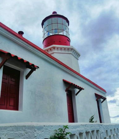

Cabo Corrientes Light, Jalisco, September 2020
Google Maps photo by Hector Macias

Michoacán Lighthouses

Lázaro Cárdenas Lighthouses
Named for a former President of Mexico, Lázaro Cárdenas is a newly expanded seaport in southernmost Michoacán; it has become one of Mexico's largest ports, handling cargos bound to and from the U.S. as well as Mexico.
Lázaro Cárdenas East Channel (2)
2018. Active; focal plane 35 m (115 ft); continuous light, white, red or green depending on direction. 15 m (49 ft) square pyramidal white skeletal tower. No photo available but Google has a satellite view. This light replaced a pair of range lights guiding vessels into the east branch of the harbor. Located at the head of the eastern basin of the harbor. Site status unknown. CF-16-115.14(?); Admiralty G3470.67.
Lázaro Cárdenas Commercial Channel (2)
2018. Active; focal plane about 30 m (98 ft); continuous light, white, red or green depending on direction. Approx. 25 m (82 ft) square pyramidal white skeletal tower. No photo available but Google has a satellite view. This light is at the location of the former rear range light. Located northeast of the commercial branch of the harbor. Site status unknown. CF-16-115.13(?); Admiralty G3470.53.
Lázaro Cárdenas North Channel Range Rear
Date unknown. Active; focal plane 21 m (69 ft); white flash every 3 s; also a continuous light, white, red or green depending on direction. 18 m (59 ft) square pyramidal white skeletal tower. No photo available but Google has a satellite view and a very distant street view. Located at the northern edge of the harbor area. Site status unknown. CF-16-116; Admiralty G3470.691.
Lázaro Cárdenas Entrance Range Front
Date unknown. Inactive since 2018. 13 m (43 ft) square pyramidal skeletal tower, painted with red and white horizontal bands and carrying a diamond shaped daymark. In 2018 this light was replaced by a 24 m (79 ft) blue steel mast (focal plane 30 m (98 ft); continuous light, white, red or green depending on direction). Jose Manuel Nuñez Navarro has a 2018 photo of the skeletal tower and Google has a satellite view. Julio Ivan's 2020 sunset photo shows both the mast and the older tower. Located on the west side of the Río Balsas, the harbor of Lázaro Cárdenas, beside an on-ramp to the harbor bridge. Site and tower closed (the harbor area is a bonded warehouse district closed to the public). ex-Admiralty G3470.4; NGA 15160.5. Active light: CF-16-045; Admiralty G3470.38.
Lázaro Cárdenas Entrance Range Rear
Date unknown. Inactive since 2018. 18 m (59 ft) square pyramidal skeletal tower, painted with red and white horizontal bands. Karin Alejandro Roman Bautista has a 2019 street view and Google has a satellite view. Located on the west side of the road approaching the harbor bridge, 310 m (0.2 mi) northwest of the former front light. Site and tower closed. ex-CF-16-045.1; ex-Admiralty G3470.41; NGA 15161.
Lázaro Cárdenas
Date unknown. Active; focal plane 40 m (131 ft); white flash every 7 s. 36 m (118 ft) round cylindrical concrete tower with lantern and gallery, painted with black and white horizontal bands. A photo by Yaritza Salgutz is at right and Google has an excellent satellite view. Located in an industrial area on the west side of the harbor entrance. Site and tower closed. ARLHS MEX-142; CF-16-020; Admiralty G3469; NGA 15160.
Lázaro Cárdenas Light
Lázaro Cárdenas Light, Lázaro Cárdenas, August 2009
ex-Panoramio photo copyright Yaritza Salgutz; used by permission

Western Michoacán Lighthouses
Caleta de Campos (Bufadero Bluff)
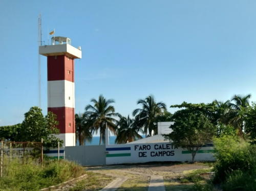
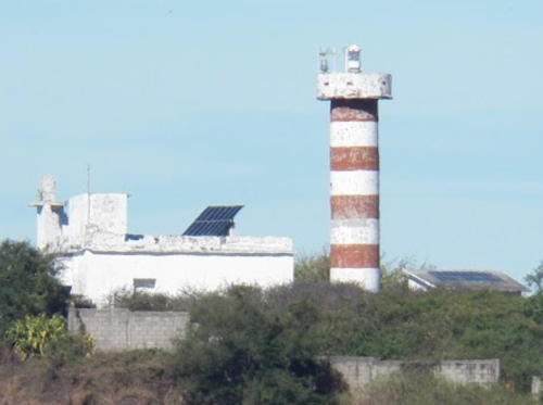
Date unknown. Active; focal plane 42 m (138 ft); four white flashes every 20 s. 16 m (52 ft) square cylindrical tower with lantern and gallery, painted with red and white horizontal bands. 1-story keeper's house and other buildings. A 2018 photo is at right, David Haggard has a closeup, a distant view is available, and Google has a satellite view. The lighthouse is accessible from the coastal road (hwy 200) in Caleta de Campos, about 50 km (30 mi) west of Playa Azul. Site status uncertain, but the lighthouse can be seen from nearby. ARLHS MEX-140; CF-16-470; Admiralty G3471; NGA 15156.
Punta San Telmo (Faro de Bucerias)
Date unknown. Active; focal plane 70 m (230 ft); two white flashes every 10 s. 12 m (39 ft) square cylindrical concrete tower with keeper's house. Lighthouse painted with red and white horizontal bands. Trabas has Hendrik Martin Porath's photo, Henri Willox has a photo, Gabriel Juarez has a 2023 photo, Osvaldo Milanes has a street view, and Google has a satellite view. The beach east of the lighthouse is a well known turtle sanctuary. Located on a high bluff in western Michoacán, about 1.5 km (1 mi) off the coast road (hwy 200). Accessible from the beach via a long stairway. Site and tower open. ARLHS MEX-062; CF-16-010; Admiralty G3472; NGA 15152.
Punta Cabeza Negra (San Juan de Alima)
Date unknown. Active; focal plane 80 m (262 ft); white flash every 6 s. 8 m (26 ft) square pyramidal white skeletal tower. Trabas has Capt. Peter's distant view and Google has an indistinct satellite view. Located atop a mountainous headland at the western border of Michoacán about 40 km (25 mi) southeast of Tecomán. Site status unknown. CF-16-005; Admiralty G3473; NGA 15146.

Caleta de Campos Light, Caleta de Campos, June 2018
Google Maps photo by Cámara Rápida Con Dany

Colima Lighthouses

Manzanillo Lighthouses
Manzanillo, a city of about 200,000 residents, has one of the busiest ports of Mexico's west coast. The closest port to Mexico City, it's also an important fishing port and a resort city.

Laguna de Cuyutlan Outbound
Date unknown. Active; focal plane 30 m (98 ft); flash every 3 s, white or red depending on direction. Approx. 20 m (66 ft) square skeletal tower. Google has a satellite view showing the tower east of a railway; a 2012 photo shows the former front range light on the west side of the railway. Google has a street view showing both lights. This is probably a directional light; the former rear light has disappeared. Located on the east edge of the Laguna de Cuyutlan. Site status unknown. CF-06-410 (former front range light); Admiralty G3480.5001.
Laguna de Cuyutlan Range Front (?)
Date unknown. Inactive. 17 m (56 ft) square skeletal tower carrying a large slatted daymark. No photo available but Google has a satellite view. It's possible this tower has been removed. Located on the east side of the dredged entrance to the Laguna de Cuyutlan, a liquified natural gas terminal south of Manzanillo. Site and tower closed.
Laguna de Cuyutlan Leading Light (ex-Range Rear)
Date unknown. Active; focal plane 34 m (112 ft); continuous light, white, red or green depending on direction. 18 m (59 ft) square skeletal tower carrying a large slatted daymark. Trabas has Capt. Peter's distant view of the two range lights from the sea and Google has a satellite view. Located about 150 m (490 ft) northeast of the front light. Site and tower closed. CF-06-405 (former range rear light); Admiralty G3480.495.
* Punta Campos (Manzanillo)
1906. Active; focal plane 109 m (358 ft); white flash every 5 s. 11 m (36 ft) octagonal cylindrical tower with lantern and gallery, attached to a 2-story keeper's house. Entire building painted white. Anibal Galindo's photo is at right, Trabas has Capt. Peter's photo, Marco Antonio Cacho Emult has a photo, a 2021 closeup and a 2023 photo are available, the tower is at the far right of another photo, and Google has a street view and a satellite view. Located atop the point south southeast of Manzanillo, marking the eastern entrance to the Bahía de Manzanillo. Accessible by road, although the access road is narrow and winding. Site and tower closed but the lighthouse can be seen from outside the fence. ARLHS MEX-052; CF-06-030; Admiralty G3476; NGA 15140.
Pemex Range Front
Date unknown. Active; focal plane 45 m (148 ft); white flash every 3 s. 45 m (148 ft) square skeletal tower painted with red and white horizontal bands. Anibal Galindo has a photo, Fernando Chavira has a photo, and Google has a satellite view. Located near the base of the breakwater sheltering the Pemex oil terminal on the south side of Manzanillo. Site and tower closed. CF-06-040.1; Admiralty G3478.5.
Pemex Range Rear
Date unknown. Active; focal plane 50 m (164 ft); white light, 1 s on, 1 s off. 45 m (148 ft) square skeletal tower painted with red and white horizontal bands. Angel Cruz has a view showing both range lights, the tower is partially visible at the left edge of Fernando Chavira's photo, and Google has a satellite view. Located on a pier about 150 m (500 ft) west southwest of the front light. Site and tower closed. CF-06-040.2; Admiralty G3478.51.
* San Pedrito Range Front
Date unknown. Active; focal plane about 30 m (98 ft); white flash every 3 s. Approx. 28 m (92 ft) square skeletal tower, painted white. The top of the tower carries a rectangular daymark colored red with a yellow vertical stripe. Trabas has Capt. Peter's photo and Google has a street view and a satellite view. This is the entrance range for Manzanillo's commercial harbor. NGA lists the focal plane as 14 m (46 ft), but it's clear from the photo that the tower was doubled in height by the addition of a pyramidal upper section. Located beside the Boulevard Miguel de la Madrid. Site open, tower closed. CF-06-055; Admiralty G3480.4; NGA 15132.
* San Pedrito Range Rear
Date unknown. Active; focal plane about 44 m (144 ft); white flash every 3 s. Approx. 28 m (92 ft) square skeletal tower, painted white, mounted on a square concrete equipment room. The top of the tower carries a rectangular daymark colored red with a yellow vertical stripe. Trabas has Capt. Peter's photo and Google has a street view and an indistinct satellite view. NGA lists the focal plane as 23 m (75 ft), but it's clear from the photo that the tower was doubled in height by the addition of a pyramidal upper section. Located on a bluff above the Calle Acambaro, 350 m (1/4 mi) east northeast of the front light. Site open, tower closed. CF-06-060; Admiralty G3480.41; NGA 15136.
Faro de Punta Campos
Punta Campos Light, Manzanillo, July 2009
ex-Panoramio photo copyright Anibal Galindo
used by permission
Morro Carrizal
Date unknown. Active; focal plane 27 m (89 ft); two white flashes every 10 s. 7.5 m (25 ft) square white skeletal tower mounted on a concrete base. Trabas has Capt. Peter's photo and Google has an indistinct satellite view. Located on a huge rock just off the headland on the west side of the bay of Manzanillo. Accessible only by boat. Site status unknown. CF-06-010; Admiralty G3480.57; NGA 15093.

Jalisco Lighthouses

Lago de Chapala Lighthouses
The Lago de Chapala, Mexico's largest freshwater lake, is located on the southern border of Jalisco. The lake is 80 km (50 mi) long and as much as 18 km (11 mi) wide; its normal surface elevation is listed as 1524 m (5000 ft).

*
Muelle de Chapala (2)
1950s (station established 1907). Active; green light, 1 s on, 1 s off. 6 m (20 ft) concrete post projecting through the end of a pier; at pier level the tower is surrounded by a round pavilion supported by six posts. Steven Miller has a good 2007 photo, a 2008 photo is available, and Google has a street view and a satellite view. This is Mexico's best known inland lighthouse. The lighthouse was restored in 2007. Located at the end of a long pier projecting into the lake at Chapala, a town on the north side of the lake about 40 km (25 mi) south of Guadalajara. Site open; the lighthouse is accessible by walking the pier. CF-14-100; ARLHS MEX-188.
*Roca Azul
Date unknown. Active; two white flashes every 10 s. 10 m (33 ft) round brick tower with gallery; the light is atop a sombrero-style roof over an open lantern. A photo is at right, the yacht club has a good photo and a closeup photo, César Cornejo has a 2022 photo, and Google has a satellite view. Located in a yacht club at the west end of the lake about 2.5 km (1.5 mi) south of Jocotepec. Site open; the tower is closed in the photos but may be open sometimes. Owner/site manager: Club de Yates de Chapala. CF-14-105.1.
*San Cristóbal
Date unknown. Active (unofficial); white light, characteristic unknown. Approx. 9 m (30 ft) round tower with lantern and gallery, painted yellow; lantern dome painted gray. No photo available but Google has a satellite view. Located on the south shore of the lake about 7 km (4 mi) east of San Pedro Tesistán. Site open, tower closed. CF-14-170.

Roca Azul Light, Jocotepec, July 2009
ex-Panoramio Creative Commons photo by Aislander

Pacific Coast Lighthouses
Punta Graham
Date unknown. Active; focal plane 200 m (656 ft); three white flashes every 12 s. 11 m (36 ft) square skeletal tower centered on a square 1-story concrete equipment building. Trabas has Capt. Peter's photo and Google has an indistinct satellite view. Located on a precipitous headland about 4 km (2.5 mi) south of Barra de Navidad, at the extreme southern tip of Jalisco state. Site status unknown. CF-06-005; Admiralty G3481; NGA 15092.
Punta Farallón
Date unknown. Active; focal plane 62 m (203 ft); two white flashes every 10 s. 22 m (72 ft) square cylindrical white concrete tower with lantern, gallery, and four ribs. Entire lighthouse is white, except the lantern roof is painted red. Two 1-story keeper's houses. Trabas has Capt. Peter's photo (also seen at right), a 2019 closeup and an aerial photo (a little over halfway down the page) are available, and Google has a satellite view. Near the lighthouse, at the point of the cape, is a remarkable structure, the Copa del Sol (Cup of the Sun), built by landowner and developer Gian Franco Brignone. Punta Farallón is in southern Jalisco about 135 km (85 mi) southeast of Cabo Corrientes. Site status unknown. ARLHS MEX-124; CF-14-090; Admiralty G3481.4; NGA 15088.
Punta Ipala
Date unknown. Active; focal plane 96 m (315 ft); four white flashes every 16 s. 11 m (36 ft) square white skeletal tower. A 2019 photo is available, Alfredo E. Lara has a distant view from the sea, and Bing has an indistinct satellite view. Located on a steep headland about 25 km (15 mi) southeast of Cabo Corrientes. Site status unknown. CF-14-070; Admiralty G3481.8; NGA 15084.
Cabo Corrientes
1903. Active; focal plane 93 m (305 ft); white flash every 6 s. Approx. 18 m (60 ft) octagonal cylindrical masonry tower with lantern and gallery, rising from 1-story keeper's house. Buildings painted white; lantern painted red. A photo by Hector Macias is at the top of this page, Mario Alberto Morales Catalán has a closeup photo, Alfredo E. Lara has a photo, a 2008 view and a 2019 drone view are available, and Google has a satellite view. Matt Faust visited the lighthouse in 2012 and reported the building to be in need of restoration. He found no keeper, although the station is normally staffed. The lighthouse was restored and repainted in 2019-20. The cape, about 65 km (40 mi) west of Puerto Vallarta, is one of the most important headlands of Mexico's Pacific coast; here the coast turns northward to face the mouth of the Sea of Cortés (Gulf of California). Accessible by a popular hike from Corrales. Site open, tower closed. ARLHS MEX-022; CF-14-065; Admiralty G3482; NGA 15080.
 

Punta Farallón Light, Jalisco
photo copyright Capt. Peter Mosselberger; used by permission
 

Puerto Vallarta Lighthouses
Puerto Vallerta is a beach resort city with a metropolitan population of nearly 500,000. The marina lighthouse in Puerto Vallarta is well known and often photographed, but it is not an official aid to navigation.

*
Puerto Vallarta Anterior (Range Front) (1)
1932. Inactive since 1970. 10 m (33 ft) square pyramidal tower with gallery painted with black and white horizontal bands. Aaron Anderer's closeup photo is at right, Javier Doren has a 2008 photo, another photo is available, and Google has a 2022 street view and a satellite view. The tower was repainted in 2010 with red and white bands; an October 2010 photo shows this pattern. By 2015 the bands were again black and white. The lights were deactivated when the harbor was rebuilt and the approach range shifted to the north. Located at the south end of the Malecón of downtown Puerto Vallarta, at the foot of Gaieana street, about 4 km (2.5 mi) south of the cruise ship harbor. (The lighthouse is known locally as the Faro del Malecón.) Site open; tower closed, but visitors can climb to the gallery by an external ladder. ARLHS MEX-186.
* Puerto Vallarta Posterior (Range Rear) (1)
1932. Inactive since 1970. 12 m (39 ft) square pyramidal tower with gallery, painted with black and white horizontal bands. Lantern removed. John Lawrence has a 2022 photo, a 2008 photo is available, and Google has a street view and a satellite view. Located on Calle Matamoros just north of Calle Mina, four blocks southeast of the front light. Site open; tower closed, but visitors can climb to the gallery by an external spiral stairway. ARLHS MEX-187.
Puerto Vallarta South Breakwater
Date unknown. Active; focal plane 11 m (36 ft); red flash every 5 s. 8 m (26 ft) square red skeletal tower. Trabas has Cameron's photo and Google has a satellite view. Despite its name the light is not on a breakwater pier; it is at the east point of the entrance to Puerto Vallarta's harbor. Site and tower closed. CF-14-015; Admiralty G3485.2; NGA 15076.
* [Puerto Vallarta (Aramara) (Directional Light)]
2014. Active; focal plane 35 m (115 ft); white, red or green light depending on direction, 2 s on, 2 s off. 32 m (105 ft) steel mast painted with red and white horizontal bands. Trabas has Jim Smith's photo and Google has a street view and a satellite view. Located beside the coastal highway at the cruise ship terminal of Puerto Vallarta. Site open, tower closed. Admiralty G3484; NGA 15064.
Puerto Vallarta North Breakwater
Date unknown. Active; focal plane 11 m (36 ft); green flash every 5 s. 8 m (26 ft) square green skeletal tower. Trabas has Cameron's photo and Google has a satellite view. Located on a short breakwater mole at the west point of the entrance to Puerto Vallarta's harbor. Site and tower closed. CF-14-010; Admiralty G3485; NGA 15072.
Puerto Vallarta Posterior
Puerto Vallarta Range Front Light, December 2009
Flickr Creative Commons photo by Aaron Anderer

Nayarit Lighthouses

Southern Nayarit Lighthouses
Isla Marieta
Date unknown. Active; focal plane 23 m (75 ft); two white flashes every 10 s. 11 m (36 ft) square pyramidal skeletal tower, painted red; two sides of the tower carry a slatted daymark. Google has a sea view and the shadow of the tower is seen in Google's satellite view. Located at the north end of Isla Marieta la Larga, the larger of two small islands about 40 km (25 mi) west of Puerto Vallarta. The islands were closed to the public in 2016 to conserve their wildlife; guided boat tours are available from Puerto Vallarta. Site and tower closed. Site manager: Islas Marietas National Park. CF-18-145.1; Admiralty G3491; NGA 15060.
* Punta Mita (2)
Date unknown. Active; focal plane 21 m (69 ft); three white flashes every 12 s. 16 m (52 ft) triangular cylindrical concrete tower. No photo available but Google has a satellite view. This light replaced a shorter skeletal tower. Punta Mita is a sharp cape at the northern entrance to the Bahía de Banderas; it is now the location of an upscale resort. Located in a traffic roundabout on the cape. Site open, tower closed. CF-18-100; Admiralty G3492; NGA 15056.
Chacala
Date unknown. Active; focal plane 30 m (98 ft); three white flashes every 12 s. 11 m (36 ft) square pyramidal aluminun tower painted in a red and white checkered pattern. No photo available but Google has a satellite view. Located on a headland sheltering the bay of Chacala, about 40 km (25 mi) south of San Blas. Site status unknown. CF-18-095; Admiralty G3493; NGA 15048.

San Blas Lighthouses
The only significant port of Nayarit, San Blas is a historic fishing port with a population of about 35,000.
* San Blas Range Front
Date unknown. Active; focal plane 14 m (46 ft); white flash every 3 s. 12 m (39 ft) square pyramidal skeletal tower, painted with red and white horizontal bands. Google has a street view and a satellite view. Located at the foot of El Rey street on the waterfront in downtown San Blas. Site open, tower closed. CF-18-030; Admiralty G3494.4; NGA 15014.
* San Blas Range Rear
Date unknown. Active; focal plane 19 m (62 ft); white light, 1 s on, 1 s off. 16 m (52 ft) square pyramidal skeletal tower, painted with red and white horizontal bands. Google has a street view and a satellite view. Located on a street corner next to the port office, one block from the waterfront in downtown San Blas. Site open, tower closed. CF-18-030.1; Admiralty G3494.41; NGA 15015.
* San Blas (Isla del Rey)
Date unknown. Active; focal plane 44 m (144 ft); two white flashes every 10 s. 14 m (46 ft) round cylindrical concrete tower with gallery but no lantern, painted with red and white bands. The adjacent concrete keeper's house is in ruins. Daniel Rivera's photo is at right, Emily Hoyer has a 2008 photo, another 2008 photo is available, Omar Silis has a 2018 closeup, Trabas has a photo by Hendrik Martin Porath, and Google has a satellite view. The lighthouse is located on a peninsula (not actually an island) on the west side of the harbor entrance; boat rides are available from the town waterfront. Site open, tower closed. ARLHS MEX-095; CF-18-015; Admiralty G3494; NGA 15012.

San Blas Light, San Blas, December 2012
Google Maps photo by Daniel Rivera

Islas Marías Lighthouses
The Islas Marías are an archipelago of four islands spread northwest to southeast roughly 100 km (60 mi) east of San Blas. The islands are protected as a Unesco Biosphere Reserve. The only settlement is Puerto Balleto on Isla María Madre, the largest of the islands. It was for many years the site of a federal prison, but the prison was ordered closed in February 2019.

Isla María Madre (Puerto Balleto)
Date unknown. Active; focal plane 62 m (200 ft); two white flashes every 10 s. 7 m (23 ft) round cylindrical concrete tower with lantern and gallery attached to a large 1-story keeper's house. Tower painted white; gallery painted with red and white vertical stripes. Roberto Uriarte has the 2023 photo at right; it shows the new lantern installed since 2021. Jorge Flores Camargo has a 2021 photo, Miriam Del Toro also has a 2021 photo, and Google has a satellite view. Located on a ridge above Puerto Balleto, the only port on the island. Site status unknown. CF-18-125; Admiralty G3498; NGA 15028.
Espolón del Diablo ("Devil's Spur")
Date unknown. Active; focal plane unknown; three white flashes every 12 s. 9 m (30 ft) square skeletal tower. No photo available but Google has a satellite view. Located on a rocky pinnacle at the western tip of Isla María Madre. Site status unknown. CF-18-140; Admiralty G3499.6; NGA 15032.

Isla Isabela Lighthouse
Isla Isabela
Date unknown. Active; focal plane 55 m (180 ft); four white flashes every 16 s. 11 m (36 ft) square pyramidal skeletal tower covered with a daymark showing a red and white checkered pattern, mounted on a square concrete base. David Pérez has a 2020 street view and Google has a distant satellite view. Isla Isabela is an isolated volcanic island about 30 km (19 mi) offshore and 80 km (50 mi) northwest of San Blas. The island is a national park protected for its bird nesting areas. Located above the landing area at the south end of the island. Site status unknown. CF-18-085; Admiralty G3502; NGA 15008.

Puerto Balleto Light, Isla María Madre, February 2023
Google Maps photo by Roberto Uriarte

Information available on lost lighthouses:

Notable faux lighthouses:

Adjoining pages: South: South Coast | North: Northwest Coast

Return to the Lighthouse Directory index | Ratings key

Posted 2003. Checked and revised November 7, 2023. Lighthouses: 38. Site copyright 2023 Russ Rowlett and the University of North Carolina at Chapel Hill.