Lighthouses of Norway: Akershus

The Kingdom of Norway (Norge in Norwegian) is one of the world's most maritime nations. The country is long and narrow with drowned valleys called fjords that bring the sea far inland in most regions. The mainland coast is estimated to be 2650 km (1650 mi) long and when all the islands and minor indentations are counted the total coastline approaches an astonishing 60,000 km (37,500 mi), long enough the go around the world one and a half times. With such a lengthy and rocky shore it's not surprising that Norway has a large number of lighthouses.

Norway is divided into 15 counties (fylker) and the counties are divided into townships (kommuner). This page lists lighthouses of Akershus County. Akershus is in the southeastern corner of the country, on the upper Oslofjord, surrounding the City of Oslo, the national capital. It included Oslo until the city became a separate county in 1842.

Although it has always been considered a separate realm, Norway has only been independent since 1905; it was ruled by the Danish king until 1814 and then by the Swedish king until the Norwegian parliament arranged a peaceful separation of the two kingdoms.

In Norwegian a lighthouse is a fyrtårn (fire tower) or simply a fyr; a fyrlykt is a beacon and a lyktehus is a lantern. Øy is an island, holmen is an islet, skjær is a skerry (a tiny island or rocky reef), sund is a strait (often between an island and the mainland), bukt is a bay, nes is a headland, and havn is a harbor.

Aids to navigation in Norway are maintained by the Kystverket (Coast Directorate), an agency of the Ministry of Transport and Communications.

ARLHS numbers are from the ARLHS World List of Lights. NF numbers are from the Norsk Fyrliste, the official Norwegian light list. Admiralty numbers are from volume B of the Admiralty List of Lights & Fog Signals. U.S. NGA List numbers are from Publication 115.

General Sources
Online List of Lights - Norway - Skaggerak
Photos by various photographers posted by Alexander Trabas. Several of these photos were taken by Rainer Arndt or Erich Hartmann.
Norwegian Lighthouse Association
News and photos from the Association.
Leuchttuerme.net - Oslo Fjord
Photos posted by Malte Werning.
Lighthouse Pages from Anke and Jens - Norway
Good photos and and brief accounts for some of the Oslofjord lighthouses, in English.
World Lighthouses - Norway
Photos taken in 2008 by James Christie.
Norway Lighthouses
Photos by Larry Myhre, also in 2008.
Leuchttürme in Norwegen
Photos by Andreas Köhler.
Lighthouses in Norway
Photos by various photographers available from Wikimedia.
World of Lighthouses - Norway
Photos by various photographers available from Lightphotos.net.
Norwegische Leuchttürme
Photos by Klaus Huelse.
Norsk Fyrliste
Current edition of the Norwegian light list.
Norwegische Leuchttürme auf historischen Postkarten
Historic postcard images, also posted by Klaus Huelse.
Liste over Norske Fyr
From Norwegian Wikipedia, a handy list of Norwegian light stations with their dates of establishment.
GPSNauticalCharts
Navigational chart for the Oslofjord.
Google Maps
Satellite view of the upper Oslofjord.


Old and new Filtvet Lights, Asker, April 2024
Google Maps photo by Serhii Mykhalkov
East Side Oslofjord Lighthouses

Vestby Lighthouse
Sauholmene
Date unknown. Active; focal plane 13 m (43 ft); red, white or green light depending on direction, 3 s on, 3 s off. 4 m (13 ft) lantern, painted white with a red roof. This light guides vessels into the Sonsbukta, a strait behind a series of islands off the community of Son. Located near the south end of Sauholmen. No photo available but Google has a satellite view. Site status unknown. NF-018600; Admiralty B2352; NGA 0368.

Frogn (Drøbak Area) Lighthouses
[Elle]
Date unknown. Active; focal plane 4.5 m (15 ft); two flashes every 8 s, white, red or green depending on direction. 3 m (10 ft) lantern, painted white with a red roof. Trabas has Arndt's 2012 photo and Google has a satellite view. Located on the east side of the Oslofjord near Drøbak, on the south side of Frogn. Site closed (access is through privare property). NF-019000; Admiralty L2358; NGA 0384.
[Elle Fog Bell]
1911. Inactive since 1983. Approx. 6 m (20 ft) square "Swiss-chalet" wood fog bell tower with open bell enclosure and bell. Tower painted white; roof is black. Rune Skogsrud has a 2021 photo, Lisa Havness has a 2019 photo, Anke and Jens have a closeup photo, Huelse also has a photo, and Google has a satellite view. The original bell and striking mechanism are preserved at this historic little tower. Located on the east side of the Oslofjord near Drøbak, on the south side of Frogn. Site closed (access is through privare property). Site manager: Follo Museum.
* Drøbak Tollboden (Customs House)
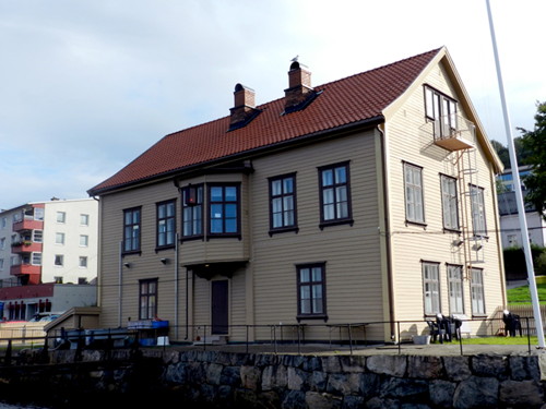
1868. Inactive since 1961. 2-story wood building, painted gray, with a terra cotta tile roof. The light was mounted on a dormer window on the second floor. Boucher's photo is at right and Google has a street view and a satellite view of the building. Since 1962 the building has been owned by the University of Oslo as a conference center. Located at 43 Storgata on the waterfront of Drøbak's traditional harbor. Site open, building generally closed to the public. Owner/site manager: University of Oslo (Marine Research Station Drøbak).
Drøbak Tollboden
Drøbak Tollboden, September 2011
contributed photo copyright Michael Boucher; used by permission
* [Drøbak Molo (2)]
Date unknown. Possibly active (privately maintained?); focal plane 5 m (17 ft); white light, 1 s on, 1s off. 3 m (10 ft) round white fiberglass lantern on a concrete base. Trabas has posted Arndt's photo, Benjamin King has a street view, and Google has a satellite view. This light replaced an octagonal metal lantern; Anke and Jens have a 2006 photo, Huelse has a photo, Werning has a wider view, Oliver Tomic has a good photo, and Elin Enger has a closeup of the older lantern. This light is missing from the updated Norsk Fyrliste and has been dropped by the Admiralty. In the nineteenth century Drøbak served as a winter harbor for Oslo. Located at the end of the short mole on the north side of the harbor at Frogn, about 700 m (0.45 mi) north of the historic customs house. Readily accessible by walking the mole. Site open, tower closed. ARLHS NOR-068; ex-NF-019100; ex-Admiralty B2359.
Småskjærene (2)
Date unknown (station established 2010). Active; focal plane 9 m (28 ft); continuous red light. 9 m (30 ft) hexagonal cylindrical tower mounted on a small platform supported by piles. Lighthouse painted white with two black horizontal bands; lantern roof is red. Trabas has a 2023 photo and Google has a satellite view. Located on the west side of the main channel of the Oslofjord about 800 m (1/2 mi) northwest of the Drøbak mole. Accessible only by boat. Site open, tower closed. NF-019300; Admiralty B2360.3; NGA 0386.5.
Drøbakgrunnen
Date unknown. Active; focal plane 9 m (28 ft); continuous green light. 9 m (30 ft) hexagonal cylindrical tower mounted on a small platform supported by piles. Lighthouse painted white with two black horizontal bands; lantern roof is red. Trabas has a 2023 photo and Köhler's 2019 photo (also seen at right), Per N. Schwabe has a 2020 view, and Google has a satellite view. This light replaced a buoy. Located on the east side of the main channel of the Oslofjord about 800 m (1/2 mi) northwest of the Drøbak mole. Accessible only by boat. Site open, tower closed. NF-019400; Admiralty B2360.32; NGA 0386.6.
Husvikodden
Date unknown. Active; focal plane 9 m (28 ft); quick-flashing light, red, white or green depending on direction. Trabas has a 2023 photo, Köhler also has a photo, and Tore Jan Jakobsen has a 2022 photo, but the light is not shown in Google's satellite view. The white sector guides vessels southbound past the two Kaholmen islands. Located just off the waterfront of Husvikodden. Accessible only by boat. Site open, tower closed. NF-019440; Admiralty B2363.5.
[Nordre Kaholmen]
Date unknown (station established 1897). Active; focal plane 9.5 m (31 ft); white, red or green light depending on direction, occulting once every 6 s. 3 m (10 ft) octagonal lantern mounted on a large rock. Lantern painted white with a red roof. Werning has a closeup photo, Trabas has a closeup 2023 photo, Huelse also has a photo, and Google has a satellite view. Located at the east end of Kaholmen, an island in the Oslofjord about 1 km (0.6 mi) northwest of Drøbak. Accessible only by boat. Site open, tower closed. NF-019500; Admiralty B2364; NGA 0396.

Drøbakgrunnen Light, Oslofjord, June 2019
photo copyright Andreas Köhler; used by permission
Hallangstangen
2017. Active; focal plane 9 m (30 ft); white, red or green light, depending on direction, 1 s on, 1 s off. 6 m (20 ft) octagonal fiberglass tower. Lighthouse colored white with two narrow black horizontal bands; lantern roof painted red. Trabas has a 2023 photo and Google has an indistinct satellite view. Located near the end of the Langebåt peninsula. Accessible only by boat. Site open, tower closed. NF-019520; Admiralty B2367.5.
Langebåt (2?)
Date unknown. Active; focal plane 12 m (39 ft); white, red or green light, depending on direction, occulting twice every 8 s. 12 m (39 ft) octagonal fiberglass tower. Lighthouse colored white with two narrow black horizontal bands; lantern roof painted red. Trabas has a 2023 photo, a 2015 photo of the earlier light is available, Christie has a photo of the earlier light under construction in 2008, and Google has a satellite view. Located off the end of the Langebåt peninsula. Accessible only by boat. Site open, tower closed. NF-019613; Admiralty B2368; NGA 0413.
Tronstadodden (2?)
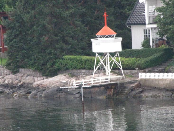
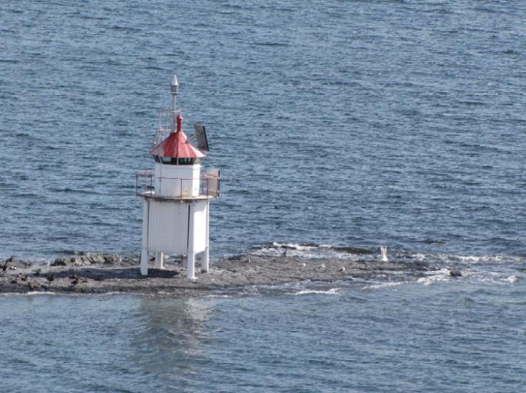
Date unknown. Active; focal plane 14.5 m (48 ft); white, red or green light depending on direction, occulting three times every 10 s. 13 m (43 ft) concrete post with lantern and gallery. Lighthouse painted white, lantern roof red. A 2026 photo is at right, Werning has a great photo, Huelse has a photo, Trabas has Hartmann's 2025 photo, and Google has a satellite view. This light was missing for a time from the Norsk Fyrliste but it has returned with a higher focal plane. Located just off the east coast of Håøy, an island in the Oslofjord about 2 km (1.25 mi) northwest of Drøbak. Accessible only by boat. Site open, tower closed. NF-019660; Admiralty B2370; NGA 0408.
Storegrunnen (2)
Date unknown. Active; focal plane 12 m (39 ft); white, red or green light depending on direction, occulting once every 6 s. 9 m (30 ft) octagonal fiberglass tower centered on a hexagonal stone pier. Lighthouse colored white with two narrow black horizontal bands and a red top. Trabas has a 2023 photo and Google has a satellite view. The original light was in an octagonal cast iron lantern; Huelse has a closeup, Anke and Jens have a 2006 photo, and Werning has a photo. Located on a shoal in the Oslofjord about 4 km (2.5 mi) northwest of Drøbak. Accessible only by boat. Site open, tower closed. NF-019900; Admiralty B2376; NGA 0404.
 

Tronstadodden Light, Oslofjord, May 2026
Google Maps photo by Kieran
 

Nesodden Lighthouses
Nesodden, a suburb of Oslo with about 20,000 residents, occupies a peninsula projecting into the northern end of the Oslofjord. Ships round the tip of the peninsula as they enter Oslo harbor.

#Digerudgrunnen (2)
1975 (station established 1871). Demolished in 2008. 11 m (36 ft) round tower with lantern and gallery, painted white; lantern roof is red. Werning has a good photo, Anke and Jens have a page with a 2006 photo of the former lighthouse and the Norwegian Wikipedia has an article on the history of the station. Google has a satellite view of the former location. The lighthouse was replaced by offshore lights (next two entries). Nina Driever has the 2022 photo at right showing the 1949 keeper's house onshore; the house is now a vacation home for Kystverket employees. Formerly located just offshore on the east side of Oslofjorden near the end of the Digerudgbakken road, about 1.5 km (1 mi) southwest of Fagerstrand. Site open. ARLHS NOR-067; ex-Admiralty B2378; ex-NGA 0416.
Digerud Søndre (2)
Date unknown (station established 2009). Active; focal plane 8 m (26 ft); white, red or green light depending on direction, 2 s on, 2 s off. 8 m (26 ft) octagonal fiberglass tower mounted on a small platform supported by piles. Lighthouse colored white with two narrow black horizontal bands and a red top. Trabas has a 2023 photo, the light is in the distance in Nina Driever's photo at right, and Google has an indistinct satellite view. Located about 150 m (170 yd) southwest of the site of the Digerudgrunnen lighthouse. Accessible only by boat. Site open, tower closed. NF-019990; Admiralty B2378; NGA 0417.
#Digerud Nordre (1)
Date unknown. Replaced. This was a 12 m (39 ft) concrete post with lantern and gallery, mounted on a small platform supported by piles. Lighthouse painted white with two narrow green horizontal bands; lantern roof was red. Google has a satellite view. The lighthouse has been replaced by a light on a mast (focal plane 12 m (39 ft); continuous green light); Trabas has Arndt's 2018 photo. Located about 300 m (330 yd) northwest of the Digerudgrunnen lighthouse. Accessible only by boat. Site open, tower closed. Active light: NF-019925; Admiralty B2378.1.

Digerudgrunnen Light Station, Nesodden, July 2022
Google Maps photo by Nina Driever
Ristodden (2)
Date unknown. Active; focal plane 9.5 m (31 ft); white, red or green light depending on direction, occulting twice every 8 s. 10 m (33 ft) octagonal fiberglass tower mounted on a small platform supported by piles. Lighthouse colored white with two narrow black horizontal bands and a red top. Trabas has Arndt's 2018 photo and Google has an indistinct satellite view. Christie has a photo of the original lighthouse, a 10.5 m (34 ft) concrete post with lantern and gallery. Located on the west side of the channel off the northeastern end of Haøya. Accessible only by boat. Site open, tower closed. NF-020100; Admiralty B2378.2; NGA 0418.
#Aspond (Søndre) (2)
Date unknown. Replaced. This was a 11 m (36 ft) concrete post with lantern and gallery, mounted on a small platform supported by piles. Lighthouse painted white with a narrow green horizontal band, lantern roof red. Huelse has a photo. The lighthouse has been replaced by a light on a mast (focal plane 10 m (33 ft); continuous yellow light); Trabas has Rainer Arndt's 2018 photo and Google has a satellite view. Located off the east side of the island of Aspond. Accessible only by boat. Site open, tower closed. Active light: NF-020167; Admiralty B2378.3; NGA 0419.
* Torodden (Fagerstrand) (3)
2008 (station established 1893). Active; focal plane 6.5 m (21 ft); continuous red light. 4.5 m (14 ft) octagonal lantern painted white with a red roof mounted on a concrete base. Trabas has Klaus Wolfgang's closeup 2016 photo and Google has a satellite view. The original lighthouse, a square skeletal tower, is on display on the waterfront of Trondheim. Located at the end of the breakwater at Fagerstrand. Accessible by walking the pier. Site open, tower closed. NF-020545; Admiralty B2381.
#Langåra (2)
Date unknown. Replaced. This was a 6.5 m (21 ft) concrete post with lantern and gallery, mounted on a triangular concrete platform supported by piles. Huelse has a photo. The lighthouse has been replaced by a light on a mast (focal plane 11 m (36 ft); red light occulting once every 6 s). Trabas has Arndt's 2018 photo and Google has a satellite view. Located off the east side of the island of Langåra (Lågøya), a long, slender island in the Oslofjord off Spro. NGA lists an older light (ex-Admiralty B2384) that was located onshore. Accessible only by boat. Site open, tower closed. Active light: NF-020628; Admiralty B2384.1; NGA 0428.
* [Søndre Langåra Fog Bell]
1896. Inactive since 1967. Approx. 7 m (23 ft) square "Swiss-chalet" wood fog bell tower with open bell enclosure and bell. Tower painted white; roof is green. 1-story wood keeper's house and boathouse. Dave Shaver's 2026 photo is at right, Hylco Bouwstra has a 2015 photo, Myhre has a 2008 photo, Anke and Jens have excellent photos, Wikimedia has M. Prinke's photo, Köhler has a photo, and Google has a satellite view. This is believed to have been the only staffed fog signal station (with no lighthouse) in Norway. Located at the northern end of Langåra. Accessible only by boat. Site manager: unknown. .

Søndre Langåra Fog Bell Station, Nesodden, April 2026
Google Maps photo by Dave Shaver
Langårarabbane
2017. Active; focal plane 14 m (46 ft); white light, 1 s on, 1 s off. 9 m (30 ft) octagonal fiberglass tower mounted on a concrete pile. Lighthouse colored white with two narrow black horizontal bands and a red top. Trabas has a 2023 photo and Google has a distant satellite view. Located about 300 m (0.2 mi) north of the northern tip of Langåra. Accessible only by boat. Site open, tower closed. NF-020820; Admiralty B2386.
* Spro (2)
Date unknown (station established 1896). Active; focal plane 9 m (30 ft); white, red or green light depending on direction, occulting three times every 10 s. 7 m (23 ft) hexagonal fiberglass tower. Lighthouse colored white with two narrow black horizontal bands and a red top. Trabas has a 2023 photo, Köhler has a 2019 photo, Brian Jones has a 2020 photo, and Google has a satellite view. This light replaced a 6 m (20 ft) square skeletal tower with lantern and gallery; Werning has a photo of the former light, Huelse has a closeup, and Google has a satellite view of its location. Located at the shoreline in Spro, near the end of the Nordre Sprovei. Site and tower closed (private property), but the light can be seen from nearby. NF-020800; Admiralty B2388; NGA 0432.
Steilene (4)
1967 (station established 1837). Inactive since 2017. 8 m (27 ft) post with gallery; lantern removed. The adjacent 1-1/2 story keeper's house, built in 1917, was formerly attached to a square concrete light tower. Žvejybinis Almanachas's 2020 photo is at right, Werning has a photo, Anke and Jens also have a page with photos, Huelse has a photo, Trabas has a photo by Helmut Seger, and Google has a satellite view of the station. The house is now available for overnight stays. The original lighthouse was 90 m (100 yd) north near the later location of the Fyrsteilene light (next entry). Located on the southwest end of one of a group of small islands on the east side of Oslofjorden about 2 km (1.2 mi) northwest of Fjellstrand. Accessible only by boat. Passenger ferry service is available. Site open, tower closed. Site manager: Oslofjordens Friluftsråd (Oslofjord Outdoor Recreation Council). . ARLHS NOR-229; ex-NF-020900; ex-Admiralty B2392; NGA 0440.

Steilene Light, Nesodden, July 2020
Google Maps photo by Žvejybinis Almanachas
#[Fyrsteilene (Steilene Northeast)]
Date unknown. Inactive since 2017 and apparently removed. Octagonal lantern, painted white with a red roof. Werning has a photo, Huelse has a photo and Trabas has Helmut Seger's photo. Google's satellite view appears to show only the foundation pad of the light. Located at the northeast point of the island, only a short distance from the Steilene lighthouse. Site open, tower closed. ARLHS NOR-320; ex-NF-021000; ex-Admiralty B2394; NGA 0444.
Østre Måsane
2016. Active; focal plane 17 m (56 ft); white light, 1 s on, 1 s off. 9 m (30 ft) hexagonal fiberglass tower mounted on a concrete pile. Lighthouse colored white with two narrow black horizontal bands and a red top. Trabas has Arndt's 2018 photo and Google has a satellite view. Located on the east side of the main Oslofjord channel southeast of Bronnøy. Accessible only by boat. Site open, tower closed. NF-021100; Admiralty B2395.2.
Vestre Måsane
2016. Active; focal plane 17 m (56 ft); flash every 2 s, white, red or green depending on direction. 9 m (30 ft) hexagonal fiberglass tower mounted on a concrete pile. Lighthouse colored white with two narrow black horizontal bands and a red top. Trabas has Arndt's 2018 photo and Google has a satellite view. Located on the west side of the main Oslofjord channel southeast of Bronnøy. Accessible only by boat. Site open, tower closed. NF-021150; Admiralty B2395.1.
Ildjernsflu (2)
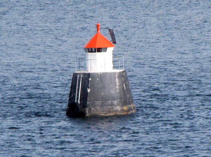
2016 (light station established 1968, lightship station established 1914). Active; focal plane 16 m (52 ft); white, red or green light depending on direction occulting three times every 10 s. 9 m (30 ft) hexagonal fiberglass tower mounted on a concrete pile. Lighthouse colored white with two narrow black horizontal bands and a red top. P. Wong's 2022 photo is at right, Trabas has Hartmann's 2025 photo, Köhler has a September 2019 photo, and Google has a satellite view. This light replaced an octagonal cylindrical concrete tower with lantern and gallery; Huelse has a photo of the former light and a closeup photo is available (near the bottom of the page). The original lightship sank after being rammed by the steamship Storesand I in February 1929; the wreck is well-preserved and is a popular destination for divers. Located on the east side of the Oslofjord about 1 km (0.6 mi) offshore west of Nesodden. Accessible only by boat. Site open, tower closed. ARLHS NOR-129; NF-021300; Admiralty B2402; NGA 0468.

Ferry and Ildjernsflu Light, Nesodden, July 2022
Google Maps photo by P.Wong
* Nesodden
1902 (fog signal station established 1883). Inactive since 2009. 4 m (13 ft) lantern mounted on tripod piles on a concrete base. Lighthouse painted white, piles black. The station was established in 1883 with the historic fog bell tower seen in Anders Omholt's 2023 photo at right, Mattis Laudal has a 2025 closeup of the light, Huelse also has a photo, Dawood Hamidi has a 2016 street view, and Google has a satellite view. The light was replaced by a buoy. The fog bell tower was restored in 2023; a traditional "Swiss chalet" roof and a bell were added. We don't know if the bell is the original. A 2023 closeup of the restored fog bell tower is available and Boucher contributed an older photo of the fog bell tower before the restoration. Located just offshore at the ferry terminal on the northernmost point of land in Nesodden, on the south side of the entrance to Oslo harbor. Site open, tower closed. ex-NF-021800; ex-Admiralty B2404; ex-NGA 0472.
Østre Tangflu (2)
Date unknown (station established 2009). Active; focal plane 19 m (62 ft) (?); white, red or green light depending on direction, occulting once every 6 s. 9 m (30 ft) hexagonal fiberglass tower mounted on a concrete pile. Lighthouse colored white with two narrow black horizontal bands and a red top. Trabas has Hartmann's 2025 photo and Google has a satellite view. This light and the next one guide vessels approaching the south end of Oslo harbor. Located about 1.2 km (3/4 mi) northeast of the former Nesodden light. Accessible only by boat. Site open, tower closed. NF-021900; Admiralty B2404.3; NGA 0473.
* Nordre Langøy (2)
Date unknown. Active; focal plane 9 m (30 ft); white, red or green light depending on direction, occulting twice every 8 s. 8 m (26 ft) hexagonal fiberglass tower. Trabas has Arndt's 2018 photo and Google has a satellite view. The original light was an octagonal cast iron lantern. Located at the north side of the island of Langøy in the inner Oslofjorden. Island accessible by ferry. Site open, tower closed. ARLHS NOR-301; NF-022500; Admiralty B2406; NGA 0476.

Nesodden Fog Bell (left) and Light, Nesodden, August 2023
Google Maps photo by Anders Omholt

Northwest Side Oslofjord Lighthouses

Bærum Area Lighthouses
Gåsøy (Arnesflua) (2)
Date unknown. Active; focal plane 7 m (23 ft); white, red or green light depending on direction, 3 s on, 3 s off. 7 m (23 ft) hexagonal fiberglass tower mounted on a small concrete pier. Lighthouse colored white with two narrow black horizontal bands and a red top. Trabas has Arndt's 2018 photo and Google has a satellite view. The original lighthouse was a lantern mounted on a tripod. Werning has a photo and Huelse also has a photo. Gåsøy is an inhabited island in the northern Oslofjord, accessible by a series of ferries and bridges. Located just off the south coast of Gåsøy. Accessible only by boat. Site open, tower closed. NF-021200; Admiralty B2398; NGA 0456.
Gåsungane North
2016. Active; focal plane 14 m (46 ft); white, red or green light depending on direction, 1 s on, 1 s off. 9 m (30 ft) hexagonal fiberglass tower mounted on a concrete pile. Lighthouse colored white with two narrow black horizontal bands and a red top. Trabas has a 2023 photo and Google has a satellite view. Located about 400 m (1/4 mi) northeast of the Gåsungane shoal east of Bronnøy. Accessible only by boat. Site open, tower closed. NF-021180; Admiralty B2396.5; NGA 0449.
#Gåsungene (1)
Date unknown. Replaced. Lighthouse painted white, lantern roof painted red. This was a 5 m (16 ft) lantern and gallery mounted on a short square tower on piles. The light was replaced in 2016 by a light on a mast (focal plane 7 m (23 ft); green light, 2 s on, 2 s off). Trabas has Arndt's 2018 photo and Google has a fuzzy satellite view. Anke and Jens have a page for the original lighthouse, Werning has a good photo and Huelse has a closeup. Note that there is another Gåsungene Fyr in Fredrikstad. Located on a shoal in the center of the Oslofjord about 5 km (3 mi) southeast of Bærum. Accessible only by boat. Site and tower closed. ARLHS NOR-300. Active light: NF-021177; Admiralty B2396; NGA 0448.

Asker Lighthouses
Nordre Sundbyholmen (2?)
About 2019. Active; focal plane 11.5 m (38 ft); white, red or green light depending on direction, occulting three times every 10 s. 5 m (16 ft) hexagonal cylindrical tower painted white with two black horizontal bands; lantern roof is red. Lighthouse painted white, lantern roof red. Trabas has Jim Smith's 2019 photo. Werning has a photo of the earlier light, a 4 m (13 ft) post with lantern and gallery, and Google has a satellite view. Located on an islet in the Oslofjord about 800 m (1/2 mi) east of Båtstø. Accessible only by boat. Site open, tower closed. NF-020200; Admiralty B2379; NGA 0420.

Nordre Sundbyholmen Light, Oslofjord, 2019
photo copyright Jim Smith; used by permission
** Filtvet (1)
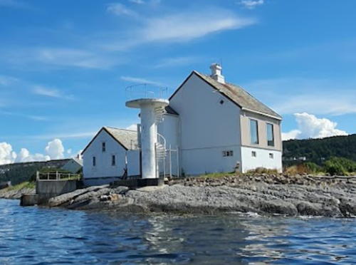
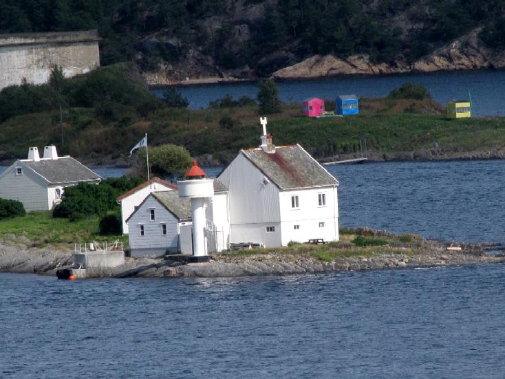
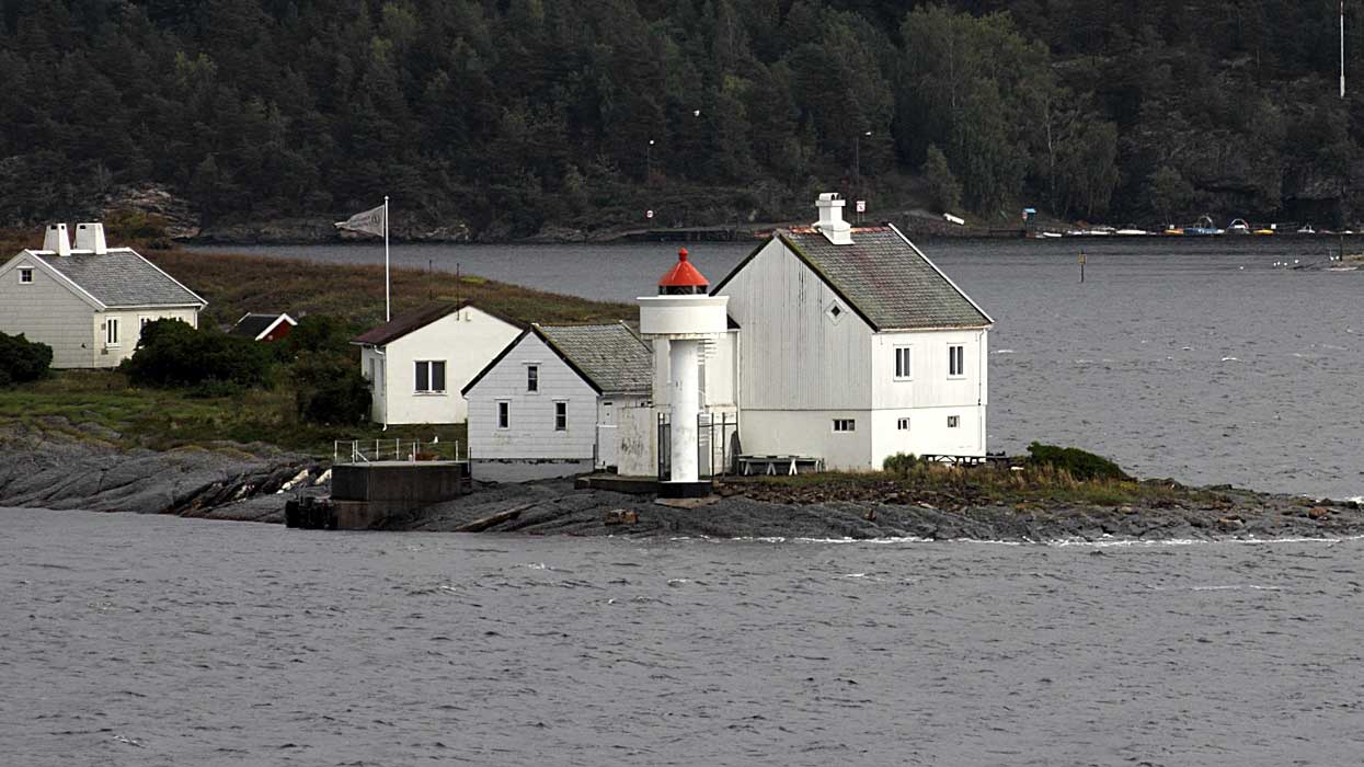
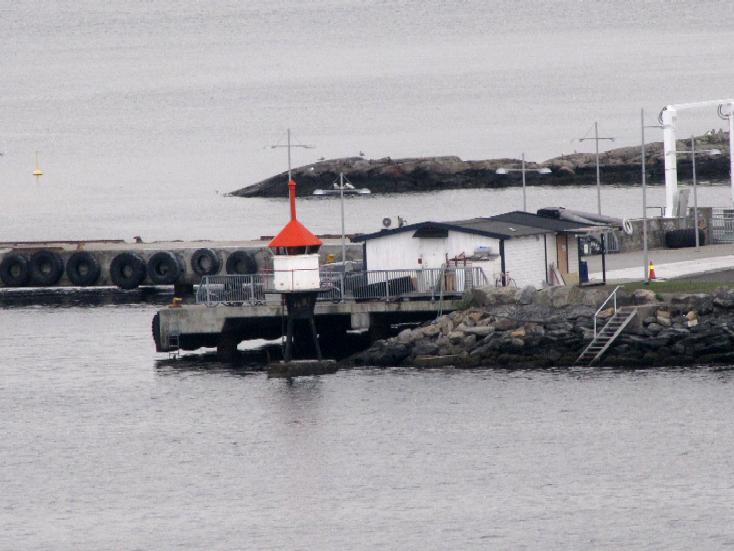
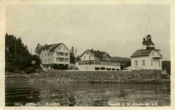
1840. Inactive since 1985 (a decorative light is sometimes displayed). Approx. 11 m (36 ft) lantern mounted on the roof of a 1-1/2 story wood keeper's house. House painted white, lantern red. The active light is in front of the house on a 14 m (46 ft) cylindrical fiberglass tower with gallery. Originally the light was shown from a lantern under the front gable, and a fog bell tower was mounted on the roof. The present lantern structure was added in 1916. Fresnel lens and blinking mechanism preserved in the lantern. Serhii Mykhalkov's 2024 photo is at the top of this page, Werning has a good photo, Anke and Jens have photos, Camilla Luihn has a 2008 photo, Wikimedia has several photos, Björn Staack has a street view, Huelse has a historic postcard view, and Google has a satellite view. The light station was purchased in 1999 by the local government, which maintains it in excellent condition. The building houses a small museum and art gallery and is available for meetings and private parties. Concerts and other special events are scheduled during the summer season. A support group, Filtvet Fyrs Venner, works to support the station. The building was restored and repainted in 2015. Located off the Nordstrandveien on the west side of Oslofjorden near Tofte, about 12 km (7.5 mi) southeast of Hurum. Parking is limited and the entrance is unmarked. Site open, tower closed. Owner: Asker Kommune. Site manager: Filtvet Fyrs Venner . ARLHS NOR-079.
* Filtvet (2)
1985 (station established 1840). Active; focal plane 13 m (43 ft); white, red or green light depending on direction, occulting twice every 8 s. 14 m (46 ft) concrete post with lantern and gallery. Lighthouse painted white with one narrow red horizontal band; lantern roof is also red. Trabas has MichaelBoucher's closeup 2011 photo and Thomas Andreas Kolding has a 2007 photo. Located in front of the historic lighthouse. Site open, tower closed. NF-018700; Admiralty B2354; NGA 0372.
Ramvikholmen (Ranvikholmen)
Date unknown. Active; focal plane 6.5 m (21 ft); white, red or green light depending on direction, occulting three times every 10 s. 6 m (20 ft) square pyramidal skeletal tower, covered with white siding, with lantern and gallery. Lighthouse painted white, lantern roof red. Pål Svendsrud has the street view at right, Trabas has a 2023 photo, and Google has a satellite view. Wikimedia has a photo of the island of Ramvikholmen; the lighthouse can be seen at the far left. In 2007 the island became a nature reserve. Located on the north point of a small island about 2.5 km (1.5 mi) southwest of Tofte. Accessible only by boat. Site open, tower closed. NF-025800; Admiralty B2434; NGA 0532.

Ramvikholmen Light, Asker, August 2021
Google Maps photo by Pål Svendsrud
Østnestangen
Date unknown (station established 1899). Active; focal plane 6 m (20 ft); white, red or green light depending on direction, occulting once every 6 s. 4 m (13 ft) octagonal lantern mounted on a concrete pad. Lantern painted white with a red roof. Kjell-Erik Torgersen has a closeup photo, David Peter Brooks has a 2022 photo, Svein Erlandsen has a photo, Trabas has a 2023 photo, and Google has a distant satellite view. Located at the tip of a sharp promontory about 3 km (2 mi) southwest of Tofte. Probably accessible by a hiking trail. Site open, tower closed. NF-025900; Admiralty B2436; NGA 0536.
Rødtangen (1)
1840. Inactive since 1897. 1-1/2 story wood house with a small square lantern room attached to the front of the house, a few feet above the ground. A 2010 photo is at right and Google has a satellite view. Around 2000 area residents built a replica of the historic fog bell tower; Espen Felder has a closeup 2017 photo of the tower. The house is a private residence. Located on a point of land on the east side of the entrance to the Drammensfjord. Site and lighthouse closed but a path leads to the fog bell. Owner/site manager: private. ARLHS NOR-195
* Rødtangen (2)
1897 (station established 1840). Active; focal plane 8 m (26 ft); white, red or green light depending on direction, occulting three times every 10 s. 6 m (20 ft) octagonal lantern mounted on a square stone base. Lantern painted white with a red roof. Trabas has a closeup 2023 photo, a closeup photo, a second photo, and a distant view are available, Ove Borgersen has a 2023 photo, and Google has a satellite view. Located on the east side of the Drammensfjord, about 600 m (3/8 mi) northwest of the historic lighthouse and 3 km (2 mi) south of Holmsbu. Site open, tower closed. . NF-026200; Admiralty B2440; NGA 0540.

Rødtangen Light, Asker, July 2010
Google Maps photo by trolvag
Bjørneskjær (Range Front)
Date unknown. Active; focal plane 6 m (20 ft); white, red or green light depending on direction, 2 s on, 2 s off. 6.5 m (21 ft) lantern mounted on a tripod. Lighthouse painted white with a red vertical stripe. Trabas has a 2023 photo and Google has a satellite view. The directional light (formerly a front range light) guides vessels southbound from Svelvik. The rear light has been replaced by a triangular daymarker on a mast. Located at the northern tip of a small island just off the east coast of the Drammensfjord. Accessible only by boat. Site status unknown (the island appears to be privately owned). NF-026900; Admiralty B2449; NGA 0548

Information available on lost lighthouses:

Notable faux lighthouses:

Adjoining pages: North: Oslo | South: Østfold | West: Vestfold and Buskerud

Return to the Lighthouse Directory index | Ratings key

Posted April 10, 2006. Checked and revised July 14, 2026. Lighthouses: 38. Site copyright 2026 Russ Rowlett and the University of North Carolina at Chapel Hill.