Lighthouses of Northern Panamá

The Reoublic of Panamá is at the southeastern end of the isthmus of Central America, providing the crucial link between the continents of North America and South America. The country is aligned west to east, facing the Caribbean Sea to the north and the Pacific Ocean to the south. This page includes lighthouses of Panamá's northern (Caribbean) coast. There is another page for lighthouses of the Pacific coast.

As one might expect, the lighthouses of Panamá are generally associated with passage through the Panama Canal. The Canal opened on 15 August 1914 after ten years of U.S. construction following earlier work by a French company.

In 1903, shortly after winning its independence from Colombia, Panama granted the U.S. extraterritorial jurisdiction over the Panama Canal Zone. The Zone remained under exclusive U.S. control until the 1978 Panama Canal Treaty provided for its restoration to Panama in 1979. Under the treaty Panama assumed full operation of the Canal at the end of 1999. The U.S. Panama Canal Commission, which operated the canal until the reversion, was replaced by the Autoridad del Canal de Panamá (Panama Canal Authority).

The Authority has expanded the Canal, doubling its capacity by constructing two new flights of locks and widening and deepening the entire route. The original locks were not removed; to maximize capacity both sets of locks are operated. Groundbreaking for the enormous project was held in September 2007 and the expanded canal was opened on 26 June 2016. Fortunately it was not necessary to remove any of the historic lighthouses to construct the new locks and channels.

Several dozen range lighthouses were constructed to help guide ships through the Canal. Most of these lighthouses survive but the Canal Authority has replaced them with skeletal towers. The deactivated lighthouses are painted black, making them somewhat harder to spot. They are not being demolished routinely (so far, anyway), but all of them must be considered endangered. Further information would certainly be very welcome.

The listing here is from the Atlantic toward the Pacific. Since the Isthmus of Panama runs east to west the Atlantic (Caribbean) coast lies north of the Pacific coast. Accordingly, northbound on the Canal means toward the Atlantic, and southbound is toward the Pacific. The actual zigzag course of the Canal has many turns joining straight sections called reaches.

In Spanish the word for a lighthouse is faro, baliza is a beacon, isla is an island, cabo is a cape, punta is a promontory or point of land, péñon is a rock, arrecife is a reef, bahía is a bay, ría is an estuary or inlet, estrecho is a strait, río is a river, and puerto is a port or harbor.

Navigational aids in Panamá are maintained by the Maritime Authority (Autoridad Marítima de Panamá). Apparently this includes the lights of the Canal.

ARLHS numbers are from the ARLHS World List of Lights. Admiralty numbers are from volume J of the Admiralty List of Lights & Fog Signals. U.S. NGA numbers are from Publication 110. The lights of the Panamá Canal itself are listed by the Admiralty but not by NGA.

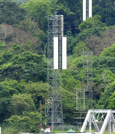
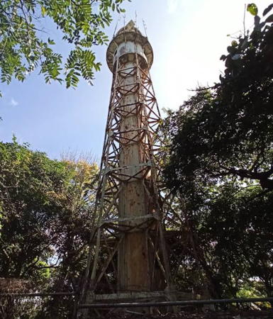
Old (left) and new Gatún Northbound Rear Lights, Gatún, December 2019
photo copyright Kevin Blake; used by permission
General Sources
Online List of Lights - Panama (Caribbean)
Photos posted by Alexander Trabas. Most of the Canal photos are by Capt. Peter Mosselberger ("Capt. Peter"); Michael Boucher contributed additional photos.
Panama Canal Range Lights
This report by Jan Rommers is a careful study of the lighthouses seen on a passage northbound through the Canal on 29 January 2009. Photos are included for all the lighthouses seen.
Panamá Canal Lights - Page 1 and Page 2
Photos contributed by Jim and Hilari Seery following a southbound April 2010 passage through the Canal.
Panama Canal Lighthouses
Flickr album of photos taken by Larry Myhre in May 2012.
World of Lighthouses - Panama
Photos by various photographers available from Lightphotos.net.
Lighthouses in Panama
Photos by various photographers available from Wikimedia.
Leuchttürme Mittelamerikas und der Karabik auf historischen Postkarten
Historic postcard views posted by Klaus Huelse.
Navionics Charts
Navigational chart for Panamá.

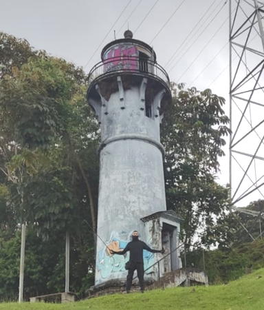
Atlantic Entrance Rear Light, Gatún, Sept. 2014
ex-Panoramio Creative Commons photo
by Omar Gayle

West Caribbean Coast Lighthouses

Bocas del Toro Province Lighthouses
Sixaola
Date unknown. Active; focal plane 14 m (46 ft); white flash every 10 s. 12 m (39 ft) square cylindrical steel skeletal tower, painted white. No photo available but Google has a satellite view. This lighthouse marks Panama's border with Costa Rica, which lies along the Río Sixaola. Although NGA lists the light under Costa Rica it is on the east (Panamanian) side of the river. Site status unknown. Admiralty J6072; NGA 16527.
Hospital Point (2?)
Date unknown. Active; focal plane unknown; two white flashes every 10 s. NGA lists a 7 ft pedestal with a focal plane of 11 m (36 ft). However, a view from the sea by Anarelis Salerno shows a white skeletal tower on the ridge behind the waterfront village. Google has an indistinct satellite view. This light was probably built in connection with a new container terminal at Almirante. Located on the westrn tip of the Isla Solarte helping guide vessels into the Bahía Almirante. Site status unknown. Admiralty J6081; NGA 16528.
Isla Pastores (Punta Maya)
Date unknown. Active; focal plane 18 m (59 ft); one long (1.5 s) white flash every 10 s. 15 m (49 ft) "metal windmill tower," according to NGA. No photo available but the tower is seen in Bing's satellite view of the station. Isla Pastores is an island in Bahía Almirante, a large protected bay. Located at the western end of the island. Site status unknown. Admiralty J6090; NGA 16572.

Panama Canal Lighthouses

Limón Bay (Colón Area) Lighthouses
Named for Columbus, Colón is a city of about 250,000 residents at the Caribbean entrance to the Canal. The city is on the east side of Limón Bay, a natural harbor often crowded with ships waiting to begin their transit of the Canal. A series of breakwaters protects them from storm waves.
Toro Point
1893 (French). Active; focal plane 33 m (108 ft); white light, 5 s on, 25 s off. 27.5 m (90 ft) steel skeletal tower with central cylinder, mounted on a stone base. Entire lighthouse painted white. A photo is at right, Trabas has Rainer Arndt's photo, a 2016 photo is available, Ildefonso Menacho has a 2021 photo, Klaus Huelse has a historic postcard view, and Google has a satellite view. This elegant lighthouse, built by the French during their efforts to construct the Canal, is a familiar landmark for everyone passing through the waterway. The Canal Authority restored the lighthouse in 2019. The lighthouse is in Fort Sherman, a former U.S. Army base. Located at the root of the Limón Bay West Breakwater, on the west side of the entrance to Limón Bay from the Caribbean. Accessible by road but site status unknown. ARLHS PAN-021; Admiralty J6092; NGA 16592.
Limón Bay West Breakwater
Date unknown. Active; focal plane 30.5 m (100 ft); two very quick red flashes every 2 s. 31 m (102 ft) steel mast with gallery, a tripod base and a small metal equipment shelter, mounted on a triangular concrete platform. The tower carries a large slatted daymark, painted red. Trabas has Capt. Peter's photo and Bing has a satellite view. Located just inside the hooked end of the west breakwater at the entrance to Limón Bay and the Canal. Accessible only by boat. Site and tower closed. Admiralty J6092.5 (ex-J6102); NGA 16600.
Limón Bay East Breakwater
Date unknown. Active; focal plane 33 m (108 ft); two short green flashes followed by one very long (5 s) flash every 20 s. 33 m (108 ft) steel mast with gallery, a tripod base and a small metal equipment shelter, mounted on a triangular concrete platform. The tower carries a large slatted daymark, painted green. Trabas has Capt. Peter's photo, a 2010 view from the sea is available, and Google has a satellite view. Located just inside the hooked end of the east breakwater at the entrance to Limón Bay and the Canal. Accessible only by boat. Site and tower closed. Admiralty J6092.6 (ex-J6098); NGA 16604.
Manzanillo Entrance West Head (2)
Date unknown. Active; focal plane 25 m (82 ft); red flash every 5 s. Approx. 21 m (69 ft) round metal tower painted red. Trabas has Capt. Peter's photo and Google has an indistinct satellite view. The Manzanillo Entrance is a break in the Limón Bay Breakwater near its eastern end; it is used by ships bound for the docks of Colón city rather than for the Canal. Arturo Sottolichio has a 2013 photo of the original lighthouse, a skeletal tower. Located on the west side of the entrance. Accessible only by boat. Site and tower closed. Admiralty J6133; NGA 16593.
Manzanillo Entrance East Head (2)
Date unknown. Active; focal plane 23 m (75 ft); green flash every 5 s. Approx. 20 m (66 ft) round metal tower painted green. Trabas has Capt. Peter's photo, Michael Schreiber has a 2023 photo, and Google has an indistinct satellite view. Located on the east side of the Manzanillo Entrance. Accessible only by boat. Site and tower closed. Admiralty J6133.2; NGA 16594.

Toro Point Light, Fort Sherman, December 2019
La Prensa Panamá photo posted to Twitter by Agustin Chung

Gatún Area Lighthouses
Gatún Approach Northbound Range Rear (2 lights)
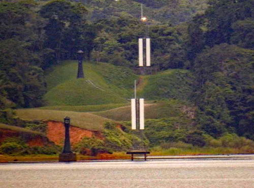
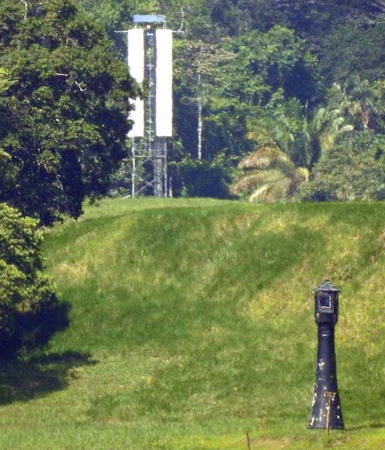
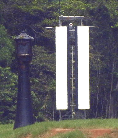
Date unknown. Active; focal plane 48 m (157 ft); occulting green light. A pair of approx. 23 m (75 ft) square cylindrical skeletal towers; the west (centerline) tower carries a long rectangular daymark painted white with a black vertical stripe, and the east (east channel limit) tower carries a long rectangular daymark painted white with a black cross. Trabas has Capt. Peter's photo of the east channel limit range rear light and his photo of the centerline light; Google has a satellite view (the centerline light is on the left). This range guides vessels departing the original Canal. The east limit front light and centerline front light are on short skeletal towers. Located on the east side of the Canal entrance. Site status unknown. Admiralty J6094.11 (east limit light) and J6094.113 (centerline light); NGA 16608.5.
* Atlantic Entrance Range Middle
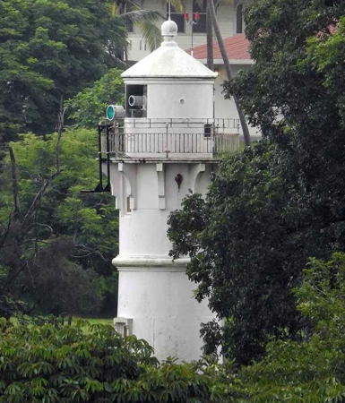
1914. Active; focal plane about 26 m (85 ft); continuous yellow light. 23 m (75 ft) concrete tower with lantern and gallery. Trabas has Capt. Peter's photo, another of his photos is at right, Myhre has a 2012 photo, Wikimedia has a 1993 photo, a 2017 closeup is available, and Google has a satellite view. The front light is on a small skeletal tower. This lighthouse faces southbound (Pacific-bound) ships approaching the Gatún Locks from the Atlantic side. These range lights are east of the original canal and west of the new locks. The range serves vessels bound for both sets of locks. Located about 100 m (100 yd) east of the Canal near the southbound entrance to the Gatún Locks. Site and tower closed but the lighthouse can be viewed from the end of a street nearby. ARLHS PAN-017. Active light: Admiralty J6094.21 (ex-J6132.1); NGA 110-16616.
* Atlantic Entrance Range Rear
1914. Active; focal plane unknown but at least 48 m (158 ft); occulting yellow light. 14 m (46 ft) concrete tower with lantern and gallery. Omar Gayle's photo is at the top of this page, Jim Seery has a photo, Myhre has a 2012 photo, Trabas has Boucher's photo, and Google has a satellite view. Located on Lighthouse Road in the town of Gatún, roughly 500 m (0.3 mi) east of the Gatún Locks and 1.2 km (3/4 mi) south of the middle range light. Site open, tower closed. ARLHS PAN-018; Admiralty J6094.211 (ex-J6132.2); NGA 16620.
Gatún Northbound Rear (Gatún Locks) (1)
1914. Inactive since 2019. Roughly 27 m (89 ft) concrete tower with lantern and gallery, painted black. Kevin Blake's photo of the old and new lights is at the top of this page, Larry Myhre has a good 2012 photo, Wikimedia has a photo, a 2012 photo is available, Huelse has a historic postcard view, and Google has a satellite view. This historic lighthouse was the rear light of the range for northbound (Atlantic-bound) ships approaching the Gatún Locks from Gatún Lake. The tallest and most conspicuous traditional lighthouse of the Canal, it is frequently photographed. The photos show that the lighthouse has been restored and is in good condition. Located on the west wall of the Gatún Locks. Site and tower closed, although the view from ships passing through the locks is excellent. ARLHS PAN-014.
Gatún Northbound Rear (Gatún Locks) (2)
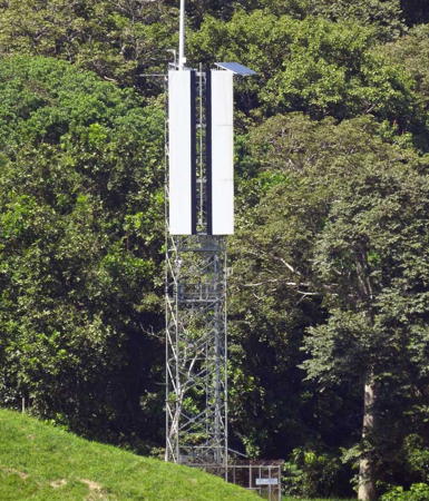
2018 (station established 1914). Active; six green lights occulting once every 4.5 s. Roughly 40 m (131 ft) square skeletal tower carrying a large rectangular daymark colored white with a black vertical stripe. Trabas has Capt. Peter's photo and Kevin Blake's photo of the old and new lights is at the top of this page. Located a short distance north of the historic lighthouse on the west wall of the Gatún Locks. Site and tower closed, although the view from ships passing through the locks is excellent. Admiralty J6094.221.

Atlantic Entrance Range Middle Light, Gatún
photo copyright Capt. Peter Mosselberger
used by permission
Gatún Northbound Front (3?)
2018 (station established 1914). Active; continuous green light. Approx. 20 m (66 ft) triangular steel skeletal tower carrying a large rectangular daymark colored white with a black vertical stripe. Trabas has Capt. Peter's photo and the shadow is seen in Google's satellite view. Leonard d'Souza has a photo showing the present front light, the previous front light painted black in the foreground and the original rear light in the background. Located on the pier between the northbound and southbound Gatún Locks. The original light was a round concrete tower on a platform supported by piles; Michel Forand has historic photos. Site and tower closed, although the view from ships passing through the locks is excellent. ARLHS PAN-028; Admiralty J6094.22.

Gatún Lake Range Lighthouses
The crossing of Gatún Lake comprises 2/3 of the total length of the Panama Canal. Formed by the Gatún Dam on the Río Chagres, the lake is maintained at a constant elevation of 26.7 m (88 ft). The lights in this group guide ships on a zigzag course through the open waters of the lake.

Peña Blanca Northbound Front (1 and 2)
1914. Original light approx. 9 m (30 ft) concrete tower with lantern, painted black on the side facing northbound ships. Active light on a skeletal tower (continuous green light). The Seerys have photos of the original lights and Myhre has a 2012 photo. Trabas has Capt. Peter's photo of the new light and Google has a satellite view. The Peña Blanca Northbound lights can be seen from the starboard side of southbound vessels just as they begin their first turn south of the Gatún Locks. Located just off the waterfront on the west side of the lake about 4 km (2.5 mi) south of Gatún Dam. Site and tower closed. Admiralty J6094.23.
Peña Blanca Northbound Rear (1 and 2)
1914. Original light approx. 9 m (30 ft) concrete tower with lantern, painted black on the side facing northbound ships. Active light on a skeletal tower (occulting green light). Roughly 9 m (30 ft) concrete tower with lantern, painted black, at least on the side facing northbound ships. The Seerys have a photo and Myhre has a 2012 photo of the original light, Trabas has Capt. Peter's photo of the new light, and Google has a satellite view of the two lights. Located between the two historic range lights. Site and tower closed. Admiralty J6094.231.
Gatún Southbound Front (1 and 2)
1914. Original light approx. 9 m (30 ft) concrete tower with lantern, painted black on the side facing northbound ships. Active light on a skeletal tower (continuous green light). Michael Boucher's photo of both pairs of range lights is at right, Trabas has Capt. Peter's photo of the current light, the Seerys have a photo of the original light, Myhre has a 2012 photo, and Google has a satellite view. This is the first range for vessels leaving the Gatún Locks. Located on a concrete pier just off a peninsula projecting into the south side of Gatún Lake; this is the peninsula separating the two principal branches of the lake. Accessible only by boat. Site and tower closed. Admiralty J6094.24.
Gatún Southbound Rear (1 and 2)
1914. Original light approx. 9 m (30 ft) concrete tower with lantern, painted black on the side facing northbound ships. Active light on a skeletal tower (occulting green light). Michael Boucher's photo of both pairs of range lights is at right, Trabas has Capt. Peter's photo of the current light, and Google has a satellite view. This lighthouse is located in the jungle about 800 m (1/2 mi) south of the front light; a cleared corridor connects the two lights. The site is accessible by boat along a twisting side channel of the lake. Site and tower closed. ARLHS PAN-029; Admiralty J6094.241.

Old and new Gatún Southbound Range Lights, Gatún Lake
photo copyright Michael Boucher; used by permission
Bohio Northbound Range Front
Date unknown. Active; continuous green light. Approx. 15 m (49 ft) square skeletal tower carrying a white vertically striped daymark and topped by a mast. Trabas has Capt. Peter's photo and Google has a satellite view. Located on Punta Palenquilla, a promontory on the south side of the lake. Accessible only by boat. Site and tower closed. Admiralty J6094.25.
Bohio Northbound Range Rear
Date unknown. Active; occulting green light. Approx. 15 m (49 ft) square skeletal tower carrying a white vertically striped daymark. Trabas has Capt. Peter's photo and Google has a satellite view. Located about 400 m (1/4 mi) west southwest of the front light. Accessible only by boat. Site and tower closed. Admiralty J6094.251.
Peña Blanca Southbound Front (1 and 2)
1914. Original light approx. 9 m (30 ft) concrete tower with lantern, painted black. The Rommers report has photos (page 4) of the original lights and Myhre has a 2012 photo. Trabas has Capt. Peter's photo of the square skeletal tower (continuous green light) that has replaced the historic lighthouse and Google has a satellite view showing both towers. Located on a peninsula projecting into the lake on the north side of Barro Colorado Island. Accessible only by boat. Site and tower closed. Admiralty J6094.26.
Peña Blanca Southbound Rear (1 and 2)
1914. Original light approx. 9 m (30 ft) concrete tower with lantern, painted black. The Rommers report has photos (page 4) of the original lights and Myhre has a 2012 photo. Trabas has Capt. Peter's photo of the newer skeletal tower (occulting green light) and Google has a satellite view showing both towers. Located at the end of a cleared corridor on the north side of Barro Colorado Island, about 600 m (0.4 mi) southeast of the front light. Accessible only by boat. Site and tower closed. Admiralty J6094.261.
Buena Vista Northbound Front (1 and 2)
1914. Original light approx. 14 m (46 ft) concrete tower with lantern, painted black on the side facing northbound ships. Active light on a skeletal tower (continuous green light). Myhre has a 2012 photo of the original lights, Betty Reed has a 2007 photo, Pierre Marc has a 2010 photo, and the Seerys also have a photo. Trabas has Capt. Peter's photo of the new tower (also seen at right) and Google has a satellite view showing both towers. Located on the east side of the canal near the end of the Bohio Peninsula projecting into the central part of Gatún Lake. Accessible only by boat. Site and tower closed. ARLHS PAN-034; Admiralty J6094.27.
Buena Vista Northbound Rear (1 and 2)
1914. Original light approx. 9 m (30 ft) concrete tower with lantern, painted black on the side facing northbound ships. Active light on a skeletal tower (occulting green light). Myhre has a 2012 photo of the original lights, Betty Reed has a 2007 photo, and the Seerys also have a photo. Trabas has Capt. Peter's photo of the new tower and Google has a satellite view showing both towers. Located about 300 m (325 ft) behind the front light on the east side of the canal near the end of the Bohio Peninsula projecting into the central part of Gatún Lake. Accessible only by boat. Site and tower closed. ARLHS PAN-035; Admiralty J6094.271.

New Buena Vista Northbound Range Light, Gatún Lake
photo copyright Capt. Peter Mosselberger; used by permission
Bohio Southbound Range Front
Date unknown. Active; continuous green light. Approx. 20 m (66 ft) square skeletal tower carrying a white daymark with a black vertical stripe. Trabas has Capt. Peter's photo and Google has a satellite view. Located on Isla Buena Vista, a small island of the south side of the Bohio Peninsula. Accessible only by boat. Site and tower closed. Admiralty J6094.28.
Bohio Southbound Range Rear
Date unknown. Active; occulting green light. Approx. 25 m (82 ft) square skeletal tower carrying a white daymark with a black vertical stripe. Trabas has Capt. Peter's photo and Google has a satellite view. Located about 60 m (200 ft) east of the front light. Accessible only by boat. Site and tower closed. Admiralty J6094.281.
Tabernilla Northbound Front (1 and 2)
1914. Original light approx. 9 m (30 ft) concrete tower with lantern, painted black. The Rommers have a photo of the original light and the Seerys also have a photo. Trabas has Capt. Peter's photo of the new light (continuous green light) and Google's satellite view shows both towers. Located on a peninsula projecting into the lake northwest of Frijoles. Accessible only by boat. Site and tower closed. Admiralty J6094.29.
Tabernilla Northbound Rear (1 and 2)
1914. Original light approx. 9 m (30 ft) concrete tower with lantern, painted black. The Rommers has a photo. Capt. Peter's photo at right and Google's satellite view show the original light and the skeletal tower (occulting green light) that has replaced the historic lighthouse. Located on the south side of the Bohio Peninsula near its base, northwest of Frijoles and about 800 m (1/2 mi) north of the front light. Accessible only by boat. Site and tower closed. Admiralty J6094.291.
Buena Vista Southbound Front (1 and 2)
1914. Original light approx. 9 m (30 ft) concrete tower with lantern, painted black on the side facing northbound ships. Active light on a skeletal tower (continuous green light). The Rommers report has photos (page 3), the Seerys also have a photo, and Google has a satellite view. Trabas has Capt. Peter's photo of the new light and Google has a satellite view of that light; it is about 230 m (750 ft) southeast of the original light. Located in the open waters of the lake southeast of the Buena Vista Range. Accessible only by boat. Site open, tower closed. Admiralty J6094.31.
Buena Vista Southbound Rear (1 and 2)
1914. Original light approx. 15 m (49 ft) concrete tower with lantern, painted black. The Rommers report has photos (page 3). Trabas has Capt. Peter's photo of the skeletal tower (occulting green light) that has replaced the historic lighthouse, and Google has a satellite view of both lights. Located at the base of a forested peninsula on the east side of the lake, about 1.2 km (3/4 mi) southeast of the front light. Site and tower closed. Admiralty J6094.311.


Old (lower right) and new Tabernilla Northbound Range Rear Lights
photo copyright Capt. Peter Mosselberger; used by permission


Río Chagres Range Lighthouses
In this section of the Canal the waters of Gatún Lake have flooded the course of the Río Chagres, including a bend known as the Mamei Curve.
San Pablo Northbound Front (1)
1914. Inactive. Roughly 14 m (45 ft) concrete tower with lantern, painted black. Myhre has a 2012 photo and Google has a satellite view. The range helps guide northbound ships through the middle portion of the Mamei Curve, which connects the San Pablo and Gamboa Reaches. The new lights for this range are about 1.5 km (1 mi) west of the original towers. Located on the west side (really the south bank) of the Canal about 1000 m (0.3 mi) west of the Gamboa Northbound Front Light. Site and tower closed. ARLHS PAN-037.
San Pablo Northbound Rear (1)
1914. Inactive. Roughly 18 m (56 ft) concrete tower with lantern, painted black. This light is seen hiding in the rear in Myhre's 2012 photo and Google has a satellite view. Located about 400 m (1/4 mi) behind the front light. Site and tower closed.
San Pablo Northbound Rear (2)
Date unknown. Inactive. Approx. 18 m (59 ft) square pyramidal skeletal tower. This tower is seen in Myhre's 2012 photo. Located about 400 m (1/4 mi) behind the front light. Site and tower closed.
San Pablo Northbound Front (2)
Date unknown. Active; continuous green light. Approx. 15 m (49 ft) square pyramidal steel skeletal tower, with an enclosed equipment building in the base. The tower also carries a horizontally slatted daymark. Lighthouse painted white. Trabas has Capt. Peter's photo and Google has a satellite view. Located about 1.2 km (3/4 mi) west of the historic lights. Site and tower closed. Admiralty J6094.32.
San Pablo Northbound Rear (3)
Date unknown. Active; occulting green light. Approx. 15 m (49 ft) square steel skeletal tower. The tower also carries a horizontally slatted daymark. Lighthouse painted white. Trabas has Capt. Peter's photo and Google has a satellite view. Located about 1.5 km (1 mi) west of the historic lights. Site and tower closed. Admiralty J6094.321.
Tabernilla Southbound Front (1 and 2)
1914. Original light approx. 9 m (30 ft) concrete tower with lantern, painted black. Active light on a skeletal tower (continuous green light). The Rommers report has a photo (page 2) of the original light, Myhre has a 2012 photo, and Google has a satellite view. Boucher has the photo of both lights seen at right, Trabas has Capt. Peter's photo of the new light, and Google has a satellite view. A. Rodriguez has a 2015 photo of the two original lights and the new front light. Located near the waterline at the head of a bay in the southeast corner of the lake. Accessible only by boat. Site open, tower closed. Admiralty J6094.325.
Tabernilla Southbound Rear (1 and 2)
1914. Original light approx. 9 m (30 ft) concrete tower with lantern, painted black. Active light on a skeletal tower (occulting green light). The Rommers report has a photo (page 2) of the original light and Google has a satellite view. Trabas has Capt. Peter's photo of both lights and Google has a satellite view. The old light is about 400 m (1/4 mi) south of the front light and the new one is about 250 m (820 ft) farther south. Site and tower closed. Admiralty J6094.3251.

Old and new Tabernilla Southbound Range Front Lights
photo copyright Michael Boucher; used by permission
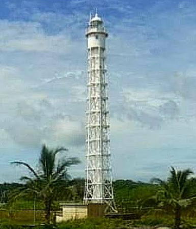
Mamei Northbound Range Front
Date unknown. Active; continuous green light. Approx. 15 m (49 ft) square skeletal tower carrying a white daymark with a black vertical stripe. Trabas has Capt. Peter's photo and Google has a satellite view. Located on the south side of the Canal. Accessible only by boat. Site and tower closed. Admiralty J6094.33.
Mamei Northbound Range Rear
Date unknown. Active; occulting green light. Approx. 15 m (49 ft) square skeletal tower carrying a white daymark with a black vertical stripe. Trabas has Capt. Peter's photo and Google has a satellite view. Located 133 m (436 ft) southwest of the front light. Accessible only by boat. Site and tower closed. Admiralty J6094.331.
San Pablo Southbound Range Front (1 and 2)
1914. Original light approx. 9 m (30 ft) concrete tower with lantern. Active light on a skeletal tower (continuous green light). Lightphotos.net has Andreas Köhler's photo of the old light, the Seerys have a good photo, and Myhre has a photo of the original range lights. Trabas has Capt. Peter's photo of the new light and Google has a satellite view. Located on an island on the south side of the canal at the exit from Gatún Lake. Accessible only by boat. Site open, tower closed. Admiralty J6094.35.
San Pablo Southbound Range Rear (1 and 2)
1914. Original light approx. 9 m (30 ft) concrete tower with lantern. Active light on a skeletal tower (occulting green light). Myhre has a photo of the original range lights and Trabas has Capt. Peter's photo of the new light. Google has a satellite view of the new light and also a satellite view of the historic rear range lighthouse about 300 m (330 yd) behind the current light. Located on a hill about 1.2 km (3/4 mi) east of the front light. Accessible only by boat. Site open, tower closed. Admiralty J6094.351.
Juan Grande Northbound Range Front
Date unknown. Active; continuous green light. Approx. 15 m (49 ft) square skeletal tower carrying a white daymark with a black vertical stripe. Trabas has Capt. Peter's photo and Google has a satellite view. Located on the north side of the Canal. Accessible only by boat. Site and tower closed. Admiralty J6094.37.
Juan Grande Northbound Range Rear
Date unknown. Active; occulting green light. Approx. 15 m (49 ft) square skeletal tower carrying a white daymark with a black vertical stripe. Trabas has Capt. Peter's photo and Google has a satellite view. Located 101 m (331 ft) southwest of the front light. Accessible only by boat. Site and tower closed. Admiralty J6094.371.
Gamboa Northbound Front (1)
1914. Inactive since 2018. Roughly 14 m (45 ft) concrete tower with lantern and gallery, painted white on the northbound side, black on the southbound. Myhre has a 2012 photo, the Rommers report has photos (bottom of page 1 and top of page 2) and Google has an indistinct satellite view. Located on the north side of the Canal about 6 km (4 mi) west of Gamboa, marking the end of the Gamboa Northbound Reach leading into Gatún Lake. Accessible only by boat. Site and tower closed.
Gamboa Northbound Front (2) (2 towers)
2018. Active. This range now has two sets of lights, each on a square skeletal tower carrying a daymark colored white with a black vertical stripe: a Centerline Range Front (continuous yellow light) and a Right Limit Range Front (continuous green light). The Centerline tower is just off the bank on a square platform supported by piles. Trabas has Capt. Peter's photos of the Centerline and Right Limit towers (the old lighthouse appears behind the Right Limit tower) and Google has a satellite view. Accessible only by boat. Site and tower closed. AdmiraltyJ6094.381 (Centerline) and J6094.39 (Right Limit).
Gamboa Northbound Rear (1)
1914. Inactive since 2018. Roughly 18 m (60 ft) concrete tower with lantern and gallery, painted white on the northbound side at least. Boucher's photo is at right, the Seerys have a photo, Myhre has a 2012 photo, the Rommers report has photos (bottom of page 1 and top of page 2), and Google has a satellite view. Accessible only by boat. Site and tower closed.
Gamboa Northbound Rear (2) (2 towers)
2018. Active. Two lights, each on a square skeletal tower carrying a daymark colored white with a black vertical stripe: a Centerline Range Rear (occulting yellow light) and a Right Limit Range Front (occulting green light). Trabas has Capt. Peter's photos of the Centerline and Right Limit towers. Located 337 m (1105 ft) northwest of the front lights. Accessible only by boat. Site and tower closed. Admiralty J6094.382 (Centerline) and J6094.391 (Right Limit).

1914 Gamboa Northbound Range Rear Light, Gamboa
photo copyright Michael Boucher; used by permission
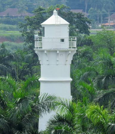
Mamei Southbound Range Front
Date unknown. Active; continuous green light. Approx. 15 m (49 ft) square skeletal tower carrying a white daymark with a black vertical stripe. Trabas has Capt. Peter's photo and Google has a satellite view. Located on the north side of the Canal. Accessible only by boat. Site and tower closed. Admiralty J6094.41.
Mamei Southbound Range Rear
Date unknown. Active; occulting green light. Approx. 15 m (49 ft) square skeletal tower carrying a white daymark with a black vertical stripe. Trabas has Capt. Peter's photo and Google has a satellite view. Located 122 m (400 ft) northeast of the front light. Accessible only by boat. Site and tower closed. Admiralty J6094.411.
Juan Grande Southbound Range Front
Date unknown. Active; continuous green light. Approx. 15 m (49 ft) square skeletal tower carrying a white daymark with a black vertical stripe. Trabas has Capt. Peter's photo and Google has a satellite view. Located on the north side of the Canal. Accessible only by boat. Site and tower closed. Admiralty J6094.42.
Juan Grande Southbound Range Rear
Date unknown. Active; occulting green light. Approx. 25 m (82 ft) square skeletal tower carrying a white daymark with a black vertical stripe. Trabas has Capt. Peter's photo and Google has a satellite view. Located 359 m (1178 ft) east of the front light. Accessible only by boat. Site and tower closed.Admiralty J6094.421.

Gamboa Area Range Lighthouses
Gamboa is a town at the point where the Río Chagres makes a sharp turn and enters Gatún Lake. South of Gamboa the Culebra Cut carries the canal through the Continental Divide. Navigation in the Cut is aided by smaller range lights not listed by the Directory. Beyond the Cut the Canal descends to the Pacific; lights of that section are described on the Southern Panama page.

*
Chagres Crossing Northbound Centerline Range Front
2018. Active; continuous yellow light. Approx. 20 m (66 ft) square skeletal tower carrying a white daymark with a black vertical stripe. Trabas has Capt. Peter's photo and Google has a satellite view. Located on a pier on the west side of Gamboa. Site open, tower closed. Admiralty J6094.43.
Chagres Crossing Northbound Centerline Range Rear
2018. Active; occulting yellow light. Approx.20 m (66 ft) square skeletal tower carrying a white daymark with a black vertical stripe. Trabas has Capt. Peter's photo and Google has a satellite view. Located on a hillside about 1 km (0.6 mi) northwest of the front light. Site status unknown. Admiralty J6094.431.
Chagres Crossing Northbound Right Limit Range Front
2018. Active; continuous yellow light. Approx. 15 m (49 ft) square skeletal tower carrying a white daymark with a black vertical stripe. Trabas has Capt. Peter's photo and Google has a satellite view. Located on a hillside about 1 km (0.6 mi) northwest of Gamboa. Site status unknown. Admiralty J6094.44.
Chagres Crossing Northbound Right Limit Range Rear
2018. Active; occulting yellow light. Approx.15 m (49 ft) square skeletal tower carrying a white daymark with a black vertical stripe. Trabas has Capt. Peter's photo and Google has a satellite view. Located about 60 m (200 ft) northwest of the front light. Site status unknown. Admiralty J6094.441.
* Gamboa Southbound Range Front (1)
1914. Inactive. Roughly 14 m (45 ft) concrete tower with lantern and gallery, painted black. This lighthouse faces southbound ships at the entrance to the Culebra Cut from Gatún Lake. A 2023 photo by Dario Bastidas is at right, Myhre has a 2012 photo, a 2008 photo is available, Lighthouse Digest has a historic postcard view, and Google has a 2023 street view and a satellite view. The lighthouse was abandoned and in poor condition as of 2000; there have been only modest improvements since. Located on the west side of the Río Chagres, at the entrance to the Gamboa Rainforest Reserve, in the town of Gamboa. Site open, tower closed. ARLHS PAN-027.

Gamboa Southbound Front Light, Gamboa, August 2023
Google Maps photo by Dario Bastidas
Gamboa Southbound Range Front (2 towers)
2018. Active. This range has two sets of lights, each on a square skeletal tower carrying a daymark colored white with a black vertical stripe: a Centerline Range Front (continuous yellow light) and a Right Limit Range Front (continuous green light). Trabas has Capt. Peter's photos of the Centerline and Right Limit towers. In Bing's satellite view the Centerline tower is the short tower above center and the Right Limit tower is to its lower left. Both Right Limit Range lights are seen in Capt. Peter's photo at right. Located on the east bank of the Río Chagres opposite Gamboa. Site status unknown but the towers can be seen from nearby. Admiralty J6094.451 (Centerline) and J6094.46 (Right Limit).
Gamboa Southbound Range Rear (2 towers)
Date unknown. Active. This range has two sets of lights, each on a square skeletal tower carrying a daymark colored white with a black vertical stripe: a Centerline Range Front (occulting yellow light) and a Right Limit Range Front (occulting green light). Trabas has Capt. Peter's photos of the Centerline and Right Limit towers. Bing has satellite views of the Centerline light and the Right Limit light. Located on the north side of the Canal on the east side of the Río Chagres. Site status unknown, but the Centerline light can be seen from the highway. Admiralty J6094.452 (Centerline) and J6094.461 (Right Limit).
Bas Obispo Northbound Range Rear (2 towers)
Date unknown. Active. This range has two sets of lights, each on a square skeletal tower carrying a daymark colored white with a black vertical stripe: a Centerline Range Front (occulting yellow light) and a Right Limit Range Front (occulting green light). Trabas has Capt. Peter's photos of the Centerline and Right Limit towers. In Google's satellite view the Right Limit tower is on the right. Located near the Gamboa Southbound Front Lights, on the north side of the Canal on the east side of the Río Chagres. Site status unknown, but the lights can be seen from the highway. Admiralty J6094.471 (Right Limit) and J6094.481 (Centerline).
Bas Obispo Northbound Range Front (2 towers)
Date unknown. Active. This range has two sets of lights, each on a square skeletal tower carrying a daymark colored white with a black vertical stripe: a Centerline Range Front (continuous yellow light) and a Right Limit Range Front (continuous green light). Trabas has Capt. Peter's photos of the Centerline and Right Limit towers. In Google's satellite view the Right Limit tower is on the right. Located on the north bank of the Canal about 400 m (1/4 mi) southeast of the rear lights. Site status unknown, but the lights can be seen from the highway. Admiralty J6094.47 (Right Limit) and J6094.48 (Centerline).
Chagres Crossing Southbound Range Front (2 towers)
Date unknown. Active. This range has two sets of lights, each on a square skeletal tower carrying a daymark colored white with a black vertical stripe: a Centerline Range Front (continuous yellow light) and a Right Limit Range Front (continuous green light). Trabas has Capt. Peter's photos of the Centerline and Right Limit towers. In Google's satellite view the Right Limit tower is below and to the left of the Centerline tower. Located on the north bank of the Canal about 800 m (1/2 mi) southeast of Gamboa. Site and tower closed. Admiralty J6094.51 (Right Limit) and J6094.49 (Centerline).

Front to back, three Gamboa lights:
Gamboa Southbound Right Limit Range Front Light,
Bas Obispo Northbound Centerline Range Rear Light, and
Gamboa Southbound Right Limit Range Rear Light,
photo copyright Capt. Peter Mosselberger; used by permission
Chagres Crossing Southbound Range Rear (2 towers)
Date unknown. Active. This range has two sets of lights, each on a square skeletal tower carrying a daymark colored white with a black vertical stripe: a Centerline Range Front (continuous yellow light) and a Right Limit Range Front (continuous green light). Trabas has Capt. Peter's photos of the Centerline and Right Limit towers. In Google's satellite view the Right Limit tower is on the left. Located on the north bank of the Canal about 800 m (1/2 mi) southeast of Gamboa. Site and tower closed. Admiralty J6094.511 (Right Limit) and J6094.491 (Centerline).

Note: Lighthouses of the Panama Canal continue on the Southern Panamá page.

East Caribbean Coast Lighthouses

Colón Province Lighthouses
Bahía las Minas Range Rear (2?)
Date unknown. Active; focal plane unknown; continuous green light. Approx. 23 m (75 ft) steel mast painted with red and white horizontal bands. Trabas has Capt. Peter's photo and Google has a satellite view. The front light, on a much shorter mast, has been deactivated and possibly removed; the rear light is now a directional light. The range guides vessels to a petroleum refinery. Located in a tank farm about 10 km (6 mi) east of Colón. Site and tower closed. Site manager: Refinería Panama S.A. Admiralty J6134.1; NGA 16621.1.
Farallón Sucio (Sucio Rock) (2)
Date unknown (station established 1925). Active; focal plane 32.5 m (107 ft); red flash every 5 s. 7 m (23 ft) pyramidal concrete tower, painted white. Trabas has Capt. Theo Hinrich's photo, José A. Jiménez has a distant photo, and Google has an indistinct satellite view. The original tower was a 6 m (20 ft) white pyramidal steel framework tower on a tank house. Located about 10 km (6 mi) west northwest of Isla Grande. Accessible only by boat. Site and tower closed. ARLHS PAN-023; Admiralty J6136; NGA 16624.
** Isla Grande
1894 (French). Active; focal plane 93 m (305 ft); white flash every 5 s. 26 m (85 ft) steel skeletal tower with central cylinder. Lighthouse painted white. The original 2nd order Barbier & Cie. Fresnel lens from this light is on display at the Museo del Canal Interoceánico in Panamá City. A 2022 photo by Edwin Ramos is at right, Xavier Nuñez has a 2018 photo, Zahira Figueroa has a 2021 photo, Luis Yun has a 2023 closeup, Kelly Nielsen has a 2007 photo, Nilo Moreno has a closeup photo, Trabas has Capt. Peter's distant view, and Google has a satellite view. The lighthouse is a twin of the Toro Point Light (see below). This is a landfall light for ships arriving at the Canal from the northeast. The lighthouse was repaired and repainted about 2020. Located at the highest point of Isla Grande, a resort island off Punta Manzanillo, about 80 km (50 mi) northeast of the Canal entrance. Accessible by a 30 minute walk from the town and from nearby resorts. Site open, tower reported open for climbing. ARLHS PAN-026; Admiralty J6138; NGA 16628.

Information available on lost lighthouses:

  • Colón Breakwater (1852-?), Colón. The breakwater has been removed. ARLHS PAN-040.

Isla Grande Light, October 2022
Google Maps photo by Edwin Ramos

Adjoining pages: East: Northern Colombia | South: Southern Panamá | West: Costa Rica Caribbean

Return to the Lighthouse Directory index | Ratings key

Posted April 2001. Checked and revised April 21, 2024. Lighthouses: 89. Site copyright 2024 Russ Rowlett and the University of North Carolina at Chapel Hill.