Lighthouses of the United States: Rhode Island

The United States of America is a federal union of 50 states and a capital district. The smallest of the states, the northeasten state of Rhode Island is in the southern New England region south of Massachusetts and east of Connecticut.

Small in size but long in coastline, Rhode Island surrounds and includes Narragansett Bay, a complex inlet of the Atlantic Ocean. Historically Rhode Island is the name of the largest island in the bay. In 1644 the settlements of Newport (on the island), and Providence and Portsmouth (on the mainland) banded together as the Colony of Rhode Island and Providence Plantations. The state continued to be known officially as the State of Rhode Island and Providence Plantations until November 2020 when voters agreed to drop the reference to Plantations. Providence, at the head of the bay, is the state capital.

Rhode Island is divided administratively into five counties but local government is provided by the cities and towns within each county.

Jeremy D'Entremont's book, The Lighthouses of Rhode Island (Beverly, Mass.: Commonwealth Editions, 2006) is an excellent resource for the study of Rhode Island lighthouses.

Navigational aids in Rhode Island are operated by the U.S. Coast Guard Sector Southeastern New England in Woods Hole, Massachusetts; an Aids to Navigation Team based at Bristol is responsible for the Rhode Island lights. However ownership (and sometimes operation) of historic lighthouses has been transferred to local authorities and preservation organizations in many cases.

ARLHS numbers are from the ARLHS World List of Lights. Admiralty numbers are from volume J of the Admiralty List of Lights & Fog Signals. USCG numbers are from Vol. I of the USCG Light List.

General Sources
New England Lighthouses: A Virtual Guide - Rhode Island
Excellent photos and good data on all the lighthouses; an outstanding resource created by Jeremy D'Entremont.
Rhode Island Lighthouses
Excellent photos and historical accounts by Kraig Anderson of LighthouseFriends.com.
Rhode Island Lighthouse History
An informative website maintained by Richard Holmes.
Online List of Lights - Rhode Island
Photos by various photographers posted by Alexander Trabas.
Rhode Island, United States Lighthouses
Aerial photos posted by Marinas.com.
Lighthouses in Rhode Island
Photos by various photographers available from Wikimedia.
Leuchttürme USA auf historischen Postkarten
Historic postcard images of U.S. lighthouses posted by Klaus Huelse.
U.S. Coast Guard Navigation Center: Light Lists
The USCG Light List can be downloaded in pdf format.
NOAA Nautical Charts
Nautical charts for the coast can be viewed online.
Navionics Charts
Navigation chart for Rhode Island.


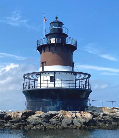
Point Judith Light, Narragansett, September 2019
Facebook photo by Abel Silva

Newport County Lighthouses

Little Compton Lighthouse
Sakonnet Point
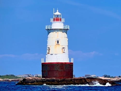
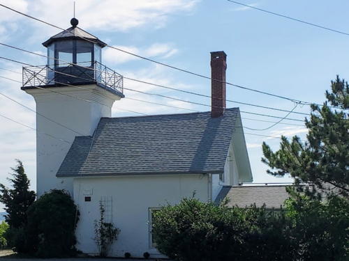
1884. Reactivated (inactive 1955-1997); focal plane 58 ft (19 m); flash every 6 s, white to the east and red to the west. 66 ft (20 m) round cast iron sparkplug tower (brick lined) with lantern, double galleries above and lower gallery, incorporating 3-story keeper's quarters, mounted on a concrete caisson. The original 4th order Fresnel lens is on display at the Maine Lighthouse Museum in Rockland, Maine. Lighthouse painted white except for a red band around the base of the lantern. David Cabral's 2023 photo is at right, Anderson has a good page for the lighthouse, Robert English has a great 2006 photo, Alex Wang has a 2016 photo, Peter Bond has a photo, Trabas has a good photo, Marinas.com has aerial photos, Huelse has a historic postcard view, and Google has a satellite view and a distant street view from shore. The lighthouse was repaired after it was damaged by the Great Hurricane of 1938. After it was damaged again by Hurricane Carol in 1954 the Coast Guard decided to deactivate and demolish the lighthouse. In 1961 Carl Haffenreffer bought the lighthouse for $1111.11, and in 1985 he donated it to the newly-formed Friends of Sakonnet Lighthouse. The Friends group worked to restore and relight the lighthouse, and after an act of Congress absolved them of any liability the light was relit in March 1997. In 2005 a grant of $843,000 to restore the tower was approved by the U.S. Department of Transportation. The Friends of Sakonnet Lighthouse raised an additional $170,000. Work began in the summer of 2010 and continued in stages over a two-year period with completion in July 2012. The friends group received the Rhody Award for its work on this restoration. The exterior of the lighthouse was repaired and repainted in 2016. In 2021 Cavanagh Marine Services repaired and replaced the door and windows and made other structrural repairs. Marking the entrance to the Sakonnet River estuary, the lighthouse stands on Little Cormorant Rock, the westernmost of a group of rocky islets and ledges, 800 yards (730 m) southwest of Sakonnet Point in Little Compton (end of RI 77). Accessible only by boat. Site and tower closed. Owner/site manager: Friends of Sakonnet Point Lighthouse . ARLHS USA-718; Admiralty J0523; USCG 1-17577.

Sakonnet Light, Little Compton, August 2023
Google Maps photo by David Cabral

Newport Lighthouses
The town of Newport, founded in 1639, occupies the southwestern peninsula of Aquidneck (Rhode) Island. Its sheltered harbor was an important port in early American history and it remains active today.
[Narragansett Bay Entrance (Lightfloat)]
1992. Active; focal plane 6 m (20 ft); one short and one long white flash. Whistle. 6 m (20 ft) skeletal tower painted with red and white horizontal bands and carrying a red spherical topmark. Holmes has a closeup photo and Bing has a satellite view. This buoy is at the former location of the 1962 Brenton Reef Light, a 26.5 m (87 ft) square "Texas" tower. It is about 0.9 mi (1.44 km) west of the former location of the Brenton Reef Lightship. Located between the inbound and outbound shipping lanes south of the Narragansett Bay entrance, about 3.6 mi (6 km) south southwest of Brenton Point, the southwestrn tip of Rhode Island. Accessible only by boat. Site open. USCG 1-17675.
* Castle Hill
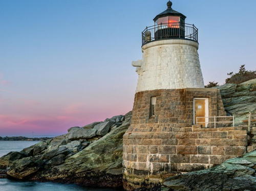
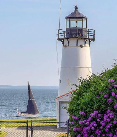
1890. Active; focal plane 40 ft (12 m); red light, 3 s on, 3 s off. 34 ft (10 m) round granite tower with lantern and gallery, 300 mm lens. Fog horn (1 s blast every 10 s) on demand. Upper half of tower painted white, lower half unpainted; lantern painted black. Several web sites report erroneously that the keeper's house was demolished in the 1930s. In fact, the 2-story brick keeper's house stands near Castle Hill Cove, a few hundred feet from the lighthouse; D'Entremont has a photo of the house (about 2/3 the way down the page). A 2023 photo is at right, Anderson also has a fine page for the station, Trabas has a photo by Ronald Wöhrn, Wikimedia has a closeup, a 2021 photo is available, Alexey Sergeev has a photo, Marinas.com has aerial photos, Huelse has a historic postcard view, Brian Kelley has a street view, and Google has a satellite view and a distant sea view. A fog bell believed to be from this lighthouse is on display outside the nearby Castle Hill Coast Guard Station. A traditional location for weddings, this lighthouse is accessible by a short walk from the nearby Castle Hill Cove Marina (where parking is available), or (if you're a guest) from the adjacent Castle Hill Inn. In 2021 the Inn repainted and refurbished the lighthouse after signing a five-year maintenance agreement. Located at Castle Hill Point at the southwestern end of Newport. Site open, tower closed. Owner: U.S. Coast Guard. Site manager: Castle Hill Inn. . ARLHS USA-144; Admiralty J0530; USCG 1-17795.

Castle Hill Light, Newport, December 2023
Instagram photo by steve_dito
Ida Lewis Rock (Lime Rock)
1854. Inactive since 1927 (a decorative light is now displayed in season). 13 ft (4 m) lantern mounted on one corner of a 2-story granite and brick keeper's house. The original 6th order Fresnel lens is on display at the Museum of Newport History. Building painted white, lantern black. Anderson also has a good page for the lighthouse, Huelse has a historic postcard view, and Google has a distant street view, a sea view and a satellite view. This tiny lighthouse is famous for its legendary keeper Ida Lewis (1857-1911). The light was moved to a skeletal tower in 1927 and discontinued in 1963; the skeletal tower was demolished. The lighthouse building, including modern additions, is now part of a yacht club, and the island has been connected to the mainland by a causeway. Note: the Coast Guard buoy tender USCGC Ida Lewis (WLM-551) is based in Newport. Located off Wellington Avenue between Chastellux and Halidon Avenues in Newport. Site and tower closed. Owner/site manager: Ida Lewis Yacht Club. . ARLHS USA-398.
* Newport Harbor (Goat Island) (2)
1842 (station established 1823). Active; focal plane 33 ft (10 m); continuous green light. 35 ft (10.5 m) octagonal granite tower with lantern and gallery, 250 mm lens. The keeper's house was demolished in 1923 after being damaged when a submarine ran aground on the island. A 5th order Fresnel lens is on display at the Suffolk County Vanderbilt Museum in Centerport, Long Island. Robert and A 2022 photo is at right, Anderson's page has several good photos, Trabas has a fine photo, Joshua Rosen has a good 2017 photo, Sanghee Lee has a 2019 photo, Marinas.com has aerial photos, and Google has a street view and a satellite view. The original (1823) lighthouse was relocated to Prudence Island in 1851; see below. The present tower stands on a foundation of granite blocks. The lighthouse is adjacent to a hotel, the Newport Harbor Island Resort. In 2000 the Coast Guard leased the tower to the American Lighthouse Foundation for preservation. ALF organized the Friends of Newport Harbor Light and in June 2005 the foundation announced a $120,000 restoration plan. In November 2005 the 1772 Foundation granted $25,000 toward the restoration, and initial work was completed in 2006 by the Abcore Restoration Company. In late 2006 a fence (seen in the photo at right) was built around the pier on which the lighthouse stands, so that visitors can safely access the tower. Located on the northern tip of Goat Island in Newport Harbor; the island is accessible by a bridge from RI 238 in downtown Newport and the lighthouse is accessible by walking through the hotel lobby. Site open, tower closed. Owner: U.S. Coast Guard. Site manager: Friends of Newport Harbor Light. . ARLHS USA-548; Admiralty J0540; USCG 1-17850.

Newport Harbor Light, Newport, April 2022
Instagram photo by Only In Rhode Island
** Rose Island
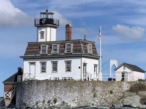
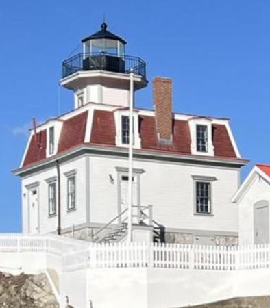
1870 (Albert Dow, designer). Reactivated (inactive 1971-1993, now maintained by the Rose Island Lighthouse Foundation); focal plane 48 ft (14.5 m); white flash every 6 s. 35 ft (10.5 m) octagonal cylindrical wood tower with lantern and gallery, mounted on a 2-story Empire-style wood keeper's house. Brick oil house (1912) and brick fog signal building (1912). Building painted white; lantern black. A 2022 photo by David Walters is at right, Anderson has a good page for the lighthouse, Trabas has a view from the harbor, Kristina Conlon has a 2021 photo, Jenna Robbins has a photo, Marinas.com has aerial photos, and Google has a satellite view and a distant street view from the Claiborne Pell Newport Bridge. Sibling of Colchester Reef Light, Vermont. When the lighthouse was deactivated in 1971 it was leased to the University of Rhode Island, but the university never made any use of it. Ownership was transferred to the newly-formed Rose Island Lighthouse Foundation in 1985. Since 1992 the lighthouse has been carefully restored to its 1912 appearance. The first floor of the building is a museum; the second floor has four guest rooms available year-round for overnight accommodations. In 2005 a federal grant of $330,000 was awarded for repairs and improvements at the light station. In 2013 a new, historically accurate 6th order Fresnel lens was installed as part of a thorough restoration, and in 2014 the lighthouse received a state preservation project award. Located on the southwestern tip of Rose Island, in the center of Narragansett Bay between Newport and Jamesown and just south of the Newport Bridge. Accessible during the summer by the Newport-Jamestown ferry (toll). Site restricted in bird nesting season (April 1 to August 15), otherwise open; lighthouse open to visitors from Memorial Day (late May) through Labor Day (early September) (admission fee); guided tours available in other months. Owner: City of Newport. Site manager: Rose Island Lighthouse and Fort Hamilton Trust . ARLHS USA-703; Admiralty J0543; USCG 1-17857.

Rose Island Light, Newport, September 2022
Google Maps photo by David Walters
[Gull Rocks (1)]
1887. Inactive since 1961. The A-frame keeper's house (two lights were mounted at the peak ends of the roof) was demolished in 1970. The lighthouse was replaced by a square skeletal tower, which was deactivated and demolished in 1961. The original oil house survives. The Coast Guard has a historic photo of this unusual light station, Anderson has a page with its history, Holmes also has a page, and Google has a street view and a satellite view of the former station. The island was sold in 1973. Located on a tiny island almost directly under the Claiborne Pell Newport Bridge (RI 138) between Jamestown and Newport. Accessible only by boat. Site status unknown. Owner/site manager: private. ARLHS USA-362.

Jamestown (Conanicut Island) Lighthouses
Conanicut Island lies in the center of Narragansett Bay, dividing the bay into the East Passage and the West Passage. The island is connected to Newport on the east by the Claiborne Pell Newport Bridge and to North Kingstown on the west by the Jamestown Verrazzano Bridge.
*** Beavertail (3)
1856 (station established 1749). Active; focal plane 68 ft (21 m); white flash every 6 s, day and night. 45 ft (14 m) square cylindrical granite tower with lantern and double gallery attached to a 2-story stucco-clad brick keeper's house (1856); VRB-25 beacon (2019). The tower is unpainted granite; lantern and watchroom painted black; keeper's house white with red roofs. Fog horn (3 s blast every 30 s) on demand. The assistant keeper's house (1898) houses a museum; the 4th order Fresnel lens used 1907-1991 is on display. Fernando Casanova's 2023 photo is at right, Alex Tucker has a closeup photo, Anderson has a good page for the station, Rick Payette has a good 2011 photo, Marinas.com has aerial photos, and Google has a street view and a satellite view. This is the nation's fourth oldest light station (after Boston MA, Tybee Island GA, and Brant Point MA). The foundations of the 1749 lighthouse remain visible and were restored in 2013. The Beavertail Lighthouse Museum Association (BLMA) works for preservation of the light station. BLMA has coordinated a plan for ownership by the State of Rhode Island and Town of Jamestown with the BLMA as the site manager in anticipation of the property being declared excess under the National Historic Lighthouse Preservation Act. BLMA operates the museum in the keepers's houses. The fog signal building houses an aquarium operated by the state Department of Environmental Management. In 2006 BLMA announced plans for expansion of the museum into all six structures on the light station when the station becomes available for transfer. In early 2008 the Champlin Foundation granted $227,000 for restoration of the light tower; Trabas has a photo showing this work in progress. Also in early 2008 the Coast Guard rejected a request from the town to lease the keeper's house to a caretaker. Instead, the house was restored and opened as an expansion of the museum in 2013. In 2014 the fog signal building was restored and replica diaphone horns installed. A $46,275 state grant in January 2017 supported repairs to the tower and keeper's house. In July 2019 a VRB-25 beacon was installed to replace the DCB aerobeacon that had failed in April. In February 2020 the loop road in front of the lighthouse was closed permanently due to beach erosion, but visitors can still walk to the lighthouse from the parking areas in the rear. In 2021 the lighthouse finally became available for transfer under NHLPA and in June 2024 it was transferred to the Rhode Island Department of Environmental Management as an addition to Beavertail State Park. Located on Beavertail Point on the southern tip of Conanicut Island in Jamestown. Site open daily; museum open daily mid June through Labor Day and on weekends late May through mid June and early September through mid October; tower open on Saturday of alternate weekends during the summer. Owner: Rhode Island Department of Environmental Management. Site manager: Beavertail Lighthouse Museum Association and Beavertail State Park. ARLHS USA-048; Admiralty J0624; USCG 1-17780.

Beavertail Light, Jamestown, January 2023
Google Maps photo by Fernando Casanova
Dutch Island
1857. Reactivated (inactive 1979-2007, now privately maintained); focal plane 56 ft (17 m); red flash every 6 s. 42 ft (13 m) square cylindrical brick tower. The keeper's house, formerly attached to the tower, was demolished in 1950; the brick oil house survives. A 2023 drone view is at right, Anderson's page has good closeup photos, C.M. Hanchey has a good 2013 photo, Trabas has a view from the sound, Norman Henry Martin has a 2018 photo, a 2021 drone view is available, Huelse has a historic postcard view of the complete station, and Google has a satellite view and a very distant street view from across the West Passage. Gravely endangered by neglect, vandalism, and decay, the lighthouse was placed on the Lighthouse Digest Doomsday List. In 2000 the American Lighthouse Foundation leased the lighthouse from the Coast Guard and helped start the Dutch Island Lighthouse Society (DILS) to work for restoration of the lighthouse. In 2001 the 250 mm lens used in the lighthouse prior to 1947 was returned by a nearby resident who had held it for safekeeping for 20 years; it is now on display at the Lighthouse Foundation's museum in Wells, Maine. In 2005 a $120,000 federal grant was obtained and plans for a complete restoration were announced in June 2006. In July 2007 a contract was awarded to Abcore Construction to carry out the restoration, and on November 17 the light was reactivated. Robert English has a September 2007 photo taken while the work was in progress. Lighthouse Digest has D'Entremont's article on the last keeper at the lighthouse. Located on the southern tip of Dutch Island, a wildlife management area in the middle of the West Passage of Narragansett Bay between Jamestown and Saunderstown. Visible from Fort Getty Recreation Area in Jamestown. Accessible only by boat; since 2000 the island has been closed to the public due to dangers from collapsed cisterns and bunkers. Site and tower closed. Owner: Rhode Island Department of Environmental Management. Site manager: Dutch Island Lighthouse Society. . ARLHS USA-250; Admiralty J0621; USCG 1-19101.
Conanicut Island
1886. Inactive since 1933. 42 ft (13 m) square cylindrical wood tower with gallery attached to a 2-story wood keeper's house. Lantern removed. Building painted red with white trim. The barn (1897), oil house (1901), and fog signal building (1907) also survive. Anderson has a good page for the lighthouse, Ken Zirkel has a photo, Allan Camp has a 2012 photo, and Google has a satellite view and a street view through trees. This station has been a private residence since 1934. The light was moved initially to a 40 ft (12 m) skeletal tower, but that tower was removed in the 1980s and there is no longer a light on the point. A November 2021 Instagram photo shows a lantern atop the tower. In 2023 the Coast Guard sold a vacant lot, formerly part of the light station property, on the east side of lighthouse. Located at the end of Summit Avenue, at the northern tip of the island. Site and tower closed; there are good views only from the water. Owner/site manager: private. . ARLHS USA-185.

Dutch Island Light, Jamestown, January 2023
Instagram photo by Max, The Drone Guy

Portsmouth Lighthouses
The town of Portsmouth includes the northern half of Aquidneck (Rhode) Island and all of Prudence Island, the smallst of the three main islands of Narragansett Bay. Prudence Island has only about 300 permanent residents.
* Prudence Island (Sand Point, Sandy Point)
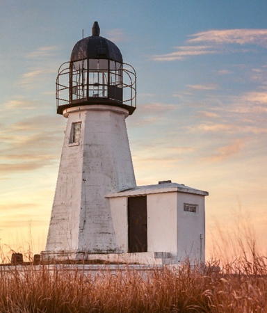
1823 (relocated from Goat Island near Newport in 1851). Active; focal plane 28 ft (8.5 m); green flash every 6 s. 30 ft (9 m) octagonal granite tower with a very rare nineteenth-century "birdcage" lantern; 250 mm lens. Lighthouse painted white, lantern black. The keeper's house was destroyed by the hurricane of 1938. Shawn Boyle's 2021 photo is at right, Anderson has a fine page with several photos, Trabas has a view from the sound, C.W. Bash has a photo, Marinas.com has aerial photos, Huelse has a historic postcard view, Sean McKenna has a street view from the beach, and Google has a satellite view. This is Rhode Island's oldest surviving lighthouse and a rare example of a small, early nineteenth century light tower. In 2000 the Coast Guard leased the lighthouse to the American Lighthouse Foundation for preservation, but after local protests this lease was transferred in 2001 to the Prudence Conservancy. In 2002 Conservancy members refurbished the lighthouse, repairing the foundation and painting the tower and lantern. In July 2020 the lighthouse became available for transfer under NHLPA, in 2023 the National Park Service recommended it be transferred to the Conservancy, and in 2024 the trasfer was carried out. The lighthouse was repainted in 2021, as seen in Craig Perkinson's photo. Located at Sandy Point, a sharp point of land on the east side of the island. Accessible by ferry from Bristol (toll; reservations required for cars; one mile walk from ferry to lighthouse). Site open, tower closed. Owner/site manager: Prudence Conservancy. . ARLHS USA-675; Admiralty J0566; USCG 1-18125.
Hog Island Shoal
1901 (lightship station established 1886). Active; focal plane 54 ft (16.5 m); white light, 3 s off, 3 s on. 60 ft (18 m) round cast iron sparkplug tower, incorporating 2-story keeper's quarters, with lantern, two upper galleries and lower gallery, mounted on a granite caisson; 250 mm lens. Lighthouse painted white with black trim, lantern black. Fog horn (two blasts every 30 s). Anderson also has a fine page for this lighthouse, Trabas has a photo, a 2017 closeup photo is available, Marinas.com has aerial photos, and Google has a satellite view and a very distant street view from Arnold Point in Portsmouth. The Coast Guard renovated and repaired the tower in 1995. In 2004 the lighthouse became available for transfer under NHLPA but no preservation groups came forward to apply for it. In October 2006 the light was sold at auction for $165,000 to Jon and Juli Chytka of South Dakota. Gravely endangered. In 2024 the Coast Guard said the tower was structurally unsound and its personnel could no longer enter it. The current owner is identified as an organization called Ocean State Castaways. Based in Portsmouth, the group says its purpose is lighthouse restoration, but so far it's not doing any. Located on a shoal off the southeastern end of Hog Island, about 500 m (0.3 mi) east of the Musselbed Shoals light. Accessible only by boat; good views from the Prudence Island ferry. Site and tower closed. Owner/site manager: private. . ARLHS USA-373; Admiralty J0570; USCG 1-18145.

Prudence Island Light, Portsmouth, April 2021
Instagram photo by Shawn Boyle
[Musselbed Shoals (3)]
1939 (station established 1873). Active; focal plane 26 ft (8 m); red flash every 6 s (also displays red, white and green directional lights). 20 ft (6 m) square cylindrical skeletal tower on a concrete pad resting on the ruins of a granite pier; the tower also carries red triangular daymarks. Anderson's page has the history of the station, and Holmes also has a page, D'Entremont has a photo, Trabas has a closeup, and Google has a satellite view and a street view from the Mount Hope Bridge. The original 1879 lighthouse was replaced in 1924; the second lighthouse was removed after being heavily damaged by the hurricane of 1938. Located off the northern end of Aquidneck Island opposite Bristol Ferry, marking the entrance to Mt. Hope Bay from Narragansett Bay. Site and tower closed. Owner/site manager: U.S. Coast Guard. ARLHS USA-959; Admiralty J0572; USCG 1-18150.

Bristol County Lighthouses

Bristol Lighthouse
* Bristol Ferry
1855. Inactive since 1927 (a decorative light is sometimes displayed). 34 ft (10 m) square cylindrical brick tower with lantern and gallery attached to the original 1-1/2 story keeper's house. The cast iron lantern was removed in 1928 but replaced by a mahogany replica in 1996. Building painted white, lantern and gallery black. Emily Fishman's 2020 photo is at right, Anderson's page has good photos, Emily Fishman has a closeup 2020 photo, D'Entremont has a 2007 photo, Huelse has a historic postcard view, Andrew Fleming has a street view, and Google has a satellite view. The lighthouse was deactivated when the Mount Hope Bridge was built over it connecting Portsmouth and Bristol. T.M Weddle has a good 2010 photo of the lighthouse under the bridge. After deteriorating for many years the lighthouse was restored by its owner in 1992 and sold in early 2000 for $400,000. In August 2022 it was back on the market for $750,000 and in September it sold for $805,000. The new owners have made the lighthouse available for overnight stays through Airbnb. Located on Old Ferry Road in the shadow of the north end of the Mount Hope Bridge (RI 114) in Portsmouth. Site and tower closed (private residence). Owner/site manager: private. . ARLHS USA-087.

Barrington Lighthouse
Nayatt Point
1856. Inactive since 1868 (a decorative light is displayed and the tower is charted as a daybeacon). 25 ft (7.5 m) square cylindrical brick tower attached to a 2-story keeper's house (1828). A 4th order Fresnel lens (1863) from a lightship is mounted in the lantern. House painted white; lantern roof is red. Anderson has a good page for the lighthouse, Ken Zirkel has an excellent photo, Maksim Mercuri has a 2023 photo, and Google has a street view and a satellite view. Long used as a private residence, the house has been expanded considerably over the years. It was on the market in 1997 and sold in 2001 to Neil and Christine Feins for $1.375 million. Located at Nayatt Point in Barrington, opposite the Conimicut lighthouse (see below); there's a view from the end of Nayatt Road. Site and tower closed. Site manager: private. . ARLHS USA-532.

Bristol Ferry Light, Bristol, July 2020
Google Maps photo by Emily Fishman

Providence County Lighthouses

East Providence Lighthouses
[Bullock's Point]
1876. Inactive since 1938, when the original lighthouse was heavily damaged by the great hurricane of that year. The lighthouse was demolished around 1940. An active light (focal plane 29 ft (9 m); white light occulting every 4 s) is on a square skeletal tower mounted atop part of the stone crib that supported the building. Trabas has a closeup photo, a 2021 drone view is available, D'Entremont has a Lighthouse Digest article on the station's history, and Google has an indistinct satellite view. Anderson has page with the history of the station, and Holmes also has a page. Located off Bullock's Point about 2 miles (3 km) north of Nayatt Point. Accessible only by boat. Site closed. Owner/site manager: U.S. Coast Guard. ARLHS USA-092. Active light: Admiralty J0592; USCG 1-18345.
* Pomham Rocks
1871 (Albert Dow, designer). Reactivated (inactive 1974-2006); focal plane 54 ft (16.5 m); continuous red light). 40 ft (12 m) octagonal cylindrical wood tower with lantern and gallery, mounted on a 2-story Empire-style wood keeper's house. The 4th order Fresnel lens used here from 1939 to 1974 was previouly on display at the Custom House Maritime Museum in Newburyport, Massachusetts, but in May 2021 it was announced that the lens will be restored and returned for display in the lighthouse. Fog signal building demolished but the oil house survives. Building painted a cream color, lantern and gallery black; red roof. A 2024 photo is at right, Anderson has a good page with several photos, Trabas has a good photo, Jesus Meza has a 2020 photo, C.M. Hanchey has a 2013 photo, Huelse has a historic postcard view, Francisco Ramirez has a distant street view, and Google has a satellite view. Sibling of Colchester Reef Light, Vermont. In 1980 Mobil Oil (now Exxon Mobil) bought the lighthouse for $40,100 "to preserve the continuity of the waterfront area." In January 2005 Exxon Mobil leased the lighthouse (at no cost) to the American Lighthouse Foundation. ALF organized the Friends of Pomham Rocks Lighthouse to work for restoration and reactivation of the lighthouse. Restoration work by the Abcore Restoration Company was nearly complete by the end of 2005, and ceremonies relighting the lighthouse were held on 30 July 2006. D'Entremont has a Lighthouse Digest article on the restoration. In 2007 volunteers refurbished the retaining wall that protects the lighthouse. On 17 April 2010 Exxon Mobil transferred ownership of the station to the Friends group. In May 2013 fundraising began for interior restoration of the lighthouse; at least $500,000 was needed. The interior restoration was underway in fall 2017 and the lighthouse opened for guided tours in the summer of 2018. In 2022 the U.S. Lighthouse Society granted $10,000 for exterior window shutters. Located just off the east shore of the river off the foot of Willett Avenue in Riverside. There are good views from the East Bay Bike Path along the river. Accessible only by boat. Site and tower closed; guided tours are available on selected dates during the summer (reservations required). Owner/site manager: Friends of Pomham Rocks Lighthouse . ARLHS USA-643; Admiralty J0602; USCG 1-18555.

Pomham Rocks Light, East Providence, June 2024
Instagram photo by American Lighthouse Foundation
[Fuller Rock (3)]
1997 (station established 1872). Active; focal plane 31 ft (9.5 m); red light, 3 s on, 3 s off. Square skeletal tower mounted on a round granite pier. Trabas has a photo and Google has a satellite view. Anderson has page with the history of the station and Holmes also has a page. The pier originally carried a 14 ft (4 m) pyramidal wood lightbeacon. The beacon was destroyed in February 1923 when a tank of acetylene fuel exploded, injuring five workmen. The present light is listed as Providence River Light 42. Located on a rock in the Providence River off Kettle Point, near the Squantum Woods Park. Accessible only by boat. Site open, tower closed. Owner/site manager: U.S. Coast Guard. ARLHS USA-957; Admiralty J0604; USCG 1-18580.

Kent County Lighthouses

Warwick Lighthouses
Conimicut (Conimicut Shoal)
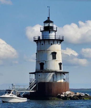
1883. Active; focal plane 55 ft (17 m); white flash every 2.5 s (red sector covers dangerous shoal). 58 ft round cast iron sparkplug tower, incorporating 3-story keeper's quarters, with lantern, two upper galleries and lower gallery, mounted on granite caisson; 250 mm lens. Lighthouse painted white with black trim, lantern black. Fog horn (two blasts every 30 s). Ivo Vinagre's photo is at right, C.W. Bash has a photo, Anderson has a good page for the lighthouse, Trabas has a photo, Mario Bruno has a 2021 photo, Marinas.com has aerial photos, Huelse has a historic postcard view, and Google has a satellite view and a distant street view from Conimicut Point Park in Warwick. Ownership of the lighthouse was transferred to the city of Warwick on 30 September 2004. In December 2005 the state Department of Transportation announced the award of $560,000 in federal transportation enhancement funds to restore the lighthouse, but with the subsequent downturn of the U.S. economy the grant was placed on long term hold. The city formed the Conimicut Lighthouse Foundation to manage and operate the lighthouse. In 2014 the city considered leasing the lighthouse to Nick Korstad, the owner of the Borden Flats Lighthouse in Massachusetts, who would renovate the tower and open it for overnight stays. In September 2015 the city advertised the project for bids. Korstad was one of two bidders but the process became imbroiled in local politics. The other bidder withdrew and Korstad's proposal was not considered. City officials toured the light in August 2016 but reached no conclusions. Korstad later left New England to take ownership of the Big Bay Lighthouse in Upper Michigan. In April 2022 the city received a federal grant of $775,000 to cover an estimated $1 million needed to restore the lighthouse. Bids were requested in early 2023 and the project was expected to start before the end of the year. Located on a shoal in mid-river; good views from Conimicut Point Park in Warwick. Accessible only by boat. Site and tower closed. Owner/site manager: City of Warwick. . ARLHS USA-188; Admiralty J0590; USCG 1-18305.

Conimicut Light, Warwick, April 2023
Google Maps photo by Ivo Vinagre
Warwick (2)
1932 (station established 1826). Active; focal plane 66 ft (20 m); green light occulting every 4 s, day and night. 51 ft (15.5 m) round steel tower with lantern and gallery; 250 mm light (1985). Fog horn (2 s blast every 15 s). The 1-1/2 story wood Victorian keeper's house (1889) is used as Coast Guard housing. Buildings painted white, lantern black; roofs red. A 2022 photo is at right, Anderson has a page for the lighthouse with good photos, Trabas has an excellent closeup, Emily Fishman has a good 2020 photo, and Google has a street view and a satellite view. Huelse has a historic postcard view of the original lighthouse. After the 1938 hurricane the lighthouse was relocated 50 ft (15 m) inland to escape beach erosion. In September 2012 the officer occupying the keeper's house retired and the Coast Guard was considering whether to transfer ownership of the lighthouse. In 2023 the lighthouse became available for transfer under the National Historic Lighthouse Preservation Act (NHLPA). According to the General Services Administration "more than a dozen" organizations expressed interest in taking ownership, but the City of Warwick is a leading candidate. Located at the end of Warwick Neck Road in Warwick. Site and tower closed; there's a limited view from the gate at the end of Warwick Neck Road. Best views are from the water. Owner/site manager: U.S. Coast Guard. . ARLHS USA-871; Admiralty J0608; USCG 1-19345.

Washington County Lighthouses

North Kingstown (West Passage) Lighthouses
[Wickford Harbor]
1882. Inactive since 1930. The original lighthouse was a square wood tower attached to a 1-1/2 story keeper's house, mounted on a round pier. The lighthouse was demolished shortly after it was deactivated in 1930. An active light (focal plane 20 ft (6 m); green flash every 6 s) on a 15 ft (4.5 m) square cylindrical steel skeletal tower stands on remnants of the original stone foundation. Trabas has a closeup photo, D'Entremont has a photo (near the bottom of the page), and Google has a street view and a satellite view. Anderson has page with the history of the station, Holmes also has a page, and Huelse has a historic postcard view. Located off the south side of the entrance to the harbor. Site and tower closed. Owner/site manager: U.S. Coast Guard. ARLHS USA-891; Admiralty J0610; USCG 1-19135.

Warwick Light, Warwick, June 2022
Instagram photo by soulpneuma
Poplar Point
1831. Inactive since 1882; charted as a landmark. 45 ft (14 m) octagonal wood tower with lantern and gallery, attached to a 1-1/2 story wood keeper's house. House painted gray, light tower white, lantern roof black. Anderson's page has several photos, Steven Thompson has a 2017 photo, Cheryl Judkins has a 2020 photo, E. Kibazze has a 2023 photo, and Google has a satellite view. Huelse has a historic postcard view. The light was moved to the new Wickford Harbor Light in 1882. The well-preserved light tower is the oldest surviving wooden lighthouse in the U.S. A private residence since 1894, the house has been much enlarged. In January 2010 the lighthouse and the surrounding estate were placed on the market for an eye-opening $7.5 million; this was reduced to $6.45 million in November 2011. The listing was taken down in November 2013. Located at the entrance to Wickford Harbor in North Kingstown. There's a good view from Sauga Point on the other side of the harbor entrance. Site and tower closed. Owner/site manager: private. . ARLHS USA-647.
Plum Beach
1899. Reactivated (inactive 1941-2003, now privately maintained); focal plane 54 ft ((16.5 m); white flash every 5 s. The base of the lighthouse is also floodlit at night. 53 ft (16 m) round cast iron sparkplug tower with lantern, double galleries above and lower gallery, incorporating 3-story keeper's quarters, and mounted on a cast iron caisson. A photo is at right, Anderson's page has "before" and "after" photos, Daryl Clark has a 2020 drone view, Trabas has a photo, C.M. Hanchey ihas a photo, Marinas.com has aerial photos, and Google has a street view and a satellite view. The light was deactivated because it was thought that construction of the first Jamestown Bridge, completed in 1940, made it redundant. Abandoned and rusting, the lighthouse spent years on the Lighthouse Digest Doomsday List. A long dispute over ownership was settled in favor of the State of Rhode Island in 1998, and in 1999 the Friends of Plum Beach Lighthouse received ownership and a $500,000 grant for restoration from the state. After several years of planning and preliminary work, the restoration project was carried out during the summer and fall of 2003. The Digest has a December 2003 feature article on the project. In 2010 the lighthouse was repainted using funds obtained through sales of the special license plate featuring the lighthouse. In 2015 a new, brighter LED beacon was installed, along with the solar-powered floodlights for the base of the lighthouse. The lighthouse was again repainted and refurbished in 2022. Located just north of the Jamestown Verrazzano Bridge (RI 138). Site and tower closed. Owner/site manager: Friends of Plum Beach Lighthouse. . ARLHS USA-604; Admiralty J0615; USCG 1-19130.

Plum Beach Light, North Kingstown, July 2021
Instgram photo by sherief_ri75

Narragansett Lighthouses
[Whale Rock]
1882. Inactive since 1938, when the cast iron sparkplug lighthouse was destroyed by the great hurricane of that year. Part of the cast iron and concrete caisson remains; Bill Lozano has a closeup street view and Google has a satellite view. Huelse has a historic postcard view of the lighthouse before the disaster and Holmes has a photo from the National Archives. In 2004 the wreckage of the lighthouse was discovered by undersea archaeologist David Robinson. Anderson has a page with the history of the station and Holmes also has a page. The shoal is now marked by a buoy with a light (green flash every 4 s) and a gong. Located on a dangerous ledge about 500 m (0.3 mi) offshore and one mile west of Beavertail Point on the other side of the West Passage. The ruins are visible from Beavertail Light and from the end of Cormorant Road on the mainland. ARLHS USA-883. Buoy: USCG 1-19090.
* Point Judith (3)
1857 (station established 1810). Active; focal plane 65 ft (20 m); white light displayed in an unusual pattern: 5 s on, 2 s off, 2 s on, 2 s off, 2 s on, 2 s off. 51 ft (15.5 m) octagonal brownstone tower with lantern and gallery; original 4th order Fresnel lens in use. Upper half of lighthouse painted brown, lower half white; lantern and gallery are black. Fog horn (2 s blast every 15 s). Active U.S. Coast Guard Station. The keeper's house was demolished in 1954; the oil house (1917) and fog signal building (1923) survive. Abel Silva's photo is at the top of this page, Anderson has a good page for the lighthouse, Britten has a photo, Trabas has an excellent photo, Atsushi Amemiya has a 2021 photo of the lighthouse in action, Ted Kerwin has a good 2007 photo, Marinas.com has aerial photos, Huelse has a historic postcard view, Richard Soares has a street view of the station, and Google has a satellite view. A $200,000 Coast Guard project restored the lighthouse during 2000; the lantern and lens were refurbished, glass replaced, and the brownstone tower repaired. Located at the end of RI 108 in Narragansett. Site open daily (free), tower closed. Owner/site manager: U.S. Coast Guard Station Point Judith . ARLHS USA-625; Admiralty J0628; USCG 1-19450.

New Shoreham (Block Island) Lighthouses
Block Island is a fragment of the same glacial ridge that forms the south fork of Long Island, New York. It is about 21 km (13 mi) south of the mainland and a similar distance east northeast of Montauk Point, New York. The island is accessible by ferry from Point Judith year round and in the summer also from New London, Connecticut, from Providence and Newport, Rhode Island, and from Montauk, New York. The permanent population is about 1400.
*** Block Island North (4)
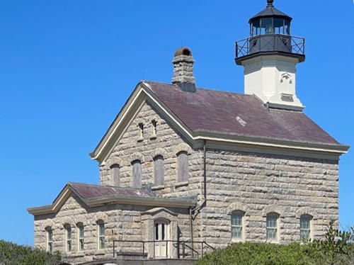
1868 (station established 1829). Reactivated (inactive 1973-1989 and 2003-2010; privately maintained); focal plane 58 ft (17.5 m); white flash every 5 s. 55 ft (17 m) octagonal cylindrical granite tower with lantern and gallery, attached "schoolhouse" style to the front of a 2-story granite keeper's house. There is a museum in the first floor of the building. The original 4th order Fresnel lens lens was returned to use in 2010. Light tower and lantern painted red; the rest of the building is unpainted granite. John Larochelle's 2022 photo is at right, Anderson's page has several photos, Trabas has Michael Boucher's closeup photo, Susan Voog has a 2021 photo, James Hatcher has a 2010 photo, Marinas.com has aerial photos, Huelse has a historic postcard view, James Gao has a 2018 street view, and Google has a satellite view. Other lighthouses of this "Long Island schoolhouse" design were built at Morgan Point, Sheffield Island, and Great Captain Island, Connecticut, and at Plum Island and Old Field Point, New York. When the lighthouse was deactivated it was transferred to the Fish and Wildlife Service. In an effort to stop persistent vandalism the Service sold the lighthouse in 1984 to the Town of New Shoreham for $1. The lighthouse was renovated in 1985-89 by the North Light Commission, efforts culminating in the return of the light on 5 August 1989. However, by 2000 it was clear that a thorough restoration of the entire building was needed. Fundraising began and in June 2002 the town received a $400,000 federal grant. Since the proposed work required temporary removal of the light tower the light was moved to a temporary skeletal tower in late 2003. In the spring of 2006 the Fresnel lens was restored for later reinstallation in the tower. In early 2008 Campbell Construction submitted the lowest bid for a $500,000 restoration of the lighthouse. The lantern was removed (as seen in a July 2008 photo) for restoration on the mainland. Dan Paquette's July 2009 photo shows the lantern restored and work on the building ongoing. The lighthouse was relit on 23 October 2010. Located at the north point of the island within the limits of the Block Island National Wildlife Refuge. Accessible by an easy 0.5 mile (0.8 km) trail from the end of Corn Neck Road. Site and museum open daily late June through mid September and on weekends late May to late June and mid September until mid October, tower closed. Owner: Town of New Shoreham. Site manager: Block Island North Light Commission. . ARLHS USA-061; Admiralty J0642; USCG 1-19481.

Block Island North Light, New Shoreham, August 2022
Instagram photo by John Larochelle
**** Block Island Southeast
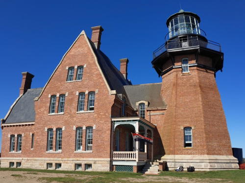
1875. Reactivated (inactive 1990-1994); focal plane 261 ft (79.5 m); green flash every 5 s, day and night. 52 ft (16 m) octagonal cylindrical brick tower with lantern and double gallery, attached to a massive, 2-1/2 story brick Gothic double keeper's house; 1st order Fresnel lens (1856, removed from Cape Lookout NC in 1980 and installed here in 1994). The tower and keeper's house are unpainted red brick; lantern and watch room painted black. Fog horn (3 s blast every 30 s). Rik Berghorn has the 2021 closeup seen at right, Anderson has a fine page for the lighthouse, Trabas has Klaus Kern's photo, a good 2018 photo is available, Marinas.com has aerial photos, Huelse has a historic postcard view, and Google has a satellite view. This is the highest light in New England. Designed as a showpiece for the Lighthouse Board, this impressive building is recognized as a National Historic Landmark. The entire 4-million-pound (1.8 million kilogram) structure was relocated 360 feet (110 m) in 1993 to escape erosion of the bluffs. In 1999 the lighthouse received $475,000 for restoration and in 2000 another $300,000 was received. The New England Lighthouse Lovers donated another $40,000 in October 2003. The restoration began in August 2003 and was completed in the summer of 2005. In July 2017 the National Park Service awarded the lighthouse a $105,000 Maritime Heritage grant. Abcore Restoration completed restoration of the exterior of the light tower in 2019. Interior restoration was in progress in 2020 and half of the duplex keeper's quarters opened as the Southeast Lighthouse Museum in July 2021. In December 2021 the Champlin Foundation granted $110.450 for window restoration. Located on the Mohegan bluffs at the southeast corner of the island. Site open; lighthouse and museum (free) open daily from Memorial Day (late May) through Labor Day (early September), then weekends to Columbus Day, (mid October); tower open (fee) when staff are available to lead guided tours. Owner/site manager: Block Island Southeast Lighthouse Foundation. . ARLHS USA-062; Admiralty J0650; USCG 1-0640.

Block Island Southeast Light, New Shoreham, September 2021
Google Maps photo by Rik Berghorn

Westerly Lighthouse
** Watch Hill (2)
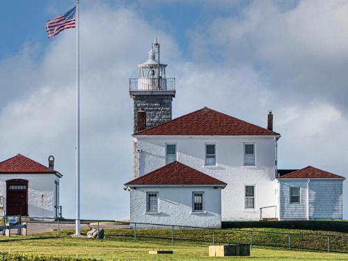
1857 (station established 1807). Active; focal plane 61 ft (20.5 m); flash every 2.5 s, alternating red and white. 45 ft (14 m) square cylindrical unpainted granite tower with lantern and gallery, attached to a 2-story brick keeper's house; VRB-25 lens. The lantern is painted white with a red roof. Fog horn (3 s blast every 30 s). The keeper's house (painted white with a red roof) houses a resident caretaker. There is a small museum in the oil house; the original 4th order Fresnel lens and its rotating mechanism are on display. Active fog signal building (1909). A 2023 photo is at right, Anderson's page has excellent photos, Trabas has a good photo, a 2008 photo is available, Jay Harty has a 2021 closeup, Huelse has a historic postcard view, Scott Michelson has a wintry street view of the station, and Google has a satellite view. Sibling of the Beavertail Light (see above). After the station was automated and destaffed in 1986 the Watch Hill Lighthouse Keepers formed and secured a lease to maintain the property. In August 2020 the Coast Guard announced it would make the lighthouse available for transfer and in 2021 the lighthouse did become available for transfer under NHLPA and in June 2023 the National Park Sevice recommended it be transferred to the Lighthouse Keepers. In August 2023 several residents and the Westerly Town Council raised questions about public access; it's not clear who owns the road to the lighthouse. In January 2024 the lighthouse was officially transferred to the Lighthouse Keepers, but the public access questions have not been answered. Located on Watch Hill Point at the end of Lighthouse Road in Westerly. The only parking at the lighthouse is for senior citizens and the disabled; other visitors must walk from town (about 15 minutes each way). Site open year round; museum open Tuesday through Thursday afternoons during July, August, and the first week of September; tower closed. Owner/site manager: Watch Hill Lighthouse Keepers Association. . ARLHS USA-872; Admiralty J0658; USCG 1-19795.

Watch Hill Light, Westerly, September 2023
Instagram photo by Jay McAnally

Information available on lost lighthouses:

Notable faux lighthouses:

Adjoining pages: East: Southern Massachusetts | West: Connecticut

Return to the Lighthouse Directory index | Ratings key

Posted May 16, 2001. Checked and revised June 12, 2024. Lighthouses: 21. Site copyright 2024 Russ Rowlett and the University of North Carolina at Chapel Hill.