Lighthouses of Tuvalu

Tuvalu is a Polynesian nation in the central Pacific Ocean, north of Fiji and northwest of Samoa. The country consists of nine atolls and reefs having a total population of less than 12,000. Funafuti atoll is the capital. Colonized by the British as the Ellice Islands in 1892, Tuvalu became part of the colony known as the Gilbert and Ellice Islands in 1916. Following a 1974 referendum the two halves of the colony parted ways, with the Gilbert Islands becoming Kiribati and the Ellice Islands becoming independent as Tuvalu in 1978.

Navigational aids are the responsibility of the Marine and Port Services Department. New Zealand has assisted with the installation of modern aids.

Admiralty numbers are from volume K of the Admiralty List of Lights & Fog Signals. U.S. NGA List numbers are from Publication 111.

General Sources
Online List of Lights - Tuvalu
Photos by various photographers posted by Alexander Trabas.
Navionics Charts
Navigation chart information for Tuvalu.


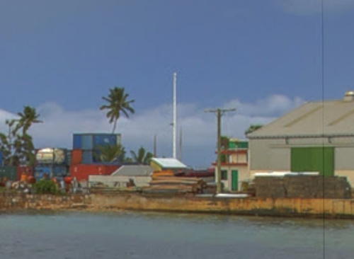
Fongafale Light, Funafuti, February 2014
Google Maps photo by Nick Hobgood
Funafuti Lighthouses
Funamanu
Date unknown. Active; focal plane 20 m (66 ft); white light, 2 s on, 3 s off. 19 m (62 ft) octagonal column colored green. No photo available but Google has a satellite view. Located on Funamanu, an islet on the north side of the lagoon entrance on the southeast side of Funafuti atoll. Accessible only by boat. Site open, tower closed. Admiralty K4766.
* Fongafale
Date unknown. Active; focal plane 20 m (66 ft); white light, 2 s on, 3 s off. 19 m (62 ft) octagonal column colored white. Nick Hobgood's photo is above and Google has an indistinct satellite view. The Admiralty spells the name as Fongfale. Located at the Funafuti International Port in Fongafale, the principal town of Funafuti atoll and seat of government for Tuvalu. Site open, tower closed. Admiralty K4768.

Vaitupu Lightbeacon
[Vaitupu]
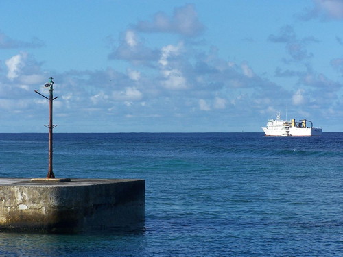
Date unknown. Active; focal plane about 6 m (20 ft); green light, characteristic unknown. 5 m (17 ft) pole. A photo is at right and Google has a satellite view. Vaitupu is an atoll with a population of about 1600. There's no harbor for large ships, so passengers from interisland ferries are brought ashore on small craft. Located on the north mole of the small boat harbor of Vaitupu. Site open. Not listed by the Admiralty.

Information available on lost lighthouses:

Notable faux lighthouses:

Vaitupu Light
Vaitupu Light and interisland ferry Monu Folau, March 2006
Wikimedia public domain photo by Cesqld

Adjoining pages: Southeast: Samoa | South: Wallis and Futuna | Northwest: Kiribati

Return to the Lighthouse Directory index | Ratings key

Posted October 18, 2020. Checked and revised October 28, 2021. Lighthouses: 2. Site copyright 2021 Russ Rowlett and the University of North Carolina at Chapel Hill.