Lighthouses of the United States: Virginia

The United States of America is a federal union of 50 states and a capital district. The central east coast state of Virginia includes the southern half of the Chesapeake Bay and the wide estuaries of the Rappahannock, York and James Rivers that empty into the bay. Hampton Roads, at the mouth of the James, is one the largest U.S. harbors and the home port of the U.S. Navy's Atlantic Fleet. East of the Chesapeake, Virginia also includes the southernmost portion of the Delmarva Peninsula, known to Virginians as the Eastern Shore.

The nation's second-tallest lighthouse is in Virginia and there are three towers surviving from the early Federal period. Unfortunately, Virginia has lost all of the cottage screwpile lighthouses that formerly guided mariners on the Chesapeake Bay and the three major estuaries. Two replicas have been built to remind us of these lights.

Navigational aids in the United States are operated by the U.S. Coast Guard but ownership (and sometimes operation) of historic lighthouses has been transferred to local authorities and preservation organizations in many cases. Virginia lights are the responsibility of the Coast Guard's Sector Virginia based in Portsmouth. Also the home of the Coast Guard's Atlantic Area command, Portsmouth calls itself the Coast Guard City.

ARLHS numbers are from the ARLHS World List of Lights. Admiralty numbers are from volume J of the Admiralty List of Lights & Fog Signals, and USCG numbers are from Vol. II of the U.S. Coast Guard Light List.

General Sources
Chesapeake Chapter of the U.S. Lighthouse Society
The society works for the preservation of lighthouses throughout Virginia and Maryland; its web site includes a Lighthouse Heritage section with information on the lighthouses.
Virginia Lighthouses
Outstanding photos, directions, and historical accounts by Kraig Anderson.
Online List of Lights - U.S. East Coast
Photos by various photographers posted by Alexander Trabas.
Virginia, United States Lighthouses
Aerial photos posted by Marinas.com.
Chesapeake Bay Lighthouse Project
This site by Matthew Jenkins has excellent photos and brief accounts of the lighthouses.
Lighthouses in Virginia
Photos by various photographers available from Wikimedia.
Leuchttürme USA auf historischen Postkarten
Historic postcard images posted by Klaus Huelse.
U.S. Coast Guard Navigation Center: Light Lists
The USCG Light List can be downloaded in pdf format.
NOAA Nautical Charts
Nautical charts for the coast can be viewed online.


Assateague Light, Chincoteague, August 2023
Instagram photo by Michael Gatti
Eastern Shore Lighthouses

The two counties of Virginia's Eastern Shore occupy the southern tip of the Delmarva Peninsula, which separates Chesapeake Bay from the Atlantic Ocean. The region was quite remote formerly but since 1964 the Eastern Shore has been connected to the rest of the state by the 23 mile (37 km) long Chesapeake Bay Bridge-Tunnel (US 13).

Accomack County Oceanside Lighthouses
** Assateague (2)
1867 (station established 1833). Active; focal plane 154 ft (47 m); 2 white flashes every 5 s. 142 ft (43 m) "early classic" round brick tower with lantern and gallery, DCB-236 aerobeacon (1961). Tower painted with red and white horizontal bands; lantern roof is black. The original 1st order Fresnel lens (restored during 2000-01) is on display at the Museum of Chincoteague Island in Chincoteague. The 2-story concrete keeper's house (1910) now houses wildlife refuge seasonal staff. The oil house (1891) also survives. Michael Gatti's 2023 photo is at the top of this page, the national wildlife refuge also has a page, Andrew Ciesla has a 2023 photo, C.M. Hanchey has a 2008 photo, Wikimedia has photos, Trabas has a photo by Brown Trout Publishing, Eric Morris has a street view, and Google has a satellite view. In 2004 ownership of the light station was transferred to the U.S. Fish and Wildlife Service. The Chincoteague Natural History Association helps to maintain the lighthouse and provides public access. The refuge visitor center, nearby, also serves as an information center for the lighthouse. In June 2006 a section of the cast iron gallery fell and the lighthouse was closed for the rest of the season. It reopened for 2007. A $1.5 million restoration project began in the spring of 2009. Work was done in phases as funds become available; during 2010 International Chimney Corporation restored the lower gallery deck and portions of the lantern room. Work was completed in the summer of 2013 and included repainting the tower. Paulo Ordoveza has a July 2013 photo taken as the project was being finished. The 150th anniversary of the lighthouse was celebrated in October 2017. Located near the road from Chincoteague to the Assateague Island beach, accessible by a short walk. Site open (refuge entry fee), tower open daily June through September and on weekends in April, May, October, and November. Owner: U.S. Fish and Wildlife Service (Chincoteague National Wildlife Refuge). Site manager: Chincoteague Natural History Association. . ARLHS USA-021; Admiralty J1364; USCG 2-0275.
Killock Shoal (2)
1939 (station established 1886). Inactive; charted as an obstruction. This was an 30 ft (9 m) square skeletal tower centered on the platform of the original lighthouse, a square tower rising from a 1-1/2 story wood keeper's house. Google's distant 2023 street view from the VA 175 bridge shows that the tower is gone; earlier street views confirm that it was removed or it collapsed between 2016 and 2019. Google also has a satellite view. The historic lighthouse was demolished when it was deactivated in 1939. The surviving structure appears dilapidated and dangerous. Located in Chincoteague Bay near the north entrance to Chincoteague harbor. Accessible only by boat. Site open, tower closed. ARLHS USA-422.

Northampton County Lighthouses
[Cape Charles (2)]
1864 (station established 1828). Inactive since 1895. This 150 ft (46 m) "early classic" brick tower collapsed into the sea in 1927. Rubble is visible in the surf. Located on uninhabited Smith Island, just north of the cape. Accessible only by boat. Site closed. Owner/site manager: Virginia Nature Conservancy (Virginia Coast Reserve). ARLHS USA-1059.
Cape Charles (3)
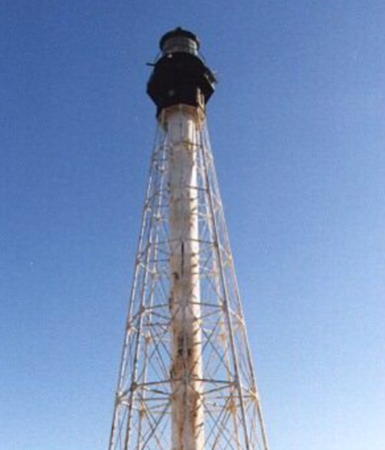
1895 (station established 1828). Inactive since 2013. 191 ft (58 m) octagonal pyramidal cast iron skeletal tower with central cylinder, lantern and gallery, solar-powered 190 mm lens. The original 1st order Fresnel lens is on display at the Mariner's Museum in Newport News. Tower painted white; the lantern and watch room are painted black. Sadly, the original 2-1/2 story shingle-style keeper's house was destroyed by a brush fire in July 2000. The brick coal house and brick generator building survive. A photo is at right, C.W. Bash has a distant view of the station, Trabas has a good photo, a 2014 photo and a distant view are available, and Google has a good satellite view. This little-known and rarely-visited tower is the second tallest U.S. lighthouse. Five lighthouses of this class were built, and two others survive, at Rawley Point, Wisconsin, and Hillsboro Inlet, Florida. The Coast Guard carried out a structural restoration of the tower in fall 2000. The Coast Guard abandoned this light after it failed in 2013, although it still continued to list the light as late as 2019. Endangered by the abandonment: in 2020 the lighthouse was placed on the Lighthouse Digest Doomsday List. Located on uninhabited Smith Island, just north of the cape. Accessible only by boat. Site and tower closed. Owner: U.S. Coast Guard. Site manager: Virginia Nature Conservancy (Virginia Coast Reserve). . ARLHS USA-109; ex-Admiralty J1404; ex-USCG 2-0350.

Cape Charles Light, Smith Island, February 2018
Instagram photo by Lighthouse On The Right
[Old Plantation Flats (3?)]
Date unknown. Active; focal plane 19 ft (6 m); white flash every 4 s. 19 ft (6 m) post. The original cottage screwpile lighthouse was demolished in 1962 but its foundation piers remain. Trabas has a photo but the light is not shown in Bing's satellite view. The lighthouse was replaced initially by a skeletal tower on the original platform. Located on a shoal off the mouth of Old Plantation Creek, near the start of the channel leading to the town of Cape Charles. Accessible only by boat. Site open. ARLHS USA-566; Admiralty J1552; USCG 2-21435.
* Old Plantation Flats (replica)
2004 replica of 1886 lighthouse. Active (privately maintained and unofficial); charted by C-Map as a landmark. 1-story square wood keeper's cottage with lantern and gallery centered on the roof. A reproduction of the original 4th order Fresnel lens is in use. 1942 fog bell (from a bell buoy). A 2020 photo by Mark Hiltz is at right, Ron Wrucke has a good 2007 photo, Laura Ezell has a closeup, and Google has a satellite view. This lighthouse was built by a resort developer after very careful research; it is considered to be a faithful reproduction. The Coast Guard has a historic photo of the original lighthouse, which was deactivated and demolished in 1962. The replica was constructed in an artificial pond just off the beach and adjacent to a golf course on Old Plantation Creek, about 2 miles (3.2 km) from the original location. In early 2014 settlement of a complicated lawsuit between the developers and Paul Galloway put the lighthouse in Galloway's ownership. In May Galloway put the lighthouse and 22 lots in the development up for auction sale. Located in the Bay Creek Resort off VA 184 near the town of Cape Charles. Site status unknown (the neighborhood is gated). Owner/site manager: private.
* Virginia Watermen's Memorial
2016. Active (unofficial but charted by C-Map); focal plane about 12 m (39 ft); continuous (?) red light. Approx. 9 m (30 ft) octagonal skeletal tower, legs painted white and top section and lantern painted black. A 2022 photo is available, Mike Dean has a 2020 photo, and Google has a satellite view. The lighthouse is designed as a small-scale replica of the Cape Charles lighthouse. Located on the waterfront of the town of Cape Charles. Site open, tower closed. Owner/site manager: Virginia Watermen's Memorial .

Old Plantation Flats Light replica, Cape Charles, July 2020
Google Maps photo by Mark Hiltz
Rappahannock Shoal Channel South Range Rear
1991. Active; focal plane 220 ft (67 m); continuous white light, day and night. 224 ft (68 m) hexagonal steel skeletal tower mounted on a caisson. The tower also carries a passing light (white flash every 6 s) at a focal plane of 33 ft (10 m). Trabas has a closeup photo, Larry Pollard has a view from the shore, and Google has a satellite view. Although this tower may not fit the traditional idea of a lighthouse it is the second tallest aid to navigation in the U.S. after the Perry Monument in Lake Erie. This is a southbound range. Located about 0.3 mi (500 m) offshore of Silver Beach, southwest of Jamesville. Accessible only by boat. There's a good view from the beach off the end of secondary route 613 (extension of VA 183). Owner/site manager: U.S. Coast Guard. ARLHS USA-1060; Admiralty J1702.91; USCG 2-7295.
Rappahannock Shoal Channel South Range Front
1991. Active; focal plane 34 ft (10.5 m); continuous white light, day and night. 36 ft (11 m) steel monopole supporting a square platform with a 1-story equipment building. Building painted white. The tower also carries a passing light (white flash every 6 s). Trabas has a distant photo and Bing has a satellite view. Located 4.15 mi (6.67 km) northwest of the front light. Accessible only by boat. Owner/site manager: U.S. Coast Guard. Admiralty J1702.9; USCG 2-7290.

Accomack County Bayside Lighthouses
Tangier Sound (1, 2)
1890. The lighthouse, a square cottage screwpile, was demolished in 1961 and replaced by a skeletal tower. The skeletal tower has also been removed but a square 1-story white equipment shelter remains on the original platform. The Coast Guard has a historic photo of the lighthouse. Located in the Chesapeake Bay at the end of the shoal extending southeast from Tangier Island. Accessible only by boat. Owner/site manager: U.S. Coast Guard. ARLHS USA-834.
Tangier Sound (3)
Date unknown. Active; focal plane 45 ft (13.5 m); white flash every 6 s (red sector covers dangerous shoal). 45 ft (13.5 m) square skeletal tower mounted on a square platform. Anderson has a 2021 photo and Google has a satellite view. Located adjacent to the historic lighthouse platform. Accessible only by boat. Owner/site manager: U.S. Coast Guard. Admiralty J1726; USCG 2-7435.

Northern Virginia Lighthouse

Alexandria City Lighthouse
** Jones Point
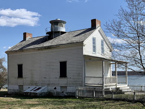
1856. Inactive since 1926; a decorative light is displayed. Approx. 20 ft (6 m) 1-1/2 story frame keeper's house with a small lantern on the roof, 155 mm lens. Lighthouse painted white; lantern is gray. The 5th order Fresnel lens is on display at the Lyceum history museum in Alexandria. The keeper's house remained in use until 1934; it is completely empty today. A 2013 photo is at right, Anderson has a fine page for the lighthouse, Jen Morrissey has a 2023 photo, Wikipedia has a page with several other photos, C.W. Bash has a 2004 photo, and Google has a good satellite view. This is a very unusual small river light; there is nothing else like it in the U.S. After it was deactivated the lighthouse was donated to the Daughters of the American Revolution, who maintained it for years with a caretaker living in the house. Much later the D.A.R. returned the property to the National Park Service, but from 1986 to 2012 the D.A.R.'s Mount Vernon Chapter had a management agreement for the lighthouse. The lighthouse was renovated and relit in 1995 with funds raised by the chapter. In 2000 architects and archaeologists studied the site as part of the preparations for replacing the nearby Woodrow Wilson Bridge (I-95). In September 2003 flooding by Hurricane Isabel damaged the steps and lower portion of the lighthouse. Anderson reports that the lighthouse has been vandalized repeatedly although it is in good condition today. In 2010 plans were announced for a major renovation of Jones Point Park including restoration of the lighthouse. In January 2012 the park service announced that restoration of the lighthouse was complete. The Mount Vernon Bicycle Trail passes the site. Located by the Potomac River in Jones Point Park on the southern edge of Alexandria. Site open daily; the park service offers interpretative events outside the lighthouse in the summer, but the interior is closed. Owner/ site manager: U.S. National Park Service (Jones Point Park). . ARLHS USA-409.

Jones Point Light, Alexandria, March 2022
Wikimedia Creative Commons photo by APK

Northern Neck Lighthouses

Virginia's Northern Neck is the peninsula between the Potomac and Rappahannock River estuaries. Because the Maryland-Virginia border is at the high tide mark on the Virginia shore the offshore lighthouses of the Potomac River are all in Maryland.

Northumberland County Lighthouses
[Palmer Cove]
Date unknown. Active (privately maintained); focal plane 19 ft (5.5 m); white flash every 4 s. 13 ft (4 m) octagonal white tower with lantern standing on a rectangular platform supported by piles. The tower is white with a black band under the lantern. Trabas has a photo and Google has a distant satellite view. This light must have been built by one or more area landowners. Located in the brach of the Yeocomico River north of Lottsburg near the western end of Northumberland County. Accessible only by boat. Site and tower closed. Owner/site manager: private. Admiralty J1816.5; USCG 2-16837.
Smith Point (4)
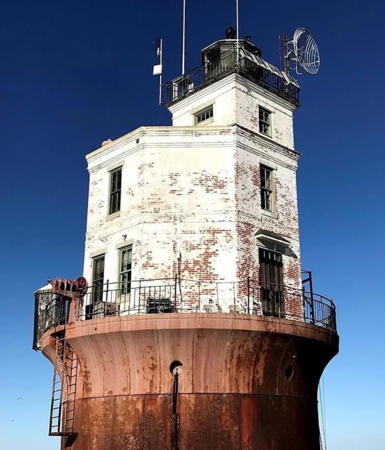
1897 (station established 1868; lightship station established 1821). Active; focal plane 52 ft (16 m); white flash every 10 s. 2-1/2 story octagonal brick keeper's house, mounted on an iron caisson, surmounted by a short square tower with lantern and gallery; DCB-24 aerobeacon. Lighthouse painted white, lantern black. Fog horn (2 s blast every 15 s) operates continuously. A 2024 photo is at right, Robert English has a closeup photo, Wikimedia has a 2012 photo, and the Coast Guard has a historic photo, but the lighthouse is not shown in Google's satellite view. This lighthouse replaced an 1868 screwpile lighthouse destroyed by ice in 1895. Earlier lighthouses were built onshore in 1802 and 1828 but the latter, endangered by erosion, was discontinued in favor of the lightship in 1859. A sibling of Wolf Trap Light (see below), the present lighthouse was repaired by the Coast Guard in 1991. In 2003-04 the lighthouse was offered for transfer under NHLPA, but there were no applications. In October 2005 the lighthouse was sold on eBay for $170,000 to Dave and Teri McNally of Winona, Minnesota. The McNallys intended to use the lighthouse as a vacation home. The McNallys made substantial renovations to the interior and maintained the lighthouse in good condition. They put the lighthouse up for sale in March 2012, asking $499,999. The lighthouse was still for sale as of June 2017 with the price reduced to $399,000. In 2018 the listing was withdrawn but in 2024 the lighthouse was back on sale for $450,000. Located in the Chesapeake off the mouth of the Potomac. Accessible only by boat; tours from Hoopers Island, Maryland, are available. Site and tower closed. Owner/site manager: private. . ARLHS USA-764; Admiralty J1790; USCG 2-7480.
#Great Wicomico River (2?) (?)
Date unknown (station established 1889.) Inactive since 2015. The lighthouse, a hexagonal cottage screwpile, was demolished in 1967. The last light was a steel skeletal tower built on the original screwpile foundation. Trabas has a photo and Anderson's page for the lighthouse has photos of the original lighthouse and the skeletal tower. The light and the screwpile platform were removed; the current USCG chart 12225 shows "stakes" at the location. Located in the Chesapeake Bay southeast of Fleeton, off the mouth of the river. Accessible only by boat. Owner/site manager: U.S. Coast Guard. ARLHS USA-351; ex-Admiralty J1772; ex-USCG 2-7475.

Smith Point Light, Potomac River entrance, May 2024
Google Maps photo by Ricky L

Lancaster County Lighthouse
[Windmill Point (3)]
2008 (station established 1869; lightship station established 1834). Active; focal plane 34 ft (10.5 m); white flash every 6 s. 34 ft (10.5 m) square skeletal tower supported by a round pier; the tower carries diamond-shaped daymark panels colored in a red and white checkerboard pattern. Anderson has a 2021 photo, Trabas has a very distant view, and Bing has a satellite view. The original lighthouse, a hexagonal cottage screwpile, was dismantled in 1965 and the screwpile platform was removed in 2008. Riprap and portions of the foundation are visible at low tide. A fog bell from the lighthouse is displayed at the Windmill Point Resort and Marina in White Stone. Located at the end of a long shoal extending from Windmill Point, on the north side of the entrance to the Rappahannock River. Accessible only by boat. Owner/site manager: U.S. Coast Guard. ARLHS USA-898; Admiralty J1644; USCG 2-7330.

Middle Peninsula Lighthouses

Virginia's Middle Peninsula is the peninsula between the Rappahannock and York River estuaries.

Middlesex County Lighthouses
[Stingray Point (3?)]
Date unknown (station established 1858). Active; focal plane 34 ft (10.5 m); white flash every 4 s. 34 ft (10.5 m) square skeletal tower supported by a round pier; the tower carries diamond-shaped daymark panels colored in a red and white checkerboard pattern. Anderson has a 2021 photo, Trabas has a distant view, and Bing has a satellite view. The Coast Guard has a historic photo of the original lighthouse, which was demolished after being deactivated in 1965. The lighthouse was replaced by a mast on the original platform, but the platform has since been removed. Riprap and portions of the foundation are visible. A replica of the original lighthouse (next entry) was built onshore. Located at the end of a long shoal extending from Stingray Point, on the south side of the entrance to the Rappahannock River. Accessible only by boat. Owner/site manager: U.S. Coast Guard. ARLHS USA-812; Admiralty J1642; USCG 2-7325.
*** Stingray Point (replica)
2003 (replica of the 1858 lighthouse). Inactive (a decorative light is displayed). 1-story hexagonal wood keeper's cottage with lantern centered on the roof. 5th order drum-style Fresnel lens (origin unknown). Darci Hillyer's 2023 photo is at right, Tyler Cook has a closeup, R.W. Dawson has a fine 2012 photo, Lighthouse Digest has Jeremy D'Entremont's article on the building of the lighthouse, and Google has a satellite view. The Coast Guard has a historic photo of the original lighthouse, which was demolished after being deactivated in 1965. The lighthouse is a museum and also serves as the office of the Stingray Point Marina in Deltaville. A fog bell and a bell striking mechanism are on display. This is an accurate replica, built from the original plans by marina owners Brent Halsey and Jimmy Rogers. Located off VA 33 in Deltaville, 1.6 miles (2.5 km) west of the original site in the Bay. Site and lighthouse open daily, whenever the marina office is staffed. Owner/site manager: Stingray Point Marina.


Stingray Point Light replica, Deltaville, October 2023
Instagram photo by Darci Hillyer


Mathews County Lighthouses
Wolf Trap (2)
1894 (station established 1870). Inactive since 2017. 2-1/2 story octagonal red brick keeper's house, mounted on an iron caisson, surmounted by a short square tower with lantern and gallery; solar-powered VRB-25 aerobeacon. Lighthouse painted fire-engine red, lantern black. A 2020 photo is at right, Anderson has an excellent page for the lighthouse, Emory Minnick has a 2019 photo, Trabas has a closeup, and the Coast Guard has a 1955 photo, but the lighthouse is not shown in Google's satellite view. This lighthouse replaced an 1870 screwpile lighthouse destroyed by ice in 1892. Endangered. In 2003-04 the lighthouse was offered for transfer under NHLPA, but there were no applications, and in October 2005 the lighthouse was sold at auction for $75,000 to Nick Korstad of North Plains, Oregon. Korstad contributed a 2005 photo of his purchase. In early 2007, after failing to secure loans for restoration of the lighthouse as a bed and breakfast, Korstad sold the lighthouse for $115,000 to James H. Southard, Jr. of Charleston, South Carolina. In 2007 Southard replaced the roof of the lighthouse but it seems he did little else to restore it. In 2012 the lighthouse was once again for sale, this time for $249,000. It was still listed for sale in March 2017 but it is now off the market. In April 2017 the Coast Guard condemned the lighthouse as too dangerous for its crews to enter and abandoned the light; a buoy (green flash every 4 s) was placed in its stead. Lighthouse Digest responded by adding the lighthouse to the Doomsday List. In March 2023 the lighthouse sold for $125,000 to Richard Cucé, who also owns the Hooper Island Lighthouse in Maryland; Cucé announced plans to restore the building using his experience as a contractor. Located on a dangerous shoal in the Chesapeake south of the mouth of the Rappahannock. Accessible only by boat. Site and tower closed. Owner/site manager: private. . ARLHS USA-903; ex-Admiralty J1618; buoy: USCG 2-7255.


Wolf Trap Light, Chesapeake Bay, September 2020
Instagram photo by Oldhouses.com

New Point Comfort
1806 (Elzy Burroughs). Reactivated (inactive 1963-2021, now privately maintained; focal plane 58 ft (17.5 m); white flash every 5 s. 58 ft (17.5 m) early Federal octagonal sandstone tower with lantern and gallery. Sibling of Old Point Comfort (a different site, about 30 miles (50 km) to the south). Lighthouse painted white, lantern black. Keeper's quarters destroyed. A photo is at right, William Brown has a 2017 photo, Mike Henrie has a 2020 photo, the state has a page for the lighthouse, the Coast Guard has a good historic photo of the light station, and Google has a satellite view. The tower was renovated in 1988, severely vandalized in 1994, then repaired and briefly relit on 12 December 1999. The lighthouse was moldy from being long closed and the cast iron was badly corroded; the lighthouse was added to the Lighthouse Digest Doomsday List. A local group called the New Point Comfort Lighthouse Preservation Task Force was formed to work toward a complete restoration of the structure. In 2002 the Virginia General Assembly budgeted $56,742 to develop a master plan for saving the lighthouse and opening it to the public. In 2003 the Army Corps of Engineers agreed to include a study of protecting the structure as part of a larger study of erosion problems on the Chesapeake. In 2004 the county constructed a pier to provide access to the lighthouse. In 2007 the preservation group announced a $750,000 plan to place a wall of granite boulders around the lighthouse. In June 2009 the county applied for permits to construct the wall, and in July 2010 a $424,000 grant from federal transportation funds supposedly completed funding for the project. Construction was scheduled then for 2011 but it was not carried out until 2012-13. In March 2015 the county received a $35,000 grant from the National Park Service to build a new dock at the lighthouse; the pier was completed in April 2016. The county had access to $1.6 million in federal transportation funds to restore the lighthouse and bids for the work were sought in July 2016. A relighting ceremony in October 2021 concluded several years of restoration work, much of it by volunteers. In March 2022 the Digest removed the lighthouse from the Doomsday List. Located on a very small island in the Chesapeake Bay off the point. Accessible only by boat. There's a good view from the observation platform at the Nature Conservancy's New Point Comfort Preserve, located at the end of secondary route 600 off VA 14 south of Bavon. Tours are sometimes available; check at the county's visitor center. Site open, tower normally closed. Owner/site manager: Mathews County (New Point Comfort Lighthouse ). ARLHS USA-543; Admiralty J1616.5; USCG 2-14077.
York Entrance East Range Rear
Date unknown. Active; focal plane 56 ft (17 m); white light, 3 s on, 3 s off, during the daytime a continuous white light visible only on the range line; also two passing lights (white flash every 4 s) at a focal plane of 16 ft (5 m). 56 ft (17 m) square skeletal tower mounted on a platform supported by piles. Trabas has a distant view and Bing has a satellite view. This range guides vessel leaving the York River. The front light is on a much shorter tower. Located in the Bay about 5 km (3 mi) southeast of the southeastern tip of Mathews County. Accessible only by boat. Owner/site manager: U.S. Coast Guard. Admiralty J1507.1; USCG 2-13497.

New Point Comfort Light, Bavon, June 2018
ex-Google Maps photo by Jason P

Gloucester County Lighthouses
[York Spit (3)]
Date unknown (station established 1870; lightship station established 1855). Active; focal plane 30 ft (10 m); white flash every 6 s. 30 ft (9 m) post carrying several diamond-shaped daymark panels. Anderson has a good page for this lighthouse, another page is available, and Bing has a satellite view. The historic lighthouse was dismantled and replaced by a square skeletal tower in 1960. The platform and skeletal tower were overthrown by a hurricane but the skeletal framework that supported the platform is still visible. Located at the end of the York Spit shoal on the north side of the entrance to the York River estuary. Accessible only by boat. Site open, tower closed. ARLHS USA-909; Admiralty J1504; USCG 2-13455.
#Pages Rock (2)
1967 (station established 1893). Demolished. The lighthouse, a hexagonal cottage screwpile, was demolished in 1967. The replacement light, on a steel skeletal tower built on the original screwpile foundation, was deactivated sometime before 2010. The light was listed as a daybeacon until 2015, when the collapsing platform was removed. Trabas has a photo of the empty platform but nothing is seen now in Google's satellite view. Located in the York River off Blundering Point on the northeast side of the estuary, about 5 miles (8 km) north of Yorktown. Accessible only by boat. Owner/site manager: U.S. Coast Guard. ARLHS USA-577; ex-Admiralty J1544; ex-USCG 2-13875.

King and Queen County Lighthouse
Bells Rock (2?)
Date unknown (station established 1881). Active; focal plane 40 ft (12 m); white flash every 4 s (with a large red sector covering shoals). The lighthouse, a hexagonal cottage screwpile, was demolished in 1928. The current light is a steel skeletal tower built on the original screwpile foundation. Trabas has a photo and Google has a satellite view. Located near the center of the river about 3 miles (5 km) southeast of West Point. Visible from the end of secondary route 666 at Belleview on the east side of the river. Accessible only by boat. Owner/site manager: U.S. Coast Guard. ARLHS USA-051; Admiralty J1549; USCG 2-13995.

Hampton Roads Area Northside Lighthouses

York County Lighthouse
York Entrance West Range Rear (1)
Date unknown. Inactive. Approx. 75 ft (23 m) square skeletal tower mounted on a platform supported by piles. No photo available but Google has a satellite view. Located on the range line about 575 ft (175 m) west southwest of the active light.
York Entrance West Range Rear (2)
Date unknown. Active; focal plane 57 ft (17.5 m); white light, 3 s on, 3 s off, visible only on the range line; also two passing lights (white flash every 4 s) at a focal plane of 15 ft (4.5 m). 57 ft (17.5 m) square skeletal tower mounted on a platform supported by piles. Trabas has a photo and Google has a satellite view. This is an entrance range for the York River. The front light is on a much shorter tower. Located just off the riverbank a short distance east of the Yorktown Battlefield. Accessible only by boat. Owner/site manager: U.S. Coast Guard. Admiralty J1508.1; USCG 2-13555.
#Tue Marshes (2)
1875. Inactive since 2012. The original lighthouse, a square cottage screwpile, was demolished in 1960. It was replaced by a steel skeletal tower built on the original screwpile foundation; but that light was deactivated in 2012 and the platform was demolished in 2015. No photo available and the platform is no longer seen in Google's satellite view. Located in the Chesapeake Bay just east of Tue Point, the southern entrance to the York River. Accessible only by boat. Owner/site manager: U.S. Coast Guard. ARLHS USA-856; ex-Admiralty J1510; ex-USCG 2-13505.

Hampton City Lighthouses
Hampton is a city of about 135,000 residents facing the north side of Hampton Roads. It has no commercial port facilities; instead it is best known for the Langley Air Force Base and NASA Researh Center on the north side of the city.
[Back River (Grandview)]
1829 (Winslow Lewis). Inactive since 1936. This 30 ft (9 m) oldstyle brick tower was destroyed by Hurricane Flossy in 1956. Ruins are visible in the water just offshore; Adam Cheskey has a distant street view and Google has a satellite view. Located off the end of Lighthouse Road in the Grand View section of Hampton, about 6 miles (10 km) north of Old Point Comfort. Site open. ARLHS USA-025.
Norfolk Entrance Reach Range Rear
Date unknown. Active; focal plane 60 ft (18 m); white light occulting once every 4 s. The tower also carries a passing light (focal plane 15 ft (4.5 m); white flash every 4 s). 60 ft (18 m) square cylindrical skeletal tower mounted on a square platform supported by piles. Trabas has a distant photo; the front light is seen on a shorter tower at the left. Bing has a satellite view. This range guides vessels departing Hampton Roads. Located about 2.5 km (1.5 mi) east of Buckroe Beach in Hampton. Accessible only by boat; there's a distant view from shore. Owner/site manager: U.S. Coast Guard. Admiralty J1419.1; USCG 2-9375.
* Old Point Comfort (Fort Monroe)
1802 (Elzy Burroughs). Active; focal plane 54 ft (16.5 m); 2 red flashes, separated by 2 s, every 12 s; white sector to the southeast. 58 ft (17.5 m) early Federal octagonal sandstone tower with lantern and gallery, 4th order Fresnel lens (installed in the 1890s). The lighthouse is painted white with green trim; the lantern is painted green with a red roof. The 2-1/2 story Queen Anne Victorian wood keeper's house (1900) was a non-commissioned officer's residence for many years. A photo is at right, Anderson has good page for the light station, Trabas has a photo by Capt. Theo Hinrichs, Jerry Gammon has a 2012 photo, Wikimedia has several good photos, Marinas.com has aerial photos, Huelse has a historic postcard view, and Google has a 2023 street view (seen at right) and a satellite view of the station. A very well preserved lighthouse, restored in the late 1990s. Located in Fort Monroe, an active Army post until the base was closed in September 2011. In November 2011 the property was designated as a national monument and transferred to the national park system. Site open, tower closed. Owner: U.S. Coast Guard. Site manager: U.S. National Park Service (Fort Monroe National Monument). . ARLHS USA-567; Admiralty J1420; USCG 2-9380.

Old Point Comfort Light, Hampton, January 2023
Google Maps street view by Virginia DOT
Fort Wool
Date unknown. Inactive since 2016. This was a beacon mounted atop a square concrete pillbox fortification at Fort Wool, one of the historic forts protecting the entrance to Hampton Roads. Trabas has a photo and Google has a satellite view. The light has been removed. Located on an island adjoining the south portal of the Hampton Roads Bridge-Tunnel (I-64) in the middle of the entrance to Hampton Roads, opposite Old Point Comfort. The island is closed due to deterioration of the structures. Site and tower closed. Owner: Commonwealth of Virginia. Site manager: City of Hampton (Fort Wool). ARLHS USA-1061; ex-Admiralty J1424; ex-USCG 2-9385.

Newport News City Lighthouses
Newport News is a city of about 190,000 residents west of Hampton; it faces southeast on Hampton Roads and southwest on the lower James River estuary. It has an important port known for exporting coal and it is the site of the Newport News Shipbuilding yard, builders of aircraft carriers and nuclear submarines for the U.S. Navy. The city is named for Christopher Newport, an English shipcaptain who brought the first English settlers to Virginia in 1607 and also led several crucial resupply voyages during the first years of the struggling colony.
Newport News Middle Ground
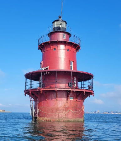
1891. Active; focal plane 52 ft (16 m); red flash every 10 s. 2-1/2 story round sparkplug-style cast iron tower with lantern and three galleries, incorporating a 3-story keeper's house, and mounted on an iron caisson; solar-powered 375 mm lens. The lighthouse is painted deep red, the lantern black. Robert Leary's 2022 photo is at right, Anderson has a good page for the lighthouse, Heath Cash has a closeup photo, Brent Cook has a 2023 photo. Trabas has an older closeup, the Coast Guard has a historic photo, and Google has a satellite view and a distant street view from the Monitor-Merrimac Bridge-Tunnel (I-664). The lighthouse was dented in a collision with the tugboat Capt. Jim in April 1979. The light was upgraded in 2000 in response to requests for a better light from pilots; after being located on a pole outside the tower since 1986, the light was returned to the lantern room and converted from white to red to make it more visible against the lights of the bridge behind the lighthouse. In July 2003 two nonprofit groups submitted applications for the lighthouse under NHLPA but neither application was accepted. As a result, in October 2005 the lighthouse was sold at auction for a bargain $31,000 to Robert Gonsoulin of Williamsburg, Virginia, with his wife, sister-in-law and brother-in-law; they worked to fix up the lighthouse as a "private retreat" for the extended family. By September 2007 Gonsoulin had spent over $60,000 to restore the lighthouse and make it habitable. Work continued and today the lighthouse is a comfortable vacation home with heat and air conditioning; this is certainly one of the most successful private restorations of a sparkplug lighthouse. . Located on a shoal off Newport News Point in Hampton Roads. Accessible only by boat but close to the Monitor-Merrimac Bridge-Tunnel; also visible from King-Lincoln Park near the north end of the bridge-tunnel. Site and tower closed. Owner/site manager: private (Middle Ground Lighthouse). . ARLHS USA-549; Admiralty J1458; USCG 2-10815.
#Deepwater Shoals (3)
1966 (station established 1855). Inactive since 2017. Skeletal tower mounted on the hexagonal platform of the 1867 lighthouse, which was demolished in 1966. No photo available but Google has a satellite view. In 2017 the Coast Guard abandoned the increasingly dilapidated platform and placed a post with a quick-flashing red light next to the ruins. Located in the James River estuary about 1 mile (1.6 km) northwest of Fort Eustis. Accessible only by boat. Site open, tower closed. Owner/site manager: U.S. Coast Guard. ARLHS USA-220. Active light: Admiralty J1475.9; USCG 2-11780.

James City County Lighthouse
Swann Point Shoal Channel Range Rear
Date unknown. Active; focal plane 62 ft (19 m); continuous green light. Approx. 59 ft (18 m) square cylindrical white skeletal tower. Trabas has a closeup photo and Google has a 2016 street view and a satellite view. The range guides eastbound vessels in a long reach in the James River. The front light is on tripod piles in the river. This light is at the historic Jamestown settlement between the reconstructed James Fort and the Colonial Parkway, but vegetation makes it hard to see from either side. Site open, tower closed. Owner/site manager: U.S. Coast Guard. Admiralty J1476.56; USCG 2-12135.

Middle Ground Light, Newport News, August 2022
Instagram photo by Robert Leary

James River Southside Lighthouses

Chesterfield County Lighthouse
[Dutch Gap Canal]
1875. Inactive since 1918. Foundations and brick chimney of an 1890 keeper's cottage remain. David Wheeler has a photo, Jennie Rodriguez has a photo showing the explanatory sign, and Google has a satellite view. The keeper tended two 27 ft (8 m) post lights, one at either end of the canal. Now called the Dutch Gap Cutoff, the canal cuts across an oxbow bend of the river and is about 4500 ft (1.4 km) long. The site is marked and preserved as part of an 800-acre (350-hectare) historical and conservation area that includes the site of the earliest English settlement in the area. Trabas has a photo of James River Light 151 (Admiralty J1478.05, USCG 2-12705), which is just offshore at the east entrance to the cutoff, near the location of the house. Located on the south bank of the river upstream from the I-295 bridge at the end of Coxendale Road. Site open. Owner: Chesterfield County. Site manager: Henricus Historical Park. ARLHS USA-1062.

Prince George County Lighthouse
Jordan Point (Range Rear) (3)
1941 (station established 1855; inactive 1927-1941). Inactive since 2021. 60 ft (18 m) cylindrical steel skeletal tower. Trabas has a photo and Google has a street view (also seen at right) and a satellite view. The range guides vessels westbound in a reach approaching Hopewell, a city of about 25,000 residents at the mouth of the Appomattox River on the south side of the James. The front light is mounted on tripod piles. The original lighthouse was demolished in 1875 when it was threatened by shoreline erosion. The Coast Guard has an 1885 photo and Huelse has a historic postcard view of the second lighthouse, a square "pepperpot" tower with a fog bell on one side. A new keeper's house was built in 1888. These buildings were abandoned in 1927 due to continuing shoreline erosion. Located just off the south approach to the Benjamin Harrison Bridge (VA 156) east of Hopewell. Site and tower closed (private property), although the light can be seen easily from the bridge. Owner/site manager: U.S. Coast Guard. ARLHS USA-995; ex-Admiralty J1477.11; ex-USCG 2-12420.

Surry County Lighthouse
Dancing Point Shoal Channel Range Rear
Date unknown. Active; focal plane 57 ft (17.5 m); continuous white light. 57 ft (17.5 m) square cylindrical skeletal tower mounted on a platform supported by piles. Trabas has a photo and Google has a satellite view. The range guides westbound vessels in a long reach in the James River (the same reach as the Swann Point Shoal light described above). The front light is mounted on tripod piles. Located just off the river bank about 4 km (2.5 mi east of Claremont. Accessible only by boat. Site open, tower closed. Owner/site manager: U.S. Coast Guard. Admiralty J1476.61; USCG 2-12240.

Jordan Point Light, Hopewell, May 2018
Google Maps street view

Isle of Wight County Lighthouse
[Point of Shoals (2)]
1871 (station established 1855). Inactive since 1933; charted as an obstruction. Hexagonal platform for the original lighthouse. No current photo available but Google has a satellite view. The lighthouse was deactivated and removed in 1933 when the newly-dredged Rocklanding Shoal Channel moved ship traffic in the James River several miles to the east. Located on the east side of the old Point of Shoals Channel off Rushmere. Accessible only by boat. Site open, platform closed (unsafe). Owner/site manager: U.S. Coast Guard. ARLHS USA-632.

Hampton Roads Area Southside Lighthouses

Portsmouth City Lighthouses
Portsmouth is a city of about 100,000 residents facing east on the Elizabeth River estuary at its junction with Hampton Roads. Its active port includes the U.S. Naval Shipyard.

*** Lightship 101 (WAL-524) Portsmouth
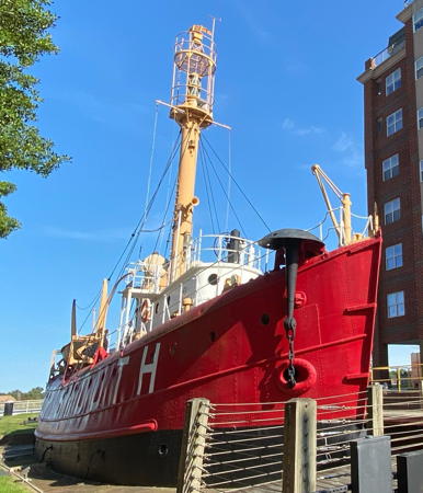
1916. Decommissioned 1962 (a decorative light is displayed). 360-ton steel ship, single-masted, length 101 ft (30.8 m), beam 25 ft (7.6 m). The light was displayed from the top of the mast. Hull painted red, superstructure painted white. A 2020 photo is at right, Anderson has a good page for the lightship, the Lightship Museum has a 2023 closeup photo, Kimberly Queen has a 2016 photo, Matthew Jenkins also has a page, and Google has a street view and a satellite view. The ship was stationed off Cape Charles, Virginia, in 1916-24, at the Overfalls station off Cape Henlopen, Delaware, in 1925-51, and on Stonehorse Shoal off Nantucket, Massachusetts, 1951-63. In 1964 the Coast Guard was preparing to sell the ship for scrap. Instead, Hampton Roads fishing boat captain Tony Panello towed the ship behind his own vessel from Nantucket to Portsmouth in order to save it. Renamed Portsmouth, the ship was donated to the city and opened as a museum in 1967. In 2004 the lightship reopened after an extensive restoration. In 2020-22 the ship had a second restoration and an upgrade in exhibits, restoring its interior to its 1955 appearance. It reopened in April 2023. Located on land at Water and London Streets, Portsmouth waterfront. Open Saturday and Sunday year round. Owner/site manager: Lightship Portsmouth Museum . ARLHS USA-663.
* [Hog Island (2) (lens)]
1896. Inactive since 1948 (decorative lighting is displayed day and night). Replica lantern with an original 1st order Henry-LePaute Fresnel lens. Giang Nguyen has a 2023 photo, a 2021 daytime photo and a nighttime photo are available and Google has a 2023 street view and a satellite view. The Hog Island lighthouse was located at Great Machipongo Inlet in Northampton County on the Eastern Shore. A pyramidal skeletal tower very similar to Cape Charles Light was built there in 1896, but it was demolished in 1948 because of continuing beach erosion in the area. The 1st order lens was displayed at the Mariner's Museum in Newport News until 1972. After being in storage for 30 years, it was restored and since 2004 it shines at the end of High Street on the Portsmouth waterfront, 2 blocks south of the lightship Portsmouth. Owner (lens): U.S. Coast Guard. Site manager: City of Portsmouth.

LV-101 Portsmouth, Portsmouth, September 2020
Instagram photo by aintnothing_andie

Norfolk City Lighthouse
Norfolk is a city of about 240,000 residents and the center of the Hampton Roads metropolitan area. It faces southwest on the Elizabeth River estuary, northwest on the south side of Hampton Roads, and north on the open waters of Chesapeake Bay. Its large U.S. Navy base facing Hampton Roads is the home port of the U.S. Atlantic Fleet.

Thimble Shoal (3)
1914 (station established 1872). Active; focal plane 55 ft (16.5 m); white flash every 10 s. 40 ft (12 m) round sparkplug-style cast iron tower, with lantern and upper and lower galleries, incorporating a 3-story keeper's house, and mounted on an iron caisson; solar powered RB-355 aerobeacon. The original 4th order Fresnel lens is on display at the USCG Training Center at Yorktown. Lighthouse painted red, lantern black. Fog horn (3 s blast every 30 s) operates continuously. A 2020 photo by Caleb Sanders is at right, Brody Williams has a 2020 closeup photo, Marinas.com has aerial photos, Lighthouse Digest has Judy Bloodgood Bander's article on the light station and its history, a long blog post has the history of the lighthouse, the Coast Guard has a historic photo, and Bing has a satellite view. Cottage screwpile lighthouses at this high-traffic location burned in 1880 and again in 1909, the second time after a collision with a ship. Huelse has a historic postcard view of the 1880 lighthouse. The present lighthouse was extensively restored by the Coast Guard in 1988, repainted and repaired in 1997, and placed on the National Register of Historic Places in 2002. In 2003-04 the lighthouse was offered for transfer under NHLPA, but there were no applications. In October 2005 the lighthouse was sold at auction for $65,000 to Peter Jurewicz of Smithfield, Virginia. Jurewicz grew up in the nearby Ocean View neighborhood of Norfolk and bought the lighthouse because he always wanted to visit it. It is now endangered: a 2021 photo shows the lighthouse in need of repainting, and Rick Parmelee's 2024 photo shows it in very poor condition. Located in the Chesapeake off Willoughby Spit, adjacent to the main channel into Hampton Roads. Accessible only by boat, but there are good views from the beach at many points of Willoughby Spit in the Willoughby-Ocean View neighborhood. Site and tower closed. Owner/site manager: U.S. Coast Guard. . ARLHS USA-842; Admiralty J1416; USCG 2-9310.

Thimble Shoal Light, Norfolk, June 2020
Google Maps photo by Caleb Sanders

Virginia Beach City Lighthouses
Virginia Beach is a large city (including all of the former Princess Anne County) that includes the suburbs of Norfolk and a popular resort area on the Atlantic beach south of Cape Henry, the southern entrance to Chesapeake Bay. The city's population is about 460,000, making it the most populous city in Virginia.

Little Creek Range Rear
Date unknown. Active; focal plane 76 ft (23 m); continuous green light visible only on the range line. 72 ft (22 m) square cylindrical skeletal tower. Trabas has a photo that shows this light in the center and the front light on the left, and Google has a satellite view. Little Creek, a harbor on the south side of the Chesapeake just east of Norfolk, is the headquarters of amphibious forces for the U.S. Atlantic Fleet. Until completion of the Chesapeake Bay Bridge-Tunnel in 1964 it was also the terminal for ferries crossing the Bay to the Eastern Shore. Located in the naval base on the east side of the former ferry terminal. Site and tower closed. Site manager: Joint Expeditionary Base Little Creek-Fort Story. Admiralty J1413.1; USCG 2-10500.
Little Creek East Jetty
Date unknown. Active; focal plane 70 ft (21.5 m); quick-flashing green light. 70 ft (21.5 m) triangular cylindrical skeletal tower. Trabas has a photo and Google has an indistinct satellite view. Located at the end of the east jetty at the entrance to Little Creek. Accessible only by boat. Site and tower closed. Site manager: Joint Expeditionary Base Little Creek-Fort Story. Admiralty J1414; USCG 2-10505.
*** Cape Henry (1)
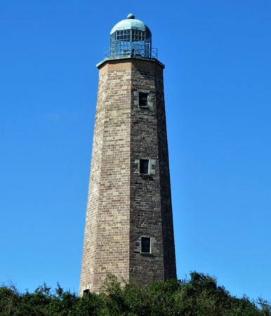
1792 (John McComb). Inactive since 1881. 90 ft (27.5 m) octagonal sandstone tower with lantern and gallery. Tower unpainted; lantern is silver-colored. A 2021 photo is at right, Anderson has an excellent page for the lighthouse, Jason Persaud has a 2022 photo, Marinas.com has aerial photos, Huelse has a historic postcard view of both lighthouses, and Google has a street view and a satellite view. This is the first lighthouse built by the Federal government and one of the best preserved lighthouses of the early Federal period. Recognized as a National Historic Landmark. Congress transferred ownership of the lighthouse in 1930 to the Association for the Preservation of Virginia Antiquities, now called Preservation Virginia. The interior was restored in 2002 and in 2003 the eroded sandstone foundation of the lighthouse was repaired. In August 2011 an earthquake created some cracks in the tower, but engineers determined they were not serious. In 2018 the City of Virginia Beach and Preservation Virginia began an $845,000 project to restore the lighthouse, stabilize the dune, and improve visitor access. The lighthouse reopened in spring 2019. Located on Atlantic Avenue in Virginia Beach but surrounded by Fort Story, an active U.S. Army post. Visitors who have a valid military ID are allowed to dtive to the lighthouse; for others the lighthouse is accessible by a free shuttle bus service from a parking lot just inside Gate 8 at 89th Street and Atlantic Avenue. Photo IDs are required for all visitors over 15 years old and drivers must show valid registration and proof of insurance. Vehicles are subject to search. Site and tower open daily (tower will close if heat inside is excessive). Owner/site manager: Preservation Virginia (Cape Henry Lighthouse). . ARLHS USA-122.
* Cape Henry (2)
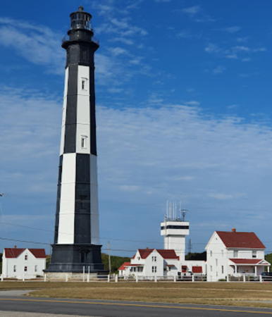
1881. Active; focal plane 164 ft (50 m); three flashes every 20 s: two short flashes followed by one long (7 s) flash; red sector covers dangerous shoals. 164 ft (50 m) octagonal cast-iron-clad brick tower, original 1st order Fresnel lens. Unusual daymark: alternating black and white vertical bands; lantern is black. The 2-story brick principal keeper's house and two 1-1/2 story wood assistant keepers' house buildings are all standing; one is currently in use as an Army residence. A photo by Mauricio Zavala is below right, an excellent 2018 photo is available, Cindy Mims has a 2021 photo, Marinas.com has aerial photos, and Google has a street view and a satellite view. In 2001 the Coast Guard conducted a test of fuel cells as the lighthouse energy source. In late 2005 the Association for the Preservation of Virginia Antiquities (now Preservation Virginia) announced it was seeking an agreement with the Coast Guard to manage and interpret the light station; this could lead to opening the tower and keeper's houses to the public. So far no agreement has been obtained. In 2016 the Coast Guard hired the International Chimney Corporation to restore the lighthouse and repair the keeper's houses and other auxiliary buildings. Located across the street from the old tower (see previous entry). Site and tower closed but the lighthouse can be seen at close range from the old light. Owner/site manager: U.S. Coast Guard. . ARLHS USA-121; Admiralty J1408; USCG 2-0370.

Old Cape Henry Lighthouse, Virginia Beach, February 2021
Instagram photo by solitude_wickie

Offshore Light Tower
Chesapeake
1965 (lightship station established 1930). Main light inactive since 2016. 117 ft (35.5 m) square cylindrical tower with lantern at one corner of a Texas-style platform. Two active (privately maintained) lights are mounted on corners of the platform: focal plane 84 ft (25.5 m); white flash every 4 s. The platform formerly also carried a NOAA C-MAN automatic weather station. Anderson has a page for the lighthouse, Amresh Vaidya has a 2020 photo, and a 2022 photo is available, but the tower is not shown in Google's satellite view. The tower was considered for deactivation in 2004 and was deactivated officially in 2016. In January 2013 the U.S. Department of Energy announced plans to use the station as a platform for wind energy testing. Apparently this project was completed by June 2016 when the station was placed on auction sale by the General Services Administration. The tower sold in early August for $215,000; the new owner is not yet known. The light no longer acts as the entry light for the Chesapeake; there are two buoyed entry routes, one to the north and the main entry to the south. Located 14.5 miles (23 km) east northeast of Cape Henry. Accessible only by boat. Owner/site manager: U.S. Coast Guard. ARLHS USA-168; Admiralty J1403; USCG 2-0360.

Information available on lost lighthouses:

  • Bowler's Rock (1868-1920), Rappahannock River off Bowlers Wharf, Essex County. No photo of the original lighthouse, a rectangular cottage screwpile, has been found. It was removed after being heavily damaged by ice in 1918. Trabas has a photo of the small lightbeacon at this location today. ARLHS USA-074; Admiralty J1680; NGA 2-15445.
  • Cherrystone Bar (1858-1919), off Cape Charles harbor, Chesapeake Bay, Northampton County. In 1920 the lighthouse was moved to Maryland as the Choptank River Light; it was demolished in 1964 but a replica was built at Cambridge, Maryland, in 2011-12. The light was replaced by a smaller beacon, and lights were maintained at this location at least to the 1970s. However, there is no longer a light today on Cherrystone Bar. ARLHS USA-166.
  • Craney Island (1855-1936), Hampton Roads, west side of the entrance to the Elizabeth River, Portsmouth City. The site of this screwpile lighthouse is now on land in a large area of dredged spoil. ARLHS USA-202
  • Hog Island (1852-1948), north side of Great Machipongo Inlet, Atlantic coast, Northampton County. The second (1896) lighthouse was a sibling of the Cape Charles Light. It was demolished in 1948 when it was threatened by beach erosion, and its location is now underwater. The inlet is marked by a lightbuoy. The Fresnel lens is displayed on the Portsmouth waterfront (see above). ARLHS USA-374; USCG 2-6815.
  • Lambert Point (1872-1911), east side of the entrance to the Elizabeth River, Norfolk City. The light became useless when the surrounding area developed as a major port. It was deactivated in 1892 and collapsed in 1911. ARLHS USA-427.
  • Nansemond River (1878-1935), off Pig Point, the east side of the entrance to the river, Suffolk City. The lighthouse was initally replaced by a skeletal tower, but the platform has now been removed and there is no longer a light at this location. ARLHS USA-519
  • Pungoteague River (1854-1856), off the mouth of Pungoteague Creek, Chesapeake Bay, Accomack County. The lighthouse, a very early screwpile, was overthrown by ice after only 15 months of service. The Chesapeake Chapter has a photo of a lightbeacon installed in 1908, and there is a small lightbeacon on the site today. ARLHS USA-678; Admiralty J1704; USCG 2-21845.
  • Watts Island (1833-1944), Tangier Sound, Accomack County. John Donahoo, a famous Maryland lighthouse engineer, built this 48 ft (15 m) tower on Little Watts Island in 1833; it was his only Virginia lighthouse. The lighthouse was overturned in a winter storm in 1944 and the island has completely eroded away. There is a small lightbeacon over the submerged ruins of the lighthouse today. ARLHS USA-873; Admiralty J1714.2; NGA 2-22115.
  • White Shoal (1855-1934), near the center of the James River off Newport News, about 2.5 mi (4 km) west of the James River Bridge (US 17). Although it was discontinued in 1934 the abandoned lighthouse survived until it was destroyed by ice in the 1970s. There is no light on the shoal today. ARLHS USA-996

1881 Cape Henry Light, Virginia, October 2021
Google Maps photo by Mauricio Zavala

Notable faux lighthouses:

Adjoining pages: North: Maryland Western Shore | Northeast: Maryland Eastern Shore | South: North Carolina

Return to the Lighthouse Directory index | Ratings key

Posted 2000. Checked and revised August 15, 2024. Lighthouses: 36. Lightships: 1. Site copyright 2024 Russ Rowlett and the University of North Carolina at Chapel Hill.