Lighthouses of Southeast Vietnam

The Socialist Republic of Vietnam occupies the east coast of Mainland Southeast Asia. After being independent for many centuries Vietnam was colonized by France as part of French Indochina from the mid 1800s until 1941, when the country was invaded and conquered by Japan. After the end of World War II in 1945 French attempts to re-establish control triggered 30 years of warfare. In 1954 an armistice agreement provided for the French withdrawal but divided the country into northern and southern halves. The Vietnam War, a complex struggle between the two Vietnamese governments, was already underway in the late 1950s and escalated with U.S. intervention beginning in 1964. U.S. troops were withdrawn in 1973 and two more years of war led to the reunifucation of the country in 1975.

Vietnam is long and narrow, with a coastline measuring some 3000 km (1875 mi) in length. The northern third of the coast faces the Gulf of Tonkin (Vịnh Bắc Bộ, "Northern Bay" in Vietnamese) and the rest faces east and southeast on the open waters of the South China Sea, known as Biển Đông, "East Sea" in Vietnamese.

Fortunately the lighthouses of Vietnam were not usually seen as targets during the Vietnam War and most of them survived the fighting without major damage. A few of the historic French lighthouses have been replaced but most remain in service and are regarded as historic monuments. In general Vietnamese lighthouses have resident keepers.

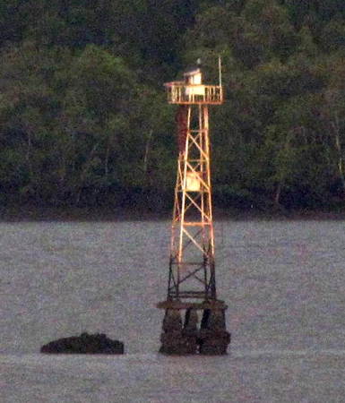
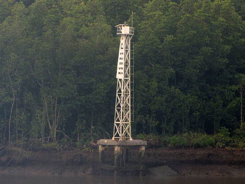
Vietnam is divided into 58 provinces and five province-level municipalities. This page describes lighthouses on the approaches to Hồ Chí Minh City (Saigon). The city is on the Saigon River (Sông Sài Gòn). Below the city the river expands into a complicated delta; the shipping channel follows the branch known as the Long Tau River (Sông Lòng Tàu). It has a twisting course and navigation is guided by a large number of skeletal range light towers.

The Vietnamese words for a lighthouse are hải đăng or đèn biển ("sea light"). Dao or hòn is an island, mũi is a cape, sông is a river, cửa ("door") is the mouth of a a river, vịnh is a bay, and hải cảng is a harbor.

Aids to navigation are maintained by two Maritime Safety Companies, Vietnam Maritime Safety - North (VMS-North) maintaining lights in the northern half of the country and Southern Vietnam Maritime Safety (SVMS) maintaining the lights of the southern half. All the lights on this page are in SVMS service area.

ARLHS numbers are from the ARLHS World List of Lights. Admiralty numbers are from volume F of the Admiralty List of Lights & Fog Signals. U.S. NGA List numbers are from Publication 112.
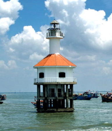
Cần Giờ Light, Cần Giờ
Southern Vietnam Maritime Safety photo
General Sources
Southern Vietnam Maritime Safety - Lighthouses
An interactive map of lighthouse locations, linking to pages on the individual light stations.
Online List of Lights - Vietnam
Photos by various photographers posted by Alexander Trabas. The Saigon River photos are by Douglas Cameron.
Lighthouses in Vietnam
Photos by various photographers available from Wikimedia.
World of Lighthouses - Vietnam
Photos by various photographers available from Lightphotos.net.
Leuchttürme in Vietnam
Photos by Andreas Köhler.
List of AtoN System
Light data published by SVMS in 2016.
Leuchttürme Asiens auf historischen Postkarten
Historic postcard images posted by Klaus Huelse.
Navionics Charts
Navigation chart for the Vietnamese coast.

Bà Rịa–Vũng Tàu Province Lighthouses

Vũng Tàu Area Lighthouses
Vũng Tàu is a seaport with a population of more than half a million, located on a narrow peninsula east of the entrance to the Saigon River (Sông Sài Gòn) and Hồ Chí Minh City. The port is an important base for oil drilling operations in the South China Sea.

Ba Kiềm
2006. Active; focal plane 87 m (285 ft); three green flashes every 10 s. 12.5 m (41 ft) square tower with lantern and gallery centered on a 2-story building. Lighthouse painted white (formerly yellow with white trim) and with blue shutters. Thanh Lam Nguyen has a photo, Trung Trần has a 2022 photo, and Google has a satellite view of the station. Located on heights above a cape about 50 km (30 mi) northeast of Vũng Tàu. Site status unknown. Admiralty F3115.
**** Vũng Tàu (Cap St.-Jacques) (3)
1913 (station established 1865). Active; focal plane 193 m (633 ft); two white flashes every 12 s. 18 m (59 ft) round cylindrical tower with lantern and gallery, surrounded by four massive concrete buttresses. A rotating Fresnel lens is in use. Entire lighthouse painted white. Arash Archer's 2023 photo is at right, Wikimedia has a closeup 2012 photo, Chung Lam Ngoc also has a closeup, Trabas has Eckhard Meyer's closeup photo, Nguyên Nguyên has a 2021 photo, Phương Trần Minh has a street view, and Google has a satellite view. This important lighthouse is the landfall light for Hồ Chí Minh City (Saigon). Huelse has historic postcard views of the 1885 lighthouse, a short octagonal masonry tower with a first order lantern and gallery, and of the 1913 lighthouse in its original form. The lighthouse was repainted all white in the spring of 2007 with the results shown in a July photo. The setting of the lighthouse is quite spectacular, with a sweeping view of the South China Sea. Located on Hải Dăng (Lighthouse) Mountain on the point of Mũi Vũng Tàu, about 8 km (5 mi) south of the town of Vũng Tàu. Site open, tower open daily. . ARLHS VIE-041; Admiralty F3066; NGA 20416.
Cao Da
Date unknown. Active; focal plane about 12 m (39 ft); green light, pattern unknown. Approx. 12 m (39 ft) round barbell-shaped tower colored with green and white horizontal bands and mounted on a square platform supported by piles. Trabas has Jim Smith's photo and Google has a satellite view and a very distant street view. Located off the west end of the Vũng Tàu peninsula. Accessible only by boat. Site open, tower closed. Admiralty F3066.2.
* Cao Trang (2)
2007 (station established 1898). Active; focal plane 20 m (66 ft); three green flashes every 12 s. 8 m (26 ft) hexagonal tower with lantern and gallery, painted white with blue trim. Trabas has Eckhard Meyer's closeup photo, Lê Minh Chánh has a photo, Hieu Nguyen has a 2024 closeup, and Google has a street view and a satellite view. The 1898 tower was square. Located on the shore on the west side of the Vũng Tàu peninsula, about 6 km (4 mi) north of the Vũng Tàu lighthouse. The coastal road passes close by the lighthouse, although there is no parking turnout. Site open, tower closed. ARLHS VIE-035; Admiralty F3070; NGA 20428.
* Ghành Rái (Ganh Rai)
Date unknown (station established 1911). Active; focal plane 19 m (62 ft); two green flashes every 4 s. 14 m (46 ft) hexagonal cylindrical concrete tower with gallery but no lantern. Lighthouse painted with dark green and white horizontal bands (described as black and white by NGA). Lê Minh Chánh has a photo, a 2022 photo and another good photo are available, and Google has a street view and a satellite view. This lighthouse guides ships into the harbor of Vũng Tàu city. The coastal road passes close by the lighthouse, although there is no parking turnout. Located at the northwestern point of the Vũng Tàu peninsula. Site open, tower closed. ARLHS VIE-049; Admiralty F3076; NGA 20432.


Vũng Tàu Light, Bà Rịa–Vũng Tàu, October 2023
Google Maps photo by Arash Archer

Vũng Tàu Inner Harbour Range Front
Date unknown. Active; focal plane about 12 m (39 ft); quick-flashing white light. Approx. 12 m (39 ft) square skeletal tower painted with red and white horizontal bands. No photo available but Google has a satellite view. Located off the waterfront of Vũng Tàu harbor. Accessible only by boat. Site open, tower closed. Admiralty F3078; NGA 20436.
Vũng Tàu Inner Harbour Range Rear
Date unknown. Active; focal plane about 20 m (66 ft); quick-flashing white light. Approx. 20 m (66 ft) square skeletal tower painted with red and white horizontal bands. No photo available but Google has a satellite view. Located 997 m (0.6 mi) east of the front light. Accessible only by boat. Site open, tower closed. Admiralty F3078.1; NGA 20440.

Đồng Nai Province and Hồ Chí Minh City Lighthouses

Sông Lòng Tàu Entrance Lighthouses
Cần Giờ (Aval)
1864. Active; focal plane 22.5 m (74 ft); three white flashes every 8 s. 22.5 m (74 ft) round cylindrical cast iron tower with lantern and gallery centered on the roof of an octagonal keeper's house, mounted on pilings. Lighthouse painted white; the roof of the keeper's house is red. An SVMS photo is at the top of this page, Trabas has a good photo, a 2008 closeup is available, Ngu Tam also has a closeup, and Bing has a satellite view. This is an extremely rare example of a 19th century pile lighthouse in Asia. SVMS has restored this historic lighthouse and converted it to solar power. Located in the entrance to the Sông Sài Gòn (Saigon River) channel to Hồ Chí Minh City (Saigon), about 10 km (6 mi) west of Vũng Tàu. Accessible only by boat. Site and tower closed. ARLHS VIE-010; Admiralty F3082; NGA 20444.
Sông Đồng Đinh (Song Nga)
Date unknown. Active; focal plane about 10 m (33 ft); two quick flashes every 3 s, white, red or green depending on direction. 9 m (30 ft) square white skeletal tower mounted on a platform supported by piles. No photo available but Google has a satellite view. This is a leading light for the entrance to the Lòng Tau River. Located on the west side of the river entrance. Accessible only by boat. Site open, tower closed. Admiralty F3083; NGA 20446.
Mui Nuoc Van (Beacon 13)
Date unknown. Active; focal plane about 14 m (46 ft); green light, pattern unknown. Approx. 14 m (46 ft) square skeletal tower painted with green and white horizontal bands. Nguyễn Đức Dũng has a photo and Google has a satellite view. Located off a swampy point marking the first sharp turn in the channel. Accessible only by boat. Site open, tower closed. Admiralty F3083.8.
Ba Yen (Rach Cai Gau) Range Front (A1)
Date unknown. Active; focal plane 13.5 m (45 ft); two white flashes every 6 s. 13.5 m (45 ft) square skeletal tower painted with red and white horizontal bands and mounted on a platform supported by piles. Trabas has Cameron's photo (also seen at right) and Google has a satellite view. This range guides vessels into the Lòng Tau River. Located off the Saigon delta, east of the river entrance. Accessible only by boat. Site open, tower closed. Admiralty F3084; NGA 20448.
Ba Yen (Rach Cai Gau) Range Rear (A2)
Date unknown. Active; focal plane 22 m (72 ft); two white flashes every 6 s. 22 m (72 ft) square skeletal tower painted with red and white horizontal bands. No photo available but Google has a satellite view. Located in marshland about 375 m (0.23 mi) northwest of the front light. Site status unknown. Admiralty F3084.1; NGA 20452.
Sông Lòng Tau (Beacon 15)
Date unknown. Active; focal plane 18 m (58 ft); green flash every 4 s. 18 m (58 ft) square white skeletal tower mounted on a square platform supported by piles. No photo available but Google has a satellite view. Located just off the east bank of the lower Lòng Tau River. Site status unknown. Admiralty F3084.15.

Ba Yen Range Front Light, Lòng Tau River
photo copyright Douglas Cameron; used by permission

Thiềng Liềng Area Lighthouses
Thiềng Liềng Outbound Range Front (C1)
Date unknown. Active; focal plane 17 m (56 ft); light characteristic unknown. Approx. 18 m (59 ft) square skeletal tower mounted on a platform supported by piles. No photo available but Google has a satellite view. These range lights guide ships approaching a 70° turn in the river. Located just off the east bank of the Lòng Tau River in northern Thiềng Liềng. Site status unknown. Admiralty F3084.25.
Thiềng Liềng Outbound Range Rear (C2)
Date unknown. Active; focal plane about 32 m (105 ft); light characteristic unknown. Approx. 30 m (98 ft) square skeletal tower. No photo available but Google has a satellite view. Located in northern Thiềng Liềng about 300 m (0.2 mi) east of the front light. Site status unknown. Admiralty F3084.251.
Thiềng Liềng Inbound Range Front (B1)
Date unknown. Active; focal plane 17 m (56 ft); three white flashes every 12 s. Approx. 18 m (59 ft) square skeletal tower painted white and mounted on a platform supported by piles. No photo available but Google has a satellite view. Located just off the east bank of the Lòng Tau River in northern Thiềng Liềng, a short distance north of the C1 light. Site status unknown. Admiralty F3084.3.
Thiềng Liềng Inbound Range Rear (B2)
Date unknown. Active; focal plane 24 m (79 ft); three white flashes every 12 s. Approx. 30 m (98 ft) square skeletal tower painted white. No photo available but Google has a satellite view. Located in northern Thiềng Liềng about 400 m (0.25 mi) east of the front light. Site status unknown. Admiralty F3084.301.
Les Quatres Bras North (Beacon 21)
Date unknown. Active; focal plane 17 m (56 ft); green flash every 2.5 s. 17 m (56 ft) round tower painted with green (?) and white horizontal bands. No photo available but Google has a satellite view. At Quatres Bras ("Four Arms") branches of the river join the Lòng Tau on both sides creating a watery crossroads. Located on the north side of the Lòng Tau about 2.5 km (1.5 mi) west northwest of Thiềng Liềng. Site status unknown. Admiralty F3084.4.
Les Quatres Bras South (Beacon 16)
Date unknown. Active; focal plane about 20 m (66 ft); red flash every 2.5 s. Approx. 20 m (66 ft) round tower painted with red (?) and white horizontal bands. No photo available but Google has a satellite view. Located on the south side of the Lòng Tau about 2.5 km (1.5 mi) west northwest of Thiềng Liềng. Site status unknown. Admiralty F3084.45.

Tam Thôn Hiệp and An Thới Đông Area Lighthouses
Tam Thôn Hiệp Inbound Range Front (D1)
Date unknown. Active; focal plane 17 m (56 ft); white flash every 3 s. 17 m (56 ft) square skeletal tower. No photo available but Google has a satellite view. Located on the north side of the Lòng Tau about 6 km (4 mi) west of Quatres Bras. Site status unknown. Admiralty F3084.75.
Tam Thôn Hiệp Inbound Range Rear (D2)
Date unknown. Active; focal plane 22 m (72 ft); white flash every 3 s. 22 m (72 ft) square skeletal tower. No photo available but Google has a satellite view. Located about 500 m (0.3 mi) northwest of the front light. Site status unknown. Admiralty F3084.751.
An Thới Đông (Outbound Leading Light F)
Date unknown. Active; focal plane about 35 m (115 ft); light characteristic unknown. Approx. 32 m (105 ft) square skeletal tower painted white with two red horizontal bands. Trabas has Cameron's photo and Google has an indistinct satellite view. This light guides vessels approaching a sharp bend in the river. Located on the south side of the Lòng Tau about 10 km (6 mi) west of Quatres Bras. Site status unknown. Admiralty F3084.85.
An Thới Đông Inbound Range Front (E1)
Date unknown. Active; focal plane about 16 m (52 ft); white flash every 3 s. Approx. 16 m (52 ft) square skeletal tower painted white and mounted on a square platform supported by piles. Trabas has Cameron's photo (also seen at right) and Google has a satellite view. This light guides vessels approaching a sharp bend in the river. Located on the south side of the Lòng Tau about 200 m (220 yd) northwest of Leading Light F. Site status unknown. Admiralty F3084.9.
An Thới Đông Inbound Range Rear (E2)
Date unknown. Active; focal plane 21 m (69 ft); white flash every 3 s. 21 m (69 ft) square skeletal tower painted white. No photo available but Google has an indistinct satellite view. This light guides vessels approaching a sharp bend in the river. Located about 200 m (220 yd) west northwest of the front light. Site status unknown. Admiralty F3084.901.

Range Front Light E1, Lòng Tau River
photo copyright Douglas Cameron; used by permission
An Thới Đông Outbound Range Front (G1)
Date unknown. Active; focal plane 17 m (55 ft); white flash every 2,5 s. 17 m (55 ft) square skeletal tower mounted on a platform supported by piles. No photo available but Google has a satellite view. Located just off the east bank of the Lòng Tau River about 1 km (0.6 mi) north of the inbound range lights. Site status unknown. Admiralty F3085.1.
An Thới Đông Outbound Range Rear (G2)
Date unknown. Active; focal plane 19 m (62 ft); white flash every 2,5 s. 19 m (62 ft) square skeletal tower. No photo available but Google has a satellite view. Located in northern Thiềng Liềng about 150 m (0.1 mi) east of the front light. Site status unknown. Admiralty F3085.101.
An Thới Đông Beacon 32
Date unknown. Active; focal plane 17 m (55 ft); red flash every 5 s. Approx. 20 m (82 ft) square skeletal tower mounted on a square platform supported by piles. Lighthouse painted red with one green horizontal band. Trabas has Cameron's photo (also seen at right) and Google has a satellite view. Located on the west side of the Lòng Tau River about 1.5 km (0.9 mi) west of the G range lights. Site status unknown. Admiralty F3085.13.

Pointe de l'Est Area Lighthouses
Pointe de l'Est Inbound Range Front (H1)
Date unknown. Active; focal plane 17.5 m (58 ft); white flash every 3 s. Approx. 20 m (66 ft) square skeletal tower mounted on a square platform supported by piles. No photo available but Google has a satellite view. Pointe de l'Est is a right-angle turn in the river about 25 km (15 mi) south of Hồ Chí Minh City. Located just off the east bank of the river about 1 km (0.6 mi) south of the bend. Site status unknown. Admiralty F3085.15.
Pointe de l'Est Inbound Range Rear (H2)
Date unknown. Active; focal plane 21 m (69 ft); white flash every 3 s. 21 m (69 ft) square skeletal tower. No photo available but Google has an indistinct satellite view. Located about 250 m (0.15 mi) north of the front light. Site status unknown. Admiralty F3085.151.
Pointe de l'Est (Beacon 35)
Date unknown. Active; focal plane 17 m (56 ft); green flash every 2.5 s. 17 m (56 ft) square skeletal tower mounted on a square platform supported by piles. Lighthouse painted with red and white horizontal bands. Trabas has Cameron's distant view and Google has a satellite view. Located just offshore of the point at Pointe de l'Est. Site status unknown. Admiralty F3085.2.

Beacon 32, Lòng Tau River
photo copyright Douglas Cameron; used by permission
Pointe de l'Est Inbound Upper Range Front (Beacon 36)
Date unknown. Active; focal plane 16 m (52 ft); white light, characteristic unknown. Approx. 16 m (52 ft) square skeletal tower painted white and mounted on a square platform supported by piles. Trabas has Cameron's photo, these range lights are at the lower left in a 2022 view, and Google has a satellite view. Located just off the west bank of the river opposite the Point de l'Est light. Site status unknown. Admiralty F3085.23.
Pointe de l'Est Inbound Upper Range Rear (Beacon 36B)
Date unknown. Active; focal plane 30 m (98 ft); red light, characteristic unknown. Approx. 25 m (82 ft) square skeletal tower. Trabas has Cameron's photo, these range lights are at the lower left in a 2022 view, and Google has a satellite view. Located about 250 m (0.15 mi) northwest of the front light. Site status unknown. Admiralty F3085.231.
Pointe de l'Est (Beacon 38)
Date unknown. Active; focal plane about 25 m (82 ft); red flash every 4 s. Approx. 20 m (66 ft) square skeletal tower mounted on a square platform supported by piles. Lighthouse painted with red and white horizontal bands. Trabas has Cameron's photo and Google has a satellite view. Located just offshore on the upstream side of the point at Pointe de l'Est. Site status unknown. Admiralty F3085.28.

Coude de Propontis Area Lighthouses
Coude de Propontis (Beacon 39)
Date unknown. Active; focal plane about 25 m (82 ft); green flash every 5 s. Approx. 20 m (66 ft) square skeletal tower mounted on a square platform supported by piles. Lighthouse painted with red and green horizontal bands. Trabas has Cameron's photo, Thanh Bình Phan has a very distant street view across the river, and Google has a satellite view. Coude de Propontis is the location of a right-angle turn in the river east of Pointe de l'Est. Located just offshore on the outside of the bend. Site status unknown. Admiralty F3085.3.
Coude de Propontis (Beacon 42)
Date unknown. Active; focal plane about 25 m (82 ft); red flash every 2.5 s. Approx. 20 m (66 ft) square skeletal tower mounted on a square platform supported by piles. Lighthouse painted with red and white horizontal bands. Trabas has Cameron's photo (also seen at right) and Google has a satellite view. Ngu Tam has a 2010 photo that appears to be of this light, although it was marked then as number 43. Located just offshore on the inside of the bend, opposite Beacon 39. Site status unknown. Admiralty F3085.33.
Coude de Propontis (Beacon 41)
Date unknown. Active; focal plane about 25 m (82 ft); green flash every 2.5 s. Approx. 20 m (66 ft) square skeletal tower mounted on a square platform supported by piles. Lighthouse painted with black and white horizontal bands. Trabas has Cameron's fuzzy photo, Thanh Bình Phan has a very distant street view across the river, and Google has a satellite view. Located just offshore on the east side of the river about 1 km (0.6 mi) northeast of Beacon 42.. Site status unknown. Admiralty F3085.35.
 

Beacon 42, Lòng Tau River
photo copyright Douglas Cameron; used by permission

Tam Thôn Hiệp Area Lighthouses
* Tam Thôn Hiệp Inbound Range Front (I1)
Date unknown. Active; focal plane about 20 m (66 ft); three white flashes every 10 s. Approx. 18 m (59 ft) square skeletal tower painted white. Trabas has Cameron's photo (also seen at right), Ân Nguyễn Hữu has a 2022 photo, Chi Bin has a street view, and Google has a satellite view. These range lights guide vessels around an S-turn in the river. Located on the west bank of the river in the Tam Thôn Hiệp neighborhood of Hồ Chí Minh City. Site open, tower closed. Admiralty F3085.38.
Tam Thôn Hiệp Inbound Range Rear (I2)
Date unknown. Active; focal plane about 35 m (115 ft); three white flashes every 10 . Approx. 30 m (98 ft) square skeletal tower painted white. Trabas has Cameron's photo and Google has a satellite view. Located about 250 m (0.15 mi) north of the front light. Site open, tower closed. Admiralty F3085.381.
Tam Thôn Hiệp Inbound Upper Range Front (J1)
Date unknown. Active; focal plane about 20 m (66 ft); red flash every 3 s. Approx. 18 m (59 ft) square skeletal tower painted white. Trabas has Cameron's photo, Phan Hữu Nên has a distant street view across the river, and Google has a satellite view. Located off the east bank of the river opposite Tam Thôn Hiệp. Site status unknown. Admiralty F3085.43.
Tam Thôn Hiệp Inbound Upper Range Rear (J2)
Date unknown. Active; focal plane about 35 m (115 ft); red flash every 3 s. Approx. 30 m (98 ft) square skeletal tower painted white. Trabas has Cameron's photo and Google has a satellite view. Located off the east bank of the river about 250 m (0.15 mi) northeast of the front light. Site status unknown. Admiralty F3085.45.
Tam Thôn Hiệp Outbound Range Front (K1)
Date unknown. Active; focal plane 15.5 m (51 ft); three white flashes every 12 s. 15.5 m (51 ft) square skeletal tower painted white with a black horizontal band. Trabas has Cameron's fuzzy photo, the range lights are seen across the river on the left in Wu Jesse's photo, and Google has a satellite view. These range lights guide outbound vessels on an eastbound reach. Located on the east bank of the river north of the Tam Thôn Hiệp neighborhood of Hồ Chí Minh City. Site status unknown. Admiralty F3085.47.

Range Front Light I1, Lòng Tau River
photo copyright Douglas Cameron; used by permission
Tam Thôn Hiệp Outbound Range Rear (K2)
Date unknown. Active; focal plane about 19 m (62 ft); three white flashes every 12 s. Approx. 19 m (62 ft) square skeletal tower painted white with a black horizontal band. Trabas has Cameron's fuzzy photo, the range lights are seen across the river on the left in Wu Jesse's photo, and Google has a satellite view. Located about 250 m (0.15 mi) southeast of the front light. Site status unknown. Admiralty F3085.48.
Tam Thôn Hiệp Inbound Range Front (L1)
Date unknown. Active; focal plane 15 m (49 ft); white flash every 4 s. 15 m (49 ft) square skeletal tower painted with black and white horizontal bands. Trabas has Cameron's fuzzy photo and Google has a satellite view. These range lights guide inbound vessels on a northbound reach. Located on the east bank of the river north of the Tam Thôn Hiệp neighborhood of Hồ Chí Minh City. Site status unknown. Admiralty F3085.53.
Tam Thôn Hiệp Inbound Range Rear (L2)
Date unknown. Active; focal plane 19 m (62 ft); white flash every 4 s. 19 m (62 ft) square skeletal tower painted white with with black and white horizontal bands. Trabas has Cameron's fuzzy photo and Google has a satellite view. Located about 120 m (0.07 mi) north of the front light. Site status unknown. Admiralty F3085.55.

Downtown Hồ Chí Minh City Lights
* Sông Nha Be Inbound Range Front (M1)
Date unknown. Active; focal plane 21 m (62 ft); white flash every 2.5 s. 21 m (62 ft) square skeletal tower. No photo available but Google has a satellite view. Nha Be is an alternate name for the section of the Saigon River in downtown Hồ Chí Minh City. Located on the waterfront in downtown Hồ Chí Minh City. Site open, tower closed. Admiralty F3087.2.
* Sông Nha Be Inbound Range Rear (M2)
Date unknown. Active; focal plane 26 m (85 ft); white flash every 2.5 s. 26 m (85 ft) square skeletal tower. Nguyễn Minh Đăng has a photo and Google has a satellite view. Located on a street called Hoàng Quốc Việt near the waterfront in Hồ Chí Minh City, about 600 m (3/8 mi) northwest of the front light. Site open, tower closed. Admiralty F3087.21.
* Sông Nha Be Entrance (Beacon 62)
Date unknown. Active; focal plane about 20 m (66 ft); red light, pattern unknown. Approx. 15 m (49 ft) square skeletal tower painted with red and white horizontal bands. Luc Nguyen has a photo, Ngoc Hưng Ngô has a 2023 photo, a distant view is available, and Google has a satellite view. Located on the point of land at the junction of the Sông Sài Gòn (Saigon River) and the Sông Nha Be (Nha Be River) in Hồ Chí Minh City. Site status unknown. Admiralty F3087.61.
Sông Nha Be Inbound Upper Range Front (N1)
Date unknown. Active; focal plane 12 m (39 ft); two red flashes every 6 s. 12 m (39 ft) square skeletal tower carrying a diamond-shaped daymark. No photo available but Bing has a fuzzy satellite view. Located on the point of land at the junction of the Sông Sài Gòn (Saigon River) and the Sông Nha Be (Nha Be River) in Hồ Chí Minh City. Site status unknown. Admiralty F3087.5.
Sông Nha Be Inbound Upper Range Rear (N2)
Date unknown. Active; focal plane 16 m (52 ft); two white flashes every 6 s. 16 m (52 ft) square skeletal tower carrying a diamond-shaped daymark. Nguyễn Đức Dũng has a photo and Bing has a satellite view. Located about 225 m (740 ft) northeast of the front light. Site status unknown. Admiralty F3087.51.
Mũi Den Do (Beacon 75)
Date unknown. Active; focal plane about 21 m (69 ft); green flash every 3 s. Approx. 21 m (69 ft) square skeletal tower painted with green and white horizontal bands. Trabas has Cameron's photo (also seen at right) and Google has an indistinct satellite view. Located at the point of land in a switchback turn of the Sông Sài Gòn just downstream of the Phú Mỹ Bridge. Site status unknown. Admiralty F3087.63.
Sông Sài Gòn Inbound Range Front (P1)
Date unknown. Active; focal plane 18 m (59 ft); white flash every 2.5 s. 18 m (59 ft) square skeletal tower painted white. Trabas has Cameron's photo, Hải Phong Hoàng has an aerial view (lighthouse at extreme lower left), and Google has an indistinct satellite view. These range lights guide vessels in a northbound reach upstream from the Phú Mỹ Bridge. Located on the east bank of the river about 2 km (1.25 mi) north of the bridge. Site status unknown. Admiralty F3087.65.
* Sông Sài Gòn Inbound Range Rear (P2)
Date unknown. Active; focal plane 21 m (69 ft); white flash every 2.5 s. 21 m (69 ft) square skeletal tower painted white. Trabas has Cameron's photo, Hải Phong Hoàng has an aerial view (lighthouse beside street at lower left), and Google has a satellite view. Located on the Đường số 103-TML, the riverfront street on the east side of the river about 250 m (0.15 mi) north of the front light. Site open, tower closed. Admiralty F3087.651.

Mũi Den Do Light, Hồ Chí Minh City
photo copyright Douglas Cameron; used by permission

Information available on lost lighthouses:

Notable faux lighthouses:

Adjoining pages: North: Central Vietnam | East: Spratly Islands | South: Southern Vietnam | West: Cambodia

Return to the Lighthouse Directory index | Ratings key

Posted April 24, 2006. Checked and revised March 24, 2024, Lighthouses 52. Site copyright 2024 Russ Rowlett and the University of North Carolina at Chapel Hill.