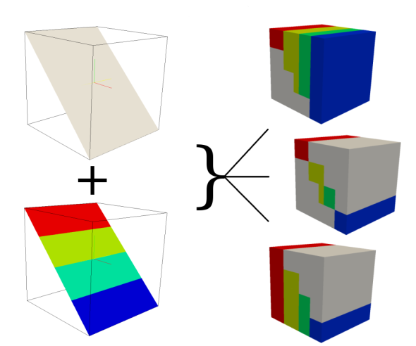


g.region rast=elevation.10m
g.region res=200 res3=200 t=2000 b=0 tbres=20

# Write the values of raster map soils based on the elevation of elevation.10m
# to the 3D map volev

r.to.rast3elev --o in=soils elev=elevation.10m out=volev

# Write the values of map soils based on the elevation of elevation.10m
# to the 3D map volev_l and fill the lower cells with the soils map values

r.to.rast3elev --o in=soils elev=elevation.10m out=volev_l -l

# Write the values of map soils based on the elevation of elevation.10m
# to the 3D map volev_u and fill the upper cells with the soils map values

r.to.rast3elev --o in=soils elev=elevation.10m out=volev_u -u

# Example with multiple elevation maps.
## first we need three support maps

r.mapcalc --o expression="one = 1"
r.mapcalc --o expression="two = 2"
r.mapcalc --o expression="three = 3"

## Now we generate the new evelation maps

r.mapcalc --o expression="elev_mid = elevation.10m - 500"
r.mapcalc --o expression="elev_bottom = elevation.10m - 1000"

## Now fill the lower cells below the elevation maps with the values one, two and three

r.to.rast3elev --o -l input=one,two,three elevation=elevation.10m,elev_mid,elev_bottom output=threelayer

## Export the map for visualization with paraview (http://www.paraview.org)
## By default the null value is -9999.99, we adjust it to 0.0 for
## better visualization
r3.out.vtk --o null=0.0 input=threelayer output=/tmp/threelayer.vtk

# Start paraview

paraview --data=/tmp/threelayer.vtk

# First you need to choose the surface representation style and then color by "threelayer" in paraview .
Last changed: $Date: 2011-02-21 23:49:31 -0800 (Mon, 21 Feb 2011) $
Main index - raster index - Full index
© 2003-2010 GRASS Development Team