Lighthouses of Southern Brazil

The Federative Republic of Brazil (Brasil in Portuguese), the largest country in South America and fifth largest in the world, has a lengthy coastline, a large number of lighthouses, and a distinguished lighthouse history. Colonized by Portugal, Brazil declared its independence in 1822. Uniquely among American nations it was a monarchy as the Empire of Brazil until 1889.

Brazil is a federal republic with 26 states and a federal district. This page covers the lighthouses of Brazil's two southernmost states, Santa Catarina and Rio Grande do Sul. The northern part of this coastline features beautiful sandy beaches framed by steep, sometimes mountainous headlands with a scattering of offshore islands. Rio Grande do Sul is different: its coastline is mostly a very long and generally roadless sand beach, broken at the entrance to the estuary for which the state is named.

The Portuguese word for a lighthouse is farol, plural faróis. In Brazilian use, the word farol generally applies to all light towers, regardless of whether they are enclosed structures or not. The word farolete or farolim is sometimes used for smaller towers. In Portuguese ilha is an island, ilhéu is an islet, cabo is a cape, ponta is a promontory or point of land, rocha is a rock, recife is a reef, baía is a bay, estreito is a strait, rio is a river, and porto is a port or harbor.

Active lighthouses in Brazil are owned by the navy (Marinha do Brasil) and maintained by the Centro de Sinalização Náutica e Reparos Almirante Moraes Rego (CAMR) in the Diretoria de Hidrografia e Navegacão (DHN). Many of the larger lighthouses are staffed by resident keepers or by rotating crews of naval personnel. Only a small number of Brazilian lighthouses are open to the public.

ARLHS numbers are from the ARLHS World List of Lights. BR numbers are from the official Brazilian Lista de Faroís. Admiralty numbers are from volume G of the Admiralty List of Lights & Fog Signals. U.S. NGA numbers are from Publication 110.

General Sources
Faroís Brasileiros
This web site for Brazilian lighthouses has small photos and historical information for many of the major lights.
Online List of Lights - Brazil - South Coast
Photos by various photographers, posted by Alexander Trabas. Most of the photos for this area are by Capt. Peter Mosselberger ("Capt. Peter").
Faróis
Photos from Rio Grande do Sul and Uruguay posted on Flickr.com by Gilberto Lima.
Lighthouses in Brazil
Photos by various photographers available from Wikimedia.
World of Lighthouses - Brazil
Photos by various photographers available from Lighthouses.net.
Lista de faróis do Brasil
Index to articles on the Portuguese Wikipedia.
Leuchttürme Südamerikas auf historischen Postkarten
Historic postcard views posted by Klaus Huelse.
Lista de Faróis
Online version of the official Brazilian light list.
GPSNauticalCharts
Navigational chart information for Brazil.


Chuí Light, Chuí, May 2021
Instagram photo by Renan

Lighthouses of Santa Catarina

Itapoá and São Francisco do Sul Lighthouses
* Trincheira (Pontal da Barra, Itapoá)
1948. Active; focal plane 9 m (30 ft); red flash every 6 s. 8 m (26 ft) octagonal masonry tower with gallery, painted with red and white horizontal bands. Walter J. Steppan has posted a closeup 2016 photo, Milene de Aragão has a 2017 photo, Everson Mincewicz has a closeup street view, and Google has a satellite view. The lighthouse was previously endangered by beach erosion, with stones placed around it for protection; around 2016 a sea wall was constructed and fill was placed to protect the lighthouse. Located on the north side of the Rio São Francisco do Sul estuary in Itapoá, a resort town of about 20,000 residents. Site open, tower closed. . ARLHS BRA-274; BR-3764; Admiralty G0545; NGA 18764.
Sumidouro
Date unknown. Inactive since 2018. 13 m (43 ft) square pyramidal white fiberglass skeletal tower. No photo available but Google has a satellite view. Located on the Ilha de São Francisco do Sul, marking the south side of the harbor entrance. Site status unknown. ex-BR-3752; ex-Admiralty G0544; NGA 18763.
Ilha da Paz
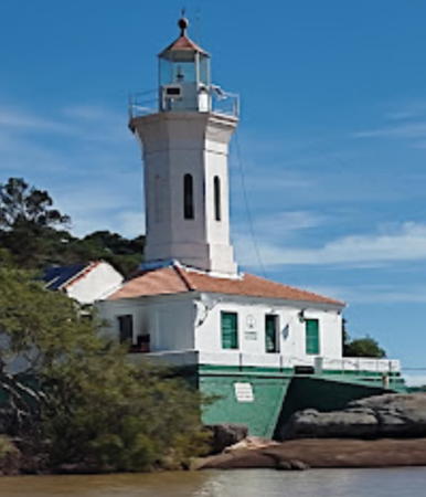
1906. Active; focal plane 84 m (276 ft); white light, 3.5 s on, 16.5 s off. 16 m (52 ft) square cylindrical stone tower with lantern and gallery, attached to a 1-story stone keeper's house. The original 4th order F. Barbier & Cie. Fresnel lens, removed in 1989, is on display at the Museu Histórico de São Francisco do Sul. A Brazilian Navy photo is at right, Gislaine Schatzmann has a distant photo, Portuguese Wikipedia has an article with a distant view, Wikimedia has a closeup by Dalila Dalprat Sousa Santos, a 2017 view from the sea is available, Huelse has a historic postcard view, and Google has a satellite view. According to a July 2007 article the lighthouse was being restored and would open to the public in 2009 with a museum in the keeper's house; however, it appears that this project was delayed and then suspended in 2012. The lighthouse guards the entrance to the port of São Francisco do Sul, a city of about 55,000 residents. Located on an island about 4 km (2.5 mi) off the coast. Site and tower closed (at least in the past, landing on the island required special permission from the navy). . ARLHS BRA-137; BR-3700; Admiralty G0540; NGA 18760.

Ilha do Paz Light, São Francisco do Sul, June 2021
Flickr Creative Commons photo by Marinha do Brasil

Itajaí Area Lighthouses
Itajaí is a city of about 225,000 residents and an important port shipping agricultural products.
* Ponta do Varrido
Date unknown. Active; focal plane 50 m (164 ft); white flash svery 6 s. 10 m (33 ft) square pyramidal skeletal tower painted white with a black horizontal band. No photo available but Bing has a satellite view. Located atop a sharp headland at Penha, about 15 km (9 mi) north of Itajai. Accessible by road. Site apparently open, tower closed. ARLHS BRA-175; BR-3816; Admiralty G0551; NGA 18784.
* Itajaí North Breakwater
1938. Active; focal plane 16 m (52 ft); three red flashes every 10 s. 12 m (39 ft) 3-stage round cylindrical tower, colored with tiles in red and white horizontal bands. The lowest stage appears to covered with small colored tiles. Rodrigo Osorio has a photo, Trabas has a good photo by Capt. Peter, Teresa Teixeira has a 2020 closeup, Leonel da Silva has a street view from the south breakwater, and Google has a satellite view. Sometime in 2018-19 the breakwater was shortened and the lighthouse relocated about 140 m (460 ft) northwest. Located at the end of the north breakwater at the mouth of the Rio Itajaí. Accessible by driving on the breakwater. Site open, tower closed. BR-3832; Admiralty G0554; NGA 18800.
** Itajaí South Breakwater
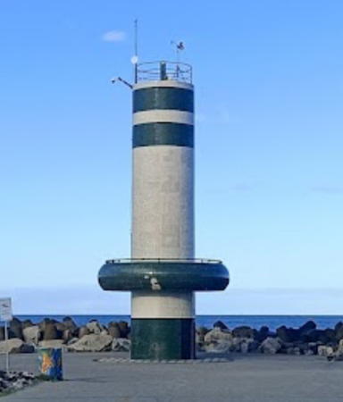
1945. Active; focal plane 16 m (52 ft); green flash every 3 s. 12 m (39 ft) round cylindrical tower, colored with tiles in white with green horizontal bands. The tower also has a public observation deck about 4 m (13 ft) above the base, accessible by an exterior stairway. Wendeel Palheta's 2022 photo is at right, a closeup by Amelie Pouglain is available, Fernanda Platner has a 2018 photo, Everaldo José dos Santos also has a good photo, Trabas has Capt. Peter's photo, and Google has a satellite view. Located at the end of the south breakwater at the mouth of the Rio Itajaí. Accessible by walking the breakwater. Site open, observation deck open, remainder of tower closed. . BR-3828; Admiralty G0555; NGA 18796.
[Ponta das Cabeçudas]
Date unknown (station established 1902). Active; focal plane 58 m (190 ft); flash every 10 s, two white flashes followed by one red flash. Approx. 6 m (20 ft) post adjoining a square 1-story concrete or masonry equipment building. Lighthouse painted white. Marisco Rio has a 2017 photo, Marcelo Rizzo has a closeup, Trabas has Capt. Peter's distant photo, and Bing has a satellite view. Located at the tip of a narrow peninsula projecting northeastward about 4 km (2.5 mi) southeast of Itajaí. Site status unknown (there is a road to the lighthouse, but it may not be open to the public). ARLHS BRA-121; BR-3868; Admiralty G0552; NGA 18788.

Itajaí South Breakwater Light, Rio Itajaí, August 2022
Google Maps photo by Wendeel Palheta

Ilha de Santa Catarina (Florianópolis Area) Lighthouses
Ilha de Santa Catarina is an island about 54 km (34 mi) long and as much as 18 km (11 mi) wide, connected to the mainland by several bridges. The island is the location of the state capital of Florianópolis and several popular beach resorts.
Ilha da Galé (Pedrada Galé) (2)
Date unknown (station established 1939). Active; focal plane 78 m (256 ft); white flash every 10 s. 10 m (33 ft) square cylindrical concrete tower with gallery, painted with black and white horizontal bands. Trabas has Capt. Peter's photo, Volfredo Neves has a distant view (1/3 the way down the page) and Bing has an indistinct satellite view. Located atop an island about 10 km (6 mi) east of Canto Grande and the same distance north of the Ilha do Arvoredo. Site status unknown. BR-3872; Admiralty G0558; NGA 18848.
Calhau de São Pedro
Date unknown. Active; focal plane 19 m (62 ft); quick white flash every 3 s. 5 m (17 ft) short mast centered on a square white concrete tower. Trabas has Capt. Peter's distant view, Sílvio César Montibeller has a photo and Bing has an indistinct satellite view. Brazilian sailors use calhau (literally "pebble") to mean a skerry. Located on a rocky reef about 8 km (5 mi) northwest of the northern tip of the Ilha do Arvoredo. Accessible only by boat. Site open, tower closed. BR-3876; Admiralty G0560; NGA 18852.
Ilha do Arvoredo
1883. Active; focal plane 90 m (295 ft); white light with four occultations every 60 s. 16 m (52 ft) round cast iron tower with lantern and gallery, painted with red and white horizontal bands. The original 2nd order Chance Brothers Fresnel lens is in use. Three 1-story keeper's houses. A 2020 Navy photo is at right, Trabas has Capt. Peter's photo, Roger Frony posted a 2010 photo on Panoramio, and Google has a satellite view. The lighthouse was prefabricated in England, also by Chance Brothers. In 2020 the Navy repainted the lighthouse and refurbished the rotation device. Along with neighboring islands the Ilha do Arvoredo is included in the Reserva Biológica Marinha do Arvoredo, an ecological reserve. Tours of the reserve are available but it's not clear if these include visits to the lighthouse. Located on an island off the northern end of the Ilha de Santa Catarina. Site and tower closed except possibly for ecotours. ARLHS BRA-042; BR-3880; Admiralty G0562; NGA 18856.
* [Ilha Anhatomirim (3?)]
Date unknown (station established 1873). Active; focal plane 39 m (128 ft); red flash every 6 s. 8 m (26 ft) mast with ladder, supported by guy wires, painted white. Fernando Santos has a closeup photo and Google has a satellite view. Anhatomirim is a small island on the west side of the northern entrance to the Canal Santa Catarina, the strait and harbor sheltered by the Ilha de Santa Catarina. The island is occupied by a well-preserved 18th century fortress, the Forteleza de Santa Cruz de Anhatomirim. NGA misspells the name as Anhatomirin. The fort is a popular tourist attraction, accessible by passenger ferry. Located on the highest point of the island. Site open, tower closed. ARLHS BRA-209; BR-3884; Admiralty G0566; NGA 18860.

Ilha do Arvoredo Light, July 2020
Marinha do Brasil photo
Ponta da Enseada Cedro
Date unknown. Active; focal plane 8 m (26 ft); green flash every 10 s. 6 m (20 ft) round stone tower painted white. Raimundo Neto has a closeup 2023 photo, Alexsandro Seidler has a 2021 photo, and Google has a satellite view. Located at the base of a headland on the west (mainland) side of the Canal Santa Catarina. May be accessible only by boat. Site open, tower closed. BR-3900; Admiralty G0580; NGA 18880.
Ponta de Galheta (Barra da Lagoa) (2)
Date unknown. Active; focal plane 150 m (492 ft); white flash every 10 s. 10 m (33 ft) round cylindrical white concrete tower. Ivan Tiago Schreiner has a 2023 closeup photo, Trabas has Capt. Peter's photo, Samuel Batista de Souza has a photo, and Google has a satellite view. Light lists formerly described the original light, a 10 m (33 ft) square skeletal tower. Located on a promontory on the central east coast of the Ilha de Santa Catarina, about 12 km (7.5 mi) due east of Florianópolis. Probably accessible by a hiking trail. Site open, tower closed. ARLHS BRA-170; BR-3883; Admiralty G0562.5; NGA 18857.
Ponta dos Naufragados (Santa Catarina)
1861. Active; focal plane 43 m (141 ft); two white flashes, separated by 3 s, every 15 s. 10 m (33 ft) round concrete tower, painted white. Lantern removed but the watch room with its gallery remains. A drone view by Daniel Schulz is at right, Trabas has Andreas Köhler's photo, Zeca Baronio has a 2008 closeup, another good photo is available, Carlos Tuyama has a street view from the base of the lighthouse, and Google has a satellite view. This appears to be the historic lighthouse without its lantern; if so, it deserves much more attention than it has been receiving. Ponta dos Naufragados means "Cape of the Shipwrecked." There's no road access to the site, but the lighthouse can be reached by a hike of about 40 minutes from the nearest road or 20 minutes from the beach below the lighthouse, which is popular with surfers. Andreas Köhler visited this site in early 2009 and reported that the trails are not so easy to follow. Located on a bluff at the southern end of the Ilha de Santa Catarina about 20 miles south of Florianópolis. Site open, tower open, at least at times. . ARLHS BRA-077; BR-3908; Admiralty G0584; NGA 18888.
Ilha dos Corais (Ilha de Coral)
Date unknown. Active; focal plane 81 m (266 ft); white flash every 3 s. 12 m (39 ft) round white concrete tower. Trabas has Capt. Peter's photo and Google has a satellite view. Located on heights at the north end of an island about 5 km (3 mi) offshore and 12 km (7.5 mi) south of Ponta dos Naufragados. Accessible only by boat. Site status unknown. ARLHS BRA-041; BR-3912; Admiralty G0588; NGA 18892.

Ponta das Naufragados Light, January 2017
Google Maps drone view by Daniel Schulz

Southern Santa Catarina Lighthouses
* Imbituba (2)
1918 (station established 1882). Active; focal plane 69 m (226 ft); three white flashes every 15 s. 7 m (23 ft) square pyramidal masonry tower with gallery but no lantern, mounted atop a square 1-story masonry service room. Lighthouse painted white. Trabas has a photo by Capt. Theo Hinrichs, a 2020 photo is available, Sidnei José Romano has a street view, and Bing has a satellite view. The original light was described as an "iron column and house." Located on a bluff on a hook-shaped peninsula sheltering the harbor at Imbituba. Site open, tower closed. . ARLHS BRA-055; BR-3924; Admiralty G0592; NGA 18900.
Ilha das Araras
Date unknown (station established 1911). Active; focal plane 54 m (177 ft); two quick white flashes every 6 s. 11 m (36 ft) round concrete tower, painted with red and white horizontal bands. Trabas has a photo by Capt. Peter and Google has a satellite view. The Ilha das Araras (Island of the Macaws) is a small island about 6 km (4 mi) offshore and 13 km (8 mi) south of Imbituba. Located on the highest point of the island. Accessible only by boat. Site status unknown. ARLHS BRA-040; BR-3936; Admiralty G0594; NGA 18904.
Ilha dos Lobos
Date unknown. Active; focal plane 50 m (164 ft); white flash every 5 s. 6 m (20 ft) round concrete tower, painted white. João Felipe Brito da Silva has a closeup 2022 drone view, Trabas has Capt. Peter's photo, and Bing has a satellite view. Located on the highest point of Ilha dos Lobos, a small island about 12 km (7.5 mi) northeast of Laguna. Accessible only by boat. Site status unknown. ARLHS BRA-138; BR-3940; Admiralty G0596; NGA 18908.
**** Santa Marta
1891. Active; focal plane 74 m (243 ft); white light (red sector covers shoals) occulting three times every 30 s. 29 m (95 ft) square stone tower with lantern and gallery rising from a square cluster of 1-story keeper's houses and other light station buildings. Entire lighthouse painted white; roofs of the other buildings are red. The original giant "hyper-radiant" Fresnel lens (larger than 1st order) is still in use; it is one of the world's most powerful lenses and the only one of its kind installed in Latin America. The original clockwork mechanism is still in place although no longer used. A 2021 photo is at right, Wikimedia has Edi Galvani Uliano's 2014 photo, Dieter Heiss has a 2009 photo, Felipe Skroski has a photo of the station and the sea behind, Wikimedia has additional photos, Trabas has a distant view by Capt. Theo Hinrichs, and Google has a street view and a satellite view. Built by French contractors, this magnificent lighthouse is one of the best known landmarks of the Santa Catarina coast. Located on the Cabo Santa Marta, a prominent headland about 13 km (8 mi) south of the city of Laguna. Site open, lighthouse and tower open for tours during the summer. . ARLHS BRA-032; BR-3956; Admiralty G0600; NGA 18920.
* Araranguá (Morro dos Conventos)
1953. Active; focal plane 85 m (279 ft); three white flashes, separated by 3.3 s, every 20 s. 8 m (26 ft) round concrete tower, painted white with a broad black horizontal band. José Maciel has a fine closeup photo, Caminha da Joinville has a second photo, and Google has a street view and a satellite view. This light stands on the Morro dos Conventos, a rocky bluff overlooking the beach; this is a popular lookout point. Located at the end of the Rua Atlântica in Araranguá about 80 km (50 mi) southwest of Laguna. Accessible by road; parking provided. Site open, tower closed. ARLHS BRA-007; Admiralty G0602; BR-3960; NGA 18924.
* Mampituba North Mole
Date unknown. Active; focal plane 12 m (39 ft); red flash every 3 s. 10 m (33 ft) round cylindrical concrete tower, painted white. A 2021 closeup photo is available, Google has a street view and Google has a satellite view. Located on the north mole at the entrance to the Rio Mampituba, which separates Santa Catarina and Rio Grande do Sul, in Passo de Torres. Site open, tower closed. BR-3964; Admiralty G0603.

Santa Marta Light, Laguna, April 2021
Instagram photo
by Farol de Santa Marta

Lighthouses of Rio Grande do Sul

Torres Area Lighthouses
Torres is a resort city with about 35,000 permanent residents but numerous beach resorts attracting up to 300,000 visitors in the summer.

* Mampituba South Mole
Date unknown. Active; focal plane 12 m (39 ft); green flash every 3 s. 10 m (33 ft) round cylindrical concrete tower, painted white. Lourdes Padoin has a 2019 photo, Cicero Altreiter has a 2023 photo, Google has a distant street view and Google has a satellite view. Located on the south mole at the entrance to the Rio Mampituba, which separates Santa Catarina and Rio Grande do Sul, in Passo de Torres. Site open, tower closed. BR-3968; Admiralty G0603.2.
* Torres (3)
1952 (station established 1912). Inactive since 1993. 15 m (49 ft) square white masonry tower with lantern and gallery. A 2024 photo by Lucélia Morais is at right, Wikimedia has several photos, Thiago Ferronatto has a good photo, and Google has a 2024 street view of both towers and a satellite view. The original lighthouse, an iron skeletal tower, was replaced in 1928 by another skeletal tower; both towers suffered from corrosion. The 1952 tower was designed by Roberto Lacombe and Flavio Barbosa. It has been transferred to IBAMA, the Brazilian environmental and ecological institute. Located atop a high hill, the Morro do Farol (Lighthouse Bluff), in the northern section of the city of Torres, at the northeastern corner of Rio Grande do Sul. Site open, tower closed. . ARLHS BRA-273.
* Torres (4)
1993 (station established 1912). Active; focal plane 85 m (278 ft); white light, 2 s on, 8 s off. 46 m (151 ft) round cylindrical tower; at a distance the lighthouse appears white with black vertical stripes. The lower 2/3 of the tower appears in the photo at right, Lima has a distant view showing both towers, and Google has a 2024 street view and a satellite view. Located atop a high hill, the Morro do Farol (Lighthouse Bluff) in the northern section of the city of Torres, at the northeastern corner of Rio Grande do Sul. Site open, tower closed. ARLHS BRA-203; BR-3972; Admiralty G0604; NGA 18928.
* Arroio do Sal (Itapeva)
1993. Active; focal plane 42 m (138 ft); five white flashes, separated by 5 s, every 30 s. 40 m (131 ft) square cylindrical concrete tower painted white with two red horizontal bands on the lower half. A 2018 photo is available, Jarbas Augusto has a photo, Luciane Huffel has a panoramic view, and Google has a street view and a satellite view. Located on the beach at Arroio do Sal, about 25 km (15 mi) southwest of Torres. Site open, tower closed. . ARLHS BRA-270; BR-3974; Admiralty G0605; NGA 18930.
* Capão da Canoa (2)
Date unknown (station established 1930). Active; focal plane 27 m (89 ft); two white flashes, separated by 2 s, every 10 s. 24 m (85 ft) 2-stage square cylindrical tower with gallery but no lantern, painted with black and white horizontal bands. Aguinaldo Severino has a closeup, Pelas Janelas has another photo, and Google has a 2022 street view and a satellite view. The first lighthouse was a 16 m (52 ft) square concrete tower. Located on the beach about 45 km (28 mi) southwest of Torres. Site open, tower closed. ARLHS BRA-021; BR-3976; Admiralty G0606; NGA 18932.

1952 Torres Light, Torres, February 2024
Instagram photo by Lucélia Morais

Northern Beach Lighthouses
These lighthouses are found along a great beach extending more than 300 km (about 200 mi) southwestward from Capão de Canoa to the Rio Grande do Sul entrance. The northern part of this beach is crowded with resort towns. The southern portion, south of Mostardas, is part of a broad barrier between the ocean and the Lagoa dos Patos; lighthouses in this section are best seen from 4WD expeditions along the beach.
* Tramandaí (2)
Date unknown (station established 1954). Active; focal plane 25 m (82 ft); white light, 2 s on, 13 s off. 23 m (75 ft) round tower with lantern and gallery, painted in a black and white diamond pattern. Lise Pereira has a photo, Ivan Bustamante has a second photo, Fabiel Bruce Dickinson has a 2024 photo, and Google has a street view and a satellite view. Located across the Avenida Beira Mar from the beach, at the foot of the Avenida Osvaldo Aranha, in the center of Tramandai. Site open, tower closed. ARLHS BRA-103; BR-3980; Admiralty G0607.4; NGA List 18936.
* Cidreira
1933 (station established 1907). Active; focal plane 33 m (108 ft); white flash every 6 s. 30 m (98 ft) narrow round cylindrical concrete tower, its base supported by four buttresses. Tower painted in a red and white spiral (barber-pole) pattern; lantern, gallery, and base painted red. R. Pretto has a photo, a 2017 closeup photo and another closeup photo (second on the page) are available,and Google has a street view and a satellite view. Located at the foot of the Rua Lupicínio Rodrigues in the resort city of Cidreira. Site open, tower closed. . ARLHS BRA-025; BR-3992; Admiralty G0608; NGA 18944.
* Berta (Quintão, Dunas Altas)
Date unknown. Active; focal plane 42 m (138 ft); white flash every 10 s. 40 m (131 ft) square cylindrical brick (or concrete?) tower, painted white with a black horizontal band. Lima has a photo, Wikimedia has a 2012 photo, a 2015 photo is available, and Google has a street view and a satellite view. Located on the beach at Quintão, in an area called Dunas Altas (High Dunes), about 30 km (19 mi) southwest of Cidreira. Site open, tower closed. . ARLHS BRA-210; BR-3994; Admiralty G0609 (ex-G0610); NGA 18945.
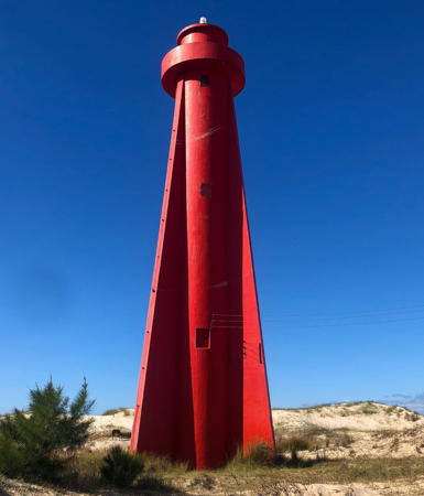
* Solidão (2)
1949 (station established 1929). Active; focal plane 24 m (78 ft); two white flashes every 12 s. 21 m (69 ft) red round cylindrical concrete tower with lantern, gallery and four buttresses. The reddish color of the tower appears to be in the concrete rather than painted. Leandro Abreu's 2021 photo is at right, Marcelo Koelho has a photo, Fabricio Padilha Martins has a photo, Rafael Webber has a street view, and Google has a satellite view. The original lighthouse was a 17 m (56 ft) steel skeletal tower. Located on the beach about 70 km (45 mi) northeast of Mostardas and 40 km (25 mi) southwest of Quintão. Accessible by 4WD. Site open, tower closed. . ARLHS BRA-100; BR-3996; Admiralty G0612; NGA 18948.

Solidão Light, Mostardas, April 2021
Instagram photo by Leandro Abreu
** Mostardas (2)
1940 (station established 1894). Active; focal plane 39 m (128 ft); white light on 10 s, off 4.5 s, white flash, off 4.5 s, red light on 10 s, off 4.5 s, red flash, off 4.5 s. 38 m (125 ft) round concrete tower with lantern and gallery, painted with black and white horizontal bands. A Barbier, Bénard & Turenne Fresnel lens (1934) is in use. Victor Varela's 2023 photo is at right, a 2012 photo is available, Rui Capalonga has a closeup photo, Victor Ferreira has a 2017 photo, and Google has a satellite view. This lighthouse is located in a national park, the Parque Nacional da Lagoa do Peixe. The original lighthouse was a 33 m (108 ft) cast iron tower prefabricated in France. Located on the beach about 20 km (13 mi) south of the town of Mostardas. Accessible by 4WD from the seaside resort of Balneário Mostardense 9 miles northeast. Site open, tower open but the schedule is not known. . ARLHS BRA-065; BR-4000; Admiralty G0614; NGA 18956.
* Capão da Marca de Fora
Date unknown. Active; focal plane 42 m (138 ft); three white flashes every 10 s. 12 m (39 ft) round cylindrical concrete tower with gallery, painted white with one red horizontal band. Antonio Carlos Torres Vianna has a closeup photo and a more distant view, Leonardo Rodrigues has a 2021 photo, and Google has a satellite view. Not to be confused with the historic Capão de Marca lighthouse on the Lagoa dos Patos (see below). Located just off the beach about 40 km (25 mi) southwest of Tavares. Accessible by 4WD. Site open, tower closed. BR-4002; Admiralty G0615; NGA 18959.7.
* #Conceição (2)
Date unknown (station established 1929). Destroyed around 2022; still listed with focal plane 33 m (108 ft); white light, 2 s on, 13 s off. 30 m (98 ft) square cylindrical steel skeletal tower, painted red with a white horizontal band. C.W. Bash has posted a photo taken by Rafael Podolano, Jefferson Rodrigues Amaral has a photo, and Cleiton Rodrigues Teixeira has a 2017 photo. The original lighthouse was a 24 m (79 ft) hexagonal masonry tower that was overturned by beach erosion; Rodrigues Teixeira has a photo of the fallen tower. The new tower also seemed endangered by sea level rise and, sure enough, Gleidson Ribes has a July 2023 photo of the ruins of the tower on the beach. Dalila Martins has a 2024 photo and Google has a satellite view. Located on the beach about 65 km (40 mi) northeast of Rio Grande do Sul. Accessible by 4WD. Site open, tower closed. ARLHS BRA-027; BR-4004; Admiralty G0616; NGA 18960.
* Estreito
Date unknown. Active; focal plane 42 m (138 ft); white light, 2 s on, 13 s off. 40 m (131 ft) square cylindrical steel skeletal tower, painted white. Cristiel Lemos has a 2019 closeup photo, Wikimapia has photos, and Google has a satellite view. Located on the beach about 40 km (25 mi) northeast of Rio Grande do Sul. Accessible by 4WD. Site open, tower closed. ARLHS BRA-212; BR-4006; Admiralty G0618; NGA 18962.

Mostardas Light, Mostardas, April 2023
ex-Google Maps photo by Victor Varela

Rio Grande do Sul Entrance Lighthouses
The Rio Grande do Sol is not a true river, it is a the narrow outlet for two large lagoons, the Lagoa dos Patos and the Lagoa Mirim, fed by several rivers.

* Barra Rio Grande (4?)
1847 (station established 1820). Active; focal plane 32 m (105 ft); white light on 10 s, then five flashes in the next 11 s. 31 m (102 ft) round cast iron tower with lantern and gallery, painted with black and white horizontal bands. A 2nd order Barbier & Fenèstre Fresnel lens (1886) is in use. A 2021 photo by Ademir Rodrigues is at right, Fernando Zafalon Pieper has a photo, Mara M.C. Hermes has a 2022 photo, Trabas has Capt. Peter's photo, Eduardo Rosca has a closeup drone view, and Google has a satellite view. Lights are said to have been shown from this point as early as 1698. Denise Giacomini has a 2021 photo and Wikimapia has photos showing the nearby Atalaia tower, which is sometimes described as a lighthouse; it was used for many years as a signal tower and it carried a light very briefly in 1820. One Wikimapia photo shows the lighthouse behind the Atalaia tower. Other early lighthouses were built in 1840 and 1842. The present lighthouse is the oldest cast iron lighthouse in South America and one of the oldest in the Western Hemisphere. Prefabricated in England, it is a rare example of an early English design. It was installed in 1847 and extended by installation of a larger lantern in 1852. Located on the east side of the Rio Grande do Sul in the village of Povoação da Barra. Accessible by road. Site open, tower closed. ARLHS BRA-245; BR-4008; Admiralty G0620; NGA 18964.
Rio Grande do Sul East Mole (2)
Date unknown (recent). Active; focal plane 13 m (43 ft); long red flash every 10 s. 12 m (39 ft) hexagonal cylindrical concrete tower, painted white. Rodrigo Borges Da Rosa has a photo, Carla Cristina has a closeup, and Google has a satellite view. Two long (about 2.5 miles) breakwaters protect the entrance to Rio Grande do Sul. Trabas has Capt. Peter's photo of the earlier light, which was similar but round rather than hexagonal. Located at the end of the east mole (breakwater) at Rio Grande do Sul. Site status unknown. Admiralty G0624; BR-4040; NGA 18968.
* Rio Grande do Sul West Mole (2)
Date unknown (recent). Active; focal plane 12 m (39 ft); long green flash every 10 s. 12 m (39 ft) hexagonal cylindrical concrete tower, painted white. Lucas Paulino has a 2023 photo, Igor Santos has a closeup 2017 photo, and Google has a satellite view. The West Mole has been extended recently, and the light was relocated to the end of the extension. Trabas has Capt. Peter's photo of the earlier light, which was similar but round rather than hexagonal. Site open, tower closed. ARLHS BRA-246; BR-4044; Admiralty G0622; NGA 18972.

Barra Rio Grande Light, Rio Grande do Sul, January 2021
Google Maps photo by

Lagoa dos Patos Lighthouses
The Lagoa dos Patos (Lagoon of the Ducks) is a large lagoon or estuary, 280 km (175 mi) long, emptying into the Atlantic at Rio Grande do Sul city. Porto Alegre, the capital of Rio Grande do Sul state, is located at the northern end of the lagoon.
[Bujuru (Bojuru)]
1868. Inactive since the 1950s. Formerly a square masonry tower rising from a keeper's house, the lighthouse has collapsed into ruins. Marcos Aurelio Pinheiro has a 2020 photo and Google has an indistinct satellite view. A historic photo of the tower is available, The light was replaced by a small red beacon (focal plane 8 m (26 ft); red flash every 8 s) on a pile structure off the end of the shoal. Located on a tiny island off a sandy point projecting into the Lagoa dos Patos about 16 km (10 mi) north of the village of Bujuru. Accessible only by boat. Site open. Active light: BR-4464; Admiralty G0631; NGA 18959.5.
* Capão da Marca (2)
1881 (station established 1849). Active; focal plane 19 m (62 ft); red light, 2 s on, 8 s off. 14 m (46 ft) octagonal metal cast iron skeletal tower with lantern and central cylinder. Entire lighthouse painted white. Victor Varela's 2023 photo is at right, Iriani Ghellere has a 2021 photo, Arnaldo Batista has a 2022 photo, Wikimedia has João Paulo Lucena's photo, Faroís Brasileiros has a page for the lighthouse, a closeup photo is available, Rafael Webber has a closeup street view, and Google has a satellite view. Prefabricated in France by Sautter, Lemonnier & Cie., this is the second oldest surviving lighthouse of Rio Grande do Sul, after the Farol da Barra. The original light was on a 7 m (23 ft) wood tower. The Wikipedia article describes it as inactive, but apparently it has been reactivated. Located on the beach on the east side of the lagoon near Tavares, about 11 km (7 mi) southwest of the Mostardas lighthouse. Accessible by 4WD. Site open, tower closed. . ARLHS BRA-127; BR-4472; Admiralty G0631.2; NGA 18957.
Cristóvão Pereira (2)
1861 (station established 1849). Active; focal plane 30 m (98 ft); white flash every 10 s. 28 m (92 ft) square cylindrical brick tower; no lantern. Lighthouse formerly painted white, but almost no paint remains. The keeper's houses were demolished in 1992. Lima has a good photo, Wikipedia has an article (in Portuguese) on its history, and Wikimedia has a good photo by João Paulo Lucena. Endangered: Google's satellite view reveals that the lighthouse, although protected by a seawall, is nearly surrounded by the waters of the lagoon. In 1992 the keeper's house was demolished and the windows of the tower were removed and bricked over. The lighthouse is named for Cristóvão Pereira (1678-1755), a frontier leader who explored the area and helped establish Portuguese control in the region around 1750. Located on a sandy point projecting into the Lagoa dos Patos about 25 km (15 mi) west of Mostardas and 30 km (19 mi) north of Tavares. Accessible by 4WD. Site open, tower closed. . ARLHS BRA-131; BR-4480; Admiralty G0631.4; NGA 18946.9.

Capão da Marca Light, Tavares, April 2023
ex-Google Maps photo by Victor Varela
Itapuã da Lagoa
1860. Active; focal plane 17 m (56 ft); white flash every 6 s. 13 m (43 ft) octagonal brick tower rising from 1-story keeper's houses. Lighthouse painted white; lantern roof and gallery railing painted red. Julio Cesar Silveira's2023 photo is at right, Marcus Guimarães has a photo, Paulo Angonese has another photo, an April 2007 photo is available, Wikimedia has Jesse Dill's photo, Huelse has a historic postcard view, and Google has a satellite view. One of the oldest lighthouses in the state of Rio Grande do Sul. In October 2002 the station was transferred to the state government and restored as part of a state park, the Parque Estadual de Itapuã; it is to be used as an educational center. Located at the northern end of the Lagoa dos Patos, on the east side of the entrance to the narrow channel (the Canal da Itapuã) leading to Porto Alegre, the capital of Rio Grande do Sul. Site open, tower open to guided tours from Itapuã on weekends. Accessible only by boat; there are no roads in the area. ARLHS BRA-142; BR-4528; Admiralty G0633; NGA 18946.

Lagoa Mirim Lighthouse
The Lagoa Mirim is a second lagoon, 170 km (105 mi) long, located to the south of the Lagoa dos Patos and extending across the Uruguayan border. The Lagoa Mirim is connected to the Lagoa dos Patos by a navigable channel (the Canal de São Gonçalo) at the town of Pelotas, west of Rio Grande do Sul. Navigation on the lagoon is limited to small craft.

*
Ponta Alegre
1908. Inactive since 1964. 16 m (52 ft) square cylindrical masonry tower with lantern and gallery. The lighthouse was painted white originally, but only traces of the paint remain. Lantern painted red. Ancelmo Galarraga has a 2018 photo, Rodrigo de Oliveira has a photo, and Bing has a satellite view. Endangered: the lighthouse is abandoned and vandalized. Recently the city council of Arroio Grande has discussed restoring the lighthouse as a tourist attraction, but a 2021 photo by Marcos Antônia Corá shows the lighthouse still in poor condition. Located on the Praia do Farol, a sandy peninsula on the north side of the Lagoa Mirim, about 25 km (15 mi) southeast of Arroio Grande. Apparently accessible by 4WD. Site open; tower reported open but dangerous. ARLHS BRA-288.

Itapuã da Lagoa Light, Porto Alegre, December 2023
Google Maps photo by Julio Cesar Silveira

Southern Beach (Praia do Cassino) Lighthouses
South of the Rio Grande do Sul entrance is another of the world's great beaches. A largely deserted strand that stretches about 220 km (135 mi) from Rio Grande do Sul to the Uruguayan border, the Praia do Cassino is believed to be the longest uninterrupted sand beach in the world.

Sarita (3)
1952 (station established 1909). Active; focal plane 40 m (131 ft); three white flashes, separated by 2 s, every 15 s. 37 m (121 ft) square concrete tower with lantern and gallery, rising from a 2-story square concrete base. Lighthouse painted with red and white horizontal bands. Lima has a photo, Jorge Marques has a closeup photo, Pedro Torrezin has a 2023 photo, Márcio Ramos Botelho has a photo, and Google has a satellite view. The original lighthouse, a 26 m (85 ft) cast iron tower, was replaced by a second cast iron tower in 1929. Located about 70 km (45 mi) southwest of Rio Grande do Sul. Site open, tower closed as far as we know. . ARLHS BRA-098; BR-4648; Admiralty G0636; NGA 19000.
[Verga]
1964. Inactive. This was a 10 m (35 ft) square pyramidal steel skeletal tower mounted on a 1-story square pyramidal concrete workroom. A 2019 photo is available, Marcio Mathias has a 2020 closeup, Aranha Márcio Elieser Vaz Valerio has 2022 photo, and Google has a satellite view. The skeletal tower was removed in 2022 or 2023; only the concrete base remains, as seen in Ana Mottin's December 2023 photo. Located on the beach about 110 km (70 mi) northeast of Barra do Chuí. Accessible by 4WD vehicle on the beach. Site open, tower closed. ARLHS BRA-207; ex-BR-4652; ex-Admiralty G0639; NGA 19004.
Albardão (2)
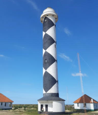
1948 (station established 1909). Active; focal plane 50 m (164 ft); four white flashes, separated by 3 s, every 25 s. 44 m (144 ft) round cylindrical concrete tower with lantern and gallery, rising from the center of 1-story concrete workroom. Lighthouse painted in a black and white diamond pattern, said to have been inspired by the Cape Lookout lighthouse in North Carolina. Four 1-story keeper's houses. A 2021 photo by Graça Fernandes is at right, Lima has a photo, Paulo de Araujo has a closeup photo, Emersom Correa has a 2021 closeup, Leonir André Colling has a great 2009 photo, the Instituto Brasil Costal posted a good photo, and Google has a good satellite view. The original lighthouse was a 35 m (115 ft) cast iron tower. Located on the beach about 90 km (55 mi) northeast of Barra do Chuí. Accessible by 4WD vehicle on the beach. Site open, tower closed as far as we know. . ARLHS BRA-002; BR-4656; Admiralty G0640; NGA 19008.
* Chuí (3)
1941 (station established 1910). Active; focal plane 42 m (141 ft); two white flashes, separated by 8 s, every 25 s. 30 m (98 ft) round concrete tower with four narrow buttresses, lantern, and double gallery. Lighthouse painted with red and white horizontal bands. Four 1-story keeper's houses. A 2021 photo is at the top of this page, Wikimedia has many photos, Carlos Magno Serrano has a 2018 photo, Roberto Bacila has a fine 2017 photo, Andre Souza has a 2022 photo, and Google has a satellite view. The original lighthouse, a 26 m (85 ft) skeletal tower, was replaced by a concrete tower in 1934. That lighthouse had to be abandoned after a few years because of an unstable foundation. Located at Barra do Chuí, at the mouth of the Arroio Chuí, which is the Uruguayan border. Accessible by road from BR 471 at Chuí. Site open, tower closed as far as we know. . ARLHS BRA-024; BR-4660; Admiralty G0644; NGA 19012.

Albardão Light, Santa Vitoria do Palmar, February 2021
Google Maps photo by Graça Fernandes

Information available on lost lighthouses:

Notable faux lighthouses:

Adjoining pages: North: Southeastern Brazil | South: Uruguay | West: Paraguay

Return to the Lighthouse Directory index | Ratings key

Posted January 30, 2004. Checked and revised August 9, 2024. Lighthouses: 44. Site copyright 2024 Russ Rowlett and the University of North Carolina at Chapel Hill.