Lighthouses of France: Western Finistère

France (officially the French Republic, République française) has coasts facing south on the Mediterranean Sea, west on the open Atlantic Ocean, and north on the English Channel (La Manche in French). Long a leader in lighthouse design, France has scores of famous and historic lighthouses. And it was a French engineer and physicist, Augustin-Jean Fresnel (1788-1837), who invented the powerful and beautiful lenses used in lighthouses around the world.

France's Département du Finistère (Department of the End of the World) occupies the rugged western end of the peninsula of Bretagne (Brittany), one of the 12 administrative regions (régions) of Mainland France. Its dangerous coastline is crowded with lighthouses, more than in any other region of France. So many, in fact, that the Directory needs three pages to cover them all. This page includes lighthouses in the western end of the département, west of Brest.

The Mer d'Iroise (Iroise Sea) is the turbulent basin of the Atlantic off the westernmost tip of France, between the Pointe du Raz and Île de Sein on the south and the Île d'Ouessant (Ushant) on the north. Subject to violent storms and huge waves, it is among the most dangerous seas of Europe. At its southern boundary the Pointe du Raz is a spectacular, razor-sharp point of rock projecting into the Atlantic. The same line of rocks continues under water for many miles as an extremely dangerous reef called the Chaussée de Sein. Lighting this infamous hazard required decades of effort and some remarkable engineering. Wikipedia has a map showing the reef and its lighthouses.

The French word for a lighthouse, phare, is often reserved for the larger coastal lighthouses; a smaller light or harbor light is called a feu (literally "fire," but here meaning "light") or a balise (beacon). The front light of a range (alignement) is the feu antérieur and the rear light is the feu postérieur. In French île is an island, cap is a cape, pointe is a promontory or point of land, roche is a rock, récife is a reef, baie is a bay, estuaire is an estuary or inlet, détroit is a strait, rivière is a river, and havre is a harbor. The Breton word for a lighthouse is tour-tan; enez is an island, and men is a rock or reef.

Aids to navigation in France are maintained by the Bureau des Phares et Balises, an agency of the Direction des Affaires Maritimes (Directorate of Maritime Affairs). The Directorate has four regional offices (called Directions Interrégionale de la Mer, or DIRM) at Le Havre, Nantes, Bordeaux, and Marseille. Lights in Brittany are managed by the DIRM Nord-Atlantique - Manche Ouest at Nantes.

ARLHS numbers are from the ARLHS World List of Lights. FR numbers are the French light list numbers, where known. Admiralty numbers are from volumes A and D of the Admiralty List of Lights & Fog Signals. U.S. NGA List numbers are from Publication 113.
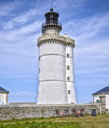

Le Stiff Light, Île d'Ouessant, August 2014
Wikimedia Creative Commons photo by Yann Caradec
General Sources
DIRM - Phares du Finistère
Information on the major historic lighthouses.
Les Sentinelles des Mers - France - Bretagne
Photos and information posted by Guy Detienne.
Le Phare à travers le Monde
A large, well known site maintained by Alain Guyomard and Robert Carceller.
Les Phares de France
Another large and well known site, this one by Jean-Christophe Fichou.
Phares et Balises: Silhouettes
Photos and information posted by M. Mocquant.
Online List of Lights - France - Atlantic Coast
Photos by various photographers posted by Alexander Trabas.
Leuchttürme.net - Frankreich
Photos and notes by Malte Werning.
Lighthouses in Finistère
Photos by various photographers available from Wikimedia.
Lighthouses in France
Aerial photos posted by Marinas.com.
Liste des phares du Finistère
From the French language Wikipedia, this page has a map of Finistère showing the locations of the lighthouses.
Seeing Lighthouses in Brittany and Île d'Ouessant
Photos and English language text by Rick Chinn, including a useful chart of visitable lighthouses.
Société Nationale pour le Patrimoine des Phares et Balises (SNPPB)
The French national lighthouse preservation organization.
Französische Leuchttürme und Baken auf historischen Postkarten
Historic photos and postcard images posted by Klaus Huelse.
GPSNauticalCharts
Navigational chart information for Finistère.
Navionics Charts
Navigation chart for Finistère.

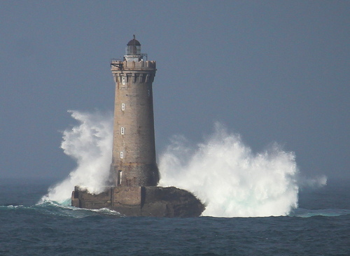
Phare du Portzic
Pointe du Portzic Light, Brest, February 2012
Wikimedia Creative Commons photo by Luca Lorenzi

Pointe du Raz Lighthouses
The Pointe du Raz is in the commune of Plogoff. The word raz ("race") refers to the strong and deadly currents around the point.
* Pointe du Raz
1839. Inactive since 1887. Approx. 17 m (56 ft) square cylindrical stone tower with gallery and a large octagonal stone watch room, attached to the front of a 1-story stone keeper's house. The lantern has been replaced by a modern control room, and communications and radar gear are mounted atop the control room. Control room painted white, tower and gallery unpainted, keeper's house white with unpainted stone trim. In front of the lighthouse is a memorial with a statue of Notre-Dame des Naufragés (Our Lady of the Shipwrecked). David Rofas has a photo, a 2007 photo of the front and a 2018 photo of the rear are available, Florent Brié has a street view, Huelse has a historic postcard view, and Google has a satellite view. This lighthouse was deactivated after construction of the Phare de la Vieille offshore made it obsolete. It was occupied by the French Navy for many years as an observation and traffic control station, but that facility has apparently been closed. The building is now referred to as a sémaphore, its previous career as a lighthouse largely forgotten. Located at the tip of the Pointe du Raz, about 5 km (3 mi) west of Plogoff. Site open, tower closed. . ARLHS FRA-786.
La Vieille
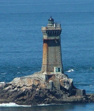
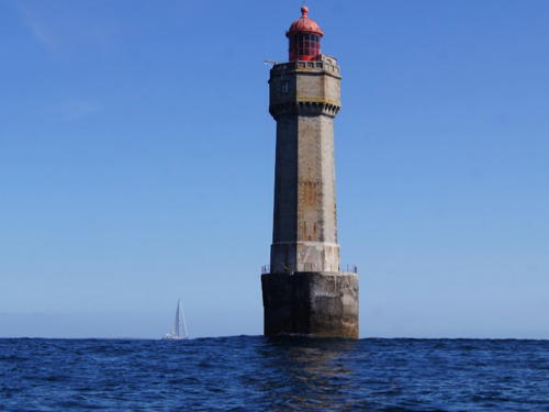
1887. Active; focal plane 33 m (108 ft); white, red or green light, depending on direction (there are nine distinct sectors), 4 s on, 1 s off, 4 s on, 1 s off, 1 s on, 1 s off. 27 m (89 ft) unpainted square granite tower with lantern and gallery. Lantern painted black. Fog horn (Morse code "R," short-long-short, every 60 s). Larry Myhre's photo is at right, Trabas has Tom Chisholm's closeup, DIRM has a page for the lighthouse, Detienne also has a page, Wikimedia has many photos, Jean-Marie Hauw has a 2021 photo, Werning has a distant view, Stephan Christoph has a distant street view from the Pointe du Raz, Marinas.com has aerial photos, Huelse has a historic postcard view, and Google has a satellite view. One of the most famous French lighthouses, this tower is built on the rock called La Vieille ("the old one" in French) or Gorlebella ("farthest rock" in Breton) about 1.6 km (1 mi) west of the Pointe du Raz. It is one of French lighthouse photographer Jean Guichard's favorite subjects. The lantern was removed for restoration in 2020 and returned in Juky 2021. From the tip of the point there is an excellent view of this lighthouse and more distant views of the Feu de la Plate and the Tévennec, Île de Sein and Ar-Men lighthouses. Accessible only by boat in very heavy seas. Site and tower closed. . ARLHS FRA-027; FR-0700; Admiralty D0870; NGA 0272.
Phare de la Vieille
La Vieille Light, Pointe du Raz, May 2009
Flickr Creative Commons photo by Larry Myhre
La Plate (Petite Vieille) (2)
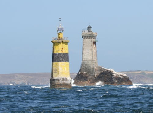
1910 (station briefly established in 1896). Active; focal plane 19 m (62 ft); nine very quick white flashes every 10 s. 26 m (85 ft) octagonal solid reinforced concrete tower with gallery but no lantern. Lighthouse painted yellow with a black horizontal band. Julien Carnot's photo is at right, Trabas has a closeup by Darlene Chisholm, Guyomard and Carceller have a photo by François Floch showing the Phare de la Vieille in the background, Lu Bey has a 2022 photo, this tower is to the left of the Phare de la Vieille in Stephan Christoph's street view from the Pointe du Raz (this tower is in the distance to the left of the La Veille tower), and Google has a satellite view. Originally this light was to have been ready at the same time as the Phare de la Vieille (1887), but construction was so difficult no tower was ready until 1896. Then the light was immediately destroyed by a great storm and another dozen years of effort was required before the present tower was completed. Huelse has an unusual postcard view of the lighthouse under construction. (Note: there is another Feu de la Plate off the Cap de la Hague on the Cotentin peninsula.) Located on a submerged rock about 300 m (330 ft) west southwest of the Phare de la Vieille. Accessible only by boat in very heavy seas; the light can be seen from the Pointe du Raz. Site and tower closed. ARLHS FRA-787; Admiralty D0872; NGA 0284.
Tévennec
1875. Active; focal plane 28 m (92 ft); quick flashing light, white or red depending on direction; also a white flash every 4s at a focal plane of 24 m (79 ft), intensified to the southeast. 15 m (49 ft) square cylindrical stone tower attached to the front of a 1-story stone keeper's house. Lighthouse painted white. Erick Fréjean has a 2018 closeup photo, DIRM has a page for the lighthouse, Detienne also has a page, Guyomard and Carceller have a photo by J. Evenat, Trabas has Darlene Chisholm's photo, Marinas.com has aerial photos, Huelse has a historic postcard view, and Bing has a satellite view. The lighthouse gained press attention in the spring of 2016 when SNPPB president Marc Pointud spent 69 days there as a fundraising stunt. He found the lighthouse to be in very poor condition. After fashioning a makeshift helicopter pad workers were able to repair and repaint the lighthouse in summer 2023. Located on a small island about 5 km (3 mi) northwest of the Pointe du Raz. Accessible only by boat. Site and tower closed. . ARLHS FRA-058; Admiralty D0866; NGA 0276.

La Plate and La Vieille Lights, Pointe du Raz, July 2005
Wikimedia Creative Commons photo by Julien Carnot,

Île de Sein Lighthouses
The Île de Sein is a small island 8 km (5 mi) west of the Pointe du Raz. The island has a population of about 200 and is accessible by passenger ferry from Audierne. The treacherous passage between the Île de Sein and the Pointe du Raz is called the Raz de Sein.
Le Chat
1933. Active; focal plane 27 m (89 ft); three white, red or green flashes, depending on direction, every 6 s. 25 m (82 ft) round cylindrical solid reinforced concrete tower with double gallery but no lantern. Upper portion of the tower is painted yellow, lower portion black. Wikimedia has a closeup photo, Trabas has Darlene Chisholm's closeup, and Bing has a satellite view. This light marks the west side of the Raz de Sein, opposite the Feu de la Plate. Located on an isolated rock about 2.5 km (1.5 mi) east southeast of the Île de Sein and about 5.5 km (3.5 mi) west of the Pointe du Raz. Accessible only by boat; distantly visible from the Pointe du Raz. Site and tower closed. ARLHS FRA-788; Admiralty D0862; NGA 0268.
* Men-Brial
1911. Active; focal plane 16 m (52 ft); white, red or green light, depending on direction, occulting twice every 6 s. 14 m (46 ft) 2-stage round masonry tower with lantern and gallery. Tower painted white with unpainted stone trim; lantern painted green; gallery painted black. An external spiral stairway around the first stage gives access to the second stage. Trabas has a closeup by Ronald Wöhrn, Carsten Rennecke has a 2023 closeup, Guyomard and Carceller have a good photo by J. Evenat, Michel Bonne has a closeup street view, Huelse has a historic postcard view, and Google has a satellite view. Located at the entrance to the harbor of Sein, the only town on the Île de Sein. Site open, tower closed. . ARLHS FRA-067; Admiralty D0860; NGA 0256.
** Île de Sein (2)
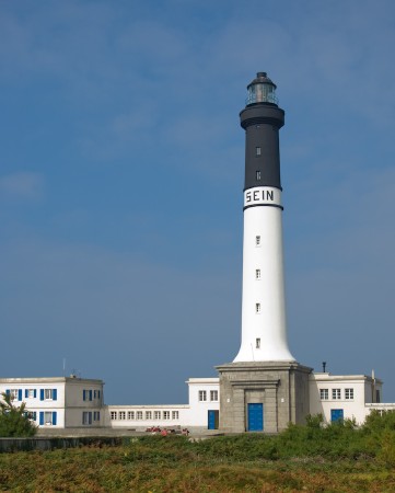
1952 (station established 1839). Active; focal plane 49 m (161 ft); four white flashes, separated by 3 s, every 25 s. 51 m (167 ft) round reinforced concrete tower with lantern and gallery, rising from the center of a 2-story stone keeper's house. Upper 40% of tower painted black, lower portion white; the white and black are separated by a horizontal band bearing the name "Sein" in black letters. A photo is at right, Detienne has a page for the lighthouse, Trabas has an excellent photo by Ronald Wöhrn, François Rosenzweig has a 2022 photo, Guyomard and Carceller also have a view from the lantern, Marinas.com has aerial photos, and Google has a street view and a satellite view. This is a staffed station controlling the other lighthouses of the area. Huelse has a postcard view of the original lighthouse, a 43 m (141 ft) stone tower, which was blown up by German troops on 4 August 1944. Located at the western point of the island, about 1.6 km (1 mi) west of the harbor. Site open, tower open in the summer (inquire locally for the schedule). . ARLHS FRA-066; FR-0695; Admiralty D0856; NGA 0252.
* [Plas ar Scoul (Ar-Guéveur Fog Signal)]
Date unknown. Active; blast every 60 s. 16 m (52 ft) white stone obelisk. Guyomard and Carceller have a photo, another photo is available, and Google has a street view and a satellite view. Located about 850 m (1/2 mi) southwest of the Phare de Sein. Site open, tower closed. ARLHS FRA-172; ex-Admiralty D0858; ex-NGA 0264.

Grand Phare de l'Île de Sein, Pointe du Raz, September 2007
Flickr Creative Commons photo by bididule

Chaussée de Sein Lighthouse
Ar-Men
1881. Active; focal plane 29 m (95 ft); three white flashes, separated by 3.6 s, every 20 s. 36 m (118 ft) round granite tower with lantern and gallery, incorporating keeper's quarters. Upper half of tower painted white, lantern painted black; the gallery and lower half of the tower are unpainted dark granite. Suhas Dubey's photo is at right, DIRM has a page for the lighthouse and a great closeup photo, Detienne also has a page, Trabas has a commercial photo by Philip Plisson, French Wikipedia has a closeup photo of the lighthouse on a rare calm day, and Huelse has a historic postcard view, but the lighthouse is not shown in Google's satellite view. The name Ar Men means "great rock" in Breton. As Carceller and Guyomard write, this is le phare héroïque. French Wikipedia, in its long article on the lighthouse, calls it un phare mythique. After years of planning and discussion efforts to build a lighthouse on the westernmost rock of the Chaussée de Sein began in 1861. So great were the difficulties it was 1867 before the first stones were actually laid. Often the masons had only minutes to work at the lowest tides and in the calmest seas. The tower rose course by course and the lighthouse was illuminated in 1881, twenty years after work began. Another twenty years were spent improving and shoring up the tower. Keepers staffed the lighthouse in 30-day shifts until it was automated in April 1990. The Atlantic crashes relentlessly, and often spectacularly, against this most exposed of lighthouses. Lightphotos.net has a photo showing the surf on an "average" day. Located 8 km (5 mi) west of Île de Sein. Accessible only by helicopter or by boat in roaring seas. Site and tower closed. . ARLHS FRA-001; FR-0694; Admiralty D0852; NGA 0248.

Bouzec-Cap Sizun Lighthouse
* Pointe du Millier
1881. Active; focal plane 34 m (112 ft); white, red or green light, depending on direction, occulting twice every 6 s. 8 m (26 ft) semicylindrical stone tower attached to the front face of a 1-story stone keeper's house. The house is painted white with unpainted stone trim. Werning has a good closeup, Trabas has a good photo by Arno Siering, French Wikipedia has an article with several photos, H. Van der Spek has a photo, Marinas.com has aerial photos, Huelse has a postcard view, and Google has a satellite view. Located on a headland on the south side of the Baie de Douarnenez, about 5 km (3 mi) northeast of Bouzec-Cap-Sizun. Site open, tower closed. . ARLHS FRA-360; Admiralty D0836; NGA 0240.
 

Ar-Men Light, Chaussée de Sein, February 2020
Google Maps photo by Suhas Dubey

Douarnenez Lighthouses
Île Tristan (Douarnenez)
1856. Active; focal plane 35 m (115 ft); white or red light, depending on direction, occulting three times every 12 s. 11 m (36 ft) round cylindrical stone tower with lantern and gallery. Tower unpainted except for a white band around the watch room; lantern and gallery painted black. Cédric Allène has a 2022 closeup photo, Trabas has a photo by Ronald Wöhrn, Werning has a similar photo, Guyomard and Carceller have photos by Philippe Gourdelier, and Google has a satellite view. The island is a protected natural area. Located on an island off the entrance to the harbor of Douarnenez, at the southeastern corner of the Baie de Douarnenez. Accessible only by boat. Site open, tower closed. ARLHS FRA-267; Admiralty D0830; NGA 0220.
* Trinity House Lightship 4 Scarweather (Smith's Knoll)
1947 (Phillip & Son, Dartmouth, England). Decommissioned 1989. 41.7 m (137 ft) steel lightship; skeletal tower with lantern and gallery amidships. Vessel painted red. The ship served on the Smith's Knoll station in the North Sea off East Anglia and later on the Scarweather Sands station off Bristol in the Severn estuary. In 1991 the ship was sold to the Port-Musée in Douarnenez. After a number of years on exhibition the ship seemed to have been abandoned; no longer docked at the museum, it was anchored forlornly in the inner harbor. The museum's web site did not even mention the vessel. A 2007 photo shows the view from a nearby bridge. In early 2008 there was good news about the vessel: it was towed to a drydock for painting and restoration. Google has a 2019 street view and a satellite view. And at last the museum has a web page for the ship. Anchored in the Rivière de Port Rhu just downstream from the D7 bridge. Site open, vessel closed. Owner/site manager: Port-Musée de Douarnenez (Bateau-Phare Scarweather).
* Môle de Rosmeur
Date unknown. Active; focal plane 6 m (20 ft); three green flashes every 20 s. Light mounted on the roof of a 1-story pier building. Trabas has Eckhard Meyer's closeup photo, Google has a street view, and Bing has a satellite view. Located on the elbow of the Môle de Rosmeur on the east side of Douarnenez. Site open, tower closed. Admiralty D0832; NGA 0232.

Crozon Lighthouse
* Pointe de Morgat
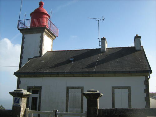
1914. Active; focal plane 77m (253 ft); white, red or green light, depending on direction, occulting four times every 12 s. 15 m (49 ft) square cylindrical stone tower with lantern and gallery, rising from the front of a 1-story stone keeper's house. Building painted white with unpainted stone trim; lantern painted red. A photo is at right, Yann Caradec has a good photo , Werning has a good photo, Trabas has a closeup, Guyomard and Carceller have photos by Benoit le Goff, Jean-Patrick Leroy has a 2011 photo, Greg Lefkeo has a closeup street view, Huelse has a historic postcard view, and Google has a satellite view. Located on the south side of the Crozon peninsula, at the southern entrance to the Anse de Morgat, about 1.1 km (2/3 mi) southeast of the Morgat waterfront. Site open, tower closed. ARLHS FRA-364; Admiralty D0826; NGA 0212.

Pointe de Morgat Light, Crozon, March 2008
Wikimedia Creative Commons photo by Wiki Fan2goscinny

Camaret-sur-Mer Lighthouses
La Parquette
1880. Active; focal plane 17 m (56 ft); green flash every 4 s; a red flash is shown over a sector toward the east. 25 m (82 ft) octagonal stone tower, painted in a black and white spiral pattern (unusual for France). Lantern removed. A closeup photo is available and Trabas has a distant view showing the tower all white, but the lighthouse is not shown in Google's satellite view. Located about 7 km (4.5 mi) south southeast of Pointe St.-Mathieu and a similar distance west of the Pointe du Toulinguet. Accessible only by boat. There's only a very distant view from shore, but there is a closer view from the ferries to the Île d'Ouessant. Site and tower closed. ARLHS FRA-383; Admiralty D0820; NGA 0136.
Pointe du Toulinguet
1849. Active; focal plane 49 m (161 ft); white or red light, depending on direction, occulting three times every 12 s. 14 m (46 ft) square cylindrical stone tower with lantern and gallery, rising from the front of a 2-story stone keeper's house. Building painted white with unpainted stone trim; lantern is gray. There is a modern French Navy signal and control tower close to the lighthouse and the area is restricted. Michael Rapp's photo is at right, Werning has a photo, Trabas has a photo, Jacques Bruylands has a distant view, and Google has a satellite view. This light marks the west end of the Crozon peninsula, which forms the south side of the approach to Brest. There are distant views from outside the naval reservation. Located about 3 km (1.8 mi) west of Camaret-sur-Mer. Site and tower closed. . ARLHS FRA-505; Admiralty D0818; NGA 0140.
* Camaret-sur-Mer (1)
1883. Inactive since 1964. 10 m (33 ft) round masonry tower with gallery, painted white (formerly all green). When the light was deactivated, the lantern was removed and replaced with a green triangular daymarker on a short mast. That daymarker has now been removed. The active light (white or green light depending on direction, 2 s on, 2 s off) was moved to the end of a new breakwater. Franck le Borgne has a street view, Guyomard and Carceller have a photo of the lighthouse while it was still green, Trabas has a photo of the new light, and Google has a satellite view of the historic lighthouse and another satellite view of the new light. Located at the end of the old breakwater on the north side of the harbor of Camaret. Accessible by walking the breakwater. Site open, tower closed. . ARLHS FRA-208. Active light: Admiralty D0816; NGA 0144.

Pointe du Toulinguet Light, Camaret-sur-Mer, September 2006
Wikipédia Creative Commons photo by Michael Rapp

Brest Lighthouses

Brest is a city with a metropolitan population of around 300,000, making it the largest city of Brittany. It is also the traditional home port of France's Atlantic Fleet. The entrance to the port is through the Goulet de Brest, a narrow strait only about 1.5 km (0.9 mi) wide.

#Brest Jetée de l'Ouest (2)
Date unknown (station established 1868). Demolished in or around 2008. This was a 9 m (30 ft) round cylindrical cast iron tower with lantern and gallery. Lighthouse painted white, lantern green. No photo available and the tower is missing in Google's satellite view of the jetty. Trabas has a photo of the new light (focal plane 10 m (33 ft); red light, 2 s on, 2 s off) on 7 m (23 ft) post painted white with a red top. Located at the end of the quay at the west end of the commercial harbor of Brest. Site status unknown. ARLHS FRA-207. Active light: Admiralty D0804; NGA 0188.
#Brest Digue Est (1)
1905. Demolished in late 2008 or early 2009. 10 m (33 ft) round cast iron tourelle with lantern and gallery. Tower painted white, lantern green. Jo Pensel has a June 2008 photo and Fichou's page has a small photo. Google has only a blurred satellite view. Trabas has a photo of the new light (focal plane 10 m (33 ft); quick-flashing green light) on a 7 m (23 ft) white tower with a green top. Located at the southern end of the east breakwater at Brest, marking the entrance to the main harbor. Accessible only by boat; the breakwater does not connect to the shore. There should be fairly good views from the waterfront. Site and tower closed. ARLHS FRA-205. Active light: Admiralty D0798; NGA 0176.
Brest Quai de l'Artillerie
Date unknown. Active; focal plane unknown; red light, characteristic unknown. Approx. 12 m (39 ft) triangular skeletal tower with lantern. Trabas has Capt. Peter's photo and Google has a very distant street view, but the light is not seen in a blurred Google satellite view. Located on the corner of a wharf opposite the main harbor of Brest. Site and tower closed (military area). Admiralty D0800.4.
Pointe du Portzic (feu postérieur)
1848 (Louis Plantier). Active; focal plane 56 m (184 ft); white or red light, depending on direction, occulting twice every 12 s. 35 m (115 ft) octagonal granite tower with lantern and gallery, attached to a 2-story stone harbor control building. Tower unpainted, lantern painted red. 1-story signal station, in the form of a modern control room, is adjacent to the front of the lighthouse. Luca Lorenzi's photo is at the top of this page, Detienne has a page for the lighthouse, Trabas has a fine closeup by Capt. Peter, Morgane Colombe has a 2021 closeup, Werning has a photo, Guyomard and Carceller's page has photos, and Huelse has a historic postcard view, but the lighthouse is not seen in Google's blurred satellite view. This light shines through the Goulet de Brest, guiding ships into the port. Located on the naval base, at the northwestern corner of the Goulet, just southwest of the city of Brest. Site and tower closed (restricted military area); the best views are from the ferries from Brest to the Île d'Ouessant. . ARLHS FRA-034; FR-0655; Admiralty D0790.1; NGA 0160.
La Roche Mengant
1898. Active; focal plane 11 m (36 ft); three white or red flashes every 12 s, depending on direction. 15 m (49 ft) round cylindrical stone tower with two galleries but no lantern, painted black with one red horizontal band. Trabas has Capt. Peter's closeup photo, Werning has a photo, Detienne has a photo, another photo is available, and Google has a satellite view. Located on an isolated rock in the middle of Goulet de Brest. Accessible only by boat. Site and tower closed. ARLHS FRA-454; Admiralty D0792; NGA 0154.
** Pointe du Petit Minou (feu antérieur)
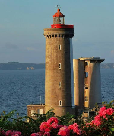
1848 (Louis Plantier). Active; focal plane 32 m (105 ft); two flashes every 6 s, white or red depending on direction; also a quick-flashing white light, focal plane 22 m (72 ft), which serves as the front light of the Portzic range. 26 m (85 ft) round granite tower with lantern and gallery, rising from a circular 1-story stone keeper's house. The tower is painted white on the southwest (seaward) side and is unpainted otherwise; lantern painted red. Fresnel lens in use. Next to the lighthouse is a shorter signal tower that formerly carried radar equipment. Paul Leven's photo is at right, Detienne has a page for the lighthouse and a page with photos of the interior, Trabas has Capt. Peter's closeup photo, Guyomard and Carceller's page has photos, Werning has a good photo, Fred Poirier has a closeup street view, Huelse has a historic postcard view, and Google has a street view and a satellite view. The lighthouse is the front light of a range, with the Portzic lighthouse (see above) as the rear light. After being closed to the public as part of a military base, the lighthouse was opened to the public for the first time in 2018. It was closed for interior renovation in 2021 but reopened in 2022. Located on an islet just offshore, connected to the mainland by an arched stone bridge, at the northern entrance to the Goulet de Brest, about 6 km (3.5 mi) southwest of La Trinité. Site open, tower reported open but no schedule has been found. . ARLHS FRA-032; FR-0652; Admiralty D0790; NGA 0152.

Petit Minou Light, Brest , June 2023
Instagram photo by Paul Leven

Plougonvelin (Saint-Mathieu) Lighthouses
Les Pierres Noires
1872. Active; focal plane 27 m (89 ft); red flash every 5 s. 28 m (92 ft) round stone tower with lantern and gallery, incorporating keeper's quarters. Upper half of tower painted red, lower half white; lantern is black. Fog horn (two blasts every 60 s). Claude Carnot has a good photo, a 2018 closeup is available, and Trabas has a commercial aerial photo but the lighthouse is not shown in Bing's satellite view. Located on a rocky islet about 9 km (5.5 mi) west of Pointe St.-Mathieu and 8 km (5 mi) southeast of Île Molène. Accessible only by boat. There is only a very distant view from shore, but there is a closer view from the ferries to the Île d'Ouessant. Site and tower closed. ARLHS FRA-050; Admiralty A1886; NGA 0116.
Les Vieux Moines
1898. Active; focal plane 16 m (52 ft); red flash every 4 s. 19 m (62 ft) octagonal concrete tower; no lantern. Tower painted red. Trabas has Capt. Peter's photo, Werning has a good photo, Guyomard and Carceller have excellent photos by Dominique Resmon, Detienne has a photo, and Google has a satellite view. Located just southwest of the Pointe St.-Mathieu. Accessible only by boat, but easily seen from shore. Site and tower closed. ARLHS FRA-533; Admiralty A1884; NGA 113-0112.
**** Saint-Mathieu (2) (feu postérieur)
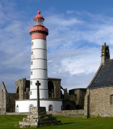
1835 (station established 1692). Active; focal plane 56 m (184 ft); white flash every 15 s; also a continuous white light visible only as the rear light of the Southbound Chenal du Four Range (the Kermorvan light is the front light, see below). 37 m (121 ft) round stone tower with lantern and gallery, rising from a round 1-story keeper's house. Lantern and top of the lighthouse painted red, rest of the tower white with gray trim. Clamshell Fresnel lens in use. The lighthouse is built amid the ruins of a 13th century Benedictine abbey; the monks began showing a light from the tower of the abbey in 1692. Nearby is a 5-story stone signal tower (sémaphore) topped by a modern control room that regulates ship traffic into and out of Brest. A photo is at right, Detienne has a page for the lighthouse, Larry Myhre has a 2009 photo, Werning has a fine photo, Trabas has a closeup by Capt. Peter, Wikimedia has dozens of photos, the Phareland site has many photos, Marinas.com has aerial photos, and Google has a street view and a satellite view. The lighthouse was repainted in 2017. Located on the Pointe St.-Mathieu about 3 km (1.8 mi) south of Le Conquet, marking the beginning of the approach to Brest. On a clear day more than a dozen lighthouses can be seen from this location. Located on the Pointe Saint-Matthieu about 30 km (19 mi) west of Brest. Accessible by road, parking provided. Site open, tower open on weekends in late May, daily except Tuesdays in June, daily in July and August, daily except Tuesdays in September and October, and also during certain holiday periods. Site manager: Le Phare Saint-Matthieu . ARLHS FRA-056; Admiralty A1874.1; NGA 0104.
* Saint-Mathieu Feu Auxiliaire (2)
1899 (station established 1894). Active; focal plane 26 m (85 ft); quick-flashing light, white, red, or green depending on direction. 8 m (26 ft) round cylindrical stone tower with lantern and gallery, painted white with unpainted stone trim. Werning has a good photo, Trabas has a closeup by Eckhard Meyer, Larry Myhre has a 2009 photo, and Bing has a satellite view. This directional light helps guide smaller ships around the Pointe St.-Mathieu. Located about 54 m (175 ft) northwest of the main lighthouse. Site open, tower closed. ARLHS FRA-624; Admiralty A1875; NGA 0108.
St.-Mathieu Light
Pointe de St.-Mathieu Light, Plougonvelin, November 2010
Wikimedia Creative Commons photo by Llorenzi

Le Conquet Lighthouses
Le Conquet is a town of about 2700 residents. The westernmost town of mainland France, it is the terminal for ferries to the Île Molène and Île d'Ouessant.
* Lochrist (feu postérieur)
1939. Active; focal plane 49 m (161 ft); white light occulting three times every 12 s, visible only near the range line and intensified on the range line.17 m (56 ft) octagonal concrete tower with concrete gallery but no lantern, mounted on an octagonal stone base. The front face of the tower is painted white on and below the gallery and red above; the rest of the tower is unpainted. Larry Myhre has a 2009 photo, Werning has an excellent photo, Trabas has a closeup, a 2022 photo is available, and Google has a street view and a satellite view. The range guides ships on a southeast course through the Chenal de la Helle; the Kermorvan light (next entry) is the front light. Located on a hilltop just south of Le Conquet, about 2.7 km (1.7 mi) southeast of the Kermorvan light, which serves as the front light of the range. Site open, tower closed. ARLHS FRA-339; Admiralty A1880; NGA 0088.
** Kermorvan (feu antérieur)
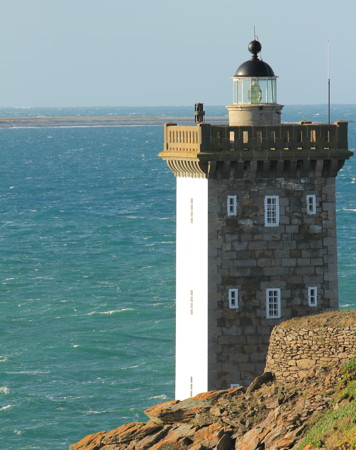
1849. Active; focal plane 20 m (66 ft); white flash every 5 s. 20 m (66 ft) square stone tower with lantern and gallery. The three seaward faces of the tower are painted white; the landward face and the stone gallery are unpainted. Fresnel lens in use. Fog horn (blast every 60 s). Julien Carnot's photo is at right, Detienne has a page for the lighthouse, Larry Myhre has a 2009 photo, Werning has a photo, Trabas has Capt. Peter's closeup, Wikimedia has several photos, Michael Port has a street view, and Google has a satellite view. Behind the lighthouse is a stone fort that was used as the keeper's quarters after the army departed from it in 1898. This versatile lighthouse serves as the front light for three ranges: the Northbound Chenal du Four Range with the Phare de Trézien as the rear light, the Chenal de la Helle Range with the Phare de Lochrist as the rear light, and the Southbound Chenal du Four Range with the Phare de Saint-Mathieu as the rear light. Located at the extreme tip of the Pointe de Kermorvan, which protects the north side of the harbor of Le Conquet. According to Detienne the interior was recently restored and the lighthouse was opened to the public in 2022; he has photos of the interior. Excellent view from the ferries to the Île d'Ouessant. Site open, tower open in July and August. . ARLHS FRA-024; Admiralty A1874; NGA 0084.
La Grande Vinotière (4)
1919 (station established with a daybeacon in 1859 and as a lighted beacon in 1898). Active; focal plane 15 m (49 ft); red light, 3 s on, 7 s off. 24 m (79 ft) octagonal stone tower on a square base, with gallery but no lantern. Tower painted red. Werning has a nice photo in which several other lighthouses can be seen, Trabas has Capt. Peter's photo, Guyomard and Carceller have photos by Dominique Resmon, Detienne has a photo, and Bing has a satellite view. A hard-luck site. The first beacon was quickly overturned by a storm. The second, raised in height to carry a light in 1898, was destroyed in a collision with a ship in 1905. Its replacement was nearly destroyed by a storm in 1915. Located about 1.5 km (1 mi) west of the Pointe de Kermorvan, on the north side of the entrance to Le Conquet and at the south end of the Chenal du Four. Accessible only by boat; there is a distant view from the Kermorvan lighthouse. Site and tower closed. ARLHS FRA-306; Admiralty A1872; NGA 0092.
Kermorvan Light
Kermorvan Light, Le Conquet, January 2012
Wikimedia Creative Commons photo by Julien Carnot

Île Molène Lighthouse
The Île Molène is a small island lying off the westernmost tip of France, between the mainland and the Île d'Ouessant. The island has a permanent population of about 275 and is accessible by passenger ferry from Brest year round and from Le Conquet and Camaret sur Mer during the summer. Some of the Ouessant ferries also call at Île Molène.

Les Trois Pierres (Île-Molène)
1923. Active; focal plane 15 m (49 ft); white, red, or green light, depending on direction, 2 s on, 2 s off. 15 m (49 ft) solid round cylindrical tower with gallery but no lantern, painted white. Access to the gallery is by an external ladder. Trabas has Capt. Peter's closeup photo, Hervé Therry has a photo, Detienne has a photo, Magali Deval has a view from the sea, and Google has a satellite view. Located on a rock on the northeast side of the island, marking the entrance to the harbor. Accessible only by boat, but there is a good view from the ferries. Site and tower closed. ARLHS FRA-526; Admiralty A1870; NGA 0040.

Île d'Ouessant (Ushant) Lighthouses
The Île d'Ouessant (called Ushant in English) is an island lying off the westernmost tip of France. Its two accessible lighthouses, Créac'h and Le Stiff, are among the most famous in France. The island has a permanent population of about 800 and is accessible by passenger ferry from Brest year round and from Le Conquet and Camaret sur Mer during the summer. Transportation on the island is by bicycle or minibus.
Men-Korn
1926 (unlit until 1953). Active; focal plane 21 m (69 ft); three very quick flashes every 5 s, white or red depending on direction. 29 m (95 ft) round cylindrical stone tower with gallery but no lantern, painted black with a yellow horizontal band. Access to the gallery is by an external ladder. Trabas has TCapt. Petet's closeup photo, Guyomard and Carceller have good photos, Hervé Serrière has a 2021 photo, and Google has a satellite view. Located about 1 km (0.6 mi) east of the easternmost point of the Île d'Ouessant. Accessible only by boat; there is a distant view from the Île d'Ouessant. Site and tower closed. ARLHS FRA-355; Admiralty A1852; NGA 0028.
Kéréon (Men-Tensel)
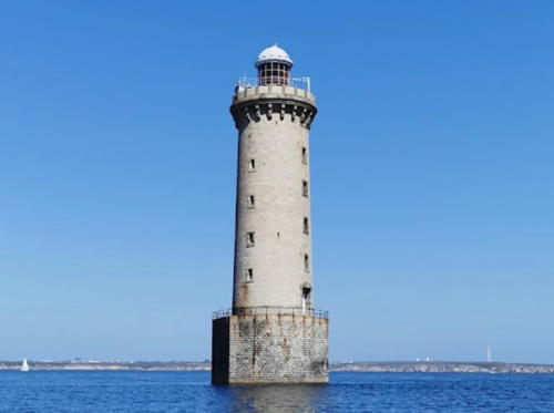
1916. Active; focal plane 38 m (125 ft); white or red light, depending on direction, occulting three times in a 2+1 pattern every 24 s. 41 m (135 ft) round stone tower with lantern and gallery, incorporating 6-story keeper's quarters, mounted on a circular concrete base. Tower unpainted, lantern painted white. Fog horn (Morse code "K," long-short-long, every 120 s). A 2021 photo is at right, Detienne has a page for the lighthouse, Trabas has Capt. Peter's photo, Cédric Caïn has a photo of the light in action and a photo of giant waves breaking on the lighthouse in January 2019, Sebastien Cannot's 2017 photo was taken on a remarkably calm dayGuyomard and Carceller have photos, and Google has a satellite view. The lighthouse is named for Charles Marie le Dall de Kéréon, who contributed 585,000 francs for its construction. It took nine years to build this lighthouse, the last of the great French waveswept towers. In the early days the accommodations were so sumptuous that keepers called the tower "Le Palace." Keepers remained in the tower until it was finally automated on 29 January 2004. The lighthouse stands at the northern end of the Molène archipelago marking the safe Passage du Fromveur on the south side of the Île d'Ouessant. Located on the usually-submerged Men-Tensel reef about 2 km (1.25 mi) southeast of the eastern point of the Île d'Ouessant. Accessible only by boat; there is a distant view from the Île d'Ouessant. Site and tower closed. ARLHS FRA-324; Admiralty A1850; NGA 0038.

Kéréon Light, Île d'Ouessant, July 2021
Google Maps photo by coucoufred
La Jument
1911. Active; focal plane 36 m (118 ft); three red flashes every 15 s. 48 m (157 ft) octagonal stone tower with lantern and gallery, incorporating 7-story keeper's quarters, mounted on a circular concrete base. Tower unpainted, lantern painted red. Françoise Brault's photo is at right, Detienne has a page for the lighthouse, the Phareland site has many photos, a good 2006 photo is available, Trabas has a recent postcard photo, and Bing has a satellite view. Construction of this lighthouse took nine years and did not result in a fully stable structure; repeated repair projects finally put it on a sound basis by 1940. Until then the trembling lighthouse was probably the least favored of all assignments for French keepers. The tower is built on a rock called La Vieille Jument, the Old Mare. Located about 2.2 km (1.4 mi) southwest of the southwestern tip of the Île d'Ouessant. Accessible only by boat. Site and tower closed. . ARLHS FRA-026; Admiralty A1848; NGA 0024.
Nividic
1936. Active; focal plane 28 m (92 ft); nine very quick white flashes every 10 s. 36 m (118 ft) octagonal stone tower, unpainted. Lantern replaced by a modern solar-powered light. This is France's westernmost lighthouse, standing at longitude 5°09.1' W. The ruined stone keeper's house was called the Villa des Tempêtes because of its exposed location. There was a fog signal station here from 1885 to 1900. Trabas has Darlene Chisholm's closeup photo, Detienne has a page for the lighthouse, Yannick Garroy has a 2017 closeup, Denis de Poortere has a 2008 photo, Rodrigo Cuellar Ricci has a 2023 drone view, and Google has a satellite view. Construction of the lighthouse began in 1912 but was suspended during and after World War I. Access to the lighthouse was formerly by a cable car, and two of the support towers for the cable still stand behind the lighthouse. Located 900 m (0.55 mi) west of the westernmost point of the Île d'Ouessant. Accessible only by boat in some of the most dangerous seas anywhere. Site and tower closed. ARLHS FRA-044; Admiralty A1846; NGA 0020.

La Jument Light, Île d'Ouessant, September 2020
Google Maps photo by Françoise Brault
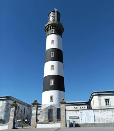
*** Créac'h
1863. Active; focal plane 70 m (230 ft); two white flashes every 10 s. 55 m (180 ft) round stone tower with lantern and gallery, rising from a 2-story keeper's house complex. the lantern is surrounded by elaborate screening to protect migrating birds. Lighthouse painted with black and white horizontal bands. The original 1st order Fresnel lens was transferred to Le Stiff in 1888. Ewen Kervella's photo is at right, DIRM has a page for the lighthouse, Detienne also has a page, Anne Gaelle has a photo, Trabas has a photo, Wikimedia has many photos, Marinas.com has aerial photos, a 2023 closeup street view is available, and Google has a satellite view. This is one of France's greatest and most important lighthouses. The lantern was replaced in 1888 and again in 1939 with what was designed to be one of the world's most powerful lights, visible for more than 60 km (37.5 mi). The keeper's complex houses a district office of the Signalisation Maritime, from which the other lighthouses of the western tip of France are controlled. It also houses a lighthouse museum exhibiting a wide range of lenses and other equipment. Located at the northwestern tip of the Île d'Ouessant. Accessible by road; limited parking. Site open, museum open in season, tower closed. Site manager: Parc naturel régional d'Armorique (Musée des Phares et Balises) . ARLHS FRA-029; Admiralty A1844; NGA 0004.
**** Le Stiff
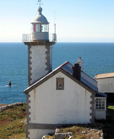
1699. Active; focal plane 85 m (279 ft); two red flashes every 20 s. 32 m (105 ft) round granite double tower, incorporating keeper's quarters, with lantern and two galleries; the lantern is carried by a 4 m (18 ft) stone tower added to the top of the original tower. 1st order Fresnel lens (1863, transferred from Créac'h in 1888) in use. Tower painted white; lantern painted black; watch room and lower gallery are unpainted dark granite. Two 1-story keeper's houses (1885) and other light station buildings preserved. Yann Caradec's photo appears at the top of this page, Detienne has a page for the lighthouse, the Phareland site has many photos, Trabas has Capt. Peter's closeup, Wikimedia has several photos, P. Bouwman has a 2022 closeup, Marinas.com has aerial photos, and Google has a satellite view. This magnificent seventeenth century lighthouse was built at the order of Louis XIV's chief military engineer, the Marquis de Vauban. It displayed an open fire until 1820, when the first lantern was installed; in 1831 the present lantern and one of the first large Fresnel lenses were added. Keepers staffed the lighthouse until 1993. Located atop a bluff at the northern end of the Île d'Ouessant. Accessible by road; limited parking. Site open, tower open in July and August. Site manager: Phare du Stiff. . ARLHS FRA-036; Admiralty A1842; NGA 0016.
* Le Stiff Tour Radar
1982. Active; continuous red light; in the daytime a quick-flashing white light is shown during fog. 82 m (269 ft) round cylindrical steel tower with a circular control room near the top. Wikimedia has a photo, Trabas has Capt. Peter's photo, Matthieu Luna has a 2022 closeup, and Google has a satellite view. This tower monitors ship traffic entering La Manche (the English Channel) from the south; it was built in response to the wreck of the supertanker Amoco Cadiz just offshore on 17 March 1978. Located about 300 m (0.2 mi) north of the lighthouse. Site open, tower closed. Admiralty A1842.5.

Créac'h Light, Île d'Ouessant, September 2022
Google Maps photo by Ewen Kervella

Lampaul-Plouarzel Lighthouses
* Pointe de Corsen (2)
Date unknown (station established 1894). Active; focal plane 33 m (108 ft); quick-flashing light, white, red, or green, depending on direction. The light is displayed through a square window of a 3 m (10 ft) concrete box. The box is embedded in the center of a wall that has a red panel on one side of the light and a green panel on the other. The original light was mounted on a stone keeper's house, which stands in ruins next to the modern light. Trabas has Capt. Peter's closeup photo, Detienne has a photo, and Google has a street view and a satellite view. The Pointe de Corsen is the westernmost point of the French mainland. Located on the point, about 1 km (0.6 mi) southwest of the Trézien lighthouse. Accessible by road, parking provided. Site open, tower closed. ARLHS FRA-061; Admiralty A1876; NGA 0080.
**** Trézien (feu postérieur)
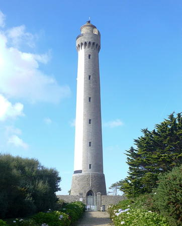
1894. Active; focal plane 84 m (276 ft); white light, occulting twice every 6 s, intensified on the range line. 37 m (121 ft) round granite tower with lantern and gallery. The south side of the tower is painted white; otherwise the lighthouse is unpainted. The original 1-story stone keeper's house now houses a small museum. A photo is at right, Detienne has a page for the lighthouse, Werning has a fine photo, Trabas has a photo by Capt. Peter, Guillaume Gallardo has a 2022 photo, and Google has a street view and a satellite view. This lighthouse marks the Pointe de Trézien, one of several traditional dividing points between La Manche (the English Channel) and the Atlantic Ocean. In addition to being a general navigation light it forms a range with the Phare de Kermorvan to guide ships into the southern entrance of the Chenal du Four, the shipping route between the Île d'Ouessant and the mainland. The original lantern was destroyed during World War II and the lower part of the lighthouse was damaged, but repairs were made after the war. Located on the Route du Phare, about 500 m (0.3 mi) west of the Pointe de Trézien in the town of Trézien. Accessible by road, limited parking. Site open, tower open daily in July and August and on Mondays and Saturdays in June and September. Site manager: Phare de Trézien . ARLHS FRA-750; Admiralty A1873.9; NGA 0076.
#Les Plâtresses (2)
1922 (station established 1892). Collapsed in 2008. This was a 23 m (75 ft) round reinforced concrete tower, painted white. No closeup photo available. According to C. Mauguier the lighthouse collapsed in January 2008 after being heavily damaged by a severe storm on 9 December 2007. The light (flash every 4 s, white or green depending on direction) has been replaced by a simple post. The original lighthouse was destroyed by a collision with the Portuguese ship Esposende on 14 November 1917. Located on a waveswept rock about 6 km (3.5 mi) offshore from Trézien. Accessible only by boat; there was formerly a distant view from shore. Site and tower closed. ARLHS FRA-400; ex-Admiralty A1860; ex-NGA 0060.

Trézien Light, Lampaul-Plouarzel, September 2021
Wikimedia Creative Commons photo by Muck
Le Faix (2)
1939 (station established 1890, inactive 1924-1939). Active; focal plane 16 m (52 ft); very quick-flashing white light. 21 m (69 ft) round cylindrical concrete tower with gallery. If there was a lantern, it was removed in 1975 when the lighthouse was converted to wind power. Trabas has Darlene Chisholm's closeup photo and Bing has a satellite view. The original lighthouse was overturned by a storm on 29 December 1924. Located on a reef about 7 km (4.5 mi) west of the coast at Trézien. Accessible only by boat. Site and tower closed. ARLHS FRA-279; Admiralty A1862; NGA 0056.
Le Four
1874. Active; focal plane 28 m (92 ft); five white flashes every 15 s. 28 m (92 ft) round stone tower with lantern and gallery mounted on a square base. Lighthouse unpainted; lantern painted black. Fog horn (five blasts, in a 3+2 pattern, every 60 s). Jean-Marie Muggianu's photo is at right, Detienne has a page for the lighthouse, Guyomard and Carceller have good photos, Trabas has Capt. Peter's photo, Sylvain Joubert has a photo, and Google has a satellite view. The lighthouse marks the northern entrance to the Chenal du Four, the shipping route between the Île d'Ouessant and the mainland. Located on a waveswept rock about 4 km (2.5 mi) west of Porspoder. Accessible only by boat. There is a distant view from the Presqu'île de St.-Laurent north of Porspodor; this requires a hike of about 800 m (1/2 mi) from a parking area. Site and tower closed. ARLHS FRA-013; Admiralty A1854; NGA 0048.
* Aber Ildut
1897. Active; focal plane 12 m (39 ft); white or red light, depending on direction, occulting twice every 6 s. Building painted white. Trabas has Helmut Seger's photo, Detienne has a photo, and Google has a street view and a satellite view. Located on the north side of the Aber Ilbut entrance in Lanildut. Accessible by a short walk south from the end of the Route de Port Blanc; parking available. Site open, tower closed. ARLHS FRA-113; Admiralty A1856; NGA 0052.

Le Four Light, October 2014
Flickr Creative Commons photo by Jean-Marie Muggianu

Information available on lost lighthouses:

Notable faux lighthouses:

Adjoining pages: North: Northern Finistère | South: Southern Finistère

Return to the Lighthouse Directory index | Ratings key

Posted August 29, 2005. Checked and revised September 23, 2023. Lighthouses: 42, lightships: 1. Site copyright 2023 Russ Rowlett and the University of North Carolina at Chapel Hill.