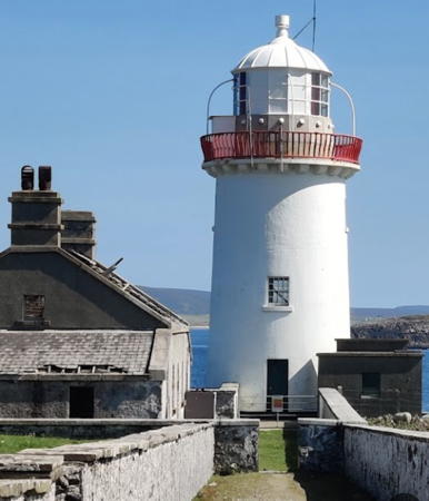
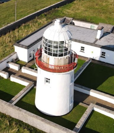
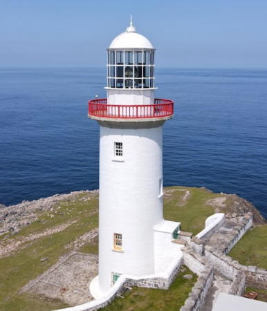
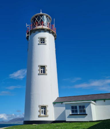
Lighthouses of Western Ireland (Connacht and Ulster)

The smaller of the two main British Isles, the island of Ireland is separated from Great Britain to its east by the North Channel, the Irish Sea, and St George's Channel. Ireland came under English rule in the 16th and 17th centuries and in 1801 the United Kingdom of Great Britain and Ireland was formally established. Following decades of struggle most of Ireland (about 7/8 of the island) became independent in 1922. The northern portion remained in the United Kingdom, forming the present United Kingdom of Great Britain and Northern Ireland.

The modern Republic of Ireland (Éire in Irish) includes 26 of the 32 historic counties of the island and has a population of more than 5 million. Some of the historic counties have been divided and there are now 31 county and city units of local government.

Ireland is traditionally divided into four provinces: Leinster in the east, Munster in the southwest, Connacht (Connaught) in the west, and Ulster in the north. These regions have no administrative function but they remain convenient divisions of the island. This page covers lighthouses of the west coast of the Republic of Ireland, including Counties Galway, Mayo, and Sligo in Connacht and County Donegal in Ulster. (The rest of the Ulster coast is in Northern Ireland).

This is a beautiful coast, often rugged, exposed to the full force of Atlantic storms, and very dangerous to ships. It is guarded by a series of handsome nineteenth century lighthouses, nearly all of them still in service under the maintenance of the Commissioners of Irish Lights. Founded in 1786 by the Irish Parliament, the Commissioners maintain lighthouses in both Northern Ireland and the Irish Republic.

The Irish language is spoken commonly as a first or second language in Ireland. The Irish phrase for a lighthouse is teach solais (plural tithe solais). Oileán (plural oileáin) is an island, rinn is a cape, abhainn is a river, and cuan is a harbor. A lough (pronounced like the Scottish loch) is a lake or an inlet of the sea.

ARLHS numbers are from the ARLHS World List of Lights. CIL numbers are from the light list of the Commissioners of Irish Lights. Admiralty numbers are from Volume A of the Admiralty List of Lights & Fog Signals. U.S. NGA numbers are from Publication 114.

General Sources
Commissioners of Irish Lights - Aids to Navigation
An interactive map leads to pages for each of the CIL lighthouses.
Great Lighthouses of Ireland
This website provides information on twelve Irish lighthouses CIL has identified for tourism development. Three (Clare Island, St. Johns Point, and Fanad Head) are described on this page.
Online List of Lights - Ireland
Photos by various photographers posted by Alexander Trabas.
Lighthouses in Ireland
Aerial photos posted by Marinas.com.
Pete's Irish Lighthouses
Peter Goulding's informative blog on the lighthouses of Ireland.
Lights of Ireland
Photos by John Eagle posted by Bill Britten on his Lighthouse Getaway site.
Lighthouses in the Republic of Ireland
Photos available from Wikimedia; many of these photos were first posted on Geograph.org.uk.
World of Lighthouses - Ireland
Photos by various photographers available from Lightphotos.net.
Britische Leuchttürme auf historischen Postkarten
Historic postcard images posted by Klaus Huelse. Irish lighthouses are at the bottom of the page.
GPSNavigationCharts
Navigation chart information for Ireland.
Navionics Charts
Navigation chart for Ireland.


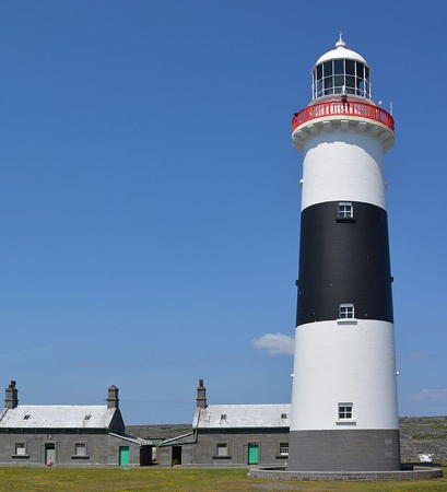
Inisheer Light, Aran Islands, June 2016
Wikimedia Creative Commons photo by G.Mannaerts

County Galway Lighthouses

Aran Islands Lighthouses
The Aran Islands form a chain oriented southeast to northwest and located in the mouth of Galway Bay. The principal island, Inishmore, is accessible by ferry from Rossaveal on the north side of the bay. Both Inishmore and Inisheer, the southernmost island, are accessible by passenger ferry from Doolin, County Clare, on the south side of the bay.

*
Inisheer (Fardurris Point, Inis Oírr)
1857. Active; focal plane 34 m (112 ft); white light, 6 s on, 6 s off; red light is shown over rocks to the east. 34 m (112 ft) round masonry tower with lantern and gallery, painted white with a single broad horizontal black band. Two keeper's houses enclosed by a stone wall. A photo by G.Mannaerts is above, Sam Schwecke has a 2022 photo, Goulding has a page with October 2016 photos and advice on finding the lighthouse, Scott Jon Siegel has a closeup, Trabas has a photo by Klaus Potschien, Marinas.com has aerial photos, and Google has a satellite view. Inisheer is accessible by passenger ferry from Doolin, and the lighthouse is accessible by hiking the service road. Located on the southeastern point of the island. Site open, tower closed. Operator: Commissioners of Irish Lights. . ARLHS IRE-041; CIL-2120; Admiralty A6334; NGA 7496.
Straw Island (Inis Mor)
1878. Active; focal plane 11 m (37 ft); two white flashes every 5 s. 10.5 m (35 ft) narrow round cylindrical masonry tower with lantern and gallery, attached to 1-story generator building. Lighthouse painted white; the gallery railing is painted red giving the tower the appearance of having a red horizontal band. A wind turbine provides power for the light. A photo is available, Goulding has a page for the lighthouse, Trabas has John Eagle's aerial photo, Marinas.com has aerial photos, and Google has a satellite view. The lighthouse is endangered by rising sea levels; it was repaired after being heavily damaged by a storm in January 2014. Located on a small island at the entrance to Killeany Harbour near the southeastern end of Inishmore. Accessible only by boat; the lighthouse is easily viewed from ferries arriving in Killeany from Rossaveal. Site open, tower closed. Operator: Commissioners of Irish Lights. ARLHS IRE-072; CIL-2090; Admiralty A6298; NGA 7480.
** Inishmore (Inis Mor, Dun Oghil)
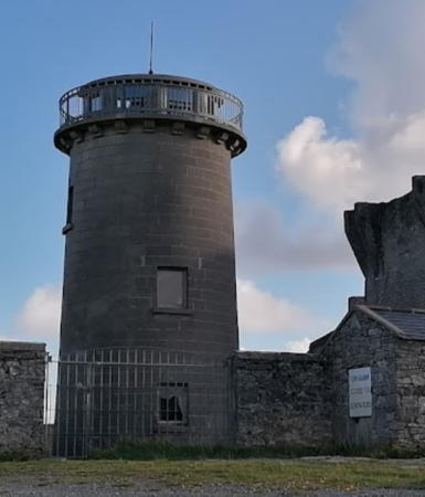
1818. Inactive since 1857. Approx. 15 m (50 ft) round stone tower with gallery, unpainted. Lantern removed. Ruined stone keeper's houses enclosed by a stone wall. A photo is at right, a 2018 photo is available, Ido Greenbaum has a street view, and Google has a satellite view. This lighthouse, located in the center of the Aran Islands, failed to warn ships away from the dangerous ends of the group, so it was replaced by the lighthouses at Eeragh and Inisheer. Ted Sarah has an undated photo showing the lighthouse for sale. In 2018 Goulding found the site open and the tower closed. In 2021 the building was once again for sale, this time for €550,000. Located atop a hill about 120 m (400 ft) high in the center of Inishmore. in 2018 Owner/site manager: private. . ARLHS IRE-087.
Eeragh (Aran North)
1857. Active; focal plane 35 m (115 ft); white flash every 15 s. 31 m (101 ft) round limestone tower with lantern and gallery, painted white with two horizontal black bands. Lantern painted white. 1-story keeper's house; other buildings demolished. Goulding has a page for the lighthouse, Trabas has an aerial photo by John Eagle, Péter I. Szabó has a 2023 view from the sea, Marinas.com also has aerial photos, and Google has a satellite view. The light was powered by a wind turbine from 1983 to 2006, when it was converted to solar power. Located on Brannock Island, a bare, rocky island at the northwestern end of the Aran group. Accessible only by boat; should be visible from the western end of Inishmore. Site open but difficult to access, tower closed. Operator: Commissioners of Irish Lights. ARLHS IRE-032; CIL-2070; Admiralty A6296; NGA 7472.

Inishmore Light
Inishmore Light, Aran Islands, June 2008
ex-Flickr Creative Commons photo by Ruairí


Galway Harbour Lighthouses
Galway, the seat of County Galway, is a city of about 85,000 residents located at the mouth of the River Corrib on the north shore of Galway Bay. The bay is a large inlet, about 50 km (30 mi) long and 10-30 km (6-19 mi) wide.
Galway Harbour (Leverets)
1977. Active; focal plane 9 m (30 ft); quick-flashing white, red or green light, depending on direction. 9 m (30 ft) round cylindrical concrete tower with lantern and a small gallery. Tower painted with black and white horizontal bands; lantern is unpainted metallic gray. Trabas has C.W. Bash's closeup photo, Goulding has two distant photos, Marinas.com has aerial photos, and Google has a satellite view. This modern lighthouse replaced the Mutton Island Light as the main light for Galway Harbour. Located in Galway Bay off Hare Island about 1.5 km (1 mi) southeast of the harbor. Accessible only by boat. Site and tower closed. Owner/operator: Galway Harbour Company. ARLHS IRE-104; Admiralty A6317; NGA 7508.
* Mutton Island
1817. Inactive since 1977. Round masonry tower with lantern and gallery, originally painted white, attached to 1-story keeper's house. Keeper's house in ruins, open to the elements. A closeup photo by Margie Cox Reynolds is at right, Claddagh School has a web page with a good photo of the lighthouse, Goulding has a page with several photos, Nuno Marques has a 2019 closeup, Marinas.com has aerial photos, and Google has a street view and a satellite view. This abandoned lighthouse was reported in very poor condition as of 2004; it has surely been one of Ireland's most endangered lighthouses. In January 2005, however, the Galway Civic Trust and the Heritage Office of the Galway City Council began a restoration project funded by a grant of €40,000. This lengthy project was completed in the fall of 2011, and the lighthouse opened for guided tours in 2012. In 2014, however, tours were suspended due to a rat infestation on the island. In June 2019 a visitor found the lighthouse had been broken into and heavily damaged by vandals. The City of Galway announced it would repair the building in 2020, but it looks to be in poor condition in the photo at right. Located next to a sewage treatment plant on a small island off Salthill about 5 km (3 mi) southwest of Galway; the island is accessible from the mainland by causeway. Site and tower closed unless and until tours resume. Owner: City of Galway. Site manager: Galway Civic Trust. . ARLHS IRE-107.

Mutton Island Light, Galway, January 2022
Instagram photo by Margie Cox Reynolds

West Coast Lighthouses
Croaghnakeela
1904. Active; focal plane 7 m (22 ft); white flash every 3.7 s. 4 m (13 ft) square white concrete equipment room with the light mounted on the top. Trabas has a distant photo and Bing has a satellite view. Croaghnakeela is a small island facing the open Atlantic about 8 km (5 mi) west of Ard. Formerly inhabited, it is now a deer sanctuary. Located on the southwestern side of the island. Accessible only by boat. Site and tower closed. Operator: unknown. ARLHS IRE-132; Admiralty A6292; NGA 7452.
* Inishnee (2)
1961 (station established 1910). Active; focal plane 9 m (30 ft); two flashes every 10 s, white, red or green depending on direction. 4 m (13 ft) square white concrete equipment room with the light mounted on the top. Trabas has a photo and Bing has a satellite view. Inishnee is a large island in Bertraghboy Bay. Located at the southwestern point of the island, marking the east side of the entrance to the harbor of Roundstone. The island is accessible by bridge. Site open, tower closed. Operator: unknown. ARLHS IRE-133; Admiralty A6290; NGA 7448.
Slyne Head (East)
1836 (George Halpin). Inactive since 1898. Approx. 18 m (60 ft) round stone tower, unpainted. Keeper's houses and other buildings enclosed by a stone wall. Trabas has a good aerial photo by John Eagle, a 2017 photo is available, Goulding has a page with distant photos, and Google has a satellite view. The Slyne Head station was built with twin towers. The east (really south) tower was abandoned and its lantern was removed when the station was upgraded in 1898. The towers are traditionally described as East and West, but this tower is actually south southeast of the active lighthouse. Located on Illaunamid, a rocky islet at the western end of a reef off Slyne Head, the westernmost point of County Galway, about 12 km (8.5 mi) southwest of Doonlaughan. Accessible only by helicopter. Site and tower closed. Owner/site manager: Commissioners of Irish Lights. ARLHS IRE-124.
Slyne Head (West)
1836 (George Halpin). Active; focal plane 35 m (115 ft); two white flashes, separated by 2.4 s, every 15 s. 24 m (79 ft) round stone tower with lantern and gallery, tower and lantern painted black. Keeper's houses and other buildings enclosed by a stone wall. A photo is at right, Marc Frey has a distant view, Trabas has a good aerial photo by John Eagle, Mark Fleury has a 2023 drone view, Goulding has a page with distant photos, Marinas.com has aerial photos, and Google has a satellite view. The original lantern was replaced with a new Chance Brothers lantern and lens in 1898, and the tower was first painted black in 1907. The light was converted to solar power in 2002. Located a short distance north northwest of the East lighthouse. Accessible only by helicopter; there are distant views from the mainland near the Connemara Golf Club. Site and tower closed. Operator: Commissioners of Irish Lights. . ARLHS IRE-069; CIL-1990; Admiralty A6288; NGA 7444.
[Fishing Point]
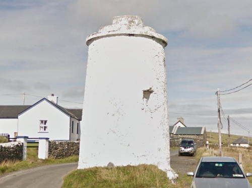
Date unknown. Unlit daybeacon. Approx. 10 m (33 ft) round stone tower, painted white. A photo is available, Goulding has a page with photos, and Google has a satellite view. The beacon is known locally as the White Lady. Located at the tip of a headland on the south side of the entrance to Clifden Bay. Site open, tower closed. Owner: Commissioners of Irish Lights. CIL-1970.
Cleggan Point
1901. Active; focal plane 20 m (66 ft); three flashes every 15 s, white, red or green depending on direction. 4.5 m (15 ft) square white concrete equipment room with the light mounted on the top. Trabas has a photo, and Google has a satellite view. Located on a rocky headland at the northern entrance to the harbor of Cleggan, about 2 km (1.25 mi) northwest of the town. May be accessible only by boat. Site and tower closed. Operator: unknown. ARLHS IRE-131; Admiralty A6284; NGA 7440.

Slyne Head West Light, Connemara, May 2017
Google Maps photo by Cf t
#[Gun Rock (Inishbofin) (2)]
Date unknown (station established 1909). Destroyed by a storm in January 2014. The light was mounted on a small square equipment cabinet, painted white with a red vertical stripe. A photo is at right, another photo is available, Dan Heller has several photos, Marinas.com has aerial photos, and Google has a satellite view. The light was swept away by a severe winter storm. Still standing is an approximately 10 m (33 ft) round masonry tower, painted white. Johnny Saunderson inquired locally and found that this tower and the two range towers (next entry) were built as daybeacons to guide local fishermen through the tricky approach to the harbor. Trabas has a photo of the new light (focal plane 8 m (26 ft); two white flashes every 6 s). on a slender mast. Located on a rock off the south coast of Inishbofin island, about 8 km (5 mi) west northwest of Cleggan. Accessible only by boat. Site open, tower closed. Operator: Commissioners of Irish Lights. Active light: CIL-1960; Admiralty A6282; NGA 7436.
* Inishbofin Range Front
Date unknown. Inactive. The light was formerly shown from a mast atop a 6 m (20 ft) round masonry tower, painted white. The 2009 photo at right shows the two range towers and the Gun Rock towers (previous entry), Google has a street view, and the tower is in a bend of the road in Google's satellite view. These beacons guided the ferry arriving at Inishbofin from Cleggan. They have been replaced (probably in 2014) by a directional light on a mast; Trabas has a photo. Located beside the road about 400 m (1/4 mi) west of the Inishbofin ferry terminal. Site open, tower closed. Operator: Commissioners of Irish Lights. Directional light: CIL-1950; Admiralty A6282.3.
* [Inishbofin Range Rear]
Date unknown. Inactive daybeacon. 6 m (20 ft) round masonry tower, painted white. Google has a street view and a satellite view. Located about 120 m (400 ft) northeast of the front beacon. Site open, tower closed.
 

Inishbofin Range Beacons (left) and Gun Rock Beacons, Cleggan, July 2009
Flickr Creative Commons photo by GrahamAndDairne

County Mayo Lighthouses

Lough Corrib Lighthouse
* Ballycurrin (Ballycurran)
1772 (Henry Lynch). Inactive. Approx. 7 m (23 ft) round rubblestone tower; access to the watch room is provided by stairs that spiral around the tower. Thomas Cooper has an excellent photo, Paul Duffy has a closeup photo, Conor Ledwith has another photo, and Google has a satellite view. Lough Corrib, Ireland's second largest lake, is located a few miles north of Galway. During the late 1800s and early 1900s vessels could reach the lake from Galway via the Eglinton Canal, but that waterway has been out of service for many years. Privately built, the lighthouse is said to have remained active until fairly recent times. Located on a dock on the northeastern shore of the lake near Ballycurrin. Site open, tower closed.

Clew Bay Lighthouses
Inishgort
1827. Active; focal plane 11 m (36 ft); one long (2 s) flash every 10 s. 8 m (26 ft) round cylindrical masonry tower with lantern and gallery, painted white. Keeper's house and other buildings enclosed by a stone wall. Trabas has a photo by John Eagle, Aiden Clark has a good view from the water, Paul Cunnane has a sunset 2023 photo, Goulding has a page with two distant views, Marinas.com has aerial photos, and Google has a satellite view. Although Findlay's 1879 Light List has 1827 as the date of this lighthouse the CIL page says it was built in 1806. This may be due to confusion of this lighthouse and the Clare Island lighthouse (next entry). Located on a small island off the harbor of Westport. Accessible only by boat. Site open, tower closed. Operator: Commissioners of Irish Lights. ARLHS IRE-042; CIL-1910; Admiralty A6278; NGA 7428.
* Clare Island (2)
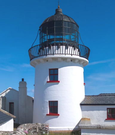
1818 (station established 1806). Inactive since 1965 (a decorative light is displayed). Approx. 11 m (36 ft) round cylindrical masonry tower with lantern and gallery, attached to 1-story keeper's house. Buildings painted white. Additional keeper's houses and other buildings enclosed by a stone wall. Colin Park's photo is at right, June Ward has a great closeup photo, CIL has a page for the station as one of the Great Lighthouses of Ireland, Goulding has a page with distant views, Marinas.com has aerial photos, and Google has a street view and a satellite view. The original lighthouse, built by the Marquis of Sligo to mark the entrance to Clew Bay, was replaced after being heavily damaged by fire in September 1813. The light was moved to Achillbeg Island in 1965. After deactivation the lighthouse was sold, restored by private owners, and operated as a bed and breakfast inn. In 2001 the owners retired and the lighthouse was sold again, this time as a private residence for Lady Georgina Forbes. In 2006 it was once again on the market and in 2008 it was sold for €1.05 million to a German doctor. Following extensive renovations the property went back on the market in January 2023 for €4.8 million. Clare Island is accessible by passenger ferry from Roonagh Quay west of Louisburgh. Located on the northern tip of the island. Site and tower closed, although the lighthouse can be viewed from outside the enclosure. Owner/site manager: Clare Island Lighthouse . ARLHS IRE-017.
Achillbeg
1965. Active; focal plane 56 m (184 ft); flash every 5 s, red or white depending on direction. 8.5 m (28 ft) round cylindrical concrete tower with lantern attached to a small square concrete equipment building. James Skinner has a closeup photo, Trabas has John Eagle's view from the sea and Google has a satellite view. This modern lighthouse was built to replace the Clare Island Light. Located on a small island off Cloughmore on the south side of Achill Island, marking the northern entrance to Clew Bay; there should be views from the Cloughmore area. Accessible only by boat or helicopter. Site open, tower closed. Operator: Commissioners of Irish Lights. ARLHS IRE-001; CIL-1890; Admiralty A6276; NGA 7416.

Clare Island Light, Clew Bay, May 2016
Wikimedia Creatice Commons photo by Colin Park

Mullet Peninsula Area Lighthouses
The Mullet Peninsula is a hook-shaped peninsula at the northwestern corner of Ireland. The peninsula is separated from the mainland by Blacksod Bay.
Blackrock Mayo
1864. Active; focal plane 86 m (282 ft); white flash every 12 s; red flashes are shown over a sector to the east. 15 m (50 ft) round stone tower with lantern and gallery attached to 1-story keeper's houses (the houses are unroofed and falling into ruin). Lighthouse painted white. One of Ireland's most remote lighthouses. Trabas has a fine aerial photo by John Eagle, Goulding's page has distant photos, Marinas.com also has good aerial photos, and Google has a satellite view. A shore station was constructed in Blacksod; keeper's houses there were sold into private ownership in 1957. In 1999, when the light was converted to solar power, one of the keeper's houses was restored to provide accommodations for work crews doing maintenance on the light. The other house is unroofed and has been gutted inside. Note that there is another Blackrock Light in Sligo (see below). Located atop a high rocky islet about 20 km (12 mi) west of Blacksod Point. Accessible only by helicopter. Site and tower closed. Operator: Commissioners of Irish Lights. ARLHS IRE-010; CIL-1860; Admiralty A6270; NGA 7388.
*** Blacksod Point
1864. Active; focal plane 13 m (42 ft); two white flashes every 7.5 s; red flashes are shown over rocks to the south southwest. 12 m (40 ft) 2-story granite block keeper's house topped by a lantern; house is unpainted, lantern painted white. An adjoining helicopter base supports the offshore Blackrock and Eagle Island lighthouses. A 2021 photo is at right, Goulding's page has a photo, Trabas has a good closeup photo, a 2021 photo is available, Laura Burgess has a 2010 photo, Marinas.com has aerial photos, and Google has a street view and a satellite view. The house was repaired after being damaged by a huge wave in 1989. In 2020 the lighthouse was leased to a community development group, Comharchumann Forbartha Ionad Deirbhile Eachléim. The group announced that the lighthouse would open to the public for the summer 2021 season. Located at the south end of the Mullet Peninsula, at the end of the R313 highway about 7 km (4 mi) south of Aughleam. Accessible by road. Site open, lighthouse open daily except Mondays July through September and on weekends and the bank holiday in October. Operator: Commissioners of Irish Lights. Site manager: Blacksod Lighthouse . ARLHS IRE-012; CIL-1870; Admiralty A6272; NGA 7392.

Blacksod Point Light, Mullet Peninsula, July 2021
Google Maps photo by Arun R
Eagle Island East
1835. Inactive since 1895. This round stone tower was originally 26.5 m (87 ft) tall, showing its light at the same focal plane as the west tower. After deactivation the lantern was removed and the tower was reduced in height to about 12 m (40 ft). It can be seen at the far right in John Eagle's photo of the station posted by Trabas. Goulding has a page with two photos. Located on a small island off Doonamo Head at the northwestern tip of County Mayo. Accessible only by helicopter; visible distantly from Corclough, about 12 km (7.5 mi) northwest of Belmullet. Site and tower closed. Operator: Commissioners of Irish Lights. ARLHS IRE-115.
Eagle Island (West)
1835. Active; focal plane 67 m (220 ft); three white flashes, separated by 2.5 s, every 15 s. 9 m (30 ft) round stone tower with lantern and gallery, painted white; lantern removed. 2-story keeper's house, unoccupied, and other buildings protected from the sea by a high stone wall rising almost to gallery level. Trabas has John Eagle's view from the sea, Goulding's page has several photos, Marinas.com has good aerial photos, and Google has a fine satellite view. Originally the station had twin towers, with the east tower being 120 m (132 yd) northeast of the surviving tower. Despite the elevation of the station it has been hit more than once by huge storm waves sweeping off the open Atlantic. A monster wave on 11 March 1861 actually broke over the east light, shattering the lantern and flooding the tower. The east light was discontinued in 1895 and its tower was reduced in height. A shore station for the lighthouse was established at Corclough in 1900; keeper's houses there were sold into private ownership in 1956 and probably survive. In 2013 the lantern of the lighthouse was removed and replaced by a steel cap with the light mounted at the top; James Skinner has a closeup photo of the beheaded tower. Located on a small island off Doonamo Head at the northwestern tip of County Mayo. Accessible only by helicopter; visible distantly from Corclough, about 12 km (7.5 mi) northwest of Belmullet. Site and tower closed. Operator: Commissioners of Irish Lights. ARLHS IRE-031; CIL-1850;Admiralty A6268; NGA 7384.
* Broadhaven (Ballyglass)
1848 (not lit until 1855). Active; focal plane 27 m (87 ft); white or red light, depending on direction, 2 s on, 2 s off. 15 m (50 ft) round masonry tower with lantern and gallery, painted white; gallery rail painted red. 1-story keeper's house. Frank Hand's photo is at right, Goulding has a page with several good photos, Trabas has a closeup photo, John Brady has a 2021 photo, Marinas.com has aerial photos, and Google has a satellite view and a distant street view. Because approval for a lighthouse could not be secured the tower was built initially as a daymark. The light marks the start of the approach to Belmullet. Located on a promentory (known as Ballyglass Point or Gubacashel Point) on the west side of the entrance to the narrow portion of Broadhaven Bay, about 5 km (3 mi) northeast of Knocknalina. There is an ungated road to this site. Site open, tower closed. Operator: Commissioners of Irish Lights. . ARLHS IRE-086; CIL-1840; Admiralty A6266; NGA 7380.

Broadhaven Light, Broadhaven, August 2021
Google Maps photo by Frank Hand

County Sligo Lighthouses

Sligo Area Lighthouses
Sligo, the seat of County Sligo, is a seaport town with a population of about 25,000. The town is on the River Garavogue halfway between the Sligo Bay estuary and Lough Gill, a large freshwater lake.
Blackrock Sligo
1835 (extension of 1819 daybeacon). Active; focal plane 24 m (79 ft); white flash every 5 s; an auxiliary light at 12 m (41 ft) shows a red flash every 3 s to the northwest over Wheat and Seal Rocks. 25 m (83 ft) round stone tower, comprising an 11 m (36 ft) solid limestone daybeacon built in 1819 topped by a 14 m (47 ft) limestone tower with lantern and gallery. Access to the lighthouse is by an external spiral stairway built around the lower segment of the tower. Lighthouse painted white with a single black horizontal band just above the joint in the tower. A CIL photo is at right, Trabas has a great closeup by John Eagle, Goulding's page has distant photos and a historic closeup, Marinas.com has aerial photos, and Google has a satellite view. The first daybeacon was built on the rock in the late 1700s; it was swept away by a storm in 1814. Note that there is another Blackrock Light, not so far away in County Mayo (see above). Located on a rocky islet, awash at high tide, marking the beginning of the approach to Sligo Harbour from Sligo Bay. Accessible only by boat; distantly visible from Raghley or Rosses Point on the mainland. Site and tower closed. Operator: Commissioners of Irish Lights. ARLHS IRE-011; CIL-1780; Admiralty A6232; NGA 7360.
[Metal Man (Range Front)]
1821. Active; focal plane 3 m (10 ft); white flash every 4 s. Light mounted on a short mast on a concrete base; standing beside the light is a cast iron sculpture of a sailor, his cap and coat painted dark blue and his trousers painted white, his arm outstretched to warn ships away from the rocks. Trabas has a closeup photo by John Eagle, a 2018 drone view is available, Marinas.com has aerial photos, and Google has a satellite view. This statue originally was intended to be placed atop the 1819 Blackrock daybeacon; it was relocated when a decision was made to convert that beacon to a lighthouse. The figure, commissioned by the widow of a ship captain who wrecked nearby, was designed by the sculptor John Kirk. Another figure cast from the same mold stands on a daybeacon at Tramore, near Waterford on the other side of Ireland (see the Southwestern Ireland page). Located off Rosses Point; easily visible from shore. Site and tower closed. Operator: Sligo County Council (Sligo Harbour). ARLHS IRE-051; CIL-1790; Admiralty A6244; NGA 7368.
Oyster Island (2) (Metal Man Range Rear)
1893 (station established 1837). Active; focal plane 13 m (43 ft); white light, 3 s on, 1 s off. 12 m (40 ft) round masonry tower with lantern and gallery. Tower painted buff, lantern white, gallery rail red. Dessie O'Neill has the photo at right, Trabas has a good photo by C.W. Bash, Marinas.com has aerial photos, and Google has a satellite view. A pair of range lighthouses were built on Oyster Island in 1837. They were discontinued in 1891 due to changes in the line of approach. This lighthouse was built on the site of the former rear range light, and in 1932 it became a rear light itself with the Metal Man (previous entry) as the front light. Located on the northwestern point of Oyster Island about 365 m (1/4 mi) southeast of the Metal Man beacon (next entry). Accessible only by boat; visible from Rosses Point. Site and tower closed. Operator: Sligo County Council (Sligo Harbour). . ARLHS IRE-056; CIL-1810; Admiralty A6244.1; NGA 7372.
Lower Rosses
1908. Active; focal plane 8 m (26 ft); two flashes every 10 s, white, red or green depending on direction. 8 m (26 ft) tower with gallery, the light atop a white square equipment room mounted on wooden pilings. Trabas has a photo and Google has a satellite view. This directional light guides ships through the Needles Channel as they approach Sligo Harbour. Located about 200 m (650 ft) offshore and about 1.6 km (1 mi) north of Rosses Point. Accessible only by boat. Site and tower closed. Operator: Commissioners of Irish Lights. ARLHS IRE-063; CIL-1800; Admiralty A6236; NGA 7364.


Blackrock Sligo Light, Sligo Bay
Commissioners of Irish Lights photo


Oyster Island Light, Rosses Point, September 2020
Google Maps photo by Dessie O'Neill

County Donegal Lighthouses

Donegal Bay Lighthouses
Donegal Bay is a large funnel-shaped inlet separating Counties Sligo and Donegal near the northwestern point of Ireland.

Finner Camp
Date unknown. Active; focal plane 67 m (220 ft); quick-flashing light, white, red or green depending on direction. Approx. 15 m (49 ft) mast mounted on a large round tower. Trabas has a photo, Google has a street view and Bing has a satellite view. This is an approach leading light for vessels entering Donegal Bay. Located on the R267 highway just west of Ballyshannon on the east coast of the bay. Site status unknown. Admiralty A6230.
* St. John's Point Donegal
1831. Active; focal plane 30 m (98 ft); one long (1.5 s) white flash every 6 s. 14.5 m (47 ft) round masonry tower with lantern and gallery, painted white. A large Fresnel lens is in use. 1-story keeper's houses and other buildings enclosed by a stone wall. Two keeper's houses were renovated in 2016 and are available for overnight accommodations. Note that there is a somewhat-better-known St. John's Point Light in County Down, Northern Ireland. Bill Ryan's drone view is at right, Trabas has a closeup photo by John Eagle, Chris Burrell has a photo, Bill Ryan has a 2021 drone view, Marinas.com has aerial photos, and Google has a street view and a satellite view. This is one of CIL's twelve Great Lighthouses of Ireland. St. John's Point is at the end of a narrow, 15 km (9 mi) long peninsula extending southwest into Donegal Bay south of Dunkineely. The lighthouse is at the end of the peninsula, with spectacular views of the bay and the Irish coast. Accessible by a narrow farm road; there may be cows on the road. Site and tower closed, but the lighthouse can be viewed from outside the enclosure. Operator: Commissioners of Irish Lights. Site manager: St. John's Point Lighthouse . ARLHS IRE-096; CIL-1760; Admiralty A6222; NGA 7336.
Rotten Island
1838. Active; focal plane 20 m (66 ft); white flash every 4 s; red flashes are shown to the south southeast to warn ships on a collision course with the island. 14.5 m (47 ft) round masonry tower with lantern and gallery, painted white. 1-story keeper's houses and other buildings enclosed by a stone wall. Trabas has a closeup, John Cahalin also has a closeup, Marinas.com has aerial photos, and Google has a satellite view. Located on a small island northeast of St. John's Point on the east side of the entrance to Killybegs Harbour. Accessible only by boat; there are distant views from the mainland and from the St. John's Point peninsula. Site and tower closed. Operator: Commissioners of Irish Lights. ARLHS IRE-065; CIL-1710; Admiralty A6224; NGA 7340.
* Killybegs Pier (Range Front) (2?)
Date unknown. Active; focal plane 17 m (56 ft); continuous (?) light, white, red or green depending on direction. 15 m (49 ft) square cylindrical skeletal tower painted white. Trabas has a photo and Google has a street view and a distant satellite view of the pier. Killybegs is a historic fishing port. It has very deep natural harbor that can host large ships including cruise ships. Located on the main pier at Killybegs. Site open, tower closed. Admiralty A6225.
* Killybegs Pier Range Rear
Date unknown. Probably inactive. Mast carrying a red diamond-shaped daymark mounted atop the harbor control tower at the base of the Killybegs Pier. This is a former rear range light still in service as a daybeacon but no longer on the Admiralty list. Charted as a daybeacon by Navionics. Google has a street view. Site open, tower closed.

St. John's Point Light, Donegal Bay, August 2021
Google Maps photo by Bill Ryan
Rathlin O'Birne
1856. Active; focal plane 35 m (116 ft); flash every 15 s, red to the northeast and white in other directions. 20 m (66 ft) round stone tower with lantern and gallery, painted white. 1-story keeper's house and other buildings. Trabas has an aerial photo by John Eagle, Marinas.com also has aerial photos, and Google has a satellite view. Not to be confused with the Rathlin Island lighthouses of Northern Ireland. This was the first major Irish lighthouse to be converted to solar power, in 1994. Earlier it had powered by a nuclear generator from 1974 to 1987 and then by a wind turbine until 1994. In 2019 the two keeper's cottages were on sale for €75,000; Goulding has a page with photos from the sale brochure. The lighthouse is located on Rathlin O'Birne, a small island about 3 km (2 mi) west of Malin Beg, off the southwestern tip of County Donegal; it marks the northern entrance to Donegal Bay. Accessible only by boat; there are distant views from the mainland. Site and tower closed. Operator: Commissioners of Irish Lights. ARLHS IRE-058; CIL-1700; Admiralty A6216; NGA 7332.

Aran Island and Aran Sound Lighthouses
* Wyon (Wine) Point
1905. Active; focal plane 8 m (26 ft); two flashes every 10 s, white, red or green depending on direction. 4.5 m (15 ft) square white concrete equipment room with the light mounted on the top. Trabas has a photo and Bing has a satellite view. Located on a headland about 1.6 km (1 mi) northwest of Maghery, guiding vessels in the southern entrance to the Sound of Aran. (Not an easy light to find; see Goulding's directions.) Site open, tower closed. Operator: unknown. ARLHS IRE-135; Admiralty A6213.8; NGA 7304.
Turk Rocks
Date unknown. Active; focal plane 6 m (20 ft); green flash every 5 s. 9 m (30 ft) square concrete tower painted green. Trabas has a photo, Goulding has a photo (last photo on the page), and Bing has an indistinct satellite view. Located on a reef about 1.5 km (1 mi) north of Wyon Point. Accessible only by by boat. Site open, tower closed. Admiralty A6214; NGA 7308.
* Aranmore (Arranmore) (2)
1865 (station established 1798, inactive 1832-1865). Active; focal plane 71 m (233 ft); two white flashes, separated by 4 s, every 20 s; an auxiliary light shows a red flash every 3 s, at a focal plane of 61 m (200 ft), over the Stags Rocks to the northeast. 23 m (75 ft) round stone tower with lantern and gallery, painted white. 3rd order Fresnel lens (1953) in use. 2-story keeper's house, unoccupied. The light station, closed when Tory Island Light was established, was reopened as a result of years of protests. The original station was demolished to provide building material for the new tower, a sibling of Rathlin O'Birne Light (see above). Hi Mullenko's photo is at right, Kenneth Allen has a photo, Trabas has posted a closeup photo by John Eagle, Marinas.com has aerial photos, and Google has a street view and a satellite view. Aran Island is accessible by car ferry from Burtonport. The attendent for the lighthouse now lives in Leabgarrow, the only town on the island. Located at the northwest corner of the island about 7 km (4 mi) northwest of Leabgarrow; accessible by road but no parking provided. Site open, tower closed. Operator: Commissioners of Irish Lights. . ARLHS IRE-002; CIL-1640; Admiralty A6208; NGA 7296.
Ballagh Rocks
1875 (light added in 1982). Active; focal plane 13 m (43 ft); white flash every 2.5 s. 10 m (33 ft) round stone tower with a rounded top, the light being mounted at the peak, attached to a square 1-story equipment room. Lighthouse painted white with one horizontal black band. Trabas has a photo, Goulding's page has photos, Marinas.com has aerial photos, and Google has a satellite view. This historic daybeacon guided mariners for more than a century before being lighted. Located on a rocky reef in the northern entrance to the Sound of Aran, about 800 m (1/2 mi) northeast of Leabgarrow. Accessible only by by boat. Site and tower closed. Operator: unknown. ARLHS IRE-005; CIL-1650; Admiralty A6210.

Aranmore Light, Aran Island, July 2021
Google Maps photo by Hi Mullenko

North Coast Lighthouses
Inishsirrer
1913. Active; focal plane 20 m (66 ft); white flash every 3.7 s. 4 m (13 ft) square white concrete equipment room with the light mounted on the top. Trabas has a photo and Bing has a satellite view. Inishsirrer is an island about 6 km (4.5 mi) northwest of Bunbeg. No longer inhabited, the island is a wildlife refuge. Located at the western tip of the island. Accessible only by boat. Site and tower closed. Operator: unknown. Site manager: Inishsirrer and Inishmeane Special Protection Area. ARLHS IRE-121; Admiralty A6204; NGA 7288.
* Tory Island (Thoraigh, Toraigh)
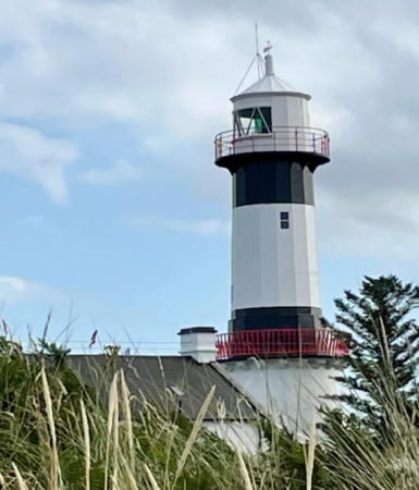
1832. Active; focal plane 40 m (131 ft); four white flashes, separated by 5 s, every 30 s, day and night. 27 m (88 ft) round stone tower with lantern and gallery, painted in broad black and white horizontal bands. 1st order Fresnel lens (1887) in use. 2-story keeper's houses and other buildings; one of the keeper's houses is occupied by a resident attendent. Berni Gallagher's photo is at right, Trabas has a closeup photo by John Eagle, Goulding's page has two photos, David Baird has a 2009 photo, Marinas.com has aerial photos, and Bing has a satellite view. Like Inishtrahull this lighthouse is an important landfall light for ships arriving to the north of Ireland. Tory Island, a popular tourist destination, is accessible in the summer by passenger ferry from Magheroarty and Bunbeg. Located at the western end of the island, about 4 km (2.5 mi) from the ferry landing; accessible by hiking trail. Site and tower closed, but the lighthouse can be viewed from outside the enclosure. Operator: Commissioners of Irish Lights. . ARLHS IRE-075; CIL-1610; Admiralty A6200; NGA 7280.
Ravedy Island
Date unknown. Active; focal plane 9 m (30 ft); white flash every 3 s. 4.5 m (15 ft) square white concrete tower. Trabas has a photo and Bing has a satellite view. Located on a small island just off Melmore Head, the west side of the entrance to Drongawn Lough. Accessible only by boat. Site open, tower closed. Admiralty A6180; NGA 7256.

Tory Island Light, Donegal, August 2018
Google Maps photo by Berni Gallagher
**** Fanad Head (2)
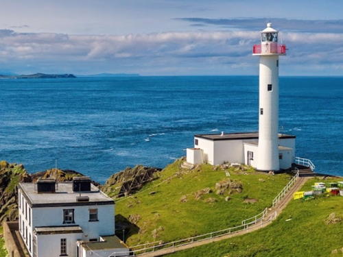
1886 (station established 1817). Active; focal plane 39 m (127 ft); five white flashes every 20 s. 22 m (72 ft) round masonry tower with lantern and gallery, painted white, connected by a covered walkway to a 2-story keeper's house; 300 mm lens. Several additional keeper's houses and other buildings enclosed by a stone wall. A photo is at right, Trabas has a great photo by Werner Furlan, Goulding's page has several photos, Clara Taylor has a 2022 closeup, Marinas.com has aerial photos, Huelse has a historic postcard view, Google has a street view, and Bing has a satellite view. One of the keeper's houses is occupied by a resident attendent. This lighthouse stands on a very picturesque site at the western entrance to Lough Swilly, making the lighthouse a favorite subject of photographers. The original lighthouse was a sibling of Mutton Island Light, Galway (see below). CIL has a page for the station as one of the twelve Great Lighthouses of Ireland. Following a €500,000 restoration of the station in 2013-14, the keeper's houses have been opened for overnight accommodations, and the tower opened to visitors for the first time in summer 2015. In July 2015 the tourism ministry announced a grant of €299,000 to construct a visitor center for the light station; it opened for the 2016 season. In April 2023 plans were announced for expanded parking, outdoor seating, and other amenities. Located atop a vertical cliff about 3 km (2 mi) northeast of Arryheernabin. Site open, tours of the tower available daily in June, July and August, daily except Monday in April, May, September and October, and on weekends November through March. Operator: Commissioners of Irish Lights. Site manager: Fanad Head Lighthouse . ARLHS IRE-085; CIL-1580; Admiralty A6168; NGA 7240.
* Buncrana Pierhead (3)
2009 (station established 1876). Active; focal plane 11 m (36 ft); red or white light, depending on direction, 2 s on, 2 s off. 8.5 m (28 ft) round cylindrical fiberglass tower, red with a white horizontal band. Goulding has a page with photos, Trabas has Werner Seiler's photo, Jeremy Hylton has a photo, Google has a street view, and Bing has a satellite view. Located at the end of the pier at Buncrana, on the east side of upper Lough Swilly. Accessible by walking the pier. Site open, tower closed. Operator: Commissioners of Irish Lights. CIL-1530; Admiralty A6174; NGA 7248.
* [Buncrana Pierhead (2) (relocated)]
1916 (station established 1876). Inactive since 2009. 5.5 m (18 ft) steel post with gallery and a small lantern. Goulding has a page with photos and Greg Clarke also has a photo. Removed from the pierhead in 2009, the beacon was restored in 2010 through the efforts of Peter Gurrie and the West Inishowen History and Heritage Group. The restored beacon was placed in Grianan Park about 800 m (1/2 mi) north of the pier. Google has a street view and Bing has a satellite view. Located on the waterfront on Aileach Road. Owner/site manager: Town of Buncrana.

Fanad Head Light
Fanad Head Light, Portsalon, July 2008
Flickr Creative Commons photo by Filko Dawidzinski

* Dunree Head (1)
1876. Inactive since 2015. 6 m (20 ft) lantern, placed directly on the ground, attached to a 1-story keeper's house. Lantern and buildings painted white. Fresnel lens in the lantern. Trabas has a good photo, Ingo Voigt has a 2021 photo, Kenneth Allen has a 2009 photo, Goulding's page has excellent photos, Marinas.com has aerial photos, and Google has a satellite view and a distant street view. The active light (focal plane 49 m (161 ft); two white flashes every 5 s) has been moved to a short round fiberglass tower. In June 2021 the tourist development agency Fáilte Ireland announced that the lighthouse will be restored and opened to the public. It appears that some restoration work has been done. Located on a sharp headland on the east side of Lough Swilly opposite Portsalon and about 20 km (13 mi) northwest of Buncrana. Site evidently open, tower closed. Operator: Commissioners of Irish Lights. ARLHS IRE-030. Active light: CIL-1490; Admiralty A6172; NGA 7244.
Inishtrahull (Inis Trá Tholl) (West)
1958 (fog signal station established in 1905). Active; focal plane 59 m (194 ft); three white flashes, separated by 2.3 s, every 15 s. 23 m (75 ft) round cylindrical reinforced concrete tower with lantern and gallery, painted white; 375 mm lens. A diaphone fog signal (deactivated in 1987) is mounted atop the lantern, so from a distance the lighthouse appears to be wearing a hat. 2-story keeper's house, fog signal building (inactive since 1958), and other light station buildings. A CIL photo is at right, Patryk Sadowski has a 2023 drone view, a distant view is available, Marinas.com has good aerial photos, and Google has a satellite view. Inishtrahull is a rocky, uninhabited island 10 km (6 mi) north of Malin Head, the northernmost point of the Irish mainland. Inishtrahull Light, Ireland's northernmost lighthouse, is the traditional landfall light for ships arriving at the North Channel. Huelse has a postcard view of the first lighthouse on the island, built in 1812 at the east end; it was deactivated in 1958 and demolished the following year. Located at the west end of the island; accessible only by helicopter (landing from a boat is very dangerous). Site and tower closed. . ARLHS IRE-045; CIL-1480; Admiralty A6164; NGA 7236.

Inishtrahull Light, North Channel
CIL photo

Lough Foyle Lighthouses (see also Northern Ireland)
Lough Foyle is a broad inlet that forms the estuary of the River Foyle; it separates County Donegal in the Republic of Ireland from County Londonderry (Derry) in Northern Ireland. The British government claims that all of Lough Foyle lies within the United Kingdom but this claim is not accepted by the Irish government. In the Belfast Agreement of 1998 the two governments agreed to continue disagreeing about the exact location of the boundary; instead of resolving it they established the intergovernmental Loughs Agency to administer the waters of Lough Foyle as well as Carlingford Lough, which forms their border on the east side of Ireland.
* Inishowen Head (Shrove, Shroove) (West)
1837. Active; focal plane 28 m (92 ft); two flashes every 10 s, white, red, or green depending on direction. 22.5 m (74 ft) round two-stage tower with lantern and double gallery. The lower portion is a 15 m (49 ft) granite tower built in 1837 by George Halpin; the upper portion is a 7.5 m (25 ft) cast iron tower added by J.S. Sloane in 1871. Lighthouse painted white with two narrow black horizontal bands (at the top and bottom of the cast iron section). Fog horn (2 blasts every 30 s). Three 2-story keeper's houses; one is occupied by a resident attendent and the others serve as vacation cottages for CIL staff. Patrick Mackie's photo is at right, Trabas has Werner Furlan's closeup, Goulding's page has several good photos, Dusan Kavcak has a 2021 photo, Marinas.com has aerial photos, Google has a street view, and Bing has a satellite view of the station. The light station has a complex history, as several generations of managers sought to provide adequate warning of the dangerous Tuns Bank offshore. Originally there was a second 15 m (49 ft) granite tower, identical to the first, about 140 m (153 yd) to the east. This became the low light after the west tower was raised in 1871. The east tower was deactivated in 1961 and its upper section was removed (see next entry). The light station is actually located at Dunagree Point, 1 km (0.6 mi) south of Inishowen Head, marking the entrance to Lough Foyle. Accessible by road at the end of the R241 highway about 5 km (3 mi) northeast of Greencastle. Site and tower closed, but the lighthouse can be viewed from outside the enclosure. Operator: Commissioners of Irish Lights. . ARLHS IRE-043; CIL-1460; Admiralty A6084; NGA 7076.
* Inishowen Head East
1837. Inactive since 1961. Approx. 7.5 m (25 ft) granite tower with gallery, painted white with a black band at the top. Goulding has a page with closeup photos, Google has a street view, and Bing has a satellite view. This is the stump of the original eastern tower. Site and tower closed, but the lighthouse can be viewed from outside the enclosure. Owner: Commissioners of Irish Lights.
* Warren Point
1861. Active; focal plane 9 m (30 ft); white flash every 1.5 s. 8 m (27 ft) round cylindrical brick tower with lantern, painted white with green trim. Trabas has an excellent closeup, Goulding's page has closeup photos, Eoin O'Riordan has another photo, Chris Newman has a good 2017 photo, Marinas.com has aerial photos, and Google has a satellite view. The light is behind the 12th green of the Greencastle Golf Club. Located 2.4 km (1.5 mi) southwest of the Inishowen Head Light and about the same distance northeast of Greencastle. Site open (with consent of the golf club), tower closed. Operator: Londonderry Port and Harbour Commissioners. Site manager: Greencastle Golf Club. . ARLHS IRE-112; Admiralty A6088; NGA 7080.
Inishowen Light
Inishowen Head Light, Greencastle, October 2012
Geograph Creative Commons photo by Patrick Mackie
Moville
1882. Active; focal plane 11 m (37 ft); flash every 2.5 s, white to the southeast and red to the northwest. 13.5 m (44 ft) round tower with lantern and gallery rising from a small watch room, mounted on a platform supported by piles. Aidan Devlin's photo is at right, Trabas has a good photo, Goulding's page has excellent photos, Marinas.com has aerial photos, and Google has a satellite view. This lighthouse is the largest of a series of pile lights built on Lough Foyle during the late 1800s and early 1900s. Keepers lived in town but spent the night in the watch room. The lighthouse was restored in 2008. Located about 550 m (1/3 mi) south of the old quay at Moville, on the northwest side of the lough. Accessible only by boat, but there is an excellent view from the Moville waterfront. Site open, tower closed. Owner/operator: Londonderry Port and Harbour Commissioners. Site manager: Loughs Agency. . ARLHS IRE-106; Admiralty A6096; NGA 7092.
[Whitecastle (2?)]
Date unknown (station established 1848). Active; focal plane 4 m (13 ft); quick-flashing red light. 4 m (13 ft) post. Close to the modern light are the pilings from the original pile lighthouse, which was similar to the Moville lighthouse. Trabas has a photo and Bing has a satellite view. Located about 3 km (1.8 mi) south southwest of Redcastle. Accessible only by boat. Site open, tower closed. Owner/operator: Londonderry Port and Harbour Commissioners. Site manager: Loughs Agency. Admiralty A6106; NGA 7116.

Information available on lost lighthouses:

  • Lough Foyle Pile Lights. The 1904 Jenkins light list includes, in addition to Moville and Whitecastle, four more pile lighthouses on Lough Foyle: Redcastle (1852), Quigleys Point (1896), Ture Point (1850), and Coneyburrow (1848). It appears that nothing remains of these lighthouses. Trabas has photos of the modern Redcastle (A6104), Quiqleys (A6108), Ture (A6114) , and Coneyburrow (A6128) lights.

Moville Light, Lough Foyle, November 2019
Google Maps photo by Aidan Devlin

Notable faux lighthouses:

Adjoining pages: North: Northern Ireland | South: Southwestern Ireland

Return to the Lighthouse Directory index | Ratings key

Posted December 2004. Checked and revised September 15, 2023. Lighthouses: 45. Site copyright 2023 Russ Rowlett and the University of North Carolina at Chapel Hill.