Lighthouses of Azerbaijan

One of the former Soviet republics, the Republic of Azerbaijan (Azərbaycan in Azerbaijani) faces the southwestern quadrant of the Caspian Sea, bordering Russia to the north and Iran to the south. In the central part of the country's coastline the Absheron (Abşeron) Peninsula projects about 60 km (37 mi) into the Caspian. The capital Bakı (Baku) is located near the base of the peninsula on the south side. The city has a population of about two million and a large port that serves cross-Caspian shipments as well as cargos bound to or from Russia or the Mediterranean via the Volga and Don waterways.

The present territory of Azerbaijan was incorporated into the Russian Empire in the early 19th century so the historic lighthouses are of Russian heritage. Following the Russian Revolution Azerbaijan became one of the constituent republics of the Soviet Union in 1920. The country has been independent since the collapse of the Soviet Union in 1991.

We are in need of "on the ground" information concerning the current condition, status, and activity of Azerbaijan's lighthouses, so if you able to visit any of them please let me know whatever you find out. Current photos would also be very welcome!

Azerbaijan is divided into 66 districts (rayon) and 11 cities (şəhər).

The Azerbaijani language is written now in a Latin script rather than the Cyrillic used in Soviet times. The language uses a modified form of the Turkish alphabet but it also includes the Cyrillic short-a character ә. The Azerbaijani word for a lighthouse is mayakı, plural mayakları (borrowed from the Russian word mayak), or dәniz kәnarı (borrowed from the Turkish deniz feneri). As in Turkish, ada or adası is an island, yarımada is a peninsula, burnu is a cape, burun ("nose") is a headland, and liman is a harbor. The Caspian Sea is known as the Xəzər Dənizi (Hazar Sea) in Azerbaijani.

Lighthouses in Azerbaijan are presumably maintained by the State Maritime Administration. Names of the lighthouses are given in Azerbaijani with the Russian names in curly brackets {}.

ARLHS numbers are from the ARLHS World List of Lights. Because the Caspian Sea is landlocked its lights are not listed on the international light lists.

General Sources
Apsheron Mayaki
This Russian-language article has historical information on the lighthouses of Azerbaijan.
Azərbaycan mayakları (Lighthouses of Azerbaijan)
Index to lighthouse articles in the Azerbaijani edition of Wikipedia. The List of the Lighthouses page has light characteristic data.
Lighthouses in Azerbaijan
Photos and postage stamp images available from Wikimedia.
World of Lighthouses - Azerbaijan
Photos by various photographers available from Lightphotos.net.
Lighthouses of the USSR - Caspian Sea
Nothing here yet, but hopefully this webmaster will be adding information on the lighthouses.
Navionics Charts
Navigation chart for Azerbaijan.


Abşeron (Artyom) Light, Gürgәn, April 2023
Google Maps photo by Sergey Agentino
Bakı City: Abşeron Peninsula Lighthouses
* Amburan (Nardaran) {Mys Amburan}
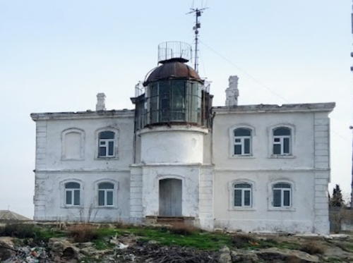
1884. Active; focal plane 72 m (236 ft); white light occulting twice every 15 s. 12 m (39 ft) round cylindrical masonry tower with lantern and gallery, attached to the seaward side of a 2-story masonry keeper's house. Ilgar Isayev's photo is at right, Lightphotos.net also has a Wikimapia photo, the lighthouse appears on a postage stamp, and Google has a satellite view. The building was restored in 1983 and it appears that the light was moved atop the lantern. Elshan Ibrahimov's 2020 photo shows the building in poor condition but the light apparently returned to the lantern, if it continues active. Historically the lighthouse showed a red sector light in addition to a white light but apparently that is no longer the case. Nardaran, on the north shore of the Abşeron Peninsula, is a medieval religious center that has become a beach resort and a suburb of Bakı. Located atop a steep bluff about 650 m (0.4 mi) from the shore in Nardaran, about 25 km (15 mi) north of Bakı. Site status unknown, probably open; tower closed. ARLHS AZE-008.
* Şüvəlan (Shuvalan) {Shoulanskiy}
1907. Active; focal plane 19 m (62 ft); white light, 3 s on, 3 s off. 13 m (43 ft) lantern mounted on the roof of a 2-story masonry life saving station built in 1874. Building painted white. The lighthouse appears on a postage stamp and Google has a satellite view. The lighthouse marks the northern entrance to the Abşeron Strait between the mainland and Pirallahı (Pirallakhi) Island; smaller ships bound for Bakı use this strait to avoid a detour around the Bakı Archipelago. The Soviets renovated the station in 1935, installing a more powerful light. The building is in use as a residence for one or more military families. Located about 2.5 km (1.5 mi) south of the cape near the town of Şüvəlan (Shuvalan), on the north shore of the Abşeron Peninsula about 35 km (22 mi) east northeast of Bakı. Site status unknown, probably open; tower closed. ARLHS AZE-007.

Amburan Light, Nardaran, December 2022
Google Maps photo by Ilgar Isayev
* Abşeron (Artyom, "Danba") {Apsheron, Absheron}
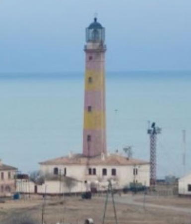
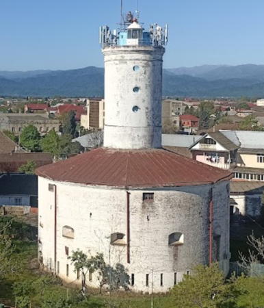
1860. Active; focal plane 101 m (331 ft); white light, 4.5 s on, 1.5 s off. 22 m (72 ft) round, unpainted masonry tower with lantern and gallery. A large Fresnel lens is in use. Sergey Agentino's photo is at the top of this page, Emil Abdullayev has a 2014 photo, Tahir Miralay has a 2011 photo, the lighthouse appears on a postage stamp, Uzeyir Mikayil has a 2018 street view, and Google has a satellite view. Navionics charts the lighthouse as the rear light of a range guiding ships in a dredged channel leading to an oil terminal on the west side of the Abşeron Strait, but no front light has been located. Located near Gürgәn (Türkan) on the eastern end of the Abşeron Peninsula. Site open, tower closed. ARLHS AZE-006.

Bakı City: Caspian Sea Island Lighthouses
Çilov Adası (Jilov, Chilov Island) {Ostrov Zhiloy}
1881. Active; focal plane 51 m (167 ft); three long white flashes and one long red flash every 30 s. 47 m (154 ft) octagonal stone tower with lantern and gallery, rising through the center of a 2-story keepers house. Tower painted with red and yellow horizontal bands; lantern dome is black. A portion of Mehri Hüseynova's distant 2022 view is at right, the lighthouse appears on a postage stamp, and Google has a satellite view of the station. Located on Çilov Island several miles northeast of Neft Daşları. Accessible only by boat. Site status unknown. ARLHS AZE-004.
Neft Daşları {Neftyanye Kamin}
Date unknown (recent). Active; focal plane about 50 m (164 ft); white light, pattern unknown. Skeletal mast with gallery mounted atop a tall apartment building. The light is probably at the left edge of an aerial photo but nothing is seen in Google's satellite view of the area. Built in 1949-51, Neft Daşları (Oil Rocks) is an offshore town, built on platforms, serving a large producing oil field. Located 55 km (34 mi) offshore, to the south of Çilov Island. Accessible only by boat. Site status unknown. ARLHS AZE-005.

Çilov Adası Light, Neft Daşları, June 2022
Google Maps photo by Mehri Hüseynova

Bakı City: Bakı Urban Area Lighthouses
Böyük Zirə (Boyuk Zira, Bakı) {Ostrov Nargin} (2)
1958 (station established 1884). Active; focal plane 42 m (138 ft); three white flashes every 9 s. 18 m (59 ft) octagonal tower with lantern and gallery. Lighthouse painted white, lantern room red. İsmayıl Namazov's 2023 photo is at right, Ralph Hälbig has a 2011 photo, the lighthouse appears on a postage stamp, Russian Wikipedia has an article on the lighthouse, and Google has a satellite view. This light functions as the landfall light for Bakı. The original lighthouse was very similar in appearance to the present light; Soviet troops blew it up in 1941 so that German bombers could not use it as a landmark. Böyük Zirə (Nargin Island) is located in the entrance to Bakı's crescent-shaped harbor. The island served as a prisoner of war camp during both world wars, and it also had a small Soviet naval station. Nearly all these buildings have been demolished. Located near the center of the narrow island. Accessible only by boat. Site status unknown. ARLHS AZE-009.
Azertrans Range Front
Date unknown. Active; focal plane at least 20 m (66 ft); green light, pattern unknown. At least 20 m (66 ft) square skeletal tower. No photo available but Google has a satellite view. This range guides ships to the Azertrans Oil Terminal in eastern Bakı. Located in the oil terminal area on the waterfront of Bakı. Site and tower closed.
Azertrans Range Rear
Date unknown. Active; focal plane unknown; green light, pattern unknown. Perhaps 30 m (98 ft) square pyramidal skeletal tower. No photo available but Google has a satellite view. Located in the oil terminal area about 50 m (165 ft) north of the front light. Site and tower closed.
 

Böyük Zirə Light, Bakı, January 2023
Google Maps photo by İsmayıl Namazov
 
Bakı Range Front
Date unknown. Active; focal plane at least 20 m (66 ft); red light, pattern unknown. At least 20 m (66 ft) square skeletal tower carrying a daymark colored white with a black vertical stripe. No photo available but Google has a satellite view. This is the entrance range for Bakı harbor. Located in an industrial area on the waterfront of Bakı. Site and tower closed.
* Bakı Range Rear
Date unknown. Active; focal plane unknown; red light, pattern unknown. Perhaps 15 m (49 ft) square skeletal tower carrying a daymark colored white with a black vertical stripe. Ali Azimov has a distant 2022 street view and the tower is centered in Google's satellite view. Located in a residential area about 500 m (1/3 mi) north of the front light. Site open, tower closed.
*** Qız Qalası (Maiden Tower)
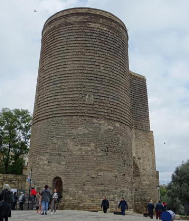
1858. Inactive since 1907. Ancient 35 m (115 ft) key-shaped stone tower. Heather Craven's photo is at right, Keith Mellnick has a good photo, Wikimedia has numerous photos, and Google has a street view and a satellite view. This is Bakı's best known landmark. No one knows for sure how the Maiden Tower got its name. It dates at least from the twelfth century, possibly from the ninth. Presumably intended as a fortress, the tower has had many uses over the years, including service at least occasionally as a lighthouse. In 1858 the Russians added a light to the historic tower, as seen in a 1900 photo. The light was removed in 1907 since the Nargin Island lighthouse (see above) had made it unnecessary. Located about 150 m (165 yd) from the waterfront in Bakı. Site open, tower open daily.
* Bakı
Date unknown (recent). Active; focal plane 60 m (197 ft); continuous white light. Approx. 60 m (197 ft) round white concrete tower rising from a semicircular glass-enclosed building. Elman Zaynalov has a 2016 photo, Sabina Tumanskaya has a 2016 view from the sea, Niyaz Najafov has a street view, Riccardo Bertolla has a nighttime street view of the lighthouse in action, and Google has a satellite view. The building includes a popular restaurant. Located on a breakwater pier at the southwestern end of the waterfront in Bakı. Site open, tower closed.

Maiden Tower, Bakı, November 2019
photo copyright Heather Craven; used by permission
* Qaradağ {Mys Poota}
Date unknown. Active (?); focal plane 40 m (130 ft); light characteristic unknown. Approx. 12 m (40 ft) square white stone tower painted with narrow black horizontal bands. A photo is at right, Sabit Tagiyev has a 2011 photo, and Google has a satellite view and a distant 2021 street view. Located on a hilltop at Qaradağ (Qaradagh), about 20 km (13 mi) southwest of Bakı. Site open, tower closed.

Bakı City: South Coast Lighthouses
Kara Zhira {Ostrov Bulla}
Date unknown. Probably inactive. Approx. 12 m (39 ft) square stone or concrete tower. Uzeyir Mikayil has a 2019 street view and Google has a distant satellite view. Located on an island about 65 km (40 mi) southwest of Bakı. Accessible only by boat. Site status unknown.
Səngi Muğan Adası (Sangi-Mugan) {Ostrov Svinoy} (1?)
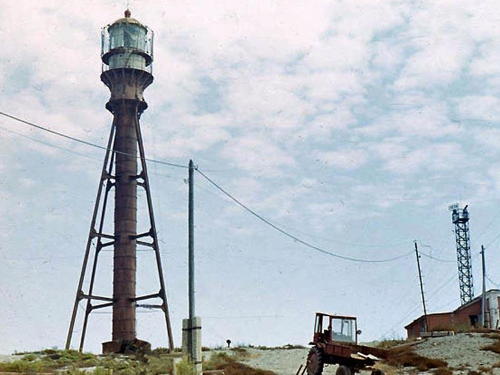
1891. Charted as active by Navionics; focal plane about 50 m (164 ft); white light, pattern unknown. 50 m (164 m) square pyramidal cast iron skeletal tower with lantern, gallery, and central cylinder. Several contemporary and historic photos (halfway down the page) are available and Google has a satellite view. This lighthouse was prefabricated in France. The island is the summit of a mud volcano and the lighthouse was abandoned after being damaged by an eruption of the volcano in April 1932. Azerbaijan is well known for the large number of mud volcanos associated with its extensive oil fields. According to the historical article there is now a "new electronic beacon" on the island although another source says the lighthouse was repaired and still stands. Thus the active light may be on a new tower. Located on a small island about 65 km (40 mi) southwest of Bakı. Accessible only by boat. Site status unknown. ARLHS AZE-003.

Qaradağ Light, Qaradağ
ex-Trip Advisor photo; may be reproduced with attribution

Neftchala District Lighthouse
Kura {Kurinskiy}
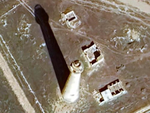
1911. Inactive since 1966. Approx. 50 m (164 ft) stone tower with lantern and gallery. Wikimapia has a small photo and Bing has a good satellite view of the lighthouse and the station ruins. According to a historical account (no longer online), there are two inactive lighthouses at or near the mouth of the Kura (Cyrus) River, roughly halfway between the Səngi Muğan and Lənkəran lighthouses. Apparently they would be this lighthouse and the Kurkosa lighthouse (next entry). Located near the south end of the river's delta; there is no longer a mouth of the river at this location. We need more information concerning this station! Accessible only by boat. Site status unknown. ARLHS AZE-010.

Lənkəran District and City Lighthouses
Kurkosa {Ostrov Zharskiy}
1911. Inactive since 1966. Approx. 50 m (164 ft) stone tower with lantern and gallery. No photo available but Google has a distant satellite view. Located on the southeast coast of Kurkosa Island, which is offshore about 50 km (30 mi) south of the river's delta. We need more information concerning this station! Accessible only by boat. Site status unknown.
[Nərimanabad (Iliç) {Ilyich} (?)]
Date unknown. Inactive. Navionics charts indicate a former lighthouse. No information about it is available; Google has a satellite view that probably shows a former light station at the charted location. The former port here has silted up and is no longer functional. Located in marshland at Nərimanabad, about 10 km (6 mi) north of Lənkəran. Site status unknown.
* Lənkəran (Lankaran, Lenkoren) {Lenkoranskiy}
1869. Active; focal plane 33 m (108 ft); two long (3 s) white flashes every 15 s. 30.5 m (100 ft) round brick tower centered on a large round building. Entire building painted white with a red roof. A photo of the lighthouse is at right, Wikipedia has an Azerbaijani article with a photo, Elshan Imamaliyev has a closeup, Huseyn Mammadov has a 2023 closeup, a 2007 photo is available, Javid Asadov has a 2018 photo, Russian Wikipedia has an article on the lighthouse, and Google has a satellite view. Except for Qız Qalası this is Azerbaijan's best known lighthouse. The building was originally a prison, and apparently it was used for that purpose even in Soviet times. The light tower was added in 1869 and the building was restored in 1957. Lənkəran is the southernmost major town in Azerbaijan, located about 50 km (30 mi) north of the Iranian border. The lighthouse is on the north side of the city. Site open, tower closed. ARLHS AZE-001.

Astara District Lighthouses
[Astara North Breakwater]
Date unknown. Active; focal plane about 11 m (36 ft); green light, characteristic unknown. Approx. 6 m (20 ft) green barbell-shaped tower. Wikimedia has a photo but Bing has only a fuzzy satellite view. Located on the north breakwater of a small boat harbor in northern Astara. Site status unknown.
[Astara South Breakwater]
Date unknown. Active; focal plane about 11 m (36 ft); red light, characteristic unknown. Approx. 6 m (20 ft) red barbell-shaped tower. Wikimedia has a photo but Bing has only a fuzzy satellite view. Located on the south breakwater of a small boat harbor in northern Astara. Site status unknown.
* Astara
Date unknown. Active; focal plane about 25 m (82 ft); white light, pattern unknown. Approx. 23 m (75 ft) square cylindrical skeletal tower with gallery and a small lantern. The front of the lighthouse carries a slatted daymark, painted white. Timur Mammadrzaev has a distant street view and Google has a satellite view. Historically Astara lacked harbor facilities, so the only purpose of the light was to mark the Iranian frontier. Located about 250 m (820 ft) from the beach and 400 m (1/4 mi) north of the Aras River, which forms the border with Iran. Site apparently open, tower closed. ARLHS AZE-002.

Lənkəran (Lankaran) Light, August 2013
ex-Panoramio photo copyright Leonid Yaitsky; used by permission

Information available on lost lighthouses:

Notable faux lighthouses:

Adjoining pages: North: Russia: Caspian Sea | South: Northern Iran

Return to the Lighthouse Directory index | Ratings key

Posted March 12, 2007. Checked and revised July 6, 2023. Lighthouses: 19. Site copyright 2023 Russ Rowlett and the University of North Carolina at Chapel Hill.