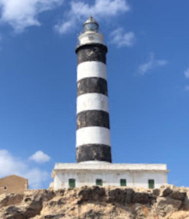
Lighthouses of Spain: Mallorca and Menorca

The Kingdom of Spain occupies nearly 85% of the Iberian Peninsula in southeastern Europe with coastlines facing south and southeast on the Mediterranean Sea and northwest on the Atlantic Ocean. Spain also includes the Balearic Islands in the Mediterranean, the Canary Islands in the Atlantic, and the cities of Ceuta and Melilla on the north coast of Morocco.

The Balearic Islands are an archipelago in the Mediterranean off the east coast of Spain. Mallorca (Majorca) is by far the largest of the islands; the other principal islands are Menorca (Minorca) to the northeast and Ibiza (Eivissa) and Formentera to the southwest. The islands were conquered by the Kingdom of Aragon in the 13th century and have been part of Spain for several centuries. The Catalan language is spoken and the islands are known officially by their Catalan name, Illes Balears. In the 20th century the Balearics became very popular resort destinations. The islands are one of the 17 autonomous communities (comunidads autónoma) into which Spain is divided. They form a single province but each of the four major islands has an insular council for local government.

This page is for Mallorca and Menorca; there is a second page for Ibiza and Formentera.

In Catalan the word for a lighthouse is far, balisa is a beacon, illa is an island, cap is a cape, punt is a promontory or point of land, roca is a rock, escull is a reef, badia is a bay, ria is an estuary or inlet, estret is a strait, riu is a river, and port is a port or harbor. The word for a lighthouse is faro in Spanish but its use is generally restricted to the larger coastal light stations. Smaller lighthouses are called balizas (beacons). In Spanish isla is an island, cabo is a cape, punta is a promontory or point of land, péñon is a rock, arrecife is a reef, bahía is a bay, ría is an estuary or inlet, estrecho is a strait, río is a river, and puerto is a port or harbor.

Navigational lights in Spain are the responsibility of the national port authority, Puertos del Estado, but many of them are operated and maintained by regional port authorities. The Balearics have their own port authority, the Autoritat Portuària de Balears. The Comisión de Faros, founded in 1842 to build and maintain Spanish lighthouses, is now an advisory panel.

ARLHS numbers are from the ARLHS World List of Lights. ES numbers are from the Spanish national list of lights, Libro de Faros. Admiralty numbers are from volume E of the Admiralty List of Lights & Fog Signals. U.S. NGA List numbers are from Publication 113.

General Sources
Libro de Faros y Señales de Niebla
Online edition of the official Spanish light list.
Fars de Balears
An outstanding and comprehensive web site, with versions in English as well as Spanish and Catalan.
Online List of Lights - Islas Baleares and Menorca East Coast
Photos by various photographers posted by Alexander Trabas.
Leuchttürme.net - Islas Baleares
Photos of Mallorca lighthouses posted by Malte Werning.
Faros de las Islas Baleares
Photos by Laure Chappuis, posted by Alain Guyomard and Robert Carceller.
Lighthouses in Balearic Islands
Photos by various photographers available from Wikimedia.
World of Lighthouses - Non-continental Spain
Photos by various photographers available from Lightphotos.net.
Lighthouses in Spain
Fine aerial photos posted by Marinas.com.
Leuchttürme Spaniens auf historischen Postkarten
Historic postcard images posted by Klaus Huelse.
GPSNauticalCharts
Navigational chart information for the islands.
Navionics Charts
Navigational chart for the islands.


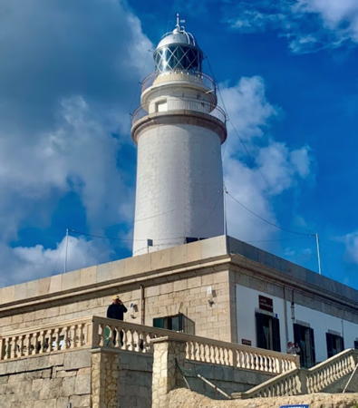
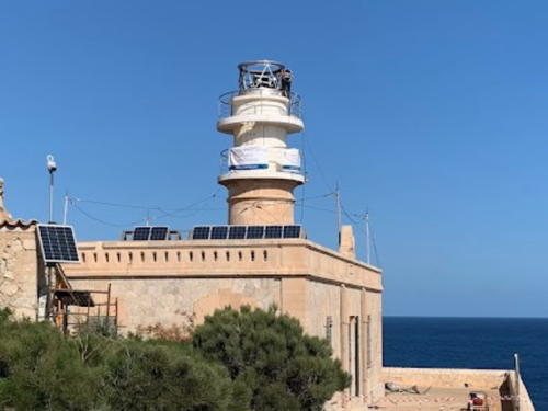
Cap Formentor Light, Mallorca, May 2023
ex-Google Maps photo by Margarita Armenteras
Mallorca (Majorca) Lighthouses

Mallorca (often spelled Majorca and pronounced "ma-yor-ka" in English) is the largest and most populous of the Balearic Islands, with a population of about 950,000. The provincial capital Palma de Mallorca is located in the southwest of the island.

Palma de Mallorca City Lighthouses
Palma de Mallorca, or simply Palma, is the capital, most important port, and largest city of the Balearic Islands. Founded by the Romans in 124 BCE, it has a metropolitan population now of roughly 550,000.
Palma Dique de Levante (Dique Est) (Far de la Riba) (5) (relocated)
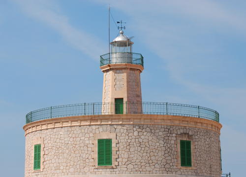
1903 (station established in the 1700s). Inactive since 1982. Approx. 15 m (49 ft) octagonal stone tower rising from the center of a circular 2-story stone keeper's house. Lighthouse painted white with green trim. A port authority photo is at right, Paco Romo Torres has a 2020 photo, Werning has a photo, Huelse has a historic postcard view, and Google has a satellite view and a closeup street view. In 1982 this lighthouse was dismantled and rebuilt, although it's not clear how far it was moved. Located near the end of the main pier at Palma de Mallorca. Site and tower closed; this is a heavily commercial area that is closed to the public. ARLHS BAL-044.
#Palma Dique de Levante (Dique Est) (6)
Date unknown. Replaced after 2008. Formerly a 15 m (49 ft) slender round cylindrical concrete tower rising from the center of a square 1-story equipment room; access to the light was by a external stairway that spiralled around the tower. Tower painted green; the equipment room at the base was painted white with a large green triangular daymark painted on each face. Werning has a photo of this light. Trabas has Douglas Cameron's photo showing that the light has been replaced by a much smaller light and Google has a satellite view of the location. Located at the southwestern corner of the main pier at Palma de Mallorca; this pier also serves as the breakwater for the inner harbor. Accessible by walking the pier. Site status unknown; this is a heavily commercial area probably closed to the public. ARLHS BAL-045. Current light: ES-34710; Admiralty E0322; NGA 4976.
Palma Tacón RoRo (RoRo Terminal)
Date unknown. Active; focal plane 8 m (28 ft); green flash every 3 s. 5 m (17 ft) round hourglass-shaped concrete tower, painted green. Trabas has Douglas Cameron's photo and Google has a satellite view. Located on the south side of the Dique de Levante. Site and tower closed. ES-34705; Admiralty E0322.3.

La Riba Light, Palma de Mallorca
Autoritat Portuària de Balears photo
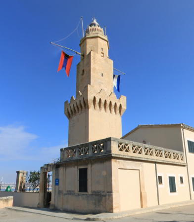
** Porto Pí (Palma de Mallorca, Torre Senyals) (3)
1617 (station established in the late thirteenth century). Reactivated (inactive 1972-1977); focal plane 41 m (135 ft); two white flashes every 15 s. 38 m (125 ft) four-stage round tower with lantern and three galleries; the lower stages are square and the upper ones are octagonal. The lowest stage is the Torre Senyals, a 21 m (69 ft) square cylindrical medieval signal tower with castellated top built in the 14th century. Built atop the medieval tower is a 17 m (56 ft) tower, the lower part square and the upper part octagonal. The tower is unpainted stone; the lantern is gray metallic. EuroWeb Media has the 2020 street view seen at right, Trabas has Arno Siering's photo, a 2020 photo and a 2006 view are available, Javier Caro Munar has a 2023 photo, Wikimedia has a photo by Antoni Alomar, and Google has a street view and a satellite view. This is one of the oldest lighthouses surviving in the Mediterranean. The lower (square) portion of the tower dates from about 1400. In the 1950s there were several proposals to demolish the lighthouse but fortunately these plans were not carried out. The lighthouse sits today on a busy industrial waterfront on the east side of the harbor of Palma de Mallorca. The lighthouse was declared a national historic monument in 1983 and in 2004 the Port of Palma opened a museum in the attached building. The museum includes a large collection of historic Fresnel lenses and other lighthouse equipment. The original lantern of the Far de l'Avançada (see below) was restored in 2015 and is displayed outside the museum. Located off the Passaig Maritim about 3 km (2 mi) southwest of the downtown waterfront of Palma de Mallorca. Site and museum open Monday, Wednesday, and Friday afternoons (call for reservations and access to the restricted area around the lighthouse), tower closed. . ARLHS BAL-056; ES-34500; Admiralty E0318.8; NGA 4932.
* Palma Dic de l'Oest (Dique Ouest) Ángulo Sud-Oest
Date unknown. Active; focal plane 16 m (52 ft); six quick white flashes followed by one long white flash every 10 s. 10 m (33 ft) slender round cylindrical concrete tower rising from the center of a square 1-story equipment room; access to the light is by a external stairway that spirals around the tower. Upper half of the tower painted yellow, lower half black; the equipment room at the base is painted white. Trabas has Darlene Chisholm's closeup photo and Google has a satellite view. Located at the inner elbow of the west (outer) breakwater at Palma de Mallorca. Apparently accessible by walking the pier. Site open, tower closed. ES-34520; Admiralty E0318.6; NGA 4944.
* Palma Dic de l'Oest (Dique Ouest) Ángulo Oest
Date unknown. Active; focal plane 16 m (52 ft); three quick white flashes every 5 s. 10 m (33 ft) slender round cylindrical concrete tower rising from the center of a square 1-story equipment room; access to the light is by a external stairway that spirals around the tower. Tower painted black with one yellow band; the equipment room at the base is painted white. Trabas has Darlene Chisholm's closeup photo and Google has a satellite view. Located at the outer elbow of the west (outer) breakwater at Palma de Mallorca. Apparently accessible by walking the pier. Site open, tower closed. ES-34530; Admiralty E0318.3; NGA 4940.

Porto Pí Light, Palma de Mallorca, February 2020
Google Maps street view by EuroWeb Media
* Palma Dic de l'Oest (Dique Ouest) Extremo
Date unknown. Active; focal plane 19 m (62 ft); red flash every 2.5 s. 13 m (43 ft) slender round cylindrical concrete tower rising from the center of a square 1-story equipment room; access to the light is by a external stairway that spirals around the tower. Tower painted red; the equipment room at the base is painted white with a large red rectangular daymark painted on each face. Trabas has Rainer Arndt's closeup photo, a 2019 photo is available, and Google has a satellite view. Located at the end of the west (outer) breakwater at Palma de Mallorca. Apparently accessible by walking the pier. Site open, tower closed. ARLHS BAL-098; ES-34540; Admiralty E0318; NGA 4936.

Andratx: Southwest Coast Lighthouses
Andratx is an upscale resort town at the southwestern tip of Majorca.

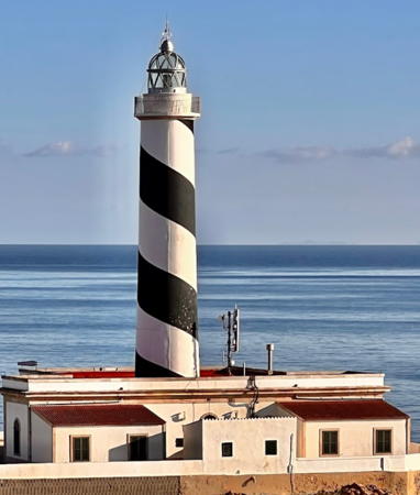
* Cala Figuera (Calafiguera) (2)
1860 (modified in 1962) (Emili Pou). Active; focal plane 45 m (148 ft); four white flashes every 20 s. 24 m (79 ft) round masonry tower with lantern and gallery attached to a 1-story keeper's house. Lighthouse painted with black and white spiral bands; lantern is gray metallic. Günther Hiltrop's 2022 photo is at right, Wikimedia has a good photo by Nikolai Maksimovich, Trabas has a closeup photo by Hans-Albert Liebetrau, Norman Bauersfeld has a nice 2017 photo, a 2014 photo is available, the port authority has a 2010 aerial photo, and Google has a satellite view. The tower was reconstructed and raised in height by 10 m (33 ft) in 1962. This lighthouse stands on a rocky promontory at the western entrance to the Badia de Palma, about 7 km (4.5 mi) south of Son Ferrer. Site and tower closed, but the lighthouse can be viewed from nearby. Accessible by a hiking trail. . ARLHS BAL-018; ES-35090; Admiralty E0330; NGA 5008.
Illa del Bou (Isla del Toro)
Date unknown. Active; focal plane 31 m (102 ft); white flash every 5 s. Approx. 6 m (20 ft) round masonry tower centered on a round 1-story keeper's house. Lantern removed. Entire lighthouse painted white. Gabriel Sabater has a 2019 closeup photo, Trabas has a distant view by Arno Siering, Stein Arne Jensen has a view, and Google has a satellite view. Illa del Bou is an islet (shaped vaguely like a bull) at the end of a very sharp, partially submerged ridge projecting from the southwestern tip of Mallorca. Located on the highest point of the island. Accessible only by boat. Site status unknown. ARLHS BAL-033; ES-35120; Admiralty E0332; NGA 5012.
* Cap de sa Mola (Cabo de la Mola)
1974. Active; focal plane 128 m (420 ft); four white flashes, in a 1+3 pattern, every 12 s. 10 m (33 ft) slender round concrete tower mounted on a square 1-story equipment shelter. Tower painted with black and white horizontal bands; equipment shelter painted white; the small lantern is red. Trabas has Werner Seiler's closeup, and Google has a good street view and an indistinct satellite view. Located on the cape, about 3 km (2 mi) southwest of Port d'Andratx on the southwestern tip of Mallorca. Site open, tower closed. Accessible by road. . ARLHS BAL-019; ES-35170; Admiralty E0334; NGA 5016.
 

Cala Figuera Light, Port d'Andratx, January 2022
Google Maps photo by Nikolai Maksimovich
 
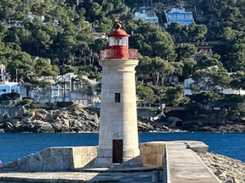
* Port d'Andratx (2)
1904 (station established 1859) (Mateu Garau). Active; focal plane 12 m (39 ft); two red flashes every 7.5 s. 9 m (30 ft) round masonry tower with lantern and gallery. Tower is unpainted stone; lantern and gallery painted red. Fabian Siegler's 2023 photo is at right, Reinhard Schuldt has a good photo, Trabas has a closeup, Jano van Hemert also has a fine photo, Werning has a photo, and Google has a street view and a satellite view. The walkway to the lighthouse was rebuilt in 2010 after being destroyed by storm waves. Located on the west mole at Port d'Andratx; accessible by walking the mole. Site open, tower closed. ARLHS BAL-005; ES-35190; Admiralty E0336; NGA 5020.

Andratx: Dragonera Lighthouses
Illa Sa Dragonera is an uninhabited island off the southwestern tip of Mallorca. The island was purchased by the Council of Mallorca in 1987 and is now included with some smaller islets in the Parque Natural Sa Dragonera. Tours are available from Sant Elm or Port d'Andratx, and hiking trails reach most parts of the island. The island is part of the Andratx municipality.

Cap Llebeig (Cabo Llebeitx)
1910 (Eusebi Estada). Active; focal plane 130 m (427 ft); white flash every 7.5 s. 15 m (49 ft) round masonry tower with lantern and double gallery, adjoining two 1-story keeper's houses. Lighthouse painted white; lantern is gray metallic. Trabas has a photo by Hans-Albert Liebetrau, a 2021 closeup is available, Michael Taschka has a photo, Wikimedia has a view from the sea, Marinas.com has aerial photos, and Google has a satellite view. The original lantern, replaced in 1971, was flown by a U.S. Navy helicopter to the Porto Pí lighthouse in Palma, where it is on display. Note that there is another Cap Llebeig lighthouse on the Illa Cabrera (see below). Located at the southwestern tip of the Illa sa Dragonera. Site open, tower closed. ARLHS BAL-025; ES-35260; Admiralty E0282; NGA 5032.

Port d'Andratx Light, Port d'Andratx, February 2023
Google Maps photo by Fabian Siegler
 
Dragonera (Far de na Pòpia)
1852 (Antonio López y Montalvo). Inactive since 1910. 12 m (39 ft) round masonry tower with lantern and gallery, attached to a 1-story, 2-level masonry keeper's house. The buildings are in ruins. Andreas Riedl has a 2018 closeup photo, Klaus Schwenk also has a closeup, Wikimedia has photos, and Google has an indistinct satellite view. Gravely endangered. This lighthouse had a focal plane of 363 m (1191 ft), higher than any other Spanish lighthouse. In fact it was too high; during storms, when it was most needed, it was usually obscured by clouds. As a result, it was replaced by the Cap Llebeig and Cap de Tramuntana lighthouses in 1910. Abandoned for a century, it is crumbling into ruin. Located on the summit of Pico Single de Ginavera, the highest point of the island. Apparently accessible by hiking trails. Site open, tower closed. ARLHS BAL-097.
Cap de Tramuntana (Cabo Tramontana)
1910 (modified in 1960 and 1972) (Miguel Massenet). Active; focal plane 67 m (220 ft); two white flashes every 12 s. 15 m (49 ft) round masonry tower with lantern and double gallery, attached to a 2-story keeper's house. Lighthouse painted white; lantern is gray metallic. Sergio Rodriguez has the 2022 photo seen at right, Trabas has an excellent closeup photo by Heike and Friedrich Klett, Jose Fuentes has a closeup photo, Benjamí Villoslada Gil has a photo of the light in action, a view from the sea is available, Marinas.com has aerial photos, and Google has a satellite view. The original tower had only a single gallery; we don't know if the second gallery was added in 1960 or in 1972. According to the port authority, "there is an agreement with the Council of the Island of Mallorca, which permits the old lighthouse keeper’s dwellings to be used as small museums and spaces for cultural activities." Located at the northeastern tip of the Illa sa Dragonera. Site open, tower closed. . ARLHS BAL-029; ES-35310; Admiralty E0284; NGA 5036.

Cap de Tramuntana Light, Dragonera, January 2022
Google Maps photo by Sergio Rodriguez

Port de Sóller Lighthouses
Port de Sóller is a small port on the west coast of Majorca, serving mostly recreational vessels.
* Cap Gros (Port de Sóller, La Muleta)
1859 (modified in 1963 and 1971). Active; focal plane 120 m (394 ft); three white flashes every 15 s. 22 m (72 ft) round masonry tower with lantern and double gallery, attached to a 1-story keeper's house. Lighthouse painted white; lantern is gray metallic. Werning has a photo, Trabas has a good photo by Klaus Potschien, another good photo is available, Wikimedia has several photos, Marinas.com has aerial photos, and Google has a street view and a satellite view. This lighthouse was built in 1842 by the town of Sóller, but it was not activated until 1859. The original tower had only a single gallery; we don't know if the second gallery was added in 1963 or 1971. Located on a promontory on the west side of the harbor entrance at Port de Sóller on the central northwestern coast of Mallorca. Accessible by road; parking provided. Site open, tower closed. . ARLHS BAL-024; ES-35360; Admiralty E0289; NGA 5040.
* Sa Creu (Punta de la Cruz) (1)
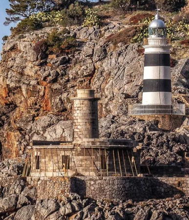
1864 (Emili Pou). Inactive since 1945. Approx. 9 m (30 ft) round stone tower rising from a 1-story stone keeper's house. Lantern removed. The old lighthouse is unpainted. Chris Herling's 2022 photo is at right, Reinhard Schuldt has a photo of both lighthouses, Bernardo Roca has a photo of the two lighthouses, a 2013 photo of both lighthouses is available, Huelse has an interesting postcard view showing both this lighthouse and the Far de Cap Gros, and Google has a satellite view and a street view across the harbor. The lighthouse was replaced because storm waves are able to reach the building. Located on a promontory on the east side of the harbor entrance at Port de Sóller. Site open, tower closed. ARLHS BAL-101.
* Sa Creu (Punta de la Cruz) (2)
1944 (station established 1864). Active; focal plane 35 m (115 ft); white flash every 2.5 s. 13 m (43 ft) round masonry tower with lantern and gallery, painted with black and white horizontal bands. 2-story modern keeper's house. Chris Herling's photo is at right, Werning has a good photo, Trabas has an excellent photo by Hans-Albert Liebetrau, Bernardo Roca has a photo of the two lighthouses, Wikimedia has several views from the sea, and Google has a satellite view and a street view across the harbor. This lighthouse was actually completed in 1930, but it stood unused until 1945. Located on a promontory on the east side of the harbor entrance at Port de Sóller. If not accessible by road, this station should be accessible by a short hike from town. Site open, tower closed. . ARLHS BAL-064; ES-35380; Admiralty E0288; NGA 5044.

Old and new Sa Creu Lights, Port de Sóller, April 2022
Instagram photo by Chris Herling

Pollença Lighthouses
** Cap Formentor
1863. Active; focal plane 210 m (689 ft); four white flashes every 20 s. 22 m (72 ft) round masonry tower with lantern and double gallery, attached to a 1-story keeper's house. Lighthouse painted white; lantern is gray metallic. A 2023 photo by Margarita Armenteras appears at the top of this page, Angie and Chris Pye have a good photo, Trabas has an excellent photo by Hans-Albert Liebetrau, Werning has a photo, Wikimedia has numerous photos, Huelse has a historic postcard image, and Bing has a satellite view. This lighthouse marks the northernmost tip of Mallorca and the entrance to the Badia de Pollença; it is accessible at the end of a very crooked road about 25 km (15 mi) northeast of Port de Pollença. Visitors report that driving to the lighthouse is a challenge since the road is narrow and popular with cyclists but Google's street view shows many visitors. There is a café and gift shop at the lighthouse. Parking is limited. Site open, tower closed. . ARLHS BAL-023; ES-32900; Admiralty E0296; NGA 5068.
L'Avançada (Punta de la Avanzada) (2)
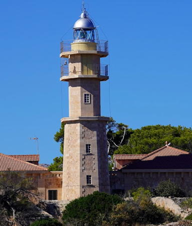
1905 (modified in 1974) (Eusebi Estada). Active; focal plane 29 m (95 ft); white light occulting twice every 8 s. 18 m (59 ft) 2-stage octagonal masonry tower with lantern and double gallery, attached to a 1-story keeper's house. A 2021 photo is at right, Trabas has a great photo by Hans-Albert Liebetrau, Svend Gjerum has a photo, a 2021 photo and a view from the sea are available, and Google has a satellite view. The tower was reconstructed in 1974; the height was increased by 6 m (20 ft), the double gallery was added, and the lantern was replaced. In Liebetrau's photo the original lantern, removed in 1973, can be seen at lower left. In 2015 the lantern was moved to Palma, restored, and placed outside the Porto Pí maritime museum (see above). The lighthouse is located on a promontory on the north side of the Badia de Pollença (Pollensa), about 5 km (3 mi) east of Port de Pollença. Site and tower closed (the road to the Avanzada point is gated). . ARLHS BAL-062; ES-32950; Admiralty E0298; NGA 5072.

Alcúdia Lighthouses
Punta Sabaté (Cabo del Pinar)
Date unknown. Active; focal plane 47 m (154 ft); three white flashes every 9 s. 12 m (39 ft) concrete tower, the lower portion square and the upper portion triangular. Lighthouse painted white with one narrow black horizontal band. Trabas has a distant photo by Heike and Friedrich Klett. a distant view from the sea is available, and Google has a satellite view. Located in Alcúdia at the northern tip of a rugged peninsula on the east side of the Badia de Pollença. Probably accessible by hiking or biking a long access road. Site open, tower closed. ES-33090; Admiralty E0303.7; NGA 5086.

L'Avençada Light, Port de Pollença, October 2021
Google Maps photo by Pixel Mike

Illa Alcanada
1861 (Emili Pou). Active; focal plane 22 m (85 ft); white light, 1.2 s on, 3.8 s off. 15 m (49 ft) round masonry tower with double gallery, centered on the roof of a square 1-story masonry keeper's house. The lantern was removed when the lighthouse was automated in 1960. Lighthouse painted white. Trabas has a closeup by Klaus Potschien, Werning has a photo, Mariann Rasmussen has a 2022 photo, Klaus Schlitt has a view from the mainland, Marinas.com has aerial photos, and Google has a satellite view. Located on an island just off the north shore of the Badia d'Alcúdia about 5 km (3 mi) east of Port d'Alcúdia. Accessible only by boat but there is a distant view from the end of the Camino de la Alcanada. Site status unknown. . ARLHS BAL-006; ES-33100; Admiralty E0304; NGA 5100.

Capdepera Lighthouse
* Capdepera (Cabo de Pera)
1861 (Emili Pou). Active; focal plane 76 m (249 ft); five white flashes, in a 2+3 pattern, every 20 s. 21 m (69 ft) round masonry tower with lantern and double gallery, centered on the roof of a 1-1/2 story keeper's house. Lighthouse painted white; lantern is gray metallic. A 2023 photo by Lei Chen is at right, Trabas has a fine closeup, Werning has a photo, Wikimedia has several photos, Mamen Corbas has a 2017 photo, a 2021 photo is available, Huelse has a historic postcard view, and Google has a street view and a satellite view. This very handsome lighthouse has a beautiful location on the northeastern tip of Mallorca, a short distance from Cala Ratjada; in fine weather it is probably possible to see Cap d'Artrutx, Menorca, to the northeast. Accessible by paved road; parking is provided but limited. Site open, tower closed. . ARLHS BAL-010; ES-33350; Admiralty E0308; NGA 5116.

Capdepera Light, Capdepera, April 2023
Google Maps photo by Lei Chen

Manacor Lighthouse
* Cala Manacor (Porto Cristo, Portocristo)
Date unknown. Active; focal plane 20 m (66 ft); white flash every 5 s. 5 m (17 ft) round stone tower with gallery, painted with black and white vertical stripes. Trabas has a closeup photo by Klaus Potschien, Werning also has a photo, Marco Meierhöfer has a closeup 2017 photo, Araceli Andrade also has a 2017 photo, and Google has a street view and a satellite view. Located on a promontory on the south side of the entrance to Porto Cristo, the port district of Manacor municipality on the east coast of Mallorca. Accessible by a short walk from the road. Site open, tower closed. . ES-33550; Admiralty E0309; NGA 5136.

Felanitx Lighthouse
Portocolom (Porto Colom, Punta de Ses Crestes, Punta de sa Farola)
1886 (Emili Pou) (modified in 1918 and 1965). Active; focal plane 42 m (138 ft); two white flashes every 10 s. 25 m (82 ft) round cylindrical tower with lantern and gallery, adjacent to a 2-story keeper's house. Lighthouse painted with black and white horizontal bands; lantern is gray metallic. A 2023 photo by Serđo Orihovac is at right, Trabas has a photo by Arno Siering, Víctor Chavarría has a 2016 photo, Marinas.com has aerial photos, and Google has a street view and a satellite view. The height of the tower was increased by 6 m (20 ft) in 1918 and by an additional 10 m (33 ft) in 1965. Porto Colom is a small port on Mallorca's southeast coast; the harbor is nearly enclosed by a rocky peninsula. Located at the tip of the peninsula; accessible by road. Site and tower closed (the property is gated); the best view is from the nearby Ciu de Seta street. . ARLHS BAL-055; ES-33610; Admiralty E0310; NGA 5144.

Punta de Ses Crestes Light, Portocolom, May 2023
Google Maps photo by Serđo Orihovac

Santanyí Lighthouses
* Cala Llonga
Date unknown. Active; focal plane 17 m (56 ft); three white flashes, in a 1+2 pattern, every 20 s. 6 m (20 ft) square concrete post attached to a square 1-story equipment shelter. Lighthouse painted with black and white vertical stripes. Trabas has a closeup photo, Andres Perello has a street view, and Google has a satellite view. Located on the Punta d'es Fortí, the south side of the entrance to Cala Llonga, on the north side of Portopetro. Site open, tower closed. ES-33680; Admiralty E0311.4; NGA 5156.
Portopetro (Porto Petro)
Date unknown. Active; focal plane 22 m (72 ft); four white flashes, in a 3+1 pattern, every 10 s. 9 m (30 ft) concrete post light centered on a square 1-story equipment shelter. Tower painted white, equipment room painted with black and white vertical stripes. Trabas has a closeup photo by Hans-Albert Liebetrau, Matthias Gantert has a 2018 photo, Artem Shubinsky has a street view, and Google has a satellite view. Located on the south side of the harbor entrance at Porto Petro. Site status unknown; access to the light may be blocked by private property. . ARLHS BAL-099; ES-33750; Admiralty E0311.8; NGA 5160.
* Torre den Beu (Cala Figuera de Santanyí)
1953. Active; focal plane 32 m (105 ft); white flash every 3 s. 7 m (23 ft) octagonal cylindrical tower, painted with black and white vertical stripes. No lantern. Trabas has a photo by Werner Seiler that shows a radar antenna mounted above the light, Horst Schlämmer has a closeup, and Google has a satellite view. The name Torre den Beu (Bull Tower) actually belongs to the historic stone watchtower that stands behind the lighthouse. Despite its small size this light is classified as a far (lighthouse) rather than a balisa (beacon) because its range of 22 km is more than 10 nautical miles. Located on the north side of the entrance to the harbor of Cala Figuera de Santanyí. There is road access to a point close to the lighthouse. Site open, tower closed. ARLHS BAL-073; ES-33830; Admiralty E0312.6; NGA 5172.
* Cap Salines (Punta de las Salinas)
1863 (modified in 1960) (Emili Pou). Active; focal plane 17 m (56 ft); three white flashes, in a 2+1 pattern, every 20 s. 17 m (56 ft) round cylindrical tower with lantern and double gallery. Lighthouse painted white with buff trim; lantern is gray metallic. A 2023 photo appears at right, Werning has a fine photo, Trabas has a good closeup, Jacobo Portillo has a photo, a 2021 photo is available, Wikimedia has additional photos, and Google has a street view and a good satellite view. This lighthouse marks the southernmost tip of Mallorca. The tower was reconstructed in 1960, raising its height by 6.5 m (21 ft) and adding the double galleries. In a failed experiment, it was powered for a time by wind generators; then in 1980 it was the first Spanish lighthouse converted to solar power. Today the keeper's house accommodates scholars from the Mediterranean Institute for Advanced Studies (IMEDEA). Located at the end of the PM-611 highway, about 15 km (9 mi) south of Ses Salines. Limited parking available. Site open, tower closed. . ARLHS BAL-070; ES-33890; Admiralty E0314; NGA 4872.

Cap de's Salines Light, Santanyí, April 2023
Google Maps photo by Hirschmugl C

Ses Salines Lighthouses
Illa na Guardis (Isla de la Guardia)
Date unknown. Active; focal plane 7 m (23 ft); nine very quick white flashes every 10 s. 5 m (17 ft) round concrete tower, the lower half strongly conical. Lighthouse painted yellow with one black horizontal band. Mariann Rasmussen has a 2022 photo. The tower was formerly painted all green, as seen in Helmut Seger's photo posted by Trabas. A distant view from the sea is available and Google has a satellite view. The new daymark and light pattern meet the international standard for a light that must be passed to the west. Located on an island off the entrance to the harbor of Colónia Sant Jordi. Accessible only by boat. Site open, tower closed. ES-33930; Admiralty E0314.2; NGA 4885.
* Punta Puntassa
Date unknown. Active; focal plane 18 m (59 ft); three white flashes every 10.5 s. 12 m (39 ft) round cylindrical tower with gallery and a small lantern, rising from a square equipment room. Tower painted with black and white horizontal bands. Trabas has a good photo, a second photo is available, Guillermo Ramis de Ayreflor has a street view, and Google has a satellite view. This modern lighthouse marks the entrance to the harbor of Colónia Sant Jordi. Located at the end of Calle de Puntassa on the western side of the harbor entrance. Site open, tower closed. . ES-33940; Admiralty E0315; NGA 4884.

S'Estanyol de Migjorn Lighthouses
* S'Estanyol (El Estañol, Punta Plana)
Date unknown. Active; focal plane 16 m (52 ft); four quick white flashes every 7 s. 12 m (39 ft) round cylindrical tower with gallery and a small lantern, rising from a square equipment room. Tower painted with black and white horizontal bands. A 2017 closeup photo and another closeup are available, Trabas has a good photo by Hans-Albert Liebetrau, Werning has a photo, and Google has a street view and a satellite view. This modern lighthouse marks the entrance to the harbor of S'Estanyol, a resort town on the south coast of Mallorca. Located on a promontory about 1.5 km (1 mi) southwest of the S'Estanyol waterfront. Accessible by a hike of about 2 km (1.25 mi) round trip. Site open, tower closed. ARLHS BAL-100; ES-34130; Admiralty E0315.8; NGA 4888.
Cap Blanc (Cabo Blanco)
1863. Active; focal plane 95 m (312 ft); white occulting once every 5 s. 12 m (39 ft) round masonry tower with lantern and gallery, attached to the front of a 1-story masonry keeper's house. Lighthouse painted white with unpainted stone trim; lantern is gray metallic. A 2022 photo is at right, Werning has a photo, Trabas has a closeup by Rainer Arndt, a good 2021 photo is available, Antonio F. Gutierrez has a 2017 photo, Wikimedia has several photos, and Google has a street view and a satellite view. The lighthouse marks the eastern entrance to the Badia de Palma, the wide bay leading to Palma. Located atop a steep promontory off the coastal road about 15 km (9 mi) south of S'Arenal. Site and tower closed (the entrance road is gated). . ARLHS BAL-014; ES-34180; Admiralty E0316; NGA 4892.

Cap Blanc Light, S'Estanyol de Migjorn, September 2022
Google Maps photo by Kamil J

Cabrera Lighthouses

The Illa de Cabrera is the largest of a group of small islands stretching southward from Cap Salines, Mallorca. The entire archipelago is included in a national park. Group tours to the island can be arranged, but landing from private boats requires special permission from the park authority.
* N'Ensiola (Punta Anciola)
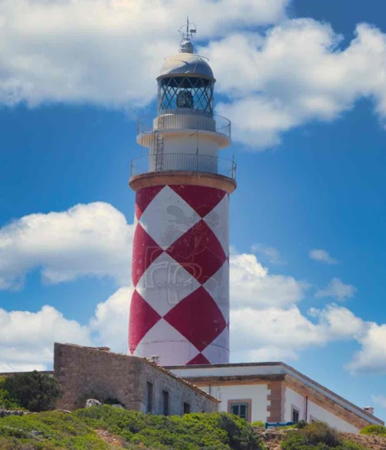
1870 (Emilio Pou). Active; focal plane 121 m (397 ft); three white flashes every 15 s. 21 m (69 ft) round masonry tower with lantern and gallery, rising from the center of a 1-story masonry keeper's house. Lighthouse painted in a red and white diamond pattern. Paco Romo Torres has the 2020 photo seen at right, Trabas has Douglas Cameron's photo, Ernst Pechler has a good photo, David Andrés has a distant view, Fran Losada has a closeup street view, and Google has a satellite view. The park service offers guided tours of the area including a visit to the station. Located at the southwestern tip of the Illa de Cabrera. Site open, tower closed. Site manager: Parc Nacional Maritimoterrestre de l'Arxipèlag de Cabrera. . ARLHS BAL-059; ES-35740; Admiralty E0338; NGA 4852.
Cap Llebeig (Cabo Lebeche)
Date unknown. Active; focal plane 74 m (243 ft); four white flashes every 14.5 s. 7 m (23 ft) octagonal stone tower painted in a black and white checkerboard pattern. Trabas has Hans-Albert Liebetrau's photo, Guyomard and Carceller have a photo at #19 in their portfolio (click the forward button 18 times), Pere Carlos has a view from the sea, and Google has a satellite view. There is also a Cap Llebeig lighthouse on the island of Dragonera (see above). Located on a steep promontory at the northwest corner of the Illa de Cabrera, marking the entrance to the island's natural harbor. The site does not appear to be readily accessible. Site and tower closed. Site manager: Parc Nacional Maritimoterrestre de l'Arxipèlag de Cabrera. ES-35590; Admiralty E0338.3; NGA 4856.
Punta de Sa Creveta
Date unknown. Active; focal plane 13 m (43 ft); red flash every 4 s. 7 m (23 ft) octagonal cylindrical concrete tower painted white with a red upper section. Trabas has Hans-Albert Liebetrau's closeup photo and Google has a satellite view. Located at the tip of a sharp promontory marking the east side of the entrance to the bay of Creveta, a deep inlet on the north side of Cabrera. Accessible only by boat. Site and tower closed. Site manager: Parc Nacional Maritimoterrestre de l'Arxipèlag de Cabrera. ES-35640; Admiralty E0338.6; NGA 4860.
Na Foradada (Isla de Horadada)
1926. Active; focal plane 42 m (138 ft); two white flashes every 12 s. 13 m (43 ft) round cylindrical tower with gallery, lantern removed, rising from a 1-story building. Lighthouse painted with black and white horizontal bands. Trabas has Hans-Albert Liebetrau's closeup photo, a 2022 photo and another photo are available, and Google has a closeup street view and a satellite view. Located on the northernmost islet of the Cabrera Archipelago, a flat-topped island about 10 km (6 mi) southwest of the southern tip of Mallorca. Accessible only by boat. Site and tower closed. Site manager: Parc Nacional Maritimoterrestre de l'Arxipèlag de Cabrera. ARLHS BAL-048; ES-35540; Admiralty E0340; NGA 4868.

N'Ensiola Light, Cabrera, August 2020
Google Maps photo by Paco Romo Torres

Menorca (Minorca) Lighthouses

Menorca (traditionally spelled Minorca in English) is the second largest of the Balearic Islands, with a population of about 100,000. Britain seized control of the island in 1708 and kept control for most of the Eighteenth Century, leaving behind a British influence still noticeable today.

Ciutadella de Menorca (Western Menorca) Lighthouses
** Cap d'Artrutx
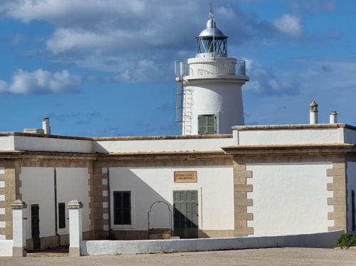
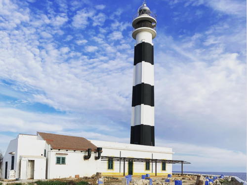
1859 (Emili Pou) (substantially modified in 1970). Active; focal plane 45 m (148 ft); three white flashes every 10 s. 34 m (111 ft) round concrete tower with four ribs, lantern, and double gallery. Lighthouse painted with black and white horizontal bands; lantern is gray metallic. A 2022 photo appears at right, Trabas has Andreas Köhler's closeup photo, Dario Santos has a 2021 photo, Fran Martinez has a view from the sea, Wikimedia has a good photo, Marinas.com has aerial photos, and Google has a street view and a good satellite view. The tower was doubled in height in 1970 and the four buttresses were added to help support it; the double gallery was also added. The keeper's house now includes a bar and snack restaurant. Cap d'Artrutx is the southwesternmost point of Menorca and unlike most points of land in the Balearics it is quite low. Located at the end of Plaça Far in the town of Cap d'Artrutx. Site and keeper's house open, tower closed. . ARLHS BAL-015; ES-36420; Admiralty E0342; NGA 5184.
* Ciutadella (Punta de sa Farola)
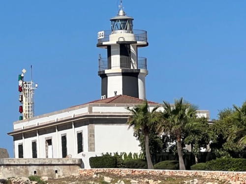
1863 (modified in 1979) (Emili Pou). Active; focal plane 21 m (69 ft); white light occulting five times, in a 2+3 pattern, every 14 s. 13 m (43 ft) round cylindrical masonry tower with lantern and double gallery, rising from a 1-story masonry keeper's house. Lighthouse painted with black and white vertical stripes; lantern is gray metallic. Pati Blanco's 2022 photo is below right, Trabas has Werner Seiler's closeup photo, Virgílio Vilela has a photo, Roc Garcia-Elias has a photo, and Google has street view and a satellite view. In 1979 the tower was increased in height and the double gallery was added. Located on on the Cami Farola on the west side of the harbor entrance in Ciutadella de Menorca, on the west end of the island. Site open, tower closed. . ARLHS BAL-078; ES-36470; Admiralty E0344; NGA 5188.

Cap d'Artrutx Light, Ciutadella de Menorca, March 2022
Instagram photo by bedmar83
* Punta Nati (Cabo Nati)
1913 (Mauro Serret). Active; focal plane 42 m (138 ft); four white flashes, in a 3+1 pattern, every 20 s. 19 m (62 ft) octagonal masonry tower with lantern and gallery, attached to the front of a 1-story U-shaped masonry keeper's house. The lighthouse is unpainted stone; lantern is gray metallic. Trabas has a photo by Alfonso Biescas Vignau, Manuel Melon has a 2019 photo, Rudi Ceuppens has a good photo, Marinas.com has aerial photos, and Google has a closeup street view and a good satellite view. This lighthouse on the relatively wild and barren northwest coast of Menorca is not often visited. Located at the end of secondary road CF-5 about 6 km (4 mi) north of Ciutadella de Menorca. Site open, tower closed. . ARLHS BAL-026; ES-36680; Admiralty E0348; NGA 5220.

Es Mercadal (North Coast) Lighthouses
*** Cap de Cavallería (Cabo Caballeria)
1857. Active; focal plane 94 m (308 ft); two white flashes every 10 s. 15 m (49 ft) round masonry tower with lantern and gallery, rising from the front of 1-story masonry keeper's house. Lighthouse painted all white; lantern is gray metallic. Trabas has a photo, an excellent closeup is available, Wikimedia has several photos, Xavier Llobet has a 2021 photo, David Martínez has a closeup street view, and Bing has a satellite view. The Cap de Cavallería is a narrow, rocky spine that projects from the north coast of Menorca, forming a very dangerous obstacle for ships. Despite its remoteness the site is accessible by road and is often visited for the spectacular view. There is a café at the light station and a small museum in the lighthouse. Located at the end of secondary road CF-3 about 6 km (4 mi) northwest of Platges de Fornells by sea, but more like 25 km (15 mi) by road. Site open, café and museum open daily May through October, tower closed. . ARLHS BAL-017; ES-35790; Admiralty E0350; NGA 5224.

Ciutadella Light, Ciutadella de Menorca, August 2022
Instagram photo by Pati Blanco
* Cap de sa Paret
Date unknown. Active; focal plane 29 m (95 ft); white flash every 2 s. Approx. 8 m (26 ft) post attached to a 1-story equipment room. Lighthouse painted white with one black horizontal band. Wikimedia has a closeup photo, Trabas has Andreas Köhler's closeup photo, and Google has a street view and a satellite view. An ancient fortified tower nearby, the Torre de Fornells, is better known than the light. NGA misspells the name as Cap de sa Pared. Located on a promontory on the west side of the entrance to Fornells. Accessible by a short walk from nearby parking at the end of the Carrer de Tramuntana. Site open, tower closed. ES-35800; Admiralty E0350.5; NGA 5226.
Fornells Range Front
Date unknown. Active; focal plane 14 m (46 ft); quick-flashing red light. 6 m (20 ft) octagonal white concrete tower with vertical red stripes. Trabas has Andreas Köhler's photo, Juan Miguel Serrano Mateo has a view from the sea of both range lights, and Google has a satellite view. Located on the Illa Sargantana, a small island in Fornells harbor. Accessible only by boat. Site open, tower closed. ES-35840; Admiralty E0351; NGA 5228.
Fornells Range Rear
Date unknown. Active; focal plane 23 m (75 ft); red light, 2 s on, 2 s off. 9 m (30 ft) octagonal white concrete tower with vertical red stripes. Trabas has Andreas Köhler's photo, Juan Miguel Serrano Mateo has a view from the sea of both range lights, and Google has a satellite view. Located on the Illa Sargantana, a small island in Fornells harbor. Accessible only by boat. Site open, tower closed. ES-35841; Admiralty E0351.1; NGA 5232.

Maó Lighthouses
Maó (Mahón in Spanish, spelled Mahon and pronounced Ma-On in English) is the capital of Menorca. Its English name is a reminder that Britain occupied Menorca for most of the 18th century (1708-1756, 1763-1782, and 1798-1802). The harbor is an important naval base for the Spanish fleet today as it was for the British fleet then.

*
Cap Favàritx
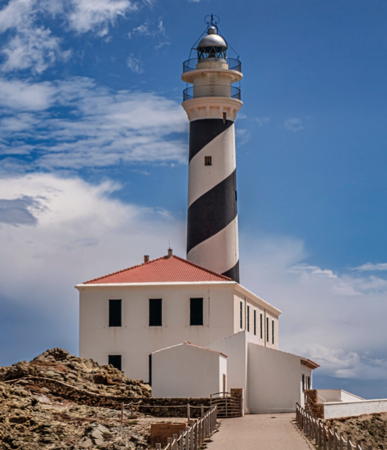
1922 (Miguel Massenet). Active; focal plane 47 m (154 ft); three white flashes, in a 1+2 pattern, every 15 s. 28 m (92 ft) round masonry tower with lantern and double gallery, rising from one end of a 2-story masonry keeper's house. Lighthouse painted with black and white spiral bands; lantern is gray metallic. Oliver Isermann's 2024 photo is at right, Trabas has Werner Seiler's photo, Jesús Rubial has a 2022 photo, another good photo is available, Massimo Scarano has a 2022 photo, Wikimedia has several views, Marinas.com has aerial photos, Jon Thomson has a street view, and Google has a satellite view. Cap Favàritx is a sharp promontory projecting from the northeastern coast of Menorca. Located at the end of secondary road CF-1 about 12 km (7.5 mi) off the main road ME-7. Accessible by a short hike from the parking area. Site open, tower closed. . ARLHS BAL-022; ES-35900; Admiralty E0352; NGA 5236.
Punta S' Esperó (Punta del Espero0 (2)
Date unknown. Active; focal plane 22 m (72 ft); three white flashes, in a 1+2 pattern, every 15 s. Approx. 8 m (26 ft) round fiberglass tower with a conical base, colored with black and white horizonyal bands. A May 2021 photo is available. This light replaced an 11 m (36 ft) round cylindrical tower, painted with black and white horizontal bands, rising from one end of 1-story equipment building. Trabas has Andreas Köhler's photo of the older light and Google has a satellite view. Located on the easternmost tip of Menorca, about 2.5 km (1.5 mi) northeast of the entrance to the Port de Maó. Site status unknown, tower closed. ARLHS BAL-067; ES-35940; Admiralty E0355; NGA 5238.
* Maó Directional
Date unknown. Active; focal plane 9 m (30 ft); white, red or green light depending on direction, 2 s on, 2 s off. Light mounted atop a 2-story building. Building painted white. Trabas has Andreas Köhler's photo, Alejandro Luis Carreras has a street view and Google has a satellite view. The light guides ships within Maó's inner harbor. Located on a pier on the north side of Maó harbor. Site open, tower closed. ES-35960; Admiralty E0361.65; NGA 5278.

Cap Favàritx Light, Maó, May 2024
Instagram photo by Oliver Isermann

Es Castell Lighthouses
* Punta de Ne Cafayas (Calas Fonts, Villacarlos)
Date unknown. Active; focal plane 8 m (26 ft); three red flashes every 9 s. 7 m (23 ft) small round tower, painted red, adjoining a white 1-story equipment shelter. Trabas has Andreas Köhler's photo, and Google has a closeup street view and an indistinct satellite view. Calas Fonts is a popular waterfront district in Es Castell, on the east side of Maó. Located on a promontory projecting into the harbor; the little lighthouse stands in a parking lot on the Paseo de Santa Agueda. Site open, tower closed. ES-36090; Admiralty E0358; NGA 5256.
Illa del Rei (Isla del Rey, Isla del Hospital)
Date unknown. Active; focal plane 13 m (43 ft); four green flashes every 11 s. 13 m (43 ft) round cylindrical concrete tower, painted white with slender green triangle daymarks. Trabas has Andreas Köhler's photo and Google has a satellite view. The island is the site of the historic British military hospital. Located at the southern tip of an island in the harbor of Máo. Accessible only by boat. Site status unknown. ES-36130; Admiralty E0361; NGA 5268.
[San Carles-Maó (Punta de San Carlos, Puerto de Mahon) (3?)]
1971 (station established 1852). Active; focal plane 22 m (72 ft); white light occulting twice every 6 s. 15 m (49 ft) post with gallery rising from a square white equipment room. Trabas has Andreas Köhler's photo and Google has a satellite view. A page for the light has a photo of the current light and a historic photo of the original lighthouse, a 16 m (52 ft) masonry tower with lantern and gallery attached to a keeper's house. In 1912 it was replaced by a small beacon because it stood in the line of fire of coastal defense artillery. The historic lighthouse was demolished in 1917. Located within the Fort of Sant Felipe on a promontory on the south side of the harbor entrance. Fort open Thursday and Sunday mornings, tower closed. ARLHS BAL-066; ES-35950; Admiralty E0354; NGA 5240.

Sant Lluís Lighthouses
Illa de l'Aire (Isla del Aire, Punta Prima)
1860 (modified in 1965). Active; focal plane 53 m (174 ft); white flash every 5 s. 38 m (125 ft) round masonry tower with lantern and double gallery, rising from a 1-story keeper's house. Lighthouse painted with black and white horizontal bands; lantern is gray metallic. A 2020 photo is at right, Dorit and Jorgen Skovmand have a photo, Elliot Berman has a good photo, Trabas has Andreas Köhler's photo, Marinas.com has aerial photos, and Google has a satellite view. The tower was reconstructed and the double galleries added in 1965. The Illa de S'Aire is a low, rather flat island, about 1.2 km (0.75 mi) long, located off the southeastern tip of Menorca. Located near Punta Prima, the eastern tip of the island. Accessible only by boat. Site open, tower closed. . ARLHS BAL-002; ES-36370; Admiralty E0366; NGA 5180.

Illa de l'Aire Light, Sant Lluís, August 2020
Google Maps photo by Gigi Rh

Information available on lost lighthouses:

Notable faux lighthouses:,

Adjoining pages: North: Catalonia | West: Valencia and Murcia | Southwest: Ibiza and Formentera

Return to the Lighthouse Directory index | Ratings key

Posted March 20, 2006. Checked and revised June 2, 2024. Lighthouses: 49. Site copyright 2024 Russ Rowlett and the University of North Carolina at Chapel Hill.