Lighthouses of Indonesia: Southern Java

The Republic of Indonesia has been independent since 1945 after having been the Dutch East Indies for more than 350 years. It is a huge country, stretching along both sides of the Equator for more than 46 degrees of longitude (roughly 5100 km or 3200 miles). Comprised of some 17,000 islands (more than 6000 inhabited islands), it has hundreds of major aids to navigation.

The island of Java (Jawa in Indonesian) is the heart of the country and home to 57% of the population. In fact, with more than 140 million residents it is the world's most populous island. The national capital, Jakarta, is on the northwestern coast of Java.

Indonesia is divided into 38 provinces (provinsi) and the provinces are subdivided into county units called regencies (kabupaten). This page includes lighthouses of the southern coast of Java, including the Yogyakarta Special Region and the south coast of Central Java Province. Central Java Province has two coasts: a north coast facing the Java Sea and a south coast facing the Indian Ocean. Lighthouses of the north coast are described on the North Central Java page.

More than 700 languages are spoken in Indonesia. The official national language, Indonesian (Bahasa Indonesia), was standardized from a form of Malay that served as a lingua franca across the archipelago. In Indonesian a lighthouse is a mercusuar or a menara suar. Tanjung is a cape, ujung is a headland or point of land, bukit is a hill, sungai is a river, kuala or muara is an estuary or river mouth, pulau is an island, karang is a reef, batu is a rock, laut is a sea, selat is a strait, teluk is a bay, pelabuhan is a harbor, and labuhan is a port.

The original Dutch names of historic lighthouses, if known, are shown in curly brackets {}.

Aids to navigation in Indonesia are operated and maintained by the Directorate of Marine Navigation within the Directorate General of Sea Transportation

ARLHS numbers are from the ARLHS World List of Lights. Admiralty numbers are from volume Q of the Admiralty List of Lights & Fog Signals. U.S. NGA List numbers are from Publication 112.

General Sources
Leuchttürme in Indonesien
Photos posted by Andreas Köhler.
Lighthouses in Indonesia
Wikimedia photos, including a collection of historic photos from the collection of the Tropenmuseum in Amsterdam.
World of Lighthouses - Indonesia
Photos by various photographers available from Lightphotos.net.
Online List of Lights - Indonesia
Photos by various photographers posted by Alexander Trabas.
Indonesian Lighthouses
Historic postcard views from the collection of Michel Forand.
Leuchttürme Asiens, Australiens, und Ozeaniens auf historischen Postkarten
Historic postcard views posted by Klaus Huelse.
Navionics Charts
Navigation chart for Java.


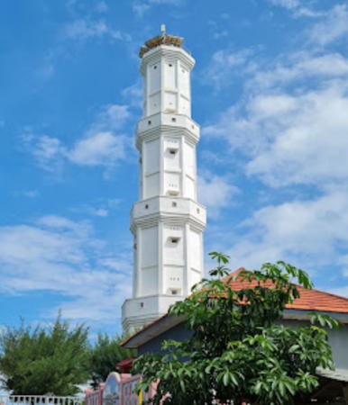
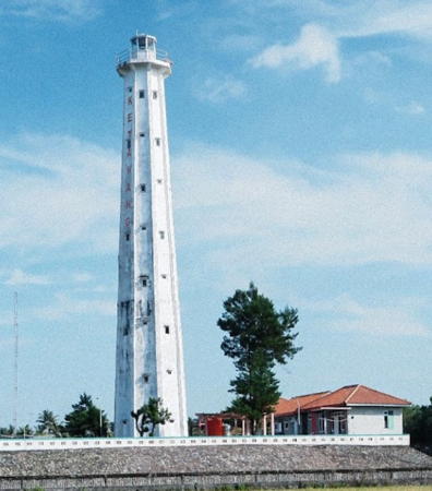
Ketawang Light, Purworejo, July 2021
Google Maps photo by Tulus Hamdani
Yogyakarta Special Region Lighthouses

The Yogyakarta Special Region (Daerah Istimewa Yogyakarta) is a province-level region facing the Indian Ocean in the southeastern corner of Central Java Province. It is unique among all regions of Indonesia in being ruled by a hereditary sultan.

Gunung Kidul Regency Lighthouses
Sadeng Range Front
2008. Active; focal plane 23 m (75 ft); white light, 2 s on, 2 s off. 12 m (39 ft) square skeletal tower with gallery recently enclosed with white metal panels. The tower is at the right in Hermawan C. Nugroho's 2017 photo, Muhammad Ifrad has a distant view showing both range lights, and Google has a 2014 street view (before the white panels were added) and a satellite view. Located on a hillside west of the harbor at Sadeng. Site open, tower closed. Admiralty Q1263; NGA 23821.61.
Sadeng Range Rear
2008. Active; focal plane 25 m (82 ft); white light, 1 s on, 1 s off. 15 m (49 ft) square skeletal tower with gallery recently enclosed with white metal panels. Muhammad Ifrad has a distant view showing both range lights and Google has a 2014 street view (before the white panels were added) and a satellite view. Located 35 m (115 ft) northeast of the front light. Site open, tower closed. Admiralty Q1263.1; NGA 23821.62.
Teluk Sadeng East (2)
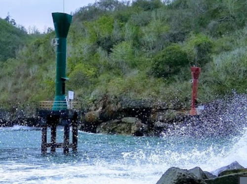
Date unknown. Active; focal plane 14 m (46 ft); green flash every 4 s. 14 m (46 ft) round fiberglass tower with a flared top mounted on a square concrete platform supported by four concrete piles. Tower painted green. Paulus Suwito has a closeup photo, Arif Gunawan has a 2020 photo (a portion is seen at right) showing this light in the foreground as well as the next three, a 2018 photo shows this light and the next one and Google has a satellite view. The original light, a square skeletal tower, is on the left in a 2014 Google street view. Located just off the end of the breakwater at Sadeng, a small protected harbor at the southeast corner of the Special Region. Site open, tower closed. Admiralty Q1263.5.
Teluk Sadeng West (2)
Date unknown. Active; focal plane 14 m (46 ft); red flash every 3 s. 14 m (46 ft) round fiberglass tower with a flared top mounted on a square concrete platform supported by four concrete piles. Tower painted red. Mega Saputra has a photo, this light is to the right in Arif Gunawan's photo at right and in the photo by Adit Bagus), and Google has a distant satellite view. The original light, a square skeletal tower, is in the center (behind a tree) in a Google street view. Located on the west side of the harbor entrance at Sadeng. Site open, tower closed. Admiralty Q1263.7.

Teluk Sademg East (left) and West Lights, Sadeng, January 2020
Google Maps photo by Arif Gunawan
Teluk Sadeng South
Date unknown. Active; focal plane about 14 m (46 ft); red light, pattern unknown. Approx. 14 m (46 ft) round fiberglass tower with a flared top mounted on a square concrete platform supported by four concrete piles. Tower painted red. This light is to the left in Arif Gunawan's photo and in the photo by Adit Bagus, and Google has a fuzzy satellite view. Located about 300 m (0.2 mi) southwest of the Teluk Sadeng West light, marking the west side of the entrance to the bay. The Admiralty has two listings, Q1263.4 and Q1263.45, but there is only one light seen.
Tanjung Sadeng
Date unknown. Active; focal plane 33 m (108 ft) (?); white flash every 5 s. Approx. 20 m (66 ft) square tapered skeletal tower with gallery, painted white. A view from the bay is available, the light is seen in the photo by Adit Bagus, Chandra Gunawan has a distant street view, and Google has a satellite view. NGA lists the focal plane as 33 ft, clearly an error. Located on heights southwest of Sadeng harbor. Site status unknown. Admiralty Q1263.9; NGA 23821.6.
Wediombo
Date unknown. Active; focal plane unknown; white light, pattern unknown. Approx. 10 m (33 ft) round barbell-shaped white fiberglass tower. No photo available but Google has a satellite view. Located on a steep bluff above a protected cove southeast of Purwodadi. Site status unknown. Admiralty Q1263.98.
Tanjung Gunung Batur
Date unknown. Active; focal plane 83 m (272 ft); white flash every 6 s. Approx. 12 m (39 ft) round barbell-shaped white fiberglass tower. Entire lighthouse is white. No photo available but Google has a satellite view. Gunung Batur is a mountain with an elevation of 655 m (2148 ft). Located on the south slope of the mountain southeast of Purwodadi. Site open, tower closed. Admiralty Q1264; NGA 23821.7.
#Tanjung Bukit Baron (1)
Date unknown. Removed. This was an approx. 35 m (115 ft) square white skeletal tower. Ronni Widyantoro has a December 2014 street view of the old and new towers, but recent photos show only the new one. Note: bukit is a hill or bluff. Located atop a steep bluff near the popular Baron beach. Site status unknown.
Tanjung Bukit Baron (2)
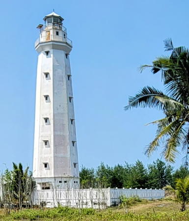
2015. Active; focal plane 70 m (230 ft); white flash every 5 s. Approx. 35 m (115 ft) 4-stage octagonal white concrete tower with lantern and four galleries. Raihan Al Fauzan's photo is at right, Erik van Hassel has a 2017 photo, Afif Makarim has a 2018 closeup and Google has a satellite view. Located atop a steep bluff near the popular Baron beach. Site status unknown. . Admiralty Q1264.1.

Tanjung Bukit Baron Light, Kemadang, May 2022
Google Maps photo by Raihan Al Fauzan

Bantul Regency Lighthouse
*** Pantai Pandansari (Pandansari Beach, Wates, Kali Opak)
1997. Active; focal plane 44 m (144 ft); white flash every 4 s. Approx. 38 m (125 ft) octagonal concrete tower with lantern and gallery. The tower appears to be unpainted white concrete. Six keeper's houses and other buildings. Sulistianto Sulistianto has a 2018 photo, Jurito Sudarmo also has a photo, a 2022 photo is available, and Google has a street view and a satellite view. This lighthouse seems to have many names; it is Wates in the Admiralty list and Kali Opak in the NGA List, but Pantai Pandansari (Pandansari Beach) is the name over the entrance. The lighthouse does not seem to be well known outside the Jogjakarta area. Located on the south coast of Java about 30 km (19 mi) south of Yogjakarta. Site open, tower open by arrangement with the attendant, who charges a fee for tours. . Admiralty Q1264.5; NGA 23821.9.
* [Trisik]
Date unknown. Active; focal plane about 14 m (46 ft); white light, pattern unknown. Approx. 9 m (30 ft) white mast. Google has a street view and a satellite view. Located just above the beach at Trisik. Site open, tower closed. Admiralty Q1264.7.
* [Glagah Kulon Progo]
Date unknown. Active; focal plane about 15 m (49 ft); white light, pattern unknown. Approx. 9 m (30 ft) white mast. Google has a street view and the light is centered near the end of a street in Google's satellite view. Located about 250 m (275 yd) from the beach at Glagah. Site open, tower closed. Admiralty Q1264.75.

Kulon Progo Regency Lighthouse
Karangwuni (Karang Wuni, Wates) (2)
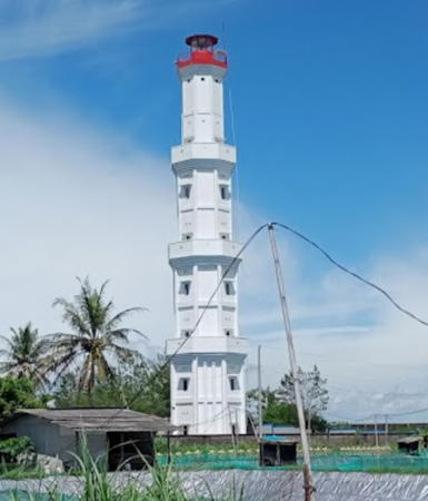
2020. Active; focal plane 32 m (105 ft); white flash every 5 s. Approx. 30 m (98 ft) octagonal white concrete tower with lantern and gallery. A photo is at right, Helmy Aditya has a November 2020 photo, Dwi Dwi Hrdiyanto has a 2021 photo, and Agus San has a closeup. This lighthouse replaced a square white skeletal tower, painted white. Joni Mancing has a January 2020 photo of the soon-to-be-replaced tower. Google's satellite view shows the older light. This is another light with multiple and confusing names; the official name Karangwuni is misleading since the lighthouse is onshore, not on a reef; NGA lists the light as Wates. Located above the beach in Wates, in the Kulon Progo Regency about 35 km (22 mi) west of Yogyakarta City. Site status unknown. . Admiralty Q1265; NGA 23822.

Karangwuni Light, Kulon Progo, January 2023
Google Maps photo by Seto

Central Java Province South Coast Lighthouses

Purworejo Regency Lighthouse
** Ketawang (2?)
Date unknown (before 1998). Active; focal plane 32 m (105 ft); white flash every 4 s (?). Approx. 26 m (85 ft) round white concrete tower with four ribs, lantern and gallery. A 2021 photo by Tulus Hamdani is seen at the top of this page, a 2013 photo, a closeup photo and another nice photo (2/3 the way down the page) are available, Rian Ady has a 2022 photo, and Google has a 2023 street view and a satellite view. The tower is very similar to the Pandansari Light. This lighthouse is accessible by road, but it is not well known. Located near the coast about 20 km (13 mi) south of Purworejo. Site open, tower. open by arrangement with the keepers. . Admiralty Q1276.5; NGA 23822.2.

Kebumen Regency Lighthouses
* Klirong (2)
Date unknown. Active; focal plane 42 m (138 ft); white flash every 5 s. Approx. 35 m (115 ft) 4-stage octagonal white concrete tower with lantern and four galleries. Top gallery painted red. Syamsul Hidayat's 2023 photo is at right, Ememge Papbi has a 2016 closeup, and Google has a street view and a satellite view. A 2011 photo shows the earlier lighthouse, a tapered square skeletal tower. The tower is similar to the Bedadung Light shown on the Eastern Java page. This lighthouse is in a well-populated area, but it is not on any route likely to be taken by tourists. Located near the coast about 20 km (13 mi) south of Kebumen. Site probably open, tower closed. . Admiralty Q1276.2; NGA 23822.4.
* Tanjung Karangbata (Karang Batu, Pantai Menganti)
Date unknown. Active; focal plane 63 m (207 ft); white flash every 5 s. Approx. 12 m (39 ft) round barbell-shaped fiberglass (?) tower. Entire lighthouse is white. A 2019 closeup photo, a closeup street view and a distant view (halfway down the page) are available, Sandhi Nugroho has a 2021 photo, and Google has a satellite view. Located on heights of a prominent headland near Ayah, about 30 km (19 mi) west of Kebumen. Site open, tower closed. . Admiralty Q1276; NGA 23822.6.

Cilacap Regency Lighthouses
Cilicap is the metropolis and only major commercial port on the south coast of Central Java. The regency has a population of about 2 million; about 300,000 live in the city proper. Cilacap faces east on an open bight known as Teluk Penyu (Penyu Bay), sheltered by the headland of Kambangan Island to the south. The city's docks are in the Kali Donan estuary on the west side of the city.

Klirong Light, Kebumen, Jnuary 2023
Google Maps photo by Syamsul Hidayat
PLTU Cilacap (Teluk Penyu, Penyu Bay)
Date unknown. Active; focal plane 15 m (49 ft); white light, 2 s on, 3 s off. 15 m (49 ft) square white skeletal tower. No photo available but Google has a satellite view. Located in a large power plant northeast of Cilacap. Site and tower closed. Admiralty Q1267.8; NGA 23823.8.
* Teluk Penyu (Cilacap Fishing Harbor)
Date unknown. Active; focal plane 17 m (56 ft); white light, 2 s on, 2 s off. 15 m (49 ft) square pyramidal skeletal tower. A view from the harbor is available, Iman Komara has a street view, and Google has a satellite view. Located on the waterfront of Cilacap's fishing harbor, which opens directly on Teluk Penyu. Site open, tower closed. ARLHS IDO-085; Admiralty Q1267; NGA 23823.
* Cilacap Fishing Harbor North Breakwater
Date unknown. Active; focal plane about 15 m (49 ft); green light, pattern unknown. Approx. 10 m (33 ft) square skeletal tower painted green. Nafriman Nazir has a 2020 closeup photo, Tri Wibowo also has a 2020 photo, and Google has an indistinct satellite view. Located at the end of the north (main) breakwater of the fishing harbor. Accessible by walking the pier. Site open, tower closed. Admiralty Q1267.6.
* Cilacap Fishing Harbor South Breakwater
Date unknown. Active; focal plane about 15 m (49 ft); red light, pattern unknown. Approx. 10 m (33 ft) square skeletal tower painted red. Ardi Prayitno has a photo, Budi Harsono has a 2019 closeup photo, Endang Suherman has a view from the north breakwater, and Google has an indistinct satellite view. Located at the end of the south breakwater of the fishing harbor. Accessible by walking the pier. Site open, tower closed. Admiralty Q1267.55.
* Teluk Penyu (Cilacap Main)
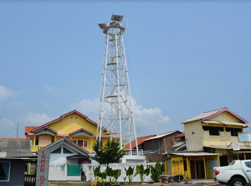
Date unknown. Active; focal plane 18 m (59 ft); white light, 1.5 s on, 3.5 s off. 15 m (49 ft) hexagonal white skeletal tower. Wahyu Budhi has a closeup photo (also seen at right) and Google has a street view and a satellite view. Located one block west of the main entrance to the Teluk Penyu Beach, at the foot of Jalan Laut (Sea Road). Site open, tower closed. Admiralty Q1270; NGA 23852.

Teluk Penyu (Cilacap Main) Light, Cilacap, September 2013
Google Maps photo by Wahyu Budhi
Teluk Penyu Entrance Range Front
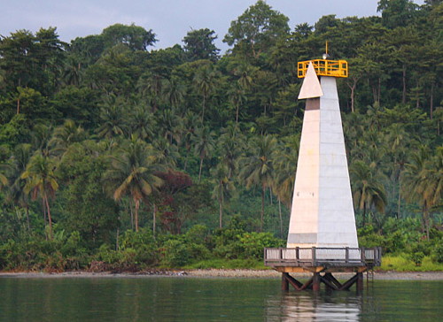
Date unknown. Active; focal plane 17 m (56 ft); white light, 2 s on, 2 s off. 17 m (56 ft) square tower, mounted on a square pier supported by piles. Henry Mazuu has a photo, Rian Yulianto has a distant street view from the beach, and Google has a satellite view. This is the approach range for Cilacap. Located in the water about 500 m (0.3 mi) east of the rear light. Accessible only by boat. Site open, tower closed. Admiralty Q1270.1; NGA 23828.
* Teluk Penyu Entrance Range Rear
2007(?). Active; focal plane 23 m (79 ft); white light, 1 s on, 1 s off. 22 m (72 ft) square skeletal tower, covered with white metal panels. Febri Kustiono has a closeup photo, Aryo Viiorellz has a street view, and Google has a satellite view. In Erwin Hanafi's 2009 photo, the upper panels are missing and the red skeletal structure of the tower is visible. Located in a seaside park near the Teluk Penyu oil terminal near Cilacap. Site apparently open, tower closed. Admiralty Q1270.11; NGA 23832.
Teluk Penyu Second Range Front
Date unknown. Active; focal plane 17 m (56 ft); white light, 2 s on, 2 s off. 17 m (56 ft) square tower, mounted on a square pier supported by piles. Soga Soegiarto's photo is at right, Ahmad Fuad Hasan has a view from the beach, Ammar Faisal has a photo, and Google has a satellite view. This is an entrance range for the Kali Donan estuary. Located in the water of the south side of the estuary. Accessible only by boat. Site open, tower closed. Admiralty Q1272; NGA 23836.
* Teluk Penyu Second Range Rear
2007(?). Active; focal plane 23 m (79 ft); white light, 1 s on, 1 s off. 22 m (72 ft) square skeletal tower, covered with white metal panels. No photo available but Bing has a satellite view. Located behind the beach on the south side of the estuary 125 m (410 ft) southwest of the front light. Site apparently open, tower closed. Admiralty Q1272.1; NGA 23840.
Teluk Penyu Second Range Front Light
Teluk Penyu Second Range Front Light, Cilacap, August 2010
ex-Panoramio photo copyright Soga Soegiarto; used by permission
Tanjung Karangrempak (Third) Range Front
Date unknown. Active; focal plane 12 m (39 ft); white light, 1 s on, 1 s off. 12 m (39 ft) square tower, mounted on a square pier supported by piles. Yuliyani Kusnanda has a photo of the two range lights and Google has a satellite view. This is an outbound range for vessels leaving the Kali Donan estuary. Located in the water about 1 km (1.2 mi) east of the Second Range Lights. Accessible only by boat. Site open, tower closed. Admiralty Q1274; NGA 23844.
Tanjung Karangrempak (Third) Range Rear
2007(?). Active; focal plane 17 m (56 ft); white light, 2 s on, 2 s off. 17 m (56 ft) square skeletal tower, covered with white metal panels. Yuliyani Kusnanda has a photo of the two range lights and Google has a satellite view. Located just off the beach about 100 m (330 ft) east southeast of the front light. Site apparently open, tower closed. Admiralty Q1274.1; NGA 23848.
[Tanjung Sodong Range Front and Rear]
Date unknown. Active; focal plane about 20 m (66 ft) (front) and 23 m (69 ft) (rear); white lights, pattern unknown. Approx. 9 m (30 ft) square white masts with triangular daymarks, closely spaced. Fanny Andhika has a photo but the lights are not conspicuous in Google's satellite view. This range guides ships leaving the Cilacap docks. Located on the south side of the Kali Donan estuary opposite the waterfront. Site status unknown. Admiralty Q1274.6 (front) and Q1274.61 (rear).
Cimiring (Cilacap, Tjilatjap, Nusa Kambangan) (2)
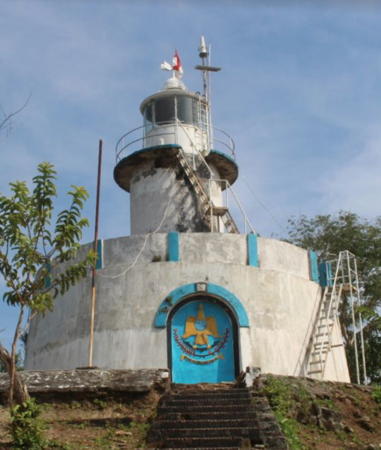
Date unknown (station established 1870). Active; focal plane 178 m (584 ft); white flash every 5.5 s. Approx. 12 m (40 ft) round cylindrical concrete tower with lantern and gallery centered on a round 1-story concrete base. A photo is at right, a 2015 photo is available, Erdy Yunan has a 2018 photo and a second photo showing the light in action, and Google has a satellite view of the station. The station has several coast guard buildings and a Fresnel lens is in use. The NGA light list describes the original lighthouse, a 32 m (105 ft) round stone tower with lantern and gallery; the Tropenmuseum has a historic photo and Huelse has a historic postcard view. Satellite views show no trace of the historic lighthouse. Located at the east end of the island of Kambangan, marking the entrance to the port of Cilacap. Accessible by a hiking trail, but local guidance is probably needed. Site open, and visitors are free to climb exterior stairways to the gallery. ARLHS IDO-060; Admiralty Q1268; NGA 23824.
Kali Babakan
Date unknown (2018?). Active; focal plane about 16 m (52 ft); white light, pattern unknown. Approx. 16 m (52 ft) square skeletal tower covered with white panels, mounted on a square platform supported by piles. Bayu Nur Aji has a photo, Edang Supandi has a closeup photo, and Google has a distant satellite view. Located on the east side of the mouth of the Babakan River estuary about 50 km (30 mi) west of Cilacap. Site open, tower closed. Admiralty Q1278.4.

Cimiring Light, Cilacap, February 2018
ex-Google Plus photo by wahyu budhi s

Information available on lost lighthouses:

Notable faux lighthouses:

Adjoining pages: East: Eastern Java | West: Southwestern Java

Return to the Lighthouse Directory index | Ratings key

Posted April 13, 2006. Checked and revised September 1, 2023. Lighthouses: 28. Site copyright 2023 Russ Rowlett and the University of North Carolina at Chapel Hill.