Lighthouses of Indonesia: North Central Java

The Republic of Indonesia has been independent since 1945 after having been the Dutch East Indies for more than 350 years. It is a huge country, stretching along both sides of the Equator for more than 46 degrees of longitude (roughly 5100 km or 3200 miles). Comprised of some 17,000 islands (more than 6000 inhabited islands), it has hundreds of major aids to navigation.

The island of Java (Jawa in Indonesian) is the heart of the country and home to 57% of the population. In fact, with more than 150 million residents it is the world's most populous island. The national capital, Jakarta, is on the northwestern coast of Java. The island is about 1000 km (620 mi) long and up to 210 km (130 mi) wide, with a mountainous spine that includes about three dozen historically active volcanos.

Indonesia is divided into 38 provinces (provinsi) and the provinces are subdivided into county units called regencies (kabupaten). This page includes lighthouses of the well-populated central northern coast of Java in Central Java Province. Tegel and Semarang are major ports on this coast. Central Java Province spans the island and has two coasts: the north coast facing the Java Sea and a south coast facing the Indian Ocean. Lighthouses of the southern coast are listed on the Southern Java page.

More than 700 languages are spoken in Indonesia. The official national language, Indonesian (Bahasa Indonesia), was standardized from a form of Malay that served as a lingua franca across the archipelago. In Indonesian a lighthouse is a mercusuar or a menara suar. Tanjung is a cape, ujung is a headland or point of land, bukit is a hill, sungai is a river, kuala or muara is an estuary or river mouth, pulau is an island, karang is a reef, batu is a rock, laut is a sea, selat is a strait, teluk is a bay, pelabuhan is a harbor, and labuhan is a port.

The original Dutch names of historic lighthouses, if known, are shown in curly brackets {}.

Aids to navigation in Indonesia are operated and maintained by the Directorate of Marine Navigation within the Directorate General of Sea Transportation.

ARLHS numbers are from the ARLHS World List of Lights. Admiralty numbers are from volume Q of the Admiralty List of Lights & Fog Signals. U.S. NGA List numbers are from Publication 112.

General Sources
Leuchttürme in Indonesien
Photos posted by Andreas Köhler.
Lighthouses in Indonesia
Wikimedia photos, including a collection of historic photos from the collection of the Tropenmuseum in Amsterdam.
World of Lighthouses - Indonesia
Photos by various photographers available from Lightphotos.net.
Online List of Lights - Indonesia
Photos by various photographers posted by Alexander Trabas. The Semarang photos are by Jim Smith.
Indonesian Lighthouses
Historic postcard views from the collection of Michel Forand.
Leuchttürme Asiens, Australiens, und Ozeaniens auf historischen Postkarten
Historic postcard views posted by Klaus Huelse.
Navionics Charts
Navigation chart for Java.

Semarang Light, Semarang, October 2014
ex-Google Plus photo by Badroe Zaman
Brebes Regency Lighthouses
Muara Kiuwit (Kiuwit River Estuary) West
Date unknown. Active; focal plane 13 m (43 ft); red flash every 4 s. 13 m (43 ft) square red skeletal tower mounted on a platform supported by piles. No photo available but Google has a satellite view. Located off the estuary entrance in the bay west of Ujung Brebes.Accessible only by boat. Site open, tower closed. Admiralty Q1100.5.
Muara Kiuwit (Kiuwit River Estuary) East
Date unknown. Active; focal plane 13 m (43 ft); green flash every 4 s. 13 m (43 ft) square green skeletal tower mounted on a platform supported by piles. No photo available but Google has a satellite view. Located about 600 m (3/8 mi) east of the west light. Accessible only by boat. Site open, tower closed. Admiralty Q1100.
Ujung Brebes
Date unknown. Active; focal plane 22 m (72 ft); white flash every 4 s. 20 m (66 ft) square skeletal tower with lantern and gallery, painted white. No photo available but Google has a satellite view. Ujung Brebes is not a cape but a delta formed by sedimentation along the mouth of the Brebes River; continued sedimentation has pushed the point of land 1.2 km (3/4 mi) north of the lighthouse. Located 12 km (7.5 mi) north northwest of Brebes. Site status unknown. ARLHS IDO-348; Admiralty Q1101; NGA 23502.

Tegel City and Regency Lighthouses
Tegal is a seaport and industrial center at the northwestern corner of Central Java Province. The population inside the city limits is about 250,000 and the metropolitan population exceeds 1.3 million.
Tegel West Mole
Date unknown. Active; focal plane 13 m (43 ft); green light, 1.5 s on, 3.5 s off. 13 m (43 ft) square pyramidal skeletal tower painted green and mounted on a square pier. Nur Chymenk has a 2020 photo of the two mole lights and Bing has a satellite view. Located just off the end of the west breakwater of Tegel. Accessible only by boat. Site open, tower closed. Admiralty Q1108; NGA 23512.
* Tegal West Side
Date unknown. Active; focal plane 19 m (62 ft); white flash every 3 s. 13 m (43 ft) square skeletal tower painted white. Hagai Anton Puji Raharjo has a 2021 photo and Google has a street view and a satellite view. The light lists call this the East Side light but it is located on the quay of the west harbor basin in Tegal. Site open, tower closed. Admiralty Q1106; NGA 23508.
Tegal East Side
Date unknown. Active; focal plane 11 m (36 ft); red light, 1.5 s on, 6 s off. 9 m (30 ft) square red skeletal tower. No photo available but Bing has a satellite view. Located on the quay near the base of the East Mole. Site status unknown. Admiralty Q1110; NGA 23517.
Tegel East Mole
Date unknown. Active; focal plane 12 m (39 ft); red flash every 5 s. 12 m (39 ft) square pyramidal skeletal tower painted red and mounted on a square pier. Nur Chymenk has a 2020 photo of the two mole lights and Bing has a satellite view. Located just off the end of the east breakwater of Tegel. Accessible only by boat. Site open, tower closed. Admiralty Q1112; NGA 23516.
* Tegal (Rede Tegal) (2)
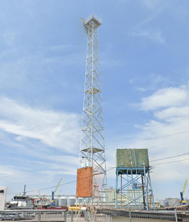
Date unknown (station established 1880). Active; focal plane 32 m (105 ft); white light, 5 s on, 5 s off. 30 m (98 ft) square tapered skeletal tower, painted white. Heri Rahman has a closeup photo and the tower is seen in a Google street view (also seen at right) and a satellite view. Huelse has a postcard view of the original Dutch lighthouse, and Forand has a second postcard view. Located just east of the harbor of Tegal, a port about 25 km (15 mi) west of Pemalang. Site open, tower closed. ARLHS IDO-263; Admiralty Q1105; NGA 23504.
Karang Jeruk
Date unknown. Active; focal plane 16 m (52 ft); white flash every 5 s. 16 m (52 ft) square white skeletal tower mounted on a platform supported by piles. No photo available and the light is not seen in Google's satellite view. Located on a reef about 6 km (3.5 mi) northeast of Tegal. Accessible only by boat. Site open, tower closed. Admiralty Q1102; NGA 23520.

Tegel Light, Tegel, August 2022
Google Maps street view

Pemalang Regency Lighthouses
Pemalang is a city of about 175,000 residents located about 35 km (22 mi) east of Tegel.

Tanjung Sori (Pemalang) West Mole (2)
Date unknown. Active; focal plane about 13 m (43 ft); green light, pattern unknown. Approx. 13 m (43 ft) square pyramidal skeletal tower painted green and mounted on a square platform supported by piles. This is the tower on the left in Dody Muhadi's 2018 photo (also seen is an older light, a short green barbell-shaped tower, since removed). Google has an indistinct satellite view. Located just off the end of the west breakwater of Pemalang. Accessible only by boat. Site open, tower closed. Admiralty Q1116.
Tanjung Sori (Pemalang) East Mole (2)
Date unknown. Active; focal plane about 13 m (43 ft); red light, pattern unknown. Approx. 13 m (43 ft) square pyramidal skeletal tower painted red and mounted on a square platform supported by piles. A photo is available, this is the tower on the right in Dody Muhadi's photo and Google has an indistinct satellite view. A 2016 photo shows the older light, a short red barbell-shaped tower, since removed. Located just off the end of the east breakwater of Pemalang. Accessible only by boat. Site open, tower closed. Admiralty Q1116.2.

Pekalongan Regency Lighthouse
* Pekalongan (2)
Date unknown. Active; focal plane 14 m (72 ft); white light, 1.5 s on, 3.5 s off. 14 m (46 ft) barbell-shaped white fiberglass tower. No photo available but Google has a satellite view. NGA lists a framework tower. Located at the harbor terminal building in Pekalongan. Site open, tower closed. Admiralty Q1122; NGA 23532.

Batang Regency Lighthouses
Batang is a city of about 125,000 residents roughly 100 km (60 mi) west of Semarang.
* Batang
2019 (?). Active; focal plane 13 m (43 ft); white flash every 4 s. 12 m (39 ft) square white skeletal tower. No photo available but Google has a 2022 street view and a satellite view. Located at the rear of the harbor facilities at Batang. Site open, tower closed. Admiralty Q1126.8.
Batang West Breakwater
2020 (?). Active; focal plane 13 m (43 ft); green flash every 4 s. 13 m (43 ft) square green skeletal tower on a square platform supported by piles. This tower is on the left in Edhar Pelipurlara's August 2020 photo and Google has a satellite view. Located just off the end of the west breakwater at Batang. Site open, tower closed. Admiralty Q1127.15.
Batang East Breakwater
2020 (?). Active; focal plane 13 m (43 ft); three red flashes in a 2+1 pattern every 6 s. 13 m (43 ft) square red skeletal tower on a square platform supported by piles. This tower is on the right in Edhar Pelipurlara's August 2020 photo and Google has a satellite view. Located just off the end of the east breakwater at Batang. Site open, tower closed. Admiralty Q1127.1.
* Celong Fishing Harbor
Date unknown. Active; focal plane 19 m (62 ft); white flash every 4 s. 16 m (52 ft) square white skeletal tower with gallery mounted on a platform supported by piles. Adin Boyak has a photo, Bagas Tri Widodo has a closeup street view, a distant drone view is available, and Google has a satellite view. Located at a small harbor in eastern Batang Regency. Site and tower closed but the lighthouse can be seen from nearby. Admiralty Q1127.6.

Kendal Regency Lighthouses
* Tanjung Celong
Date unknown. Active; focal plane 30 m (98 ft); white flash every 4 s. Approx. 25 m (82 ft) tapered square pyramidal skeletal tower, painted white. Fahrizal Utama has a photo, Gondang Hadi has a 2016 closeup, and Google has a street view (also seen at right). Located on the east side of an estuary entrance at Gempolsewu. Site open, and several photos show visitors climbing the tower. ARLHS IDO-299; Admiralty Q1128; NGA 23539.
* Pelabuhan Kendal
2016. Active; focal plane 14 m (46 ft); white flash every 5 s. 10 m (33 ft) square white skeletal tower. Paidulz Dudulz has a distant view from the sea, Fadhilur Rahman has an aerial photo, and Google has an indistinct satellite view. Located on the waterfront of Kendal harbor. Admiralty Q1129.8.

Tanjung Celong Light, Kendal Regency, July 2019
Google Maps street view
Kendal (?)
Date unknown. Active; focal plane 16 m (52 ft); white flash every 2 s. Approx. 13 m (43 ft) "white beacon," probably a skeletal tower. No photo available and the tower is not shown in Google's satellite view. Located at a commercial harbor on the east side of Kendal. Site status unknown. Admiralty Q1130; NGA 23542.

Semarang City Lighthouses
Semarang, the capital city of Central Java Province, is an important port. The population of the city proper is about 2 million, with 6 million in the metropolitan area.
#Semarang West Outer Breakwater (1)
Date unknown. Replaced. This was a 12 m (39 ft) round green fiberglass tower, flared at the top. Trabas has Smith's photo of the current post light (focal plane 14 m (46 ft); green flash every 10 s) and Google has a satellite view. Semarang has long outer breakwaters protecting the port from monsoon-driven waves. Located at the end of the west breakwater, which is 3.5 km (2.2 mi) long. Accessible only by boat. Site and tower closed. Current light: Admiralty Q1134; NGA 23558.
#Semarang East Outer Breakwater (1)
Date unknown. Replaced. This was a 12 m (39 ft) round red fiberglass tower, flared at the top. Trabas has Smith's photo of the current post light (focal plane 14 m (46 ft); red flash every 10 s) and Google has a satellite view. Located at the west end of the detached east breakwater. Accessible only by boat. Site and tower closed. Admiralty Q1133.3; NGA 23557.
* Semarang (Tanjung Emmas, Mercusuar Willem III) (2)
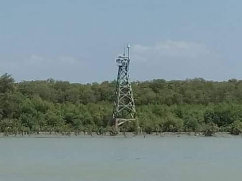
1883 (station established 1872). Active; focal plane 33 m (108 ft); four white flashes every 20 s. 30 m (98 ft) 12-sided cast iron tower with lantern and gallery. Entire lighthouse painted white. Badroe Zaman's photo is at the top of this page, a 2008 photo is available, Köhler has a 2011 photo, Trabas has Smith's photo, Wikimedia has a photo, Lightphotos.net has a closeup of the lantern, the Tropenmuseum has a historic photo, Huelse has a historic postcard view, Forand has a different postcard view, and Google has a street view and a satellite view. The lighthouse is named for William III, the king of the Netherlands from 1849 to 1890. Located on a promontory on the east side of the harbor of Semarang, a major port of central north Java. Site open, tower closed. . ARLHS IDO-040; Admiralty Q1132; NGA 23560.
Semarang Range Front
Date unknown. Active; focal plane 27 m (89 ft); white flash every 2 s. 25 m (82 ft) square skeletal tower. The tower also carries a triangular daymark, point up, painted black with a white vertical stripe. Trabas has Smith's photo and Google has a satellite view. This is the entrance range for Semarang. Located on a quay in the middle of the Semarang harbor district. Site status unknown, but the tower can be seen from nearby streets. Admiralty Q1133; NGA 23552.
* Semarang Range Rear
Date unknown. Active; focal plane 32 m (105 ft); white flash every 3 s. 30 m (98 ft) square skeletal tower. The tower also carries a triangular daymark, point down, painted black with a white vertical stripe. Trabas has Smith's photo and Google has a street view (also seen at right) and a satellite view. Located beside Ampenan Street at the south end of the Semarang harbor. Site open, tower closed. Admiralty Q1133.1; NGA 23556.

Range Rear Light, Semarang, June 2015
Google Maps street view

Jepara Regency: Mainland Lighthouses
Jepara is a small port on Java's northern peninsula, about 55 km (35 mi) north of Semarang.
Pulau Panjang
Date unknown. Active; focal plane 22 m (72 ft); three white flashes every 20 s. 19 m (62 ft) square skeletal tower with lantern and gallery, painted white; lantern painted red. Staffed coast guard station with several buildings. Heri Rahman's photo is at right, a closeup photo is available, Zulhendri Koto has a view from the beach, and Google has a street view and a good satellite view. Pulau Panjang is a small island about 3 km (2 mi) west of Jepara harbor. Located at the west end of the island. Accessible only by boat. Site status unknown. Admiralty Q1138; NGA 23584.
Tanjung Kelor
Date unknown. Active; focal plane 13 m (43 ft); white flash every 4 s. 13 m (43 ft) square white skeletal tower mounted on a platform supported by piles. No photo available but Google has a satellite view. Located in Jepara Bay about halfway between Pulau Panjang and the Jepara waterfront. Accessible only by boat. Site open, tower closed. Admiralty Q1138.25.
Jepara (Djapara)
Date unknown (station established 1908). Active; focal plane 17 m (56 ft); white flash every 3 s. 15 m (49 ft) white concrete post with double gallery mounted on a square concrete base. Hadi Bindowi has a closeup photo and a closeup street view and Google has a satellite view. Site status unknown. ARLHS IDO-356; Admiralty Q1139; NGA 23580.
Tanjung Kuniran
Date unknown. Active; focal plane 13 m (43 ft); white flash every 5 s. 13 m (43 ft) square white skeletal tower mounted on a platform supported by piles. Google has a satellite view and a distant street view from shore. Located off a promontory at Kartini, about 2.5 km (1.5 mi) north of Jepara. Accessible only by boat. Site open, tower closed. Admiralty Q1138.2.
Pulau Mandalika (Mondoliko)
1887. Active; focal plane 86 m (282 ft); white flash every 5 s. 16 m (52 ft) hexagonal skeletal tower with lantern and gallery, painted white. Staffed coast guard station with several buildings. Hedi Prasetyo has a closeup photo, Muchamad Muchlisin has a photo of the light in action, and Bing has a satellite view of the station. Pulau Mandalika is a small island off the tip of Java's northern peninsula. Located at the highest point of the island. Accessible only by boat. Site status unknown. ARLHS IDO-224; Admiralty Q1144; NGA 23572.

Pulau Panjang Light, Jepara, August 2018
Google Maps photo by Heri Rahman

Jepara Regency: Karimunjawa Islands Lighthouses
The Karimunjawa group includes 27 small islands located about 80 km (50 mi) northwest of Jepara. 22 of the islands are protected in the Karimunjawa National Park. Seven of the islands are inhabited and the permanent population is about 9000. Fast ferry service is available from Jepara and Kendal.

Pulau Nyamuk (Mosquito Island) {Pulau Njamoek} (2)
Date unknown. Active; focal plane 30 m (98 ft); three white flashes every 15 s. 30 m (98 ft) tapered square skeletal tower with lantern and gallery, painted white. Staffed coast guard station with several buildings. Satria Handrianto has a 2022 photo, a 2023 photo is available, amateur radio operator YF1AR has a photo (first lighthouse on the page) and Google has a satellite view of the station. Located on a small island at the western end of the archipelago, about 130 km (80 mi) north northwest of Semarang. Accessible only by boat. Site status unknown. ARLHS IDO-073; Admiralty Q1140; NGA 23568.
Pulau Parang (2)
Date unknown. Active; focal plane 13 m (43 ft); quick-flashing white light. Approx. 18 m (59 ft) square white skeletal tower, upper half painted black and lower half yellow, mounted on platform supported by piles. Amateur radio operator Septian Chandra Dwi Nugraha has a 2017 photo, Brilliani Nadiva has a similar photo, and Google has an indistinct satellite view. Located at the northern tip of Pulau Parang, at the northwestern extremity of the Karimunjawa Islands. Accessible only by boat. Site open, tower closed. Admiralty Q1140.24.
* Karimun (Pelabuhan Karimunjawa)
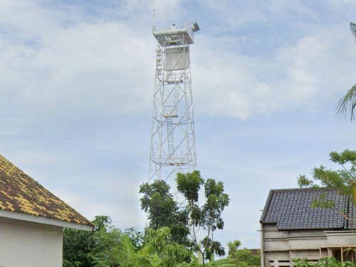
Date unknown (recent). Active; focal plane 18 m (59 ft); white flash every 4 s. 15 m (49 ft) square skeletal tower with gallery, painted white. A photo is at right, Hadi Bindowi has a photo, another photo (halfway down the page) is available, amateur radio operator YF1AR has a photo (second lighthouse on the page), and Google has a street view and a satellite view. Located on the quay at Karimun port, near the southwestern tip of the largest island of the archipelago. Site open, tower closed. Admiralty Q1140.8.
Pulau Kemujan North
2017. Active; focal plane 13 m (43 ft); green flash every 5 s. 13 m (43 ft) green tower on a platform supported by piles. No photo available but Google has a satellite view. Located off the pier of Legon Bajak, the port of Pulau Kamujan, an island on the northeast of Pulau Karimun, separated by only a narrow channel. Accessible only by boat. Site open, tower closed. Admiralty Q1140.35.
* Legon Bajak
2019. Active; focal plane 13 m (43 ft); white flash every 4.5 s. 10 m (33 ft) square white skeletal tower. Nur Rokhma Azizah has a view from the pier, Kelly Tjandra has an aerial view, and Google has a satellite view. Located at the foot of the pier at Legon Bajak, a small port at the north end of Pulau Kamujan. Site open, tower closed. Admiralty Q1140.32.

Karimun Light, Pulau Karimun, December 2017
ex-Google Maps photo by yanuar IDC
Pulau Kemujan South
2017. Active; focal plane 13 m (43 ft); red flash every 5 s. 13 m (43 ft) red tower on a platform supported by piles. No photo available but Google has a satellite view. Located off the pier of Legon Bajak, the port of Pulau Kamujan. Accessible only by boat. Site open, tower closed. Admiralty Q1140.33.
Tanjung Pudak (Pulau Karimunjawa)
Date unknown. Active; focal plane 25 m (82 ft); white flash every 3 s. 15 m (49 ft) square skeletal tower painted white. No photo available but Google has a satellite view. Located at the southeastern tip of Pulau Karimunjawa. Site status unknown. ARLHS IDO-381; Admiralty Q1141; NGA 23569.
Pulau Genting
Date unknown. Active; focal plane 50 m (164 ft); white flash every 4 s. Approx. 40 m (131 ft) square skeletal tower with lantern and gallery, painted white. No photo available but Hadi Bindowi has a view from the gallery and Google has a satellite view. Pulau Genting is the easternmost island of the Karimunjawa archipelago. Located at or near the north end of the island. Site status unknown. ARLHS IDO-071; Admiralty Q1140.5; NGA 23570.

Pati Regency Lighthouses
* Tanjung Bugel (Banyutowo)
Date unknown. Active; focal plane 31 m (102 ft); white flash every 4 s. Approx. 25 m (82 ft) square skeletal tower painted white and carrying a white rectangular daymark panel. Ijang Bordir has a distant view and Google has a street view and a satellite view. Tanjung Bugel is a low cape at the northeastern corner of Java's northern peninsula, but the lighthouse is located near the waterfront north of the pier in Banyutowo, a town about 4 km (2.5 mi) south of the cape. Site open, tower closed. Admiralty Q1144.1; NGA 23572.5.
Karang Juwana
Date unknown. Active; focal plane 14 m (46 ft); white light, 1.2 s on, 4.8 s off. 14 m (46 ft) round white tower with gallery mounted on a square concrete platform. No photo available but Google has a satellite view. Located on submerged bank about 2.5 km (1.5 mi) northwest of the entrance to the Juwana River. Accessible only by boat. Site open, tower closed. Admiralty Q1144.2; NGA 23572.8.
Juwana Channel North Inner
Date unknown. Active; focal plane about 12 m (39 ft); red light, pattern unknown. Approx. 12 m (39 ft) square red skeletal tower on a platform supported by piles. No photo available but Google has a satellite view. This is light and the next one are the largest in a series of lights guiding vessels to the Juwana River. Located about 500 m (1/3 mi) north northwest of the mouth of the river. Accessible only by boat. Site open, tower closed. Admiralty Q1144.4.
Juwana Channel South Inner
Date unknown. Active; focal plane about 12 m (39 ft); green light, pattern unknown. Approx. 12 m (39 ft) square green skeletal tower on a platform supported by piles. No photo available but Google has a satellite view. Located about 400 m (1/4 mi) northwest of the mouth of the river. Accessible only by boat. Site open, tower closed. Admiralty Q1144.45.

Rembang Regency Lighthouses
Karang Panowo
Date unknown. Active; focal plane 13 m (43 ft); white flash every 4 s. 13 m (43 ft) square white skeletal tower mounted on a square platform supported by piles. No photo available but Bing has a satellite view. Located on a reef about 15 km (9 mi) northwest of Rembang harbor. Site open, tower closed. Admiralty Q1144.6 NGA 23573.5.
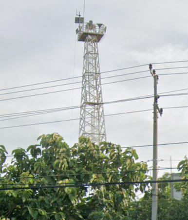
* #Rembang (?)
2007 (?). Active; focal plane 33 m (108 ft); white flash every 5 s. 30 m (98 ft) square skeletal tower painted white. Google has a 2015 street view (also seen at right) and a 2019 street view, but the lighthouse is missing in a 2022 street view and the current satellite view. Located on the waterfront of Rembang harbor. Site status unknown (Google Maps indicates an "army facility" in the area), but the tower could be seen from nearby. Admiralty Q1144.7.
Pulau Gurian
Date unknown. Active; focal plane 14 m (46 ft); white flash every 2.5 s. 14 m (46 ft) square white skeletal tower with gallery mounted on a square concrete platform. No photo available but Google has a distant satellite view. Located on submerged bank (not an island) about 2 km (1.25 mi) off the waterfront of Rembang. Accessible only by boat but there must be distant views from shore. Site open, tower closed. Admiralty Q1144.8; NGA 23573.6.
 
Tanjung Bendoh (?)
2008 (?). Active; focal plane 30 m (98 ft); white flash every 5 s. Probably an approx. 27 m (89 ft) tower, listed only as a "white beacon" when announced by the Indian Notices to Mariners in July 2008. No photo available and the tower has not been located in Google's indistinct satellite view. Located on a low cape about 25 km (15 mi) east northeast of Rembang. Site status unknown. Admiralty Q1144.85.
 

Rembang Light, Rembang, July 2015
Google Maps street view

Information available on lost lighthouses:

Notable faux lighthouses:

Adjoining pages: North: Kalimantan (Borneo) | East: Eastern Java | West: North West Java

Return to the Lighthouse Directory index | Ratings key

Posted April 13, 2006. Checked and revised August 11, 2023. Lighthouses: 45. Site copyright 2023 Russ Rowlett and the University of North Carolina at Chapel Hill.