Lighthouses of Indonesia: Northern Maluku (Halmahera Area)

The Republic of Indonesia has been independent since 1945 after having been the Dutch East Indies for more than 350 years. It is a huge country, stretching along both sides of the Equator for more than 46 degrees of longitude (roughly 5100 km or 3200 miles). Comprised of some 17,000 islands (more than 6000 inhabited islands), it has hundreds of major aids to navigation.

Maluku (the Moluccas) includes the islands traditionally known in the West as the "Spice Islands." Maluku lies east of Sulawesi (Celebes), south of the Philippines, and west of New Guinea. The Portuguese established a settlement in the islands at Ambon in 1526. They were replaced in 1609 by the Dutch, who established a second colonial settlement at Ternate. Today Ambon is the capital of Maluku province and Ternate was until recently the capital of North Maluku province.

Indonesia is divided into 38 provinces (provinsi) and the provinces are subdivided into county units called regencies (kabupaten). North Maluku Province includes the large island of Halmahera and nearby islands, notably Morotai to the north, Bacan and Obi to the south, and the Sula Islands to the southwest. On the west the Maluku Sea separates Halmahera from Sulawesi (Celebes). To the northeast is the open Philippine Sea and on the southeast the Halmahera Sea separates Halmahera from Papua (New Guinea). On the south the narrow waters of the Seram Sea separate Halmahera from Seram (Ceram) and the other islands of Maluku Province. The population of the province is barely one million, a small population for Indonesia. The largest settlement, Ternate, is on a small island off the west coast of Halmahera. The provincial capital was moved in 2010 from Ternate to Sofifi on the west coast of Halmahera.

This page includes the lighthouses of North Maluku except for those of the Sula Islands. Lighthouses of the Sula Islands are described on the Western Maluku page.

More than 700 languages are spoken in Indonesia. The official national language, Indonesian (Bahasa Indonesia), was standardized from a form of Malay that served as a lingua franca across the archipelago. In Indonesian a lighthouse is a mercusuar or a menara suar. Tanjung is a cape, ujung is a headland or point of land, bukit is a hill, sungai is a river, kuala or muara is an estuary or river mouth, pulau is an island, karang is a reef, batu is a rock, laut is a sea, selat is a strait, teluk is a bay, pelabuhan is a harbor, and labuhan is a port. It's also worth knowing that the word for an island is nusa in Balinese and gili in the Sasak language spoken on Lombok and in western Sumbawa.

Aids to navigation in Indonesia are operated and maintained by the Directorate of Marine Navigation within the Directorate General of Sea Transportation

ARLHS numbers are from the ARLHS World List of Lights. Admiralty numbers are from volumes F and Q of the Admiralty List of Lights & Fog Signals. U.S. NGA List numbers are from Publication 112.

General Sources
Online List of Lights - Indonesia - Vol. F and Vol. Q
Photos by various photographers posted by Alexander Trabas.
World of Lighthouses - Indonesia
Photos by various photographers available from Lightphotos.net.
Navionics Charts
Navigation chart for Maluku.

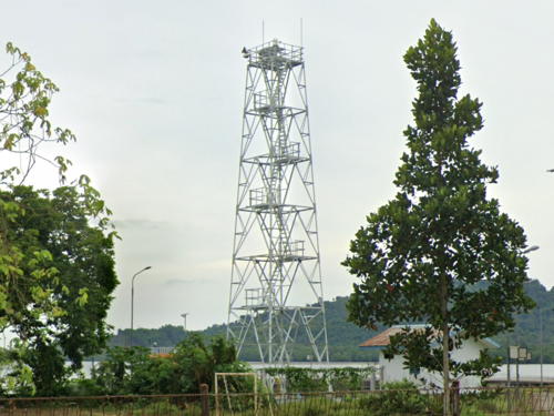
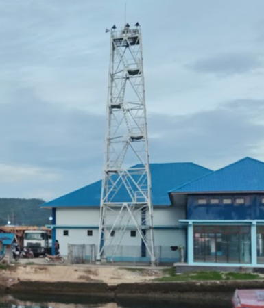
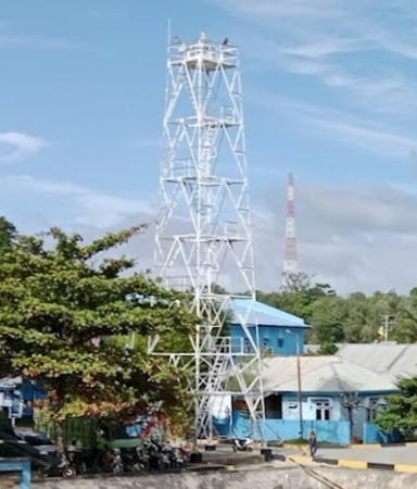
Pelabuhan Dama Light, Pulau Dama, August 2021
Google Maps photo by Zain

Halmahera West Side Lighthouses

Tidore is an island off the west coast of Halmahera, south of the more populous island of Ternate. Historically a rival to Ternate, Tidore today has a population of about 50,000. At present the Tidore Islands City also includes the neighboring central west coast of Halmahera. There is a plan is to establish a city administration for Sofifi, the new provincial capital, that will include the four Oba districts on the mainland.

Tidore City: Halmahera West Coast Lighthouses
* Gita Bandar
2017. Active; focal plane 23 m (75 ft); white flash every 3 s. 20 m (66 ft) square white skeletal tower. Google has a 2023 street view and a satellite view. Located on the waterfront at Gita, a small port in the Oba Selatan (South Oba) district on the southwestern coast of Halmahera. Site open, tower closed. Admiralty F2107.2.
* [Sofifi]
Date unknown. Active; focal plane about 12 m (39 ft); green light, pattern unknown. Approx. 12 m (39 ft) post mounted on a square platform supported by piles. A photo is available, Imel Berliani has a 2022 photo, and Google has a satellite view. Located just off the ferry pier at Sofifi in the Oba Utara district. Accessible only by boat but easily seen from the pier. Site open, tower closed. Admiralty F2106.3.
Karang Luelue (2)
2022. Active; focal plane 13 m (43 ft); six quick white flashes followed by one long white flash every 10 s. 13 m (43 ft) skeletal tower, upper half painted yellow and lower half black, on a square platform supported by piles. No photo available. The Admiralty announced this light in September 2022; Bing's satellite view shows the earlier post light on the platform. Located on a reef about 5 km (3 mi) north of Sofifi. Accessible only by boat. Site open, tower closed. Admiralty F2106.35.

Tidore City: Pulau Tidore Lighthouses

* Trikora Bandar (Tidore)
2017. Active; focal plane 24 m (79 ft); white flash every 3 s. 20 m (66 ft) square white skeletal tower. Part of Micky Isima's photo is at right, Zulfikar Lesmana also has a photo, Rahmat Ismail has a 2022 photo, and Google has a satellite view. Located at the ferry terminal on the east side of Pulau Tidore. Site open, tower closed. Admiralty F2106.8.
[Pelabuhan Feri Dowora]
Date unknown. Active; focal plane about 12 m (39 ft); light characteristic unknown. Approx. 12 m (39 ft) post mounted on a triangular platform supported by piles. Iswan Maujud has a distant view from an arriving ferry and Google has a distant satellite view. Located south off the Dowora ferry pier on the north side of Trikora. Accessible only by boat but easily seen from the pier. Site open, tower closed. Admiralty F2106.75.

Trikora Bandar Light, Tidorw, December 2017
Google Maps photo by Micky Isima

Ternate City Lighthouses
Ternate is an island off the west coast of Halmahera. The Sultans of Ternate ruled most of the spice islands in the centuries before Europeans arrived, and from the early 17th century Ternate was the principal Dutch base in the area. With a population of around 200,000, the city of Ternate is the largest city of North Maluku. It was the provincial capital until the capital was moved to the mainland town of Sofifi in 2010.

*
Ternate Pier (1 and 2)
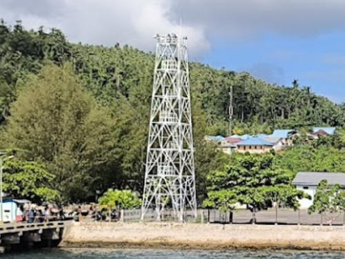
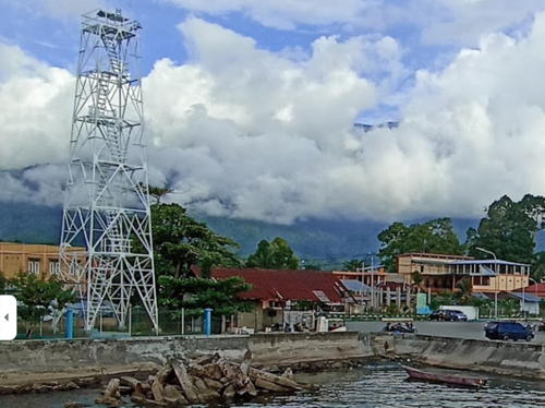
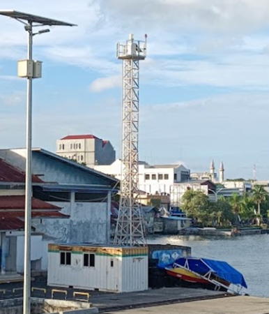
Date unknown. Active; focal plane 23 m (75 ft); white flash every 3 s. 20 m (66 ft) slender skeletal tower, painted white. Muh Khudori's photo is at right, Glenn Wantalangi has a 2019 photo, and Google has a fuzzy satellite view. A shorter tower next to the active one was apparently an older lighthouse; this tower had been removed prior to Ar Roofi Nurul's 2022 photo. Located beside the main passenger terminal at Ternate. Site open, tower closed. Admiralty F2100; NGA 25208.
Tanjung Kahu Merah
Date unknown. Active; focal plane 32 m (105 ft); two white flashes every 15 s. Approx. 27 m (89 ft) skeletal tower, painted white. Google has a drone view, a street view, and an indistinct satellite view. Located on the south waterfront of Ternate. Site status unknown (the lighthouse is in a commercial port area). Admiralty F2105; NGA 25212.
Terminal BBM Ternate
Date unknown. Active; focal plane about 15 m (49 ft); four quick white flashes every 8 s. Approx. 12 m (39 ft) square white skeletal tower. A view from the sea is available and Google has a distant satellite view. Located at the base of the pier at an oil terminal on the southwest side of Ternate. Site and tower closed. Admiralty F2105.5; NGA 25216.
Pulau Hiri
2003. Active; focal plane 115 m (377 ft); white flash every 4 s. 30 m (98 ft) skeletal tower, painted white. No closeup photo available but Sillya Delima has a very distant view and a Google satellite view shows this station. Pulau Hiri is a small island off the northern tip of Pulau Ternate. Located on the west side of the island. Site status unknown. Admiralty F2106; NGA 25217.

Ternate Pier Light, Ternate, September 2015
Google Maps photo by Muh Khudori

Ternate City: Pulau Batang Dua Lighthouses
Pulau Batang Dua is a high island in the Maluku Sea about halfway between Halmahera and the northeastern tip of Sulawesi. The island has a population of about 2500 and is governed as a district of the city of Ternate.

Tanjung Mayu
2003. Active; focal plane 33 m (108 ft); white flash every 5 s. 20 m (66 ft) skeletal tower, painted white. No photo available but Google has a satellite view. Located on the eastern tip of Pulau Batang Dua. Accessible only by boat. Site status unknown. Admiralty F2107.56; NGA 25222.8.
Tanjung Lelew (Pasirputih)
2006. Active; focal plane 40 m (131 ft); white flash every 3 s. 40 m (131 ft) skeletal tower, painted white. No photo available but Google has a satellite view. Located on the western tip of Pulau Batang Dua. Accessible only by boat. Site status unknown. ARLHS IDO-221; Admiralty F2107.5; NGA 25222.7.
 

West Halmahera Regency Lighthouse
Sidangoli Starboard
Date unknown. Active; focal plane about 12 m (39 ft); green light, pattern unknown. Approx. 12 m (39 ft) round barbell-shaped green fiberglass tower on a platform supported by piles. Fatma Rois has a 2018 photo of the two Sidangoli lights, Sari Wahyuni has a 2019 photo, and Google has an indistinct satellite view. Located on the right side of the approach to the ferry pier at Sidangoli. Accessible only by boat but easily seen from the pier. Site open, tower closed. Not listed by the Admiralty.
Sidangoli Port
Date unknown. Active; focal plane about 12 m (39 ft); red light, pattern unknown. Approx. 12 m (39 ft) round barbell-shaped red fiberglass tower on a platform supported by piles. Rizal Abdillah has a photo, Fatma Rois has a 2018 photo of the two Sidangoli lights, Sari Wahyuni has a 2019 photo, and Google has an indistinct satellite view. Located on the left side of the approach to the ferry pier at Sidangoli. Accessible only by boat but easily seen from the pier. Site open, tower closed. Not listed by the Admiralty.
Tanjung Babo (Bobo) (Saria)
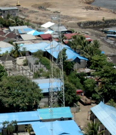
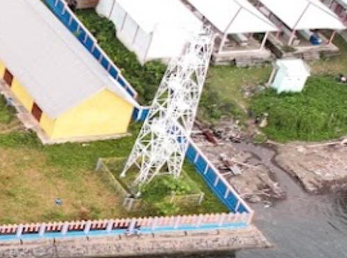
2003. Active; focal plane 210 m (689 ft); two white flashes every 6 s. 40 m (131 ft) square pyramidal skeletal tower with lantern and gallery, painted white. A drone view is at right, Muhammad Faturachman Husin's has a closeup photo, Ibnu Khoirul Fajar has a 2019 drone view, and Google has a good satellite view. The Admiralty calls the light Tanjung Bobo, but signs at the lighthouse have it as Tanjung Babo. Located on a promontory at Saria, near the base of Halmahera's northern peninsula, about 25 km (15 mi) north of Ternate. Site status unknown. Admiralty F2107.8; NGA 25222.45.

Tanjung Babo Light, West Halmahera, August 2020
Google Maps photo by lowday 18

Halmahera North Side Lighthouses

North Halmahera Regency: West Coast Lighthouses
Pulau Sidanga
2003. Active; focal plane 93 m (305 ft); white flash every 3 s. 30 m (98 ft) square skeletal tower with gallery, painted white. No photo available but the tower is seen in Google's satellite view. Located on the west side of a small island off the northwestern coast of Halmahera, about 160 km (100 mi) north of Ternate. This island is known as a scuba diving site. Accessible only by boat. Site status unknown. Admiralty F2110.3; NGA 25222.4.
* Pelabuhan Dama (Pulau Doi)
Date unknown. Active; focal plane about 22 m (72 ft); white light, pattern unknown. Approx. 20 m (66 ft) square white skeletal tower. A 2021 photo is at the top of this page, Dhany Vapes has a photo, Prasetyo Budi Widagdo has an evening photo, and Google has a satellite view. Pulau Doi is an island off the northwestern tip of Halmahera. Located on the waterfront of Dama, the ferry port for Pulau Doi. Site open, tower closed. Admiralty F2110.1.

Pulau Morotai Regency Lighthouses
Morotai is a rugged, mostly forested island north of Halmahera. The island is elliptical in shape, 80 km (50 mi) long and 42 km (26 mi) wide; the population is a little over 75,000. The northernmost major island of Maluku, Morotai was the base for the U.S. invasion of the Philippines in early 1945.
Karang Dododahohe
Date unknown. Active; focal plane 10 m (33 ft); white flash every 3 s. 10 m (33 ft) round barbell-shaped white fiberglass tower on a square platform. No photo available but Bing has a distant satellite view. Located on a reef off the southern tip of Morotai. Accessible only by boat. Site open, tower closed. Admiralty F2111.5; NGA 25222.5.
* Pelabuhan Daruba
2018(?). Active; focal plane 23 m (75 ft); white flash every 3 s. 20 m (66 ft) square white skeletal tower. Glenn Wantalangi has a photo, an aerial view is available and Google has a satellite view. Daruba is the terminal for ferries from Tobelo, Halmahera. Located on the waterfront of Daruba, a port at the southern tip of Morotai. Site open, tower closed. Admiralty F2111.03.
Pelabuhan Wayabula
2018(?). Active; focal plane 25 m (82 ft); white flash every 3 s. 20 m (66 ft) square white skeletal tower. Several station buildings. Ihwan Hakim has a 2020 photo and Google has a satellite view. At Wayabula a narrow strait separates Morotai from Pulau Rao. Located at a terminal and coast guard station on the west coast of Morotai. Site open, tower closed. Admiralty F2111.45.
* Morotai Bandar (Sopi)
2017. Active; focal plane 23 m (75 ft); white flash every 3 s. 20 m (66 ft) square white skeletal tower. Sriayu Rakim's photo shows the lower 2/3 of the tower, he also has a distant view, and Google has a satellite view. Located at the base of the pier at Sopi harbor on the north coast of the island. Site open, tower closed. Admiralty F2111.4.
Tanjung Sopi (Pulau Morotai)
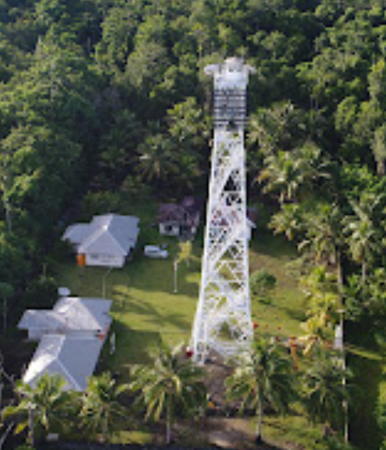
2003. Active; focal plane 93 m (305 ft); white flash every 6 s. 40 m (131 ft) square skeletal tower with gallery, painted white. The top of the tower also carries a slatted daymark. Several coast guard station buildings. Darius Arkwright's photo is at right, a drone view is available, Laszlo Wagner has a photo (halfway down the page), and Google has a satellite view of the station. Package tours of the island sometimes include a visit to the lighthouse. Located at the northern tip of the island. Accessible only by boat. Site open, and nothing prevents visitors from climbing the tower. Admiralty F2111.3; NGA 25222.55.
* Berebere Bandar
2017. Active; focal plane 24 m (79 ft); white flash every 3 s. 20 m (66 ft) square white skeletal tower. Febrie Purwoandhika's 2023 photo shows the lower 2/3 of the tower and Google has a satellite view. Located at the ferry terminal of Berebere on the northeast coast of Pulau Morotai. Site open, tower closed. Admiralty F2111.1.

Tanjung Sopi Light, Pulau Morotai, May 2017
Google Maps photo by Darius Arkwright

North Halmahera Regency: East Coast Lighthouses
* Galela
Date unknown. Active; focal plane about 15 m (49 ft); white light, pattern unknown. Approx. 13 m (43 ft) square white skeletal tower. Fariz Hidayat has a photo (a portion is seen at right), Nurkholis B. Saputra has a 2023 photo, and Google has a satellite view. Located at a small port on Galela Bay, sheltered at the base of the northern peninsula of Halmahera. Site open, tower closed. Not listed by the Admiralty.
Tobelo (2?)
Date unknown. Active; focal plane about 12 m (39 ft); white light, pattern unknown. Approx. 9 m (30 ft) tapered square skeletal tower. A photo (halfway down the page) is available, Wilson Kakunsi has a drone view, and Google has an indistinct satellite view. This light doesn't match the current description of the Tobelo light in NGA (focal plane 9 m (30 ft), 6 m (20 ft) tower, continuous red light). Located on the containership quay at Tobelo, the capital of North Halmahera Regency. Site status unknown. Admiralty F2110; NGA 25222.
Kupakupa Oil Depot
Date unknown. Active; focal plane 13 m (43 ft); white flash every 3 s. Approx. 11 m (36 ft) square white pyramidal tower. Ruchi d'Seaman has a view from the sea, Agunawan Opa has an aerial view and Bing has a satellite view. Located at an oil terminal about 10 km (6 mi) south of Tobelo. Site status unknown. Admiralty F2110.5; NGA 25220.
* Tanjung Loleo (Tanjung Barnabas)
Date unknown. Active; focal plane 14 m (46 ft); two white flashes every 7 s. 12 m (39 ft) square skeletal tower. NGA describes it as a "white beacon" but it appears rusted in Giliat Tapatab's photo (lighthouse near the left edge). Google has an indistinct satellite view. Located at a small industrial port on the west side of Teluk Kau, a long bay separating the northern and eastern peninsulas of Halmahera. Site open, tower closed. Admiralty F2109 NGA 25218.

Galela Light, North Halmahera, January 2017
Google Maps photo by Fariz Hidayat

Halmahera East Side Lighthouses

East Halmahera Regency Lighthouse
* Pelabuhan Buli
2017(?). Active; focal plane 24 m (79 ft); white flash every 3 s. 20 m (66 ft) square white skeletal tower. Arief E. Saputro has a 2019 photo, Isra Culank has a 2018 photo, and Google has a satellite view. Located on the waterfront of Buli, a port on the east side of the base of the northeastern peninsula of Halmahera. Site open, tower closed. Admiralty F2109.3.
* [Subaim]
Date unknown. Active; focal plane about 16 m (52 ft); white light, pattern unknown. approx. 14 m (46 ft) steel post. Muhammad Iksan Yunus has a photo and Google has a satellite view. Subaim is a small port on Teluk Wasile, a basin of Teluk Kau on the west side of Halmahera's northeastern peninsula. Located between the two piers of the port. Site open, tower closed. Not listed by the Admiralty.
Pulau Leleve
2006. Active; focal plane 26 m (85 ft); white flash every 5 s. 20 m (66 ft) white concrete tower. No photo available but Google has a good satellite view. Located on a small island in Buli Bay, off the east coast of Halmahera about 20 km (13 mi) north of Bicoli. Accessible only by boat. Site status unknown. Admiralty F2109.6.

Central Halmahera Regency Lighthouses
Pulau Yiew (Jiuw)
2006. Active; focal plane 45 m (148 ft); two white flashes every 10 s. 40 m (131 ft) square white skeletal tower. Ririn Ambar has a photo and Bing has a satellite view. Located on a small island about 50 km (30 mi) northeast of the eastern tip of Halmahera's eastern peninsula, marking the northern entrance to the Halmahera Sea. Accessible only by boat. Site status unknown. Admiralty F2109.8; NGA 25222.65.
Tanjung Sofa (Jailolo Strait)
Date unknown. Active; focal plane 71 m (233 ft); white flash every 10 s. 40 m (131 ft) square white skeletal tower. Several 1-story station buildings. No photo available but Bing has a satellite view of the station. This lighthouse is less than 5 km (3 mi) north of the Equator. Located at the northwestern tip of Pulau Gebe, marking a narrow passage around the eastern tip of Halmahera. Accessible only by boat. Site status unknown. Admiralty F2111.8; NGA 25222.6.
* [Pelabuhan Sif]
Date unknown. Active; focal plane about 16 m (52 ft); white light, pattern unknown. approx. 14 m (46 ft) steel post. The light is to the left of the pier in Arby Feblisa Samallo's view but it is not visible in Bing's indistinct satellite view. Located at the ferry terminal in Sif, on the south coast of the southeastern peninsula of Halmahera. Site open, tower closed. Not listed by the Admiralty.
* Pelabuhan Weda
2016. Active; focal plane 23 m (75 ft); white flash every 3 s. 20 m (66 ft) square skeletal tower. Sabrifajri Jumesya has the 2022 photo seen at right, Indra Satya Nagari has a 2017 photo, and Google has a satellite view. Weda is the capital of the Central Halmahera Regency. Located at the foot of the ferry pier in Weda. Site open, tower closed. Admiralty F2109.85.

Pelabuhan Weda Light, Weda, January 2022
Google Maps photo by Sabrifajri Jumesya

Halmahera South Side (South Halmahera Regency) Lighthouses

Mainland Lighthouses
Maffa (Wafa) Approach
Date unknown. Active; focal plane about 15 m (49 ft); red light, pattern unknown. Apprrox. 15 m (49 ft) square red skeletal tower on a platform supported by piles. No photo available but Bing has a fuzzy satellite view. This light guides vessels around the north end of long shoal that shelters the harbor of Maffa. Located about 300 m (0.2 mi) northeast of the Maffa pier. Accessible only by boat. Site open, tower closed. Admiralty F2109.92.
* Tanjung Maffa (Wafa) (Pelabuhan Maffa)
Date unknown. Active; focal plane about 23 m (75 ft); white flash every 3 s. Approx. 20 m (66 ft) square white skeletal tower. No photo available but Google has a satellite view. Located at the foot of the ferry pier at Maffa, a village about 32 km (20 mi) south of Weda. Site open, tower closed. Admiralty F2109.9.
* Pelabuhan Saketa
Date unknown (may be new). Active; focal plane about 23 m (75 ft); white light, pattern unknown. Approx. 20 m (66 ft) square white skeletal tower. Upp Babang has a distant 2022 view, a December 2020 view from the port entrance is available, and Google has a satellite view. Located at the ferry terminal of Saketa, a village on the west coast of Halmahera's southern peninsula. Site open, tower closed. Not listed by the Admiralty.

Bacan Islands Lighthouses
The Bacan Islands lie off the west coast of Halmahera's southern peninsula. Pulau Bacan itself is the largest of the islands.

Tanjung Gegoru
Date unknown. Active; focal plane about 15 m (49 ft); light characteristic unknown. Approx. 14 m (46 ft) round barbell-shaped tower. No photo available but Bing has a satellite view. Located at the western tip of Pulau Mandioli, marking the southwestern point of the Bacan Islands. Probably accessible only by boat. Site status unknown. Admiralty Q1585.5.
* Pelabuhan Indari
Date unknown. Active; focal plane about 22 m (72 ft); white light, pattern unknown. Approx. 20 m (66 ft) white skeletal tower. A 2022 photo is available and Google has a satellite view. Located on the pier at Indari, a port on the northwest side of Pulau Bacan. Site open, tower closed. Not listed by the Admiralty.
Pulau Pokal
Date unknown. Active; focal plane 110 m (361 ft); two white flashes every 15 s. Approx. 40 m (131 ft) square skeletal tower, painted white. No photo available but Google has a satellite view. Located on a small island in the center of the narrow Patientie Strait separating southwestern Halmahera from the neighboring Pulau Bacan. Accessible only by boat. Site status unknown. Admiralty Q1588; NGA 25770.
* Babang (?)
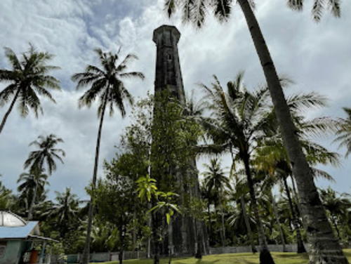
Date unknown. Apparently removed in 2018 but still listed with focal plane 14 m (46 ft); white flash every 6 s. 12 m (39 ft) round concrete tower, flared at the top and buttressed at the base. Google has a 2017 street view but recent construction on the docks seen in Alief Nusantara's July 2017 photo and Google's satellite view makes the status of this light somewhat uncertain. Located on the waterfront of Babang, a town on the east coast of Pulau Bacan, the largest of the Bacan Islands. Site open, tower closed. Admiralty Q1587.5; NGA 25769.
* Pelabuhan Wayaua
Date unknown. Active; focal plane about 22 m (72 ft); white light, pattern unknown. Approx. 20 m (66 ft) white skeletal tower. A 2022 photo is available and Google has a satellite view. Located on the pier at Wayaua, a port on the south side of Pulau Bacan. Site open, tower closed. Not listed by the Admiralty.
* Pelabuhan Kupal
Date unknown. Active; focal plane about 22 m (72 ft); white light, pattern unknown. Approx. 20 m (66 ft) white skeletal tower. A 2023 photo is available but the tower may be too new to appear in Google's satellite view of the port. Located at Kupal, a port on the southwestern coast of Pulau Bacan. Site open, tower closed. Not listed by the Admiralty.

Kupal Light, Bacan Islands, June 2023
Google Maps photo by inDONYsea

Kayoa Islands Lighthouses
The Kayoa Islands are a group of smaller islands off the west coast of Halmahera's southern peninsula north of Pulau Bacan and south of Pulau Makian.

Pulau Sarangburung (Lata Lata) (2)
Date unknown. Active; focal plane about 40 m (131 ft); white flash every 2 s. Approx. 30 m (98 ft) square skeletal tower painted white. No photo available but Bing has a distant satellite view. NGA lists a 10 m (33 ft) tower but the satellite view shows a much taller structure. Located on a small island at the west end of Pulau Sarangburung, the southwestern point of the Kayoa Islands. Accessible only by boat. Site status unknown. Admiralty Q1582; NGA 25771.
* Pelabuhan Busua (Pulau Muari)
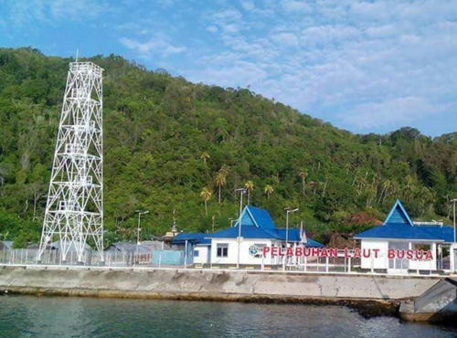
2017. Active; focal plane 23 m (75 ft); white flash every 3 s. 20 m (66 ft) square skeletal tower. A photo is at right, Sultan Bosthon has a 2018 photo, and Salus Yustian has a 2021 photo, but the tower imay be too new to be seen in Bing's satellite view. Located at the foot of the ferry pier in Busua, a small port at the northeastern end of Pulau Muari. Site open, tower closed. Admiralty Q1583.
* Pelabuhan Laromabati (Pulau Kayoa)
Date unknown. Active; focal plane about 23 m (75 ft); white light, pattern unknown. Approx. 20 m (66 ft) square skeletal tower. No photo available but Google has a satellite view. Located at the ferry terminal near the northern end of Pulau Kayoa. Site open, tower closed. Not listed by the Admiralty.

Busua Light, Kayoa Islands, August 2022
Google Maps photo by upp babang

Makian Lighthouses
Pulau Makian
2003. Active; focal plane 25 m (82 ft); white flash every 5 s. 20 m (66 ft) tapered square skeletal tower, painted white. No photo available but Google has a satellite view. Pulau Makian is a volcanic island off the west coast of Halmahera about 60 km (38 mi) south of Ternate. Located on the western tip of the island. Site status unknown. Admiralty F2107.3; NGA 25210.
* Pelabuhan Makian
Date unknown. Active; focal plane about 15 m (49 ft); white light, pattern unknown. Approx. 12 m (39 ft) square white skeletal tower. The tower is behind the left posts of the harbor gate in Rinaldi Ad's 2023 photo, Marwan Mohamad has a very distant view from the sea, and Google has an indistinct satellite view. Located at the ferry terminal on the east coast of the island. Site open, tower closed. Not listed by the Admiralty.

Obi Islands Lighthouses
The Obi Islands lie to the south of Halmahera and north of Seram. Obira (also called Obi and Obi Mayor) is by far the largest of the islands.

Pulau Laiola (Pulau Lawin)
Date unknown. Active; focal plane 34 m (112 ft); two white flashes every 6 s. 30 m (98 ft) square skeletal tower, painted white. Several 1-story station buildings. No photo available but Bing has a satellite view of the light station. Located on Pulau Laiola, easternmost of the Tema Islands, in the Halmahera Sea about 55 km (35 mi) east of the island of Obira. Accessible only by boat. Site status unknown. Admiralty Q1603; NGA 25764.
* Jikotamo Bandar (Pelabuhan Jikotamo, Pelabuhan Laiwui)
Date unknown. Active; focal plane 23 m (75 ft); white flash every 3 s. 20 m (60 ft) skeletal tower, painted white. Januar Retristian's photo is at right, Viktor Rendra has a 2018 photo, Ahmad Siroji has a 2019 photo, Pardi Laapo has a photo, and Google has a satellite view. Located at the Jikotamo ferry port on the north coast of Pulau Obira. Site open, tower closed. Admiralty Q1589.
Tanjung Wok (Woka)
Date unknown. Active; focal plane 17 m (56 ft); white light, 5 s on, 7 s off. 17 m (56 ft) "white beacon." No photo available. The Admiralty's position data for this light appears to be incorrect. The tower is not seen in Bing's satellite view of the area. Located (apparently) at the tip of a promontory on the north coast of Pulau Obira. Site status unknown. Admiralty Q1591; NGA 25766.
Pelabuhan Wayaloar ("Wai Lower")
Date unknown. Active; focal plane 23 m (75 ft); white flash every 3 s. 20 m (66 ft) square white skeletal tower. No photo available but Bing has a satellite view. The Admiralty interpreted the name of this village as "Wai Lower." Located at the ferry terminal at Wayaloar, a small port on the south coast of Pulau Obira. Site open, tower closed. Admiralty Q1590.8.
Tanjung Akelamo
Date unknown. Active; focal plane 46 m (151 ft); white flash every 10 s. 40 m (131 ft) octagonal white concrete tower with gallery. Several 1-story station buildings. A closeup photo and an aerial view are available and Bing has a good satellite view of the station. Located on the southwestern tip of Pulau Obira, marking the east side of the southern entrance to the Maluku Sea. Site status unknown. Admiralty Q1590.5.

Pelabuhan Laiwui Light, Pulau Obira, June 2017
ex-Google Plus photo by Januar Retristian

Information available on lost lighthouses:

Notable faux lighthouses:

Adjoining pages: East: West Papua North Coast | South: Central Maluku | Southwest: Western Muluku | West: Northeastern Sulawesi

Return to the Lighthouse Directory index | Ratings key

Posted December 31, 2008. Checked and revised November 17, 2023. Lighthouses: 48. Site copyright 2023 Russ Rowlett and the University of North Carolina at Chapel Hill.