Lighthouses of Indonesia: Southeastern Maluku (Moluccas)

The Republic of Indonesia has been independent since 1945, after having been the Dutch East Indies for more than 350 years. It is a huge country, stretching along both sides of the Equator for more than 46 degrees of longitude (roughly 5100 km or 3200 miles). Comprised of some 17,000 islands (more than 6000 inhabited islands), it has hundreds of major aids to navigation.

Indonesia is divided into 38 provinces (provinsi) and the provinces are subdivided into county units called regencies (kabupaten). This page includes the lighthouses of the southeastern portion of Maluku Province. The province includes the central and southern islands of Maluku (the Moluccas), the islands traditionally known in the West as the "Spice Islands." Broadly speaking, Maluku lies east of Sulawesi (Celebes), south of the Philippines, and west of New Guinea.

Maluku Province is divided into nine regencies and two regency-level cities. This page includes lighthouses of the Aru Islands Regency, the Kai Islands Regency, and Tual City, located at the eastern end of the province in the Arafura Sea southwest of New Guinea.

More than 700 languages are spoken in Indonesia. The official national language, Indonesian (Bahasa Indonesia), was standardized from a form of Malay that served as a lingua franca across the archipelago. In Indonesian a lighthouse is a mercusuar or a menara suar. Tanjung is a cape, ujung is a headland or point of land, bukit is a hill, sungai is a river, kuala or muara is an estuary or river mouth, pulau is an island, karang is a reef, batu is a rock, laut is a sea, selat is a strait, teluk is a bay, pelabuhan is a harbor, and labuhan is a port. It's also worth knowing that the word for an island is nusa in Balinese and gili in the Sasak language spoken on Lombok and in western Sumbawa.

Aids to navigation in Indonesia are operated and maintained by the Directorate of Marine Navigation within the Directorate General of Sea Transportation

ARLHS numbers are from the ARLHS World List of Lights. Admiralty numbers are from volume Q of the Admiralty List of Lights & Fog Signals. U.S. NGA List numbers are from Publication 112.

General Sources
World of Lighthouses - Indonesia
Photos by various photographers available from Lightphotos.net.
Online List of Lights - Indonesia
Photos by various photographers posted by Alexander Trabas.
Topographic Map of the Kai Islands
Map posted by Wikipedia.
Navionics Charts
Navigation chart for Indonesia.
 

Tanjung Ular Light, Aru Islands, October 2017
Google Maps photo by Rizqi Df

Kepulauan Aru (Aru Islands) Regency Lighthouses

The Aru Islands are the easternmost island group of Maluku, located about 150 km (90 mi) southwest of the Papua (New Guinea) coast. The largest island by far is Tanahbesar (also called Wokam). Dobo, the capital of the regency and chief port of the islands, is on Wamar, a much smaller island just off the west coast of Tanahbesar. Known for pearls and seafood, Dobo has a population of about 45,000. During the last ice age the Aru Islands were uplands in a land bridge connecting New Guinea and Australia.

Wamar (Dobo Area) Lighthouses
* Tanjung Ular
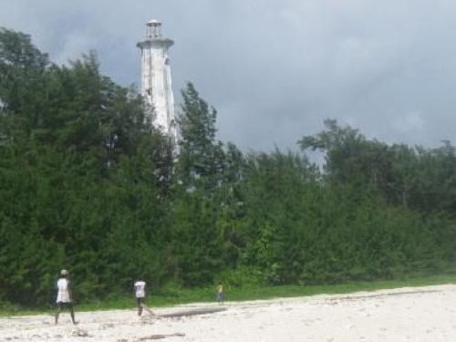
Date unknown (station established 1906). Active; focal plane 22 m (72 ft); white light, 3 s on, 2 s off. 13 m (43 ft) iron skeletal tower, painted white. A photo is at the top of this page, Selo Kendal has a 2022 photo, and Google has a satellite view of the station. Located at the northwestern tip of Pulau Wamar, marking the approach to the port of Dobo. Accessible by road from Dobo. Site status unknown. Admiralty Q1632; NGA 25872.
Dobo Channel (2)
Date unknown. Active; focal plane about 13 m (43 ft); green flash every 5 s. Approx. 13 m (43 ft) square pyramidal skeletal tower on a square platform supported by piles. No photo available but Google has a satellite view. The light was described as a post light in a 2010 Australian notice to mariners. Located on the south side of the strait leading to Dobo, about 2.5 km (1.5 mi) west of the Dobo waterfront. Site open, tower closed. Admiralty Q1632.3.
* Dobo (2)
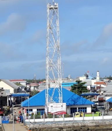
Date unknown. Active; focal plane about 30 m (98 ft); continuous red light. Approx. 25 m (82 ft) square skeletal tower. Salman Lanang has the photo at right, Jon Budi has a photo, additional photos are available, Roedy Rustam has a street view from one of the piers, and Google has a satellite view. NGA lists a previous tower having a focal plane of only 8 m (26 ft). The lighthouse is similar to the Saumlaki lighthouse (see the Southern Maluku page). Located on the waterfront at Dobo on Pulau Wamar. Site open, tower closed. Admiralty Q1632.4; NGA 25884.
Dobo Fuel Depot
Date unknown. Active; focal plane 10 m (33 ft) (?); white flash every 3 s. 10 m (33 ft) (?) square white skeletal tower. Agunawan Opa has an aerial view (light just to the right of the base of the pier) and Google has a satellite view. Located at the base of the pier at the oil depot at the southeastern corner of Pulau Wamar. Site and tower closed. Admiralty Q1632.6; NGA 25886.

Aru Utara (North Aru) Lighthouses
Pulau Warilau (Tanjung Watuleijurung)
Date unknown. Active; focal plane 30 m (98 ft); white flash every 4 s. 28 m (92 ft) skeletal tower, painted white. No photo available and the tower is not seen in Google's satellite view of the area. Located on Pulau Warilau at the northern end of the Aru Islands. Accessible only by boat. Site status unknown. Admiralty Q1633; NGA 25876.
Pulau Konan
Date unknown. Active; focal plane 33 m (108 ft); two white flashes every 14 s. 30 m (98 ft) square skeletal tower painted white. No photo available but Google has a satellite view. Located on a small island off the northeastern tip of Pulau Tanahbesar. Accessible only by boat. Site status unknown. Admiralty Q1632.98.

Dobo Light, Dobo, August 2021
Google Maps photo by Salman Lanang

Aru Tengah Timur (East Central Aru) Lighthouse
Pulau Karaweira Mariri
Date unknown. Active; focal plane 32 m (105 ft); two white flashes every 12.5 s. 30 m (98 ft) square skeletal tower painted white. No photo available but Google has a satellite view. Located on a small island off the northeast coast of Pulau Tanahbesar. Accessible only by boat. Site status unknown. Admiralty Q1632.95.

Aru Tengah Selatan (South Central Aru) Lighthouse
Tanjung Uafu Fenjuring
Date unknown. Active; focal plane 32 m (105 ft); three white flashes every 15 s. 30 m (98 ft) square skeletal tower painted white. No photo available but Google has a satellite view. This light marks the easternmost point of the Aru Islands. Located on the northeast coast of Pulau Penambulai. Accessible only by boat. Site status unknown. Admiralty Q1632.9.

Aru Selatan Timur (Southeast Aru) Lighthouses
Pulau Kultubai (North)
Date unknown. Active; focal plane 32 m (105 ft); two white flashes every 10 s. 30 m (98 ft) square skeletal tower painted white. No photo available but Google has a satellite view. Located on an island on the east side of the Aru group. Accessible only by boat. Site status unknown. Admiralty Q1632.85.
Pulau Kultubai (Reef)
2007 (?). Active; focal plane 35 m (115 ft); two white flashes every 12 s. 30 m (98 ft) "white beacon." No photo available and the tower is not seen in Bing's satellite view of the islet. Apparently located on a tiny island on a dangerous reef at the southeastern corner of the Aru group. Accessible only by boat. Site status unknown. Admiralty Q1632.7; NGA 25886.3.
Pulau Karang
Date unknown. Active; focal plane 33 m (108 ft); three white flashes every 16 s. 30 m (98 ft) "white beacon," presumably a skeletal tower. No photo available but Bing has a satellite view. Located on the south side of Pulau Karang, an island on the southeastern side of the Aru Islands. Accessible only by boat. Site status unknown. Admiralty Q1632.75.
Pulau Enu (Pulau Eno)
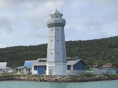
2006. Active; focal plane 46 m (151 ft); white flash every 10 s. 40 m (131 ft) octagonal concrete tower with lantern and gallery. Entire lighthouse is white. Several coast guard station buildings. A photo is at right and Bing has a satellite view of the station. Pulau Enu is a small island in the Arafura Sea at the southeastern corner of the Aru group. Located on the south side of the island. Accessible only by boat. Site status unknown. Admiralty Q1632.8; NGA 25886.5.
Pulau Batugoyang
Date unknown. Active; focal plane 32 m (105 ft); two white flashes every 11 s. 30 m (98 ft) square skeletal tower painted white. No photo available but Bing has a satellite view. Located on a small island at the extreme southern tip of the Aru Islands. Accessible only by boat. Site status unknown. Admiralty Q1632.65.

Pulau Enu Light, Aru, November 2013
Aru Regency tourist development photo

Kei Islands (Southeast Maluku Regency and Tual City) Lighthouses

The Kei Islands (formerly called the Kai Islands and known to the inhabitants as the Evav Islands) are a group of relatively small islands lying northeast of the Tanimbar group, west of the Aru group, and southeast of the large island of Seram; they are the easternmost of the Banda Sea islands. Tual, the chief town of the archipelago, suffered a severe earthquake in September 2010.
Tanjung Patingru
2015. Active; focal plane 85 m (279 ft); white light occulting once every 11 s. 40 m (131 ft) square skeletal tower painted white. Several 1-story station buildings. No photo available and the station is not yet seen in Google's satellite view. This lighthouse is part of a new coast guard station on Kei Besar, the largest and easternmost island of the Kei group. The mountainous island is at least 100 km (60 mi) long but rarely more than 5 km (3 mi) wide). Located on the northwestern tip of Pulau Kei Besar. Site status unknown. Admiralty Q1631.5.
* Elat (2)
Around 2021. Active; focal plane about 25 m (82 ft); white flash every 3 s. Approx. 25 m (82 ft) octagonal concrete tower with lantern and gallery. Rikhardus Tanlain's 2022 photo is at right. This lighthouse replaced an approx. 13 m (43 ft) round barbell-shaped metal tower that was painted blue although most of that paint had worn off; Ale Bakri has a 2020 photo of that light. Bing has only an indistinct satellite view of the port. Located at the base of a pier in Elat, the principal port of Pulau Kei Besar, on the southwest coast of the island. Site open, tower closed. Admiralty Q1631; NGA 25848.
Uf Danar (Uf Mar)
Date unknown. Active; focal plane 23 m (75 ft); white flash every 3 s. 20 m (66 ft) square skeletal tower painted white. Yus Hattu has a photo, a distant 2022 view with two Coast Guard vessels is available, and Google has a satellite view. Located at the base of a pier at the Tual Navigation Distict office at Uf Danar, a small port on the south coast of Pulau Kei Kecil Timur. Site open, tower closed. Admiralty Q1628.93.
Tual Approach (Selat Duroa)
Date unknown. Active; focal plane 18 m (59 ft); red flash every 3 s. 18 m (59 ft) red beacon, presumably mounted on a platform supported by piles. No photo available and clouds block the view in Bing's current satellite view. Located in the Duroa Strait, a narrow channel between the islands of Duroa and Kei Kecil, marking the beginning of the approach to Tual. Accessible only by boat. Site open, tower closed. Admiralty Q1629; NGA 25832.

Elat Light, Kei Islands, May 2022
Google Maps photo by Rikhardus Tanlain
Pulau Uber Northeast
Date unknown. Active; focal plane about 15 m (49 ft); green flash every 4 s. Approx. 15 m (49 ft) green square skeletal tower on a platform supported by piles. No photo available but Bing has a fuzzy satellite view. Located off the northeast corner of Pulau Uber marking a right angle turn in the approach to Tual. Accessible only by boat. Site open, tower closed. Admiralty Q1629.32.
* Tual (2)
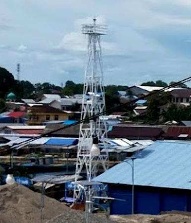
Date unknown. Active; focal plane about 23 m (75 ft); white flash every 3 s. Approx. 20 m (66 ft) square skeletal tower painted white. A photo is at right, R. Silangen has a 2023 photo, and Google has an indistinct satellite view. NGA lists a smaller tower. Located on the main quay at Tual, the capital of the regency, on Pulau Dullah. Site open, tower closed. Admiralty Q1630; NGA 25840.
* Dumar (Pelabuhan Perikanan Nusantara Tual)
Date unknown. Active; focal plane about 20 m (66 ft); white light, pattern unknown. Approx. 17 m (56 ft) square skeletal tower painted white. Ade Prakasa Putra has a photo but the tower is hard to see in Google's satellite view. Located at a port about 2 km (1.25 mi) north of the main Tual port. Site open, tower closed. Admiralty Q1629.9.
* Ngadi
Date unknown. Active; focal plane 18 m (59 ft); white light, 2 s on, 3 s off. 15 m (49 ft) white steel mast. A distant view is available (mast right of center background) and Google has a distant satellite view. Located at a commercial port about 5 km (3 mi) north of the main Tual port. Site open, tower closed. Admiralty Q1629.36; NGA 25834.
Karang Tegal (Tegal Reef)
Date unknown. Active; focal plane 14 m (46 ft); white flash every 4 s. 14 m (46 ft) square white skeletal tower on a platform supported by piles. No photo available and the light is not shown in Google's satellite view. Located about 8 km (5 mi) north of Pulau Dullah, marking the beginning of the northern approach to Ngadi and Tual. Accessible only by boat. Site open, tower closed. Admiralty Q1630.6; NGA 25844.
Tanimbar Kei (Keitanimbar, Kaitanimbar, Atnebar)
Date unknown. Active; focal plane 60 m (197 ft); three white flashes every 10 s. Approx. 40 m (131 ft) square white skeletal tower. Two 1-story coast guard station buildings. No photo available, but Google has a satellite view. Located near the only settlement on the island of Atnebar or Tanimbar Kei at the southern end of the Kei group. Accessible only by boat. Site status unknown. Admiralty Q1628.8; NGA 25830.

Tual Light, Kei Islands, February 2020
Google Maps photo by Robing Robroy
Pelabuhan Tayando
Date unknown. Active; focal plane about 18 m (59 ft); white light, pattern unknown. Approx. 15 m (49 ft) square white skeletal tower. Rikhardus Tanlain's 2022 photo is at right, Ewhi Ewr has a distant view, and Google has a satellite view. Pulau Tayando is about 40 km (25 mi) west of Pulau Kei Kecil, the northernmost major island of the Kei group. Located at base of the pier at Pulau Tayando. Accessible only by boat. Site open, tower closed. Admiralty Q1628.7.
Pulau Kur (Koer)
Date unknown. Active; focal plane 120 m (394 ft); three white flashes every 20 s. 40 m (131 ft) square skeletal tower with gallery, painted white. Several 1-story station buildings. This tower is seen atop the hill right of center in Bung Randi's distant view and Google has a satellite view of the station. Pulau Kur is about 80 km (50 mi) northwest of Pulau Kei Kecil, the northernmost major island of the Kei group. Located at the northeastern tip of the island. Accessible only by boat. Site status unknown. Admiralty Q1628.5; NGA 25828.
Pelabuhan Pulau Kur (Koer)
Date unknown. Active; focal plane about 18 m (59 ft); white light, pattern unknown. Approx. 16 m (52 ft) square skeletal tower rising from a 1-story square equipment room, painted white. Bung Randi has a distant view and Google has a satellite view. Located at the base of the pier at Pulau Kur. Accessible only by boat. Site open, tower closed. Admiralty Q1628.6.
Pulau Bui (1 and 2)
Date unknown. Active; focal plane about 25 m (82 ft); white flash every 5 s. Approx. 22 m (72 ft) white skeletal tower. No photo available but Google has a satellite view. The satellite view shows an earlier, shorter tower to the left (west) of the current tower. The older tower was in use at least as late as 2014. The listed focal plane of 15 m (49 ft) presumably refers to the older tower. Located at the northwestern tip of the island of Bui about 30 km (19 mi) north of the Pulau Kur light and about 175 km (110 mi) southeast of Seram. Accessible only by boat. Site status unknown. ARLHS IDO-117; Admiralty Q1628; NGA 25824.

Pelabuhan Tayando Light, Kei Islands, May 2022
Google Maps photo by Rikhardus Tanlain

Information available on lost lighthouses:

Notable faux lighthouses:

Adjoining pages: North: Central Maluku | East: West Papua | South: Timor Leste | Southwest: Northeastern Sundas

Return to the Lighthouse Directory index | Ratings key

Posted December 31, 2008. Checked and revised October 27, 2023. Lighthouses: 28. Site copyright 2023 Russ Rowlett and the University of North Carolina at Chapel Hill.