Lighthouses of Southwestern Ireland (Munster)

The smaller of the two main British Isles, the island of Ireland is separated from Great Britain to its east by the North Channel, the Irish Sea, and St George's Channel. Ireland came under English rule in the 16th and 17th centuries and in 1801 the United Kingdom of Great Britain and Ireland was formally established. Following decades of struggle most of Ireland (about 7/8 of the island) became independent in 1922. The northern portion remained in the United Kingdom, forming the present United Kingdom of Great Britain and Northern Ireland.

The modern Republic of Ireland (Éire in Irish) includes 26 of the 32 historic counties of the island and has a population of more than 5 million. Some of the historic counties have been divided and there are now 31 county and city units of local government.

Ireland is traditionally divided into four provinces: Leinster in the east, Munster in the southwest, Connacht in the west, and Ulster in the north. These regions have no administrative function but they remain convenient divisions of the island. The Republic includes all of Leinster, Munster, and Connacht and one county of Ulster. This page covers lighthouses of Munster, including the counties of Waterford, Cork, Kerry, Limerick, and Clare.

This is a beautiful coast, often rugged, much of it exposed to the full force of Atlantic storms and very dangerous to ships. It is guarded by a series of handsome nineteenth century lighthouses, nearly all of them still in service under the maintenance of the Commissioners of Irish Lights. Founded in 1786 by the Irish Parliament, the Commissioners maintain coastal lighthouses in both Northern Ireland and the Irish Republic. Harbor lights are maintained by the local port authorities.

The Irish language is spoken commonly as a first or second language in Ireland. The Irish phrase for a lighthouse is teach solais (plural tithe solais). Oileán (plural oileáin) is an island, rinn is a cape, abhainn is a river, and cuan is a harbor. A lough (pronounced like the Scottish loch) is a lake or an inlet of the sea.

ARLHS numbers are from the ARLHS World List of Lights. CIL numbers are from the light list of the Commissioners of Irish Lights. Admiralty numbers are from Volume A of the Admiralty List of Lights & Fog Signals. U.S. NGA numbers are from Publication 114.

General Sources
Commissioners of Irish Lights - Aids to Navigation
An interactive map leads to pages for each of the CIL lighthouses.
Online List of Lights - Ireland
Photos by various photographers posted by Alexander Trabas.
Pete's Irish Lighthouses
Peter Goulding's informative blog on the lighthouses of Ireland.
Great Lighthouses of Ireland
This website provides information on twelve Irish lighthouses CIL has identified for tourism development. Four of the twelve (Ballycotten, Galley Head, Valentia Island, and Loop Head) are in Munster.
Lights of Ireland
Photos by John Eagle posted by Bill Britten on his Lighthouse Getaway site.
Ireland Lighthouses
Aerial photos posted by Marinas.com.
Lighthouses in the Republic of Ireland
Photos available from Wikimedia; many of these photos were first posted on Geograph.org.uk.
World of Lighthouses - Ireland
Photos by various photographers available from Lightphotos.net.
Britische Leuchttürme auf historischen Postkarten
Historic postcard images posted by Klaus Huelse. Irish lighthouses are at the bottom of the page.
GPSNavigationCharts
Navigation chart information for Ireland.
Navionics Charts
Navigation chart for Ireland.

Fastnet Light
Fastnet Light, Celtic Sea, June 2006
Geograph Creative Commons photo by Richard Webb

County Waterford Lighthouses

Waterford Harbour Lighthouses
Waterford (Port Láirge) is a historic seaport with a population of more than 60,000. Waterford Harbour is an estuary receiving the waters of the Rivers Nore, Suir, and Barrow.
[Passage Point]
1867. Active; focal plane 7 m (23 ft); flash every 5 s, white or red depending on direction. 7 m (23 ft) post mounted on the screwpile platform of the original lighthouse. Goulding has a page for the light, Trabas has a good closeup, and Google has a satellite view. The short brick column seen in Trabas's photo has been removed. Located at the end of a sandbar projecting into Waterford Harbour near Passage East, on the west side of the estuary about 10 km (6 mi) north of Dunmore East. Site status unknown. Operator: Port of Waterford. ARLHS IRE-137; Admiralty A5808; NGA 6484.
* Dunmore East
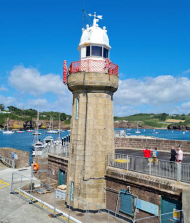
1825 (Alexander Nimmo). Active; focal plane 13 m (44 ft); flash every 8 s, white or red depending on direction. 15 m (50 ft) 16-sided sandstone tower with lantern and gallery. The unpainted tower is fluted in the style of a Doric column. Lantern painted white; gallery rail painted red. Sean Byrne's 2009 photo is at right, Goulding has a page with several photos, Steve Caulfield has a photo, Wikipedia has a photo of the harbor and lighthouse, Marinas.com has aerial photos, and Google has a street view and a satellite view. The design of this handsome lighthouse is unique in Ireland. It stands on a pier built in 1823-25 to serve mail packets sailing between Waterford and Milford Haven, Wales. The pier now serves the local fishing fleet. In the 1960s the breakwater was extended beyond the lighthouse and a small post light added at its end. Trabas has a photo that shows restoration work in progress in 2004. Located on the pierhead in Dunmore East, at the western entrance to Waterford Harbour, directly opposite Hook Head. Accessible by walking the pier. Site open, tower closed. Operator: Commissioners of Irish Lights. . ARLHS IRE-029; CIL-0370; Admiralty A5800; NGA 6464.
[Brownstown Head Beacons]
1823 (?). Two daybeacons, never lit. Two round unpainted stone towers, perhaps 10 m (33 ft) tall. Anna Della Corte has a 2019 photo of the two towers, Christoph Walsh has a drone view of one of them, and Google has a street view and a satellite view. These towers mark the east side of the entrance to Tramore Bay, and the Metal Man Beacons (next entry) mark the west side. Located on Brownstown Head, about 8 km (5 mi) southeast of Tramore. Site open, tower closed. .
[Metal Man (Westtown) Beacons]
1823. Three daybeacons, never lit. Three round stone towers, perhaps 10 m (33 ft) tall, painted white, one of them topped by a cast iron sculpture of a sailor, his cap and coat painted dark blue and his trousers painted white, his arm outstretched to warn ships away from the rocks. A photo of all three towers is available, David Moloney has a drone view, Górska Menda has a 2022 photo, and Google has a street view and a satellite view. The figure was designed by the sculptor John Kirk. It is one of several that were cast, and another one survives atop a lighted beacon off Rosses Point, County Sligo (see the Western Ireland page). Located on a rocky promontory at Westtown, about 4 km (2.5 mi) southwest of Tramore. Site and towers closed (private property), although the towers can be seen from various points nearby.
Dunmore East Light
Dunmore East Light, Dunmore East, May 2009
Flickr Creative Commons photo by Sean Byrne

Dungarvan Area Lighthouses
Dungarvan (Dún Garbhán) is a town of about 10,000 residents at the mouth of the Colligan River.
Ballinacourty (Ballynacourty)
1858. Active; focal plane 16 m (52 ft); directional light: two flashes every 10 s, white, red, or green depending on direction. 13 m (44 ft) round limestone tower with lantern and gallery, painted white; gallery rail painted red. 1-story unpainted stone keeper's house and other buildings enclosed by a stone wall. A photo by Philip Brennan is at right, Trabas has a good closeup, Goulding has a page with several photos, Marinas.com has aerial photos, and Bing has a satellite view. CIL renovated the lighthouse and added modern lighting equipment in 2005-06. Located on Ballinacourty Point at the northern entrance to Dungarvan Harbour. Access to the lighthouse is through the Gold Coast Golf Club, the path being between the 6th and 7th holes. Site open by arrangement with the club, tower closed. Operator: Commissioners of Irish Lights. . ARLHS IRE-006; CIL-0350; Admiralty A5782; NGA 6440.
Mine Head
1851 (George Halpin, Sr.). Active; focal plane 87 m (285 ft); four quick white flashes, separated by 2.4 s, every 20 s. 22 m (72 ft) round sandstone tower with lantern and gallery, painted white with a single black horizontal band. Two 1-1/2 story keeper's houses enclosed by a stone wall. Trabas has a closeup photo by John Eagle, Goulding has a 2022 page for the lighthouse, Marinas.com has aerial photos, and Google has a satellite view of the station. This is Ireland's highest lighthouse; it had a range of 45 km (28 mi) until 2003, when conversion to solar power lowered the range to 32 km (20 mi). Located on a headland about 25 km (16 mi) south of Dungarvan. Accessible by road, although some local knowledge may be needed to find the correct road. The road to the lighthouse crosses private property, but it is not gated. Site open, tower closed. Operator: Commissioners of Irish Lights. . ARLHS IRE-052; CIL-0340; Admiralty A5778; NGA 6436.

Ballinacourty Light, Ballinacourty, March 2022
Google Maps photo by Philip Brennan

County Cork Lighthouses

Youghal Area Lighthouses
Youghal (Eochaill) is a seaside resort town and of about 8000 residents at the mouth of the River Blackwater.
* Youghal (Eochaill)
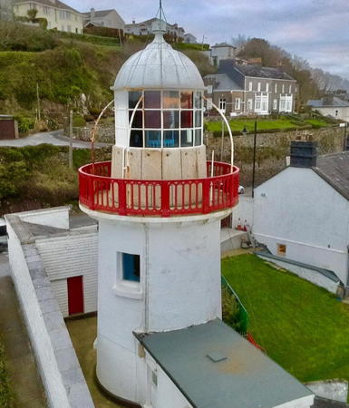
1852. Active; focal plane 24 m (79 ft); flash every 5 s, white or red depending on direction. 15 m (49 ft) round masonry tower with lantern and gallery, painted white; gallery rail painted red. Keeper's house and tower enclosed by a high wall, also painted white. A drone view is at right, Trabas also has a good closeup, Wikimedia has photos, Marinas.com has aerial photos, Huelse has a historic postcard view, Google has a street view, and Bing has a satellite view. From 1190 to 1542 nuns of the Convent of St. Anne's lit torches in a tower of the convent at this location. Ownership of the lighthouse was transferred to Cork County in 2014. The keeper's house, a private residence, was sold in 2017 and is now available for rental through Airbnb. In November 2017 the county received a grant of €78,000 from the European Union to support opening the lighthouse to tourists. In 2019 the county took ownership of the lighthouse. In 2021 a new entrance allowed access to the lighthouse grounds and plans were released for a viewing platform next to the tower. Located off Lighthouse Road on the easternmost point of County Cork, on the west side of the entrance to the harbor of Youghal from Youghal Bay. Site open, tower closed. There is limited on-street parking near the lighthouse. Owner/operator: Cork County Council. . ARLHS IRE-080; ex-CIL-0310; Admiralty A5776; NGA 6432.
[Capel Island]
1848. Never completed as a lighthouse but maintained by CIL as a daybeacon. Approx. 8 m (26 ft) round unpainted stone tower capped by a dome. Lightphotos.net has Tom Kennedy's view from the sea and Google has a satellite view. After several years of controversy construction was halted on this lighthouse in favor of the lighthouses at Ballycotton to the southwest and Mine Head to the northeast. The dome was added to the incomplete tower, which has been maintained ever since as a daybeacon. Capel Island is privately owned and managed as a bird sanctuary. Located on the highest point of the island about 1 km (0.6 mi) off Knockadoon Head, at the southern entrance to Youghal Bay. Accessible only by boat. Site and tower closed; landing on the island require written permission from Birdwatch Ireland. Owner: private. Owner: Commissioners of Irish Lights. Site manager: Birdwatch Ireland. CIL-0300.
** Ballycotton
1851. Active; focal plane 59 m (195 ft); flash every 10 s, white toward the sea and red toward the land. 15 m (50 ft) round sandstone tower with lantern and gallery; entire lighthouse painted black. Several keeper's houses and other buildings enclosed by a stone wall; the white wall contrasts sharply with the black tower and dark island. CIL has a page for the light station as one of the Great Lighthouses of Ireland, Trabas has a photo by John Eagle, John Finn also has a good photo, Goulding's page has two photos, Clark Hatch has a photo of the station, Marinas.com has aerial photos, and Google has a satellite view and a distant street view. This lighthouse was staffed until 1992. In 2004 the station was renovated and connected to electricity by an undersea cable. The fog horn was deactivated in January 2011, but the light is displayed during the daytime when the visibility is poor. In July 2014 the lighthouse opened to public tours for the first time. Located on a small, steep-sided island just off Ballycotton Head at the southern entrance to Ballycotton Bay. Accessible only by boat but there are good views from the mainland. Site and tower open to guided tours daily from Ballycotton (reservations recommended). April through September. Operator: Commissioners of Irish Lights. Tour manager: Ballycotton Sea Adventures . ARLHS IRE-007; CIL-0290; Admiralty A5774; NGA 6428.

Youghal Light, Youghal, March 2021
Instagram photo by Sky High Shots

Cork Harbour (Cobh Area) Lighthouses
Cork (Corcaigh in Irish) is the second largest city in the Republic of Ireland with a population of more than 220,000; it is the principal port of southern Ireland.

[Poer (Power) Head Fog Signal]
1879. Inactive since 1970. 1-1/2 story fog signal building. Two 2-story keeper's houses. Google has a satellite view. In either spelling the name is pronounced "power." The abandoned station buildings have been purchased and will be restored as residences. Tamas Haasz has a street view showing a stone daybeacon on the point below the station. Located on a headland about 7 km (4 mi) east southeast of Roche's Point. Site open, but this is private property.
* Roches Point (2)
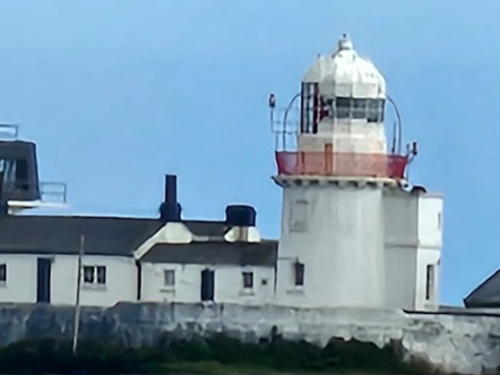
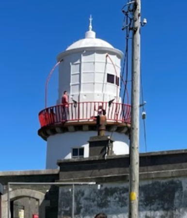
1835 (station established 1817). Active; focal plane 30 m (98 ft); flash every 3 s, white or red depending on direction. 15 m (49 ft) round masonry tower with lantern and gallery, painted white. Tower attached to 2-story and 1-story keeper's houses enclosed by a stone wall. Simon Aspell's photo is at right, Trabas has Rainer Arndt's closeup photo, John Finn has an excellent photo, Goulding has a page with several photos, a 2008 closeup is available, Marinas.com has aerial photos, Huelse has a historic postcard view, and Google has a satellite view and a distant street view. The original lighthouse was relocated as the Duncannon North Light (see the Eastern Ireland page). The lighthouse was automated in 1995 and in 1998 one of the keeper's houses was leased to the Sirius Arts Centre as a residence and studio for visiting artists. The fog horn was deactivated in January 2011 but the light is displayed during the daytime when the visibility is poor. CIL opened the lighthouse to the public for the first time on 4 June 2017 to mark its 200th anniversary and in connection with the city's Harbour Festival. Located on a sharp promontory on the east side of the entrance to Cork Harbour. Accessible by a short walk from a parking area. Site open, tower closed except for an occasional open house. Operator: Commissioners of Irish Lights. . ARLHS IRE-061; CIL-0250; Admiralty A5718; NGA 6356.
[White Bay Range Front]
Date unknown. Active; focal plane 11 m (35 ft); red light occulting once every 5 s, synchronized with the rear light. 1.8 m (6 ft) square metal building, painted white; the light is shown through a window. Trabas has a closeup photo, Warner Athey has a view from the sea (the light is at the far left), and Bing has a satellite view. Located on the east shore of Cork Harbour about 2 km (1.25 mi) north of Roche's Point. Site and tower closed (private property). Operator: Port of Cork. Admiralty A5722; NGA 6360.

Roches Point Light, Youghal, July 2023
Google Maps photo by Simon Aspell
[White Bay Range Rear]
Date unknown. Active; focal plane 21 m (69 ft); red light occulting once every 5 s, synchronized with the front light. 2.5 m (8 ft) square metal building, painted white; the light is shown through a window. Trabas has a closeup photo and Bing has a satellite view. Located 113 m (371 ft) northeast of the front light. Site and tower closed (private property). Operator: Port of Cork. Admiralty A5722.1; NGA 6364.
Spit Bank
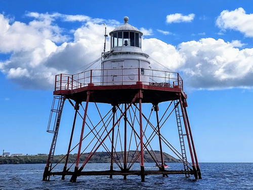
1853 (Alexander Mitchell). Active; focal plane 10 m (33 ft); white or red light, depending on direction, 2 s on, 2 s off. 10.5 m (35 ft), lantern and watch room atop a platform supported by nine cast iron piles. Light tower painted white, piles and platform painted red. Kevin Blake's photo is at right, Trabas has an excellent photo by Rainer Arndt, Bash has a 2005 photo, and Google has a satellite view and a very distant street view. Missing from many listings of Irish lighthouses, this is an exceptionally rare and historic light tower. Alexander Mitchell designed the first successful screwpile lighthouse for installation at Wyre, Lancashire, in 1840. The only survivors of Mitchell's design are three Irish lighthouses: this lighthouse, the Dundalk Light in County Louth, and the Moville Light in Lough Foyle. The lighthouse was restored by a major project in the summer of 2013. Located at the end of a long mud bar in Cork Harbour south of Cobh, marking a sharp turn in the main ship channel. Safely accessible only by boat, although the bar is sometimes exposed at unusually low tides. Goulding found that the best view of the light is from the extreme east end of the Cobh waterfront. Site and tower closed. Operator: Port of Cork. . ARLHS IRE-078; Admiralty A5736; NGA 6380.
* Blackrock Castle
1582 (rebuilt in 1722 and 1829). Inactive since 1903. Stone castle with a round main tower (currently topped by the dome of an astronomical observatory) and a more slender and taller tower. Lorenzo Biguzzi has a fine photo, Werner Günther has a 2019 photo, and Google has a street view and a satellite view. Peat fires were lit atop the castle to guide ships at least since 1608, when James I transferred the tower to local control. By the nineteenth century lights were displayed through a window of the taller tower, which came to be known as the Lighthouse Tower. In the 20th century the castle was privately owned. It was in poor condition when the Cork Corporation purchased it in 2001. Completely restored, the castle now houses a restaurant, a Cork Institute of Technology research facility, and the Blackrock Castle Observatory, which offers astronomy programs for the public. Located on a promontory on the southside of the entrance to the River Lee and Cork's inner harbor. Site and observatory open, tower status unknown. Site manager: Blackrock Castle Observatory.

Spit Bank Light, Cork Harbour, September 2016
photo copyright Kevin Blake; used by permission

Kinsale Area Lighthouses
Kinsale (Cionn tSáile) is a former fishing village, now mostly a resort destination; the permanent population of about 5300 is augment by many tourists in the summer.

*
Charles Fort (2?)
1929 (station established 1804). Active; focal plane 18 m (60 ft); directional light, flash every 5 s, white, red, or green depending on direction. 5 m (17 ft), lantern atop a 1-story equipment building, painted white. Trabas has an excellent closeup by John Eagle, a nice panoramic view is available, Marinas.com has aerial photos, and Google has a street view and a satellite view. The lighthouse is built on one of the ramparts of Charles Fort (Dún Chathail), a star-shaped late 17th century fort; the original (1804) light was displayed through a barracks window. According to CIL lights were exhibited at the fort as early as 1665. This light guides vessels entering Kinsale Harbour. Located on the east side of the harbor. Guided tours of the fort are available daily from mid April to late October; tower closed. Operator: Commissioners of Irish Lights. ARLHS IRE-016; CIL-0210; Admiralty A5712; NGA 6344.
Old Head of Kinsale (1 and 2)
1665. Inactive since 1853. The original lighthouse was a 1-story stone cottage with a brazier for a coal fire on the roof; the coal fire was replaced by a lantern in 1804. In 1814 the old lighthouse was supplanted by a 13 m (42 ft) round stone tower with a semicircular stone keeper's house surrounding the base. Ruins of both the 1665 and 1814 lighthouses remain on the seventh hole (called the Legal Eagle) of the Old Head Golf Links. Peter Goulding has photos, and Google has a satellite view. Site closed to the public. Owner/site manager: Old Head Golf Links. ARLHS IRE-130.
Old Head of Kinsale (3)
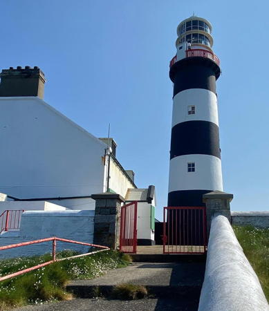
1853 (station established 1665). Active; focal plane 72 m (236 ft); two white flashes every 10 s. 31 m (100 ft) round masonry tower with lantern and gallery, painted with black and white horizontal bands. 2-story keeper's houses and other buildings enclosed by a stone wall. Fog horn (3 blasts every 45 s). A 2023 photo by Alan Boyers is at right, Trabas has a good photo by John Eagle, Joshua Dragotta has a 2000 photo, Dave Walsh has a 2019 drone view, Wikimedia has several photos, Alan Boyers has a portfolio of photos on Instagram, Marinas.com has aerial photos, Huelse has a historic postcard view, and Google has a satellite view. This lighthouse replaced the 1665 and 1814 lighthouses (previous entry), which were found to be too high for good visibility in foggy or low cloudy weather. On 7 May 1915 keepers witnessed the sinking of the RMS Lusitania, torpedoed 17.5 km (11 mi) off the lighthouse by a German submarine. In the 1990s a golf club, the Old Head Golf Links, was built on the Old Head; the light station now stands behind the green of the fourth hole (called the Razor's Edge). Public access to the lighthouse was closed in 1997. This was a matter of great controversy, and on several occasions anarchists of the Workers Solidarity Movement staged mass trespasses (called "peoples' picnics"), climbing the fences and walking through the course to the lighthouse. One people's picnic was held on 22 August 2004 and another on 26 August 2007. However, the Irish Supreme Court has confirmed the golf club's right to close access through its property. More recently the Old Head Signal Tower Project negotiated an agreement to hold a single open house weekend once a year when visitors are taken to the lighthouse by bus. Peter Goulding has photos taken at the May 2014 open house and the photo at right was taken at the 2023 open house. Located at the end of a narrow, rocky peninsula about 7 km (4 mi) south of Old Head and about 20 km (12 mi) south of Kinsale. Site and tower closed. except for tours on open days. Operator: Commissioners of Irish Lights. Site manager: Old Head Golf Links. . ARLHS IRE-055; CIL-0200; Admiralty A5710; NGA 6340.

Old Head of Kinsale Light, Old Head, May 2023
Instagram photo by Alan Boyers
** Galley Head
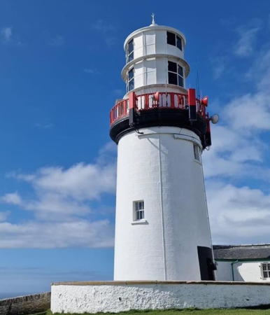
1878. Active; focal plane 53 m (174 ft); five quick white flashes, separated by 2.5 s, every 20 s. 21 m (69 ft) round masonry tower with lantern and gallery. The two 2-story keeper's houses are leased to the Irish Landmark Trust and are available for vacation rental. CIL has a page for the station as one of the Great Lighthouses of Ireland, a 2019 closeup is available, Trabas has a panoramic view by John Eagle, Ned Dwyer has a photo, Marinas.com has fine aerial photos, Martin Šálek has a street view, and Google has a satellite view of the station. Located atop a headland at the southern tip of Dundeady Island, about 8 km (5 mi) southeast of Rosscarbery. The island is connected to the mainland by a narrow isthmus, and the station is accessible by road. Site open, tower closed. Operator: Commissioners of Irish Lights. Site manager: Irish Landmark Trust. . ARLHS IRE-035; CIL-0160; Admiralty A5708; NGA 6332.

Cape Clear Area Lighthouses
* [Baltimore Beacon (Barrack Point)]
1849. Daybeacon, never active as a lighthouse. Round stone tower topped by a short mast with a ball topmark. Tower painted white, mast and topmark red. Par Andersson has a closeup photo, Alan Cotter has a good photo, Sascha Abraham has a street view, and Google has a satellite view of the beacon. Wikipedia's article on Baltimore has a photo and describes the history of the beacon. Local residents sometimes call it "Lot's Wife" due to its resemblance to a pillar of salt. Located on a headland about 3 km (2 mi) southwest of the village of Baltimore, marking the entrance to the harbor. Accessible by road; the spectacular view makes this a popular site for tourists. Site open, tower closed. Site manager: Commissioners of Irish Lights. . CIL-0090.
* Barrack Point (Sherkin Island, Inisherkin)
1885. Active; focal plane 40 m (130 ft); two flashes every 6 s, white or red depending on direction. 8 m (27 ft) round cylindrical cast iron tower with lantern, painted white. 1-1/2 story keeper's house. Trabas has a photo by John Eagle that shows this lighthouse and the view across the narrow entrance of Baltimore Harbour to the Baltimore Beacon (previous entry). Steve Brett's view from the other side of the strait shows the keeper's house, Sven Pauli has a 2023 photo, Matthias Burkhardt has a street view, and Google has a satellite view of the station. The light was automated in the 1970s. Located on a headland at the eastern entrance to Baltimore Harbour and the western entrance to Horseshoe Harbour on Sherkin Island (Inisherkin). The island is accessible by passenger ferry from Baltimore. Site open, tower closed. Operator: Cork County Council (Baltimore/Skibbereen Harbour Commissioners). ARLHS IRE-036; Admiralty A5705; NGA 6324.

Galley Head Light, Dundeady, April 2023
Instagram photo by Galley Head Lighthouse
* Cape Clear (Cléire)
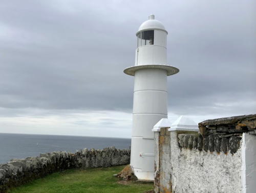
1818. Inactive since 1854. Approx. 12 m (40 ft) round stone tower; lantern removed. Allison Yoshimura has a closeup photo, Brian Lynch has a good photo, Rob O'Farrell has a closeup street view, and Google has a satellite view. This lighthouse became redundant with the completion of the first Fastnet lighthouse in 1854. The tower was used as a lookout tower during World War II. In recent years the tower has been owned and maintained by the Doyle family. In 2004, the 150th anniversary of the first Fastnet Light, the museum placed a commemorative plaque at the older Cape Clear light. Located high on a cliff on the southeast side of Cape Clear Island, Ireland's southernmost community. The island is accessible by passenger ferry from Baltimore. Site open, tower closed. Owner/site manager: private. ARLHS IRE-117.
Copper Point (Long Island)
1864 (not lighted until 1977). Active; focal plane 16 m (52 ft); three quick white flashes every 10 s. 14 m (46 ft) round solid stone tower topped by a light on a short mast. Tower painted white. Access to the light is by an external ladder. Trabas has a good photo by John Eagle, a closeup photo is available, Goulding's page has several photos taken from the Clear Island ferry, Marinas.com has aerial photos, and Google has a satellite view.This is a historic daybeacon to which a light has now been added. Located at the eastern tip of Long Island marking the entrance to Schull from Roaringwater Bay. Accessible only by boat (Long Island has a few residents but there is no ferry service). Site open, tower closed. Operator: Commissioners of Irish Lights. ARLHS IRE-019; CIL-0050; Admiralty A5703; NGA 6312.
[Little Goat Island]
1864. Unlit daybeacon. 7.5 m (25 ft) round stone tower with a conical top. This smaller tower was built under the same contract as the Copper Point beacon. Michael Reilly has a 2023 drone view and Google has a satellite view. Located on the southern tip of the island, about 2 km (1.25 mi) west southwest of the western tip of Long Island. Accessible only by boat. Site open, tower closed. Owner: Commissioners of Irish Lights. CIL-0020.

Fastnet and Crookhaven Lighthouses
Fastnet (Carraig Aonair) (2)
1904 (designed by William Douglass and built by James Kavanagh). Station established 1854. Active; focal plane 49 m (160 ft); white flash every 5 s. 54 m (176 ft) tapered round granite tower with lantern and double gallery, painted white. The original (and unique) 2-tiered 1st order Chance Brothers Fresnel lens focused 2.5 megacandelas of light with a range of 45 km (28 mi). Sadly, and despite the protests of lighthouse fans, this historic lens was replaced by a weaker LED optic in 2018. Fog horn (4 blasts every 60 s). Richard Webb's photo is at the top of this page, Trabas has an aerial photo by John Eagle, Benjamin Ledabyll has a 2023 photo, Wikimedia has numerous photos, Marinas.com has excellent aerial photos, Huelse has a historic postcard view, and Bing has a satellite view. Ireland's tallest and southernmost lighthouse and surely one of the world's great lighthouses, Fastnet is a landfall light for ships arriving from America and for Irish immigrants to America it was their last sight of their former home country. Huelse also has a postcard view of the original lighthouse. The present tower took five years to build using over 2000 huge granite blocks intricately and carefully interlocked to withstand the force of the waves. The shore station at Crookhaven is seen in Brian Lynch's photo at right. There are displays on the lighthouse and its construction at the Mizen Head Signal Station Visitor Centre. Located on a rocky islet 13 km (8 mi) southeast of Crookhaven and 5 km (3 mi) southwest of Cape Clear. Acc sessible only by boat or helicopter; distantly visible from Mizen Head and Crookhaven Lights. Boat tours from Cape Clear Island are available in the summer, weather permitting. Site and tower closed. Operator: Commissioners of Irish Lights. . ARLHS IRE-034; CIL-0010; Admiralty A5702; NGA 6308.
Fastnet (Carraig Aonair) (1)
1854. Inactive since 1904. Originally a tall round cast iron tower. When the present lighthouse was built, the 1854 tower was dismantled except for the first story, which became the oil house. This stump of the old tower can be seen clearly in Marinas.com aerial photos. Klaus Huelse has a postcard view of the lighthouse as it appeared before replacement. ARLHS IRE-127.

Crookhaven Light, Crookhaven, March 2017
Google Maps photo by Rene Schoeters
** Crookhaven
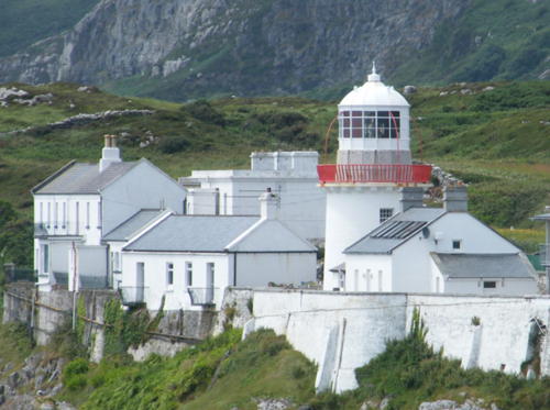
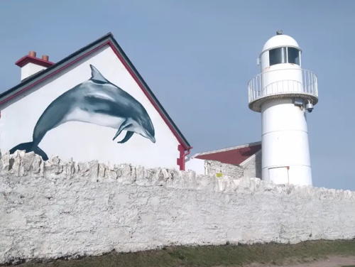
1843. Active; focal plane 20 m (67 ft); one long (2 s) flash every 8 s, red or white depending on direction. 14 m (46 ft) round cylindrical masonry tower, painted white. Rene Schoeters's photo is above right, Trabas has a fine closeup, Daniel Lanfranchi has a closeup, Marinas.com has aerial photos, and Google has a street view and a satellite view. This was also the shore station for Fastnet Light, so it has an unusually large number of buildings, all well preserved. Four keeper's houses are available for vacation rental; a fifth is occupied by a resident attendent. The town of Crookhaven is on a long hooked peninsula enclosing a harbor that opens eastward. Located on Rock Island Point on the north (mainland) side of the harbor entrance. Site open, tower closed. Operator: Commissioners of Irish Lights. Site manager: Crookhaven Lighthouse. ARLHS IRE-023; CIL-2570; Admiralty A6450; NGA 7688.
**** Mizen Head
1959 (fog signal station established 1909). Active; focal plane 55 m (180 ft); white light, 2 s off, 2 s on. 4 m (13 ft) octagonal cylindrical stone tower attached to a 1-story rectangular fog signal building, all painted white. No lantern. The light was formerly displayed from a short mast atop the building; it is now on a short mast in front of the building. Original keeper's house and other buildings. Jessica Curtin's photo is at right, Trabas has a closeup photo by Oliver Schwarze, Goulding's page has closeup photos, Nigel Cox has a distant view, Marinas.com has distant aerial photos, and Google has a satellite view and a street view showing the view. Although there is no tall light tower this is a famous and well-visited station indeed. It marks the extreme southwest corner of Ireland and it is difficult to imagine a more spectacular site. Cloghnane Island, on which the station is built, is linked to the mainland by a spectacular arched reinforced concrete footbridge originally built along with the fog signal in 1909. After the station was automated in 1993 it was leased to the Mizen Tourism Co-operative Society, which has developed a popular visitor center on the mainland and restored the keeper's house on the island. There are displays of lighthouse equipment, buoys, and a display on the construction of Fastnet Light. In 2005 the bridge was closed due to deterioration of the steel supports. In 2009 €1.8 million was allocated to reconstruct the bridge and an exact copy of the original opened to the public in March 2011. Located at the end of the road about 15 km (9 mi) southwest of Goleen. Site open, keeper's house open daily April through October and on weekends in the winter, tower closed. Operator: Commissioners of Irish Lights. Site manager: Mizen Head Signal Station Visitor Centre . ARLHS IRE-053; CIL-2560; Admiralty A6448; NGA 7684.

Mizen Head Light, October 2007
ex-Flickr Creative Commons photo by Jessica Curtin

Bantry Bay Area Lighthouses
Sheep's Head
1968. Active; focal plane 83 m (272 ft); three white flashes every 15 s; red flashes are shown over a narrow sector to the south covering rocks off Three Castle Head. 7 m (23 ft) round cylindrical concrete tower with lantern attached to a small square concrete equipment building. A photo is at right, Trabas has a good photo by John Eagle, a 2018 photo is available, Mike Smyth has a 2021 closeup, Marinas.com has aerial photos, and Google has a closeup street view and an indistinct satellite view. Sibling of Achillbeg Light, County Mayo. The lighthouse was built to guide tankers bound for the oil terminal at Whiddy Island near the eastern end of Bantry Bay. Located high on a steep headland at the western tip of the Sheep's Head Peninsula, marking the southern entrance to Bantry Bay. No road access but the lighthouse can be reached by a hike of about 2.6 km (1.6 mi) on the Sheep's Head Way, a trail that circles the peninsula. Site and tower closed. Operator: Commissioners of Irish Lights. . ARLHS IRE-067; CIL-2550; Admiralty A6432; NGA 7680.
Roancarrigmore (Roancarrig) (1)
1847. Inactive since 2012. Approx. 12 m (40 ft) round tower with lantern and gallery attached to 2-story keeper's house. Lighthouse painted white with a single black band under the gallery. Trabas has a nice photo by John Eagle, Ulrich Hartmann has a distant view, Marinas.com has aerial photos, and Google has a satellite view. In late 2010 CIL announced that the light would be moved to a small stainless steel tower adjacent to the lighthouse and this move was completed in May 2012. The new lighthouse (focal plane 18 m (59 ft); flash every 3 s, white or red depending on direction) has a solar-powered LED light. James Skinner has a closeup photo showing the new light. In 2016 the historic lighthouse and keeper's house were listed for sale at €130,000 and in early 2017 the property was sold. Located on a small islet off the eastern end of Bere Island, marking the eastern entrance to Castletownbere from Bantry Bay. Accessible only by boat; should be visible from the eastern end of Bere Island, which is accessible by road. Site and tower closed (private property). Operator: Commissioners of Irish Lights. ARLHS IRE-060. Active light: CIL-2500; Admiralty A6442; NGA 7660.

Sheep's Head Light, Bantry Bay, August 2021
Google Maps photo by Don S.C
* Castletownbere (Castletown Bearhaven) (2)
1983 (station established 1965). Inactive since 2011. 4 m (13 ft) octagonal concrete equipment room, with the light formerly displayed through the center of a 6 m (20 ft) rectangular concrete panel at the front. Building painted white; the rectangular panel was formerly painted with a large red daymark. CIL has a page for this light, Trabas has a closeup photo, and Google has a satellite view of the two beacons. This light replaced a pair of unlit range beacons. The original light was at the location of the rear beacon, and the present light is at the location of the former front beacon. Located on the west end of Dinish Island, which shelters the harbor of Castletownbere. Site open, tower closed.
* Castletownbere (Castletown Bearhaven) (3)
2010 (station established 1965). Active; focal plane 7 m (23 ft); white, red, or green light, depending on direction, occulting once every 5 s. 6 m (23 ft) octagonal cylindrical concrete tower, painted white with a black vertical stripe. Google has a 2019 street view of the rear of the new light and Google has a satellite view of the two beacons. Prior to 1965 this station had a pair of unlit range beacons. Located on the west end of Dinish Island, which shelters the harbor of Castletown. Site open, tower closed. Operator: Commissioners of Irish Lights. ARLHS IRE-089; CIL-2440; Admiralty A6436; NGA 7644.
Ardnakinna (Bere, Bearhaven)
1850. Reactivated (inactive 1863-1965); focal plane 62 m (202 ft); two flashes every 10 s, white or red depending on direction. 20 m (66 ft) round stone tower with lantern and gallery, painted white. Joe O'Brien's photo is at right, Trabas has John Eagle's view from the sea, another nice view from the sea is available, Marinas.com has aerial photos, and Google has a satellite view. The lighthouse was capped in 1863 and remained in use as a daybeacon until reactivated as a light more than a century later. The lantern added in 1965 was relocated from a decommissioned lightship. Located on a bare rocky cliff at the west end of Bere (Ardnakinna) Island, marking the western entrance to Castletownbere from Bantry Bay. No road access; the station is accessible by a hiking trail described as "rugged." Bere (Bear) Island is accessible by ferry from Castletownbere. Site open, tower closed. Operator: Commissioners of Irish Lights. . ARLHS IRE-003; CIL-2420; Admiralty A6434; NGA 7640.
[Bull Rock Shore Station]
1866. In use until 1939. 2-story keeper's houses, now in use as private residences. Google has a street view and a satellite view. Located on the R572 highway at Dursey Head. Site closed (private property) but the houses can be seen from the street.
[Dursey Point]
1882. Inactive since 1889. This was a temporary light that served after the destruction of the Calf Rock Light (next entry) until completion of the Bull Rock Light. The lighthouse, a lightship lantern mounted on a small wood building, has been demolished, but the stone wall that surrounded the station survives. A.L. Hickey has a 2022 photo (note Calf Rock in the distance) and Google has a satellite view. The Calf Rock and Bull Rock lighthouses can be seen from this location. Located at the southwestern tip of Dursey Island, which is in turn off Dursey Head at the northern entrance to Bantry Bay. The island is accessible from the mainland by cable car, and a hiking trail reaches Dursey Point. Site open.

Ardnakinna Light, Castletownbere, June 2021
Google Maps photo by Joe O'Brien
Calf Rock
1866. Inactive since 1881. The lighthouse, a 31 m (102 ft) cast iron tower, was destroyed by a violent storm on 27 November 1881; the upper portion of the tower was toppled by a wave and fell into the sea. Ruins of keeper's houses and the lower half of the lighthouse survive. Ger Heath has a 2021 photo and Bing has a satellite view of the island. Located about 1.5 km (1 mi) off Dursey Island. Inaccessible. Owner/site manager: unknown. ARLHS IRE-100.
Bull Rock (1)
1889 (station established 1864). Original lighthouse inactive; current light listed with focal plane 83 m (271 ft); white flash every 15 s. 15 m (49 ft) round tower with lantern and double gallery, painted white. Keeper's house and other buildings enclosed by a stone wall. From the photo at right we see that the light was moved atop the fog signal building at the peak of the rock; other sources report that this move occurred after 2012 so the 2006 date on the photo may be a typo for 2016. Trabas has an aerial photo by John Eagle (notice the birds crowding the ledges of the rock), Goulding's page has photos, Nigel Cox has a distant view, Marinas.com has a series of aerial photos, and Bing has a satellite view of the station. This lighthouse replaced a cast iron lighthouse built in 1866 on nearby Calf Rock but destroyed by a storm in 1881. The island is famous for a natural tunnel that bores all the way through the rock. Located about 5 km (3 mi) off the end of Dursey Island. Dursey is accessible from the mainland by cable car, and a hiking trail leads to the west end of the island, from which there is a distant view of the lighthouse. Lighthouse accessible only by helicopter. Site and tower closed. Operator: Commissioners of Irish Lights. . ARLHS IRE-098; CIL-2410; Admiralty A6430; NGA 7636.

Bull Rock Light, County Cork, May 2006 (?)
Google Maps photo by Plinio Lisboa

County Kerry Lighthouses

Iveragh Peninsula Lighthouses
The Skelligs are two small islands about 20 km (12.5 mi) west of Bolus Head. A monastery was established on Great Skellig (Skellig Michael) in the 6th century and the island is now designated as a UNESCO World Heritage Site. Both islands are also famous for their large seabird nesting colonies. Several tour companies offer boat trips to the Skelligs from Valentia Island; one of them, Sea Quest, has posted the history of the Skelligs light station.

Skellig Michael (Skelligs) High
1826. Inactive since 1870. Approx. 7 m (24 ft) round stone tower, in poor condition. Lantern removed. Unroofed ruins of a 2-story stone keeper's house. Michael Herrmann has a photo (fourth photo on the page) and Google has an indistinct satellite view. Located high on the slope of the island above the modern lighthouse (next entry). ARLHS IRE-123.
* Skellig Michael (Skelligs) (Low) (2)
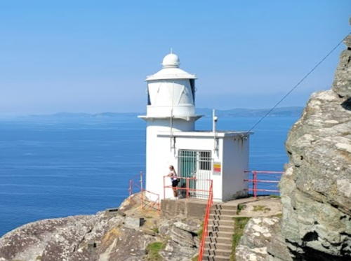
1967 (station established 1826). Active; focal plane 53 m (175 ft); three white flashes, separated by 2.5 s, every 15 s. 12 m (39 ft) round cylindrical (concrete?) tower attached to a 2-story keeper's house. Entire station painted white. The light station is tucked into a notch in the side of a rocky pinnacle, similar to Inishtearaght Light. A photo is at right, Michael Herrmann has photos of the lighthouse and its Fresnel lens, Trabas has a photo by John Eagle taken from above the lighthouse, Wikimedia has a photo (also seen at right) taken from below the light, Marinas.com has aerial photos, and Google has a satellite view. Located on Skellig Michael, the outermost of the islands. Site open, tower closed. Operator: Commissioners of Irish Lights. ARLHS IRE-068; CIL-2390; Admiralty A6422; NGA 7624.
Skellig Michael Light
Skellig Michael Light, Skelligs, October 2006
Wikimedia Creative Commons photo by Jibi44
*** Cromwell Point (Valentia Island, Fort Point)
1841. Active; focal plane 16 m (53 ft); white flash every 2 s; red flashes are shown over a sector to the southeast. 15 m (49 ft) round stone tower with lantern and gallery. 2-story keeper's house. The light station is built within the walls of a 17th century fort. Entire station, including the walls of the fort, painted white. Peter Craine's photo is at right, CIL has a page for the station as one of the Great Lighthouses of Ireland, Trabas has a photo, a 2019 photo of the station is available, Adrian Beney has a view from the water, Marinas.com has aerial photos, Huelse has a historic postcard view, and Google has a street view and a satellite view. A Millennium grant was obtained in 1999 to restore the keeper's house and CIL transferred the house to the Irish Landmark Trust. The tower was opened for tours beginning in June 2013 and the house has been developed as a visitor center. More recently management has been transferred to the Valentia Island Development Company. Located on the northeast point of Valentia (Dairbhre) Island about 4 km (2.5 mi) northwest of Knightstown. The island is accessible by bridge and ferry; the lighthouse is accessible by road and a short walk. Site open, tower open daily Easter through the end of September, weather permitting. Operator: Commissioners of Irish Lights. Site manager: Valentia Island Lighthouse. . ARLHS IRE-077; CIL-2320; Admiralty A6416; NGA 7612.
* Valentia (Directional) (2)
2011 (station established 1913). Active; focal plane 25 m (82 ft); white, red or green light, depending on direction, occulting once every 3 s on, 1 s off. 6 m (20 ft) conical solid concrete tower, painted white with an orange vertical stripe, adjacent to a 1-story white equipment shelter. Trabas has a photo, CIL has a page for the light, and Google has a street view and a satellite view. A daybeacon was built here in 1891; it was replaced by the front light of a range in 1913. The range was replaced by this directional light in 2011. Located on the north coast of Valentia (Dairbhre) Island about 1.2 km (3/4 mi) west of Knightstown. Site open, tower closed. Operator: Commissioners of Irish Lights. ARLHS IRE-090; CIL-2340; Admiralty A6417; NGA 7616.
* [Valentia Shore Station]
Date unknown. These eight townhouse-style dwellings housed the families of the keepers at the Skellig Light and Inishtearaght Light. Google has a street view and a satellite view. The houses have been renovated as holiday homes. Located on the west side of Knightstown. Owner: Trident Holiday Homes Valentia. Site open.
#[Rossbehy (Rossbeigh) Point (Castlemaine Beacon)]
Date unknown (19th century). Unlit daybeacon, destroyed in 2011. Approx. 12 m (39 ft) round stone tower topped by a tall mast. The unpainted tower was rather dilapidated, leaning at about a 10° angle. Graham Horn has a 2008 closeup photo and Google has a satellite view of the former location. The tower is mentioned in the 1866 Admiralty British Islands Pilot, so it was at least that old. In July 2010 CIL announced it would no longer maintain the tower and in February 2011 it succumbed to the attacks of storm waves. Formerly located off the end of a long sand spit at Rossbehy Point, marking the entrance to Castlemaine Harbour from Dingle Bay.

Cromwell Point Light, Valentia, September 2006
Geograph Creative Commons photo by Peter Craine
* [Rossbehy (Rossbeigh) Point (Castlemaine Beacon)] (replica)
2016. Approx. 12 m (39 ft) round stone tower topped by a tall mast. This replica of the historic beacon was dedicated on 3 September 2016. It was built using as many of the original stones as could be salvaged from the sea. Located next to the sports field in the village of Glenbeigh. Google has a street view and a distant satellite view. Site open, tower closed.

Dingle Peninsula Lighthouses
* Dingle (An Daingean) Harbour
1885. Active; focal plane 20 m (66 ft); green flash every 3 s. 7 m (24 ft) round cast iron tower. Keeper's house and other buildings enclosed by a stone wall. Fionn O'Brien's photo is at right, Trabas has a photo by Kees Aalbersberg, Greg Stringham has a 2021 photo, Peter Church has a distant view, Nati Poletti has a street view, Marinas.com has aerial photos, and Google has a satellite view and a very distant street view. Located on the east side of the entrance to Dingle Harbour from Dingle Bay, about 3 km (2 mi) off the N86 highway southeast of Dingle. Accessible by hiking path and there's a distant view from the end of the road in Beenbawn. Operator: Dingle Fishery Harbour Centre. . ARLHS IRE-102; Admiralty A6410; NGA 7604.
[Eask Tower]
1847. Daybeacon, never lit. 12 m (40 ft) round solid stone tower. A small wooden arm on the side of the tower points the way to the harbor entrance. Rich Roesing has a closeup photo and Google has a satellite view. The tower was originally 8 m (27 ft) tall but it was extended sometime around 1900. The entrance to Dingle Harbour is hidden from sailors in the bay and the beacon helped prevent confusion over its location. Located atop Carhoo Hill, a steep bluff about 100 m (330 ft) above Dingle Bay and about 800 m (1/2 mi) west of the harbor entrance. This location is on private property but the owner allows hikers to climb the hill for a small fee.

Dingle Harbour Light, Dingle, September 2017
ex-Google Plus photo
by Fionn O'Brien
Inishtearaght (Tearaght Island)
1870. Active; focal plane 84 m (275 ft); two white flashes, separated by 4.2 s, every 20 s; light shown by day when visibility is poor. 17 m (56 ft) round stone tower with lantern and gallery attached to a 1-story keeper's house complex. The original rotating 1st order Fresnel lens continues in use. Mika Laureque's photo is at right, Trabas has a good aerial photo by John Eagle, Jolande Rommens-Musquetier has a view from the sea, Andrew Collins has photos, including photos of the lens, Marinas.com has aerial photos, and Google has a satellite view. A spectacular site: the lighthouse and keeper's houses are built on ledges cut into a steep rocky pinnacle. The station took six years to build. This is the westernmost lighthouse, not just in Ireland but in all of Europe (Iceland excluded). In 2003 the rotating mechanism was modernized and solar power was installed. Its light now has a range of 35 km (19 nautical miles). Located on Inishtearaght (Tearaght Island), the westernmost of the Blasket Islands, about 22 km (14 mi) southwest of Slea Head, the northern entrance to Dingle Bay. Accessible only by helicopter. Site and tower closed. Operator: Commissioners of Irish Lights. ARLHS IRE-044; CIL-2300; Admiralty A6408; NGA 7600.
Little Samphire Island
1854. Active; focal plane 17 m (56 ft); flash every 5 s, white, red, or green depending on direction. Approx. 12 m (40 ft) round stone tower with lantern and gallery attached to 2-story keeper's house. Tower unpainted; lantern painted white. The station is protected from wave action by a sea wall around three sides. Colm Doyle has a 2022 photo, Nigel Cox has a photo, Trabas has a distant view by John Eagle, Marinas.com has aerial photos, and Google has a satellite view of the station. The lighthouse is no longer on the CIL list; sometime in 2010-11 it was transferred to local harbor authorities. Located on a small islet at the entrance to Tralee Bay about 5 km (3 mi) northwest of Fenit. Site and tower closed, but there are good views from the mainland. Owner: Kerry County Council. . ARLHS IRE-049; Admiralty A6392; NGA 7584.

Inishtearaght Light, July 2019
Wikimedia Creative Commons photo by Mika Laureque

The River Shannon, Ireland's longest river, has an estuary about 100 km (62 mi) long extending from Limerick to the sea. Lying along the southern boundary of County Clare, the Shannon Estuary has been an important and busy waterway throughout Ireland's history. The Shannon Foynes Port near Limerick is Ireland's second largest port.

Shannon Estuary South Side Lighthouse
Tarbert Island
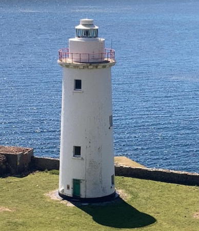
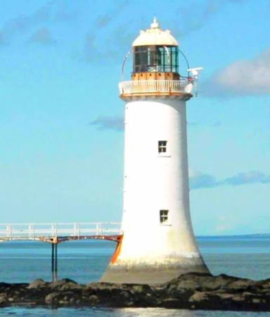
1834. Active; focal plane 18 m (60 ft) (?); white light, 2 s on, 2 s off; red light is shown in a narrow sector westward over Bowline Rock. 22.5 m (74 ft) round limestone tower with lantern and gallery, painted white. A spidery cast iron bridge, built about 1840, connects the tower to shore. Keeper's house apparently demolished. The lighthouse is now dwarfed by the huge smokestacks of an electric power generating plant built immediately behind. Roland Christian Richter's photo is at right, Trabas has a fine photo by John Eagle, a 2010 photo is available, David Moloney has a photo, Goulding has a photo, Marinas.com has aerial photos, and Google has a sea view and a satellite view. Long maintained by CIL, the lighthouse was formally transferred to the Limerick Harbour Commissioners in 1981. However, CIL has a buoy depot nearby and the same attendent manages both facilities. Located on the south (County Kerry) side of the Shannon estuary just north of Tarbert. Site and tower closed, but there are good views from the ferry crossing the Shannon from Tarbert to Killimer. Operator: Shannon Foynes Port Company. . ARLHS IRE-073; Admiralty A6343; NGA 7540.

County Limerick Lighthouses

Shannon Estuary South Side Lighthouses
[Scarlets]
Date unknown. Inactive daybeacon, never lit. Approx. 12 m (39 ft) round stone tower. No photo available but Google has a satellite view and a distant sea view. Built at least by the early 1800s, this historic beacon marks a large shoal on the south side of the estuary. Located near Cratloe. Accessible only by boat. Site open, tower closed.
Spillane's Tower
1885 (tower built 1870). Active; focal plane 11 m (36 ft); white flash every 3 s. 11 m (36 ft) medieval-style castellated square stone tower with a solar-powered light mounted on the top. A closeup photo is available, Trabas has a photo, Google has a sea view, and Google has a satellite view. The Spillane family built the tower to honor William Spillane, mayor of Limerick. The Spillanes were tobacco importers and added the light as a private navigational aid. This light is on the south side of the Shannon near the western edge of the city of Limerick. Site status unknown. Operator: Shannon Foynes Port Company. ARLHS IRE-134; Admiralty A6386.

Tarbert Island Light, Tarbert, April 2018
Google Maps photo by Roland Christian Richter

County Clare Lighthouses

Shannon Estuary North Side Lighthouses
Meelick Range Rear (Meelick #2)
Date unknown. Active; focal plane 9 m (30 ft); red light, 2 s on, 2 s off. 9 m (30 ft) square skeletal tower painted white. Trabas has a closeup photo and Google has an indistinct satellite view. This is the rear light of an upstream range. Located on the north side of the estuary near the Limerick Tunnel Toll Plaza on the N18 expressway. Site status unknown. Admiralty A6374.1.
Crawfrord Range Rear (Crawford #2)
Date unknown. Active; focal plane 10 m (33 ft); white light, 3 s on, 3 s off. 9 m (30 ft) steel tripod with a platform. Upper 2/3 of the tower painted white, lower third green. Trabas has a closeup photo and Google has an indistinct satellite view. This is the rear light of both an upstream and a downstream range. Located at the edge of a farm field near Cratloe. Site status unknown. Admiralty A6365.
Sod Rock
1870. Inactive since the 1950s. 10.5 m (34 ft) tripod wood tower with lantern. Google has a sea view and Bing has an indistinct satellite view. Located on the north side of the estuary about 8 km (5 mi) east of Shannon International Airport. Accessible only by boat. Site open, tower closed.
#Horse Rock (2)
1870 (station established 1853). Inactive since the 1950s; destroyed in 2014. This was a 10.5 m (34 ft) wood tower with lantern, supported by piles. The dilapidated lighthouse was destroyed in the severe Storm Darwin on 12 February 2014. A photo is available and Goulding has photos of the beacon before and after the storm. Google has a satellite view of the location and a 2018 sea view shows that stubs of the pilings remain. Formerly located on the north side of the estuary off Shannon International Airport. Site open.
Beeves Rock
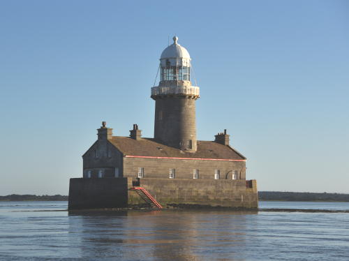
1855 (George Halpin). Active; focal plane 12 m (40 ft) (?); white flash every 5 s; red flashes are shown to the north and northwest. 18 m (60 ft) round stone tower with lantern and gallery rising through the center of a 1-1/2 story stone keeper's house, surrounded by a sea wall at least 4 m (13 ft) high. Tower and keeper's house are unpainted stone; lantern painted white. Mika Laureque's photo is at right, Trabas has a good closeup by John Eagle, Luis Alberto Kalife has a photo, a 2023 photo is available, Marinas.com has aerial photos, and Google has a satellite view. The listed focal plane height seems too low. The lighthouse replaced a stone daybeacon built in 1816. Long maintained by CIL, it was transferred to the Limerick Harbour Commissioners in 1981. Located in the Shannon estuary off the mouth of the Fergus estuary, north of Askeaton. Accessible only by boat. Site and tower closed. Operator: Shannon Foynes Port Company. ARLHS IRE-008; Admiralty A6348; NGA 7576.

Beeves Rock Light, September 2019
Wikimedia Creative Commons photo by Mika Laureque
 
* Scattery Island (Rineana)
1872. Active; focal plane 15 m (50 ft); two white flashes every 8 s. 12.5 m (41 ft) round stone tower with lantern and gallery, painted white. The 1-story keeper's house nearby appears abandoned. A closeup photo is at right, Trabas also has a good closeup photo by John Eagle, the Clare Library has a page for the lighthouse, another closeup is available, Richard Clune has a photo, Marinas.com has aerial photos, and Google has a sea view and a satellite view. The Fresnel lens, removed when the lighthouse was converted to solar power in 2002, is on display at the Scattery Island Centre in Kilrush. Scattery Island (Inis Cathaigh), site of a sixth century monastery, is now a nature reserve; tours of the island are available from Kilrush. Among the ruins on the island is a 36 m (118 ft) round tower, one of the best examples of these early medieval towers in Ireland. Scholars dispute the purpose of the round towers; they were not used as lighthouses, but this one was certainly a fine daybeacon before the lighthouse was built. Lighthouse located on the south side of the island in the Shannon estuary about 8 km (5 mi) southwest of Kilrush. Site open, tower closed. Operator: Commissioners of Irish Lights. ARLHS IRE-066; CIL-2280; Admiralty A6342; NGA 7536.
* Querrin Quay (Corlis Point Range Rear)
1998. Active; focal plane 28 m (92 ft); white light occulting once every 5 s. 24 m (79 ft) square skeletal tower with gallery, painted white. Trabas has a closeup photo, Goulding has a page for the lighthouse, and Google has a distant sea view, a street view and an indistinct satellite view. This is the entrance range for the Shannon estuary. Located at Querrin Quay about 2 km (1.2 mi) northeast of the front light. Site open, tower closed. Operator: Commissioners of Irish Lights. ARLHS IRE-021; CIL-2240; Admiralty A6340.51 NGA 7534.

Scattery Island Light, River Shannon
County Clare Tourism Forum photo (no longer online)
[Corlis Point (Range Front)]
1998. Active; focal plane 9 m (30 ft); white light occulting once every 5 s. Light mounted on a short mast atop a 1-story white concrete equipment shelter. Trabas has a closeup photo, Goulding has a page for the lighthouse, and Google has a satellite view. This relatively new range guides vessels on the Shannon Estuary Entrance Channel. Located on Corlis Point about 5 km (3 mi) west of Querrin. Site status unknown. Operator: Commissioners of Irish Lights. ARLHS IRE-020; CIL-2230; Admiralty A6340.5 NGA 7533.
Kilcredaun (Kilcredan) Head
1824. Inactive since 2011. 13 m (43 ft) round stone tower with lantern and gallery attached to a 1-story keeper's house. Lighthouse painted white. A 2011 photo are available, Goulding has a page for the lighthouse, Marinas.com has aerial photos, and Google has a sea view and a satellite view. Located on a promentory on the north side of the Shannon estuary about 5 km (3 mi) south of Carrigaholt. Site and tower closed. Owner/site manager: Commissioners of Irish Lights. ARLHS IRE-046; ex-Admiralty A6340; ex-NGA 7532.
*** Loophead (Loop Head) (3)
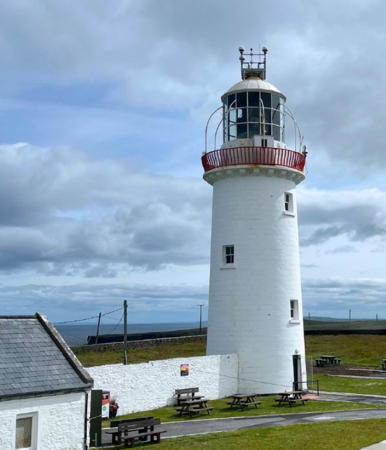
1854 (station established about 1670). Active; focal plane 84 m (277 ft); four white flashes, separated by 2.4 s, every 20 s. 23 m (75 ft) round masonry tower with lantern and gallery, painted white. 1st order Fresnel lens in use. Two 2-story keeper's houses and other buildings. Mark Waters's photo is at right, CIL has a page for the light station as one of the Great Lighthouses of Ireland, Gordon Ryan has a sunset photo, Trabas has a fine closeup photo, Marinas.com has aerial photos, and Google has a street view and a satellite view. This famous light station marks the north side of the entrance to the estuary of the River Shannon. The original lighthouse, a stone cottage with a brazier for a coal fire on the roof, was replaced by a conventional lighthouse in 1802. Part of the wall of the cottage light survives. One of the keeper's houses has been renovated and is available for vacation rental; another is occupied by a resident attendent. In July 2011 the lighthouse was opened to the public for the first time. This experimental opening was such as success it was decided to open the lighthouse regularly beginning summer 2012 with development of a small museum on site. In April 2020 the Clare County Council signed a 25-year lease of the light station and began a major restoration project that closed the lighthouse for the 2020-21 seasons. The lighthouse reopened in July 2022. In 2021 plans were announced to restore the keepers' houses and upgrade visitor facilities; planning approval was granted for this project in April 2024. Located atop a vertical cliff on a sharp promentory at the end of the R487 highway about 8 km (5 mi) southwest of Kilbaha. Site open; tower open daily mid March thorough mid November. Operator: Commissioners of Irish Lights. Site manager: Clare County Council (Loop Head Lighthouse). . ARLHS IRE-050; CIL-2130; Admiralty A6338; NGA 7528.
Loophead Light
Loophead Light, Kilbaha, September 2006
Flickr Creative Commons photo by Mark Waters

Galway Bay South Side Lighthouse
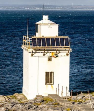
* Black Head (Blackhead Clare)
1936. Active; focal plane 20 m (67 ft); white flash every 5 s; red flashes are shown over rocks to the east. 8.5 m (28 ft) square cylindrical concrete (?) tower with lantern and gallery, painted white. No traces of keeper's houses; presumably this light was automated from the beginning. Laurenz Bobke's photo is at right, Trabas has an excellent closeup by John Eagle, Marinas.com has aerial photos, and Google has a street view and a satellite view. This light is known as "Blackhead Clare" because there is also a Blackhead Light in County Antrim, Northern Ireland. The light was built by CIL at the request of the Galway Harbour Commissioners, who agreed to maintain it. In 1952 the Commissioners informed CIL that due to financial difficulties they would have to discontinue the light unless CIL could assume its maintenance. After several years of negotiation CIL did acquire the lighthouse in 1955. Located just off the spectacular R477 highway along the south shore of Galway Bay, about 7.5 km (4.5 mi) north of Fanore. Site open, tower closed. Operator: Commissioners of Irish Lights. ARLHS IRE-009; CIL-2060; Admiralty A6332; NGA 7500.

Information available on lost lighthouses:

  • Dunkettle (1864-1926), Cork Harbour. This pile lighthouse was destroyed in a collision with the steamship Freddysmith; it was rpelaced by a buoy.  
  • Lough Mahon (1859-1930), Cork Harbour. This pile lighthouse was destroyed in a collision with the steamship Ardmore in January 1930.

Notable faux lighthouses:

Black Head Light
Black Head Light, Fanore, August 2005
Flickr Creative Commons photo
by Laurenz Bobke

Adjoining pages: North: Western Ireland (Connacht) | East: Eastern Ireland (Leinster)

Return to the Lighthouse Directory index | Ratings key

Posted December 2004. Checked and revised September 9, 2023. Lighthouses: 48. Site copyright 2023 Russ Rowlett and the University of North Carolina at Chapel Hill.