Lighthouses of Eastern Ireland (Leinster)

The smaller of the two main British Isles, the island of Ireland is separated from Great Britain to its east by the North Channel, the Irish Sea, and St George's Channel. Ireland came under English rule in the 16th and 17th centuries and in 1801 the United Kingdom of Great Britain and Ireland was formally established. Following decades of struggle most of Ireland (about 7/8 of the island) became independent in 1922. The northern portion remained in the United Kingdom, forming the present United Kingdom of Great Britain and Northern Ireland.

The modern Republic of Ireland (Éire in Irish) includes 26 of the 32 historic counties of the island and has a population of more than 5 million. Some of the historic counties have been divided and there are now 31 county and city units of local government.

The island of Ireland is traditionally divided into four provinces: Leinster in the east, Munster in the southwest, Connacht in the west, and Ulster in the north. These regions have no administrative function but they remain convenient and well-known divisions of the island. The Republic includes all of Leinster, Munster, and Connacht and one county of Ulster. This page covers lighthouses of Leinster (Laighin in Irish, pronounced "Lenster" in English). Along its coast Leinster includes the modern counties of Louth, Meath, Fingal, Dublin City, Dun Laoghaire–Rathdown, Wicklow, and Wexford.

Shipping is heavy along this coast, facing England and Wales across St. George's Channel and the Irish Sea. The coast is guarded by a series of historic and well-known lighthouses maintained by the Commissioners of Irish Lights. Founded in 1786 by the Irish Parliament, the Commissioners maintain lighthouses in both Northern Ireland and the Irish Republic. Less well known are a number of harbor lighthouses, including several rare screwpile lighthouses.

The Irish language is spoken commonly as a first or second language in Ireland. The Irish phrase for a lighthouse is teach solais (plural tithe solais). Oileán (plural oileáin) is an island, cuan is a bay, inbhear is an estuary, rinn is a cape, and chuain is a harbor. A lough (pronounced like the Scottish loch) is a lake or an inlet of the sea.

ARLHS numbers are from the ARLHS World List of Lights. CIL numbers are from the light list of the Commissioners of Irish Lights. Admiralty numbers are from Volume A of the Admiralty List of Lights & Fog Signals. U.S. NGA numbers are from Publication 114.

General Sources
Commissioners of Irish Lights - Aids to Navigation
An interactive map leads to pages for each of the CIL lighthouses.
Pete's Irish Lighthouses
Peter Goulding's informative blog on the lighthouses of Ireland.
Great Lighthouses of Ireland
This website provides information on twelve Irish lighthouses CIL has identified for tourism development. Two (Hook Head and the original Wicklow Head High Light) are in Leinster.
Online List of Lights - Ireland
Photos of Irish lights by various photographers posted by Alexander Trabas.
Ireland Lighthouses
Aerial photos posted by Marinas.com.
Lights of Ireland
Photos by John Eagle posted by Bill Britten on his Lighthouse Getaway site.
Lighthouses in the Republic of Ireland
Photos available from Wikimedia; many of these photos were first posted on Geograph.org.uk.
World of Lighthouses - Ireland
Photos by various photographers available from Lightphotos.net.
Britische Leuchttürme auf historischen Postkarten
Historic postcard images posted by Klaus Huelse. Irish lighthouses are at the bottom of the page.
GPSNavigationCharts
Navigation chart information for Ireland.
Navionics Charts
Navigation chart for Ireland.


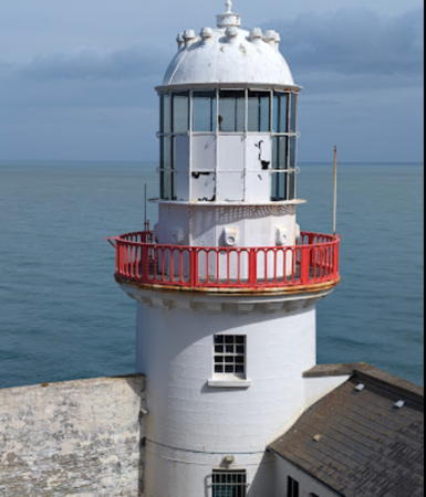
Wicklow Head Light, Wicklow, February 2008
Geograph Creative Commons photo by David Quinn

County Louth Lighthouses
County Louth ( in Irish), the smallest of the Irish counties, encircles Dundalk Bay, an inlet of the Irish Sea. Dundalk, the county town, is a port at the mouth of the Casteltown River. At the north end of the county Carlingford Lough marks the border with Northern Ireland.

Newry River Range Front
Date unknown. Active (?); focal plane 5 m (16 ft); white light, 2 s on, 2 s off. 5 m (16 ft) rubblestone tower with a conical top; the light is shown through a window near the top of the tower. Most of the tower is unpainted, but a rectangular area surrounding the window is painted white as a daymark. Trabas has a photo and Google has a satellite view. These range lights have disappeared from the Admiralty list but Navionics charts them as active. The Newry River forms part of the border between Northern Ireland and the Republic of Ireland, emptying into Carlingford Lough. Located in the river about 1.2 km (3/4 mi) west of Warren Point. Accessible only by boat. Site open, tower closed. ARLHS NTI-036; ex-Admiralty A5946; NGA 6724.
* Newry River Range Rear
Date unknown. Active (?); focal plane 15 m (49 ft); white light, 2 s on, 2 s off. Approx. 10 m (33 ft) rubblestone tower with a conical top; the light is shown through a window near the top of the tower. Most of the tower is unpainted, but a rectangular area surrounding the window is painted white as a daymark. Trabas has a photo, Albert Bridge has a second photo, a view across the river is available, and Google has a satellite view. Located on the south bank of the river about 275 m (300 yd) west of the front light. Site open, tower closed. ARLHS NTI-037; ex-Admiralty A5946.1; NGA 6728.
* Greenore
1830 (George Halpin Sr.). Inactive since 1986. Approx. 11 m (36 ft) round stone tower with lantern and gallery. Lighthouse painted white, gallery rail red. Keeper's cottages in very poor condition. A 2023 Google Maps street view is at right, Goulding has 2014 photos, Eric Jones has a 2018 photo, a 2010 photo is available, the National Inventory of Architectural Heritage has additional photos, the National Library has a historic photo, and Google has a satellite view. This long-abandoned lighthouse has been deteriorating and endangered by poor maintenance, but the street view at right shows recent improvement in its condition. Located off Euston Street near the former ferry terminal on the Greenore waterfront, on the south side of Carlingford Lough. Site and tower closed, but the lighthouse can be viewed from outside the wall. Owner/ site manager: Greenore Port. . ARLHS IRE-037.
* [Gyles Quay Pier]
Date unknown. Active; focal plane about 12 m (39 ft); green flash every 3 s. Approx. 6 m (20 ft) square stone tower. Trabas has a photo, a more distant photo is available, and Bing has a satellite view. Located at the end of the pier at White House Point on the north side of Dundalk Bay. Accessible by walking the pier. Site open, tower closed. Admiralty A5926.
Dundalk
1855 (Alexander Mitchell). Active; focal plane 10 m (33 ft); flash every 15 s, white or red depending on direction; a green light occulting once every 5 s is shown over a narrow sector to the southeast from a focal plane of 8 m (26 ft). 10 m (33 ft) lantern and watch room mounted on an octagonal platform supported by piles. Lantern painted white, pilings painted red. Fog horn (3 blasts every 60 s). Trabas has a closeup photo by Al Morris and Bing has a satellite view. One of only three pile lighthouses still in service in the British Isles; the other two are also in Ireland, the Spit Bank Light at Cork (see the Southwestern Ireland page) and the Moville Light near Londonderry (see the Western Ireland page). A new solar-powered light with reduced range was installed in June 2011. Located at the entrance to Dundalk Harbour from Dundalk Bay. Accessible only by boat. Site and tower closed. Operator: Dundalk Port Company. ARLHS IRE-094; ex-CIL-1000; Admiralty A5920; NGA 6696.
* Aleria (Drogheda)
1936. Active; focal plane 11 m (36 ft); quick-flashing green light. 10 m (33 ft) concrete pedestal atop a round solid stone beacon. The stone is unpainted; the pedestal is white. Trabas has a photo showing restoration of the stonework in progress, Patrick McDonagh has a 2011 photo, Marinas.com has aerial photos, and Google has a satellite view. A similar stone beacon, unlighted, marks the north edge of the channel, and a view along the jetty shows both beacons. Located at the end of a rubblestone jetty on the north side of the entrance to the River Boyne about 7 km (4.5 mi) east of Drogheda. Site open, tower closed. Operator: Drogheda Port Company. ARLHS IRE-136; Admiralty A5912; NGA 6692.
 

Greenore Light, Greenore, May 2023
Google Maps street view

County Meath Lighthouses
County Meath is mostly an inland county; it has a short coast extending south from the mouth of the River Boyne. The river flows through the port of Drogheda, most of which is in County Louth.

* Drogheda North (2)
About 1880 (station established 1842). Recently inactive. 7 m (23 ft) octagonal pyramidal cast iron tower with lantern and gallery. Lantern painted white, skeletal tower black. 1-story keeper's house and other light station buildings. Goulding's page has photos, Martin Cashman has a 2017 photo, and Google has a street view and a satellite view. The three Drogheda lighthouses were built to guide ships entering the River Boyne and the port of Drogheda. In October 2016 the Drogheda Port Company began a restoration of the lighthouse. The surrounding area is being developed but the lighthouse sites have been set aside as special protected areas. Located on the south side of the river entrance near Mornington, about 6 km (4 mi) east of Drogheda. Site and tower closed (private property), but the lighthouse can be viewed from nearby. Operator: Drogheda Port Company. ARLHS IRE-103; ex-Admiralty A5911.
* Drogheda West (Range Rear) (2)
About 1880 (station established 1842). Inactive since 2000. 8 m (26 ft) octagonal cylindrical cast iron tower with lantern and gallery. Lantern painted white, skeletal tower black. 1-story keeper's house. Goulding's page has 2013 photos and Google has a street view and a satellite view. The three Drogheda lighthouses were built to guide ships entering the River Boyne and the port of Drogheda and the two range lights were built on rails so that their position could be adjusted to fit changes in the entrance channel. The surrounding area is being developed but the lighthouse sites have been set aside as special protected areas. Trabas has a photo of the directional light (Admiralty A5910.5, NGA 6682) that has replaced the range lights. Located 85 m (280 ft) west of the front light. Site and tower closed (private property), but the lighthouse can be viewed from nearby. Owner/site manager: unknown. ARLHS IRE-025; ex-Admiralty A5910.1.
* Drogheda East (Range Front) (2)
About 1880 (station established 1842). Inactive since 2000. 7 m (23 ft) octagonal pyramidal cast iron tower with lantern and gallery, painted black. A brick wall surrounds the lighthouse. Kieran Campbell's photo is at right, Goulding's page has 2013 photos, Martin Cashman has a 2017 photo, and Google has a street view and a satellite view. The three Drogheda lighthouses were built to guide ships entering the River Boyne and the port of Drogheda and the two range lights were built on rails so that their position could be adjusted to fit changes in the entrance channel. The surrounding area is being developed but the lighthouse sites have been set aside as special protected areas. Located at the end of Coney Hall Road, on the south side of the river entrance near Mornington, about 6 km (4 mi) east of Drogheda. Site open, tower closed. Owner/site manager: unknown. ARLHS IRE-024; ex-Admiralty A5910.
Drogheda East Light
Drogheda East Light, Drogheda, September 2007
Geograph Creative Commons photo by Kieran Campbell

County Fingal Lighthouses
In 1994 the historic County Dublin was divided into four council areas. County Fingal comprises roughly the northern half of the former County Dublin.
* Balbriggan
1769. Active; focal plane 12 m (39 ft); directional light: three flashes every 20 s, white, red, or green depending on direction. 11 m (36 ft) round stone tower with lantern and gallery attached to a 1-story keeper's house. The original lantern was removed around 1960 and the light was displayed from a short mast atop the capped tower. Lighthouse painted white. A 2019 photo is at right, Jim Gallagher has a street view from the west breakwater, and Google has a satellite view. Huelse has a historic postcard view showing the original appearance of the lighthouse. This is Ireland's second oldest active lighthouse, after Hook Head; it was built by a local nobleman, Baron George Hamilton, to promote commercial development of the port. Fingal County Council made plans to restore the lighthouse and replace the lantern. By 2012 the lighthouse was repainted and refurbished but no funds had been secured for the lantern. In 2015 it was announced that funding for a lantern had been secured. Restoration of the lighthouse was underway in the fall of 2017 and installation of the new lantern took place sometime around the beginning of 2018. Trabas has a closeup photo by John Eagle showing the lighthouse before its lantern was installed, William Murphy also has a photo, Marinas.com has aerial photos, and Google has a 2010 street view. Located at the end of Lighthouse Quay in Balbriggan, a town 34 km (21 mi) north of Dublin; accessible by walking the short quay. Site open, tower closed. Operator: Dublin Port Company. . ARLHS IRE-004; Admiralty A5908; NGA 6672.
* Skerries Bay Pierhead
Early 1980s (station established 1878). Active; focal plane 7 m (23 ft); red light occulting once every 6 s. 7 m (26 ft) square equipment room, painted white, mounted atop the concrete pier; the light is displayed through a window. Trabas has a photo, Goulding has a distant 2014 photo, Piers Scott has a street view, and Google has a satellite view. Located at the end of the breakwater pier in Skerries. Site open, tower closed. Operator: unknown. ARLHS IRE-138; Admiralty A5906; NGA 6668.

Balbriggan Light, Balbriggan, June 2019
Wikimedia Creative Commons photo by Dzakharov
Rockabill
1860. Active; focal plane 45 m (148 ft); flash every 12 s, white toward the sea and red toward the land. 32 m (105 ft) round granite and limestone tower with lantern and gallery, painted white with one broad black horizontal band. Fog horn (4 blasts every 60 s); light is shown when the horn is operating during the day. 2-story keeper's house and other buildings. Goulding has a page with 2014 photos, Marinas.com has good aerial photos, Trabas also has an aerial photo by John Eagle, Huelse has a historic postcard view, and Google has a good satellite view. Goulding also has a page for the onshore keeper's cottages in Skerries; they were sold as private residences around 1975 (Google has a street view and a satellite view). Located on the larger of two small rocky islands about 5 km (3 mi) east of Skerries, northeast of Dublin. Accessible only by boat or helicopter; Skerries Sea Tours offers boat tours to the lighthouse, and there are distant views from Skerries. Site and tower closed (sensitive bird sanctuary). Operator: Commissioners of Irish Lights. ARLHS IRE-062; CIL-0960; Admiralty A5904; NGA 6664.
* Howth Harbour (1)
1818 (John Rennie). Inactive since 1982. 10 m (33 ft) round stone tower with lantern and gallery, attached to a 2-story stone keeper's house. Tower unpainted; lantern painted white, gallery rail red. The station is partly surrounded by a semicircular stone sea wall, which formerly protected an artillery position. A photo is at right, a nice 2006 photo and a 2008 photo are available, Mike Giles has a 2022 photo, Marinas.com has aerial photos, and Google has a street view and a satellite view. The lighthouse continues to be well maintained as a daybeacon. This is one of a pair of lighthouses designed by John Rennie to guide packet boats sailing beween Howth Harbour and Holyhead Harbour, Anglesey (see Wales for the twin lighthouse). Howth Head is a peninsula marking the north side of Dublin Bay; Howth is a town on the northeast face of the peninsula. Located at the end of the east pier at Howth Harbour. Site appears open, tower closed. Site manager: Dublin Port Company. . ARLHS IRE-126.
* Howth Harbour (2)
1982 (station established 1818). Active; focal plane 13 m (43 ft); two flashes every 7.5 s, white shown southeastward over the harbor entrance and red in other directions. 10 m (33 ft) round cylindrical concrete tower with gallery; light displayed from a short mast. The tower is white; gallery rail painted red. Trabas has John Eagle's photo, a photo showing both lighthouses is available, Goulding has a closeup photo, and Google has a distant street view and a satellite view. Located on a spur of the Howth East Pier, near the old lighthouse. Site open, tower closed. Operator: Dublin Port Company. ARLHS IRE-039; CIL-0900; Admiralty A5900; NGA 6656.
Howth Harbour Lighthouse
1818 Howth Harbour Light, Dublin, March 2014
Flickr Creative Commons photo by Zruda
* Baily
1814. Active; focal plane 41 m (134 ft); white flash every 15 s. 13 m (42 ft) round granite tower with lantern and gallery, centered on a round keeper's house. Tower unpainted; lantern painted white, gallery rail red. 375 mm lens; the 1st order Fresnel lens used 1902-1972 is on display at the National Maritime Museum of Ireland in Dún Laoghaire. Paolo Adamoli's photo is at right, Trabas has a closeup by Ian Dawson, Tom Cosgrave has a photo, Mindaugas Viršilas has a 2021 drone view, Marinas.com has aerial photos, Huelse has a historic postcard view, and Google has a satellite view. This historic and famous light station, often called simply "The Baily," replaced a 1667 cottage-style lighthouse high atop Howth Head. The lighthouse is surrounded by buildings, including a 2-story principal keeper's house built in 1953 (occupied by a resident attendent), two 1892 assistant keeper's houses (sold as private residences in 1995) and a 3-story building used as a school for supernumerary assistant lightkeepers from 1973 to 1995. In 1997 the lighthouse was the last in Ireland to be automated. The station is the helicopter base for Kish Bank and Rockabill Lights and has radar and communications equipment operated by the Dublin Port Company for port control. In 2012 the former lightkeepers school was leased by Decisions [D4H], a company producing software for emergency response team management. Located at the southeastern tip of the Howth Peninsula, which juts into the north side of Dublin Bay. Accessible by road. Site open, tower closed. Owner: Commissioners of Irish Lights. Operator: Dublin Port Company. . ARLHS IRE-040; ex-CIL-0890; Admiralty A5898; NGA 6652.

Baily Light, Dublin, March 2022
Google Maps photo by Paolo Adamoli

Dublin City Lighthouses
Ireland's capital city of Dublin (Baile Átha Cliath in Irish) is located on Dublin Bay at the mouth of the River Liffey. The urban area of the city has a population of about 1.25 million.
Lightship Kittiwake (South Rock) (?)
1959. Decommissioned 2007. 40.8 (134 ft) steel lightship; hexagonal skeletal light tower with lantern and gallery amidships. Entire ship painted red. Fog horn (3 blasts every 45 s). Wikimedia has one of William Murphy's photos, Goulding has photos of the ship moored on the north side of the Liffey in October 2008 and William Murphy has a February 2009 photo. The ship was located formerly about 1.2 km (3/4 mi) east of the South Rock lighthouse in Northern Ireland; Marinas.com has aerial photos of the ship on station. Kittywake was decommissioned in 2007. There is a dispute as to its subsequent ownership. Dublin entrepeneur Harry Crosbie says that he bought the ship from CIL in 2007, but the Dublin Port Company (DPC) says it bought the ship from the National Asset Management Agency in 2012. In August 2011 Crosbie's plan to raise the ship onto the North Quay and convert it to a café and bar was rejected. Sometime in 2013 DPC took possession of the ship and moved it to a DPC pier a short distance north of the North Wall Quay. Robbie Cox has closeup photos of the ship at its August 2014 location. The ship appeared abandoned in Bob Passmore's June 2018 photo. However, a March 2020 "Docklands Visitor Experience Development Plan" included restoration of the lightship as one of its goals. DPC states it "plans to renovate the Kittiwake and incorporate the ship into the Pumphouse heritage area at Dublin Port." In May 2021 Crosbie "launched a campaign," according to press reports, to recover his former lightship and in late 2022 he announced he was suing DPC for ownership. In December 2022 DPC lifted the ship from the water for retoration. We don't know where the restoration is occurring. Owner: Dublin Port Company. ARLHS NTI-027; ex-Admiralty A5966; ex-NGA 6772.
North Wall Quay (Dublin Port) (2)
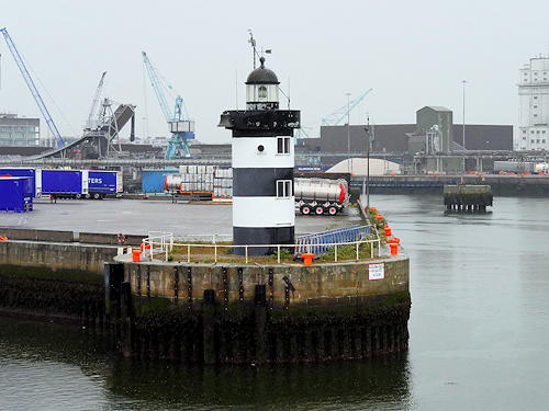
1904 (station established 1820). Active; focal plane 12 m (39 ft); quick white flash every 2 s. 12 m (39 ft) round cylindrical cast iron tower with lantern and gallery, painted black with two white horizontal bands. 5th order Fresnel lens. Trabas has an excellent photo by Douglas Cameron, Gerald England has a view from the sea, Marinas.com has aerial photos, and Google has a satellite view and a street view from across the Liffey. In a 2020 post Goulding has additional information on the history of this station and a drawing of the original lighthouse. Located at the end of the North Wall Quay on the north side of the River Liffey in Dublin, marking the entrance to the Alexandra Basin. Site and tower closed. Operator: Dublin Port Company. ARLHS IRE-109; Admiralty A5894; NGA 6648.

North Wall Quay Light, Dublin, May 2017
Wikimedia Creative Commons photo by David Dixon
#Alexandra Basin East Breakwater
1886. Deactivated and demolished in 2004. Formerly a 16 m (52 ft) square cylindrical brick tower with lantern and gallery, located at the end of the breakwater quay on the north side of the entrance to the River Liffey in Dublin. The lantern and fog bell were saved and there is a plan to display them in a new Industrial Heritage Park nearby. ARLHS IRE-099; ex-Admiralty A5888.
North Bank
1882. Active; focal plane 10 m (33 ft); green light, 7 s on, 1 s off. 11 m (36 ft) square cylindrical tower with lantern and gallery, mounted on concrete piles. Tower painted green, lantern white. A fog bell, hanging from the gallery, is not in use. Trabas has a good photo by Thomas Philipp, C.W. Bash also has a photo, Ronan Browne has a closeup, Goulding has a distant view, Marinas.com has aerial photos, Eirian Evans has an aerial photo, and Google has a satellite view. Located on the north side of the River Liffey entrance channel about 1.5 km (1 mi) west of North Bull Light. Accessible only by boat, but there are views from the walkway along the South Wall on the other side of the channel. Site and tower closed. Operator: Dublin Port Company. . ARLHS IRE-108; Admiralty A5886; NGA 6632.
North Bull
1880. Active; focal plane 15 m (50 ft); three green flashes every 10 s. 15 m (49 ft) round stone tower, painted green with white trim. Lantern removed; the light is displayed from a short mast atop the capped tower. Trabas has a closeup photo by Thomas Philipp, Eirian Evans has a good aerial photo, Goulding has photos taken from the Poolbeg lighthouse, a 2023 closeup is available, Marinas.com also has aerial photos, and Bing has a satellite view. The entrance to the River Liffey is constrained between the South Wall and the North Bull Wall, but the northern wall is designed so that the section leading to the lighthouse is only exposed at low water; the effect of this is that scouring by the ebb tide tends to keep the channel open. Located at the end of the North Bull Wall, opposite Poolbeg Light. Accessible only by boat, but there is an excellent view from Poolbeg Light on the South Wall. Site and tower closed. Operator: Dublin Port Company. . ARLHS IRE-054; Admiralty A5884; NGA 6628.
* Poolbeg (2)
1820 (station established 1768). Active; focal plane 20 m (66 ft); red light, 8 s on, 4 s off, 4 s on, 4 s off. 20 m (66 ft) round stone tower with lantern and gallery. Entire structure painted red. A 2016 photo is at right, Trabas has a great closeup photo by Thomas Philipp, a 2007 closeup is available, Marinas.com has aerial photos, and Bing has a satellite view. In a 2020 post Goulding discusses the history of the station and provides historic drawings of the original lighthouse. Located at the end of the South Wall, a long breakwater that protects the entrance to the River Liffey and Dublin's inner harbor from shoaling. Accessible in good weather by walking the breakwater, a round trip of about 4 km (2.4 mi). Site open, tower closed. Operator: Dublin Port Company. . ARLHS IRE-057; Admiralty A5882; NGA 6620.

Poolbeg Light, Dublin, June 2016
ex-Flickr Creative Commons photo by Nigel S

County Dun Laoghaire-Rathdown Lighthouses
The county of Dun Laoghaire-Rathdown is one of the four council areas created by the division of the historic County Dublin in 1994. Dún Laoghaire (pronounced "dun-LEER-ee"), formerly called Kingstown and sometimes spelled Dunleary, is a port at the south entrance to Dublin Bay; it is also the headquarters of the Commissioners of Irish Lights.
* Dún Laoghaire West
1852. Active; focal plane 11 m (36 ft); two green flashes every 8 s synchronized with the east pier light. 9 m (29 ft) round stone tower with lantern and gallery. Tower unpainted; lantern and gallery painted green with a white horizontal band. Sharon Flynn's photo is at right, Nick Huggins has a good 2007 photo, Trabas has a closeup photo, and Google has a satellite view. The lantern was painted green in 1996. Luis E. Hernández Lorenzana has a 2017 street view that shows the tower wrapped to commemorate the 200th anniversary of Dún Laoghaire Harbour. Lighthouse located at the end of the west pier, a large stone structure. Accessible by walking the pier. Site open, tower closed. Operator: Dublin Port Company. . ARLHS IRE-027; Admiralty A5874; NGA 6604.
#Carlisle Pier (Mailboat Pier) (1)
Date unknown (station established 1908). Demolished in 2009. The light was formerly mounted atop the second story of a 3-story ferry terminal. The abandoned building is seen in Trabas's photo. In September 2009 the building was demolished and the light (focal plane 9 m (30 ft); red flash every 3 s) is now shown from a pole. The Carlisle Pier is on the Dún Laoghaire waterfront near the foot of the East Breakwater. Site open, tower closed. Operator: Dublin Port Company. Active light: Admiralty A5876; NGA 6608.
* Dún Laoghaire East
1847. Active; focal plane 16 m (53 ft); two red flashes every 8 s synchronized with the west pier light. 12.5 m (41 ft) round stone tower with lantern and gallery. Tower unpainted; lantern and gallery rail painted red. Two keeper's houses built on the pier. Trabas has a fine photo by Stephan Hix, William Murphy has a good closeup, Dara Howlett has a 2022 photo, the light is in the background of Sharon Flynn's photo at right, and Google has a street view and a satellite view. The red trim color was added to the lighthouse in 1996. Lighthouse located at the end of the east pier, a large stone structure. Accessible by walking the pier. Site open, tower closed. Operator: Dublin Port Company. . ARLHS IRE-026; Admiralty A5872; NGA 6600.
Muglins
1880 (lighted since 1906). Active; focal plane 14 m (46 ft); red flash every 5 s. 9 m (30 ft) round conical solid stone tower, painted white with one red horizontal band. Access to the light atop the tower is by an external ladder. Trabas has an excellent photo, Goulding has a page with 2014 closeup photos, Ragnars Upenieks has a 2019 photo, Marinas.com has aerial photos, and Google has a satellite view. The light showed a white flash from 1979 to 2008. Located on a rock off Dalkey, southeast of Dublin. Accessible only by boat. Site and tower closed. Operator: Commissioners of Irish Lights. . ARLHS IRE-088; CIL-0800; Admiralty A5868; NGA 6596.

West (foreground) and East Lights, Dún Laoghaire, May 2015
Wikimedia Creative Commons photo by Sharonlflynn
Kish Bank
1965 (lightship station established 1811). Active; focal plane 29 m (94 ft); two white flashes every 20 s. 31 m (100 ft) round concrete and steel tower incorporating keeper's quarters, with lantern and four galleries, topped by a large helipad. Lighthouse painted white with one broad horizontal red band. Cían Hughes has a 2020 photo, Marc Sweeney has a photo, another photo is available, Marinas.com has excellent aerial photos, and Trabas has an aerial photo by John Eagle, but the lighthouse is not shown in Google's satellite view. The construction of this offshore lighthouse was an engineering triumph. Designed by Christiani & Nielsen Ltd., the entire lighthouse was prefabricated so that it fit into its own caisson. After the caisson was sunk into place, the telescoped sections of the tower were raised, and the lighthouse was completed in a little over three months. Located on a notorious rocky shoal southeast of Dublin. Accessible only by helicopter. Site and tower closed. Operator: Commissioners of Irish Lights. . ARLHS IRE-048; CIL-0850; Admiralty A5865; NGA 6592.

County Wicklow Lighthouses
South of Dublin, County Wicklow has a relatively straight coast on the Irish Sea about 65 km (40 mi) in length. The county town of Wicklow is the only important port in the county.

*
Wicklow East Pier
1884. Active; focal plane 11 m (36 ft); flash every 5 s, white or red depending on direction. 7 m (23 ft) round cast iron tower with lantern, painted white with a red horizontal band at the base. 5th order (?) Fresnel lens in use. Andreas Köhler's photo is at right, Trabas has a great closeup photo, Aubrey Dale has an excellent photo, Marinas.com has aerial photos, Lukasz Sauc has a street view along the pier, and Google has a satellite view. The lantern was removed for restoration in April 2023; this included reinstalling the original dome, which had been blown off by a storm in 1976. The lantern was returned to the tower in October. Located at the end of the east pier at Wicklow. Accessible by walking the pier. Site open, tower closed. Operator: Wicklow Port Company. ARLHS IRE-113; Admiralty A5854; NGA 6576.

Wicklow East Pier Light, Wicklow, October 2015
photo copyright Andreas Köhler; used by permission
* Wicklow Head High (1)
1781 (John Trail). Inactive since 1818. 31 m (100 ft) octagonal granite tower; lantern replaced with a brick dome. David Quinn's photo is at right, Davida De La Harpe has a photo of both high lighthouses, Colm Smyth has a 2022 photo, Jerzy Wieczorek has a street view, and Google has a satellite view. This lighthouse and its accompanying low light were discontinued because they were too high to be seen in poor weather. The low light was demolished. Lightning struck this tower in 1863 causing a fire that gutted the interior. Because the tower was useful as a daybeacon it was preserved in 1866 by being capped with a brick dome. In 1996 the Irish Landmark Trust leased the lighthouse, restored the interior of the 6-floor building and made it available for vacation housing. This tower is identified as one of the twelve Great Lighthouses of Ireland. Located about 4 km (2.5 mi) southeast of Wicklow. Accessible by road. Site open, tower open only to paying guests. Site manager: Irish Landmark Trust. ARLHS IRE-084.
* Wicklow Head High (2)
1818 (station established 1781) (George Halpin). Inactive since 1865. Approx. 20 m (66 ft) round stone tower with gallery; lantern removed. Lighthouse originally painted white, but only traces of the paint remain. David Quinn has a fine photo, Davida De La Harpe has a photo of both lighthouses, W.J. Wieczorek has a street view, and Google has a satellite view. This tower occupies nearly the same location as the original (1781) low light. Located about 4 km (2.5 mi) southeast of Wicklow. Accessible by road. Site open, tower closed. Site manager: Commissioners of Irish Lights. ARLHS IRE-083.
* Wicklow Head (Low) (2)
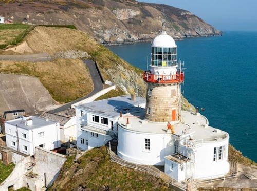
1818 (station established 1781) (George Halpin). Active; focal plane 37 m (121 ft); three white flashes, separated by 2.3 s, every 15 s. 14 m (46 ft) round stone tower with lantern and gallery, painted white; gallery rail painted red. 4th order (?) Fresnel lens. Two 2-story keeper's houses. David Quinn has the excellent photo seen at the top of this page, Trabas has a closeup photo of the lighthouse, Goulding has a page with good photos, Marinas.com has aerial photos, Huelse has a historic postcard view, and Google has a satellite view. This lighthouse was built much lower than its predecessors, which required placing it in a notch cut into the cliff. Site and tower closed but the lighthouse can be viewed from above. Operator: Commissioners of Irish Lights. ARLHS IRE-079; CIL-0700; Admiralty A5850; NGA 6572.
* Lightship Skua (light tower and lantern)
1960. Decommissioned in 2004 and scrapped in 2012. 36.3 m (119 ft) steel lightship; hexagonal skeletal light tower with lantern and gallery amidships. Entire ship painted red. The ship was converted to an automated lightfloat in 1982. It served alternately on the South Rock and Coningbeg stations, but in later years it was moored at Dún Laoghaire as CIL's reserve lightfloat. In December 2004 Skua was declared redundant and listed for sale. It was purchased by Arklow Shipping and in June 2005 the ship was towed to Arklow. However, in January 2006 the ship was once again for sale for £50,000. The ship was apparently sold in the summer of 2007. Goulding has photos of the ship still moored at Arklow on 29 June 2008 and another photo shows it there in March 2009. Sadly, in October 2012 the lightship was in the process of being scrapped. The light tower was removed and restored and is displayed in a roundabout on the south side of the M11 expressway at Junction (exit) 20 on the north side of Arklow. A decorative light is displayed. Adrian Cadden has a closeup photo and Google has a street view and a satellite view. Site open, tower closed. ARLHS IRE-122.
Old Wicklow High Light
1781 Wicklow High Light, Wicklow, February 2008
Geograph Creative Commons photo
by David Quinn
* Lightship Albatross (light tower and lantern)
1925 (H. Robb Ltd, Leith). Decommissioned 1970. 31 m (102 ft) steel lightship; light shown from a round lantern on a slender mast amidships. In 2000 the ship was sold to James Tyrrell and moved to Arklow. The light tower was removed and restored and is displayed on the North Quay in Arklow. Goulding has a photo, Miklós Bereznai has a photo, and Google has a street view and a satellite view. The rest of the ship was returned to Dublin, but in 2011 it was towed to the Medway, off the Thames below London. (The ship is for sale for £70,000.) Site open, tower closed.
 
* Roadstone Jetty (Arklow Head)
Date unknown. Active; focal plane 9 m (30 ft); red light, 8 s on, 2 s off. Light mounted atop a 7 m (23 ft) 2-story corrugated iron building. Trabas has a photo of what might be Ireland's ugliest lighthouse and Google has a satellite view. The Roadstone Jetty serves a large rock quarry at Arklow Head, about 2 km (1.25 mi) south of Arklow Harbour. Located at the end of the jetty. Site open, tower closed. Operator: unknown. Admiralty A5847; NGA 6560.

County Wexford Lighthouses
County Wexford occupies the southeastern corner of Ireland, facing southern Wales across the wide strait of St. George's Channel. The ferry port of Rosslare is the busiest port in the county, and at its southwestern corner the county borders the important port of Waterford Harbour in County Waterford.
* Rosslare Pierhead (2)
1906 (station established 1881). Active; focal plane 15 m (50 ft); directional light: white, red, or green depending on direction, occulting once every 5 s. Approx. 7.5 m (25 ft) round cast iron tower with lantern and gallery, painted red with white trim. Linda Bailey has a photo, Trabas has a photo by John Eagle, another photo is available, Marinas.com has aerial photos, and Google has a satellite view. The first pier light was replaced when a new pier was built in 1906. Rosslare was then, and still is, a major port of entry to Ireland for ferries from Wales, France, and Spain; a 2007 photo shows a Stena Line ferry moored behind the lighthouse. Located at the end of the main pier in Rosslare Harbour. Site status unknown; may be accessible by walking the pier. Operator: Iarnród Éireann (Irish Rail) (Rosslare Europort). ARLHS IRE-064; Admiralty A5842; NGA 6544.
* [Tuskar Rock Shore Station (2)]
1886. 2-story keeper's quarters building. Google has a street view and a satellite view. These quarters housed off-duty keepers and their families until 1973, when the building was sold. Located just off the N25 (E30) highway at La Rochelle Drive, overlooking Rosslare Harbour. Site open, buildings closed. Owner/site manager: private.
* [Tuskar Rock Shore Station (1)]
1815. Four attached 1-story cottages. Google has a street view and a satellite view. These cottages housed off-duty keepers and their families until 1834; thereafter (until 1886) keepers were required to live in the lighthouse. Located at St. Helens, a short distance south of the St. Helens Golf Resort and about 4 km (2.5 mi) south of Rosslare. Site and houses closed, although the house can be seen from outside the surrounding wall. Owner/site manager: private.
Tuskar Rock
1815. Active; focal plane 33 m (108 ft); two quick white flashes every 7.5 s. 34 m (111 ft) round granite tower with lantern and gallery attached to 2-story keeper's house. Buildings painted white; gallery rail painted red. Fog horn (4 blasts every 45 s). Blair Kelly's photo is at right, Trabas has a nice photo by John Eagle, Goulding has excellent photos from a 2014 visit, Cian Brady Shorten has a 2021 photo, Wikimedia has a photo, Marinas.com has excellent aerial photos of the station, and Bing has a satellite view. Located on Tuskar Rock, an isolated rocky islet 11 km (7 mi) off the southeastern corner of Ireland, marking the entrance to St. George's Channel. Accessible only by helicopter, but there are distant views from ferries arriving at or departing from Rosslare. Site and tower closed. Operator: Commissioners of Irish Lights. ARLHS IRE-076; CIL-0470; Admiralty A5838; NGA 6540.
Tuskar Rock Light
Tuskar Rock Light, Irish Sea, August 2004
Flickr Creative Commons photo by Blair Kelly
#Lightship Guillemot
1923. Decommissioned 1968 and scrapped in 2011. 31 m (101 ft) single-masted steel lightship; the light was shown from a large lantern atop the mainmast. Entire ship painted red. Malcolm McGrath has a 2007 photo and Goulding has August 2008 photos. After its retirement the ship was sold to the Wexford Maritime Committee and from 1974 it was displayed on land at Kilmore Quay as a maritime museum. Since the ship was sold with all its original furniture and fittings, it appeared in historically accurate condition. Sadly, the ship was allowed to deteriorate; an August 2010 closeup shows its poor condition. The vessel was scrapped onsite by metal recyclers in March 2011. Google has a satellite view of its former location. ARLHS IRE-114.
**** Hook Head
Perhaps 1172, but more likely about 1245; much altered over the centuries. Active; focal plane 46 m (152 ft); quick white flash every 3 s. 35 m (115 ft) round broadly cylindrical stone tower topped by a 19th century watch room lantern and a second gallery. Tower painted with black and white horizontal bands; watch room and lantern painted white; gallery rail painted red. Keeper's house and other buildings. Fog horn (two blasts every 45 s). Michael Foley's photo is at right, Trabas has a photo, Goulding's page has excellent photos, Wikimedia has several good photos, Marinas.com has aerial photos, Huelse has a historic postcard view, and Google has a street view and a satellite view. This is one of the oldest active lighthouses in the world. The original tower, 18 m (60 ft) tall, was begun by Raymond LeGros, a Norman noble, and completed in the early 1200s by William Marshal, Earl of Pembrokeshire. At some later time (little is known about the early history of the light) the tower was enclosed by a larger tower, 24 m (80 ft) tall, with a spiral stairway between the older and newer outer walls. The lighthouse displayed a fire tended by Augustine monks until the outbreak of the English Civil War in 1641. The light was extinguished until 1667, when it was renewed by Sir Richard Reading. The open fires were finally replaced by a lantern in the 1790s; the present lantern and Fresnel lens were installed in 1864. After being automated in 1996 the station became a well-known historic attraction. In 2012 a €150,000 grant improved visitor facilities. To no one's surprise this lighthouse was identified as one of the Great Lighthouses of Ireland in 2014. In 2016 a new high-tech tour was introduced, including holograms of historic figures explaining the history of the lighthouse. In 2017 the number of visitors grew so large that online tour booking was introduced. Located at the end of a narrow peninsula southwest of New Ross at the eastern entrance to Waterford Harbour. Accessible by road; parking provided. Site open, tower and visitor facilities open daily all year; tower access is by guided tours only. Operator: Commissioners of Irish Lights. Site manager: Hook Heritage, Ltd. . ARLHS IRE-038; CIL-0380; Admiralty A5798; NGA 6460.

Hook Head Light, New Ross, November 2014
Flickr Creative Commons photo by Michael Foley
Duncannon Fort (Range Front)
Date unknown (before 1838; station established 1774). Active; focal plane 13 m (43 ft); directional light: white, red or green depending on direction, 3 s on, 1 s off. 7.5 m (25 ft) round white tower mounted on the walls of Duncannon Fort. Trabas has a closeup photo, Marinas.com has good aerial photos, and Google has a satellite view. Until fairly recently this lighthouse was the front light of a range, the Duncannon North Light being the rear light. Parts of the fort date to the 15th century and it remained in military use until 1986. Ownership of the fort was transferred to the Wexford County Council in 1993. Located at Duncannon on the east side of Waterford Harbour about 20 km (12.5 mi) north of Hook Head. Fort open for tours daily June through August, but the area around the tower is closed. Operator: Port of Waterford. Owner/site manager: Wexford County Council (Duncannon Fort). ARLHS IRE-081; Admiralty A5806; NGA 6476.
* Duncannon North (Range Rear)
1817 (relocated here in 1838). Active; focal plane 39 m (128 ft); white light occulting once every 6 s visible only along the range line. 10.5 m (35 ft) round stone tower with lantern and gallery, painted white. 1-story keeper's house and other buildings enclosed by a stone wall. Entire lighthouse painted white. Frank Peters's photo is at right, Aubrey Skelly also has a good photo, Trabas has Klaus Potschien's photo, and Google has a street view and a satellite view. This is the original (1817) Roche's Point Light (see Southwest Ireland), dismantled and rebuilt at Duncannon in 1838 in order to create a range with the existing Duncannon Fort Light. Now used as a vacation home, the property was sold at auction in 2011 for €300,000. Located about 1 km (0.6 mi) north of Duncannon Fort. Site and tower closed, although there are views of the lighthouse from nearby. Operator: Port of Waterford. Owner/site manager: private. ARLHS IRE-028; Admiralty A5806.1.
Duncannon North Light
Duncannon North Light, Duncannon, October 2005
Flickr Creative Commons photo by Frank Peters

Information available on lost lighthouses:

Notable faux lighthouse:

Adjoining pages: North: Northern Ireland | South: Southwestern Ireland

Return to the Lighthouse Directory index | Ratings key

Posted December 28, 2004. Checked and revised September 2, 2023. Lighthouses: 34. Lightships: 4. Site copyright 2023 Russ Rowlett and the University of North Carolina at Chapel Hill.