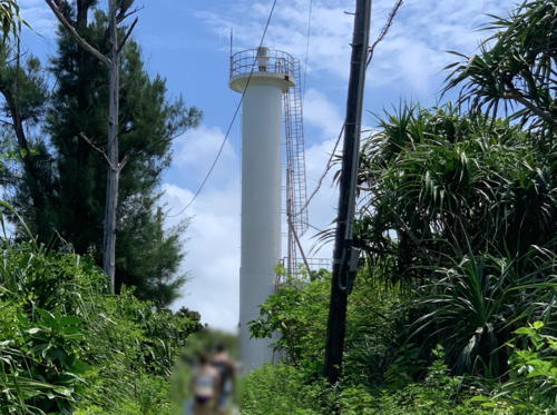
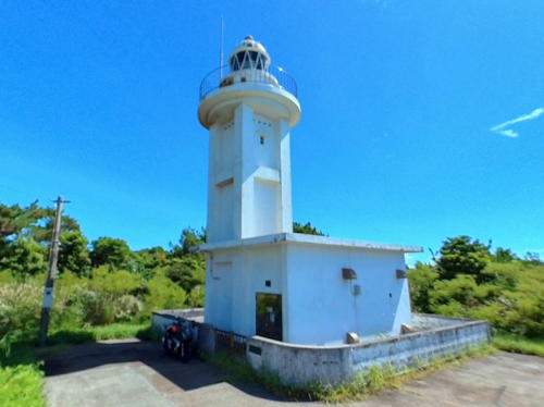
Lighthouses of Japan: Okinawa Islands

The nation of Japan, known in Japanese as Nihon or Nippon (日本), occupies an archipelago off the east coast of Asia. The four main islands are Hokkaidō in the north, Honshū (the largest), Shikoku in the south, and Kyūshū in the southwest. The country includes thousands of other islands of all sizes; among them the Ryūkyū (Nansei) Islands are a long chain extending to the southwest and including the large island of Okinawa, and the Nanpō Islands are another long chain extending south into the Pacific Ocean. Much of Japan is mountainous but the coastal regions are densely populated and urbanized; the country's population is about 126 million.

Okinawa Prefecture, one of the 47 prefectures of Japan, includes the southern half of the Nansei (or Ryūkyū) Islands (Nansei-shotō or "southwest islands" in Japanese). The prefecture includes two main groups of islands: the Okinawa Islands, including the principal island of Okinawa itself, and the Sakishima Islands to the southwest. This page includes lighthouses of the Okinawa Islands and there is a separate page for the lighthouses of the Sakishima Islands.

Okinawa was the home of the Ryūkyū Kingdom, established in the early 1400s. In 1609 the islands were conquered by Japan, and thereafter the Ryūkyū Kingdom paid tribute to both Japan and China. Japan annexed the islands in 1879 over Chinese protests; U.S. President Ulysses Grant, called in as arbitrator, ruled in favor of Japan. At the end of World War II in 1945 the Ryūkyū Islands from the Tokara group southward came under U.S. control, at first under a Military Government and then after 1950 under a Civilian Administration. The Okinawa and Sakishima Islands remained under U.S. control until the U.S. ceded sovereignty over all of the Ryūkyūs back to Japan in 1972.

In Japanese the word for a lighthouse is tōdai or toudai (灯台). The words saki and misaki are for capes and headlands, hana ("nose") is a promontory, hantō is a peninsula, shima (also spelled sima or jima) is an island, bae is a reef, iwa or shi is a rocky reef, amase or se is a shoal, wan is a bay, nada is a sound or basin, kaikyō is a strait, kawa is a river, and or minato is a harbor.

Lighthouses in Japan are operated and maintained by the Japanese Coast Guard's Maritime Safety Agency. The Eleventh Coast Guard Region covers Okinawa Prefecture and the Coast Guard office at Naha is responsible for the lights on this page.

ARLHS numbers are from the ARLHS World List of Lights. JCG numbers are the Japanese Coast Guard's light list numbers. Admiralty numbers are from volume M of the Admiralty List of Lights & Fog Signals. U.S. NGA List numbers are from Publication 112.

General Sources
Lighthouses in Japan - Okinawa
This site has data and photos for nearly all of Japan's major lighthouses.
Lighthouse of Japan - Okinawa
This large site has photos and accounts for lighthouses of the Okinawa and Sakishima Islands.
Form of a Lighthouse - Okinawa
Another site with many photos of Japanese lighthouses, cited below as FOAL.
Lighthouses in Okinawa Prefecture
Photos by various photographers available from Wikimedia.
Milestones of the Sea - Okinawa
Posted by the Eleventh Coast Guard Region office, this page has an interactive map that links to data pages with smaller photos of all the lights in the region.
Naha Coast Guard Major Lighthouses
Information and small photos posted by the Naha Coast Guard Office.
Online List of Lights - Nansei Shoto
Photos by various photographers posted by Alexander Trabas. Most of the photos for this area were provided by Jonathon Post (Selector Jonathon Photography).
Navionics Charts
Navigation chart for the islands.


Zanpa Saki Light, Kadena, Okinawa, June 2008
Flickr Creative Commons photo by Tim Bocek

Okinawa Lighthouses

Naha City Lighthouses
Naha, a city of about 325,000 residents, is the capital and largest population center of Okinawa Prefecture.
Naha Kō Breakwater
2009. Active; focal plane 17 m (56 ft); red flash every 4 s. 10 m (33 ft) robust post attached to a 1-story concrete equipment building. The lighthouse is red with a yellow checkerboard-type design on the sides of the equipment building. Trabas has Darlene Chisholm's photo, Lighthouse of Japan has a photo of the light in action, FOAL has a photo (fourth row, left), and Google has a satellite view. NGA lists a smaller light; this may refer to an older breakwater. Located at the end of the detached south breakwater protecting Naha's traditional harbor. Accessible only by boat. Site open, tower closed. JCG-7065.8; Admiralty M4744.8; NGA 13382.
* Naha Kō Entrance Starboard
1972. Active; focal plane 6.5 m (21 ft); red flash every 3 s. 4.5 m (15 ft) light centered on a square 1-story pierhead building. Entire lighthouse is red. Lighthouse of Japan has a page with photos, FOAL has a photo (second row, right), and Google has a satellite view. Located on the south side of the entrance to Naha's inner harbor. Site open, tower closed. JCG-7074; Admiralty M4743; NGA 13392.
Naha Sinkō Breakwater South End (2)
Date unknown (station established 1979). Active; focal plane 22 m (72 ft); green flash every 4 s. 19 m (62 ft) round cylindrical concrete tower with lantern and gallery. Entire lighthouse is white. Tim Bocek's photo is at right, Lighthouse of Japan has a photo of the light in action, Konishi Takashi has a photo, Xiǎo Xītiān has a photo, FOAL has a photo (2/3 the way down the page), Trabas has Andreas Köhler's photo, and Google has a good satellite view. Naha Sinkō (Naha Sin Kō) is a new harbor that has been developed on the north side of Naha, the capital of Okinawa. John Rayong Undau's 2008 photo appears to show an earlier, shorter version of the breakwater. Located at the south end of the detached main breakwater of Naha Sinkō. Accessible only by boat. Site and tower closed. ARLHS JPN-2614; JCG-7066; Admiralty M4740.85; NGA 13380.
Naha Sinkō Breakwater North End (2)
Date unknown (station established 1984). Active; focal plane 22 m (72 ft); continuous red light with a more intense flash every 3 s. 19 m (62 ft) round cylindrical concrete tower with lantern and gallery. Entire lighthouse is red. Lighthouse of Japan has a page with photos, FOAL has a photo (2/3 the way down the page), Trabas has Darlene Chisholm's photo, Akamine Tsuyoshi has a 2021 view from the sea, and Google has a satellite view. NGA formerly listed a lighthouse having a focal plane of only 11 m (36 ft). Located at the north end of the detached main breakwater of Naha Sinkō. Accessible only by boat. Site and tower closed. JCG-7078.5; Admiralty M4740.87; NGA 13372.
Kamiyama Shima
1972. Active; focal plane 21 m (69 ft); white flash every 4 s. 10 m (33 ft) square pyramidal concrete tower attached to a small 1-story concrete equipment building. Entire lighthouse is white. The Coast Guard has a page for the lighthouse, and Google has a distant satellite view. Located on a small, uninhabited island about 9 km (5.5 mi) west northwest of the entrance to Naha harbor. Accessible only by boat. Site status unknown. ARLHS JPN-218; JCG-7092; Admiralty M4740; NGA 13412.
Naha Sinko Breakwater South End Light
Naha Sinkō Breakwater South End Light, Naha, June 2008
Flickr Creative Commons photo
by Tim Bocek

Yomitan Town Lighthouse
* Zanpa Saki (Zampa Saki)
1974. Active; focal plane 40 m (131 ft); two white flashes every 10 s. 30.5 m (100 ft) round cylindrical concrete tower with lantern and gallery, rising from a 1-story concrete equipment building. Entire lighthouse is white. Tim Bocek's photo is at the top of this page, Lighthouses of Japan has a page for the lighthouse, FOAL has a page with good photos, David Hasenick has a great photo, Trabas has Post's photo, a 2021 photo is available, and Google has a street view and a satellite view. This soaring tower is a popular tourist attraction and by far the best known lighthouse of Okinawa and of the Nansei Islands. Located on a sharp promontory on the west coast of Okinawa, about 30 km (19 mi) north of Naha. Accessible by road and a short walk; parking is available. Site open, tower closed. . ARLHS JPN-767; JCG-7101; Admiralty M4740.3; NGA 13420.
 

Nago City West Coast Lighthouses
The city of Nago spans the island of Okinawa, so it has coasts facing both east and west. The city has a population of about 62,000.

* Ryūkyū Nago Kō (Nago Wan)
1980. Active; focal plane 12 m (39 ft); green flash every 3 s. 9.5 m (31 ft) concrete post attached to a square 1-story concrete equipment shelter. Entire lighthouse is white. FOAL has a page with good photos, the Coast Guard's page has a small photo, Takuya Enomoto has a street view, and Google has a satellite view. Located at the end of the main breakwater of Nago harbor. Accessible by walking the pier. Site open, tower closed. ARLHS JPN-2613; JCG-7102; Admiralty M4763.7; NGA 13432.

Motobu Town Lighthouses
#Sesoku (Sesoko) Shima
1976. Inactive since 2009 and apparently demolished. This was an 11 m (36 ft) round cylindrical concrete tower with double gallery. Entire lighthouse was white. No tower is seen in Google's satellite view. Sesoku Shima is an island about 3 km (2 mi) long off the west coast of Okinawa; a bridge connects the island to the mainland. The light was dropped from the 2011 NGA List and does not appear on the Coast Guard's interactive map. Located on the western tip of the island. Accessible by road, with parking provided, but conditions are crowded in the summer. Site open, tower closed. ARLHS JPN-552; ex-JCG-7118; ex-Admiralty M4763.62; ex-NGA 13456.
Minna Shima
1972. Active; focal plane 27 m (89 ft); white flash every 3 s. 12 m (39 ft) round cylindrical concrete tower, attached to a small 1-story concrete equipment room. Entire lighthouse is white. A 2019 photo is at right, the Coast Guard has a page for the lighthouse, Takuma Rei has a 2018 photo, FOAL has a distant view (second photo on the page), and Google has a satellite view. Minna Shima is a small island about 4 km (2.5 mi) due west of Sesoku Shima. Located on the eastern end of the island. The island is accessible by ferry, and there's also a distant view from Sesoku Shima. Site open, tower closed. ARLHS JPN-356; JCG-7140; Admiralty M4763.64; NGA 13452.
* Toguchi Kō South Breakwater
1972. Active; focal plane 10 m (33 ft); red flash every 3 s. 8 m (28 ft) concrete post centered on a square 1-story equipment shelter. Entire lighthouse is red. Trabas has Post's photo, FOAL has a page with photos, the Coast Guard page has a small photo, and Google has a satellite view. Located on the south breakwater of the Toguchi small boat harbor, on the north side of Motubu. Accessible by walking the pier. Site open, tower closed. ARLHS JPN-2624; JCG-7116; Admiralty M4763.5; NGA 13424.
 

Minna Shima Light, August 2019
Google Maps photo by yamato
 
* Bise Saki
1953. Active; focal plane 17 m (56 ft); white flash every 5 s. 12 m (39 ft) concrete post supporting a large lantern and gallery, attached to a small 1-story equipment shelter. Entire lighthouse is white. A closeup photo is available, the Coast Guard has a page for the lighthouse, Lighthouse of Japan has a page with photos, FOAL also has a page, and Google has a satellite view. Located on a rocky reef at the end of a peninsula projecting from the west coast of Okinawa, about 20 km (13 mi) northwest of Nago. Accessible by wading at low tide. Site open, tower closed. . ARLHS JPN-045; JCG-7119; Admiralty M4763.4; NGA 13440.

Ie Shima (Iejima) Town Lighthouses
Ie Shima is an island about 8 km (5 mi) long and about 6 km (3.5 mi) west of Bise Saki. It was the scene of furious fighting during World War II, and the famous U.S. cartoonist Ernie Pyle was killed here in April 1945. The island is readily accessible by ferry from Motobu.

Ie Kō
1989. Active; focal plane 17 m (56 ft); green flash every 3 s. 11 m (36 ft) round concrete tower with a flared top, attached to a 1-story concrete equipment shelter. Entire lighthouse is white. FOAL's page has photos (near the bottom of the page) and Google has a satellite view and a street view from shore. Located at the east end of the detached main breakwater of Ie Shima's harbor, on the southeast side of the island. Accessible only by boat, but there's a good view from ferries arriving at the island. Site open, tower closed. JCG-7138.5; Admiralty M4763.57; NGA 13449.
* Ie Shima (2)
1954 (station established 1897). Active; focal plane 31 m (102 ft); white flash every 4 s. 11 m (36 ft) square pyramidal concrete tower. Entire lighthouse is white. John Hagensieker's photo is at right, FOAL's page has good photos, Aori Ika has a good photo, Paul Zhang has a closeup street view, and Google has a satellite view. The original lighthouse was destroyed during the fighting in April 1945. The present lighthouse was built by U.S. occupation authorities. Located at the western end of the island, on a U.S. military reservation. Site and tower closed (fenced), but there's a good view from outside the fence. . ARLHS JPN-2600; JCG-7139; Admiralty M4763.6; NGA 13448.

Ie Shima Light, April 2010
photo copyright John Hagensieker; used by permission

Nakijin Town Lighthouse
* Kouri Shima (Toshima)
1975. Active; focal plane 53 m (174 ft); white light, 3 s on, 3 s off. 11 m (36 ft) round cylindrical concrete tower attached to a square 1-story concrete equipment room. Entire lighthouse is white. The Coast Guard's page has the photo seen at right, Trabas has Post's photo, a 2022 photo is available, and Google has a satellite view. Kouri Shima is a round island off the north side of the Bise Saki peninsula. The island is connected to the mainland of Okinawa by a bridge about 2.5 km (1.5 mi) in length. Located on a wooded bluff on the northwestern side of the island; accessible from the road by a short trail. Site open, tower closed. ARLHS JPN-293; JCG-7120; Admiralty M4763.44; NGA 13444.

Kunigami Town Lighthouses
Kunigami occupies the wild and mountainous northeastern tip of Okinawa.

*
Hedo Misaki
1961. Active; focal plane 71 m (233 ft); white flash every 6 s. 11 m (36 ft) concrete post centered on a 1-story concrete equipment room. Entire lighthouse is white. FOAL's page has closeup photos, Lighthouse of Japan has a page with photos, Trabas has Post's photo, the Coast Guard has a page with two small photos, Masaki Miyake has a 2021 closeup, and Google has a satellite view. Hajime Toma has a 2019 photo showing the lighthouse under restoration. Located on the west side of the northern tip of Okinawa. Accessible by road but the entrance to the light station is unmarked. Site open, tower closed. . ARLHS JPN-100; JCG-6983; Admiralty M4763; NGA 13264.
* Sedaka (Setake) Saki
1968. Active; focal plane 87 m (285 ft); white flash every 10 s. 15 m (49 ft) square cylindrical concrete tower with lantern and gallery, attached to a 1-story concrete equipment building. A 2022 street view is below right, Lighthouse of Japan has a page with good photos, FOAL has a fine page for the lighthouse, a 2021 closeup is available, Natalia Tim has a 2018 photo, the Coast Guard page has a small photo, Aron Weaver has a street view, and Google has a satellite view. Located near the village of Ada and the northeastern tip of Okinawa. Accessible by road but the entrance to the light station is unmarked. Site open, tower closed. . ARLHS JPN-548; JCG-6984; Admiralty M4762.9; NGA 13268.
Kouri Shima Light
Kouri Shima Light
Japanese Coast Guard Naha Office photo


Nago City East Coast Lighthouses
Takabaka Saki
1972. Active; focal plane 25 m (82 ft); two white flashes every 6 s. 10 m (33 ft) concrete post attached to a small 1-story equipment shelter. Entire lighthouse is white. FOAL's page has closeup photos, a 2019 closeup is available, Brian Parker has a 2020 photo, the Coast Guard's page has small photos, and Google has a satellite view. Located on a promontory on the east coast of Okinawa about 10 km (6 mi) southeast of Nago, marking the north side of the entrance to Oura Bay. Probably accessible by a hiking trail, although a 2008 visitor reports it wasn't easy to find the light. Site status unknown. ARLHS JPN-612; JCG-6985; Admiralty M4762.2; NGA 13272.
Naga Shima
1972. Active; focal plane 26 m (85 ft); white flash every 3 s. 10 m (33 ft) concrete post with an unusual square gallery, rising from a square 1-story concrete equipment room. Entire lighthouse is white. FOAL's page has closeup photos, Lighthouse of Japan has a distant view, and Google has a satellite view. Located on an islet about 2 km (1.25 mi) southwest of the Takabaka Saki lighthouse. Accessible only by boat. Site status unknown. ARLHS JPN-2612; JCG-6987; Admiralty M4762.4; NGA 13280.

Uruma City Lighthouses
Facing Oura Bay on the east coast of Okinawa, Uruma is home to several large U.S. military bases. The city has about 120,000 residents.

#Kin Wan
Date unknown. Inactive since 2008; probably demolished. 10 m (33 ft) square cylindrical white concrete tower. A 2006 photo is available (near the bottom of the page, #7016) but the lighthouse has not been found in Google's satellite view. This tower carried a directional light guiding vessels across Kin Bay to the harbor of Ishikawa. Located on a hill on the south side of Ishikawa. Site status unknown. ex-JCG-7016; ex-Admiralty F2761; ex-NGA 13288.

Sedaka Saki Light, Nago, August 2022
Google Maps street view by mako
Menguisho (Mengui Syo)
1972. Active; focal plane 12 m (39 ft); quick-flashing white light. 12 m (39 ft) post supporting a vase-shaped gallery. Lower half of the lighthouse painted yellow, upper half black. The light has a total length of 43 m (140 ft); it is attached by a flexible coupling to a concrete pad on the bottom, so it can sway with the current, but a buoyant tank just below the surface prevents it from disappearing under the waves. (This unusual design makes the light intermediate between a buoy and a lighthouse.) The light is not seen in Bing's satellite view. Located about 4 km (2.5 mi) east of the Ikei Shima lighthouse (next entry). Accessible only by boat. Site open, tower closed. JCG-6996; Admiralty M4758; NGA 13284.
* Ikei (Ike) Shima
1977. Active; focal plane 14 m (46 ft); white or red light depending on direction, 3 s on, 3 s off. 14 m (46 ft) round hourglass-shaped concrete tower with lantern and gallery, a particularly graceful design. Entire lighthouse is white. A photo is at right, Trabas has a good photo by Post, Lighthouse of Japan has a page with photos, FOAL's page has a closeup photo, the Coast Guard has a page for the light, Michael Lynch has a 2017 photo, Masaki Miyake has a 2021 photo, a closeup street view is available, the lighthouse peeks over the tree line in a Google street view, and Google has a satellite view. Ikei Shima is a small island about 5 km (3 mi) northeast of Urama on the southeast coast of Okinawa. The northernmost of three islands, Ikei Shima is accessible by a series of bridges. Located on the highest point of the island. Accessible by road and a short walk. Site open, tower closed. . ARLHS JPN-157; JCG-7017; Admiralty M4759; NGA 13296.
#Katsuren (Katuren) Saki
1972. Removed in 2019. 10 m (33 ft) square pyramidal concrete tower. Entire lighthouse is white. FOAL's page has photos and Google has a satellite view. This lighthouse is on the grounds of Camp Courtney, a major U.S. Marine Corps base. Located on a sharp promontory on the east side of Okinawa. It was deactivated in January 2019 and demolished later that year. Site and tower closed. ARLHS JPN-244; ex-JCG-7024; ex-Admiralty M4754; NGA 13308.
Nakagusuku Kō West Breakwater
1991. Active; focal plane 13 m (43 ft); green flash every 3 s. 9.5 m (31 ft) round concrete tower with a flared top, attached to a small equipment shelter. Entire lighthouse is white. An overhead drone view is available, FOAL has a photo (third row, right) and Google has a satellite view. Located at the east end of a detached breakwater off the harbor of Suzaki in Nakagusuku Bay, south of the Katsuren Saki peninsula. Accessible only by boat. Site open, tower closed. JCG-7030.3; Admiralty M4754.8; NGA 13310.

Ikei Shima Light, Urama, August 2021
Google Maps photo
by cokeccoco
Tsuken (Tuken) Shima
1976. Active; focal plane 51 m (167 ft); white flash every 4 s. 14 m (46 ft) round cylindrical concrete tower with gallery. Entire lighthouse is white. Tsuken Shima is a small island off the tip of the Katsuren Saki peninsula on the southeast coast of Okinawa. Trabas has Post's closeup photo, Thom Key has a 2018 photo, FOAL's page has photos, another photo is available and Google has a street view and a satellite view. Located on the highest point of the island, near the southwest end. Accessible only by boat. Site open, tower closed. ARLHS JPN-687; JCG-7028; Admiralty M4752; NGA 13316.
Taira Sone (Hira Sone)
1972. Active; focal plane 12 m (39 ft); white flash every 4 s. 11 m (36 ft) round cylindrical concrete tower with gallery. Entire lighthouse is white. FOAL has a distant view (second row) and Google has a satellite view. Located on a reef about 5 km (3 mi) south southwest of Katsuren Saki. Accessible only by boat. Site open, tower closed. JCG-7030; Admiralty M4753; NGA 13324.

Nanjō City Lighthouses
Nanjō, a city of about 45,000 residents, occupies a peninsula on the southeastern tip of Okinawa.

Baten Kō
1976. Active; focal plane 12 m (39 ft); continuous red light with a more intense flash every 3 s. 9.5 m (31 ft) post centered on a square 1-story concrete equipment building. Entire lighthouse is red. Trabas has a good photo by Post, FOAL has a page for the lighthouse, and Google has a street view and a satellite view. Formerly located at the end of the north breakwater of Baten harbor, at the southwestern corner of Nakagusuku Bay, but following recent reconstruction it is now on a detached pier. Site status unknown. ARLHS JPN-2595; JCG-7049; Admiralty M4750.4; NGA 13356.
* China (Tina) Saki
1972. Active; focal plane 35 m (115 ft); white flash every 3 s. 12 m (39 ft) round concrete tower with flared top, attached to a small 1-story concrete equipment room. Entire lighthouse is white. The red statue on the roof of the equipment room is a shiisa, or "lion dog," a figure from Okinawan legend and the traditional protector of Okinawa from evils of all kinds. The Coast Guard has a page and a second page for the lighthouse, FOAL has a page for the lighthouse, Trabas has Post's closeup photo, a 2018 closeup is available, Eiji Onaga has a street view, and Google has a satellite view. Located on a promontory on the southeast coast of Okinawa, about 10 km (6 mi) east of Naha. Site open, tower closed. . ARLHS JPN-2596; JCG-7050; Admiralty M4750; NGA 13352.
China Saki Light
China Saki Light, Nanjō, 2011
City of Nanjō photo (no longer online)
Kudaka Shima
1972. Active; focal plane 25 m (82 ft); white light, 3 s on, 3 s off. 11 m (36 ft) square cylindrical concrete tower connected to a small 1-story equipment shelter. Entire lighthouse is white. A 2021 view is available, FOAL has distant views, and Google has a satellite view and a sunrise street view. Kudaka Shima is an island about 8 km (5 mi) east southeast of China Saki. Located on the highest point of the island, adjacent to a playground. The island is accessible by ferry and it's a short walk to the lighthouse from the harbor. Site status uncertain, but the lighthouse is easy to see from nearby. ARLHS JPN-2608; JCG-7051; Admiralty M4749; NGA 13360.

Itoman (Ichuman) City Lighthouses
Itoman is a city of about 60,000 residents located on the southern tip of Okinawa.

*
Kiyan (Kyan) Saki (Cape Kyan)
1972. Active; focal plane 47 m (154 ft); white flash every 5 s. 15 m (49 ft) round cylindrical concrete tower with lantern and gallery, attached to a 1-story concrete equipment building. Entire lighthouse is white. Ippei Suzuki's photo is at right, Trabas has Tom Chisholm's closeup photo, Tsaiyin Lin has a good 2017 photo, a 2021 photo is available, Lighthouse of Japan has a page with good photos, FOAL has a fine page for the lighthouse, the Coast Guard has a page for the lighthouse, and Google has a street view and a satellite view. This was a "last-stand" area for Japanese forces during the Battle of Okinawa, and there is a war memorial at the entrance to the lighthouse. Accessible by road, the lighthouse is a well-known attraction. Located at the southern tip of Okinawa. Site open, tower closed. . ARLHS JPN-264; JCG-7054; Admiralty M4748; NGA 13364.
Rukan Syo (Rukan Sho)
1972. Active; focal plane 22 m (72 ft); two white flashes every 10 s. 17 m (56 ft) round cylindrical concrete tower with a large gallery, attached to a small 1-story equipment room. Entire lighthouse is white. The Coast Guard has a photo, a 2018 closeup photo and a 2019 photo are available, and Google has an indistinct satellite view. Located on a reef about 8 km (5 mi) west northwest of Kiyan Saki. Accessible only by boat. Site open, tower closed. ARLHS JPN-2618; JCG-7062; Admiralty M4746; NGA 13368.

Kiyan Saki Light, Itoman, July 2010
Flickr Creative Commons photo by Ippei Suzuki

Outlying Okinawa Islands (Shimajiri District) Lighthouses

Under this heading are small, sparsely populated islands lying to the northwest or southwest of the island of Okinawa. All these islands are administered as parts of Shimajiri District in southern Okinawa.

Iheya Village Lighthouses
Iheya Shima, the northernmost island of Okinawa Prefecture, is about 30 km (19 mi) northwest of the northern end of Okinawa. The island has a population of about 1500 and is accessible by ferry from Okinawa.
* Dana Misaki (Iheya Shima)
1972. Active; focal plane 115 m (377 ft); white flash every 12 s. 15 m (49 ft) round cylindrical concrete tower with lantern and gallery, attached to a 1-story crew building. Entire lighthouse is white. A photo is at right, another good closeup photo is available, Tabinchu Shima has a street view, and Google has a street view and a satellite view. The lighthouse is accessible by road; parking provided. Located on the northeastern tip of the island. Site open, tower closed. . ARLHS JPN-2559; JCG-6973; Admiralty M4765; NGA 13260.
Maedomari Kō
1994. Active; focal plane 17 m (56 ft); green flash every 3 s. 12 m (39 ft) round cylindrical concrete tower with gallery. Entire lighthouse is white. Toshiaki Sakumoto has a view from an arriving ferry and Google has a satellite view and a very distant street view from shore. Located at the end of the south breakwater of Maedomari, the ferry port on the east coast of Iheya Shima. Accessible only by boat (a gap prevents access via the breakwater). Site open, tower closed. ARLHS JPN-2572; JCG-6974.5; Admiralty M4765.05; NGA 13261.

Izena Village Lighthouse
Izena Shima, located south of Iheya, has a population of about 1750. The island is accessible by ferry from Okinawa.

Nakada Kō (Izena Shima)
1994. Active; focal plane 19 m (62 ft); red flash every 3 s. 12 m (39 ft) round concrete tower with a flared top, attached to a square 1-story equipment shelter. Entire lighthouse is red. Hiroaki Higa has a 2020 street view and Google has a satellite view. Located at the south end of the north breakwater of Nakada harbor, the harbor of Izena (the breakwater has been extended recently and the light was relocated to the new ending). Accessible only by boat, but there's a good view from ferries arriving from Okinawa. Site open, tower closed. JCG-6976.2; Admiralty M4764.5; NGA 13263.

Dana Saki Light, Iheya Shima, May 2016
ex-Google Plus photo by Wesley W

Tokashiki Village Lighthouses
Tokashiki and Zamami are towns in the Kerama Islands, which include some 22 small islands about 32 km (20 mi) west of Naha. These islands were the first Okinawan islands taken by U.S. forces in March 1945. Today they are a popular national park, readily accessible by ferry from Naha. Four of the islands are inhabited.
Hate Shima (Hashima)
1980. Active; focal plane 35 m (115 ft); white flash every 3 s. 13 m (43 ft) round cylindrical concrete tower with gallery. Entire lighthouse is white. The light is barely visible in a view of the island from the sea and Google has a satellite view. Hate Shima is a small island about 25 km (15 mi) west of Naha. Located on the east side of the island. Accessible only by boat. Site status unknown. ARLHS JPN-2598; JCG-7093; Admiralty M4739.9; NGA 13408.
* Tokashiki Kō
1989. Active; focal plane 16 m (52 ft); green flash every 3 s. 12 m (39 ft) round concrete tower with a flared top, attached to a 1-story concrete equipment shelter. Google has a satellite view and a distant street view. Tokashiki Shima is the largest of the Kerama Islands. Located at the end of the south breakwater of Tokashiki harbor. Accessible by walking the pier. Site open, tower closed. JCG-7142.5; Admiralty M4739.85; NGA 13462.
* Aware (Aharen) Saki
1972. Active; focal plane 97 m (318 ft); white flash every 8 s. 9.5 m (31 ft) round cylindrical concrete tower, attached to a small 1-story equipment shelter. Entire lighthouse is white. The Coast Guard has a page for the lighthouse that includes the photo at right, Gregory Su has a 2020 closeup photo and view showing the stairway leading to the lighthouse, another 2022 closeup is available, and Google has a satellite view. Located at the southern tip of Tokashiki Shima. Site open, tower closed. Site manager: Kerama Shotō National Park. ARLHS JPN-031; JCG-7142; Admiralty M4739.8; NGA 13460.
Aware Saki Light
Aware Saki Light, Tokashiki
Japanese Coast Guard Naha Office photo

Zamami Village Lighthouses
Kitabirasi (Ushino Shima)
Date unknown. Active; focal plane 97 m (318 ft); white flash every 8 s. 9.5 m (31 ft) round cylindrical concrete tower, attached to a small 1-story equipment shelter. Entire lighthouse is white. Gregory Su has a 2021 photo and Google has a satellite view. Located on a small island off the eastern tip of Zamami Shima. Accessible only by boat. Site status unknown. JCG-7143; Admiralty M4739.5; NGA 13464.
Kahi Shima
1972. Active; focal plane 43 m (141 ft); white flash every 4 s. 9.5 m (31 ft) round cylindrical concrete tower, rising from a square 1-story concrete equipment building. A 2022 closeup photo is available, Yukio Katakura has a 2021 drone view, Yuusei Higa also has a drone view and Google has a satellite view. Located on an islet between the larger islands of Aka Shima and Zamami Shima, at the western end of the Kerama Islands. Accessible only by boat. Site open, tower closed. ARLHS JPN-2604; JCG-7144; Admiralty M4739.6; NGA 13468.

Aguni Village Lighthouse
* Aguni Shima
1978. Active; focal plane 108 m (354 ft); white light occulting once every 4 s. 16 m (52 ft) round cylindrical concrete tower with gallery, attached to a 1-story concrete equipment building. Lantern removed. Entire lighthouse is white. Google has a street view and an indistinct satellite view. Onsen Hopper's 2023 photo shows the lighthouse being repainted. Aguni Shima is a small island about 50 km (30 mi) west northwest of Zanpa Saki, Okinawa. The island's population is about 1000. Located at the southwestern tip of the island. Accessible only by boat. Site open, tower closed. . ARLHS JPN-004; JCG-7141; Admiralty M4739.48; NGA 13472.

Tonaki Village Lighthouse
* Tonaki Shima
1978. Active; focal plane 15 m (49 ft); white light, 4 s on, 4 s off. 10.5 m (34 ft) square cylindrical concrete tower. Entire lighthouse is white. The Coast Guard also has a page for the lighthouse, Google has a closeup street view, and the tower is halfway between the Community Center and Village Hall in Google's satellite view. Tonaki Shima is about 50 km (30 mi) west northwest of Naha and 25 km (15 mi) south of Aguni Shima. The island has a population of about 500 and is accessible by ferry from Naha. Located on the waterfront of Tonaki, on the northwestern side of the island. Site open, tower closed. ARLHS JPN-670(=2625); JCG-7145; Admiralty M4739.47; NGA 13476.
Aguni Shima Light
Aguni Shima Light, Aguni, 2009
Creative Commons photo posted by gpzagogo

Kumejima Town Lighthouses
Kume Shima (Kumejima) is the largest of a group of islands about 100 km (60 mi) west of Naha. The island is about 12 km (7.5 mi) long and 8 km (5 mi) wide; it has a population of about 9000 and is accessible by air or ferry from Naha.
Ogan Misaki (Ugan Saki) (2?)
1972. Active; focal plane 9.5 m (31 ft); white flash every 10 s. 9.5 m (31 ft) round cylindrical concrete tower, attached to a small 1-story equipment shelter and mounted on a square concrete pier. Entire lighthouse is white. Lighthouses of Japan has a very distant view and Google has a fuzzy satellite view. Located at the northeastern tip of the coral reef off the east coast of Kume Shima. Accessible only by boat. Site status unknown. ARLHS JPN-2617; JCG-7149; Admiralty M4739.4; NGA 13480.
* Nakazato Kō
1990. Active; focal plane 17 m (56 ft); red flash every 3 s. 9.5 m (31 ft) round concrete tower with flared top, attached to a small equipment shelter and mounted on a large square concrete pier. Tower painted red. Takatake Homma has a 2021 drone view and Google has a distant satellite view. Located at the end of the main breakwater of Nakazato, the principal harbor of Kume Shima. Accessible by walking the pier. Site open, tower closed. ARLHS JPN-2616; JCG-7149.8; Admiralty M4739.42; NGA 13482.
* Kume Shima (Nishime Saki)
1958. Active; focal plane 54 m (177 ft); white light, 3 s on, 3 s off. 21 m (69 ft) round cylindrical concrete tower with lantern and gallery, attached to a 1-story concrete equipment building. Entire lighthouse is white. The Coast Guard has the photo at right as well as a page for the lighthouse, Tomokazu Yasuda has a nice 2018 photo, and Google has a street view and a distant satellite view. This important lighthouse marks the western extremity of the Okinawa Islands and the entrance to the Miyako Strait (also called the Kerama Gap), the 250 km (155 mi) wide passage between the Okinawa and Sakishima Islands. Located at the western end of the island. Site open, tower closed. . ARLHS JPN-300; JCG-7158; Admiralty M4739.2; NGA 13492.

Kitadaitō Village (Daitō Islands) Lighthouse
The three islands of the Daitō group are located in the northern Philippine Sea about 350 km (220 mi) east of Okinawa. Although these islands are not part of the Nansei Islands geographically they are administered within the Shimajiri District of Okinawa Prefecture. The islands were uninhabited until the imperial government sent out settlers in the late 1800s to occupy the islands for Japan. The modern population is about 2000. The islands are not often visited but there is air service from Naha.

Kita Daitō (Kitadaitō) Shima
1972. Active; focal plane 90 m (295 ft); white flash every 15 s. 22 m (72 ft) round cylindrical concrete tower with lantern and gallery, attached to a 1-story concrete equipment building. Entire lighthouse is white. Yasuki Yanagihara has a 2017 closeup photo, a 2020 photo is available, and Google has a satellite view and a distant street view. Located on heights near the northwestern tip of Kita-Daitō, the northernmost of the three islands. Site open, tower closed. . ARLHS JPN-262; JCG-7159; Admiralty M4765.1; NGA 13496.
Kume Shima Light
Nishime Saki Light, Kumejima
Japanese Coast Guard Naha Office photo

Information available on lost lighthouses:

Notable faux lighthouses:

Adjoining pages: North: Amami Islands | Southwest: Sakishima Islands

Return to the Lighthouse Directory index | Ratings key

Posted August 27, 2007. Checked and revised March 16, 2023. Lighthouses: 44. Site copyright 2023 Russ Rowlett and the University of North Carolina at Chapel Hill.