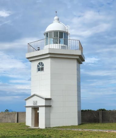
Lighthouses of South Korea: Yeosu South

For most of its history Korea was an independent kingdom, or at least an autonomous kingdom under Chinese influence. This came to an end in 1910 when Japan annexed all of Korea. At the end of World War II in 1945 the 38° parallel was established as the dividing line between U.S. and Soviet zones of occupation, and in 1948 separate civil administrations were established in the two halves of the country. The Korean War (1950-53) ended in a draw with the armistice line falling close to the prewar 38° line. The Republic of Korea (ROK; 대한민국, Daehan Minguk in Korean), commonly called South Korea, occupies the Korean peninsula south of the armistice line.

The name Korea, used internationally, is a Western version of Goryeo or Koryŏ (고려), the name of a kingdom that unified the country in the tenth century. From 1392 to 1897 the kingdom was known instead as Joseon or Chosŏn (조선). Today South Koreans usually call their country Hanguk (한국, literally "one country") and the official name of the Republic of Korea is Daehan Minguk (대한민국).

South Korea is divided into eight provinces and nine province-level cities. This page is one of three pages covering lighthouses of the municipal city of Yeosu, a major port in southeastern Jeollanam (South Jeolla) province. Yeosu is located in the central part of Korea's south coast. The city occupies the Yeosu peninsula and includes several hundred islands of all sizes, 49 of them inhabited. This page lists lighthouses of Hwayang Township and Nam (South) Township, occupying a series of islands south of the peninsula.

Navigational aids in the ROK are regulated by the Ministry of Oceans and Fisheries (MOF). The lights on this page are maintained by the Yeosu Regional Oceans and Fisheries Administration.

In 2000 South Korea adopted a Revised Romanization System to replace systems formerly used in the West. In the Revised System, the word for a lighthouse is deungdae (등대); dan (formerly tan) is a cape, seom (som) or do (to) is an island, am or amseog is a rock, man is a bay, and hang is a harbor. Some place names may be more familiar to Westerners in the spellings of older systems.

ARLHS numbers are from the ARLHS World List of Lights. KR numbers, where available, are from the Korean light list. Admiralty numbers are from volume M of the Admiralty List of Lights & Fog Signals. U.S. NGA

General Sources
World of Lighthouses - South Korea
Photos by various photographers available from Lightphotos.net.
Online List of Lights - Korea
Coming soon: photos by various photographers posted by Alexander Trabas.
Navionics Charts
Navigation chart information for the Yeosu area.
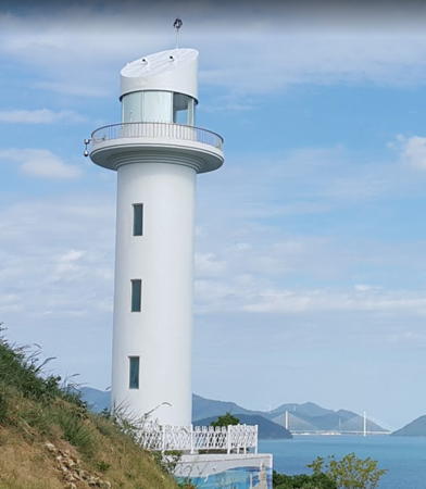

Baegyado Light, Baegyado, August 2016
Google Maps photo by Jt Kim
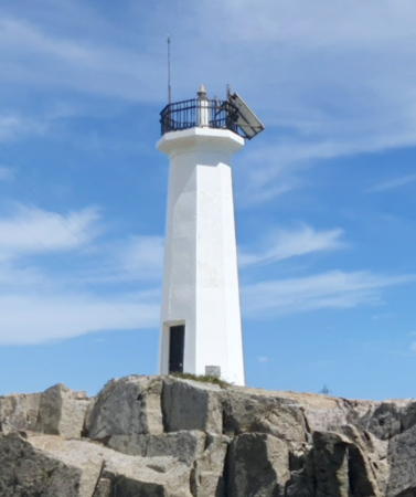
Yeoja Bay and Hwayang Township Lighthouses

Yeoja Bay Lighthouses
Yeoja Bay occupies a roughly circular basin on the west side of Yeosu and east of the base of the Goheung Peninsula. Note that all the lighthouses of this group are listed as Yeoja Man by the Admiralty.

Dulyeongyeo
1991. Active; focal plane 14 m (46 ft); two white flashes every 5 s. 13 m (43 ft) round concrete tower, painted black with one red horizontal band. No photo available but Google has a satellite view. This light and the next two appear to be within the limits of Sora Township. Located on an isolated rock in the eastern part of Yeoja Bay. Accessible only by boat. Site open, tower closed. KR-2538; Admiralty M4305.5; NGA 17218.
Dongsinyeo
Date unknown. Active; focal plane 14 m (46 ft); two white flashes every 10 s. 11 m (36 ft) round concrete tower, painted black with one red horizontal band. No photo available but Google has a satellite view. Located on an isolated rock in the northeastern part of Yeoja Bay about 2 km (1.25 mi) east of Dulyeongyeo light. Accessible only by boat. Site open, tower closed. KR-2538.7; Admiralty M4305.53.
Noryangyeo
Date unknown. Active; focal plane 10 m (33 ft); quick-flashing white light. 11 m (36 ft) round concrete tower, upper half painted black and lower half yellow. No photo available but Google has a satellite view. Located on a reef off Sagok Village in Sora Township, on the east side of Yeoja Bay. Accessible only by boat. Site open, tower closed. KR-2474.12; Admiralty M4305.54.
Soyeojado (Soyoja-do)
2008. Active; focal plane 15 m (49 ft); white flash every 6 s. 8 m (26 ft) round cylindrical white concrete tower flared at the top. The light is just barely visible on the islet in the center of Younggil Kim's view from shore and Google has a satellite view. Located on an isolated islet south of Soyeojado, a small island in the center of Yeoja Bay. Accessible only by boat. Site status unknown. KR-2538.2; Admiralty M4305.45; NGA 17218.1.
Sambugyeo
Date unknown. Active; focal plane about 13 m (43 ft); red light, pattern unknown. Approx. 13 m (43 ft) red concrete tower. No photo available but Google has a satellite view. Located off the northwestern end of Daeyeojado, the larger of the two inhabited islands in the center of Yeoja Bay. Accessible only by boat. Site status unknown. Admiralty M4305.445.

Nangdo Area Lighthouses
Nangdo is an island about 4 km (2.5 mi) long and 2 km (1.25 mi) wide. Together with associated smaller islands, it lies southwest of the Godolsan Peninsula of Yeosu and east of the Goheung Peninsula, stretching across the mouth of Yeoja Bay. A series of bridges connect the islands to both the Godolsan and Goheung Peninsulas.
Chudo
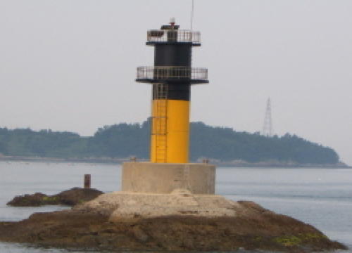
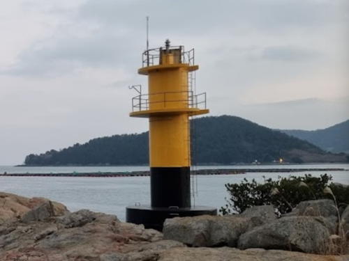
Date unknown. Active; focal plane about 12 m (39 ft); six quick white flashes followed by one long white flash every 15 s. Approx. 10 m (33 ft) round cylindrical concrete tower, upper half painted yellow and lower half black, mounted on a round stone base. Han Gyeong-ok has a view, Noh Hongmoon has a very distant view, and Google has a satellite view. Located on a reef off the south end of Nangdo. Accessible only by boat. Site open, tower closed. KR-2531.8; Admiralty M4305.1.
Nangdo (Nang Do) (2?)
1985. Active; focal plane 21 m (69 ft); white flash every 5 s. 9 m (30 ft) octagonal white concrete tower mounted an an octagonal base. A photo is at right and Google has street view, a satellite view and a very distant drone view. NGA describes the lighthouse as square. Located on a small island just off the southern tip of Nangdo. Accessible only by boat. Site status unknown. KR-2537; Admiralty M4305; NGA 17220.
* Nangdo Hang
2003. Active; focal plane 18 m (59 ft); red flash every 4 s. 13 m (43 ft) octagonal concrete tower. Entire lighthouse is red. Jung Woosung has a closeup photo and a second photo, Melani Park has a 2024 view along the pier, the light is at the far left of a distant view and Google has a satellite view. Located at the end of the south (main) breakwater of Nangdo harbor, at the southwestern corner of the island. Accessible by walking the pier. Site open, tower closed. KR-2537.5; Admiralty M4305.2; NGA 17221.
Jobal Sudo
2003. Active; focal plane 8 m (26 ft); six quick white flashes and one long white flash every 15 s. 14 m (46 ft) round cylindrical concrete tower, upper half painted yellow and lower half black. Shim Shim Jae-ok has a photo, Jin-Yeo Song has a distant street view, and Google has a satellite view. Located on a reef in the narrow passage between Jeokgeumdo and the northwestern tip of Nangdo, a short distance east of the bridge connecting Nangdo to Jeokgeumdo. Accessible only by boat. Site status unknown. KR-2537.2; Admiralty M4305.36; NGA 17219.1.
Odong (Odo, Chokkum-do)
2002. Active; focal plane 17 m (56 ft); white flash every 6 s. 11 m (36 ft) octagonal white concrete tower with gallery. Seunghee Kim has a very distant view, Google has a satellite view, and the light is barely visible at the center of Google's drone view. Located on an islet between Jeokgeumdo and Dunbyeongdo, two smaller islands north of Nangdo. Accessible only by boat. Site status unknown. KR-2538.1; Admiralty M4305.4; NGA 17219.

Nangdo Light, Nangdo, August 2022
Google Maps street view by 시몰SimAll
Hagwado Sudo
Date unknown. Active; focal plane 11 m (36 ft); six quick white flashes and one long white flash every 15 s. 10 m (33 ft) round cylindrical concrete tower, upper half painted yellow and lower half black. This light is in the right background of Shim Shim Jae-ok's photo of Jobal Sudo, Google has a satellite view. Located on a reef off the south side of Dongbyeongdo. Accessible only by boat. Site status unknown. KR-2537.26; Admiralty M4305.38; NGA 17219.2.
Samcho
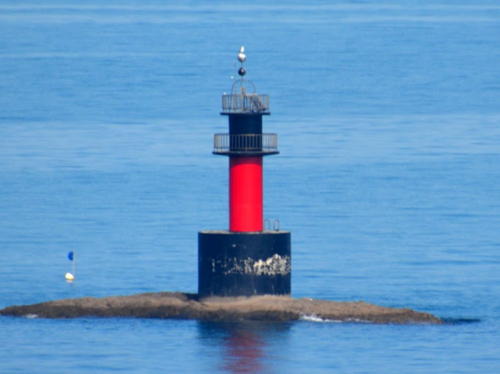
2001. Active; focal plane 10 m (33 ft); two white flashes every 5 s. 13 m (43 ft) round cylindrical concrete tower mounted an a round concrete pier. Lighthouse painted black with a red horizontal band. A drone view is available and Google has an indistinct satellite view. Located on a reef in the passage between the south end of the Godolsan Peninsula and the island of Jobaldo. Accessible only by boat. Site status unknown. KR-2474.7; Admiralty M4305.55.

Baegyado Area Lighthouses
Baegyado is an island about 1.6 km (1 mi) in diameter located just off the southern tip of the Godolsan Peninsula; a bridge connects it to the mainland.

Sanghwado
Date unknown. Active; focal plane about 11 m (36 ft); white light, pattern unknown. Approx. 11 m (36 ft) round cylindrical concrete tower painted black with one red horizontal band. No photo available but Google has a satellite view. Located on a reef north of Sanghwado, an island midway between Nangdo and Bargwado. Accessible only by boat. Site status unknown. KR-2473.6; Admiralty M4305.58.
Janggudo (Changgudo, Chilyeo)
Date unknown. Active; focal plane 13 m (43 ft); red flash every 4 s. 15 m (49 ft) round concrete tower with gallery. Entire lighthouse is red. A drone view is available and Google has a satellite view and a very distant street view. Located in narrow passage between two islands about 5 km (3 mi) west of the Baegyado lighthouse. Accessible only by boat. Site status unknown. KR-2474.5; Admiralty M4305.6; NGA 17222.
#Baegyado (Paegyado, Paekyado) (1)
1928. Inactive since 2006. 14 m (46 ft) round concrete tower with lantern and gallery, painted white. Sadly, this historic lighthouse was demolished to make way for the new one. Located on the eastern end of the island. Site status unknown. ARLHS SKR-022.
Baegyado (Paegyado, Paekyado) (2)
2006 (station established 1928). Active; focal plane 58 m (190 ft); white flash every 20 s. 24 m (79 ft) round cylindrical concrete tower with lantern and gallery. Several 1-story keeper's houses and other light station buildings. All structures painted white. Jt. Kim 's 2016 photo is seen at the top of this page, Doo-Taek Lim has a 2021 photo, Kang Hyun Gu has a 2017 photo, another photo is available, and Google has a satellite view of the station. The new lighthouse was announced in a Notice to Mariners dated 1 December 2006. Located at the southern tip of the island. Accessible by road. Site status unknown. KR-2474; Admiralty M4306; NGA 17216.

Gaedo Area Lighthouses
Gaedo is an island about 8 km (5 mi) long and 2 km (1.25 mi) wide located south of Baegyado.

Goseo (Koso)
1985. Active; focal plane 34 m (112 ft); white flash every 6 s. 9 m (30 ft) octagonal white concrete tower with gallery. Seongha Kim has a 2020 aerial photo and Google has a satellite view. Located on a small island about 10 km (6 mi) northwest of Yeondo. Accessible only by boat. Site status unknown. KR-2473.1; Admiralty M4307; NGA 17224.
Horido
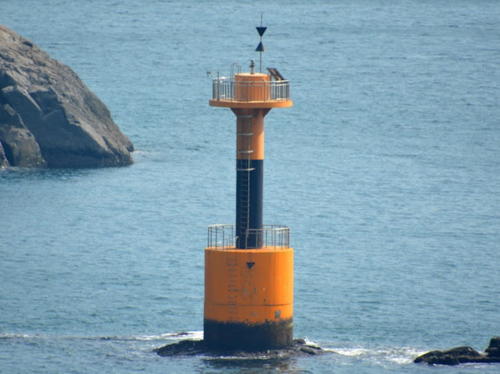
1995. Active; focal plane 11 m (36 ft); quick-flashing white light. 9 m (30 ft) round cylindrical concrete tower, mounted on a round concrete pier. Upper half of the lighthouse painted black, lower half yellow. A photo is at right and Google has a satellite view. Located on a rock in the channel about 8 km (5 mi) southwest of Dolsando. Accessible only by boat. Site open, tower closed. Admiralty M4306.5; NGA 17215.

Horido Light, Gaedo
Yeosu Port Office photo

South Township Lighthouses

Hwataedo Area Lighthouses
Hwataedo is one of the numerous small islands east of Gaedo, north of Geumodo and off the southern tip of the large island of Dolsando.

Hwataedo Northwest
Date unknown. Active; focal plane 9 m (30 ft); nine quick white flashes every 15 s. 14 m (46 ft) round concrete tower, painted yellow with one black horizontal band. A 2023 photo and distant view are available, Google has a satellite view. NGA lists the light as "Tolsan-do Approaches." Located off the northwestern tip of Hwataedo. Accessible only by boat. Site open, tower closed. KR-2489.2; Admiralty M4307.25 NGA 17153.
Hwataedo
1997. Active; focal plane 12 m (39 ft); six quick flashes followed by one long white flash every 15 s. 12 m (39 ft) round concrete tower, upper half painted yellow and lower half black. Jooyoung Lee has a photo (a portion is seen at right) and Google has a satellite view. NGA describes the lighthouse as green and showing a green flash every 6 s; the daymark and light characteristic were changed in 2018. Choi Daeun has a 2016 street view of the lighthouse painted green. The lighthouse is located just off the east end of Hwataedo. Accessible only by boat. Site open, tower closed. KR-2489; Admiralty M4307.1; NGA 17154.
Wolho
2000. Active; focal plane 11 m (36 ft); green flash every 4 s. 15 m (49 ft) round cylindrical concrete tower, mounted on a round concrete pier. Lighthouse painted green. A photo is available and Google has a satellite view. Located on a rock off the south side of Hwataedo. Accessible only by boat. Site open, tower closed. KR-2489.5; Admiralty M4307.2.
 

Hwataedo Light, South Township, December 2021
Google Maps photo by Jooyoung Lee
 
Daehoenggando (Taehonggan Do) (2)
Date unknown (station established 1965). Active; focal plane 9 m (30 ft); nine quick white flashes every 15 s. 9 m (30 ft) round hourglass-shaped concrete tower, painted yellow with one black horizontal band. Kim Cheol Bong has a 2015 photo of what is presumably the newer light and Bing has an indistinct satellite view. This light guides vessels in the Hoenggan Sudo, the narrow strait leading to Yeoja Bay. Located at the end of an underwater reef off the northwestern tip of Hoenggando, about 2 km (1.25 mi) south of Dolsando. Accessible only by boat. Site open, tower closed. KR-2469; Admiralty M4308.4; NGA 17156.
Sohoenggando
1989. Active; focal plane 72 m (236 ft); white flash every 6 s. 10 m (33 ft) octagonal white concrete tower. A port office photo is at right and Google has a satellite view. Located at the southwestern end of an island south of Daehoenggando and off the northeastern tip of Geumodo. Accessible only by boat. Site open, tower closed. KR-2490; Admiralty M4307.8; NGA 17075.

Geumodo Area Lighthouses

Geumodo is an island south of Dolsando and north of Yeondo. The island is about 8 km (5 mi) long from northwest to southeast and about 3 km (1.8 mi) wide. The island is accessible by ferry.

Hamgumi
2000. Active; focal plane 13 m (43 ft); white flash every 6 s. 11 m (36 ft) round cylindrical concrete tower with double gallery, painted white. No photo available but Google has a satellite view. Located on the northwestern tip of Geumodo. Site status unknown. KR-2483.7; Admiralty M4307.05; NGA 17226.
Sohoenggando Light
Sohoenggando Light, Sohoenggando
Yeosu Port Office photo
Baedaseo
2007. Active; focal plane 13 m (43 ft); white flash every 6 s. 10 m (36 ft) round cylindrical concrete tower with double gallery, mounted on a round concrete pier. Upper half of the lighthouse painted black, lower half yellow. No photo available but Google has a satellite view. Located on a shoal about 5 km (3 mi) east of Geumodo. Accessible only by boat. Site open, tower closed. KR-2488.1; Admiralty M4307.78.
Huseo (Huso)
1998. Active; focal plane 13 m (43 ft); two white flashes every 5 s. 13 m (43 ft) round cylindrical concrete tower with double gallery, mounted on a round concrete pier. Lighthouse painted black with a red horizontal band. Kim Cheol Bong's photo is at right and Google has a satellite view. Located on a reef just off the central east coast of Geumodo. Accessible only by boat. Site open, tower closed. KR-2488; Admiralty M4307.75; NGA 17074.5.
Soyu
1989. Active; focal plane 13 m (43 ft); three quick white flashes every 10 s. 10 m (33 ft) round cylindrical concrete tower with double gallery, mounted on a round concrete pier. Lighthouse painted black with a yellow horizontal band. Kim Cheol Bong has a photo and Google has a satellite view. Located on a shoal just off the central east coast of Geumodo. Accessible only by boat. Site open, tower closed. KR-2487; Admiralty M4307.7; NGA 17074.
Ando (Baekeum, Baekkum, Paekkum)
Date unknown. Active; focal plane 22 m (72 ft); white flash every 6 s. 9 m (30 ft) octagonal white concrete tower. No photo available but Google has a satellite view. Ando (An Do) is a smaller island off the southeastern end of Geumodo. Located at the northeastern tip of Ando. Accessible only by boat. Site open, tower closed. KR-2472; Admiralty M4307.5; NGA 17072.
Ando Hang East Breakwater
1994. Inactive since 2020. 8 m (26 ft) octagonal cylindrical concrete tower. Entire lighthouse is red. Kim Nam Su has a photo showing both breakwater lights, both are seen in a 2021 photo by Seung Ki Lee, and Google has a satellite view. The lights were deactivated after a new bridge was built linking Ando to the neighboring island of Daemudo. Located on the east breakwater of Ando harbor, near the southwestern end of the island. Accessible by walking the pier. Site open, tower closed. ex-KR-2484; ex-Admiralty M4307.4; NGA 17069.

Huseo Light, Geumodo, November 2015
Google Maps photo by Kim Cheol Bong
Ando Hang West Breakwater (2)
1994. Inactive since 2020. 8 m (26 ft) octagonal cylindrical concrete tower. Entire lighthouse is white. J.S. Choo has a 2024 closeup photo, Kim Nam Su has a photo showing both breakwater lights, both are seen in a 2021 photo by Seung Ki Lee, and Google has an indistinct satellite view. Located on the west breakwater of Ando harbor, which is attached to a smaller island sheltering the harbor. Accessible by walking the pier. Site open, tower closed. ex-KR-2485; ex-Admiralty M4307.45; NGA 17069.1.
Iljonggot (Geumodo Hang)
2008. Active; focal plane 12 m (39 ft); nine quick white flashes every 10 s. 11 m (36 ft) round cylindrical concrete tower with double gallery, mounted on a round concrete pier. Lighthouse painted yellow with a black horizontal band. Lee Yong-soo has a very distant view and Google has a satellite view. Located just off the southwestern tip of Geumodo, at the south side of the entrance to the bay leading to Geumodo harbor. Accessible only by boat. Site open, tower closed. KR-2483.1; Admiralty M4307.28; NGA 17073.
Wolpo
Date unknown. Active; focal plane 13 m (43 ft); nine quick white flashes ever 15 s. 14 m (46 ft) robust steel post with gallery rising from a round concrete base. A closeup photo is at right and Google has a satellite view. Located off a steep headland at the entrance to a bay leading to the village of Uhak on the south coast of Geumodo. Accessible only by boat. Site open, tower closed. KR-2493.2; Admiralty M4307.27; NGA 17073.1.

Yeondo (Sorido) Area Lighthouses
Yeondo, formerly called Sorido, is a rugged island about 5.5 km (3.5 mi) long, located at the end of an archipelago extending southward into the Korea Strait from the end of the Yeosu peninsula. The island is accessible by high-speed ferry from Yeosu.

Gumong-Am (Kumong-Am)
1986. Active; focal plane 21 m (69 ft); white flash every 5 s. 10 m (33 ft) octagonal white concrete tower with gallery. No photo available but Bing has an indistinct satellite view. Located on an isolated rock about 2.5 km (1.5 mi) northwest of Yeondo and 2 km (1.25 mi) south southwest of Ando. Accessible only by boat. Site open, tower closed. KR-2483; Admiralty M4307.3; NGA 17068.

Wolpo Light, Geumodo, November 2015
Google Maps photo by 쇳디TV
Singangseo (Suri Do, Shingangso, Shinganseo)
1992. Active; focal plane 12 m (39 ft); quick-flashing white light. 8 m (26 ft) round cylindrical concrete tower with double gallery, mounted on a round concrete pier. Upper half of the lighthouse painted black, lower half yellow. No photo available but Google has a satellite view. Located on a reef just off the northern tip of Yeondo. Accessible only by boat. Site open, tower closed. KR-2486; Admiralty M4308.1; NGA 17069.5.
Jakdo (Chakdo)
2003. Active; focal plane 117 m (384 ft); white flash every 10 s. 20 m (66 ft) square steel skeletal tower. Jeongjo Min has a video with a view from the sea and Google has a satellite view. Located atop a small but high island about 10 km (6 mi) east of Yeondo. Accessible only by boat. Site status unknown. KR-2493.1; Admiralty M4308.15; NGA 17063.
Ganyeo-Am
1986. Active; focal plane 23 m (75 ft); white flash every 6 s, 11 m (36 ft) octagonal white concrete tower. No photo available and the rock is onky a fuzzy spot in Google's satellite view. Located on an isolated rock in the Korea Strait about 13 km (8 mi) south of Yeondo. Accessible only by boat. Site open, tower closed. KR-2493; Admiralty M4308.2; NGA 17080.
Sorido (Sori Do, Yeondo)
1910. Active; focal plane 82 m (269 ft); white flash every 12 s. 9 m (30 ft) hexagonal cylindrical concrete tower with lantern and gallery, attached to a 1-story concrete keeper's house. Entire lighthouse painted white. Several additional 1-story station buildings. Fog siren (one blast every 54 s). Lee Dong Gun's photo is at right and Google has a satellite view of the station. Accessible by a hiking trail about 2.5 km (1.5 mi) long. Located on a sharp promontory at the southeastern tip of Yeondo. Site status unknown. ARLHS SKR-028; KR-2386; Admiralty M4308; NGA 17064.
Yeondo Breakwater South (2)
2010. Active; focal plane 16 m (52 ft); yellow flash every 5 s. Approx. 12 m (39 ft) round cylindrical concrete tower, painted yellow. No photo available but Google has a satellite view. The light was formerly about 175 m (190 yd) to the southwest of the breakwater. Located at the south end of the detached breakwater of Yeondo port, at the western side of the island. Site open, tower closed. KR-2494.7; Admiralty M4308.03; NGA 17067.
Yeondo Breakwater North (2)
2010. Active; focal plane 16 m (52 ft); red flash every 5 s. Approx. 12 m (39 ft) round cylindrical concrete tower, painted red. No photo available but Google has a satellite view. The light was formerly just off the north end of the breakwater. Located at the north end of the detached breakwater of Yeondo port. Site open, tower closed. KR-2494.8; Admiralty M4308.04; NGA 17067.1.

Sorido Light, Yeondo, August 2022
Google Maps photo by Lee Dong Gun
Jeolliseo (Sorido West Side)
Date unknown. Active; focal plane 11 m (36 ft); green flash every 6 s. 11 m (36 ft) round cylindrical concrete tower, painted green. No photo available but Google has a satellite view. Located on a reef on the north side of the entrance to Yeondo port. Accessible only by boat. Site open, tower closed. KR-2495; Admiralty M4308.05; NGA 17066.
 

Information available on lost lighthouses:

Notable faux lighthouses:

Adjoining pages: North: Yeosu | South: Jeju | West: Goheung Area

Return to the Lighthouse Directory index | Ratings key

Posted January 9, 2008. Lighthouses: 40. Checked and revised February 20, 2024. Site copyright 2024 Russ Rowlett and the University of North Carolina at Chapel Hill.