Lighthouses of the United States: Southern Maine

The United States of America is a federal union of 50 states and a capital district. The state of Maine is located in the northeastern corner of the nation bordering the Canadian provinces of Québec and New Brunswick. The coast of Maine is rugged and deeply indented with many small harbors and about 70 lighthouses.

Maine is divided into sixteen counties. This page includes lighthouses of the southern coast of Maine, from the Camden and Rockland area south to the border of New Hampshire, including western Knox County and Lincoln, Sagadahoc, Cumberland, and York Counties. This includes the regions known in Maine as the Mid Coast and the South Coast.

Lighthouse preservation is very strong in Maine, as evidenced by the large number of local preservation societies and trusts. The Maine Lights program, passed by Congress in 1996, led to the transfer of 28 lighthouses from the Coast Guard to local preservation groups or other agencies and served as a model for the National Historic Lighthouse Preservation Act of 2000. Except for eight privately-owned towers, all but a handful of Maine's lighthouses now have local support groups. In addition, two powerful national forces for lighthouse preservation, the American Lighthouse Foundation and Lighthouse Digest magazine, are based in Maine.

Aids to navigation in Maine are maintained by the U.S. Coast Guard Sector Northern New England and its Aids to Navigation Team based at Southwest Harbor, but ownership (and sometimes operation) of historic lighthouses has been transferred to local authorities and preservation organizations in many cases.

ARLHS numbers are from the ARLHS World List of Lights. Admiralty numbers are from volume J of the Admiralty List of Lights & Fog Signals. USCG numbers are from Vol. I of the USCG Light List.

General Sources
New England Lighthouses: A Virtual Guide - Maine
Extensive data, historical accounts, and photos for all of the lighthouses.
Maine Lighthouses
Photos of Maine lighthouses from Kraig Anderson's LighthouseFriends.com site.
Online List of Lights - Maine and New Hampshire
Photos by various photographers posted by Alexander Trabas.
Lighthouses in Maine
Photos by various photographers available from Wikimedia. Several Portsmouth harbor lights are on the New Hampshire page.
Lighthouses in Maine
Aerial photos posted by Marinas.com.
Leuchttürme USA auf historischen Postkarten
Historic postcard images of U.S. lighthouses posted by Klaus Huelse.
Lighthouses of Maine
From Lighthouse Getaway (Bill Britten, University of Tennessee): photos and brief accounts of many of the lighthouses.
U.S. Coast Guard Navigation Center: Light Lists
The USCG Light List can be downloaded in pdf format.
NOAA Nautical Charts
Nautical charts for the coast can be viewed online.
Navionics Charts
Online navigation chart for southern Maine.
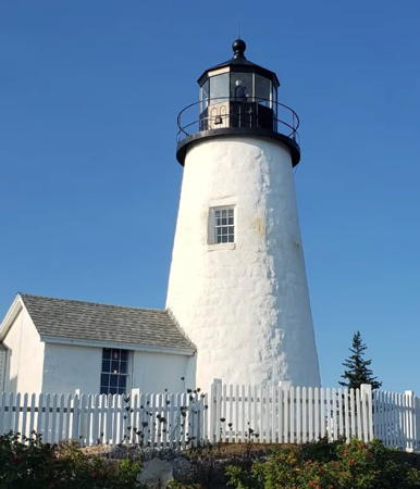

Pemaquid Point Light, March 2023
Instagram photo by Ben Reeder

Western Knox County Lighthouses

Knox County extends eastward across lower Penobscot Bay to include Isle au Haut, Vinalhaven Island, and Matinicus Island. Lighthouses of those islands and their surroundings are described on the Eastern Maine page.

Camden and Rockland Area Lighthouses
Camden is a popular resort town with about 5200 permanent residents. Rockland, a town of about 7000 residents, is the county seat of Knox County and a ferry terminal for the islands of Penobscot Bay.
Curtis Island (Negro Island) (2)
1896 (station established 1835). Active; focal plane 52 ft (16 m); green light occults every 4 s. 25 ft (7.5 m) round cylindrical brick tower with lantern and gallery; solar-powered 300 mm lens (1994). Tower painted white, lantern and gallery black. The original 4th order Fresnel lens is on display at the Camden Town Hall. The original 1-1/2 story wood keeper's house, occupied by a caretaker, has a conspicuous red roof. Barn (1889), oil house (1895), and other light station buildings. Britten has a good photo, Anderson has a fine page with good photos, Trabas has a good photo, Marinas.com has aerial photos, Huelse has a historic postcard view, and Google has a good satellite view. The Coast Guard has a photo of the original lighthouse. Negro Island was renamed in 1934 for Cyrus Curtis, a town resident and publisher of the Saturday Evening Post. The lighthouse was automated in 1972 and the town acquired the station except for the light tower in that year. The lighthouse itself was transferred to the town in 1998 under the Maine Lights program. In December 2023 the Town of Camden and the newly-formed Curtis Island Foundation, concerned by deteriorating conditions at the light station, agreed to hire Historic Building Architects to conduct an assessment and draft a restoration plan. Located on an island in the entrance to Camden Harbor from West Penobscot Bay. Accessible only by boat; free boat rides are provided once a year on Curtis Island Day in June. Site open (city park), tower closed. Operator: U.S. Coast Guard. Owner/site manager: Town of Camden. . ARLHS USA-213; Admiralty J0096; USCG 1-4310.
Indian Island (Rockport) (2)
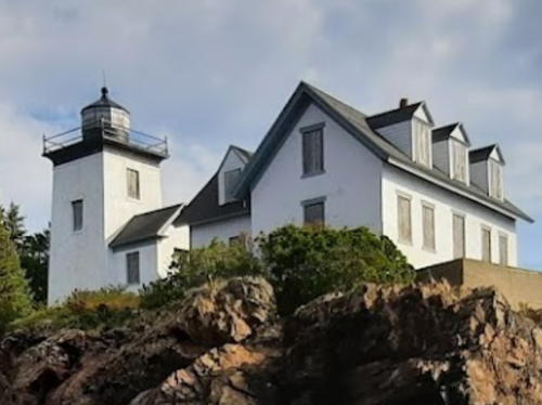
1874 (station established 1850). Inactive since 1934; charted as a landmark. 31 ft (9.5 m) square cylindrical brick tower with lantern and gallery, painted white, attached to a 1-1/2 story wood keeper's house. Oil house (1894). Barbara Richardson's 2021 photo is at right, Anderson's page has several photos, Brad Cullivan has a 2021 photo, Sue Clark has a photo, Lighthouse Digest has Diane Roesing O’Brien's article on life at the light station, Marinas.com has aerial photos, Huelse has a historic postcard view, and Google has a satellite view. The station has been a private residence since it was deactivated in 1934; it is very well maintained. The modern Lowell Rock Light (Admiralty J0100; USCG 1-4280) is displayed from a mast at the tip of the reef south of the island. Located on a small island off Beauchamp Point at the entrance to Rockport Harbor. Accessible only by boat. Many cruises and boat tours pass the site; there are views also from Rockport Marine Park. Site and tower closed. Owner/site manager: private. . ARLHS USA-400.
* Rockland Harbor Breakwater
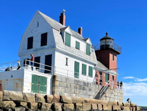
1902. Active; focal plane 39 ft (12 m); white flash every 5 s. 25 ft (7.5 m) square cylindrical red brick tower with lantern and gallery rising from one corner of a 1-1/2 story red brick and white wood keeper's house; VRB-25 lens. Tower unpainted red brick; lantern painted black. Fog horn (blast every 15 s) on demand. Original fog signal building attached to tower. Clayton & Cindy Putnam have the 2021 photo seen at right, Anderson has a good page with photos, Trabas has Michael Boucher's photo, Steve Dorsey has a photo, a good 2014 photo is available, Marinas.com has aerial photos, Huelse has a historic postcard view, Jonathan Goodnow has a closeup street view, and Google has a satellite view. The lighthouse was in poor condition when it was transferred to the city under the Maine Lights program in 1998. The American Lighthouse Foundation launched fundraising to restore and operate the lighthouse and in 1999 a local support group, Friends of the Rockland Breakwater Lighthouse, formed to carry out this effort. In July 2001 the friends group leased the lighthouse from the city. At that time about half the $250,000 needed for restoration was in hand. Restoration work began in September 2003 and continued for more than a decade, carried out mostly by volunteers. In 2021, with its membership aging, the friends group surrendered its lease to the city. In 2022 City Council agreed to ask Congress for $125,000, to be matched by local contributions, for urgently needed repairs to the building. Congress agreed to include this amount in its 2022-23 budget. Located at the end of a 4500 ft stone breakwater at Jameson Point, near the end of Samoset Road in Rockland. Accessible in good weather by walking the breakwater (7/8 mi (1.4 km) one way); there are also good views from the state ferries to North Haven and Vinalhaven. Site open, tower closed. Operator: U.S. Coast Guard. Site manager: City of Rockland (Rockland Harbor Lighthouse) . ARLHS USA-699; Admiralty J0102; USCG 1-4130.


Indian Island Light, Rockland, October 2021
Google Maps photo by Barbara Richardson


Rockland Harbor Breakwater Light, Rockland, September 2021
Google Maps photo by Clayton & Cindy Putnam

 
Rockland Harbor Southwest
1987. Active (privately maintained); focal plane 44 ft (13.5 m); continuous yellow light. Square cylindrical wood tower with lantern and gallery, painted gray, rising from a 2-story unpainted shingled residence. 5th order Fresnel lens transferred in 1989 from Doubling Point Range Lights. Anderson has closeup photos, Trabas has Michael Boucher's photo, and Google has a satellite view. The lighthouse was built by Dr. Bruce Woolett and accepted by the Coast Guard as a privately maintained aid to navigation. It was sold in 1998; the new owner, John Gazzola, renovated the building and added the shingled siding. The property was sold again in 2012 for $520,000. Located at the end of Sherman's Lane, off North Shore Drive (the road to Owl's Head) on the south side of Rockland. Site and tower closed (private residence). Owner/site manager: private. ARLHS USA-1021; Admiralty J0103.4; USCG 1-4140.
*** Owl's Head (2)
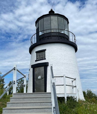
1852 (station established 1826). Active; focal plane 100 ft (30.5 m); continuous white light, displayed day and night. 30 ft (9 m) round old-style brick tower with lantern and gallery; 4th order Fresnel lens (1856). Tower painted white, lantern and gallery black. Fog horn (2 blasts every 20 s). 1-1/2 story wood keeper's house (1854). Oil house (1895). Stacey Sawyer's 2023 photo is at right, Mike Ladd has a 2007 photo, Anderson has a page with good photos, Trabas has Michael Boucher's closeup photo, a 2022 photo is available, Huelse has a historic postcard view, Amy Pietrowski has a street view, Dave Athey has a closeup 2015 street view, and Google has a satellite view. The original lighthouse was a similar rubblestone tower. The present light is a picturesque, well preserved, well known, and well visited lighthouse. The state administers the surrounding area as Owls Head State Park. In December 2007 the American Lighthouse Foundation secured a license from the Coast Guard to manage and restore the lighthouse. In 2009 the lighthouse was one of three benefiting from a $380,000 federal grant to the Foundation. Work was underway in April 2010 to restore the brickwork and windows. The keeper's house was used as Coast Guard housing until late 2012, when the American Lighthouse Foundation leased the house to use as its headquarters and as an interpretive center. Located at the end of Lighthouse Road in Owl's Head. Accessible by a short walk from the state park's parking area. There are also good views from the Rockland-Vinalhaven state ferry. Site open, tower open Monday, Wednesday, Saturday, and Sunday from Memorial Day (late May) through Columbus Day (early October). Owner: U.S. Coast Guard. Site manager: American Lighthouse Foundation (ALF Interpretive Center) . ARLHS USA-574; Admiralty J0104; USCG 1-4105.

Owl's Head Light, Owl's Head, August 2023
Instagram photo by Stacey Sawyer

St. George Area Lighthouses
Two Bush Island
1897. Active; focal plane 65 ft (20 m); white or red flash every 5 s (red sector covers west and north). 42 ft (13 m) square brick tower with lantern and gallery attached to a brick fog signal building; VRB-25 lens. Buildings painted white, lantern and gallery black. Fog horn (blast every 15 s) on demand. The keeper's house was demolished in 1970. Anderson's page has good photos, Martin Burton has a 2019 photo, Marinas.com has aerial photos, and Google has a satellite view. Huelse has a historic postcard view of the complete station. The historic fog bell now hangs in the steeple of the Spruce Head Community Church. This lighthouse guides vessels approaching Penobscot Bay from the southwest though the Two Bush Channel. Ownership was transferred to the Fish and Wildlife Service in 1998. In 2000 the Coast Guard replaced the DCB-224 aerobeacon with a weaker flashing light powered by solar panels. Located on a small island about 4 miles (6.5 km) southeast of Spruce Head. Accessible only by boat. Site and tower closed. Operator: U.S. Coast Guard. Owner/site manager: U.S. Fish and Wildlife Service (Maine Islands National Wildlife Refuge). . ARLHS USA-860; Admiralty J0120; USCG 1-4540.
Whitehead Island (3)
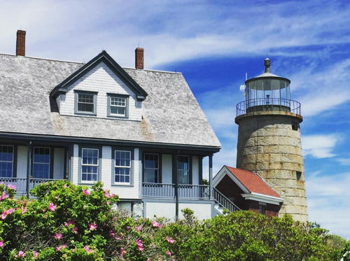
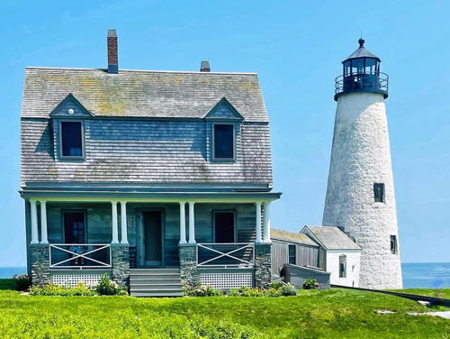
1852 (station established 1804). Active; focal plane 75 ft (23 m); green light occulting every 4 s, day and night. 41 ft (12.5 m) unpainted round granite tower with lantern and gallery, attached to a red brick service room; 300 mm lens (1982). Fog horn (2 blasts every 30 s). The original 3rd order Fresnel lens is on display at the Maine Lighthouse Museum in Rockland. 1-1/2 story wood assistant keeper's house (1891); the principal keeper's house has been demolished. Square brick fog signal building (1888), oil house (1891), boathouse, and other light station buildings. A 2020 photo is at right, Anderson's page also has good photos, Martin Burton has a 2019 photo, D'Entremont has a 2017 photo,Trabas has a view from the sea, Lighthouse Digest has an August 2000 story on the history of the light station, Marinas.com has aerial photos, and Google has a satellite view. The original lighthouse, a wood tower, was replaced by a stone tower in 1830. Transferred under the Maine Lights program in 1998, this light station became part of a summer camp for high schoolers, who helped restore the historic buildings. Starting in August 2008 the keeper's house has been used for educational programs for adults. Located on an island 2 miles (3 km) south of Spruce Head. Accessible only by boat. Site and tower closed to the public. Operator: U.S. Coast Guard. Owner/site manager: Whitehead Light Station . ARLHS USA-888; Admiralty J0122; USCG 1-4580.
Tenants Harbor (Southern Island)
1857. Inactive since 1933; charted as a landmark. 27 ft (8 m) round brick tower with lantern and gallery, attached to a 1-1/2 story wood keeper's house. Buildings painted white, lantern and gallery black. Anderson's page has several good photos, Martin Burton has a 2019 photo, Huelse has a historic postcard view, and Google has a satellite view. This light station is a private residence owned by the artist Jamie Wyeth. Wyeth has reconstructed the square pyramidal wood bell tower and uses it as his studio. The light was moved to a lighted bell buoy (USCG 1-4725). Located at the eastern tip of Southern Island, off the entrance to Tenants Harbor. Visible only by boat. Site and tower closed. Owner/site manager: private. . ARLHS USA-840.

Whitehead Island Light, St. George, June 2020
Instagram photo by Whitehead Light Station
*** Marshall Point (2)
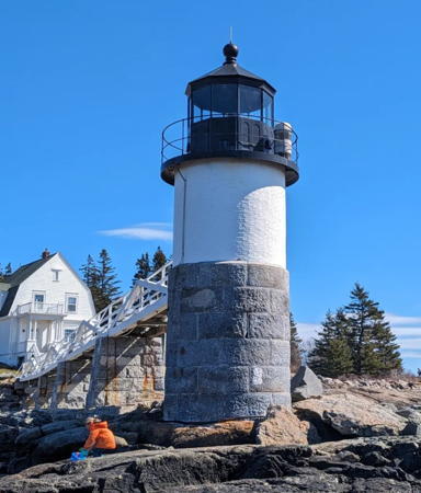
1857 (station established 1832). Active; focal plane 30 ft (9 m), continuous white light, day and night. 31 ft (9.5 m) round tower with lantern and gallery, lower part granite blocks and upper part brick, connected to land by a wooden walkway; 300 mm lens (1981). Upper part of tower and walkway painted white, lantern and gallery black. Fog horn (blast every 10 s) on demand. 1-1/2 story wood keeper's house (1895); the lower floor houses the Marshall Point Lighthouse Museum, and the upper floor is a caretaker's residence. Fog signal building demolished, but the original bell (1898) is on display. Oil house (1898) and reconstructed kitchen (1995). Erin Cochran's 2024 photo is at right, Trabas has Michael Boucher's closeup photo, Anderson has an excellent page for the lighthouse, Britten has good photos, Justin Russell has a nice 2003 photo, Marinas.com has aerial photos, Huelse has a historic postcard view, and Google has a satellite view as well as a street view of the keeper's house. The restoration effort began in 1986 when the Town of St. George leased the station from the Coast Guard. The St. George Historical Society restored the tower and keeper's house in 1988-89 and opened the museum in 1990. The lighthouse gained some notoriety when it appeared in the 1993 movie Forrest Gump as the eastern end of Gump's cross-country run. In 1995 the summer kitchen was reconstructed to provide space for more exhibits. In 1998 ownership of the station was transferred to the town under the Maine Lights program. The tower and walkway were repaired and repainted in the fall of 2017. In September 2018 ground was broken for a replica of the barn and workshop, a building demolished in 1971. The 5th order drum-style Fresnel lens removed from the lighthouse in 1971 was displayed for years at the Maine Lighthouse Museum in Rockport but has returned for display at the museum in 2020; also on display is the 300 mm lens used from 1971 to 2016. A lightning strike in July 2023 destroyed the LED lens and all electrical equipment had to be replaced. The walkway was damaged by a winter storm in January 2024. Located at the end of Marshall Point Road in Port Clyde. Site open, museum open on weekends in May and daily Memorial Day (late May) through Columbus Day (mid October), tower closed. Operator: U.S. Coast Guard. Owner: Town of St. George. Site manager: Marshall Point Lighthouse Museum . ARLHS USA-479; Admiralty J0124; USCG 1-4780.
Franklin Island (3)
1855 (station established 1807). Active; focal plane 57 ft (17 m); white flash every 6 s. 45 ft (14 m) round cylindrical brick tower with lantern and gallery; solar-powered 250 mm lens. Tower painted white, lantern and gallery gray; lantern roof is red. The original 4th order Fresnel lens is on display at the Boothbay Harbor Coast Guard Station. The keeper's house was demolished in 1967; the oil house (1895) survives but without its roof. Anderson's page has recent photos, Trabas has Michael Boucher's closeup photo, Changan Guo has a 2019 photo, and Google has a satellite view. Huelse has a historic postcard view of the complete station. In August 1999 the Coast Guard contracted with Franklin Light Preservation to maintain the lighthouse. In 2001 the group rebuilt the Coast Guard pier and built a helipad on the island for ready access to the light. In December 2003 the Maine Department of Environmental Protection ordered these improvements removed because the group had no DEP permits for them. The organization seems to have ceased operations; the IRS canceled its tax-exempt status for failure to file the necessary forms for three or more years. Located on a small island in the mouth of Muscongus Bay about 4.5 miles (7 km) southwest of Port Clyde. Accessible only by boat. Site closed for seabird nesting April through July, otherwise open; tower closed. Owner: U.S. Coast Guard. Site manager: U.S. Fish and Wildlife Service (Maine Coastal Islands National Wildlife Refuge). . ARLHS USA-309; Admiralty J0132; USCG 1-4980.

Marshall Point Light, Port Clyde, March 2024
Instagram photo by Erin Cochran

Lincoln County Lighthouses

Monhegan Island and Bristol Area Lighthouses
Monhegan is a small island located about 14 mi (22 km) southeast of Pemaquid Point and a similar distance south of Port Clyde. The permanent population is about 75. The island is accessible by passenger ferry from Port Clyde year round, or from New Harbor or Boothbay Harbor in season. Classified as a "plantation," Monhegan is not part of a town. Bristol, a town of about 3000 residents, is the closest town of the mainland.

**
Monhegan (2)
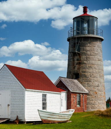
1850 (station established 1824). Active; focal plane 178 ft (54 m); white flash every 15 s. 47 ft (14 m) old-style unpainted round granite block tower with lantern and gallery, attached to a workshed; solar-powered VRB-25 aerobeacon. Lantern black with a red roof. The 1-1/2 story wood keeper's house (1874) is now a museum. Oil house (1893?) and other original buildings preserved; the 1857 assistant keeper's house was reconstructed in 1997-98. The fog bell (1855) from the nearby Manana Island fog signal station is on display. The passageway connecting the lighthouse and keeper's quarters has been rebuilt. Michael Rosenthal's photo is at right Anderson has a good page for the lighthouse, Britten has good photos, Marinas.com has aerial photos, Trabas has a very distant view by Capt. Peter Mosselberger, Christopher Jordan has a street view, and Google has a satellite view. The lighthouse was automated in 1959. In 1962 the Monhegan Associates, a conservation group, purchased the vacant keeper's house for the purpose of establishing a museum for the island. The museum opened in 1968; since 1984 it has been operated by a separate Musuem Association. The light tower was transferred to the Museum Association in 1998 under the Maine Lights program. Located atop the rocky island of Monhegan, about 1/2 mile (800 m) from the ferry dock. Site open, museum open daily late June through September, tower open to tours from the museum twice a week (weather permitting, check locally for the schedule). Owner/site manager: Monhegan Museum. . ARLHS USA-509; Admiralty J0128; USCG 1-0020.
[Manana Island Fog Signal]
1889 (station established 1855). Inactive since 2014. Original (1855) 2-story wood keeper's house. 1-story brick fog signal building (1889). The assistant keeper's house has been demolished but several other smaller station buildings survive. A photo by Bob Trapani (third photo on the page) is available, the Coast Guard has a historic photo, and Google has a satellite view. There was never a lighted aid to navigation at this station. In late 2012 the station was listed for sale at auction, and in July 2013 it sold for $199,000. Located on the west side of a small island across a narrow channel west of Monhegan Island. Accessible only by boat. Site open, station building closed. Owner/site manager: private. ex-Admiralty J0130; ex-USCG 1-0025.

Monhegan Light, Monhegan Island, August 2020
Instagram photo by Michael Rosenthal
**** Pemaquid Point (2)
1835 (Joseph Berry; station established 1827). Active; focal plane 79 ft (24 m); white flash every 6 s. 38 ft (11. 5 m) old-style round rubblestone tower with lantern and gallery, attached to a 1-1/2 story wood keeper's house (1857); 4th order Fresnel lens (1856). Buildings painted white; lantern and gallery are black. The keeper's house is now the Fishermen's Museum; a 4th order Fresnel lens from Baker Island Light (see the Eastern Maine page) is on display. Brick fog signal building with bell. The brick oil house (1896) was damaged by a storm in 1991 but repaired in 1992. Ben Reeder's 2023 photo is at the top of this page, Anderson has a fine page with photos, Trabas has a good photo, Leana Gagne has a 2021 photo, there are great photos from Britten, Marco Mazzei has a good 2006 photo, Marinas.com has aerial photos, a webcam provides a current view of the lighthouse, Huelse has a historic postcard view, and Google has a satellite view and a street view. This well known and popular lighthouse is depicted on a U.S. quarter dollar coin. In 2000 the Coast Guard refurbished the light tower and then leased it to the American Lighthouse Foundation for preservation. ALF has organized the Friends of Pemaquid Point Lighthouse to work for restoration and maintenance of the tower. In 2002 volunteers of the New England Lighthouse Lovers (NELL) painted the tower. In 2003 FPPL volunteers began conducting tours of the tower. In February 2007 the National Trust for Historic Preservation announced a grant of $50,000 to restore the exterior masonry of the tower. In 2009 the lighthouse was one of three benefiting from a $380,000 federal grant to ALF. A thorough restoration by the J.B. Leslie Company was completed by June 2010. In January 2024 a winter storm heavily damaged the station's bell house. Located just beyond the end of ME 130 south of New Harbor, about 1 km (0.6 mi) northeast of the southernmost point of land. Site open, museum and tower open daily from early May through late October. Owner: U.S. Coast Guard (tower only) and Town of Bristol. Site manager: Friends of Pemaquid Point Lighthouse (tower only) and Fishermen's Museum. . ARLHS USA-589; Admiralty J0134; USCG 1-5145.

Boothbay Harbor and Southport Area Lighthouses
Boothbay Harbor is a popular resort town of about 2000 permanent residents. Southport is a village on an island southwest of Boothbay Harbor.
Ram Island
1883. Active; focal plane 36 ft (11 m); red light, 3 s on, 3 s off. 35 ft (11 m) round tower with lantern and gallery, lower part unpainted granite blocks and upper part brick painted white; 250 mm lens. Lantern and gallery painted black. Fog horn (blast every 30 s) on demand. The original 4th order Fresnel lens is on display at the Boothbay Region Historical Society Museum in Boothbay Harbor. The original 1-1/2 story wood keeper's quarters houses a caretaker in season. Barn (1883) and brick oil house (1898). Anderson's page has good photos, Trabas has a closeup photo, Keith Moore has a 2019 photo, David Cain has a 2021 photo, and Google has a satellite view. Not to be confused with the Ram Island Ledge Light (see below). The Grand Banks Schooner Museum leased the light station except for the tower in 1983, when the Coast Guard was about to demolish the keeper's house. The Museum Trust organized the Ram Island Preservation Society to restore the house. In 1998 the Trust received ownership of the entire station under the Maine Lights program. The walkway connecting the lighthouse to shore had been removed by the Coast Guard in 1977; it was rebuilt during 2002. Located on a small island on the south side of Fisherman Island Passage, the eastern entrance to Boothbay Harbor, opposite Ocean Point. Accessible only by boat. The Maine Maritime Museum in Bath offers cruises to the island in season. Site open, tower closed. Owner/site manager: Grand Banks Schooner Museum Trust. . ARLHS USA-686; Admiralty J0136; USCG 1-5420.
** Burnt Island
1821. Active; focal plane 61 ft (18.5 m); red flash every 6 s; two white sectors cover clear channels. 30 ft (9 m) round rubblestone tower with lantern and gallery, attached to a 1-1/2 story wood keeper's house (1857); 300 mm lens. Tower painted white, lantern and gallery black. Fog horn (blast every 10 s). The 4th order Fresnel lens used from 1857(?) to 1961 is on display at the Maine Lighthouse Museum in Rockland. is at right, the state has a web site for the lighthouse, Anderson has a good page for it, Lighthouse Digest has a June 2004 feature article, Trabas has a photo, Richard Bullington-McGuire has a good 2015 photo, Katie Mahoney has a 2018 photo, a 2021 view from the sea is available, Marinas.com has aerial photos, and Google has a satellite view. The third-oldest Maine lighthouse, this is a well preserved light station with the original oil house (1899), boathouse (1880), barn (1877), and other structures. The Keepers of Burnt Island Light organization works for preservation and operation of the light. The state has developed the site as a "living lighthouse" where visitors can see a nineteenth century light station in action. Restoration began in 1999 with tree clearing and utilities work and continued in 2000 with replacement of the roof, restoration of chimneys and fireplaces, painting, and installation of a heating system. Interior restoration was completed in 2001. The light station was rededicated on 20 June 2003. A major project in 2020 restored the tower and restored the 1857 keeper's house to its 1950s-era appearance. Located on an island off the east coast of Southport Island in the entrance to Boothbay Harbor. Accessible only by boat; tours are available Mondays and Thursdays late June through early September from Boothbay Harbor. The Keepers of Burnt Island Light offer "living history" tours to the island and lighthouse in season. Site open, tower closed. Owner: Maine Department of Marine Resources. Site manager: Burnt Island Living Lighthouse . ARLHS USA-097; Admiralty J0140; USCG 1-5520.

Burnt Island Light, Boothbay Harbor, September 2020
Instagram photo by Bob Trapani for Maine Lights Today
The Cuckolds
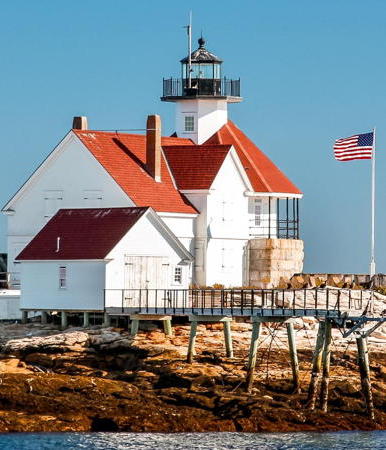
1907 (built as a fog signal station 1892, lantern added 1907). Active; focal plane 59 ft (18 m); 2 white flashes every 6 s. Unique design: 48 ft (14.5 m) overall; round wood fog signal station with granite foundation with short white octagonal tower, with lantern and gallery, mounted at the peak of the conical red roof; solar-powered VRB-25 aerobeacon (1998). Lantern and gallery painted black. Fog horn (blast every 15 s). The 1-1/2 story wood keeper's house, formerly attached, was demolished after severe damage from a blizzard (1978). The original (and rare) American-made 4th order Fresnel lens is on display at the Maine Lighthouse Museum in Rockland. A 2022 photo is at right, Anderson has a good page for the lighthouse, Trabas has Darren Setlow's closeup photo, Dan Roy has a 2017 closeup photo, Marinas.com has aerial photos, Huelse has a historic postcard view, and Google has a satellite view. In 2006 the light station was transferred to a local preservation group under the National Historic Lighthouse Preservation Act (NHLPA). By 2014 the light station had been restored and reopened as a bread and breakfast inn. After several years of operation the inn closed at the end of July 2019. Located on a small island off Cape Newagen, between Boothbay Harbor and the Kennebec River. Accessible only by boat. Visible from the public pier in Newagen. Site open, tower closed. Owner/site manager: Cuckolds Fog Signals and Light Station Council. . ARLHS USA-210; Admiralty J0142; USCG 1-5485.
Hendricks Head (2)
1875 (station established 1829). Reactivated (inactive 1933-1951); focal plane 43 ft (13.5 m); continuous light, white to the east and red to the west. 39 ft (12 m) square cylindrical brick tower with lantern and gallery; 250 mm lens (1979). Tower painted white, lantern and gallery black. The original 2-story wood keeper's house is now a private summer residence. Buildings painted white with red roofs. Brick oil house (1895) and other buildings. Pyramidal wood fog bell tower (1890), recently rebuilt. Lighthouse Digest has an article on the history of the light station, Anderson has a fine page with several views from the sea, Trabas has a closeup photo, Tim Fish has a 2021 photo, Teresa Chrzanowski Flisiuk also has a closeup, Huelse has a historic postcard view, and Google has a good satellite view. The station was deactivated and sold in 1933 to reduce costs; in response to many public requests it was reactivated in 1951 when electricity became available at the site. The blizzard of January 9, 1978, destroyed the boathouse and the covered walkway that connected the house and the fog bell tower. The present owners, Luanne and Ben Russell, have renovated the entire light station. Located off ME 27 on Sheepscot Bay in West Southport. Site and tower closed. Owner/site manager: private (Hendricks Head Lighthouse ). ARLHS USA-369; Admiralty J0144; USCG 1-5665.

Cuckolds Light, Boothbay Harbor, November 2022
Instagram photo by Oliver H.

Sagadahoc County Lighthouses

Kennebec River Lighthouses
The Kennebec River is navigable for fairly large ships; the depth maintained is 27 ft (8.2 m) for about 15 miles (25 km) to the traditional shipbuilding town of Bath. Above Bath the estuary widens into Merrymeeting Bay, a drowned valley. The lighthouses of the river are listed south to north.
Perkins Island
1898. Active; focal plane 41 ft (12.5 m); red flash every 2.5 s; 2 white sectors cover clear channel. 23 ft (7 m) octagonal wood tower with lantern and gallery, painted white; 250 mm lens. Lantern painted black. Original 2 story wood keeper's house, pyramidal wood bell tower, brick oil house, and other buildings. The original fog bell is on display at Georgetown High School. Barry Mullin's 2023 photo is at right, Anderson has a good page for the lighthouse, Trabas has a closeup photo, Rick Sieberg has a 2020 photo, Kenya Allmond has a photo, Marinas.com has aerial photos, and Google has a satellite view. Transferred to the state in the 1960s (except for the tower), the light station, especially the keeper's house and bell tower, was in disrepair for many years due to lack of maintenance. Lighthouse Digest had an October 2000 story on the sad state of the light station and placed the lighthouse on the Doomsday List. In 2000 the lighthouse (but not the rest of the station) was leased by the American Lighthouse Foundation for preservation. A new ALF chapter, Friends of Perkins Island Lighthouse, was formed to restore the keeper's quarters. In 2000 local volunteers did restore the fog bell tower. In 2005 and 2006 chapter members worked to stabilize the keeper's house, repairing the most urgent problems. A more complete restoration was carried out in fall 2014, aided by a $45,000 gift from Georgetown residents Tom and Jaana Sheehan. Additional work to restore the barn, oil house, and bell tower was underway in the fall of 2016. Located on an island on the east side of the Kennebec opposite Parker Head. Accessible only by boat. Maine Maritime Museum in Bath offers cruises passing the light. Site open, tower closed. Owner/operator: U.S. Coast Guard (tower) and Maine Department of Natural Resources. Site manager: Friends of Perkins Island Lighthouse (tower) and Maine Department of Natural Resources. . ARLHS USA-596; Admiralty J0152; USCG 1-6070.

Perkins Island Light, Phippsburg, July 2023
Instagram photo by Barry Mullin
* Squirrel Point
1898. Active; focal plane 33 ft (10 m); red or white light, 3 s on, 3 s off; the white sector covers clear channel. 25 ft (7.5 m) octagonal wooden tower with lantern and gallery, painted white, attached to the fog signal building; 250 mm lens. Lantern painted black. The original 5th order Fresnel lens is on display at Portland Head Light (see below). Original 1-1/2 story wood keeper's house, privately restored. Brick oil house (1906) and other buildings. A 2023 photo is at right, Anderson has a good page for the lighthouse, Trabas has a closeup photo, a 2021 photo of the light in action is available, Lauren Cunningham also has a 2021 photo, Patrick O'Leary has a 2017 street view, and Google has a satellite view. Sibling of Perkins Island Light. In 1996 Congress directed the Coast Guard to convey the property to Mike Trenholm and his nonprofit organization, Squirrel Point Light Associates, Inc. Then in early 1999 the lighthouse was reported for sale. This stirred up a controversy but Trenholm claimed the lighthouse was never on the market. However, in 2002 the lighthouse was indeed listed for sale and controversy began anew. When the Coast Guard indicated it would allow a sale to a retired naval officer, a new group, Citizens for Squirrel Point, sued in federal court to block the sale. Reversing course, the Coast Guard joined the suit and asked the court to recover the property because the owners had violated the terms of the 1996 transfer. In February 2005 a judge approved a magistrate's decision that the property should revert to the federal government. In early 2008 the Coast Guard leased the station to the Chewonki Foundation, which specializes in land conservation in Maine. The foundation helped plan a restoration, but in 2013 it surrendered its lease and the Coast Guard leased the station to the Citizens for Squirrel Point. Action was taken to secure the buildings and restoration plans were prepared. In 2016-17 the roofs of the boathouse and keeper's house were replaced and the chimney repointed to prevent water damage. Work is continuing, aided by small grants and many volunteers. Restoration of the boathouse was completed in 2019. Located in a nature preserve on Arrowsic Island on the east side of the Kennebec opposite Phippsburg. Accessible by a hiking trail (about 0.6 mi (1 km) long) from the end of Bald Head Road in Arrowsic, and the Maine Maritime Museum in Bath offers cruises passing the light. Note: the entrance to Bald Head Road from Arrowsic Road (ME 127) is unmarked. Site open, tower closed. Owner/operator: U.S. Coast Guard. Site manager: Citizens for Squirrel Point . ARLHS USA-788; Admiralty J0156; USCG 1-6100.

Squirrel Point Light, Arrowsic, May 2023
Instagram photo by Globe Explorer for Visit Maine
* Doubling Point Range Front
1898. Active; focal plane 18 ft (5.5 m) quick-flashing white light intensified on the range line. 13 ft (4 m) octagonal wood tower, painted white with a red pyramidal roof, mounted on a granite foundations; 250 mm lens. One of the original 5th order Fresnel lenses from this range was transferred to the Rockland Harbor Southwest Light (see above). Original 2-story wood keeper's quarters (occupied by a caretaker) and other buildings. Anderson has a fine page for the lights, Trabas has a closeup photo, Patrick O'Leary has a 2021 street view, and Google has a satellite view. In 1998 the lights and the nearby fog signal building were transferred to a new preservation group, the Range Light Keepers, under the Maine Lights program. In 2017 the group was fundraising to replace the shingles on both towers. Located off Doubling Point Road, on the east side of the Kennebec River off ME 127 near the northwest corner of Arrowsic Island. The entrance from ME 127 is marked by a small sign "To Doubling Point Rd." The Maine Maritime Museum in Bath offers cruises passing the light. Site open with permission of caretaker, tower closed. Operator: U.S. Coast Guard. Owner/site manager: Range Light Keepers . ARLHS USA-415; Admiralty J0160; USCG 1-6135.
* Doubling Point Range Rear
1898. Active; focal plane 33 ft (10 m); white light, 3 s on, 3 s off, intensified on the range line. 13 ft (4 m) octagonal wood tower, painted white with a red pyramidal roof, mounted on a granite foundation; 250 mm lens. Trabas has a closeup photo and Brian Bartlett has a closeup but an overhanging tree hides the light in Google's satellite view. The Coast Guard restored the rear tower in 1996, and the Range Light Keepers carried out another restoration in 2017. Located about 800 ft (240 m) north of the front light. Site open with permission of caretaker, tower closed. Operator: U.S. Coast Guard. Owner/site manager: Range Light Keepers. ARLHS USA-973; Admiralty J0160.1; USCG 1-6140.
[Fiddler's Reach Fog Signal]
1913. Inactive since 1972 (at least). Approx. 9 m (30 ft) square pyramidal shingle-covered wood tower. The tower was restored in 2000. A Nebraska museum loaned the fog bell installed on the tower in 2016; the original bell is on display at the U.S. Coast Guard Museum in New London, Connecticut. Located about 1100 ft (335 m) upstream from the Doubling Point Range Lights; Google has a satellite view. Site status unknown; may be accessible only by boat. Owner/site manager: Range Light Keepers.
Doubling Point
1899. Active; focal plane 23 ft (7 m); white flash every 4 s. 23 ft (7 m) octagonal wooden tower with lantern and gallery, mounted on a square unpainted granite foundation; 300 mm lens. Lantern painted black. Sibling of Perkins Island. The 5th order Fresnel lens (1902) is on display at the Maine Lighthouse Museum in Rockland. Original 1-1/2 story wood keeper's house and bell tower. Roy Heintzelman's 2022 photo is at right, Anderson has a good page for the lighthouse, Trabas has a closeup photo, Carol Weintraut has a 2022 closeup, Huelse has a historic postcard view, Patrick O'Leary has a 2017 street view, and Google has a satellite view. The lighthouse was previously endangered by ice damage to its foundation. Restoration of the foundation was completed in January 2000 and the walkway to the light was restored the following summer. In September 2023 the walkway collapsed during Maine Open Lighthouse Day. Five visitors were treated and released from hospital and the collapse was ruled an accident caused a rotten support. Located on the east side of the Kennebec River, at the end of Doubling Point Road off ME 127 near the northwest corner of Arrowsic Island, upstream from the range lights (see above). Note: the entrance from ME 127 is marked by a small sign "To Doubling Point Rd." The Maine Maritime Museum in Bath offers harbor cruises daily in season to the vicinity of the light. Site closed pending reconstruction of the walkway, tower always closed. Operator: U.S. Coast Guard. Owner/site manager: Friends of Doubling Point Light. . ARLHS USA-234; Admiralty J0166; USCG 1-6145.

Doubling Point Light, Arrowsic, November 2022
Instagram photo by Roy Heintzelman

Phippsburg Area (Kennebec Entrance) Lighthouses
* Fort Popham (3)
1940s. Active; focal plane 27 ft (8 m); green flash every 4 s. Light mounted on a short mast atop the historic fort. This light replaced a pyramidal wooden tower (1903). Lighthouse Digest has a March 2005 story on life at this station, Trabas has Michael Boucher's photo, a 2008 photo is available (light at upper right corner of the photo), and Google has a satellite view and a street view of the fort. Located on the west side of the mouth of the Kennebec River. Operator: U.S. Coast Guard. Owner: Maine State Parks. Site manager: Fort Popham State Historic Site. ARLHS USA-1205; Admiralty J0150; USCG 1-6050.
Pond Island (2)
1855 (station established 1821). Active; focal plane 52 ft (16 m); white light, 3 s on, 3 s off. 20 ft (6 m) round cylindrical brick tower with lantern and gallery, painted white; solar-powered 250 mm lens. Lantern and gallery painted black. Fog horn (2 blasts every 30 s). The keeper's house and all the other light station buildings were demolished in 1963. Anderson has a good page for the lighthouse, Trabas has a photo, and Google has a satellite view. Located on an island in the mouth of the Kennebec southeast of Popham Beach. The island is an important bird sanctuary and is closed to the public April through August. Accessible only by boat. Maine Maritime Museum in Bath offers cruises passing the light. Site open September through March but difficult to reach; tower closed. Operator: U.S. Coast Guard. Owner: U.S. Coast Guard. Site manager: Maine Audubon Society and Maine Coastal Islands National Wildlife Refuge (Pond Island). . ARLHS USA-1145; Admiralty J0148; USCG 1-6025.
** Seguin Island (3)
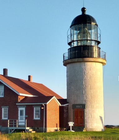
1857 (station established 1795). Active; focal plane 180 ft (55 m); continuous white light. 53 ft (16 m) round cylindrical granite tower with lantern and gallery, original Henry Lepaute 1st order Fresnel lens (the only 1st order lens in Maine). Lighthouse painted white, lantern and gallery black. Fog horn (2 blasts every 20 s). Original 1-1/2 story brick keeper's house, brick fog signal building (1889), brick oil house (1892), and other buildings. The keeper's house is occupied by volunteer caretakers in season. A 2021 photo is at right, Anderson also has a good page with excellent photos, Craig MacCormac has a 2023 photo, Trabas has a photo, Sue Clark has a 2008 photo, Marinas.com has aerial photos, Huelse has a historic postcard view, and Google has a satellite view. This is one of Maine's best known and most important lighthouses, and the highest in the state. In 1999-2000 the lighthouse was the subject of debate between preservationists and the Coast Guard, which wanted to extinguish the light and put up a solar-powered skeletal tower. In March 2000, under pressure from Congress and the public, the Guard dropped its plans to deactivate the light. Current projects include restoring the boat house and tramway engine house. In 2006 the Coast Guard carried out a restoration of the 1st order lens. In May 2019 the Coast Guard cut all power to the station due to impending failure of the undersea cable. The Friends group was able to restore power with a temporary generator and installation of solar power was scheduled for April 2020. Located atop a rocky island about 2.5 miles (4 km) south southeast of Popham Beach. Accessible only by boat; moorings provided. Maine Maritime Museum in Bath offers cruises to the island in season and several area captains provide transportation to the island. Site open, tower open daily Memorial Day (late May) through Labor Day (early September). Operator: U.S. Coast Guard. Owner/site manager: Friends of Seguin Island Lighthouse . ARLHS USA-746; Admiralty J0146; USCG 1-0035.

Seguin Island Light, Georgetown, August 2021
Google Maps photo by Tom R

Cumberland County (Portland Area) Lighthouses

Casco Bay Lighthouses
Little Mark Island Monument
Date unknown (tower built 1827). Inactive since 2019. Approx. 50 ft (15 m) unpainted square pyramidal granite monument with a modern light mounted at the top. A black vertical stripe is painted on each side of the tower, which is otherwise unpainted white granite. The tower has a room at the base, originally meant as a shelter for shipwrecked sailors and now used for storage batteries for the light. Lighthouse Digest has D'Entremont's photo, Robert van der Feyst has a 2020 photo, Earl Long has a 2010 photo, and Google has a good satellite view. Built as a daybeacon, this tower was not intended to be a lighthouse, and it is not known when it became a lighted aid to navigation. The light was deactiavted in 2019 but the tower continues to be listed as a daybeacon. In 2023 the island and monument became available for transfer under the National Historic Lighthouse Preservation Act (NHLPA). The Town of Harpswell is applying for ownership in partnership with the Presumpscot Foundation (see next entry). Located on Little Mark Island about 1 mile (1.5 km) southwest of the tip of Bailey Island and three miles (5 km) north of Halfway Rock. Accessible only by boat. Visible from the end of ME 24 in Bailey Island. Site open (but landing may be difficult), tower closed. Owner/site manager: U.S. Coast Guard. . ARLHS USA-1178; ex-Admiralty J0174; ex-USCG 1-6700.
Halfway Rock
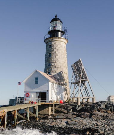
1871. Active; focal plane 77 ft (23.5 m); red flash every 5 s. 76 ft (23 m) wave-swept unpainted round granite tower with lantern and gallery; solar-powered VRB-25 aerobeacon (1994). Lantern and gallery painted black. Fog horn (2 blasts every 30 s) on demand. The original 3rd order Fresnel lens is on display at the U.S. Coast Guard Museum in New London, CT. The keeper's house and the rest of the light station were destroyed by various storms. A photo is at right, Anderson also has a good page for the lighthouse, Lighthouse Digest has D'Entremont's February 2003 article on the history of the station, Trabas has Jim Smith's photo, Richard Judkins has a 2021 drone view, Huelse has a historic postcard view, and Google has a satellite view. In 2000 the light tower was leased by the American Lighthouse Foundation for preservation. Interior restoration was needed badly. Unable to tackle such a large project, the Foundation surrendered its lease and in 2014 the lighthouse was placed on sale at auction. After surprisingly spirited bidding it sold in September for $283,000 to Ford Reiche, a retired businessman and trustee of Maine Preservation. Reiche launched the Presumpscot Foundation to be the owner of record and began restoring the lighthouse and attached boathouse to their 1950s appearance. In May 2017 the American Lighthouse Foundation honored Reiche with its Keeper of the Light Award for his successful restoration. Located on a bare, rocky island in the middle of Casco Bay about 12 miles (19 km) east of Portland. Accessible only by boat. Site and tower closed. Owner/site manager: Presumpscot Foundation. . ARLHS USA-364; Admiralty J0176; USCG 1-0040 (=1-6675).

Halfway Rock Light, Casco Bay, September 2018
Instagram photo by mainetheway

South Portland Lighthouses
Portland is the largest city in Maine and the state's most important port. South Portland, a city of about 27,000 residents, is located on the harbor at its entrance.
** Portland Breakwater ("Bug Light") (2)
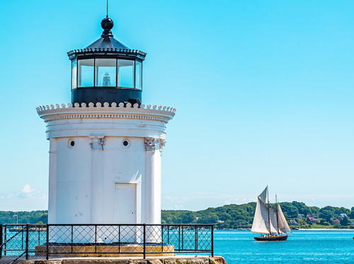
1875 (station established 1855). Reactivated (inactive 1942-2002, now privately maintained); focal plane 33 ft (10 m); white flash every 4 s. Unique design: 25 ft (7.5 m) round cast iron plate tower with lantern; the tower resembles the Choragic Monument of Lysicrates in Athens, Greece. Tower painted white, lantern black. The original 6th order Fresnel lens is on display at the South Portland Coast Guard Station. A 2022 photo is at right, Britten has a good photo, Anderson has a page with fine photos, Trabas has Michael Boucher's photo, Amy Doucette has a Christmas 2022 photo, Huelse has a historic postcard view, Patrick O'Leary has a street view, and Google has a satellite view. A keeper's house was attached to the lighthouse in 1889 but demolished in 1934 when the light was connected to city electric power. This is one of the many lighthouses known as "Bug Light." Volunteers from the South Portland/Cape Elizabeth Rotary Club and the Spring Point Ledge Lighthouse Trust organized to repaint and renovate the lighthouse in 2002, and it was relit in a ceremony on 14 August 2002. In 2003 a safety fence was built along the breakwater; some controversy arose since the fence is not historically accurate. Located in Bug Light Park (developed by the city in 1999) in South Portland; accessible by walking the short breakwater. Site open, tower closed. Owner/operator/site manager: City of South Portland (Bug Light Park). . ARLHS USA-659; Admiralty J0193.8; USCG 1-7699.
** Spring Point Ledge
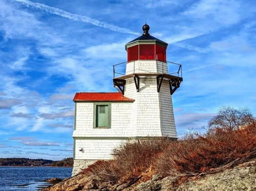
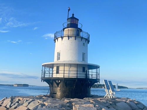
1897. Active; focal plane 54 ft (16.5 m); white flash every 6 s (two red sectors warn mariners who have strayed from the channel). 54 ft (16.5 m) sparkplug-style round brick tower with lantern and three galleries, on a brick caisson, incorporating 2-story keeper's quarters; 300 mm lens. Fog horn (blast every 10 s) on demand. Tower painted white, lantern black. Brian Bonham has a 2022 street view (also seen at right), Brent Danley has a 2007 photo, Anderson has a good page with several photos, Trabas has a closeup photo, C.M. Hanchey has a good 2009 photo, Huelse has a historic postcard view, and Google has a satellite view. This is the only Maine sparkplug tower retaining its lower gallery and canopy. Offshore when it was built, the lighthouse has been connected to land by a breakwater since 1951. The lighthouse was transferred to the Spring Point Ledge Light Trust in 1998 under the Maine Lights program. Opened to the public for the first time in 1999, this was the first sparkplug lighthouse in the nation to open for tours. The interior has been restored and furnished with period furniture. In 2001 the city provided funds to restore the canopy and repair cracks in the caisson; the project was completed in 2004. In 2007 the Trust raised $71,000 to replace the lantern glass and repair exterior cracks in the tower. In 2017 students at Southern Maine Community College built a visitor center and gift shop for the lighthouse. In 2016 the Coast Guard sued to recover a Fresnel lens believed stolen from this lighthouse and now held by a Michigan collector; in April 2017 a judge ruled that the lens must be returned to the government. Located off Spring Point a few hundred yards east of the Portland Breakwater Light. Accessible in fair weather by walking the breakwater from the Portland Harbor Museum on Fort Road, South Portland (the breakwater is not a smooth walk, so wear good shoes). Site open, tower open to tours 11 am through 1 pm Tuesdays and Thursdays Memorial Day (late May) through Labor Day (early September); check the Facebook page for possible closings. Operator: U.S. Coast Guard. Owner/site manager: Spring Point Ledge Light Trust . ARLHS USA-785; Admiralty J0195; USCG 1-7610.
Ram Island Ledge
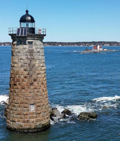
1905. Active; focal plane 77 ft (23.5 m); 2 white flashes every 6 s. 72 ft (22 m) wave-swept unpainted round granite tower with lantern and gallery, incorporating 2-story keeper's quarters; 300 mm lens converted to solar power in January 2001. Lantern and gallery painted black. Fog horn (blast every 10 s) on demand. Anderson has a good page for the lighthouse, Trabas has Ronald Wöhrn's closeup photo, Lynda Blutreich has a closeup photo, a 2021 closeup is available, Marinas.com has aerial photos, Huelse has a historic postcard view, and Google has a satellite view. Sibling of The Graves Light near Boston. Not to be confused with the Ram Island Light (see above). No information is available on the condition of this tower and it may be endangered by its age and inadequate maintenance. In 2008 the lighthouse was listed for transfer under NHLPA. After preservation groups passed on applying for the light, it was sold at auction in September 2010 for $190,000. The buyer is Jeffrey Florman, a surgeon from nearby Windham. Dr. Florman has not announced any plans for restoration. Located on a bare ledge about one mile off Portland Head at the south entrance to Portland Harbor. Accessible only by boat, but there's a good view from Portland Head Light. Site and tower closed. Operator: U.S. Coast Guard. Owner/site manager: private. . ARLHS USA-687; Admiralty J0204; USCG 1-7575.


Portland Breakwater (Bug) Light, South Portland, November 2022
Instagram photo by Lighthouse Buffs


Spring Point Ledge Light, South Portland, October 2009
Google Maps street view by Brian Bonham


Cape Elizabeth Lighthouses
Cape Elizabeth is a southern suburb of Portland; it has a population of about 10,000.
*** Portland Head
1791 (Benjamin Lincoln). Active; focal plane 101 ft (31 m); white flash every 4 s, day and night; in addition, a directional light, at the base of the tower, shows narrow green, white, and red sectors to guide ships approaching from the east. 80 ft (24.5 m) round rubblestone tower with lantern and gallery, painted white, attached through a workroom to a 2-story wood keeper's house (1891); VRB-25 optic. Lantern, watch room, and gallery painted black. Fog horn (blast every 15 s). The lower floor houses a museum; the 2nd order Fresnel lens (1885) and a 5th order Fresnel lens from Squirrel Point Light are on display. The brick fog signal building was reconstructed in 1975. Deb Fillion Hale's 2024 photo is at right, Anderson has an excellent page for the station, Lighthouse Digest has John Strout's article on the history of the light station, Wikimedia has Sumit Narayan's photo, Trabas has a photo, Ted Kerwin has a good 2008 photo, Marinas.com has aerial photos, Huelse has a historic postcard view, and Google has a street view and a fine satellite view. Maine's oldest lighthouse and one of the nation's most historic, this light station stands on a dramatically beautiful headland south of Portland. Views of the lighthouse have appeared in countless movies and television commercials. This was the very first lighthouse built by the federal government after it assumed control of lighthouses in 1789; it was dedicated in 1791 by the Marquis de Lafayette, the French officer who aided the U.S. in the Revolutionary War. The lighthouse was originally only 60 ft (18 m) tall. Its upper portion had to be rebuilt in 1813. In poor condition by 1850, it was renovated in 1855 and a 4th order Fresnel lens was installed. A brick upper section and a 2nd order lens and lantern were added in 1864. However, the brickwork did not weather well and these improvements were removed in 1883. A new extension replaced them in 1885, and the elegant Victorian 2-story double keeper's house was completed in 1891. The Town of Cape Elizabeth leased the lighthouse in 1990 and took title to the property in 1993. A $260,000 restoration, completed in 2005, included painting, window replacement, and landscape improvements. In 2014 a $150,000 project made improvements to the Fort Williams Park surrounding the lighthouse. The lighthouse was repainted and cracks in the masonry were repaired in 2016. In 2021 the DCB-224 aerobeacon in use since 1958 was replaced by the modern VRB-25 optic. Site open daily; museum open daily late May through October, also on weekends beginning May 1 and ending November 30; tower closed. Operator: U.S. Coast Guard. Owner: Town of Cape Elizabeth. Site manager: Portland Head Light and Fort Williams Park. . ARLHS USA-661; Admiralty J0206; USCG 1-7565.

Portland Head Light, Cape Elizabeth, April 2024
Instagram photo
by Deb Fillion Hale
Cape Elizabeth East (2)
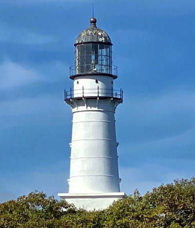
1874 (station established 1828). Active; focal plane 129 ft (39.5 m); 4 white flashes every 15 s (flashes separated by 2.5 s), day and night. 67 ft (20 m) round cast iron tower with lantern and gallery, rising from a square 1-story base; VRB-25 aerobeacon. Tower painted white, lantern and gallery painted black. Fog horn (2 blasts every 60 s) on demand. The original drum-style 2nd order Fresnel lens was on display at Cape Elizabeth Town Hall until August 2013, when the town surrendered its lease; since June 2017 it has been exhibited in a replica of the original lantern at the Maine Maritime Museum in Bath. The 2-story Victorian keeper's house (1878), a private residence, was so drastically altered in 1999 that the Maritime Heritage Program lists the original building as "demolished." Brick fog signal building (1886). A 2021 photo is at right, Anderson has a page with good photos, Trabas has a closeup photo, Kathleen Stattel has a closeup 2019 photo, Lighthouse Digest has Nikk Salata's article on keeper Marcus Hanna, Marinas.com has aerial photos, Huelse has a historic postcard view, and Google has a street view and a satellite view. This lighthouse appears in a famous painting (1929) by Edward Hopper. The light station is adjacent to but not part of Two Lights State Park. In 2000 the tower was leased by the American Lighthouse Foundation for preservation. In 2006 ALF announced plans for restoration of the concrete base of the lighthouse and of the oil house, and this project was completed in the fall of 2008. A $52,000 project repainted the lighthouse in the fall of 2014. In 2016 the Foundation gave its Keeper of the Light Award to William Kourakos, the owner of the keeper's house, for his longtime support (he paid the bill for the 2014 repainting, for example). Located at the end of Two Lights Road off ME 77 in Cape Elizabeth. Site and tower closed (gated community) but good views are available from the adjoining state park. Tower owner/operator: U.S. Coast Guard; site manager: American Lighthouse Foundation (Cape Elizabeth Lighthouse). Other buildings private. . ARLHS USA-113; Admiralty J0208; USCG 1-0060(=1-7520).
Cape Elizabeth West (2)
1874 (station established 1828). Inactive since 1924. 67 ft (20 m) round cast iron tower with gallery (twin of the east tower), painted white. The lantern was removed and replaced by a 12-sided observation room during World War II. The lighthouse was sold in 1959 and has been in private hands since. Anderson has a page for the lighthouse, Maura Jones has a 2012 photo, Ben Moll also has a photo, and Google has a street view and an aerial view. Located 300 yards (275 m) west of the east tower. Site and tower closed (gated community) but distant views are available from the east lighthouse (previous entry) and the adjoining Two Lights State Park. Owner/site manager: private. ARLHS USA-115.

Cape Elizabeth East Light, Cape Elizabeth, October 2021
Instagram photo
by Soegio

York County Lighthouses

Biddeford and Kennebunkport Lighthouses
Biddeford is a town of about 25,000 residents described as the commercial center of York County. Kennebubkport is a reosrt town with a permanent population of about 3600; it has some fame as the summer home of the Bush family including Presidents George H.W. Bush and George W. Bush.
** Wood Island
1808. Active; focal plane 71 ft (21.5 m); flash every 5 s, alternating white and green. 47 ft (14 m) round rubblestone tower with lantern and gallery, painted white, attached to a 2-story wood keeper's house (1906); VRB-25 aerobeacon (1972). Lantern and gallery painted black. Fog horn (2 blasts every 30 s). The lantern was removed in 1972 and rebuilt in 1986. This is Maine's second oldest lighthouse and the nation's eleventh oldest. The bell tower was destroyed by a storm in the 1960s but the 1872 bell was saved and is on display at Vine's Landing in Biddeford Pool (Google has a street view and a satellite view). Stone oil house (1903). Converted to solar power in 2001. A 2023 photo is at right, Anderson has an excellent page for the lighthouse, Trabas has Michael Boucher's photo, Marinas.com has aerial photos, Sawyer Baran has a 2016 street view, and Google has a satellite view. In March 2003 the Coast Guard leased the station to the American Lighthouse Foundation. Volunteers cleared the site, removed debris from the tower, and restored electrical service to the lighthouse; a restoration plan has been prepared and submitted to the state for approval. In 2008, following the installation of a new handrail, the tower was opened to guided tours. The tower was refurbished in 2009 and in 2011 the exterior of the keeper's house was restored. In 2015 a private donation funded a $218,000 project to completely restore the keeper's house. The keeper's house is occupied by resident keepers May through December. Located on an island off the mouth of the Saco River northeast of Biddeford Pool. Maineharbors.com has a chart. Most of the island is a wildlife sanctuary administered by the Maine Audubon Society. Accessible only by boat; a dock and a boardwalk to the lighthouse are provided. In 2004 the chapter began offering guided tours from Biddeford Pool on Wednesdays and Saturdays during the summer. The lighthouse is visible from the Biddeford Pool Trail, an Audubon Society trail on the mainland; the trail head is at the end of Main Street, Biddeford Pool. Site open, station and tower open to guided tours on Wednesday, Thursday, and Saturday mornings during July and August (online reservations required). Owner/operator: U.S. Coast Guard. Site manager: Friends of Wood Island Lighthouse . ARLHS USA-905; Admiralty J0214; USCG 1-0095.

Wood Island Light, Biddeford Pool, July 2023
Instagram photo by melissasmif
[Stage Island Monument]
1825. Unlit daybeacon. 60 ft (19 m) round conical unpainted rubblestone tower. Brian Bartlett has a 2015 photo, John Suhayda has a 2010 photo and a more distant view, a 2023 photo is available, and Google has a satellite view. The tower was built after the brig Hesper wrecked nearby in 1821. The first tower collapsed before it was completed due to a poor foundation, killing one of the builders. Located on the northeast point of Stage Island, about 2 km (1.25 mi) west of the Wood Island lighthouse. Accessible only by boat. Site open, tower closed. Owner/site manager: unknown. USCG 1-7960.
Goat Island (3)
1859 (station established 1834). Active; focal plane 38 ft (11.5 m); white flash every 6 s. 25 ft (7.5 m) round cylindrical brick tower with lantern and gallery; 300 mm lens. Fog horn (blast every 15 s). Tower painted white, lantern and gallary black. The original 1-1/2 story keeper's house is occupied in season by caretakers. Square pyramidal fog bell tower; the bell is on display at the Kennebunkport Historical Society on North Street, Kennebunkport. Buildings painted white; roofs red. Michael Christopher's 2021 photo is at right, Anderson's page has several photos, Trabas has a photo, Brian Sawyer has a closeup 2008 photo, Marinas.com has aerial photos, Tom Perloff has a street view, and Google has a satellite view. This was the last staffed light station in Maine, finally automated in 1990. In 1993 the Coast Guard sold the island to the Kennebunkport Conservation Trust and in 1998 the lighthouse was transferred to the Trust under the Maine Lights program. Trust volunteers Scott and Karen Dombowski have tended the island and lighthouse ever since. In 2008 the Coast Guard installed a new VLB-44 LED optic. In 2009 the Trust announced plans for a complete restoration of the station. This $1 million project was carried out in 2011; it included the rebuilding of the bell tower demolished in 1962, restoration of the keeper's house, and rebuilding the covered walkway destroyed by a 1978 storm. In November 2022 the undersea power cable to the island failed; the Trust is considering whether to install a solar-powered system for the entire station (the lighthouse continues to operate on its solar power). Located on an island in the mouth of Cape Porpoise Harbor southeast of Kennebunkport. Accessible only by boat (a dock is available). Site open; tower generally closed, but New England Eco Adventures offers cruises from Kennebuckport with guided tours of the lighthouse. Operator: U.S. Coast Guard. Owner/site manager: Kennebunkport Conservation Trust (Goat Island Lighthouse ). ARLHS USA-325; Admiralty J0218; USCG 1-0105(=1-8100).

Goat Island Light, Kennebunkport, July 2010
Google Maps photo by Michael Christopher

York and Kittery Lighthouses
York is a popular resort town with about 14,000 permanent residents. Kittery is at the southernmost point of Maine, across the Piscataqua River from Portsmouth, New Hampshire. It has about 10,000 residents and is the location of the Portsmouth Naval Shipyard.
* Cape Neddick ("Nubble Light")
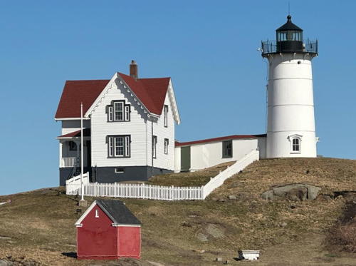
1879. Active; focal plane 88 ft (27 m); red light, 3 s on, 3 s off. 41 ft (12.5 m) round cylindrical cast iron tower with lantern and gallery, attached to the original 2-story wood keeper's house; 4th order Fresnel lens (1891, installed here in 1928). Tower painted white, lantern and gallary black. Fog horn (blast every 10 s). Red brick oil house (1902). A 2024 photo is at right, Dana Moos has a wintry 2010 photo, Brian Sawyer has a 2008 photo, Anderson's page has photos, Trabas has a photo, Marinas.com has aerial photos, Huelse has a historic postcard view, and Google has a street view and a satellite view. A sibling of Little River Light (see Eastern Maine), this is one of Maine's best known and most visited lighthouses. The lighthouse is almost always called Nubble Light. (In Maine a "nubble" is a small, rocky island, and the lighthouse is located on the islet called Cape Neddick Nubble.) The light station was transferred to the Town of York under the Maine Lights program in 1998. The town maintains a welcome center and gift shop at Sohier Town Park on the mainland opposite the lighthouse. Every year the light station is decorated gaily for Christmas; a photo shows this well. The lighting ceremony is on the Saturday after Thanksgiving. Friends of Nubble Light works for preservation of the light station. There are plans to renovate the keeper's house as a caretaker's house. In 2001 the foundation of the lighthouse was regrouted and painted, the walkway to the lighthouse was replaced, and a new boat ramp was built. In 2007 the walkway, boat landing and other outside facilities were heavily damaged by a nor'easter, and the town sought $1 million from the Federal Emergency Management Agency for repairs. The light was extinguished in March 2013 when the electrical line from the mainland failed; the town scrambled to find funds and restored service in July. Also in the winter of 2013 a storm destroyed the overhead tram used to bring supplies to the island. The Coast Guard has proposed to replace the Fresnel lens with a solar-powered LED light, a move strongly opposed by the town. In the fall of 2013 the town began offering a raffle for chances to tour the light station. A restoration project in 2017 included repainting the lighthouse and replacement of the overhead zipline used to deliver supplies to the lighthouse. Restoration continued in phases and was concluding with a $42,000 project in 2021 to replace the back deck and the windows in the tower. Located on an island off Cape Neddick at York Beach. Accessible only by boat, but the view from Sohier Town Park is excellent. Site open, visitor center open daily mid April through mid October, tower closed. Operator: U.S. Coast Guard. Owner/site manager: Town of York. (Nubble Light). ARLHS USA-130; Admiralty J0226; USCG 1-0125.

Cape Neddick (Nubble) Light, York, April 2024
Instagram photo by Nubble Light
Boon Island (5)
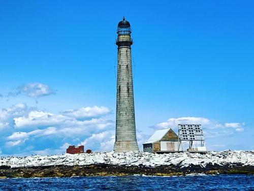
1855 (station established 1799). Active; focal plane 137 ft (42 m); white flash every 5 s. 133 ft (41 m) round unpainted waveswept granite tower with lantern and gallery; solar-powered VRB-25 aerobeacon (1993). Lantern painted black. Fog horn (blast every 10 s). The original 2nd order Fresnel lens is on display at the Kittery Historical and Naval Museum in Kittery. The keeper's house and all other light station buildings have been destroyed by storms; storms also claimed earlier light towers in 1804 and 1831. Josh McPhail's 2023 photo is at right, Anderson has a good page for the lighthouse, Tanya DeBernardo has a photo, Trabas has a distant view by Andreas Köhler, Lighthouse Digest has Tim Harrison's story on the history of the light station, also a second article by Katherine Bailey, Marinas.com has aerial photos, Huelse has a historic postcard view, and Google has a good satellite view of the station. This isolated tower is the tallest New England lighthouse. In 2000 the lighthouse was leased by the American Lighthouse Foundation for preservation. The local ALF chapter, calling itself the Republic of Boon Island, cheerfully declared its "independence." In 2012 the lighthouse was listed for transfer under NHLPA. ALF tried to organize an application for ownership but the Town of York declined participation. In May 2014 the lighthouse was placed on sale in an online auction, and in August it sold for $78,000 to Art Girard, a Portland real estate developer. In February 2015 Girard sold the lighthouse for $119,673 to philanthropist Bobby Sager, who already owned the Minots Ledge Lighthouse in Massachusetts. Located on a tiny islet about 9 miles (15 km) off the coast of York. Accessible only by boat; New England Eco Adventures offers cruises from Kennebuckport. Site and tower closed. Operator: U.S. Coast Guard. Owner/site manager: private. . ARLHS USA-071; Admiralty J0228; USCG 1-0155.
 

Boon Island Light, York, July 2023
Instagram photo by Josh McPhail
 
Whaleback Ledge (2)
1872 (station established 1831). Active; focal plane 59 ft (18 m); 2 white flashes every 10 s. 50 ft (15 m) round granite tower with lantern and gallery, incorporating 3-story keeper's quarters; rotating VRB-25 aerobeacon (2002). Tower unpainted, lantern and gallery panted black. Fog horn (2 blasts every 30 s). Stephen Rideout's 2024 photo is at right, Anderson has a page with good photos, Trabas has a photo, a 2021 photo is available, Herbie Robinson has a good photo, Marinas.com has aerial photos, and Google has a satellite view and a very distant street view from the end of Ocean Street in Portsmouth, New Hampshire. In 2002 the Coast Guard removed the DCB-224 aerobeacon; the new beacon was converted to solar power in 2003. The town of Kittery has taken ownership of Wood Island, about 400 yards (365 m) north of the lighthouse, and plans to restore the former Coast Guard station there as a lighthouse museum. In November 2005 the American Lighthouse Foundation announced it was taking over maintenance of the lighthouse from the Coast Guard. In 2007 the lighthouse became available for transfer under NHLPA. The Friends of Portsmouth Harbor Lighthouses, an ALF chapter, applied for ownership. A competing application by Beacon Preservation was withdrawn and title to the lighthouse was granted to the ALF chapter in November 2008. In late 2009 the Coast Guard installed a modern VLB-44 LED optic in the tower. In September 2013 a $7000 project completed critically needed repairs to the lantern and gallery. In January 2017 FPHL announced plans to repair breakwaters and build a new dock at the lighthouse with the goal of allowing public access. Located on a rocky reef in the mouth of the Piscataqua River off Jaffrey Point, NH. Accessible only by boat; cruises from Portsmouth, NH, pass the tower. Site open, tower closed. Operator: U.S. Coast Guard. Owner: American Lighthouse Foundation. Site manager: Friends of Portsmouth Harbor Lighthouses . ARLHS USA-963; Admiralty J0232; USCG 1-0200.
* Portsmouth Channel Range Front
Date unknown. Active; focal plane 59 ft (19 m); red light, 3 s on, 3 s off. Approx. 15 m (49 ft) square cylindrical skeletal tower carrying a rectangular daymark colored red with a white vertical stripe. Trabas has a photo, Google has a street view of the rear of the tower, and the tower is surrounded by trees in Google's satellite view. This is the entrance range for the Piscataqua River and the harbors of Kittery, Maine, and Portsmouth, New Hampshire. Located on the south side of ME 103 at Kittery Point, just east of Fort McClary State Park. Site open, tower closed. Admiralty J0233; USCG 1-8305.
Portsmouth Channel Range Rear
Date unknown. Active; focal plane 79 ft (24 m); continuous red light. Approx. 14 m (46 ft) square cylindrical skeletal tower carrying a rectangular daymark colored red with a white vertical stripe. Trabas has a photo and Google has a distant street view and a satellite view. Located 154 yd (141 m) north of the front light. Site status unknown (although Trabas was able to walk up to the tower). Admiralty J0233.1; USCG 1-8310.

Whaleback Ledge Light, Kittery, April 2024
Instagram photo by Stephen Rideout

Inland (Kennebec County) Lighthouse

Ladies Delight
1908 (Frank Morse). Active in season; flashing white light. 16 ft (5 m) round stone tower, painted white, with wood lantern and gallery. Anderson's page has good photos, Marjorie Lewis has a 2018 photo, Amy Doucette has a 2020 photo, and Google has a satellite view. In 2000 the lighthouse was considered endangered, leaning and in need of restoration. Repairs in 2001 brought the tower back to vertical. (Although Lighthouse Digest's photo by Hugh Stephens clearly shows the lean, Anderson's photos show the lighthouse restored and in good condition.) In 2005 a new aluminum lantern was installed. Located on a reef in Lake Cobbosseecontee about 1 mile (1.5 km) south of Island Park in Manchester and 10 miles (16 km) west of Augusta, the state capital. Accessible only by boat. Site and tower closed. Site manager: Cobbosseecontee Lake Association. . ARLHS USA-1127.

Information available on lost lighthouses:

Notable faux lighthouses:

Adjoining pages: North: Eastern Maine | South: New Hampshire

Return to the Lighthouse Directory index | Ratings key

Posted May 16, 2001. Checked and revised May 13, 2024. Lighthouses: 40. Site copyright 2024 Russ Rowlett and the University of North Carolina at Chapel Hill.