Lighthouses of Norway: Inner Lofoten

The Kingdom of Norway (Norge in Norwegian) is one of the world's most maritime nations. The country is long and narrow, with drowned valleys called fjords that bring the sea far inland in most regions. The mainland coast is estimated to be 2650 km (1650 mi) long and when all the islands and minor indentations are counted the total coastline approaches an astonishing 60,000 km (37,500 mi), long enough the go around the world one and a half times. With such a lengthy and rocky shore it's not surprising that Norway has a large number of lighthouses.

The Lofoten Islands are located in Nordland County off the northwestern coast of Norway. Located entirely north of the Arctic Circle, the mountainous islands are known for their spectacular scenery with dramatic mountains rising from the sea; as a result they attract many visitors. Historically they have also been a center of the Norwegian fishing industry with many small fishing harbors nestled amid the mountains.

Norway is divided into 11 counties (fylker) and the counties are divided into townships (kommuner). This page describes lighthouses of the inner Lofoten Islands in the townships of Vågan and Vestvågøy. These islands are connected to the mainland by bridges.

In Norwegian a lighthouse is a fyrtårn (fire tower) or simply a fyr; a fyrlykt is a beacon and a lyktehus is a lantern. Øy is an island, holmen is an islet, skjær is a skerry (a tiny island or rocky reef), sund is a strait (often between an island and the mainland), bukt is a bay, nes is a headland, and havn is a harbor.

Aids to navigation in Norway are maintained by the Kystverket (Coast Directorate), an agency of the Ministry of Transport and Communications.

ARLHS numbers are from the ARLHS World List of Lights. NF numbers are from the Norsk Fyrliste. Admiralty numbers are from volume L of the Admiralty List of Lights & Fog Signals. U.S. NGA List numbers are from Publication 115.

General Sources
Norsk Fyrhistorisk Forening
News and photos from the Norwegian Lighthouse Association.
Online List of Lights - Norway
Photos by various photographers posted by Alexander Trabas. Most of the photos for this area are by Capt. Peter Mosselberger (Capt. Peter), Erich Hartmann, or Arno Siering.
Lighthouse Pages from Anke and Jens - Norway
Excellent photos of more than 60 Norwegian lighthouses.
Leuchttürme an der norwegischen Küste
Photos posted by Bernd Claußen.
Lighthouses in Nordland
Photos by various photographers available from Wikimedia.
Norwegische Leuchttürme auf historischen Postkarten
Historic postcard images posted by Klaus Huelse.
Liste over Norske Fyr
From Wikipedia, a handy list of Norwegian light stations with their dates of establishment.
Norsk Fyrliste
The official Norwegian light list can be downloaded in six .pdf volumes.
GPSNavigationCharts
Navigation chart information for this area.
Navionics Charts
Navigation chart information for Nordland.

Skrova Fyr
Skrova Light, Vågan, June 2012
Wikimedia Creative Commons photo by Johan Leide

Vågan Lighthouses

Eastern Austvågøy Lighthouses
Lysøskjæret
Date unknown. Active; focal plane 10 m (33 ft); white, red or green light depending on direction, 2 s on, 2 s off. 9 m (29 ft) round tower with lantern and galley. Lighthouse painted white, lantern roof red. No photo available but Bing has an indistinct satellite view. Located on a skerry at the northeastern edge of the Risvær archipelago. Accessible only by boat. Site open, tower closed. NF-739200; Admiralty L2809; NGA 11364.
Risvær (2)
Date unknown. Active; focal plane 8.5 m (28 ft); white, red or green light depending on direction, occulting twice every 8 s. 7 m (23 ft) round tower with lantern and galley. Lighthouse painted white, lantern roof red. Trabas has Capt. Peter's photo and Google has a distant satellite view. This light replaced a square skeletal tower, covered with siding, with lantern and gallery. Located on a skerry at the southeastern edge of the Risvær archipelago. Accessible only by boat. Site open, tower closed. NF-739400; Admiralty L2810; NGA 11360.
[Digermulen]
Date unknown (station established 1901). Active; focal plane 23.5 m (77 ft); white, red or green light depending on direction, occulting once every 6 s. 4 m (13 ft) octagonal lantern, painted white with a red roof, mounted on a short stone base. Trabas has Capt. Peter's photo and Google has a distant satellite view. Located on a promontory on the east side of the entrance to the Raftsund southwest of Digermulen; there should be a good view from ferries between Digermulen and Stormolla. The Raftsund is the most-used inside passage through the Lofoten Islands for coastwise ferries and cruise ships. Site status unknown. NF-741200; Admiralty L2818; NGA 11376.
Soten
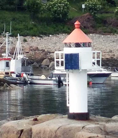
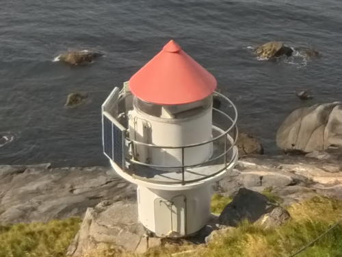
Date unknown. Active; focal plane 7 m (23 ft); white, red or green light depending on direction, occulting three times every 12 s. 6 m (20 ft) concrete post with lantern and gallery. Lighthouse painted white, lantern roof red. Trabas has Siering's photo (also seen at right) and Bing has a satellite view. Located on a skerry on the south side of Stormolla. Accessible only by boat. Site open, tower closed. NF-744100; Admiralty L2844; NGA 11420.
Soten Light
Soten Light, Vågan, June 2012
photo copyright Arno Siering; used by permission

Skrova Area Lighthouses
Skrova (Saltværsholmen)
1922. Active; focal plane 41 m (134 ft); two white flashes every 45 s. 24 m (79 ft) round cast iron tower with lantern and gallery. Tower painted red with two white horizontal bands. The keeper's house, generator house, boathouse, and several auxiliary buildings all survive at this station. Johan Leide's photo is at the top of this page, the Lighthouse Association has a page for the lighthouse, Ezra Nuakin has a photo, a good view of the station is available, Trabas has Siering's view from the sea, Anke and Jens have distant views showing the spectacular setting of the lighthouse, and Bing has a satellite view. This lighthouse guides ships crossing the Vestfjord to Svolvær and other destinations in Lofoten. The light station includes a restaurant and overnight accommodations are available. Located on a skerry just off the west coast of Skrova. Accessible only by boat, but there are excellent views from the village of Skrova, which is accessible by ferry from Vågan or from Skutvik on the mainland. Site open, tower closed. Site manager: Skrova Fyr . ARLHS NOR-211; NF-747600; Admiralty L2860.1; NGA 11452.
Skjåholmen (2)
Date unknown (station established 1856). Active; focal plane 11 m (36 ft); white, red or green light depending on direction, occulting twice every 8 s. 5 m (17 ft) octagonal lantern and gallery mounted on steel piles. Lantern painted white with a red roof, piles painted black. Trabas has Jim Smith's photo, Kristiina Puumalainen has a good photo, a view from the sea is available, and Bing has a distant satellite view. Foundation ruins of the original lighthouse survive; it was replaced by the Skrova lighthouse in 1922. Located on the waterfront at Skrova. Site open, tower closed. NF-747700; Admiralty L2862; NGA 11456.

Svolvær Area Lighthouses
Svolvær, a town of about 5000 residents and an important fishing port, is the administrative center for Vågan.
Langholmen
Date unknown. Active; focal plane 5.5 m (18 ft); white, red or green light depending on direction, occulting twice every 8 s. 7 m (23 ft) concrete post with lantern and gallery. Lighthouse painted white, lantern roof red. Trabas has Hartmann's photo and Bing has an indistinct satellite view. This light marks the entrance to a narrow, well traveled passage through Lofoten via the Øyhellesund and Raftsund. Located on a skerry on the west side of the Øyhellesund. Accessible only by boat. Site open, tower closed. NF-745000; Admiralty L2849; NGA 11440.
Vestre Vabeinan (Vestre Vabeinskjær, Fiskerkone)
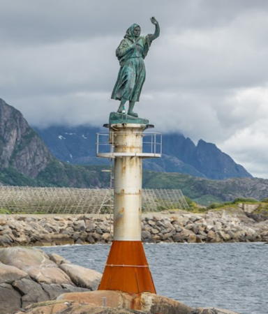
1999. Active; focal plane 11.5 m (38 ft); green light, 1 s on, 1 s off; the structure is also floodlit. This unusual beacon consists of a sculpture by Per Ung called Fiskerkone (The Fisherman's Wife), mounted on a round pedastal with a broadly conical base. The pedestal is white and the base is red. Percita Dittmar's photo is at right, Trabas has Siering's photo, another closeup photo of the sculpture is available, Jørgen Weinreich Maltesen has a good photo of the entire beacon, Giorgio Pozzo has a 2023 photo, and Bing has an indistinct satellite view. Located on a rock in Svolvær harbor. Accessible only by boat. Site open, tower closed. NF-748900; Admiralty L2870; NGA 11484.
Rødholmen (Raudholmen) (2)
Date unknown (station established 1917). Active; focal plane 18 m (59 ft); white, red or green light depending on direction, occulting once every 6 s. Approx. 8 m (26 ft) fiberglass post with round lantern and gallery, painted white; lantern roof is red. Trabas has Siering's photo, Morten Oddvik has a photo, and Bing has a satellite view. Located on a small island off Svolvær. Accessible only by boat. Site open, tower closed. ARLHS NOR-194; NF-750000; Admiralty L2879; NGA 11500.
Kleppfiskholmen (Osan)
Date unknown. Active; focal plane 6 m (20 ft); white, red or green light depending on direction, occulting three times every 10 s. Approx. 5 m (17 ft) round fiberglass post with lantern and gallery, painted white; lantern roof is red. Trabas has Capt. Peter's photo and Bing has a blurry satellite view. Located on a promontory south of Osan and west of Svolvær. Accessible only by boat. Site open, tower closed. NF-750600; Admiralty L2882; NGA 11512.
Stretarneset
Date unknown. Active; focal plane 14.5 m (48 ft); white, red or green light depending on direction, occulting twice every 8 s. 8 m (26 ft) round fiberglass post with lantern and gallery, colored white with one black horizontal band; lantern roof is red. Trabas has Siering's photo and Bing has a distant satellite view. Located on a promontory about 800 m (1/2 mi) south of the Kleggfiskholmen light. Accessible only by boat. Site open, tower closed. NF-750100; Admiralty L2880.5; NGA 11502.

Fiskerkone Light, Svolvær, August 2006
ex-Flickr Creative Commons photo by Percita Dittmar

Kabelvåg Area Lighthouses
* Kabelvåg (2)
Date unknown (station established 1892). Active; focal plane 8 m (26 ft); white, red or green light depending on direction, occulting once every 6 s. 7 m (23 ft) fiberglass post with lantern and gallery. Tower painted white with one black horizontal band; lantern roof painted red. Lisbeth Landstrøm has a great photo, Njål Stave has a good 2007 photo, Trabas has Capt. Peter's closeup, and Bing has a satellite view. Located on a skerry at the southern entrance to the harbor of Kabelvåg. The skerry is connected to the mainland by a causeway. Site open, tower closed. ARLHS NOR-131; NF-751000; Admiralty L2884; NGA 11516.
Ørsvåg (2)
1951 (station established 1862). Active; focal plane 27 m (89 ft); white, red or green light depending on direction, occulting once every 6 s. 6 m (20 ft) square skeletal tower with lantern and gallery. Lighthouse painted white, lantern roof red. Trabas has Capt. Peter's photo and Bing has a satellite view. A Facebook discussion includes a historic photo of the original lighthouse; it was sold and removed in 1960. Located on a bluff on the east side of Sagøy, off Ørsvåg harbor, about 3.5 km (2.2 mi) west southwest of Kabelvåg. Accessible only by boat. Site status unknown. ARLHS NOR-287; NF-751200; Admiralty L2888; NGA 11520.
Moholmen (2)
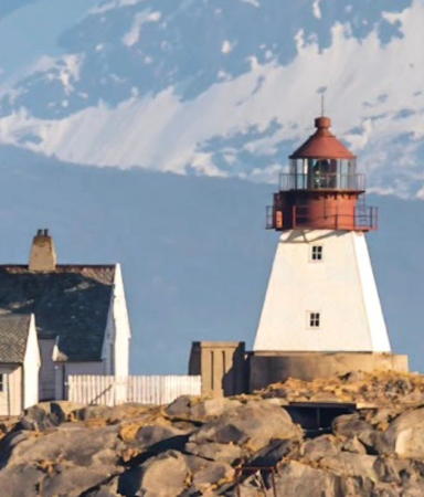
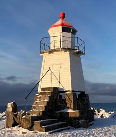
1936 (station established 1914). Active; focal plane 23 m (75 ft); white, red or green light depending on direction, occulting twice every 8 s. 12.5 m (41 ft) square pyramidal cast iron tower with lantern and gallery. Tower painted white, lantern red. 1-story keeper's house and several other buildings. John Snapper's wintry photo is at right, the Lighthouse Association has a page for the lighthouse, a 2009 photo is available, Trabas has Siering's view from the sea, and Google has a satellite view. The original lighthouse, a 27 m (89 ft) round cast iron tower with lantern and gallery, was moved to Tranøy in Hamarøy township (see the Narvik Area page). A friends group for the lighthouse was formed but gave up its efforts due to the difficulty of landing at the lighthouse. Located on a small island in the Vestfjord about 4 km (2.5 mi) southwest of Kabelvåg. Accessible only by boat. Site status unknown. . ARLHS NOR-165; NF-752500; Admiralty L2896; NGA 11540.

Henningsvær Area Lighthouses
Lille Bremholmen
Date unknown. Active; focal plane 24 m (79 ft); two flashes every 5 s, white, red or green depending on direction. 6.5 m (21 ft) lantern mounted on a square platform supported by four straight piles. Lantern painted white with a red roof; piles painted black. Trabas has Hartmann's photo, Otto and Mechtild Reuber have a distant view, and Google has a distant satellite view. Located on a small island south of Kalle, about 10 km (6 mi) northeast of Henningsvær. Accessible only by boat. Site status unknown. NF-752000; Admiralty L2894; NGA 11536.
Brødrene
Date unknown. Active; focal plane 11 m (36 ft); white, red or green light depending on direction, 2 s on, 2 s off. Approx. 6 m concrete post with lantern and gallery. Tower painted white, lantern roof is red. Next to the light is a round tower that probably survives from an earlier light. Trabas has Hartmann's photo and Google has a distant satellite view. Located on a skerry about 2.5 km (1.5 mi) east of Henningsvær. Accessible only by boat. Site and tower closed. ARLHS NOR-427; NF-752700; Admiralty L2898; NGA 11560.
Moholmen Light
Moholmen Light, Kabelvåg, March 2008
photo by John Snapper (no longer online); permission requested
Sauøy (2)
Date unknown (station established 1894). Active; focal plane 9 m (29 ft); white, red or green light depending on direction, 1 s on, 1 s off. 4 m (13 ft) lantern mounted on a stone base. Lantern painted white with a red roof. Trabas has Hartmann's closeup photo and Google has a distant street view and a distant satellite view. Sauøy is an island on the east side of Henningsvær. Located on the southeastern point of the island. Site status unknown, possibly open. NF-752900; Admiralty L2902; NGA 11544.
* [Hellandsøy (2)]
Date unknown (station established 1899). Active; focal plane 16 m (52 ft); white, red or green light depending on direction, occulting once every 6 s. 3 m (10 ft) hexagonal cast iron lantern standing on a rubblestone base. 3 m (10 ft) octagonal lantern painted white with a red roof. Trabas has Siering's photo, Otto and Mechtild Reuber have a closeup photo, a distant view is available, and Google has a distant satellite view. Located at the south point of Hellandsøy, one of the islands occupied by the town of Hellingsvær (next entry). Site open, tower closed. ARLHS NOR-431; NF-753500; Admiralty L2908; NGA 11556.
* Henningsvær (1)
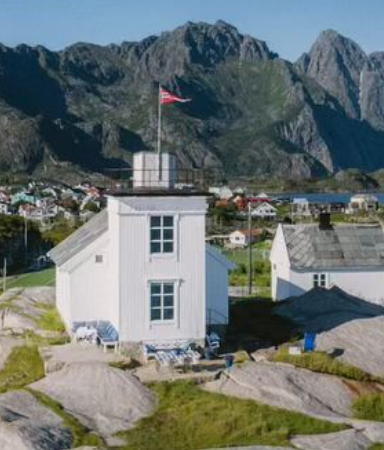
1856. Inactive since 1935. Approx. 8 m (26 ft) square cylindrical tower attached to the seaward end of a 1-1/2 story keeper's house. Lantern removed. Lighthouse painted white. Ulf Dahlslett's photo is at right, another closeup is available, Anke and Jens have good photos, a 2023 photo of the station is available, and Google has a satellite view. The lighthouse was sold shortly after deactivation and has remained in private ownership. In 1997 the light station became available for vacation rentals but it appears this is no longer the case. Henningsvær, which calls itself the Venice of the Lofotens, is a village on several small islands off the southwestern tip of Austvågøy, connected to the larger island by a series of bridges. Located on the southwest side of Henningsvær facing the Vestfjord. Site appears open, tower closed. Site manager: private . ARLHS NOR-117.
* Henningsvær (2)
1935 (station established 1856). Inactive since 2016. Approx. 8 m (26 ft) square skeletal tower with enclosed upper portion, lantern, and gallery. Lighthouse painted white, lantern roof red, skeletal legs black. Anke and Jens have good photos and a 2023 photo of the station is available. Located in front of the historic lighthouse. Site open, tower closed. ARLHS NOR-432; ex-NF-753300; ex-Admiralty L2906; NGA 11552.
Store Lysøy
Date unknown. Active; focal plane 15 m (49 ft); white, red or green light depending on direction, 2 s on, 2 s off. 6 m (20 ft) square tower with lantern and gallery, painted white; lantern roof painted red. Trabas has Capt. Peter's photo and Google has a very distant satellite view. Located on a small island about 5 km (3 mi) north of Henningsvær, marking the south entrance to the channel between the islands of Austvågøy and Gimsøy. Accessible only by boat. Site and tower closed. NF-754000; Admiralty L2910; NGA 11564.
Søre Lyngvær (2)
2020. Active; focal plane 7 m (23 ft); red light depending on direction, 1 s on, 1 s off. This was an octagonal lantern and gallery mounted on an octagonal concrete tower; in 2020 the lantern was replaced by a mast. The lantern was painted white with a red roof; tower painted black. Trabas has Capt. Peter's photo of the original light and Google has a distant satellite view. Located about 800 m (1/2 mi) east of the Store Lysøy light. Accessible only by boat. Site and tower closed. ARLHS NOR-436; NF-754202; Admiralty L2914; NGA 11568.
Henningsvær Fyr
Henningsvær Light, Henningsvær, July 2008
ex-Panoramio photo copyright Ulf Dahlslett; permission requested

Northern Austvågoy Lighthouses
Vikspollen
Date unknown. Active; focal plane 7 m (23 ft); white, red or green light depending on direction, 3 s on, 3 s off. 6 m (20 ft) square tower with lantern and gallery, painted white; lantern roof painted red. Trabas has Capt. Peter's photo, a distant street view is available, and Bing has a satellite view. Located on a promontory at the northwest tip of Gimsøy. Site status unknown. NF-781600; Admiralty L3083; NGA 12060.
* Hovsund
Date unknown. Active; focal plane 10.5 m (34 ft); white, red or green light depending on direction, occulting once every 6 s. 7 m (23 ft) square tower with lantern and gallery, painted white; lantern roof painted red. Trabas has Capt. Peter's photo, there's another good photo, Google has a distant street view, and Bing has a satellite view. Located on a skerry off the northwest tip of Gimsøy. The skerry is connected to the mainland by a causeway that serves as a breakwater. Site open, tower closed. NF-783000; Admiralty L3086; NGA 12064.
Gimsøy
Date unknown. Active; focal plane 7 m (23 ft); white, red or green light depending on direction, 2 s on, 2 s off. 7.5 m (25 ft) lantern and gallery mounted on a round stone cairn. Trabas has Capt. Peter's photo and Google has a distant satellite view and a very distant street view. Located on a skerry in the northern entrance to the Gimsøystraum, the channel between the islands of Austvågøy and Gimsøy. Accessible only by boat. Site open, tower closed. NF-755200; Admiralty L2922; NGA 11596.
* Festvåghalsen
Date unknown. Active; focal plane 10 m (33 ft); white, red or green light depending on direction, occulting three times every 10 s. 6.5 m (21 ft) lantern mounted on a platform supported by four piles. Lantern painted white with a red roof, piles painted black. Trabas has Capt. Peter's photo, Ilkka Tapio has a photo, and Google has a distant satellite view. Located beside the Sunnlandsfjordveien in Festvåg. Site open, tower closed. NF-755500; Admiralty L2926; NGA 11600.
* Laukvik
Date unknown. Active; focal plane 11 m (36 ft); white, red or green light depending on direction, occulting once every 6 s. 8 m (26 ft) square pyramidal skeletal tower with lantern and gallery. Tower covered with siding. Siding and lantern painted white, lantern red. Trabas has Capt. Peter's photo (also seen at right), two good photos are available (2/3 the way down the page), Valtteri Mulkahainen has a closeup street view, and Bing has a satellite view. Located at Laukvik, a fishing village at the northwestern tip of Austvågøy. Accessible by road. Site open, tower closed. ARLHS NOR-434; NF-784000; Admiralty L3088; NGA 12068.

Laukvik Light, Austvågøy
photo copyright Capt. Peter Mosselberger; used by permission

Vestvågøy Lighthouses

Innerside (Vestfjord) Lighthouses
Malnes
Date unknown. Active; focal plane 11 m (36 ft); two flashes every 5 s, white, red or green depending on direction. 8 m (26 ft) lantern and gallery supported by piles and mounted on a stone cairn. Trabas has Capt. Peter's photo and Bing has a distant satellite view. Located on a skerry off the southeast coast of Vestvågøy. Accessible only by boat. Site open, tower closed. NF-755700; Admiralty L2928; NGA 11604.
Valberg (2)
2008. Active; focal plane 12 m (39 ft); white, red or green light depending on direction, 3 s on, 3 s off. 8 m (26 ft) round cylindrical fiberglass tower with lantern and double gallery. The lighthouse is white, lantern roof red. This prefabricated lighthouse was installed by helicopter to replace a light overturned by a storm. Trabas has Capt. Peter's photo, Matthieu Brisset has a view from the sea, and Google has a satellite view. Located on a skerry about 1.5 km (1 mi) south of the Valberg waterfront. Accessible only by boat. Site open, tower closed. NF-756200; Admiralty L2932; NGA 11612.
* [Buøyhavn (2)]
Date unknown (station established 1890). Active; focal plane 12.5 m (41 ft); white, red or green light depending on direction, occulting once every 6 s. 3 m (10 ft) octagonal lantern, painted white with a red roof. A photo and a distant view are available, Trabas has Capt. Peter's closeup and Bing has a distant satellite view. Located on Hellen, a rocky promontory on the east side of the harbor of Stamsund, a village of about 1000 residents. Site open, tower closed. NF-756600; Admiralty L2934; NGA 11620.
* Stamsund (2)
1943 (station established 1859). Active; focal plane 20 m (66 ft); white, red or green light depending on direction, occulting twice every 8 s. 6 m (20 ft) square tower with lantern and gallery. Lighthouse covered with siding, painted white; lantern roof painted red. Trabas has Hartmann's photo, Felix Schläpfer has a nice view from the harbor, Google has a very distant street view, and Bing has a satellite view. The original lighthouse was a frame house with a lantern attached to one side; it was demolished in 1950. Located on Fyrodden, a large rock on Tørnholmen, a promontory sheltering the harbor of Stamsund. Site open, tower closed. ARLHS NOR-222; NF-756800; Admiralty L2936; NGA 11624.
* Buksnes
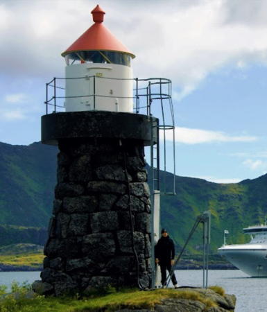
1899. Active; focal plane 12 m (39 ft); white, red or green light depending on direction, occulting once every 6 s. 8 m (26 ft) round rubblestone tower with lantern and gallery. Lantern painted white with a red roof. Haakon Rist's photo is at right, Trabas has Capt. Peter's closeup photo, Frank Stainer has a 2022 photo, and Google has a fuzzy satellite view. Located on Treborneset, the tip of a long peninsula about about 1 km (0.6 mi) east of Gravdal, marking the entrance to the harbor. Site open, tower closed. NF-759400; Admiralty L2956; NGA 11668.
* Balstadøy (Balstad North Mole)
Date unknown. Active; focal plane 7 m (23 ft); white, red or green light depending on direction, occulting once every 6 s. 6 m (20 ft) fiberglass post with lantern and gallery. Lighthouse painted white, lantern roof red. Trabas has Capt. Peter's closeup photo, a nice view and a closeup street view are available, and Bing has a satellite view. Located at the end of a breakwater on the north side of the entrance to Ballstad harbor. Accessible by walking the mole. Site open, tower closed. NF-760500; Admiralty L2961; NGA 11684.
Buksnes Fyr
Buksnes Light, Gravdal, August 2006
Wikipedia public domain photo by Haakon S. Rist
Sandholmskjæret
Date unknown. Active; focal plane 8 m (26 ft); white, red or green light depending on direction, occulting twice every 8 s. 7.5 m (25 ft) concrete post with lantern and gallery. Lighthouse painted white, lantern roof red. Trabas has a photo by Rainer Arndt and Bing has a distant satellite view of the island. A stone cairn daybeacon stands next to the lighthouse. Located on a skerry about 1.2 km (3/4 mi) south of Ballstad. Accessible only by boat. Site open, tower closed. NF-760800; Admiralty L2964; NGA 11672.
Ballstad (Balstad) (2)
1956 (station established 1857). Active; focal plane 58.5 m (192 ft); two flashes every 10 s, white, red or green depending on direction. 5 m (17 ft) lantern mounted on a square stone base. Trabas has a photo by Rainer Arndt and Bing has a satellite view of the station. The satellite view shows foundations of the original lighthouse, which was sold and removed in 1960. It appears that the modern light stands on the stone base of the original lantern house. Located on Svinøy, an island in the Vestfjord about 3 km (2 mi) south of Balstad. Accessible only by boat. Site open, tower closed. NF-760000; Admiralty L2960; NGA 11676.

Outerside (Norwegian Sea) Lighthouses
Skolmneset
Date unknown. Active; focal plane 18 m (59 ft); white, red or green light depending on direction, 2 s on, 2 s off. 8 m (26 ft) unpainted stone cairn with lantern and gallery. Trabas has Capt. Peter's photo and Google has a fuzzy satellite view. Located at the tip of a promontory at the foot of a massive ridge on the northwestern coast of Vestvågøy. Probably accessible only by boat. Site open, tower closed. NF-778200; Admiralty L3055; NGA 11976.
* Kleivheia
Date unknown. Active; focal plane 39 m (128 ft); white, red or green light depending on direction, 3 s on, 3 s off. 7 m (23 ft) square skeletal tower, covered with siding, with lantern and gallery. Lighthouse painted white, lantern roof red. René Kyllingstad's photo is at right, Michael Türschmann has a good closeup, Felix Schläpfer has another photo, Trabas has Capt. Peter's distant view, and Google has a distant satellite view. Located on a promontory about 1.2 km (3/4 mi) northwest of Unnstad. Site open, tower closed. NF-778400; Admiralty L3058; NGA 11992.

Kleivheia Light, Unnstad, August 2007
Flickr Creative Commons photo by René Kyllingstad
* Eggum
Date unknown (station established 1900). Active; focal plane 5 m (17 ft); white, red or green light depending on direction, occulting once every 6 s. 4 m (13 ft) octagonal lantern mounted on a stone base. Lantern painted white with a red roof. Trabas has Capt. Peter's closeup photo, Aslak Tronrud has a photo, Tommaso Menegazzo has a closeup, and Google has a fuzzy satellite view. One of Norway's rare sand beaches adjoins the light. Located on a promontory northeast of Eggum, on the north side of Vestvågøy. Site open, tower closed. NF-778600; Admiralty L3060; NGA 11996.
#Borgvær Havn
Date unknown. Inactive since 2020 and probably removed. 5.5 m (18 ft) lantern on a platform supported by piles. Lantern painted white with a red roof. Trabas has Capt. Peter's photo but the light is not seen in Google's satellite view. Located on an island at the northeastern tip of Borgvær, an island off Vestvågøy. Accessible only by boat. Site open, tower closed. ex-NF-780200; ex-Admiralty L3074; NGA 12028.
#[Sand (Vestresand) Range Rear]
Date unknown (station established 1910). Inactive and probably removed. 3.5 m (11 ft) octagonal lantern and gallery mounted atop a huge boulder. Lantern painted white with a red roof and a black vertical stripe. Trabas has Capt. Peter's closeup photo and Google has a distant satellite view. The front light was similar. These lights may have beeb removed. Located in Vestresand, a fishing port in northern Vestvågøy. Site open, and visitors can climb to the gallery. ex-NF-780400; ex-Admiralty L3076.1; NGA 12036.
Kvalnes (2)
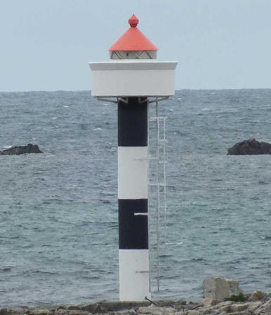
Date unknown. Active; focal plane 10 m (33 ft); white, red or green light depending on direction, occulting once every 6 s. 11 m (36 ft) concrete post with lantern and gallery, painted with black and white horizontal bands; lantern roof is red. square skeletal tower, covered with siding, with lantern and gallery. Lighthouse painted white, lantern roof red. Trabas has Siering's 2015 photo (also seen at right) and Google has a a distant street view and a distant satellite view. This light replaced a square tower with lantern and gallery. Located on a rocky promontory at the northern tip of Vestvågøy. NF-780700; Admiralty L3078; NGA 12040.

Kvalnes Light, Austvågøy, 2015
photo copyright Arno Siering; used by permission

Information available on lost lighthouses:

Notable faux lighthouses:

Adjoining pages: North: Vesterålen | East: Narvik Area | South: Outer Lofoten

Return to the Lighthouse Directory index | Ratings key

Posted August 3, 2006. Checked and revised August 22, 2023. Lighthouses: 38. Site copyright 2023 Russ Rowlett and the University of North Carolina at Chapel Hill.