Lighthouses of Norway: Southern Troms

The Kingdom of Norway (Norge in Norwegian) is one of the world's most maritime nations. The country is long and narrow, with drowned valleys called fjords that bring the sea far inland in most regions. The mainland coast is estimated to be 2650 km (1650 mi) long and when all the islands and minor indentations are counted the total coastline approaches an astonishing 60,000 km (37,500 mi), long enough the go around the world one and a half times. With such a lengthy and rocky shore it's not surprising that Norway has a large number of lighthouses.

Norway is divided into counties (fylker) and the counties are divided into townships (kommuner). This page lists lighthouses of the southern half of the former (and future) Troms County on the northern coast of Norway, including the Harstad area and the large island of Senja. This entire region is well north of the Arctic Circle, but it is well populated and attracts many summer visitors. In 2020 Troms and Finnmark Counties were merged to form Troms og Finnmark County. This merger was not popular and it proved unworkable due to the large area of the merged county. In June 2022 parliament decided to reverse the merger effective 1 January 2024.

In Norwegian a lighthouse is a fyrtårn (fire tower) or simply a fyr; a fyrlykt is a beacon and a lyktehus is a lantern. Øy is an island, holmen is an islet, skjær is a skerry (a tiny island or rocky reef), sund is a strait (often between an island and the mainland), bukt is a bay, nes is a headland, and havn is a harbor.

Aids to navigation in Norway are maintained by the Kystverket (Coast Directorate), an agency of the Ministry of Transport and Communications.

ARLHS numbers are from the ARLHS World List of Lights. NF numbers are from the Norsk Fyrliste. Admiralty numbers are from volume L of the Admiralty List of Lights & Fog Signals. U.S. NGA List numbers are from Publication 115.

General Sources
Norsk Fyrhistorisk Forening
News and photos from the Norwegian Lighthouse Association.
Lighthouse Pages from Anke and Jens - Norway
Excellent photos of more than 60 Norwegian lighthouses.
Online List of Lights - Norway
Photos by various photographers posted by Alexander Trabas. Most of the photos for this area are by Capt. Peter Mosselberger (Capt. Peter) or by Arno Siering.
Norway's Fjorden and Lighthouses
Photos taken by Charles W. Bash on a 2010 cruise from Bergen to North Cape.
Lighthouses in Troms og Finnmark
Photos by various photographers available from Wikimedia.
Norwegische Leuchttürme auf historischen Postkarten
Historic postcard images posted by Klaus Huelse.
Liste over Norske Fyr
From Wikipedia, a handy list of Norwegian light stations with their dates of establishment.
Norsk Fyrliste
The official Norwegian light list can be downloaded in six .pdf volumes.
GPSNavigationCharts
Navigation chart information for this area.
Navionics Charts
Navigation chart information for Troms.
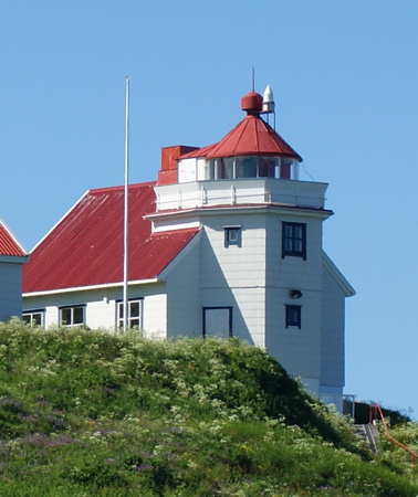

Hekkingen Light, Lenvik, July 2010
Wikimedia Creative Commons photo by Publisher
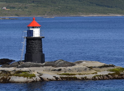
Harstad Area Lighthouses

Kvæfjord Lighthouse
Gapøy
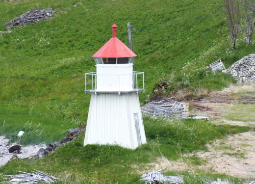
Date unknown. Active; focal plane 9.5 m (31 ft); white, red or green light depending on direction, occulting twice every 8 s. 7 m (23 ft) concrete post with lantern and gallery. Lighthouse painted white, lantern roof red. Trabas has Capt. Peter's photo and Google has a satellite view. Located in the Kvæfjord at the south end of Gapøya, about 7 km (4.5 mi) north of the town of Kvæfjord. Accessible only by boat. Site open, tower closed. NF-831200; Admiralty L3347; NGA 12684.
#Eldaflesene
Date unknown. Inactive since 2014 and probably removed. 7.5 m (25 ft) lantern on a platform supported by piles. Lantern painted white with a red roof. No photo available. The light was dropped from the 2014 Fyrliste and it is not seen in Google's distant satellite view. Located on a skerry in the Kvæfjord about 3 km (2 mi) north of Elde. ex-NF-831000; ex-Admiralty L3345; NGA 12680.

Harstad Lighthouses
Tarskjær
Date unknown. Active; focal plane 6 m (20 ft); flash every 5 s, white, red or green depending on direction. 7.5 m (25 ft) lantern mounted on a stone cairn. Lantern painted white with a red roof. No photo available but Google has a distant satellite view. Located on a skerry southwest of Meløyvær. Accessible only by boat. Site open, tower closed. NF-834300; Admiralty L3464; NGA 12952.
#Trollnesgrunnen
Date unknown. Apparently removed in 2014. This was a 7 m (23 ft) lantern mounted on a tripod. Lantern painted white with a red roof, tripod painted black. No photo available. The light was dropped from the 2014 Fyrliste and it is not seen in Google's distant satellite view. Formerly located on a shoal off the harbor of Bjarkøy. ex-NF-833800; ex-Admiralty L3468; NGA 12968.
Sandssund (Lille Dyna)
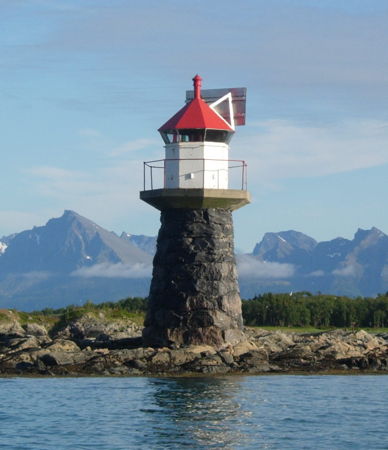
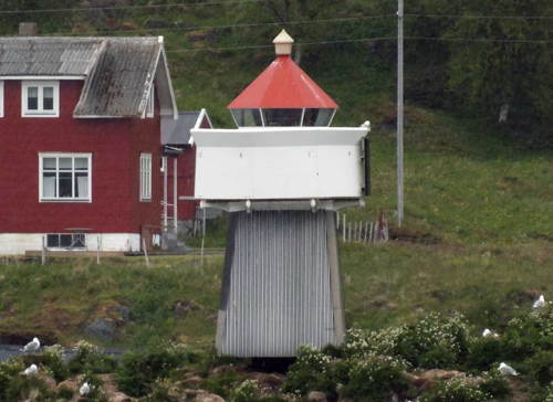
Date unknown. Inactive since 2015. This was a7 m (23 ft) round stone cairn with lantern. Lantern painted white with a red roof. Stephan Paulicks has the photo at right but Google's 2022 street view shows that the lanrern was removed, leaving the cairn as a daybeacon. Google also has a fuzzy satellite view. The light was deactivated when a new causeway and bridge linking Grytøya to Sandsøya made it unnecessary. Located on a skerry in the Sandssund off the northeastern tip of Grytøya and the northwestern tip of Sandsøya, about 1.5 km (1 mi) northeast of the town of Grytøy and 16 km (10 mi) north of Harstad. Accessible only by boat. Site open, tower closed. ex-NF-830000; ex-Admiralty L3343; NGA 12664.
* Sandsøy
Date unknown. Active; focal plane 20 m (66 ft); white, red or green light depending on direction, occulting twice every 8 s. 6 m (20 ft) square tower with lantern and gallery. Lighthouse painted white, lantern roof red. No photo available but Google has a satellite view. Located on a promontory on the west side of Sandsøya. Accessible by road. Site open, tower closed. NF-830200; Admiralty L3341; NGA 12672.
Store Kjeøy
Date unknown. Active; focal plane 7.5 m (25 ft); white, red or green light depending on direction, 2 s on, 2 s off. 6.5 m (21 ft) concrete post light with lantern and gallery. Lighthouse painted white, lantern roof red. Trabas has Michael Boucher's photo and Google has a distant satellite view. Located at the northeastern tip of Store Kjeøy, about 8 km (5 mi) north of Harstad. Accessible only by boat. Site open, tower closed. NF-829000; Admiralty L3334; NGA 12648.
Sandssund Light
Sandssund Light, Harstad, June 2011
ex-Panoramio photo copyright Stephan Paulicks; used by permission
Mågøy
Date unknown. Active; focal plane 21.5 m (71 ft); white, red or green light depending on direction, occulting three times every 12 s. 6.5 m (22 ft) square wood tower with lantern and gallery. Lighthouse painted white, lantern roof red. Bash's photo is at right, Wayne Hopkins has a photo and a more distant view, Trabas has Siering's closeup photo, and Google has a satellite view. Located at the southwestern tip of the island of Mågøy, about 5 km (3 mi) northeast of Harstad. Accessible only by boat. Site open, tower closed. NF-828500; Admiralty L3332; NGA 12644.
Stangnesodden
Date unknown. Active; focal plane 5 m (17 ft); white, red or green light depending on direction, occulting twice every 8 s. 7.5 m (25 ft) lantern and gallery mounted on tripod piles. Lantern painted white with a red roof. Trabas has Siering's view from the sea, Steve Nilsen has a very distant street view, and Google has an indistinct satellite view. Located just off a promontory on the east side of Harstad. Accessible only by boat. Site open, tower closed. NF-827900; Admiralty L3328; NGA 12632.
Harstad (Tjuvholmen)
Date unknown. Active; focal plane 10 m (33 ft); white, red or green light depending on direction, occulting once every 6 s. 5 m (17 ft) lantern mounted on an octagonal stone base. Lantern painted white with a red roof. Remi Longva has a photo, Trabas has Siering's photo, Bash has a distant view, and Google has a satellite view. Located at the south end of Tjuvholmen, an island about 3 km (2 mi) east of Harstad. Accessible only by boat, but there should be a good view from passing ferries. Site open, tower closed. NF-828100; Admiralty L3330; NGA 12636.
Grasholmen
Date unknown. Active; focal plane 6.5 m (21 ft); white, red or green light depending on direction, occulting twice every 8 s. 6 m (20 ft) square tower with lantern and gallery. Lantern painted white with a red roof, piles painted black. Trabas has Capt. Peter's photo and Google has a satellite view. Located at the east end of an island at the northern entrance to the Tjeldsund, about 18 km (11 mi) south of Harstad. Accessible only by boat, but there should be a good view from passing ferries. Site open, tower closed. NF-827000; Admiralty L3322; NGA 12620.

Tjeldsund Lighthouse
Langkvitneset
Date unknown (station established 1913). Active; focal plane 5 m (17 ft); white, red or green light depending on direction, occulting once every 6 s. 6 m (20 ft) lantern and gallery supported by four straight piles. Lantern painted white with a red roof, piles painted black. Trabas has Capt. Peter's photo, Hilde Mikelborg has a photo, Karl Olsen has a distant view, a closeup photo (third photo on the page) is available, and Google has a fuzzy satellite view and a very distant street view. Located at the tip of a headland on the east (mainland) side of the Tjeldsund about 800 m (1/2 mi) north of the Tjeldsund Bridge (E-10), which links Hinnøya to the mainland. Site status unknown. NF-826500; Admiralty L3320; NGA 12616.
Mågøy Fyr
Mågøy Light, Harstad, October 2010
Flickr Creative Commons photo by C.W. Bash

Ibestad Lighthouses
* Årneset (Årsand)
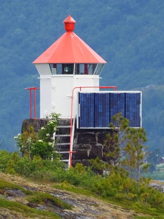
Date unknown. Active; focal plane 11 m (36 ft); white, red or green light depending on direction, 3 s on, 3 s off. 5 m (17 ft) round stone tower with lantern and gallery. Lantern painted white with a red roof. Trabas has Capt. Peter's photo (also seen at right) and Bing has a satellite view. Located on a promontory on the northeastern tip of the island Ronna Rålli northeast of Hamnvik. Site open, tower closed. NF-835500; Admiralty L3364; NGA 12732.
Engenes
Date unknown. Inactive since 2023. 6.5 m (21 ft) square skeletal tower with lantern and gallery. Lantern painted white with a red roof, piles painted black. Trabas has Capt. Peter's photo and Bing has a distant satellite view. Located on the northwestern tip of the island of Andorja. Site status unknown (probably on private property). ex-NF-837000; ex-Admiralty L3382; NGA 12764.

Salangen Lighthouse
Salangen (Revholmen)
Date unknown. Active; focal plane 16 m (52 ft); white, red or green light depending on direction, 3 s on, 3 s off. 4.5 m (15 ft) lantern and gallery on a round rubblestone tower. Lantern painted white with a red roof, piles painted black. Trabas has Capt. Peter's photo and Bing has a distant satellite view. Located on the northern tip of Revholmen, an island in the Sagfjord. Site status unknown. NF-836000; Admiralty L3376; NGA 12756.

Dyrøy Lighthouse
Kastnesskjær
Date unknown. Active; focal plane 6 m (20 ft); flash every 5 s, white, red or green depending on direction. 7 m (23 ft) post with lantern and gallery. Lighthouse is white, lantern roof red. Trabas has Capt. Peter's photo and Bing has a satellite view. Located on a skerry off a promontory of the mainland marking the entrance to the Dyrøysund. Accessible only by boat. Site open, tower closed. NF-837500; Admiralty L3384; NGA 12780.

Årneset Light, Ibestad
photo copyright Capt. Peter Mosselberger; used by permission

Senja Municipality Lighthouses

Senja, Norway's second largest island, is accessible from the mainland by the Gisund Bridge. The permanent population of the island is less than 8000, but it is a popular summer vacation area. The lights of this group are on Senja or on the mainland portion of the former Lenvik municipality opposite Senja. In 2017 the four townships of the island (Tranøy, Torsken, Berg, and Lenvik) were merged to form a single Senja Municipality.

Tranøy (Southern Senja) Lighthouses
Hyseskjæret
Date unknown. Active; focal plane 6 m (20 ft); white, red or green light depending on direction, occulting three times every 12 s. 6 m (20 ft) lantern on a platform supported by piles. Lantern painted white with a red roof. Trabas has Capt. Peter's photo and Bing has a satellite view. Located on a skerry in the entrance to a protected bay on the south side of Senja. Accessible only by boat. Site open, tower closed. NF-839100; Admiralty L3398; NGA 12804.
Stonglandseidet
Date unknown. Active; focal plane 6 m (20 ft); white, red or green light depending on direction, 3 s on, 3 s off. 7 m (23 ft) lantern and gallery mounted on a stone cairn. Lantern painted white with a red roof. Timo Koistinen's photo is at right, Trabas has Capt. Peter's photo and Bing has a distant satellite view. Located on Risøyskjær, a skerry off the east side of the Stonglandseidet isthmus, which connects Senja's southern peninsula to the rest of the island. Accessible only by boat. Site open, tower closed. NF-838500; Admiralty L3392; NGA 12796.
* Lekangneset
Date unknown. Active; focal plane 6.5 m (21 ft); white, red or green light depending on direction, occulting twice every 8 s. 6.5 m (21 ft) lantern on a square platform supported by four straight piles. Lantern painted white with a red roof, piles painted black. Trabas has Capt. Peter's photo and Bing has an indistinct satellite view. Located on the southeastern tip of Senja, marking a narrow passage between Senja and Lekangsøy. Site open, tower closed. NF-838200; Admiralty L3390; NGA 12792.
Halsvær
Date unknown. Active; focal plane 8 m (26 ft); white, red or green light depending on direction, occulting twice every 8 s. 8.5 m (28 ft) lantern on a square platform supported by four straight piles. Lantern painted white with a red roof, piles painted black. Trabas has Capt. Peter's photo and Bing has a satellite view. Located on a skerry off the western tip of Senja's southern peninsula. Accessible only by boat. Site open, tower closed. NF-851000; Admiralty L3474; NGA 12976.
Dragøyskjær
Date unknown. Active; focal plane 5 m (17 ft); white, red or green light depending on direction, 3 s on, 3 s off. 6.5 m (21 ft) lantern on a square platform supported by four straight piles. Lantern painted white with a red roof, piles painted black. Trabas has Capt. Peter's photo and Bing has a satellite view. Located on a reef off Senja's south coast about 4 km (2.5 mi) north of the Halsvær light. Accessible only by boat. Site open, tower closed. NF-851200; Admiralty L3476; NGA 13000.
Senjehestneset (2)
Date unknown (station established 1896). Active; focal plane 13 m (43 ft); flash every 5 s, white, red or green depending on direction. 10 m (33 ft) round stone cairn with a lantern and gallery supported by piles atop the cairn. Lantern painted white with a red roof. Trabas has Capt. Peter's photo and Bing has a distant satellite view. The original lighthouse had a focal plane of 8.5 m (28 ft); possibly it was on the mainland of Senja. Located on a skerry about 1 km (0.6 mi) off the southwestern tip of Senja. Accessible only by boat. Site open, tower closed. NF-851400; Admiralty L3478; NGA 13004.

Stonglandseidet Light, Tranøy, July 2008
ex-Panoramio Creative Commons photo by Timo Koistinen
Fiskeneset
Date unknown. Active; focal plane 14 m (46 ft); white, red or green light depending on direction, 3 s on, 3 s off. 6 m (20 ft) square tower with lantern and gallery. Lighthouse painted white, lantern roof red. No photo available but Bing has a satellite view. Located on a promontory on the south side of the Selfjord. Site open, tower closed. NF-853000; Admiralty L3490; NGA 13012.

Torsken Lighthouses
Leikneset
Date unknown. Active; focal plane 22 m (72 ft); two flashes every 10 s, white, red or green depending on direction. 6 m (20 ft) square tower with lantern and gallery. Lighthouse painted white, lantern roof red. No photo available but Bing has a distant satellite view. Located on a promontory (the southernmost of three in Torsken) on the west coast of Senja. Site status unknown. NF-853700; Admiralty L3494; NGA 13036.
Bloskeneset
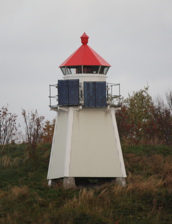
Date unknown. Active; focal plane 16 m (52 ft); white, red or green light depending on direction, occulting twice every 8 s. 6 m (20 ft) square tower with lantern and gallery. Lighthouse painted white, lantern roof red. Trabas has Capt. Peter's photo (also seen at right) and Bing has a fuzzy satellite view. Located on a promontory on the west side of the entrance to the Sifjord. Site status unknown. NF-854000; Admiralty L3496; NGA 13016.
#Senholmen
Date unknown. Inactive since 2016 and apparently removed. 6 m (20 ft) lantern and gallery mounted on a platform supported by piles. Lighthouse painted white, lantern roof red. No photo available. Bing has a distant satellite view but the light is not seen in Google's satellite view. Located on a skerry on the south side of the Torskenfjord. Accessible only by boat. Site status unknown. ex-NF-855500; ex-Admiralty L3506; NGA 13044.
Månes (Måneset)
Date unknown (station established 1902). Active; focal plane 45.5 m (149 ft); flash every 5 s, white, red or green depending on direction. 6 m (20 ft) square tower with lantern and gallery. Lighthouse painted white, lantern roof red. Trabas has Siering's distant view and Bing has a distant satellite view. The building near the light is probably a former keeper's house, but we need information on the history of this historic station. Located on a promontory (the northernmost of three in Torsken) on the west coast of Senja. Site status unknown. NF-856000; Admiralty L3510; NGA 13060.

Bloskeneset Light, Torsken
photo copyright Capt. Peter Mosselberger; used by permission
Teistneset
Date unknown. Active; focal plane 27.5 m (90 ft); two flashes every 10 s, white, red or green depending on direction. 6 m (20 ft) square tower with lantern and gallery. Lighthouse painted white, lantern roof red. No photo available but Bing has a distant satellite view. Located on a promontory about 6.5 km (4 mi) northeast of the Månes lighthouse. Site status unknown. NF-856500; Admiralty L3514; NGA 13064.

Berg Lighthouses
Kjøbmandsøy (Range Rear)
Date unknown (station established 1897). Active; focal plane 26 m (85 ft); white, red or green light depending on direction, occulting twice every 8 s. 6 m (20 ft) lantern and gallery mounted on a stone cairn. Lantern painted white with a red roof. No photo available but Bing has a distant satellite view. Located on an island in the entrance to the Bergsfjord. Accessible only by boat. Site status unknown. NF-859700; Admiralty L3536.1; NGA 13116.
Lille Teistholmen (Range Front)
Date unknown (station established 1896). Active; focal plane 7.5 m (25 ft); white, light, 3 s on, 3 s off. 6 m (20 ft) square tower with lantern and gallery. Lighthouse painted white, lantern roof red. No photo available but Google has an indistinct satellite view. Located on a small island about 1 km (0.6 mi) north of the Kjøbmansøy light. Accessible only by boat. Site status unknown. NF-859800; Admiralty L3536; NGA 13112.
Bøvær (Lille Bøholmen)
Date unknown (station established 1904). Active; focal plane 10 m (33 ft); white, red or green light depending on direction, 3 s on, 3 s off. 7 m (23 ft) square wood tower with lantern and gallery. Lighthouse painted white, lantern roof red. A photo is at right, Trabas has Capt. Peter's photo, Arnuld Elvevold has a lovely view, Google has a distant street view, and Bing has a satellite view. The neighboring building is a former fish packing factory, now used as a community center; accommodations are available. Located on a small island, Lille Bøholmen, off the harbor of Bøvær on the west coast of Senja. Accessible only by boat. Site open, tower closed. NF-858600; Admiralty L3530; NGA 13104.
Røra
Date unknown. Active; focal plane 10 m (33 ft); flash every 5 s, white, red or green depending on direction. 8 m (26 ft) lantern on a platform supported by piles. Lantern painted white with a red roof. No photo available but Google has a distant satellite view. Located on a sharp promontory at the entrance to the Steinfjord, about 7 km (4.5 mi) north of Bøvær. Site status unknown. NF-859000; Admiralty L3532; NGA 13108.
Kjølva
Date unknown. Active; focal plane 29 m (92 ft); flash every 5 s, white, red or green depending on direction. 6 m (20 ft) concrete post with lantern and gallery. Lighthouse painted white, lantern roof red. No photo available but Bing has an indistinct satellite view. Kjølva is a spectacular peak that rises 134 m (440 ft) above the sea at the tip of a sharp cape at the northwestern tip of Senja. Located near the base of the cliff. Site status unknown. NF-859500; Admiralty L3534; NGA 13144.
Bøvær Fyr
Bøvær Light, Berg, May 2008
Flickr photo copyright Elbblick; permission requested

Lenvik Oceanside Lighthouses
* [Øyfjord (Husøy)]
Date unknown (station established 1908). Active; focal plane 26 m (85 ft); white, red or green light depending on direction, occulting twice every 8 s. 3 m (10 ft) octagonal lantern, painted white with a red roof. Trabas has Capt. Peter's photo, a 2010 photo and additional photos are available (last row on the page), and Bing has a distant satellite view. Husøy (House Island) is an island in the Øyfjord off the northwest coast of Senja. A bridge connects the island to the mainland of Senja. Located at the northern tip of Husøy. Site open, tower closed. NF-862000; Admiralty L3550; NGA 13148.
Hekkingen
1859. Active; focal plane 23 m (75 ft); white, red or green light depending on direction, occulting twice every 8 s. 10 m (33 ft) trapezoidal cylindrical wood tower attached at the gable end of a 1-1/2 story wood keeper's house. Lighthouse painted white; lantern, gallery, and house roof are red. A photo is at the top of this page, Wikipedia has a photo, the Lighthouse Association has a page for the lighthouse, a 2021 photo is available, Trabas has a very distant view by Ronald Wöhrn, and Bing has a satellite view of the station. This light marks the northern tip of Senja and the entrance to Malangenfjord. The light statio is leased to the Sommarøy Arctic Hotel. Accommodtaions are not offered but the hotel organizes tours to the lighthouse. Located on an island off the north coast of Senja and about 7 km (4.5 mi) west of Sommarøy. Accessible only by boat. Site open, tower open only to guided tours. Site manager: Sommarøy Arctic Hotel. . ARLHS NOR-113; NF-862500; Admiralty L3552; NGA 13160.

Lenvik Inside Passage and Mainland Lighthouses
Klauvskjærodden
Date unknown. Active; focal plane 6 m (20 ft); two flashes every 10 s, white, red or green depending on direction. 6.5 m (21 ft) concrete post with lantern and gallery. Lighthouse painted white, lantern roof red. Trabas has Ronald Wöhrn's photo and Google has a fuzzy satellite view. Located on a promontory of Senja about 4 km (2.5 mi) southeast of Finnsnes. Site status unknown. NF-839700; Admiralty L3402; NGA 12812.
* Finnsnes (Finnsnesodden)
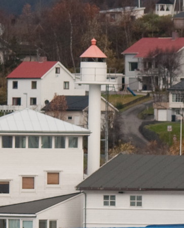
Date unknown (station established 1901). Inactive since 2016. 15.5 m (51 m) concrete post light with lantern and gallery. Lighthouse is white, lantern roof red. Bash's photo is at right, a 2009 closeup is available, Pernille Sørensen has a photo, John Dunlevy has a good view, and Google has a 2022 street view and an indistinct satellite view. Unlike many deactivated minor lights in Norway this light was not removed; formerly it marked the southern entrance to the Finnsnesrenna, a narrow channel separating the island of Senja from the mainland. It is an unusually tall example of a common type of Norwegian light. A front light was mounted on a waterfront building. Located on the waterfront in the village of Finnsnes. Site open, tower closed. ex-NF-840000; ex-Admiralty L3404; NGA 12820.
#Finnsnesrenna
Date unknown. Demolished in 2014. This was a 13 m (43 ft) (?) concrete post light with lantern and gallery, mounted on a round concrete pier. Lighthouse was white, lantern roof red. Bash has a 2010 photo and Google has a distant satellite view of the location. Formerly located on the east side of the Finnsnesrenna a short distant south of the Gisund Bridge. A series of smaller beacons now guide vessels in the Finnsnesrenna. Accessible only by boat. Site open. ex-NF-840800; ex-Admiralty L3403; ex-NGA 12836.
Nordre Leiknesøyra
Date unknown. Active; focal plane 9.5 m (31 ft); white, red or green light depending on direction, occulting three times every 10 s. 11 m (36 ft) concrete post light with lantern and gallery, mounted on a small platform supported by piles. Lighthouse painted with black and white horizontal bands, lantern roof painted red. Trabas has Capt. Peter's photo and Google has a distant satellite view. Located off a promontory of the mainland about 10 km (6 mi) north of Finnsnes. Accessible only by boat. Site open, tower closed. NF-841900; Admiralty L3411.6; NGA 12844.
Finnsnes Fyr
Finnsnes Light, Lenvik, October 2010
Flickr Creative Commons photo by C.W. Bash
* Slettnes (Slettneset)
Date unknown. Active; focal plane 6.5 m (21 ft); white, red or green light depending on direction, occulting twice every 8 s. 6 m (20 ft) square wood tower with lantern and gallery. Lighthouse painted white, lantern roof red. Siering's photo is at right, Trabas has Capt. Peter's closeup photo, Bash has a view from the fjord, and Google has a street view and a satellite view. Located at the tip of a promontory of the mainland about 2 km (1.25 mi) north of Slettnes. Site open, tower closed. NF-842600; Admiralty L3416; NGA 12860.
* [Rødbergsodden]
Date unknown (station established 1898). Active; focal plane 35 m (115 ft); white, red or green light depending on direction, occulting once every 6 s. 3 m (10 ft) octagonal lantern mounted on an octagonal stone base. Lantern painted white with a red roof. Trabas has Siering's photo, Bash has a view from the fjord, and Bing has an indistinct satellite view. This light marks an important turn in the coastal waterway south of Tromsø. Located on a promontory of the mainland north of Rødbergshamn; accessible by road. Site open, tower closed. NF-842800; Admiralty L3420; NGA 12864.
* Klavikneset (Kravikneset)
Date unknown. Active; focal plane 6.5 m (21 ft); white, red or green light depending on direction, occulting twice every 8 s. 6 m (20 ft) square tower with lantern and gallery. Lighthouse painted white, lantern roof red. Trabas has Capt. Peter's closeup photo and Google has a street view and a satellite view. Located on the west side of a southern branch of the Malangenfjord south of Kravik. Site open, tower closed. NF-843200; Admiralty L3422; NGA 12872.
Slettnes Light
Slettnes Light, Lenvik, June 2012
ex-Panoramio photo copyright Arno Siering; used by permission
Sultindvikneset
Date unknown. Active; focal plane 7.5 m (25 ft); white, red or green light depending on direction, occulting once every 6 s. 6 m (20 ft) square tower with lantern and gallery. Lighthouse painted white with a red roof. Trabas has Capt. Peter's photo, and Google has a street view through trees and a distant satellite view. Located on the west side of the Malangenfjord at the entrance to the Målselva. Site open, tower closed. NF-843400; Admiralty L3426; NGA 12876.
Stønnesbotnen (Stønnesbotn, Gavlholmen)
Date unknown. Active; focal plane 10.5 m (34 ft); white, red or green light depending on direction, 3 s on, 3 s off. 6 m (20 ft) square tower with lantern and gallery. Lighthouse painted white with a red roof. Trabas has Siering's photo and Bing has a satellite view. Located on a skerry on the east side of the approach to Botnhamn, on the northeast coast of Senja. Site open, tower closed. NF-844200; Admiralty L3432; NGA 12892.

Balsfjord Lighthouses

* Nordbyneset
Date unknown. Active; focal plane 9 m (30 ft); white, red or green light depending on direction, occulting once every 6 s. 9.5 m (31 ft) square skeletal tower with lantern, gallery, and enclosed upper portion. Skeletal portion painted black, upper portion and lantern white, lantern roof red. Trabas has Capt. Peter's photo, Tatiana Fernandes has a fine photo, and Google has an indistinct satellite view. Located at the tip of a promontory on the north side of the Malangenfjord. Accessible by road. Site open, tower closed. NF-843600; Admiralty L3428; NGA 12880.
* Tomasjordnes
Date unknown. Active; focal plane 10 m (33 ft); white, red or green light depending on direction, occulting once every 6 s. 6.5 m (31 ft) square skeletal tower with lantern and gallery. Lighthouse painted white, lantern roof red. Trabas has Capt. Peter's closeup photo and Google has a street view and a distant satellite view. Located at the tip of a sharp promontory on the east side of the Balsfjord about 2.5 km (1.5 mi) northwest of Selnes. Accessible by road. Site open, tower closed. NF-879600; Admiralty L3629; NGA 13408.

Stønnesbotnen Light, Lenvik, June 2012
photo copyright Arno Siering; used by permission
* Storneset
Date unknown. Active; focal plane 9 m (30 ft); white, red or green light depending on direction, occulting once every 6 s. 8 m (26 ft) square skeletal tower with lantern, gallery, and enclosed upper portion. Lighthouse painted white, lantern roof red. Trabas has Capt. Peter's photo and Google has a distant satellite view and a distant street view. Located at the tip of a sharp promontory on the east side of the Balsfjord about 2.5 km (1.5 mi) northwest of Selnes. Accessible by road. Site open, tower closed. NF-879200; Admiralty L3628; NGA 13400.

Information available on lost lighthouses:

Notable faux lighthouses:

Adjoining pages: North: Tromsø Area | South: Vesterålen

Return to the Lighthouse Directory index | Ratings key

Posted August 3, 2006. Checked and revised September 13, 2023. Lighthouses: 45. Site copyright 2023 Russ Rowlett and the University of North Carolina at Chapel Hill.