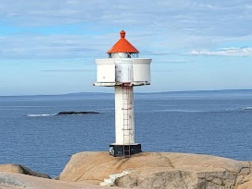
Lighthouses of Norway: Østfold (Fredrikstad Area)

The Kingdom of Norway (Norge in Norwegian) is one of the world's most maritime nations. The country is long and narrow, with drowned valleys called fjords that bring the sea far inland in most regions. The mainland coast is estimated to be 2650 km (1650 mi) long and when all the islands and minor indentations are counted the total coastline approaches an astonishing 60,000 km (37,500 mi), long enough the go around the world one and a half times. With such a lengthy and rocky shore it's not surprising that Norway has a large number of lighthouses.

Norway is divided into 15 counties (fylker) and the counties are divided into townships (kommuner). This page lists lighthouses of Østfold county in the southeastern corner of the country, adjoining Sweden. The coastline of Østfold faces south on the head of the Skaggerak strait and west on the lower Oslofjord. In 2020 Østfold was merged with Akershus and Buskerud counties to form a new county called Viken. This merger was not popular and the merger was reversed as of 1 January 2024.

Although it has always been considered a separate realm Norway has only been independent since 1905; it was ruled by the Danish king for four centuries until 1814 and then by the Swedish king until a peaceful separation of the two kingdoms was arranged in 1905.

In Norwegian a lighthouse is a fyrtårn (fire tower) or simply a fyr; a fyrlykt is a beacon and a lyktehus is a lantern. The Norwegian word fjord for a narrow, deep inlet of the sea has been adopted into English. Øy is an island, holmen is an islet, skjær is a skerry (a tiny island or rocky reef), stim is a shoal, sund is a strait (often between an island and the mainland), bukt is a bay, nes is a headland, elv is a river, and havn is a harbor.

Aids to navigation in Norway are maintained by the Kystverket (Coastal Administration), an agency of the Ministry of Trade, Industry and Fisheries.

ARLHS numbers are from the ARLHS World List of Lights. NF numbers are from the Norsk Fyrliste, the official Norwegian light list. Admiralty numbers are from volume B of the Admiralty List of Lights & Fog Signals. U.S. NGA List numbers are from Publication 115.

General Sources
Norwegian Lighthouse Association
News and photos from the Association. The Fyrene section provides information on the history and status of all of the major lights.
Online List of Lights - Norway - Skaggerak
Photos by various photographers posted by Alexander Trabas; many of these photos were taken by Michael Boucher, Ronald Wöhrn, or Capt. Peter Mosselberger.
Leuchttuerme.net - Oslo Fjord
Photos posted by Malte Werning.
Lighthouse Pages from Anke and Jens - Norway
Good photos and and brief accounts for some of the Oslofjord lighthouses, in English.
Lighthouses in Østfold
Photos by various photographers available from Wikimedia.
World of Lighthouses - Norway
Photos by various photographers available from Lightphotos.net.
Norwegische Leuchttürme
Photos by Klaus Huelse.
Norsk Fyrliste
Latest edition of the Norwegian light list.
Norwegische Leuchttürme auf historischen Postkarten
Historic postcard images, also posted by Klaus Huelse.
Liste over Norske Fyr
From Norwegian Wikipedia, a handy list of Norwegian light stations with their dates of establishment.
Navionics Charts
Navigation chart for the Østfold area.
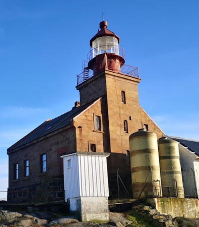

Torbjørnskjær Light, Hvaler, June 2021
Google Maps photo by Mats Karlsøen


Struten Light, Fredrikstad, October 2018
Google Maps photo by Oddvar Larsen
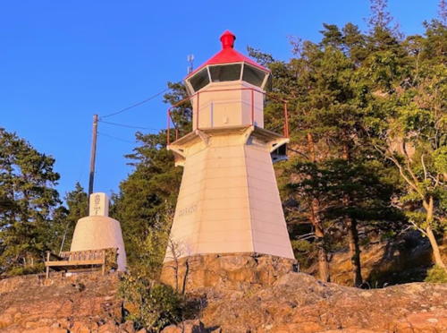
Halden and Sarpsborg Lighthouses

Halden Lighthouses
Halden is the southeasternmost town in Norway. It is the site of several technology companies and a research center of the Institute for Energy Technology.

Fløberg
Date unknown. Active; focal plane 7 m (23 ft); white, red, or green light, depending on direction, occulting twice every 8 s. 6 m (20 ft) square skeletal tower with wood siding, lantern and gallery. Lighthouse painted white, lantern roof red. A photo by Tamás Novotny is at right, he also has a closeup, and Google has a satellite view. Located on the tip of a promontory on the east side of the Iddefjord about 10 km (6 mi) south southeast of Halden. Accessible only by boat. Site open, tower closed. NF-003100; Admiralty B2209; NGA 0072.
[Knivsøyholmen]
Date unknown. Active; focal plane 8.5 m (28 ft); white, red, or green light, depending on direction, occulting twice every 8 s. 3 m (10 ft) lantern surrounded by a white snow screen; lantern roof is red. Trabas has a photo and Google has a satellite view. Located on the southern tip of Knivsøy, marking a very narrow passage in the Iddefjord between the Norwegian town of Halden and the Swedish island of Mossviken. Accessible only by boat. Site open, tower closed. NF-002200; Admiralty B2205; NGA 0060.
Sponvikskansen
Date unknown. Active; focal plane 9 m (30 ft); white, red, or green light, depending on direction, occulting once every 6 s. 6 m (20 ft) lantern and gallery mounted on a round concrete pier. Lighthouse painted white, lantern roof red, pier black. Trabas has a photo and Google has a satellite view. This light overlooks the Swedish border. Located at the base of a vertical cliff on the west side of the entrance to Sponvika from the Svinesund. Accessible only by boat. Site open, tower closed. NF-001500; Admiralty B2198; NGA 0032.

Fløberg Light, Halden, August 2021
Google Maps photo by Tamás Novotny

Sarpsborg Lighthouses
The traditional Østfold County seat, Sarpsborg is mostly an inland municipality; it has a short coastline around the inlet of the Singlefjord.

Hykkelen (Haslauflu Range Rear)
1917. Active; focal plane 18 m (59 ft); white light occulting once every 6 s, intensified on a range line to the south. 9 m (30 ft) round stone tower with lantern and gallery. Lighthouse painted white; lantern roof is red. A 2021 photo is at right, Bent Velling has a view of the lighthouse, and Google has a satellite view. Located on a rocky promontory on the north side of the Singlefjorden about 4 km (2.5 mi) northwest of Sponvika. Accessible only by boat. Site open, tower closed. NF-003600; Admiralty B2211.1; NGA 0080.
Singløy (Range Rear)
Date unknown. Active; focal plane 17 m (56 ft); white light occulting once every 6 s, visible only on a line to the west northwest. 4 m (13 ft) lantern and gallery mounted on a concrete base. Lighthouse painted white, lantern roof red. No photo available but Google has a satellite view. The light acts as the rear light of an eastbound range, the Lauskjær light (next entry) being the front light. Located on a bluff on the west side of the island of Singløy. Accessible only by boat. Site open, tower closed. NF-003700; Admiralty B2214.1; NGA 0096.
Lauskjær (Range Front)
Date unknown. Active; focal plane 6 m (20 ft); white, red, or green light, depending on direction, occulting once every 6 s. 6.5 m (21 ft) lantern on a platform supported by four piles. Lantern painted white with a red roof; piles painted black. No photo available but Google has a satellite view. In addition to being an eastbound range light the sectors of this leading light guide both northbound and southbound vessels into and out of the Singlefjord. Located on a skerry about 600 m (0.4 mi) west northwest of the Singløy light. Accessible only by boat. Site open, tower closed. NF-003800; Admiralty B2214; NGA 0092.

Hykkelen Light, Sarpsborg, March 2021
Google Maps photo by Morten

Hvaler Lighthouses

The municipality of Hvaler occupies a group of islands in the Skaggerak just east of the entrance to the Oslofjord. Kirkøy, Asmaløy, and Vesterøy are the largest of the islands.

Kirkøy Area Lighthouses
Terneskjæra (Terneskjærene)
Date unknown. Active; focal plane 5 m (17 ft); white, red, or green light, depending on direction, occulting three times every 10 s. 6 m (20 ft) lantern on a platform supported by four piles. Lantern painted white with a red roof; piles painted black. No photo available but Google has a satellite view. Sectors of this light guide both eastbound and westbound traffic. Located on a tiny skerry off the northeast coast of Kirkøy, opposite Singløy. Accessible only by boat. Site open, tower closed. NF-004700; Admiralty B2216; NGA 0100.
Kuskjær
Date unknown. Active; focal plane 6 m (20 ft); white, red, or green light, depending on direction, 2 s on, 2 s off. 6 m (20 ft) lantern on a platform supported by four piles. Lantern painted white with a red roof; piles painted black. The light is near the right edge in Rudi Olsen's 2020 photo and Google has a satellite view. Sectors of this light guide vessels in the narrow passage between Nordre Sandøy and Søndre Sandøy, islands off the east side of Kirkøy. Located on a skerry off the north coast of Søndre Sandøy. Accessible only by boat. Site open, tower closed. NF-006000; Admiralty B2226; NGA 0128.
[Reiertangen]
Date unknown. Active; focal plane 12.5 m (41 ft); white, red, or green light, depending on direction, occulting twice every 8 s. 3 m (10 ft) lantern painted white with a red roof. Ole Kasper Olsen has a 2021 photo, Geocaching.com has a photo (halfway down the page), the top of the light is seen in Stig Ulfsby's photo, and Google has a satellite view. This leading light marks the narrowest passage of the Sekkan (or Sækkan), the inlet on the Swedish border; it is about 1 km (0.6 mi) across the Sweden. Located on the northeastern coast of Søndre Sandøy. Site open, tower closed. ARLHS NOR-388; NF-000700; Admiralty B2195; NGA 0024.
Glan
Date unknown. Active; focal plane 6 m (20 ft); white, red, or green light, depending on direction, occulting once every 6 s. 6 m (20 ft) lantern on a platform supported by four piles. Lantern painted white with a red roof; piles painted black. No photo available but Google has a satellite view. Located on a skerry off the east coast of Herføl, an island southwest of Søndre Sandøy. Accessible only by boat. Site open, tower closed. NF-000600; Admiralty B2194; NGA 0020.
* Homlungen (Holmlungen)
1867. Active; focal plane 13 m (43 ft); white, red, or green light, depending on direction, occulting once every 6 s. 12 m (39 ft) square cylindrical wood tower with lantern and gallery, rising at one corner of a 1-1/2 story wood keeper's house. 4th order Fresnel lens (1878). Lighthouse painted white; conical lantern roof painted red. Jon Henriksen's 2017 photo is at right, Vegard Krog Petersen has a 2007 photo, Sigurd Rage has a photo, Terje Håheim has a photo, Wikimedia has a photo by Vibeke Weibell Eliassen, Huelse has a historic postcard view, and Google has a satellite view. The lighthouse was altered in 1915, apparently by installation of a new lantern. The light station is included in the Ytre Hvaler National Park. The keeper's house is available for rustic accommodations, but visitors must bring their own boat or be prepared to row across to the station. Located at the southernmost point of Kirkøy, 1 km (0.6 mi) southwest of Skjærhollen. Site manager: Oslofjordens Friluftsråd (Homlungen Fyr). Site open, tower closed. . ARLHS NOR-125; NF-005500; Admiralty B2222; NGA 0116.

Homlungen Light, Hvaler, August 2017
Google Maps photo by Jon Henriksen

Asmaløy Area Lighthouses
#Fugletangskjær (1)
1897. Active; focal plane 6 m (20 ft); red flash every 5 s. Formerly this was a 6 m (20 ft) square skeletal tower with wood siding, lantern and gallery, but the light is now on a mast (focal plane 6 m (20 ft); red light, 2 s on, 2 s off). Google has a fuzzy satellite view. Located on a skerry off the southeastern tip of Asmaløy, marking the Løperen channel between that island and Kirkøy. Accessible only by boat. Site open, tower closed. Active light: NF-006202; Admiralty B2232; NGA 0132.
Lubbegrunnen
2009. Active; focal plane 18 m (59 ft); green light, 2 s on, 2 s off. 18 m (59 ft) post with lantern and gallery. Lighthouse is white,wth a narrow green horizontal band. lantern roof red. Karin Gullhav has a distant view and Google has a satellite view. Located in the center of the Løperen, the strait separating Kirkøy and Asmaløy. Accessible only by boat. Site open, tower closed. ARLHS NOR-371; NF-007300; Admiralty B2234.5; NGA 0145.
Tjeldholmgrunnen
Date unknown. Active; focal plane 15 m (49 ft); red light, 2 s on, 2 s off. 15 m (49 ft) post with lantern and gallery. Lighthouse is white with one narrow red horizontal band; lantern roof is red. No photo available but Google has a satellite view. Located off the northeastern coast of Tjeldholmen, an island on the west side of the Løperen north of Asmaløy. Accessible only by boat. Site open, tower closed. NF-008300; Admiralty B2241; NGA 0161.
Vestre Fugleskjærgrunnen
Date unknown. Active; focal plane 16 m (52 ft); green light, 2 s on, 2 s off. 16 m (52 ft) post with lantern and gallery. Lighthouse is white with one narrow green horizontal band; lantern roof is red. The Oslo newspaper Dagbladet has Espen Røst's photo of the containership Godafoss aground next to the lighthouse in April 2011. Google has a satellite view. Located in the Løperen about 1 km (0.6 mi) north of the Tjeldholmgrunnen. Accessible only by boat. Site open, tower closed. NF-008400; Admiralty B2241.5; NGA 0162.
Trestenene (Tresten)
Date unknown. Active; focal plane 14.5 m (47 ft); white, red, or green light, depending on direction, occulting twice every 10 s. 8 m (26 ft) lantern and gallery on a platform supported by four piles. Lantern painted white with a red roof; piles painted black. Ole Martin Olsen has a photo and Google has an indistinct satellite view. NGA misspells the name as Tresteinene. Located on a skerry in the Skaggerak about 3 km (2 mi) southwest of Asmaløy. Accessible only by boat. Site open, tower closed. ARLHS NOR-253; NF-004900; Admiralty B2220; NGA 0112.
 

Asmalsund Light, Asmaløy, August 2019
Google Maps street view by Pål Engh
 
Asmalsund (Brattestø, Pigstens, Pikesten)
Date unknown (station established 1897). Active; focal plane 7 m (23 ft); white, red, or green light, depending on direction, occulting three times every 10 s. 8 m (26 ft) square skeletal tower, covered with wood siding, with lantern and gallery. Lighthouse painted white, lantern roof red. Pål Engh's street view is above right, Dag-Inge Simonsen has a nice sunset photo, Morten Hagen has a 2018 photo, Espen Christoffersen has a 2021 photo, and Google has a satellite view. Located at the southwestern tip of Asmaløy, marking the entrance to the Asmalsund, the passage between Asmaløy and Spjærøy. Site open, tower closed. NF-011500; Admiralty B2258; NGA 0208.

Vesterøy Area Lighthouses
[Skjelholmen]
Date unknown. Active; focal plane 8 m (26 ft); white, red, or green light, depending on direction, occulting twice every 8 s. 3.5 m (12 ft) lantern painted white with a red roof. No photo available but Google has a satellite view. This leading light guides vessels entering the very narrow passage between Vesterøy and Spjærøy. Located on an island in the entrance to the passage. Site open, tower closed. NF-011600; Admiralty B2260; NGA 0216.
Utgårdskilen
Date unknown. Active; focal plane 6.5 m (21 ft); white, red, or green light, depending on direction, occulting once every 6 s. 6 m (20 ft) lantern on a platform supported by four piles. Lantern painted white with a red roof; piles painted black. No photo available but Google has a satellite view. Located on the east side of Sauholmen, marking the narrow entrance to Utgård, on the south side of Vesterøy. Accessible only by boat. Site open, tower closed. NF-011700; Admiralty B2262; NGA 0212.
Papperhavn (Lyngholmen)
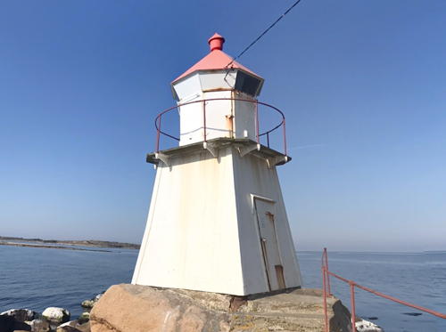
1897. Active; focal plane 17 m (56 ft); white, red, or green light, depending on direction, occulting three times every 10 s. 6 m (20 ft) square skeletal tower with wood siding, lantern and gallery. Lighthouse painted white, lantern roof red. The county's photo at right shows this small lighthouse, Petter Ask Haakonsrud has a distant drone view, the light is barely visible in Oliver Tomic's very distant street view, and Google has a satellite view. Located on Lyngholmen, a small island off the west coast of Vesterøy, about 2 km (1.2 mi) west of Hauge. Site open, tower closed. NF-011900; Admiralty B2266; NGA 0220.

Papperhavn (Lyngholmen) Light, Hvaler
Østfold County photo
Torbjørnskjær
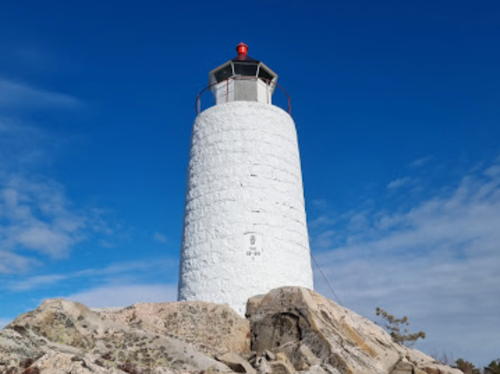
1872. Active; focal plane 26 m (85 ft); white flash every 10 s. 18 m (59 ft) square cylindrical granite tower with lantern and gallery, rising schoolhouse-style from the front of a 1-1/2 story granite keeper's house. 3rd order Fresnel lens. Lighthouse is unpainted dark gray stone; lantern painted red. A well-preserved light station with 1-story wood assistant keeper's house, engine house, boathouse, and other structures. Mats Karlsøen's 2021 photo is at the top of this page, the Swedish Lighthouse Society has a page for the lighthouse, Mats Karlsøen has a fine 2018 photo, Wikimedia has Vibeke Weibell Eliassen's 2011 photo, another photo is available, the Ytre Hvaler National Park has a distant view, Trabas has a distant view by Wöhrn, and Google has a satellite view. This lighthouse and the Færder lighthouse (see the West Oslofjord page) frame the entrance to the Oslofjord from the Skagerrak. Located on a small skerry (skjær) about 8 km (5 mi) southwest of Utgard, Vesterøy. Accessible only by boat and landing is usually difficult; the lighthouse is now maintained by helicopter. Site and tower closed. Site manager: Ytre Hvaler Nasjonalpark. . ARLHS NOR-046; NF-000200; Admiralty B2219; NGA 0012.
Tenneskjær
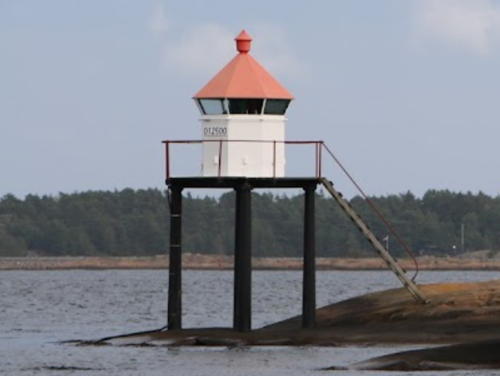
Date unknown. Active; focal plane 4 m (13 ft); white, red, or green light, depending on direction, occulting once every 6 s. Lantern and gallery mounted on four straight piles. Lantern painted white with a red roof; piles painted black. Jan Foss has the closeup photo seen at right and Google has a satellite view. This light guides vessels in narrow passages north of Vesterøy. Located on a small skerry about 2.5 km (1.5 mi) northeast of Hauge. Accessible only by boat. Site open, tower closed. ARLHS NOR-391; NF-012500; Admiralty B2268; NGA 0228.

Tenneskjær Light, Hvaler, August 2015
Google Maps photo by Jan Foss

Fredrikstad Lighthouses

Fredrikstad Harbor Lighthouses
Fredrikstad is a city of about 85,000 residents at the mouth of the Glomma River. The commercial harbor is at the south end of the city; it is approached through a fjord on the east side of Kråkerøy that extends the Løperen channel east of Asmaløy (see above).

Kallera (Kaldera) (Range Front)
2006 (?). Active; focal plane 10.5 m (34 ft); white, red, or green light, depending on direction, occulting once every 6 s. 5 m (17 ft) lantern and gallery mounted on four straight piles. Lantern painted white with a red roof; piles painted black. Google has a satellite view and a distant street view. The Kallera Range has been discontinued although this light remains active. Located on the east side of Kråkerøy opposite the south end of the Fredrikstad waterfront. Probably accessible only by boat (the light is at the bottom of a steep, rocky slope). Site status unknown. NF-010700; Admiralty B2250; NGA 0196.
* Fredrikstad Kirketårnet (Kallera Range Rear) (2)
2006 (tower built 1880). Active; focal plane 40 m (131 ft); white light occulting once every 6 s. Light mounted above one of the clocks in the tower of the Fredrikstad Domkirke (cathedral). A photo of the church is available, Wikimedia has photos, and Google has a street view and a satellite view. Located on the Nygårdsgata in downtown Fredrikstad. Site open, tower closed. Site manager: Fredrikstad Domkirke. NF-010800; Admiralty B2250.1; NGA 0200.

Lower Oslofjord Lighthouses
Struten (1)
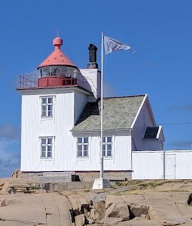
1907. Inactive since 1985. 12.5 m (41 ft) square cylindrical wood tower with lantern and gallery, attached the front of a 1-1/2 story wood keeper's house. House and tower painted white, with a red vertical stripe, lantern and gallery red. Stefan Varga's photo is at right, the Old Struten Lighthouse Association has a good photo of both lighthouses, Oddvar Larsen's 2018 photo is at the top of this page, Wikimedia has a 2011 photo of the station, Benjamin Westerfjell has a 2019 photo, Trabas has a distant view by Wöhrn, Petter Ask Haakonsrud has a street view from the beach, and Google has a satellite view. The Old Struten Lighthouse Association (Stiftelsen Gamle Struten) has leased the house from the Kystverket and made it available for overnight accommodations. The lighthouse is located on a small island on the east side of the channel in Oslofjord, about 8 km (5 mi) northwest of Torbjørnskjær. German troops fortified the island during World War II, but the fortifications saw no fighting. Accessible only by boat. Site open, lighthouse open to paying guests. Site manager: Struten Fyr . ARLHS NOR-322.
Struten (2)
1985. Active; focal plane 19 m (62 ft); white, red, or green light, depending on direction, occulting once every 6 s. Approx. 12 m (39 ft) round cylindrical concrete tower with a small lantern and gallery. Benjamin Westerfjell has a closeup photo and the Old Struten Lighthouse Association has a good photo of both lighthouses. The light is now solar-powered with storage batteries, but the generator remains on standby in case the northern sun fails to provide sufficient charge. Lighthouse painted white with a narrow black horizontal band; lantern roof red. Located between the original lighthouse and the sea. Site open, tower closed. ARLHS NOR-232; NF-013900; Admiralty B2284; NGA 0260.
Stangeskjær
Date unknown. Active; focal plane 10.5 m (34 ft); red light, 1 s on, 1 s off. 8 m (26 ft) stone cairn topped by a light on a small square cabinet. Cairn painted white with a black vertical stripe on each face. Jan Foss has a 2015 photo, a view from the fjord (almost halfway down the page) is available, and Google has a satellite view. Located on a skerry just off the west coast of Kråkerøy. Accessible only by boat. Site open, tower closed. NF-012602; Admiralty B2267; NGA 0224.
Strømtangen (Torgauten) (1)
1859. Inactive since 1977. 7 m (23 ft) lantern room, at ground level, attached to one corner of a 2-story wood duplex keeper's house. House painted white, with a red vertical stripe on the end, lantern rpainted oom red. Silvia Hjellestad Kolstad's 2023 photo is at right, Morgan Sørensen has a 2020 photo, Anne Grethe Foss Olsen has a 2018 photo, and Google has a satellite view. This lighthouse is on the east side of the Oslofjord, marking the entrance to the western harbor of Fredrikstad (Onsøy). The Onsøybeviset association has leased the house from the Kystverket and made it available for overnight accommodations (reservations should be made at least a year in advance). There is also an automatic weather station in the complex. Note: there is another Strømtangen Fyr not so far away in Telemark County. Located on a small island off the end of a rocky peninsula about 2 km (1.25 mi) southwest of Øyenkilen. Accessible only by boat. Site open, lighthouse open to paying guests. Site manager: Strømtangen Fyr . ARLHS NOR-323.
Strømtangen (Torgauten) (2)
1977 (station established 1859). Active; focal plane 15 m (49 ft); white, red, or green light, depending on direction, occulting twice every 8 s. Approx. 11 m (36 ft) round cylindrical concrete tower with a small lantern and gallery. Lighthouse painted white, lantern roof red. Silvia Hjellestad Kolstad's 2023 photo is at right and Anne Grethe Foss Olsen has a 2018 photo. Located between the original lighthouse and the sea. Site open, tower closed. ARLHS NOR-041; NF-014100; Admiralty B2288; NGA 0264.

Strømtangen Fyr, Fredrikstad, July 2023
Google Maps photo by Silvia Hjellestad Kolstad

Slevik and Engelsvik Area Lighthouses
Gåsungene
Date unknown. Active; focal plane 6 m (20 ft); white, red, or green light, depending on direction, occulting once every 6 s. 6 m (20 ft) lantern and gallery mounted on four straight piles. Lantern painted white with a red roof; piles painted black. No closeup photo available; the light is seen to the right of center in Petter Søderberg's very distant aerial view and Google has a satellite view. Located on a rock west of Kråkerøy, marking the western entrance to Fredrikstad. Accessible only by boat. Site open, tower closed. NF-014200; Admiralty B2290; NGA 0268.
Slevik (Stensholmen)
Date unknown. Active; focal plane 12 m (39 ft); white, red, or green light, depending on direction, occulting three times every 10 s. 7 m (23 ft) concrete post with lantern and gallery. Lighthouse painted white, lantern roof red. Vidar Andersen has a 2023 photo seen at right, Torbjørn Pettersen has a 2010 photo, and Google has a satellite view. Located on the west side of the skerry called Stensholmen, marking the entrance to Slevik. Accessible only by boat. Site open, tower closed. NF-017100; Admiralty B2318; NGA 0328.
Garnholmen
Date unknown. Active; focal plane 13 m (43 ft); white, red, or green light, depending on direction, occulting once every 6 s. 6 m (20 ft) lantern and gallery mounted on four straight piles. Lantern painted white with a red roof; piles painted black. Nicolas Sørbrøden has a closeup photo and Google has a satellite view. Located on a small island at the southern entrance to the Hankesund from the Oslofjord, about 2 km (1.25 mi) southwest of Vikene. Accessible only by boat. Site open, tower closed. ARLHS NOR-379; NF-017000; Admiralty B2320; NGA 0324.
Flateguri
Date unknown. Active; focal plane 9 m (30 ft); white flash every 3 s. 8 m (26 ft) concrete post with lantern and gallery. No photo available and Google has only an indistinct satellite view. Located on an island west of Hankø. Accessible only by boat. Site open, tower closed. NF-017200; Admiralty B2324; NGA 0332.
Veslecalv
Date unknown. Active; focal plane 10 m (33 ft); white, red, or green light, depending on direction, 2 s on, 2 s off. 7 m (23 ft) concrete post with lantern and gallery. Emil Miltchev has a 2022 photo, Ole Reidar Johansen has a distant sea view, and Bing has a satellite view. Located on a skerry off the northern tip of Rauøy. Accessible only by boat. Site open, tower closed. NF-017300; Admiralty B2326; NGA 0336.

Slevik Fyr, Fredrikstad, July 2023
Google Maps photo by Vidar Andersen

Moss Area Lighthouses

Rygge Lighthouses
Larkollen
Date unknown. Active; focal plane 5 m (16 ft); white, red, or green light, depending on direction, occulting once every 6 s. 5 m (16 ft) lantern and gallery mounted on tripod piles. Lighthouse painted white, lantern roof red. Trabas has Boucher's photo and Google has a satellite view. Located on the south side of the entrance to Larkollen. Accessible only by boat. Site open, tower closed. NF-017500; Admiralty B2330; NGA 0348.
Revlingen
Date unknown. Active; focal plane 5 m (16 ft); white, red, or green light, depending on direction, occulting once every 6 s. 5 m (16 ft) octagonal lantern mounted on a square rubblestone base. Lantern painted white with a red roof. Jan G. Nergaard has a closeup photo, Trabas has Boucher's distant view and Google has a satellite view. Located on a small island in the Oslofjord about 2.5 km (1.5 mi) southwest of the Moss waterfront. Accessible only by boat. Site open, tower closed. ARLHS NOR-389; NF-017600; Admiralty B2334; NGA 0352.

Moss Lighthouses
* Verlebukta
Date unknown. Active; focal plane 13 m (43 ft); white, red, or green light, depending on direction, occulting twice every 8 s. Round lantern, painted white and mounted on the roof of a pierhead building. Trabas has Boucher's closeup photo and Google has a satellite view and a distant street view across the harbor. Located at the end of the southeast quay at Moss, an industrial town with about 30,000 residents. There's a good view from ferries crossing the Oslofjord to Horten in Vestfold. Site open, tower closed. NF-017700; Admiralty B2336; NGA 0356.
Gullholmen (Guldolmen) (1)
1894. Inactive since 1984. Approx. 7 m (23 ft) square cylindrical wood tower with lantern and gallery, attached to one end of a 1-1/2 story wood keeper's house. House and tower painted white, lantern and gallery red. Monica Tjelmeland's 2019 photo is at right, Trabas has a photo by Rainer Arndt, Huelse has a photo, Werning has a photo, Anke and Jens have several good photos, Wikimedia has a distant view, and Google has a satellite view of the station. The house is available for overnight stays. The light marks a constriction in the Oslofjord near the town of Moss. Located on a small island on the east side of Oslofjordens about 5 km (3 mi) west of Moss. Accessible only by boat. Site and tower open only to overnight guests. Site manager: Oslofjordens Friluftsråd (Gullholmen Fyr ). ARLHS NOR-104.
Gullholmen (Guldolmen) (2)
1984 (station established 1894). Active; focal plane 16 m (52 ft); white, red, or green light, depending on direction, occulting once every 6 s. Approx. 7 m (23 ft) post with a small lantern and gallery, painted with red and white horizontal bands. Monica Tjelmeland's 2019 photo is at right. Located immediately in front of the original lighthouse. Accessible only by boat. Site open only to overnight guests, tower closed. ARLHS NOR-310; NF-018100; Admiralty B2346; NGA 0360.
* Kippenes
Date unknown. Active; focal plane 10 m (33 ft); white, red, or green light, depending on direction, occulting twice every 8 s. 8 m (26 ft) square pyramidal wood tower with lantern and gallery. Lighthouse painted white; lantern roof is red. Jon Arve Gundersen has a 2020 photo, Waymarking.com has a photo, amateur radio operator LA0FA has a photo, another photo is available, and Google has a satellite view. Located on the east side of Jeløy, marking a narrow passage in the Mossesund, about 3 km (2 mi) north of Moss. Site appears open, tower closed. ARLHS NOR-381; NF-018500; Admiralty B2350; NGA 0364.

Gullholmen Fyr, Moss, July 2019
Facebook photo by Monica Tjelmeland

Information available on lost lighthouses:

Notable faux lighthouses:

Adjoining pages: East: Tanum Area | North: Oslo Area | West: West Oslofjord

Return to the Lighthouse Directory index | Ratings key

Posted April 10, 2006. Checked and revised April 22, 2024. Lighthouses: 36. Site copyright 2024 Russ Rowlett and the University of North Carolina at Chapel Hill.