Lighthouses of Norway: West Oslofjord

The Kingdom of Norway (Norge in Norwegian) is one of the world's most maritime nations. The country is long and narrow, with drowned valleys called fjords that bring the sea far inland in most regions. The mainland coast is estimated to be 2650 km (1650 mi) long, and when all the islands and minor indentations are counted the total coastline approaches an astonishing 60,000 km (37,500 mi), long enough the go around the world one and a half times. With such a lengthy and rocky shore, it's not surprising that Norway has a large number of lighthouses.

Norway is divided into 15 counties (fylker) and the counties are divided into townships (kommuner). This page lists lighthouses the counties of Buskerud and Vestfold, which face the west side of the Oslofjord and the north side of the Skagerrak on Norway's south coast. In 2020 the counties of Vestfold and Telemark were merged to form the county of Vestfold og Telemark. At the same time Buskerud was merged with the counties of Akershus and Østfold to form the new county of Viken. These mergers were very unpopular and the original counties were restored effective 1 January 2024. Also in 2020 the municipality of Svelvik, formerly in Vestfold, seceded and merged with Drammen in Buskerud.

In Norwegian a lighthouse is a fyrtårn (fire tower) or simply a fyr; a fyrlykt is a beacon and a lyktehus is a lantern. Øy is an island, holmen is an islet, skjær is a skerry (a tiny island or rocky reef), sund is a strait (often between an island and the mainland), bukt is a bay, nes is a headland, and havn is a harbor.

Aids to navigation in Norway are maintained by the Kystverket (Coast Directorate), an agency of the Ministry of Transport and Communications.

ARLHS numbers are from the ARLHS World List of Lights. NF numbers are from the Norsk Fyrliste. Admiralty numbers are from volume B of the Admiralty List of Lights & Fog Signals. U.S. NGA List numbers are from Publication 115, but in 2018 NGA dropped many listings of lights on the Norwegian fjords.

General Sources
Online List of Lights - Norway - Skaggerak
Photos by various photographers posted by Alexander Trabas; many of these photos were taken by Michael Boucher, Ronald Wöhrn, Jim Smith, or Capt. Peter Mosselberger.
Norwegian Lighthouse Association
News and photos from the Association.
Leuchttuerme.net - Oslo Fjord
Photos posted by Malte Werning.
Lighthouse Pages from Anke and Jens - Norway
Good photos and and brief accounts for some of the Oslofjord lighthouses, in English.
Norway Lighthouses
Photos by Larry Myhre.
Lighthouses in Norway
Photos by various photographers available from Wikimedia.
World of Lighthouses - Norway
Photos by various photographers available from Lightphotos.net.
Norsk Fyrliste
Current edition of the Norwegian light list.
Norwegische Leuchttürme auf historischen Postkarten
Historic postcard images posted by Klaus Huelse.
Liste over Norske Fyr
From Norwegian Wikipedia, a handy list of Norwegian light stations with their dates of establishment.
GPSNauticalCharts
Navigational chart for the Oslofjord.
Navionics Charts
Navigational chart for the Oslofjord.


Svenner Light, Larvik, July 2022
Google Maps photo by Ludovic Hasse
Buskerud Lighthouses

Asker Lighthouses
Nordre Sundbyholmen (2?)
About 2019. Active; focal plane 11.5 m (38 ft); white, red or green light depending on direction, occulting three times every 10 s. 5 m (16 ft) hexagonal cylindrical tower painted white with two black horizontal bands; lantern roof is red. Lighthouse painted white, lantern roof red. Trabas has Smith's photo. Werning has a photo of the earlier light, a 4 m (13 ft) post with lantern and gallery, and Google has a satellite view. Located on an islet in the Oslofjord about 800 m (1/2 mi) east of Båtstø. Accessible only by boat. Site open, tower closed. NF-020200; Admiralty B2379; NGA 0420.
** Filtvet (1)
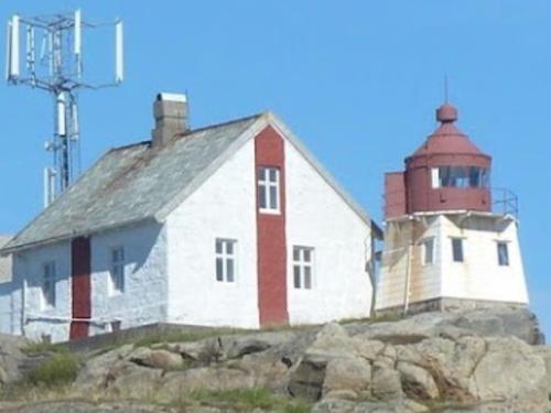
1840. Inactive since 1985 (a decorative light is sometimes displayed). Approx. 11 m (36 ft) lantern mounted on the roof of a 1-1/2 story wood keeper's house. House painted white, lantern red. The active light is in front of the house on a 14 m (46 ft) cylindrical fiberglass tower with gallery. Originally the light was shown from a lantern under the front gable, and a fog bell tower was mounted on the roof. The present lantern structure was added in 1916. Fresnel lens and blinking mechanism preserved in the lantern. A photo is at right, Werning has a good photo, Anke and Jens have photos, Camilla Luihn has a 2008 photo, Wikimedia has several photos, Björn Staack has a street view, Huelse has a historic postcard view, and Google has a satellite view. The light station was purchased in 1999 by the local government, which maintains it in excellent condition. The building houses a small museum and art gallery and is available for meetings and private parties. Concerts and other special events are scheduled during the summer season. A support group, Filtvet Fyrs Venner, works to support the station. The building was restored and repainted in 2015. Located off the Nordstrandveien on the west side of Oslofjorden near Tofte, about 12 km (7.5 mi) southeast of Hurum. Parking is limited and the entrance is unmarked. Site open, tower closed. Owner: Asker Kommune. Site manager: Filtvet Fyrs Venner . ARLHS NOR-079.
* Filtvet (2)
1985. Active; focal plane 13 m (43 ft); white, red or green light depending on direction, occulting twice every 8 s. 14 m (46 ft) concrete post with lantern and gallery. Lighthouse painted white with one narrow red horizontal band; lantern roof is also red. Trabas has Boucher's closeup photo and Thomas Andreas Kolding has a 2007 photo. Located in front of the historic lighthouse. Site open, tower closed. NF-018700; Admiralty B2354; NGA 0372.
Ramvikholmen (Ranvikholmen)
Date unknown. Active; focal plane 6.5 m (21 ft); white, red or green light depending on direction, occulting three times every 10 s. 6 m (20 ft) square pyramidal skeletal tower, covered with white siding, with lantern and gallery. Lighthouse painted white, lantern roof red. Trabas has Boucher's photo, Pål Svendsrud has a street view, and Google has a satellite view. Wikimedia has a photo of the island of Ramvikholmen; the lighthouse can be seen at the far left. In 2007 the island became a nature reserve. Located on the north point of a small island about 2.5 km (1.5 mi) southwest of Tofte. Accessible only by boat. Site open, tower closed. NF-025800; Admiralty B2434; NGA 0532.
Filtvet Light
Old and new Filtvet Lights, Asker, July 2009
Flickr Creative Commons photo by zen whisk
Østnestangen
Date unknown (station established 1899). Active; focal plane 6 m (20 ft); white, red or green light depending on direction, occulting once every 6 s. 4 m (13 ft) octagonal lantern mounted on a concrete pad. Lantern painted white with a red roof. Kjell-Erik Torgersen has a closeup photo, David Peter Brooks has a 2022 photo, Svein Erlandsen has a photo, Trabas has Arndt's distant view, and Google has a distant satellite view. Located at the tip of a sharp promontory about 3 km (2 mi) southwest of Tofte. Probably accessible by a hiking trail. Site open, tower closed. NF-025900; Admiralty B2436; NGA 0536.
Rødtangen (1)
1840. Inactive since 1897. 1-1/2 story wood house with a small square lantern room attached to the front of the house, a few feet above the ground. A photo is at right and Google has a satellite view. Around 2000 area residents built a replica of the historic fog bell tower; Espen Felder has a closeup photo and Gunnar Pedersen has a 2020 photo. The house is a private residence. Located on a point of land on the east side of the entrance to the Drammensfjord. Site and lighthouse closed but a path leads to the fog bell. Owner/site manager: private. ARLHS NOR-195
* Rødtangen (2)
1897 (station established 1840). Active; focal plane 8 m (26 ft); white, red or green light depending on direction, occulting three times every 10 s. 6 m (20 ft) octagonal lantern mounted on a square stone base. Lantern painted white with a red roof. A closeup photo, a second photo, and a distant view are available, Ove Borgersen has a 2023 photo, and Google has a satellite view. Located on the east side of the Drammensfjord, about 600 m (3/8 mi) northwest of the historic lighthouse and 3 km (2 mi) south of Holmsbu. Site open, tower closed. . NF-026200; Admiralty B2440; NGA 0540.


Rødtangen Light, Asker, July 2010
Google Maps photo by trolvag
Bjørneskjær (Range Front)
Date unknown. Active; focal plane 6 m (20 ft); white, red or green light depending on direction, 2 s on, 2 s off. 6.5 m (21 ft) lantern mounted on a tripod. Lighthouse painted white with a red vertical stripe. Trabas has Boucher's photo and Google has a satellite view. The directional light (formerly a front range light) guides vessels southbound from Svelvik. The rear light has been replaced by a triangular daymarker on a mast. Located at the northern tip of a small island just off the east coast of the Drammensfjord. Accessible only by boat. Site status unknown (the island appears to be privately owned). NF-026900; Admiralty B2449; NGA 0548

Drammen Lighthouse
These lights are on the Drammensfjord, a western branch of the Oslofjord. At Svelvik the fjord narrows to a strait only 200 m (220 yd) wide. The city of Dramman is at the head of the fjord. In 2020 the former municipality of Svelvik (which had been in Vestfold County) merged with Drammen.

Risgarden Molo
Date unknown. Active; focal plane 8 m (26 ft); white flash every 2 s. 6 m (20 ft) lantern mounted on a platform suported by piles. Lantern painted white with a red roof. A distant aerial view is available and Google has a satellite view. Located at the tip of a quay receiving automobile shipments in the harbor of Drammen, the former capital of Buskerud County, on the upper Drammensfjord. Site and tower closed. NF-028700; Admiralty B2472; NGA 0596.
* Tømmerås Range Front (Batteriøya) (1)
Date unknown. Inactive. Approx. 10 m (33 ft) square skeletal tower with lantern and gallery. Lighthouse painted white with a red vertical stripe and a red roof on the lantern. Andre Sadowski has a photo, Ove Borgersen has a 2023 photo, and Google has a satellite view. Trabas has Boucher's photo of the active light (focal plane 8.5 m (28 ft); red light occulting once every 6 s), shown from a skeletal mast mounted on a short stone pyramid. The range guides vessels departing Svelvik; new lights were needed because the channel was realigned toward the west. Located at the northern tip of Batteriøya, a small island at the south end of Svelvik harbor. Site open, tower closed. Active light: NF-027274; Admiralty B2456; NGA 0578.
#Tømmerås Range Rear (1)
Date unknown. Inactive; apparently demolished around 2014. This was an approx. 14 m (46 ft) square skeletal tower with a square lantern house and gallery. Lighthouse painted white with a red vertical stripe on the lantern house. Google has a satellite view of the former location. Trabas has Boucher's photo of the active light (focal plane 12.5 m (41 ft); red light occulting once every 6 s), shown from a skeletal mast standing by the Svelvik Boat Club (Google has a street view). Located on the mainland, off the Strandgaten in Svelvik. Site open, tower closed. Active light: NF-027272; Admiralty B2456.1; NGA 0579.
Svelvikrenna Nordvest
Date unknown. Active; focal plane 5.5 m (18 ft); red light occulting once every 6 s. 10 m (33 ft) post with lantern and gallery. Lighthouse painted white with two narrow red horizontal bands; lantern roof is red. Trabas has Boucher's photo and Google has a satellite view. Located on the east side of the Svelvikrenna channel about 2 km (1.25 mi) southeast of Svelvik. Accessible only by boat. Site open, tower closed. NF-027130; Admiralty B2450.6; NGA 0569.
Svelvikrenna Nordøst
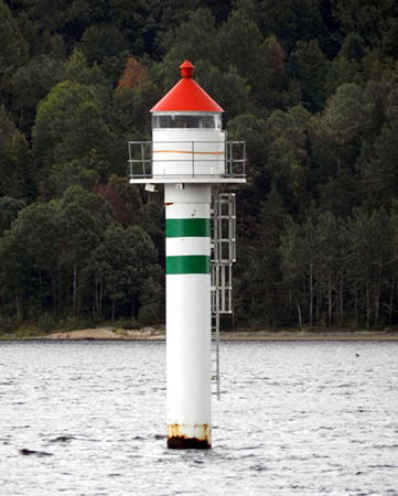
Date unknown. Active; focal plane 5.5 m (18 ft); green light occulting once every 6 s. 10 m (33 ft) post with lantern and gallery. Lighthouse painted white with two narrow green horizontal bands; lantern roof is red. Trabas has Boucher's photo seen at right and Google has a satellite view. Located on the east side of the Svelvikrenna channel about 2 km (1.25 mi) southeast of Svelvik. Accessible only by boat. Site open, tower closed. NF-027140; Admiralty B2450.65; NGA 0569.5.
Svelvikrenna Sørvest
Date unknown. Active; focal plane 5.5 m (18 ft); red light, 3 s on, 3 s off. 6.5 m (21 ft) post with lantern and gallery. Lighthouse painted white with a narrow red horizontal band; lantern roof is red. Trabas has Boucher's photo and Google has a satellite view. Located just off a point of land at the southern end of Svelvik. Site open, tower closed. NF-027010; Admiralty B2449.95; NGA 0554.
Svelvikrenna Sørøst
Date unknown. Active; focal plane 5.5 m (18 ft); green light, 3 s on, 3 s off. 6.5 m (21 ft) post with lantern and gallery. Lighthouse painted white with a narrow green horizontal band; lantern roof is red. Trabas has Boucher's photo and Google has a satellite view. Located just off a point of land at the southern end of Svelvik. Site open, tower closed. NF-027020; Admiralty B2449.96; NGA 0555.

Svelvikrenna Nordost Light, Asker
photo copyright Michael Boucher; used by permission

Vestfold Lighthouses

Tønsberg: Re Lighthouse
In 2020 the former municipality of Re was merged with Tønsberg. As a result Tønsberg now surrounds Horten.

** Mulodden
Date unknown. Active; focal plane 6 m (20 ft); white, red or green light depending on direction, occulting once every 6 s. 5 m (16 ft) lantern and gallery mounted atop a round concrete base. Lantern and gallery painted white, lantern roof red; the stone base is unpainted. Bjørn-Arve Sandvik has a 2021 photo, Ingard Jensen has a photo, a 2013 photo is available, and Google has a satellite view. Mulodden is a public park on a peninsula at the southern entrance to the Sandebukta from the Oslofjord just east of Holmestrand. Located at the tip of the peninsula. Site open; visitors can easily climb steps to the gallery. ARLHS NOR-386; NF-030400; Admiralty B2474; NGA 0628.

Horten Lighthouses
* Horten
Date unknown. Active; focal plane 5 m (17 ft); white, red or green light depending on direction, 2 s on, 2 s off. 4 m (13 ft) octagonal lantern mounted on a stone base. Lantern painted white with a red roof. Trabas has Boucher's photo, Bjørn Rehoff Larsen has a nice photo, Ove Borgersen has a 2023 photo, and Google has a closeup street view and a satellite view. Located at the end of the breakwater mole sheltering the small boat harbor in Horten, a city of about 27,000 residents; accessible by walking the mole. There should also be a good view from Bastø Fosen ferries crossing the Oslofjord between Horten and Moss. Site open, tower closed. NF-030700; Admiralty B2478; NGA 0632.
Bastøy (3)
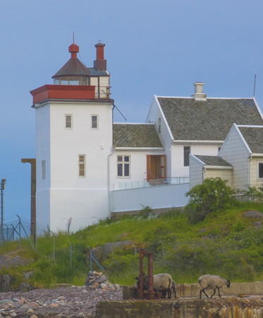
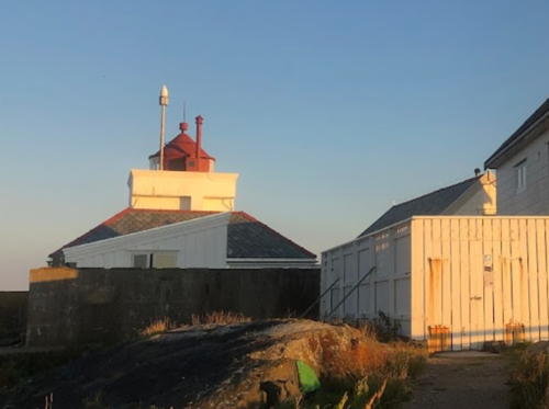
1918 (station established 1840 but inactive 1896-1918). Inactive since 1986. Approx. 14 m (46 ft) square cylindrical stone tower with lantern and gallery, attached to a 1-1/2 story wood keeper's house. Building painted white, lantern and gallery red. The active light is on a post in front of the lighthouse (focal plane 13 m (43 ft); red light occulting three times every 10 s). A photo is at right, Werning has a photo, Anke and Jens have photos, Trabas has posted a very nice photo by Wöhrn, Søren Rodriguez has a December 2010 photo, Egil Elseth has closeup, Myhre has a distant view, and Google has a satellite view. The original lighthouse was demolished in 1896, and a small light served until 1918. The house was transferred to the prison system and is used for meetings of prison personnel. Located on an island on the west side of Oslofjordens about 4 km (2.5 mi) southeast of Horten. Accessible only by boat. Site and tower closed. Owner/site manager: Kriminalomsorgen. . ARLHS NOR-307. Active light: NF-031202; Admiralty B2480; NGA 0636.
Østenskjær
Date unknown. Active; focal plane 12 m (39 ft); white, red or green light depending on direction, occulting once every 6 s. 8 m (26 ft) octagonal lantern and gallery atop a square solid rubblestone tower. Lantern and gallery painted white, lantern roof red; the stone tower is painted with black and white vertical stripes. Erland Storeng Sem has a 2020 photo, Trabas has Wöhrn's view from the sea, Kjell-Arne Haraldsen has a distant view, and Google has a satellite view. Black and white striped stone cairns are common in Norway. Located on a skerry about 1.2 km (3/4 mi) southwest of Bastøy. Accessible only by boat. Site open, tower closed. ARLHS NOR-387; NF-031500; Admiralty B2482; NGA 0644.
Bastøy Light
Bastøy Light, Horten, June 2012
Wikimedia Creative Commons photo by nidelv

Tønsberg Lighthouses
Mefjordbåen
Date unknown. Active; focal plane 13 m (43 ft); white, red or green light depending on direction, occulting twice every 8 s. 13 m (43 ft) slender round cylindrical tower supporting a round "watch room" structure with a small lantern on the roof. Wikimedia has a 2012 photo, Werning has a photo, Søren Rodriguez has a 2010 photo, Anke and Jens have a photo, Trabas has a photo by Wöhrn, and Google has a satellite view. Located in the lower Oslofjord about 3 km (2 mi) off the west coast, northeast of Tønsberg. Accessible only by boat. Site open, tower closed. ARLHS NOR-302; NF-031600; Admiralty B2482.5; NGA 0646.
Torgersøy (3?)
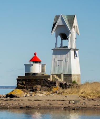
Date unknown (station established 1851). Active; focal plane 4 m (13 ft); flash every 5 s, white, red, or green, depending on direction. Lantern and gallery mounted on a stone base. Approx. 6 m (20 ft) square "Swiss-chalet" wood fog bell tower, painted white, with open bell enclosure and bell. A 2022 photo is at right, M. Prinke has a 2008 photo, Trabas has Klaus Wolfgang's distant view, and Google has a satellite view. The original lighthouse at this station was decommissioned and removed in 1890. The fog bell tower, built in 1910, was deactivated and removed in 1983, but a replica was built in 1999 and the bell and striking mechanism are original. The station is perserved as a historic monument. Located at the northwestern point of an island on the west side of the Oslofjord off Tønsberg. Accessible only by boat. Site open, tower closed. . ARLHS NOR-249; NF-032000; Admiralty B2486; NGA 0656.
Narverød
Date unknown. Active; focal plane 9 m (30 ft); white, red or green light depending on direction, occulting once every 6 s. 5 m (17 ft) lantern mounted on a concrete base. No photo available but Google has a satellite view. This light guides vessels approaching Tønsberg in the channel north of Torgersøy. Located on a dock off the Hermelinveien southeast of Tønsberg. The dock is probably private. Site status unknown. NF-032200; Admiralty B2488; NGA 0660.
* Kalnes (Range Rear)
Date unknown. Active; focal plane 8 m (26 ft); red or green light, depending on direction, occulting once every 4 s. 9 m (30 ft) square concrete post carrying a large round lantern. Lighthouse painted white; lantern roof is red. Trabas has Boucher's photo, Are Karlsen has posted a photo, and Google has a satellite view and a distant street view. This light guides vessels westbound into Tønsberg; the front light is on the Nøtterøy bridge. Located on the south side of the Tønsbergfjord, which is quite narrow at this point, about 800 m (1/2 mi) west of the Nøtterøy bridge. Site open, tower closed. NF-039500; Admiralty B2554.1; NGA 0784.

Torgersøy Light, Tønsberg, April 2022
Google Maps photo by Melanie
* Nordbyen (Range Front) (3?)
Date unknown. Active; focal plane 8 m (26 ft); white, red or green light depending on direction occulting once every 6 s. 7.5 m (25 ft) round cylindrical tower colored white with a black vertical stripe and a red top. Google has a street view and a satellite view. Trabas has Boucher's photo of the original lighthouse, a round lantern mounted on a short square wood tower. This range guided vessels eastward through the north end of the Tønsbergfjord to Tønsberg. Both lights are active, but the Norsk Fyrliste no longer lists them as a range. Located on the waterfront on the western side of Tønsberg, off the street called Nordbyen. A short mole leads to within a few feet of the lighthouse. Site open, tower closed. ARLHS NOR-392; NF-039600; Admiralty B2562; NGA 0788.

Færder: Nøtterøy Lighthouses
The former municipality of Nøtterøy was merged in the Færder municipality in 2018.

Kalvetangen
Date unknown. Active; focal plane 4 m (13 ft); white, red or green light depending on direction, occulting once every 6 s. 5 m (17 ft) lantern mounted on a concrete base. Google has a street view and a satellite view. This light guides vessels approaching Tønsberg in the channel north of Føynland, a large inhabited island. Located at the northern point of Føynland. Site and tower closed (private property). NF-032600; Admiralty B2492; NGA 0676.
Huikjæla
Date unknown. Active; focal plane 9 m (30 ft); white, red or green light depending on direction, 3 s on, 3 s off. 6 m (20 ft) lantern mounted on a platform supported by four piles. No photo available but Google has a satellite view. Located at the south end of Ramsholmen, one of a cluster of small islands in the Oslofjord off Nøtterøy. Accessible only by boat. Site open, tower closed. NF-034000; Admiralty B2498; NGA 0684.
Fulehuk (2)
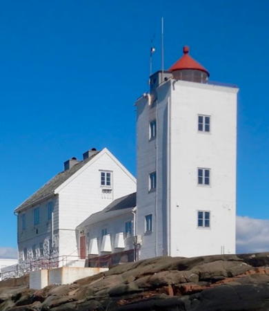
1955 (station established 1821). Inactive since 1989. 17 m (56 ft) square cylindrical stone tower with lantern and gallery, attached by a 1-story connection to a 2-story masonry keeper's house. Lighthouse painted white, lantern red. Boathouse and other light station buildings. The active light (focal plane 10 m (33 ft), red light occulting once every 6 s) is on a short skeletal tower that can't be seen in the available photos. A 2020 photo is at right, the Lighthouse Association has a page for the lighthouse, Trabas has Wöhrn's photo, Werning has a photo, Anke and Jens have photos, Casper Kongstein has another good photo, Wikimedia has several photos, Norwegian Wikipedia has a page with photos, Larry Myhre has a photo, and Google has a satellite view. The community of Nøtterøy bought the property from the Kystverket in 2005; Nøtterøy later merged with Færder. The station is now available for overnight rental. Located on a small island in the Oslofjord about 15 km (9 mi) southeast of Tønsberg. Accessible only by boat, but water taxi service is available. Site and tower closed. Owner: Færder Kommune. Site manager: Fulehuks Venner . ARLHS NOR-015. Active light: NF-033600; Admiralty B2496; NGA 0680.
Hollanderbåen
1989. Active; focal plane 19 m (62 ft); white, red or green light depending on direction, occulting three times every 10 s. 20 m (66 ft) round cylindrical tower supporting a round observation room, with gallery, topped by a lantern. Tower painted white; lantern and observation room roof painted red, gallery black. Werning has a good photo, Anke and Jens have a photo, Johan Dahle has a 2017 closeup, and Trabas has posted a good photo by Wöhrn, but the light is not seen in Google's satellite view. A twin of Mefjordbåen (see photo above). This light took over the principal function of the Fulehuk lighthouse in guiding ships on the Oslofjord. Located near the center of the Oslofjord about 20 km (13 mi) southeast of Tønsberg. Accessible only by boat. Site open, tower closed. ARLHS NOR-312; NF-033500; Admiralty B2495; NGA 0682.
Vassholmen (Vasholmen)
Date unknown. Active; focal plane 4.5 m (15 ft), flash every 5 s, white, red or green depending on direction. 5 m (17 ft) lantern, painted white with a red roof, piles painted black. No photo available but Google has a satellite view. Located on the west side of Vassholmen, a small island about 1.2 km (3/4 mi) southeast of Nøtterøy. Accessible only by boat. Site open, tower closed. NF-036000; Admiralty B2520; NGA 0724.

Fulehuk Light, Nøtterøy, April 2020
Google Maps photo by Super Svein

Tjøme Lighthouses
Leistein
1913. Active; focal plane 8 m (26 ft); two flashes every 10 s, white, red or green depending on direction. 8 m (26 ft) lantern on a platform supported by piles. Lighthouse painted white, piles black; lantern roof is red. Kurth Brekke has a photo, a distant photo by Hilde Marianne Lien is available (near the bottom of the page) and Google has a satellite view. Wikimedia has a closeup photo of a stone cairn at the highest point of the island. Located on a skerry in the Oslofjord about 4 km (2.5 mi) southeast of Arøysund. Accessible only by boat. Site open, tower closed. ARLHS NOR-383; NF-034100 Admiralty B2500; NGA 0688.
Store Færder (3)
Date unknown (station established 1697). Active; focal plane 12.5 m (41 ft); flash every 5 s, white, red, or green, depending on direction. 5.5 m (18 ft) square wood tower with lantern and gallery. Lighthouse painted white; lantern roof painted red. Myhre has a view from the sea and Google has a satellite view. The original fire tower was replaced in 1802 by a coal-fired stone tower; a Fresnel lens was added in 1852, but the lighthouse was deactivated when the Færder lighthouse was completed five years later. Today only the stone foundation ruins of the 1802 station remain; Norwegian Wikipedia's article on the station has a photo of the ruins and Google has a satellite view. Located at the northern end of Store Færder, an island in the southwestern entrance to Oslofjorden about 8 km (5 mi) east of Tjøme. Accessible only by boat. Site open, tower closed. ARLHS NOR-305; NF-035100; Admiralty B2510; NGA 0008.
Færder (Lille Færder, Tristein)
1857. Active; focal plane 47 m (154 ft); three white flashes every 30 s. 43 m (141 ft) round cast iron tower with lantern and gallery, painted dark red with one white horizontal band. The original 1st order Fresnel lens is in use. Two keeper's houses and a semaphore station building (the only such building surviving in Norway). This is a staffed station. Ulrikke Dahl's photo is at right, the Lighthouse Association has a page for the lighthouse, Geir Røsset has a nice view, Trabas has Wöhrn's view from the sea, Færder National Park has a page for the lighthouse, Huelse has a historic postcard view, and Google has a good satellite view. This magnificent lighthouse is the landfall light for Oslo and the first lighthouse listed in the Norsk Fyrliste. With all its buildings intact and well preserved, Færder is one of the most historically authentic stations in northern Europe. The iron for the light tower was cast in Norway by Bærums Verk. The 150th anniversary of the lighthouse was celebrated in 2007. According to the national park there are plans to renovate one of the keeper's houses for overnight stays. Located on Tristein, a small island off the southwestern entrance to Oslofjorden, 5 km (3 mi) south of the Store Færder station it replaced. Lille Færder is a neighboring island. Accessible only by boat. Site and tower closed. Site manager: Færder National Park (Færder Lighthouse) . ARLHS NOR-254; NF-000100; Admiralty B2506; NGA 0004.

Færder Light, Tjøme,June 2020
Instagram photo by Ulrikke Dahl
Laksskjær
Date unknown. Active; focal plane 12 m (39 ft); white, red or green light, depending on direction, occulting twice every 8 s. 10.5 m (34 ft) lantern and gallery on a platform supported by four piles. Lantern painted white with a red roof, piles black. A distant view (fourth row of photos, on the right) is available and Google has a satellite view. Located on Laksskjær, a reef at the southeastern corner of the cluster of skerries and reefs off the south end of Tjøme. Accessible only by boat. Site open, tower closed. NF-035000; Admiralty B2508; NGA 0708.
* [Verdens Ende (replica)]
1932. 6 m (20 ft) square rubblestone pyramid on a square base. A small lantern is suspended from a boom that rests across the top of the tower. Wikimedia has an excellent photo (notice the Færder lighthouse in the distance) and Google has a street view and a satellite view. This tower is a replica of a vippefyr, a small stone fire beacon of a type common on the Norwegian coast before the advent of regular lighthouses. "Verdens Ende" means "End of the World" in Norwegian. Located on the southernmost tip of Tjøme, an island on the west side of the entrance to Oslofjorden, with a supurb view of the Skagerrak and the Færder lighthouse. Site open, tower closed. Site manager: unknown.
Østre Vakersholmen
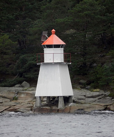
Date unknown. Active; focal plane 7 m (23 ft); white, red or green light, depending on direction, 3 s on, 3 s off. 7.5 m (25 ft) square skeletal tower, covered with white siding, with lantern and gallery. Lighthouse painted white; lantern roof is red. Trabas has Boucher's photo (also seen at right) and Google has a satellite view. This light guides vessels through a very narrow passage in the lower Tønsbergfjord. Located on the east side of the island of Vakersholmen. Accessible only by boat. Site open, tower closed. NF-037400; Admiralty B2532; NGA 0744.

Sandefjord Lighthouse
Holtskjær (Holskjæren)
Date unknown. Active; focal plane 13 m (43 ft); flash every 5 s, white, red or green depending on direction. 8 m (26 ft) lantern on a platform supported by four piles. Lantern painted white with a red roof, piles painted black. The light is near the right edge of a distant view, Morten Prom has a very distant street view, and Google has a satellite view. Located on a skerry marking the east side of the entrance to the Sandefjord. Accessible only by boat. Site open, tower closed. NF-040900; Admiralty B2572; NGA 0804.

Larvik Lighthouses
** Svenner (2)
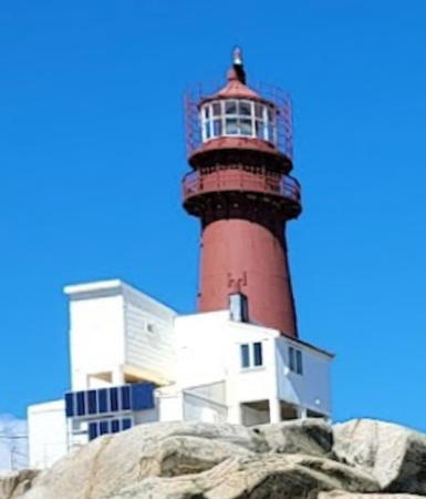
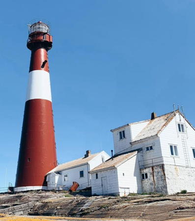
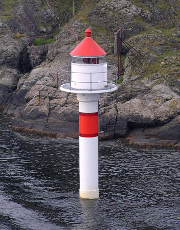
1900 (station established 1874). Active; focal plane 40 m (131 ft); white or red light, depending on direction, occulting once every 10 s. 19 m (62 ft) round cast iron tower with lantern and gallery, painted dark red. 1st order Fresnel lens in use. A complete station, staffed until 2003, with three keeper's houses, engine house, forge, and boathouse. Fog cannons from the station are now on display at the Norwegian Maritime Museum (Norsk Maritimt Museum) in Oslo. Ludovic Hasse's 2022 photo is at the top of this page, the Lighthouse Association has a page for the lighthouse, Vegar Berger Vannebo has a fine closeup, Wikimedia has a good photo, Trabas has Wöhrn's distant view, Maryla Szpala has a street view, and Google has a satellite view. After the station was finally automated in 2003 the buildings were transferred to the Vestfold Fylkeskystlag (Vestfold Coastal Association), which has made them available for rustic overnight accommodations (bring your food and sleeping bag); guided tours are also offered. Volunteers staff the lighthouse in one-week shifts. Located on a small island about 3 km (2 mi) offshore and 7 km (4.5 mi) southeast of Stavern. Boat transportation is available from Stavern. Site open, tower open for tours in the summer. Site manager: Svenner Fyr Kystled . ARLHS NOR-044; NF-041700; Admiralty B2578; NGA 0816.
Østre Vakersholmen Light
Østre Vakersholmen Light, Tjøme
photo copyright Michael Boucher; used by permission
* Larvik Havn
Date unknown. Active; focal plane 6 m (20 ft); white, red or green light depending on direction, 2 s on, 2 s off. 5.5 m (18 ft) round cylindrical white tower with lantern but no gallery. Lighthouse is white, lantern roof red. A closeup photo is available, Kjetil Bjønnes has a street view, and Google has a satellite view. Located on the Larvik waterfront in front of the Farris Bad hotel and conference center. Site open, tower closed. NF-042800; Admiralty B2588; NGA 0836.
Stavernsodden (1)
1855. Inactive since 1874. 4 m (13 ft) round cylindrical granite tower; lantern removed. No photo available. This tower is considered to be a very rare survivor of its era. The lighthouse was replaced in order to provide a tower capable of carrying a first order lantern. ARLHS NOR-319.
Stavernsodden (2)
1874 (station established 1855). Active; focal plane 44 m (144 ft); white, red or green light depending on direction, occulting three times every 10 s. 7 m (23 ft) square shingle-covered tower with lantern and gallery. Tower painted white, lantern red. Rune Grønli's photo is at right, Grønli also has a closeup of the light tower, Wikimedia has Arnstein Rønning's photo, Dag Øien has an excellent photo, Trabas has a distant view by Wöhrn, and Google has a satellite view. The light tower adjoins one corner of a 1-1/2 story keeper's house; the station also includes an assistant keeper's house, engine house, boathouse, and other structures. The station was automated in 1984. The light station was transferred to the Norwegian weather service, which used it as a test station and made the keepers house available to employees for vacations. In 2008 the station was transferred to the Fredriksvern Kystlag, which has made the houses available to the public. Two of the buildings offer overnight accommodations. Located at the southernmost point of Stavernsøy, the island protecting the harbor of Stavern, on the west side of the entrance to the Larviksfjord. Accessible only by boat. Site and tower closed; the lighthouse is best viewed from the sea. Site manager: Stavernsodden Fyr. . ARLHS NOR-225; NF-042000; Admiralty B2582; NGA 0820.

Stavernsodden Light, Larvik, March 2017
Google Maps photo by Rune Grønli
Tvistein (2)
1951 (station established 1908). Active; focal plane 17 m (56 ft); white, red or green light depending on direction, 1.5 s on, 3.5 s off. 12 m (36 ft) square cylindrical masonry tower with lantern and gallery, attached to a 1-story keeper's house. Lighthouse painted white, lantern red. Additional 2-story keeper's house and other light station buildings. Rune Grønli's 2021 photo is at right, Wikimedia has Arnstein Rønning's 2015 photo, Jørn Huseby has a photo, there's also a distant view, Trabas has Pauline and Wim de Kleine's photo, and Google has a satellite view. Larvik Kommune declined ownership of the lighthouse because of its remoteness, so in 2006 the light station was leased to private individuals. In 2011 the preservation group Tvisteins Venner was formed; it soon received the lease of the station. After several years of restoration work the houses were opened for vacation rental. Located on a small island in the Skagerrak about 5 km (3 mi) southeast of Nevlunghavn. Accessible only by boat. Site open, tower closed. Site manager: Tvistein Fyr . ARLHS NOR-294; NF-043500; Admiralty B2592; NGA 0844.
Fugløyskjær
Date unknown. Active; focal plane 11 m (36 ft); green flash every 5 s. 10 m (33 ft) concrete post with gallery; lantern removed. Tower painted white with one green horizontal band. Trabas has Capt. Peter's photo and Google has a satellite view. Located on a skerry in the entrance to the Langesundfjord. Accessible only by boat. Site open, tower closed. NF-045000; Admiralty B2597.6; ex-NGA 0892.
* Åmlirogna
Date unknown. Active; focal plane 10 m (33 ft); white, red or green light depending on direction, occulting twice every 8 s. 9 m (30 ft) concrete post with lantern and gallery. Tower painted white with one green horizontal band, lantern painted red. Tom Egil Laursen has a 2021 photo, a 2023 photo is available, and Google has a satellite view. Located on a small island in the entrance to the Langesundfjord about 2 km (1.2 mi) northwest of Nevlunghavn. The island is accessible by a footbridge from the nearby Sandvika campground. Site open, tower closed. NF-045100; Admiralty B2595; ex-NGA 0880.

Tvistein Light, Larvik, January 2015
Google Maps photo by Rune Grønli
Arøy
Date unknown. Active; focal plane 22.5 m (74 ft); white, red or green light depending on direction, occulting three times every 10 s. 5.5 m (18 ft) square skeletal tower with lantern and gallery. Tower covered with white siding; lantern is white with a red roof. Trabas has Capt. Peter's photo and Google has a satellite view. Located on the west side of Store Arøy, an island in the Langesundfjord. Accessible only by boat. Site open, tower closed. NF-044300; Admiralty B2602; ex-NGA 0856.
Kjørtingen Southeast
Date unknown. Active; focal plane 8 m (26 ft); white, red or green light depending on direction, occulting twice every 8 s. 19 m (62 ft) concrete post with lantern and gallery. Tower painted white with a green horizontal band, lantern white with a red roof. Trabas has Capt. Peter's photo and Google has a satellite view. The four Kjørtingen lights marks the ends of a dangerous passage in the Langesundfjord, about 2.5 km (1.5 mi) northeast of Langesund. Accessible only by boat. Site open, tower closed. NF-044500; Admiralty B2607; ex-NGA 0889.
Kjørtingen Southwest
Date unknown. Active; focal plane 8 m (26 ft); red light occulting once every 4 s. 17 m (56 ft) concrete post with lantern and gallery. Tower painted white with a red horizontal band, lantern white with a red roof. Trabas has Capt. Peter's photo and Google has a satellite view. Located about 200 m (660 ft) west southwest of the Kjørtingen Southeast light. Accessible only by boat. Site open, tower closed. NF-044400; Admiralty B2608; ex-NGA 0890.
Kjørtingen Northeast
Date unknown. Active; focal plane 8 m (26 ft); green light, 2 s on, 2 s off. 19 m (62 ft) concrete post with lantern and gallery. Tower painted white with a green horizontal band, lantern white with a red roof. Trabas has Capt. Peter's photo and Google has a satellite view. Accessible only by boat. Site open, tower closed. NF-044700; Admiralty B2606; ex-NGA 0888.
Kjørtingen Northwest
Date unknown. Active; focal plane 8 m (26 ft); white, red or green light depending on direction, occulting once every 6 s. 15 m (49 ft) concrete post with lantern and gallery. Tower painted white with a red horizontal band, lantern white with a red roof. Trabas has Capt. Peter's photo (also seen at right) and Google has a satellite view. Located about 200 m (660 ft) west southwest of the Kjørtingen Northeast light. Accessible only by boat. Site open, tower closed. NF-044600; Admiralty B2605; ex-NGA 0887.
Kjørtingen Northwest Light
Kjørtingen Nordvestre (Northwest) Light, Larvik
photo copyright Capt. Peter Mosselberger; used by permission

Information available on lost lighthouses:

Notable faux lighthouses:

Adjoining pages: Northeast: Oslo Area | East: Østfold (Fredrikstad Area) | West: Telemark (Skien Area)

Return to the Lighthouse Directory index | Ratings key

Posted April 10, 2006. Checked and revised May 6, 2024. Lighthouses: 47. Site copyright 2024 Russ Rowlett and the University of North Carolina at Chapel Hill.