Lighthouses of Canada: Northwest Territories

The nation of Canada was created by the British North America Act in 1867 with Ontario, Québec, New Brunswick, and Nova Scotia as the four original provinces. At that time the Hudson's Bay Company controlled most of the northern territories of modern Canada; these holdings were transferred to the new Canadian confederation in 1869. After creation of new provinces and many boundary adjustments, Canada today is a federation of ten provinces and three large federal territories in the north of the country.

Northwest Territories is a federal territory encompassing a large portion of the Canadian Arctic between the territories of Yukon on the west and Nunavut on the east (Yukon and Nunavut were separated from Northwest Territories, Yukon in 1898 and Nunavut in 1999). The territory is thinly populated; its population in 2020 was about 45,000. Yellowknife, on the northern coast of Great Slave Lake, is the capital of the territory. The territory is divided into five administrative regions.

There are no "traditional" lighthouses in the Northwest Territories but there are many substantial skeletal towers like the range light towers shown at right.

Aids to navigation in Canada are maintained by the Canadian Coast Guard. In 2008 Parliament passed the Heritage Lighthouse Protection Act to designate and protect historic lighthouses.

CCG numbers are from the Inland Waters list of the List of Lights, Buoys, and Fog Signals of Fisheries and Oceans Canada. For the Arctic Ocean (Beaufort Sea) coast Admiralty numbers are from Volume H of the Admiralty List of Lights & Fog Signals and U.S. NGA numbers are from Publication 110. None of the lights on this page are listed by ARLHS.

General Sources
Online List of Lights - Canada - Beaufort Sea
Photos by various photographers posted by Alexander Trabas.
List of Lights, Buoys, and Fog Signals
Official Canadian light lists.
GPSNauticalCharts
Navigational chart for the Arctic coast.
Navionics Charts
Navigational chart for the Arctic coast.


Range Front Light, Hay River, Septemebr 2019
Google Maps photo by Bahrg Smith

Great Slave Lake Lighthouses

Great Slave Lake is a large lake (the deepest in North America) located in the southern part of the Northwest Territories north of the Alberta border. The lake is 480 km (300 mi) long and up to 109 km (68 mi) wide. Yellowknife, the territorial capital, is on the north side of the lake, and Hay River, the terminal of the Mackenzie Northern Railway, is on the south shore. The lake is named obliquely for the indigenous Dene people who inhabit the area; they were called Slavey by their neighbors (and historic enemies) the Cree. The lake is called Tucho by the Dene.

North Slave Region Lighthouses
Hardisty Island
Date unknown. Active; focal plane 20 m (66 ft); white flash every 4 s. 18 m (59 ft) triangular skeletal tower carrying a rectangular red and white daymark. No photo available and Google has only a fuzzy satellite view of the location. The light guides vessels crossing the lake to Yellowknife. Located on a spit at the southeastern tip of Hardisty Island, off a promontory about 65 km (40 mi) south of Yellowknife. Site open, tower closed. CCG I-1705.
Yellowknife Back Bay Range Front
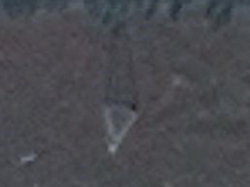
Date unknown. Active; focal plane 12.5 m (41 ft); continuous white light. 9 m (30 ft) tripod skeletal tower carrying a large triangular daymark painted red with a white vertical stripe. Llyanina Lora's 2022 photo is at right and Google has a satellite view. There is a picnic area nearby on the island. Located on Hideaway Island about 4 km (2.5 mi) northeast of the town. Accessible only by boat. Site open, tower closed. CCG I-1713.6.
East Mirage Islands Range Rear
Date unknown. Active; focal plane 20 m (66 ft); continuous white light. 15 m (49 ft) triangular skeletal tower carrying a rectangular daymark colored red with a white vertical stripe. No photo available but Bing has an indistinct satellite view. This is an approach range for Yellowknife. Located on a small island about 20 km (13 mi) southeast of Yellowknife. Accessible only by boat. Site open, tower closed. CCG I-1710.
Pilot Islands Range Rear
Date unknown. Active; focal plane 26.5 m (87 ft); continuous white light. 18 m (60 ft) triangular skeletal tower carrying a rectangular daymark colored red with a white vertical stripe. No photo available but Google has an indistinct satellite view. This is an outer approach range for Yellowknife. Located on a small island about 30 km (19 mi) southeast of Yellowknife. Accessible only by boat. Site open, tower closed. CCG I-1708.
 

Back Bay Range Front Light, Yellowknife, August 2022
Google Maps photo by Llyanina Lora
 

South Slave Region Lighthouses
The NWT government's Marine Transportation Services, based at the railhead in Hay River, operates a fleet of shallow-draft tugboats that push bargeloads of fuel and supplies to remote communities on the Mackenzie River and Beaufort Sea.
Round Island (Fort Resolution)
Date unknown. Active; focal plane 19 m (62 ft); white flash every 4 s. 15 m (49 ft) triangular skeletal tower carrying a rectangular red and white daymark. No photo available but Bing has a satellite view. Located on the north side of Round Island, about 7 km (4 mi) west southwest of Fort Resolution. Accessible only by boat. Site open, tower closed. CCG I-1680.
Hay River Inner Range Front
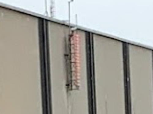
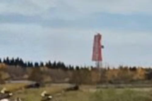
Date unknown. Active; focal plane 13.5 m (44 ft); continuous red light. 9 m (30 ft) square skeletal tower carrying a rectangular red and white daymark. Bahrg Smith has a distant street view (a small portion is at the top of this page), and Google has a satellite view. Hay River, a town of about 3000 residents on the south side of the lake, is a base for navigation of the lake and the Mackensie River. Located on the west side of the river entrance. Site status unknown. CCG I-1687.
Hay River Inner Range Rear
Date unknown. Active; focal plane 25 m (82 ft); continuous red light. the light and a rectangular red and white daymark are mounted on the north side of large shipyard building. Christopher Treco has the photo seen at right and Google has a satellite view. Located in the Marine Transportation Services shipyard in Hay River. Site status unknown. CCG I-1688.
Slave Point
Date unknown. Active; focal plane 20 m (66 ft); white flash every 4 s. 18 m (59 ft) triangular skeletal tower carrying a rectangular red and white daymark. No photo available but Bing has a satellite view. Located on a low point of land about 40 km (25 mi) northeast of the entrance to the Mackenzie River. Accessible only by boat. Site open, tower closed. CCG I-1691.


Range Rear Light, Hay River, Septemebr 2019
Google Maps photo by Christopher Treco
 

Mackenzie River Lighthouses

Flowing out of the southwestern end of Great Slave Lake, the Mackenzie River flows 1738 kilometres (1080 mi) northwest and north, emptying into the Arctic Ocean through a broad delta. In the Dene language of the upper river it is called Deh Cho, "Big River," and in the Inuvik language of the lower river it is called Kuukpak, "Great River." The river descends only 156 m (512 ft), an average grade of less than 0.01%. As a result the entire length of the river is navigable. There are numerous range light towers along the river; only the largest towers are listed here. Lights are listed south to north (downstream).

South Slave Region Lighthouses
The river flows westward in this section. The Yellowknife Highway (NWT 3) crosses the river by the Deh Cho Bridge between Beaver Lake and Mills Lake, downstream from the village of Fort Providence; this is the only bridge over the river.

Lobstick Island Range Rear
Date unknown. Active; focal plane 24.5 m (80 ft); continuous white light. 18 m (60 ft) triangular skeletal tower carrying a rectangular daymark colored red with a white vertical stripe. No photo available but a square foundation pad for the tower is seen in Bing's satellite view. This is the entrance range for northbound vessels. Located at the eastern end of Lobstick Island, in the entrance to the river. Accessible only by boat. Site open, tower closed. CCG I-1716.98.
Naylor Island Range Rear
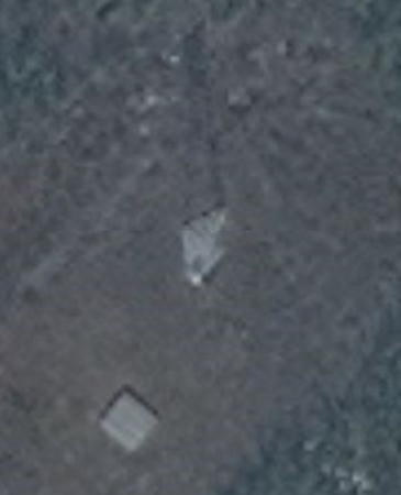
Date unknown. Active; focal plane 21 m (69 ft); continuous white light. 18 m (60 ft) triangular skeletal tower carrying a rectangular daymark colored red with a white vertical stripe. No photo available but Bing has a satellite view (a portion is at right). This range guides southbound vessels approaching Great Slave Lake. Located on the north side of Naylor Island, northwest of Lobstick Island. Accessible only by boat. Site open, tower closed. CCG I-1718.
Beaver Lake Range Rear
Date unknown. Active; focal plane 32 m (105 ft); continuous white light. 18 m (60 ft) triangular skeletal tower carrying a rectangular daymark colored red with a white vertical stripe. No photo available but Google has a distant satellite view (note the clearing for the range lights in the center of the island). Beaver Lake is a basin about 25 km (15 mi) below the river entrance. This range guides southbound vessels crossing the basin. Located on a small island on the north side of the river, off the south coast of Big Island. Accessible only by boat. Site open, tower closed. CCG I-1720.
Mills Lake East Range Rear
Date unknown. Active; focal plane 20 m (66 ft); continuous white light. 18 m (60 ft) triangular skeletal tower carrying a rectangular daymark colored red with a white vertical stripe. No photo available and Bing has only a distant satellite view. Mills Lake is a basin about 25 km (15 mi) northwest of Fort Providence. This range guides southbound vessels crossing the basin. Located on the north side of the river at the east end of the basin. Accessible only by boat. Site open, tower closed. CCG I-1733.
Mills Lake West Range Rear
Date unknown. Active; focal plane 20 m (66 ft); continuous white light. 18 m (60 ft) triangular skeletal tower carrying a rectangular daymark colored red with a white vertical stripe. No photo available and Bing has only a distant satellite view. This range guides northbound vessels departing the basin. Located on the south side of the river upstream (southwest) from the basin. Accessible only by boat. Site open, tower closed. CCG I-1735.6.


Naylor Island Range Rear Light, Mackenzie River Mile 4.4
Microsoft Bing Maps photo by Christopher Treco

Dehcho Region Lighthouses
This section of the river flows northwestward past Fort Simpson and turns northward parallel to the Rocky Mountains. The Mackenzie Highway (NWT 1) crosses the river by the N'dulee Ferry about 17 km (11 mi) south of Fort Simpson.

Browning Point Crossing Range Rear
Date unknown. Active; focal plane 21 m (69 ft); continuous white light. 18 m (60 ft) triangular skeletal tower carrying a rectangular daymark colored red with a white vertical stripe. No photo available but Google an indistinct satellite view. This range guides southbound vessels through a particularly wide stretch of the river. Located on the north side of the river at Browning's Crossing (mile 133 from Great Slave Lake). Accessible only by boat. Site open, tower closed. CCG I-1739.31.
Mile 256.7 Range Rear
Date unknown. Active; focal plane 24 m (79 ft); continuous white light. 15 m (50 ft) triangular skeletal tower carrying a rectangular daymark colored red with a white vertical stripe. No photo available and Google has only a fuzzy satellite view of the area. This range guides northbound vessels through an east-west reach of the river. Located on the east end of an island about 5 km (3 mi) west of the N'dulee Ferry. Accessible only by boat. Site open, tower closed. CCG I-1748.5.
Mile 286.9 Range Rear
Date unknown. Active; focal plane 23 m (75 ft); continuous white light. 18 m (60 ft) triangular skeletal tower carrying a rectangular daymark colored red with a white vertical stripe. No photo available but Bing has an indistinct satellite view. This range guides northbound vessels entering a braided section of the river. Located on an island downstream from the confluence of the North Nahanni River. Accessible only by boat. Site open, tower closed. CCG I-1753.6.
Mile 300.3 Range Rear
Date unknown. Active; focal plane 26.5 m (87 ft); continuous white light. 18 m (60 ft) triangular skeletal tower carrying a rectangular daymark colored red with a white vertical stripe. No photo available but Bing has a satellite view. This range guides southbound vessels on a long north to south reach. Located on the east side of a small island in the river. Accessible only by boat. Site open, tower closed. CCG I-1755.5.
Mile 300.6 Range Rear
Date unknown. Active; focal plane 25 m (82 ft); continuous white light. 18 m (60 ft) triangular skeletal tower carrying a rectangular daymark colored red with a white vertical stripe. No photo available but Bing has a satellite view (a portion is at right). This range guides northbound vessels on a long northeast reach, north of the braided section. Located on the east bank of the river across from the Mile 300.3 range lights. Accessible only by boat. Site open, tower closed. CCG I-1755.
Mile 336.6 Range Rear
Date unknown. Active; focal plane 30 m (98 ft); continuous white light. 18 m (60 ft) triangular skeletal tower carrying a rectangular daymark colored red with a white vertical stripe. No photo available but Google has a satellite view. This range guides northbound vessels on a long north reach. Located on the east bank of the river across from Old Fort Island. Accessible only by boat. Site open, tower closed. CCG I-1757.9.


Range Rear Light, Mackenzie River Mile 300.6
Microsoft Bing Maps photo
 

Sahtu Region Lighthouses
Birch Island (Mile 436.5) Range Rear
Date unknown. Active; focal plane 23 m (75 ft); continuous white light. 15 m (50 ft) triangular skeletal tower carrying a rectangular daymark colored red with a white vertical stripe. No photo available but Google has a satellite view of the range. This range guides southbound vessels on a long south reach. Located on the northern tip of Birch Island, about 15 km (9 mi) south of the confluence of the Redstone River. Accessible only by boat. Site open, tower closed. CCG I-1763.6.

Inuvik Region (Arctic Coast) Lighthouses

Mackenzie Delta and Tuktoyaktuk Area Lighthouses
Tuktoyaktuk is a community of about 850 people located at the northeastern end of the Mackenzie Delta. The town is commonly called Tuk and was formerly called Port Brabant; its name means "resembling a caribou." During the Cold War the town was a base supporting Distance Early Warning (DEW Line) stations, and more recently it has been a base supporting oil and gas exploration in the Arctic.
Swimming Point Range Rear
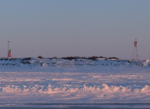
Date unknown. Active; focal plane 29 m (95 ft); continuous white light. 18 m (60 ft) triangular skeletal tower carrying a rectangular daymark colored red with a white vertical stripe. Part of a distant view by Joseph Pavlic is at right but Google has only a fuzzy satellite view of the area. This range guides northbound vessels approaching a right-angle turn in the delta. Nearby is a fuel cache for helicopters. Located on a sandy point about 100 km (60 mi) southwest of Tuktoyaktuk. Accessible only by boat. Site open, tower closed. CCG I-1813.
Tuktoyaktuk Island (Range Rear)
Date unknown. Active; focal plane 22 m (72 ft); continuous green light. 12 m (40 ft) triangular pyramidal skeletal tower carrying a trapezoidal daymark colored red with a white vertical stripe. No photo available but Google has an indistinct satellite view and a very distant street view. The range was decommissioned in 2019; the front light was on a similar, shorter tower. Located near the east end of Tuktoyaktuk Island, about 3 km (2 mi) northeast of the town. Accessible only by boat. Site status unknown. CCG I-2508; Admiralty H0012.1; NGA 0809.5.
Tuktoyaktuk Peninsula Range 2 Rear
Date unknown. Active; focal plane 18 m (59 ft); continuous white light. 13.5 m (45 ft) triangular pyramidal skeletal tower carrying a trapezoidal daymark colored red with a white vertical stripe. No photo available but Google has a satellite view and a very distant street view. The front light is on a similar, shorter tower. Located on the mainland opposite Tuktoyaktuk Island, about 4 km (2.5 mi) northeast of the town. Accessible only by boat. Site status unknown. CCG I-2511; Admiralty H0012.4; NGA 0810.1.
Tuft Point
Date unknown. Active; focal plane 23 m (75 ft); white flash every 4 s. 9 m (30 ft) triangular skeletal tower carrying a rectangular daymark colored red. No photo available but the long shadow of the tower is clear in Google's satellite view. Located on a low cape about 13 km (8 mi) northeast of Tuktoyaktuk. Site open, tower closed. CCG I-2517; Admiralty H0013.3; NGA 0804.

Swimming Point Range Lights, Mackenzie Delta, February 2015
photo copyright Joseph Pavlic; used by permission
Atkinson Point
Date unknown. Active; focal plane 21.5 m (70 ft); white flash every 4 s. 18 m (60 ft) triangular skeletal tower carrying a rectangular daymark colored white with a red vertical stripe. No photo available and Google has only a fuzzy satellite view of the point. Located on a low cape projecting into the Arctic Ocean about 32 km (20 mi) northeast of Tuktoyaktuk. Site open, tower closed. CCG I-2518; Admiralty H0013.4; NGA 0800.

Information available on lost lighthouses:

Notable faux lighthouses:

Adjoining pages: East: Nunavut | West: Alaska

Return to the Lighthouse Directory index | Ratings key

Posted November 15, 2004. Checked and revised June 11, 2024. Lighthouses: 25. Site copyright 2024 Russ Rowlett and the University of North Carolina at Chapel Hill.