Lighthouses of Canada: Central Québec

The nation of Canada was created by the British North America Act in 1867 with Ontario, Québec, New Brunswick, and Nova Scotia as the four original provinces. The province of Québec was the heart of New France, the former French empire in North America, from tthe founding of Québec city in 1608 until France was forced to cede its Canadian territories to Britain at the end of the Seven Years War in 1763.

Today Canada is a federation of ten provinces and three large federal territories in the far north of the country. Québec is the largest and second most populous of the provinces. It includes both sides of the St. Lawrence River and Estuary from Montréal to the Gulf of St. Lawrence as well as the north shore of the Gulf; it also extends far to the north with long coastlines on Hudson Bay and Hudson Strait. Its population, more than 8 million, is concentrated in the valley of the St. Lawrence.

The province once had at least 275 lighthouses but only about 80 remain today. A number of historic towers have been carefully restored but lighthouse preservation as a whole has been a little slower to take hold in Québec than in the maritime provinces. This seems to be changing for the better, with reports of several recent preservation and restoration efforts. However, there is no province-wide preservation association.

Québec is divided into 17 administrative regions (région administrative). Outside of the major urban areas Québec is further divided into 86 county-level regional county municipalities (municipalité régionale de comté). This page includes lighthouses in the regions of Saguenay - Lac-St.-Jean, Capitale-Nationale, and Mauricie, located on the north side of the St. Lawrence River in the south central part of the province surrounding Québec city.

Aids to navigation in Canada are maintained by the Canadian Coast Guard. In 2008 Parliament passed the Heritage Lighthouse Protection Act to designate and protect historic lighthouses.

French is the official language of Québec. The French word for a lighthouse, phare, is often reserved for the larger lighthouses; a smaller light or harbor light is called a feu (literally "fire," but here meaning "light"). The front light of a range (alignement) is the feu antérieur and the rear light is the feu postérieur. In French île is an island, cap is a cape, pointe is a promontory or point of land, roche is a rock, récife is a reef, baie is a bay, estuaire is an estuary or inlet, détroit is a strait, rivière is a river, and havre is a harbor.

ARLHS numbers are from the ARLHS World List of Lights. CCG Anumbers are from the Atlantic Coast list of the List of Lights, Buoys, and Fog Signals of Fisheries and Oceans Canada. Admiralty numbers are from Volume H of the Admiralty List of Lights & Fog Signals. U.S. NGA numbers are from Publication 110.

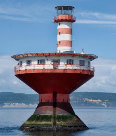
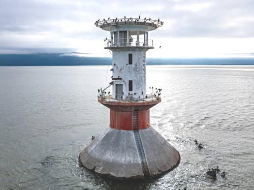
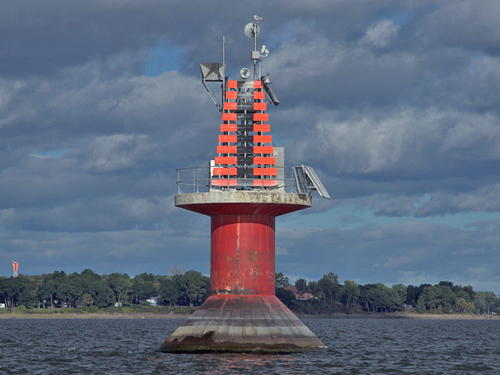
Haut-Fond Prince Light
Haut-fond Prince Light, Tadoussac, July 2013
Flickr Creative Commons photo
by Caroline Robert

General Sources
Quebec Canada Lighthouses
Photos and text, including travel directions, by Kraig Anderson.
Photos des Phares du Saint-Laurent
A Flickr.com collection of outstanding photos by Jean Goupil.
Lighthouses in Quebec
Photos by various photographers available from Wikimedia.
World of Lighthouses - Atlantic Coast of Canada
Photos by various photographers available from Lightphotos.net.
Online List of Lights - Canada
Photos by various photographers posted by Alexander Trabas. Photos for this area are by Michael Boucher.
Phares de la Côte-Nord/North Shore Lighthouses
Photos posted on Flickr.com by the Québec office of the Department of Fisheries and Oceans.
Phares/Lighthouses
Historic lighthouse photos, also posted on Flickr.com by the Québec office of the Department of Fisheries and Oceans.
Leuchttürme Kanadas auf historischen Postkarten
Historic postcard views posted by Klaus Huelse.
List of Lights, Buoys, and Fog Signals
Official Canadian light lists.
GPS Navigation Charts
Navigational chart information for this area.
Navionics Charts
Navigational chart for this area.

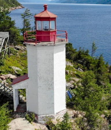
Cap à l'Est Light, Sainte-Rose-du-Nord
photo copyright Michel Boucher; used by permission
Saguenay Fjord Entrance Lighthouses
These two famous lighthouses are officially located in the La-Haute-Côte-Nord Regional County Municipality within the Côte-Nord Administrative Region. They are listed on this page in order to cover all the lights associated with Saguenay navigation.

Île Rouge (Red Island)
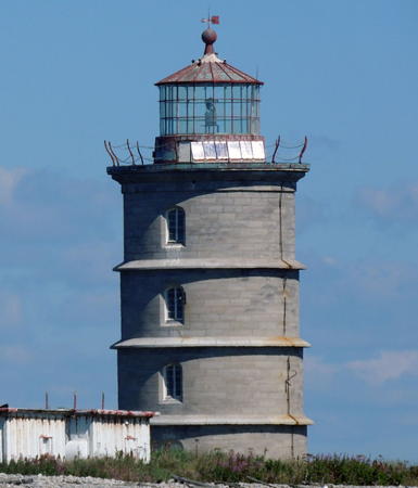
1848. Active; focal plane 20 m (65 ft); white flash every 10 s. 19.5 m (64 ft), 4-story round cylindrical limestone tower incorporating keeper's quarters, unpainted; lantern is red. Caroline Robert's photo is at right, Trabas has Boucher's closeup photo, the Coast Guard has a photo taken about 1990, and Bing has a satellite view of the station. This was one of the last staffed stations on the St. Lawrence, automated in 1988. For a number of years the station was available for vacation rental but it has been abandoned since the late 1990s. Located on an island, the visible part of a dangerous bank in the middle of the St. Lawrence off Tadoussac and the mouth of the Rivière Saguenay. Accessible only by boat; visible from whale-watching tours out of Tadoussac. Site open, tower closed. Owner/site manager: Canadian Coast Guard. ARLHS CAN-245; CCG A1770; Admiralty H2104; NGA 3432.
Haut-fond Prince (Prince Shoal)
1964 (lightship station established 1905). Active; focal plane 25 m (83 ft); white flash every 2.5 s. Approx. 14 m (45 ft) round cylindrical steel (?) tower rising from 1-story circular keeper's house, all mounted on a vase-shaped caisson. Tower painted with red and white horizontal bands; lantern and keeper's house painted white. Fog horn (2 s blast every 20 s) sounds only on radio command from passing vessels. Caroline Robert's photo is at the top of this page, Trabas has Boucher's closeup photo, Blake Maybank has a nice 2010 photo, a 2022 photo is available, Tom Duryea also has a photo, and Bing has a satellite view. Built at Champlain Drydock in Lévis, opposite Québec city, this modern structure replaced a lightship in marking the shoal at the entrance to the Rivière Saguenay off Tadoussac. Located in the St. Lawrence at the mouth of the Saguenay. Accessible only by boat; visible from whale-watching tours out of Tadoussac. Site and tower closed. Owner/site manager: Canadian Coast Guard. ARLHS CAN-223; CCG A1773; Admiralty H2106; NGA 3436.
Île Rouge Light
Île Rouge Light, Tadoussac, August 2006
Flickr Creative Commons photo by Caroline Robert

Saguenay - Lac-St.-Jean Region Lighthouses

Le Fjord-du-Saguenay (Saguenay River) Lighthouses
The lower Saguenay River is a deep fjord; tides penetrate as far upriver as Saguenay, about 100 km (60 mi) from the mouth. Only one of the historic lighthouses built to guide navigation on the Saguenay survives; Anderson's Cap à l'Est page has notes on some of the others.
Cap à l'Est
1909. Active; focal plane 17 m (56 ft); white flash every 6 s. 8 m (27 ft) octagonal cylindrical concrete tower, painted white; lantern is red. Trabas has Boucher's photo (also seen at the top of this page), Louis Brunet has a closeup photo, a 2019 closeup is available, Romain Vasseur has a closeup street view, and Google has a satellite view. Located on a prominent cape on the the north side of the Saguenay in the parish municipality of Sainte-Rose-du-Nord, off QC 172 about 40 km (25 mi) east of Chicoutimi. Accessible only by boat. Site open, tower closed. Owner: Canadian Coast Guard. Site manager: Parc Marin du Saguenay-Saint Laurent. ARLHS CAN-963; CCG A1798; Admiralty H2142; NGA 3532.
Rivière Valin Range Front (3?)
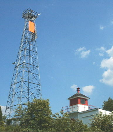
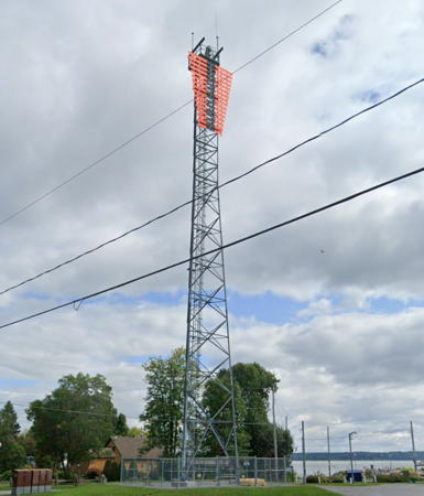
1977 (?) (station established 1873). Active; focal plane 27.5 m (90 ft); continuous white light seen only on the range line. 26 m (85 ft) square pyramidal skeletal tower carrying an orange trapezoidal daymark with a black vertical stripe. Denis Beaulieu's photo is at right, Trabas has Boucher's photo and Google has a street view and an indistinct satellite view. This is an upstream (westbound) range. The rear light is on a much shorter tower. Located on the north side of the river off the Rue Valin, on the east side of the mouth of the Valin River about 10 km (6 mi) northeast of Saguenay. Site and tower closed (private property) but the light can be seen from the road. ARLHS CAN-1167; CCG A1805; Admiralty H2143.3; NGA 3584.
Rivière Valin Range Rear (2) (relocated lantern)
1908 (station established 1893). 6 m (20 ft) square wood tower with lantern painted white with red trim and and a red band around the lantern. This was originally a 19.5 m (64 ft) square skeletal tower topped by a square wood watch room and lantern. The watch room and lantern have been relocated to private property next to the modern front range light. Denis Beaulieu's photo is at right. Site and tower closed. Owner/site manager: private.
[Rivière du Caribou Range Front (4?)]
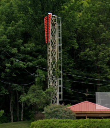
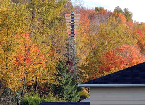
Date unknown (station established 1873). Active; focal plane 13 m (43 ft); continuous white light. 12.5 m (41 ft) skeletal mast carrying a trapezoidal slatted daymark painted red with a black vertical stripe. The rear light is on a similar tower 9.5 m (31 ft) tall. Both lights are seen in a Google street view and the shadow of the front light is visible in a satellite view. The original lighthouse was a small square wood tower; it was replaced by a taller wood tower in 1913. The rear light was originally on a mast; it was replaced by a skeletal tower with enclosed watch room in 1912. Both lighthouses were removed in the late 1970s. Located beside QC 172 about 2.5 km (1.5 mi) west of the Rivière Valin Front Light. Site and tower closed (private property) but the lights can be seen from the road. Front: ARLHS CAN-1162; Admiralty H2143.4; CCG A1808; NGA 3592. Rear: ARLHS CAN-1163; Admiralty H2143.5; CCG A1809; NGA 3596.
Rivière Valin Range Lights
Rivière Valin Front Light (left) and
lantern of former rear light, Saguenay, July 2007
ex-Panoramio photo copyright Denis Beaulieu; permission requested
[Simard Range Front (3?)]
Date unknown (station established 1912). Active; focal plane 9 m (29 ft); continuous green light. 8 m (26 ft) skeletal mast carrying a trapezoidal slatted daymark painted red with a black vertical stripe. The rear light is on a similar tower 12.5 m (41 ft) tall. Google has street views of the front and rear lights, and the towers cast long, thin shadows in Google's satellite view. The original front lighthouse was a square wood tower; the rear lighthouse was a skeletal tower with lantern and gallery. Located beside QC 172 a short distance southwest of the Rivière du Caribou range lights. Site and tower closed (private property) but the lights can be seen from the road. Front: ARLHS CAN-1191; Admiralty H2143.6; CCG A1811; NGA 3608. Rear: Admiralty H2143.7; CCG A1812; NGA 3612.
Poste St.-Martin Range Rear (4?)
1977 (?) (station established 1873). Active; focal plane 54 m (177 ft); continuous white light seen only on the range line. 19 m (62 ft) square cylindrical skeletal tower carrying an orange trapezoidal daymark with a black vertical stripe. Google has a distant street view but trees hide the light in Google's satellite view. This is an upstream (westbound) range. The original rear light was only 277 m (910 ft) northwest of the front tower. This separation was increased to 628 m (2060 ft) in 1907. Today the rear light is across the river, 3322 m (2.06 mi) from the front light. Located on the north side of the river off highway 172 at the eastern edge of Saguenay. Site and tower closed (private property) but the light can be seen from the road. ARLHS CAN-1158; CCG A1802; Admiralty H2143.1; NGA 3572.
Poste St.-Martin Range Front (4?)
1977 (?) (station established 1873). Active; focal plane 23.5 m (77 ft); continuous white light seen only on the range line. 22 m (72 ft) square cylindrical skeletal tower carrying an orange trapezoidal daymark with a black vertical stripe. Google has a street view and a satellite view. Located on the south side of the river off Rang St.-Martin about 6 km (3.5 mi) northeast of Saguenay. Site and tower closed (private property) but the light can be seen from the road. ARLHS CAN-1157; CCG A1801; Admiralty H2143; NGA 3568.

Capitale-Nationale Region Lighthouses

Charlevoix-Est Regional County Municipality Lighthouses
* [Pointe Noire Range Front (4)]
Date unknown (station established 1875). Active; focal plane 29 m (95 ft); continuous light, white or green depending on direction. 11.5 m (37 ft) square skeletal mast carrying a large trapezoidal daymark painted orange with a black vertical stripe. Square 1-story equipment building. Trabas has Boucher's photo, Google has a street view, and Google has a satellite view of the station. This is an entrance range for the Saguenay fjord. The first lighthouse was destroyed by fire. The second, a square wood tower, was deactivated in 1880 but reactivated in 1903. It was replaced by a skeletal tower in 1952, and the present tower was built in 1997. Parks Canada maintains a parking area and lookout platform at Pointe Noire, the south side of the entrance to the Saguenay. Located on the point below the lookout tower. Site open, tower closed. Site manager: Parks Canada (Parc marin du Saguenay-Saint-Laurent). ARLHS CAN-399; CCG A1779; Admiralty H2112; NGA 3464.
[Pointe Noire Range Rear (3)]
Date unknown (station established 1875). Active; focal plane 43.5 m (143 ft); continuous white light. 9 m (30 ft) square skeletal mast carrying a large trapezoidal daymark painted orange with a black vertical stripe. Lighthouse Digest has a Coast Guard photo, Trabas has Boucher's photo, and Google has a street view and an indistinct satellite view. Located on a steep slope beside highway 138, 427 m (1400 ft) west of the front light. Site open (but no parking is available), tower closed. ARLHS CAN-1129; CCG A1780; Admiralty H2112.1; NGA 3468.
Cap de la Tête au Chien
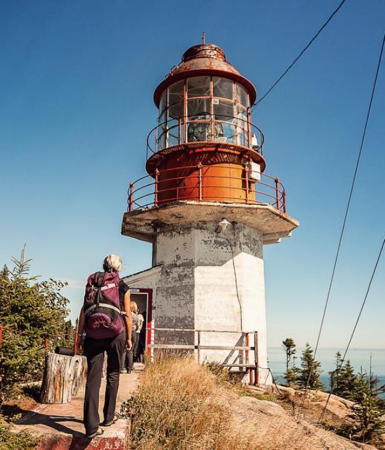
1909. Active; focal plane 63 m (207 ft); two white flashes every 5 s. 11 m (37 ft) octagonal cylindrical concrete tower with a large circular lantern; tower painted white, lantern red. Original 3rd order Fresnel lens. Two keeper's houses built in 1957 and 1962, respectively. Trabas has Boucher's photo (also seen at right), Goupil has a good photo, an aerial view is available, and Bing has a satellite view. Located atop a bluff in Baie-des-Rochers, north of Saint-Siméon. Inaccessible, though visible distantly from QC 138 and from ferries between Saint-Siméon and Rivière-du-Loup. Site and tower closed. Owner/site manager: Canadian Coast Guard. ARLHS CAN-083; CCG A1834; Admiralty H2166; NGA 3652.
* [Saint-Siméon (3?)]
Date unknown (station established 1906). Active; focal plane 9 m (30 ft); red light, 1 s on, 1 s off. 8 m (26 ft) square cylindrical skeletal tower. Trabas has Boucher's photo and Bing has a satellite view. The original lighthouse had a lantern centered on a pierhead building; Anderson has a photo from the national archives and Michel Corboz also has a photo (misidentified as Pointe-au-Pic). The building was removed by around 1970. Located at the end of the pier at Saint-Siméon. Accessible by walking the pier. Site open, tower closed. CCG A1835; Admiralty H2168; NGA 3656.

Cap de la Tête au Chien Light, Saint-Siméon
photo copyright Michael Boucher; used by permission
Cap au Saumon (Pointe des Rochers)
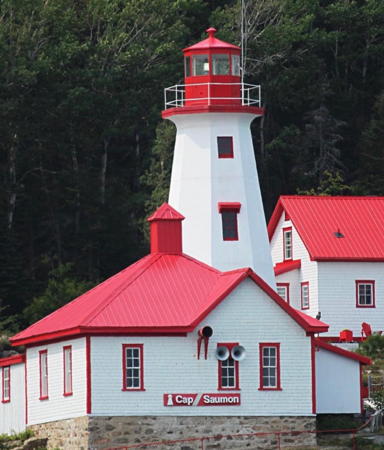
1894. Active; focal plane 25 m (82 ft); three white flashes every 15 s. 14 m (46 ft) octagonal pyramidal tower, painted white with red trim; lantern is red. 1-1/2 story keeper's house and other buildings. Trabas has Boucher's photo of the station (a portion is seen at right), Anderson has a good page for the lighthouse, Samuel Bouchard has a sunset photo, Patrick Matte has excellent photos, and Google has a satellite view of the station. In 2003 the station was leased to Peter Noreau, who formed the private Corporation du Phare de Cap-au-Saumon to restore the keeper's house and other buildings. Located on the cape about 5 miles south of Saint-Siméon. Accessible by hiking the 2.7 km (1.7 mi) access road (all on private property). Site open, tower closed. Owner: Canadian Coast Guard. Site manager: private. ARLHS CAN-078; CCG A1836; Admiralty H2182; NGA 3660.
Pointe-au-Pic (3)
Date unknown (station established 1882). Active; focal plane 19.5 m (64 ft); red flash every 6 s. 18.5 m (61 ft) square cylindrical skeletal tower. Trabas has Boucher's photo, Marc Sehrbrock has a street view, and Bing has a satellite view. The original light was a lantern mounted on the pier's passenger station. This light was (and is) on the pier of the Manoir Richelieu hotel, a popular resort. The McCord Museum has a historic photo taken about 1912. Located about 1.5 km (1 mi) south of La Malbaie (Murray Bay). Site status unknown. ARLHS CAN-1250; CCG A1844; Admiralty H2194; NGA 3676.

Charlevoix Regional County Municipality Lighthouses
* [Cap aux Oies (Goose Cape) (2)]
Date unknown (station established 1876). Active; focal plane 16 m (52 ft); white flash every 6 s. 9.5 m (31 ft) square cylindrical skeletal tower. Paul-Philippe Nadeau has a 2021 photo that also shows the foundation pads of the earlier lighthouse, Trabas has Boucher's photo, and Google has a fuzzy satellite view. An inn with a restaurant and overnight accommodations is close to the light station. Located on a cape about 10 km (6 mi) east of Les Éboulements. Site open, tower closed. ARLHS CAN-079; CCG A1849; Admiralty H2202; NGA 3680.
[#Cap Saint-Joseph (Saint-Joseph-de-la-Rive, Les Éboulements) (3?)]
Date unknown (station established 1882). Active; focal plane 13.5 m (44 ft); green light, 1 s on, 1 s off. This was an 11 m (36 ft) square cylindrical skeletal tower. Google has an indistinct satellite view. A June 2017 street view shows that the tower has been removed; the light has been moved atop the portal tower at the end of the pier. The original light was a lantern atop a pierhead shed. Located on the pier for the ferry to the Île aux Coudres at St.-Joseph-de-la-Rive. Site open, tower closed. ARLHS CAN-1322. Active light: CCG A1849.5; Admiralty H2204; NGA 3684.

Cap au Saumon Light, Saint-Siméon
photo copyright Michael Boucher; used by permission
Cap aux Corbeaux Range Front (2)
Date unknown (station established 1915). Active; focal plane 33 m (108 ft); continuous white light seen only along the range line to the southwest; a second continuous white light is visible to vessels approaching from the east. 30.5 m (100 ft) square pyramidal skeletal tower. A 2020 photo is available, the light is at the left edge of Michael Boucher's photo below right and Google has a satellite view. The rear light is on a 13 m (43 ft) skeletal tower. The range guides eastbound vessels in a narrow passage north of the Île aux Coudres. Located on the riverbank about 5 km (3 mi) west of St.-Joseph-de-la-Rive. Site status unknown. CCG A1852; Admiralty H2218; NGA 3688.
Pointe de la Prairie (Île aux Coudres) (2)
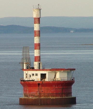
1972 (station established 1931). Active; focal plane 16 m (52 ft); white flash every 5 s. 17 m (55 ft) tall: short round cylindrical steel tower with lantern topped by a helipad, all mounted on a conical concrete base. One of Boucher's photos is at right, Trabas has a closeup taken from Boucher's photo, Tom Duryea has a good photo, Paul-Philippe Nadeau has a 2022 drone view, and Google has a satellite view. The crumbling base of the lighthouse was repaired in 2004. Located on a tiny islet just off the Île aux Coudres opposite Baie Saint-Paul. Visible distantly from the Île aux Coudres ferry and more closely from the end of the Chemin des Prairies (an unpaved bicycle path) on the island. Site and tower closed. Owner/site manager: Canadian Coast Guard. ARLHS CAN-234; CCG A1851; Admiralty H2208; NGA 3700.
Banc du Cap Brûlé Downstream Range Rear (2)
1965 (station established 1931). Active; focal plane 23 m (76 ft); continuous white light visible only on the range line. 17 m (55 ft) round cylindrical tower, painted white with an orange band at the top, mounted at the edge of a circular pier. The pier, painted orange, also carries a helipad and a small equipment building, plus the Upstream Range Front Light atop a 9 m (29 ft) slatted daymark painted orange with a black vertical stripe. Google has a satellite view. Lighthouse Digest has a 1943 photo of the lower part of the original pillar. Located in the river off Cap Brulé, which is on the north bank about 18 km (11 mi) northeast of Beaupré. Accessible only by boat. Site open, tower closed. Owner/site manager: Canadian Coast Guard. ARLHS CAN-1138; CCG A1901; Admiralty H2262.1; NGA 3780.
Banc du Cap Brûlé Upstream Range Rear (2)
1965 (station established 1931). Active; focal plane 29 m (96 ft); continuous white light visible only on the range line. 20 m (65 ft) round cylindrical tower, painted with orange and white horizontal bands, mounted at the edge of a circular pier. The pier, painted orange, also carries 1-story equipment building and a helipad, plus the Downstream Range Front Light atop a 9 m (29 ft) slatted daymark painted orange with a black vertical stripe. Larry Myhre's photo is at the bottom of this page and Google has a satellite view. Located in the river off Cap Brulé, which is on the north bank about 18 km (11 mi) northeast of Beaupré. Accessible only by boat. Site open, tower closed. Owner/site manager: Canadian Coast Guard. ARLHS CAN-1004; CCG A1899; Admiralty H2261.1; NGA 3752.
Pointe de la Prairie Light
Pointe de la Prairie Light, Baie St.-Paul, October 2014
Cap aux Corbeaux Range Front (left) and Rear Lights onshore
photo copyright Michael Boucher; used by permission

L'Île d'Orléans Regional County Municipality Lighthouses
Located on the north side of the St. Lawrence a short distance downstream from Québec City, the Île d'Orléans is 34 km (21 mi) long and 8 km (5 mi) wide. The island was one of the first places settled by the French in the 1660s but it is thinly populated today, with a population of about 6700. It is accessible by bridge from Beaufort. The eastern tip of the island is the location of the saline front: the westernmost penetration of salt water in the estuary.

Pointe Argentenaye Range Rear
Date unknown. Active; focal plane 64 m (210 ft); continuous white light visible only on the range line. 35.5 m (116 ft) square pyramidal skeletal tower. Trabas has Boucher's photo and Google has a street view and a satellite view. This range guides vessels upstream toward Québec. The front light is on a small skeletal tower. Located off the Chemin Royal on the northeast coast of the island. Site and tower closed (private property), but the light is easily seen from the road. CCG A1910.6; Admiralty H2267.1; NGA 3802.
* [Saint-Jean d'Orléans (3?)]
Date unknown (station established 1874). Active; focal plane 11 m (36 ft); red flash every 5 s. 9.5 m (31 ft) square skeletal mast carrying a red slatted daymark. David Broad's photo is at right, Trabas has Boucher's photo, Stephane Poisson has another photo, and Google has a street view and a satellite view. The original lighthouse was a square wood tower; it was replaced in 1909 by a lantern atop a freight shed at the end of the wharf. The 1909 lighthouse was demolished in 1969. Located on the pier at Saint-Jean d'Orléans. Site open, tower closed. ARLHS CAN-1135; CCG A1923; Admiralty H2282; NGA 3848.
* [Saint-Laurent d'Orléans (5?)]
2011 (station established 1869). Active; focal plane 14 m (46 ft); green flash every 5 s. 12.5 m (41 ft) light mounted atop the steel frame structure of a ferry dock. Trabas has Boucher's photo, and Google has a street view and a satellite view. The original lighthouse was a square wood tower; it was replaced in 1903 by a lantern atop a freight shed at the end of the wharf and then in 1914 by a square skeletal tower with an enclosed upper portion. This was replaced at some time by a skeletal mast. The ferry dock was built in 2011. Located on the pier at Saint-Laurent d'Orléans. Site open, tower closed. ARLHS CAN-998; CCG A1924; Admiralty H2284; NGA 3852.
* Sainte-Pétronille (Beaulieu, Pointe du Bout de l'Île) (3)
1957 (station established 1901). Active; focal plane 15 m (49 ft); yellow flash every 5 s. 14.5 m (46 ft) square cylindrical skeletal tower. Trabas has Boucher's photo and Google has a street view and a satellite view. The original lighthouse, a square wood tower with lantern and gallery, was located on the extreme tip of the island and was destroyed by fire in 1934. Huelse has a historic postcard view. It was replaced by a light on a shed on the wharf. The skeletal tower was built on the wharf in 1957 and then moved to the parking lot in 1983 when the wharf was demolished. Located in a restaurant parking lot at the southwestern tip of the island. Site open, tower closed. Site manager: Auberge La Goéliche. ARLHS CAN-997; CCG A1927; Admiralty H2288; NGA 3876.
[Pointe Saint-Pierre Range Rear (2?)]
Date unknown (station established 1885). Active; focal plane 13 m (43 ft); continuous green light. 12.5 m (41 ft) square skeletal tower carrying a daymark colored orange with a black vertical stripe. Anderson has Jon Clay's photo and Google has a satellite view. This range guides eastbound vessels in the narrow channel north of the Île d'Orléans. The original lighthouse was a skeletal tower with enclosed upper portion. The front light was shown from a square wood tower, which was replaced by a second square wood tower in 1909; it is now shown from a short skeletal tower. Located on farmland on the north side of the island. Site and tower closed. CCG A1947; Admiralty H2300.1; NGA 3928.

Saint-Jean d'Orléans Light, Île d'Orléans, July 2012
ex-Panoramio Creative Commons photo by David Broad
[Saint-Famille Range Front (3)]
1992 (station established 1885). Active; focal plane 19 m (62 ft); continuous green light. 18.5 m (61 ft) skeletal mast carrying a daymark colored orange with a black vertical stripe. No photo available but Google has a satellite view. This range guides westbound vessels in the narrow channel north of the Île d'Orléans. The original light on a mast was replaced with a square skeletal tower with enclosed upper portion in 1907. Located in a forest off QC 368. Site and tower closed (private property). ARLHS CAN-1115; CCG A1941; Admiralty H2294; NGA 3932.
[Saint-Famille Range Rear (3)]
1992 (station established 1885). Active; focal plane 76 m (249 ft); continuous green light. 15.5 m (51 ft) skeletal mast carrying a daymark colored orange with a black vertical stripe. Google has a street view and a satellite view. The original light on a small square wood tower was replaced with a square skeletal tower with enclosed upper portion in 1948. Located adjacent to a residence off QC 368, 609 m (1998 ft) northeast of the front light. Site and tower closed (private property). ARLHS CAN-1116; CCG A1942; Admiralty H2294.1; NGA 3936.

La Côte-de-Beaupré Regional County Municipality Lighthouse
* [Sainte-Anne-de-Beaupré Sector (ex-Range Front)]
Around 2011 (station established 1888). Active; focal plane 11.5 m (38 ft); red, white or green light, 1.5 s on, 1.5 s off. 9 m (41 ft) skeletal mast carrying a daymark colored orange with a black vertical stripe. Trabas has Boucher's photo and Google has a street view and a satellite view. This light guides westbound vessels entering the narrow channel north of the Île d'Orléans. The original light on a mast was replaced by a square wood tower when the range was established in 1907. The range lighthouses were replaced by skeletal towers around 1990. Located beside the road to the pier at Sainte-Anne-de-Beaupré, opposite the north end of the Île d'Orléans. Site open, tower closed. CCG A1936.1; Admiralty H2293 (ex-H2304); NGA 3900.
* [Ange-Gardien Range Front (3?)]
Date unknown (station established 1885). Active; focal plane 16 m (52 ft); continuous green light. 12.5 m (41 ft) skeletal mast carrying a daymark colored orange with a black vertical stripe. Trabas has Boucher's photo and Google has a street view and a satellite view. This range guides eastbound vessels passing under the Île d'Orléans Bridge as they enter the channel north of the Île d'Orléans. The original lighthouse was a square wood tower. Located behind an auto (Fiat) dealership on the east side of QC 138 halfway between the Montmorency River and Ange-Gardien. Site open, tower closed. ARLHS CAN-1173; CCG A1949; Admiralty H2310; NGA 3940.
[Ange-Gardien Range Rear (3?)]
Date unknown (station established 1885). Active; focal plane 24.5 m (80 ft); continuous green light. 14 m (46 ft) skeletal mast carrying a daymark colored orange with a black vertical stripe. Trabas has Boucher's photo (also seen at right) and Google has a street view and an indistinct satellite view. The original lighthouse was a square wood tower. Located on a hillside 416 m (1365 ft) north northeast of the front light. Site and tower closed but visible from the Rue Dugal. ARLHS CAN-1174; CCG A1950; Admiralty H2310.1; NGA 3942.

Ange-Gardien Range Rear Light, Ange-Gardien
photo copyright Michael Boucher; used by permission

Québec City Lighthouse
* Queen's Wharf
Date unknown. Active; focal plane 20 m (66 ft); red light, 1 s on, 1 s off. Light mounted atop the Canadian Coast Guard Québec Headquarters building. Trabas has Boucher's photo and Google has a street view and a satellite view. Located at 101 Boulevard Champlain on the Québec waterfront. Site open, tower closed. CCG A1958; Admiralty H2321; NGA 3988.

Portneuf Regional County Municipality Lighthouses
[Portneuf Range Front (3?)]
Date unknown (station established 1842). Active; focal plane 20 m (66 ft); continuous green light. 19 m (62 ft) skeletal mast carrying a daymark colored orange with a black vertical stripe. Trabas has Boucher's photo and Google has an indistinct satellite view. This range guides eastbound vessels approaching the sharp bend in the river at Portneuf. The original lighthouse had a lantern atop a keeper's house. It's not known when this building was demolished. Located on the north riverbank about 600 m (0.4 mi) east of the mouth of the Portneuf River. Site and tower closed (private property). ARLHS CAN-1155; CCG A1997; Admiralty H2346; NGA 4204.
* [Portneuf Range Rear (3?)]
Date unknown (station established 1842). Active; focal plane 41 m (134 ft); continuous green light. 14.5 m (47 ft) skeletal mast carrying a daymark colored orange with a black vertical stripe. Trabas has Boucher's photo and Google has a street view and an indistinct satellite view. The original lighthouse was a square wood tower. Located on Avenue 1 in Portneuf, 600 m (0.4 mi) northeast of the front light. Site open, tower closed. ARLHS CAN-1156; CCG A1998; Admiralty H2346.1; NGA 4208.
* Traverse Cap-Santé Range Rear (2)
Date unknown (station established 1938). Active; focal plane 22.5 m (74 ft); continuous green light. 15.5 m (50 ft) rectangular skeletal tower carrying a slatted daymark painted orange with a black vertical stripe. Trabas has Boucher's photo and Google has a street view and a satellite view. This range guides westbound vessels approaching the sharp bend in the river at Portneuf. The front light is on a short round tower. Located beside Second Avenue (Highway 138) in Portneuf. Site open, tower closed. CCG A1996; Admiralty H2344.1.
* Pointe des Grondines Range Rear (2)
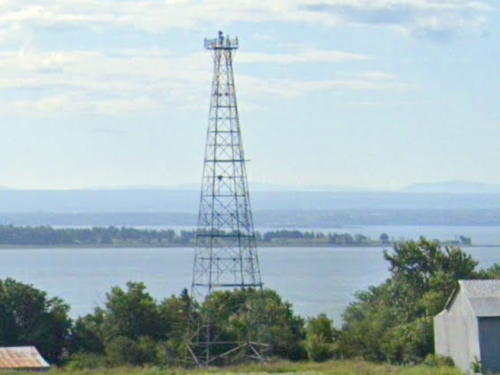
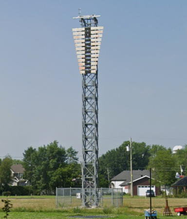
Date unknown (station established 1904). Active; focal plane 39 m (128 ft); continuous green light visible only on the range line. 33 m (108 ft) square skeletal tower with gallery, painted white. The tower carries a slatted fluorescent orange daymark with a black vertical stripe on the range line. Trabas has Boucher's photo, Marinas.com has aerial photos (incorrectly identified as the front light), and Google has a street view (also seen at right) and a satellite view. This is a downstream range. The original light was a square wood tower. Located at the marina on the Chemin des Ancêtres south of Grondines, on the north side of the river opposite Leclercville. Site open, tower closed. ARLHS CAN-1143; CCG A2024; Admiralty H2362.1; NGA 4344.
Pointe des Grondines Range Front (2)
Date unknown (station established 1904). Active; focal plane 14.5 m (48 ft); continuous green light visible only on the range line. 9 m (30 ft) square skeletal mast mounted on the large square concrete pier of the 1904 light. Google has a distant satellite view. Located on a marshy point about 2.44 km (1.5 mi) southwest of the rear light. Accessible only by boat. Site open, tower closed. CCG A2023; Admiralty H2362; NGA 4340.
[Pointe des Grondines Upper Range Rear (2)]
Date unknown (station established 1904). Active; focal plane 29.5 m (97 ft); white light, 1 s on, 1 s off. 14.5 m (48 ft) square skeletal tower with a slatted orange daymark with a black vertical stripe. Google has a street view but the tower hides in trees in Google's satellite view. This is a downstream range. The original light was a square wood tower. Located on a hillside on the north side of QC 138 about 8 km (5 mi) west of Grondines. Site and tower closed. ARLHS CAN-1144; CCG A2026; Admiralty H2364.1; NGA 4352.
[Pointe des Grondines Upper Range Front (2)]
Date unknown (station established 1904). Active; focal plane 9 m (30 ft); white light, 1 s on, 1 s off. 8 m (26 ft) square skeletal mast with a slatted orange daymark with a black vertical stripe. Google has an indistinct satellite view. The original light was a square wood tower. Located on a marshy point about 2.44 km (1.5 mi) southwest of the rear light. Accessible only by boat. Site open, tower closed. CCG A2025; Admiralty H2364; NGA 4348.

Pointe des Grondines Range Rear Light, Grondines, August 2013
Google Maps street view
 
La Pérade Range Front (1)
1921. Inactive since 1929. Approx. 6 m (20 ft) square pyramidal concrete pier. Google has a satellite view. The light was pushed over by ice and the front light was moved onshore to the location of the former rear light. Located in the river off the east end of the Isle de la Batture. Accessible only by boat. Site open, tower closed.
La Pérade Range Rear (3?)
Date unknown (station established 1929). Active; focal plane 26.5 m (88 ft); continuous green light. 26 m (85 ft) square cylindrical skeletal tower with a slatted orange daymark with a black vertical stripe. Trabas has Boucher's photo, and Google has a street view and an indistinct satellite view. Located on the south side of the Rue Sainte-Anne (QC 138) on the east side of Sainte-Anne-de-La-Pérade. Site and tower closed (private property) but the tower is easy to see from the road. ARLHS CAN-1140; CCG A2028; Admiralty H2360.1; NGA 4336.

Mauricie Region Lighthouses

Les Chenaux Regional County Municipality Lighthouses
Batiscan Range Front (5)
2010 (station established 1864). Active; focal plane 14 m (46 ft); continuous green light. 8 m (26 ft) light mounted on two posts, supporting a daymark colored orange with a black vertical stripe and mounted on the square pyramidal concrete pier of the third (1908) lighthouse. Prior to 1908 the light was onshore in a square wood tower. Trabas has Boucher's photo and Google has a street view and an indistinct satellite view. This is an upstream range. Located at the water's edge near the foot of Rue Massicotte in Le Marigot, north of Batiscan. Site status unknown. CCG A2042; Admiralty H2366; NGA 4424.
* Batiscan Range Rear (4)
Date unknown. Active; focal plane 22 m (73 ft); continuous green light visible only on the range line. 17 m (55 ft) square skeletal mast carrying an orange slatted daymark with a vertical black stripe on the range line. Trabas has Boucher's photo (also seen at right), and Google has a street view of the new light and a distant satellite view. Michel Forand's photo at Lighthouse Digest and two of Anderson's photos show the 1908 tower. Prior to 1908 the light was onshore in a square wood tower. Located on the north shore of the river northeast of Batiscan. Site appears to be open, tower closed. Owner/site manager: Canadian Coast Guard. ARLHS CAN-870; CCG A2043; Admiralty H2366.1; NGA 4428.
[Pointe à la Citrouille (5?)]
Date unknown (station established 1873). Active; focal plane 17.5 m (58 ft); continuous green light. 16 m (52 ft) square skeletal mast carrying an orange slatted daymark. Trabas has Boucher's photo but the light is hard to see in Google's satellite view. The original "temporary" light was replaced in 1892, but that lighthouse was destroyed by ice floes in 1896. The third (1898) lighthouse was replaced by a skeletal tower in 1949. Located on a sharp bend in the estuary about 10 km (6 mi) east of Champlain. Site status unknown. CCG A2053; Admiralty H2372; NGA 4480.
Champlain (Sector, Range Front) (4)
Date unknown (station established 1844). Active; focal plane 15 m (49 ft); continuous green sector light; also a passing light, red flash every 5 s. 14.5 m (48 ft) square skeletal tower, painted white and mounted on a small concrete pier connected to land by a footbridge. Trabas has Boucher's photo and Google has a satellite view. The second lighthouse was a square wood tower built in 1877; it became the front light of a range in 1881 and was replaced by a similar tower in 1906. Located at the water's edge in Champlain, about 1.5 km (1 mi) west of the village quay. Site status unknown. CCG A2062; Admiralty H2382; NGA 4544.

Batiscan Range Rear Light, Batiscan
photo copyright Michael Boucher; used by permission
* [Champlain Upper Range Front (3)]
Date unknown (station established 1904). Active; focal plane 14 m (46 ft); continuous green light. 8 m (26 ft) mast carrying a daymark colored orange with a black vertical stripe. Trabas has Boucher's photo and Google has a street view and an indistinct satellite view. The original lighthouse, a square wood tower, was replaced by a wood skeletal tower in 1937. Located at 771 Rue Notre-Dame on the west side of Champlain. Site and tower closed (private property) but the light is easy to see from the street. CCG A2063; Admiralty H2380; NGA 4528.
* Champlain Upper Range Rear (2)
2010 (station established 1904). Active; focal plane 28.5 m (94 ft); continuous green light visible only on the range line; also a passing light, red flash every 5 s. 21.5 m (71 ft) skeletal mast. The front face of the tower carries an orange daymark with a black vertical stripe on the range line. Trabas has Boucher's photo and Google has a satellite view. Lighthouse Digest has a photo of the original skeletal tower. This is an upstream range. Located on the north shore of the river west of Champlain, about 10 km (6 mi) northeast of Trois-Rivières and 455 m (0.28 mi) west of the front light. Site appears open, tower closed. Owner/site manager: Canadian Coast Guard. ARLHS CAN-1181; CCG A2064; Admiralty H2380.1; NGA 4532.
Pointe à Bigot
Date unknown. Active; focal plane 15 m (49 ft); red flash every 6 s. 13 m (43 ft) square skeletal tower with gallery carrying a red slatted daymark. Trabas has Boucher's photo and Google has a satellite view. Located on a bend of the river about 20 km (13 mi) northeast of Trois-Rivières. Site and closed (private property) but there is probably a view from the Rue des Oblats. CCG A2066.3; Admiralty H2387; NGA 4560.

Trois-Rivières City Lighthouses
[Cap-de-la-Madeleine Lower Range Front (4?)]
Date unknown (station established 1843). Active; focal plane 18.5 m (61 ft); continuous green light. 9 m (30 ft) square skeletal mast carrying a daymark colored orange with a black vertical stripe. No photo available and Google has only a fuzzy satellite view. The original square white tower had to be moved several times to escape erosion of the riverbank; it was replaced by similar towers in 1891 and again in 1906. These lights should not be confused with the well known Cap de la Madeleine lighthouse at Rivière de la Madeleine (see Eastern Québec). Located at the water's edge in Cap-de-la-Madeleine, an eastern suburb of Trois-Rivières. Site and tower closed (private property). ARLHS CAN-875; CCG A2067; Admiralty H2390; NGA 4636.
* Cap-de-la-Madeleine Lower Range Rear (4?)
Date unknown (station established 1843). Active; focal plane 33 m (108 ft); continuous green light. 23 m (75 ft) square skeletal tower with gallery carrying a daymark colored orange with a black vertical stripe. Trabas has Boucher's photo and Google has a street view and a satellite view. Located beside Route de Red Mill 975 m (0.6 mi) northeast of the front light. Site open, tower closed. ARLHS CAN-876; CCG A2068; Admiralty H2390.1; NGA 4640.
* Pointe du Lac Range Rear (3?)
Date unknown (station established 1906). Active; focal plane 49 m (161 ft); continuous green light. 34 m (112 ft) square skeletal tower carrying a daymark colored orange with a black vertical stripe. Google has a street view and a satellite view. Trabas has Boucher's photo of the earlier lighthouse. The range guides eastbound vessels crossing Lac Saint-Pierre, a 32 km (20 mi) long widening of the St. Lawrence estuary. Located on QC 138 (Rue Notre-Dame) at Pointe du Lac, the north side of the downstream exit from Lac Saint-Pierre. Site open, tower closed. ARLHS CAN-1302; CCG A2126; Admiralty H2402.1; NGA 4808.
Pointe du Lac Range Front
Date unknown (station established 1906). Active; focal plane 12.5 m (41 ft); continuous green light. 12.5 m (41 ft) short skeletal tower carrying a daymark colored orange with a black vertical stripe and mounted on a round concrete pedestal. Anderson has Jon Clay's photo seen at right, Trabas has Boucher's photo and Google has an indistinct satellite view. Located in Lac Saint-Pierre 2261 m (1.4 mi) southwest of the rear light. Accessible only by boat. Site open, tower closed. ARLHS CAN-1301; CCG A2125; Admiralty H2402; NGA 4804.
 

Pointe du Lac Range Front Light
photo copyright Jon Clay; used by permission

Information available on lost lighthouses:

  • Anse Saint-Jean (ca. 1890 - after 1915), Saguenay River. The light was moved atop the pierhead shed in 1915.
  • Baie Saint-Paul (1876-?), north side lower St. Lawrence River opposite the Île aux Coudres. There is no longer a light at this location. ARLHS CAN-868.
  • Cap Brûlé (1870-?), north side lower St. Lawrence River. There is a small skeletal beacon here today. ARLHS CAN-962. Active light: Admiralty H2259; CCG A1902; NGA 3772.
  • Cap Brûlé Range Front and Rear (1875-1972), north side lower St. Lawrence River. See Anderson's Banc du Cap Brulé page. The range was discontinued in 1972 and nothing remains of the light stations. ARLHS CAN-1150 and 1151.
  • Cap de la Madeleine (Trois Rivières) (1891-?), St. Lawrence River. This is the Cap-de-la-Madeleine Lower Range Front Light (see above). ARLHS CAN-875.
  • Cap de la Madeleine Upper Range Lights (1843-1937), St. Lawrence River. This range was discontinued and the lighthouses demolished. ARLHS CAN-877 and 878.
  • Cap de la Madeleine Village Range Lights (1904-?), St. Lawrence River. This range was discontinued and the lighthouses demolished. ARLHS CAN-879.
  • Champlain Lower Range Rear (1881-?), St. Lawrence River. See Anderson's discussion on Champlain. The lighthouse has been demolished.
  • Domaine Range Front and Rear (1907-?), northeast end of the Île d'Orléans, St. Lawrence River. This range has been replaced by the Pointe Argentenaye range lights. ARLHS CAN-967 and 968.
  • Grondines Range Front and Rear (1874-1904). This range was replaced in 1904 by the Pointe de Grondines Range Lights (see above). ARLHS CAN-953 and 954.
  • Grosse Roche (1906-?), Saguenay River about 20 km (13 mi) from the mouth. Anderson has a historic photo. There is no longer a light at this location. ARLHS CAN-819.
  • Lark Islet (Îlet aux Alouettes) (1872-1910), St. Lawrence River off the entrance to the Saguenay fjord. Anderson has a historic photo. This lighthouse was replaced by a buoy. ARLHS CAN-1119.
  • Pointe aux Trembles en Bas (1913-1956), St. Lawrence River at Neuville, just above Québec. The lighthouse no longer exists. There is a small beacon on the marina breakwater; Google has a street view. ARLHS CAN-1142; CCG A1974; Admiralty H2334; NGA 4096.
  • Pointe du Lac (1843-1906), Lac Saint-Pierre, St. Lawrence River. This lighthouse was replaced by the Point du Lac Range Rear Light (see above). ARLHS CAN-1300.
  • Portneuf-sur-Mer (Portneuf en Bas) (1873-1971), St. Lawrence River. The original lighthouse was destroyed by a storm in 1906. Nothing remains of this light station. ARLHS CAN-1154.
  • Rivière du Moulin Lower Range Front and Rear (1873-1977), Saguenay River on the east side of Saguenay. This range is marked today with short skeletal masts. Front: ARLHS CAN-1165; Admiralty H2143.9; CCG A1814; NGA 3616. Rear: ARLHS CAN-1166; Admiralty H2143.91; CCG A1815; NGA 3620.
  • Rivière du Moulin Upper Range Front (1922-1977), Saguenay River on the east side of Saguenay. This range is marked today with short skeletal masts. Front: Admiralty H2144; CCG A1817; NGA 3632. Rear: Admiralty H2144.1; CCG A1818; NGA 3636.
  • Saint-François Range Front and Rear (1875-?), St. Lawrence River.
  • Saint-François Wharf (1912-?), Île d'Orléans. The wharf is marked today by a small skeletal tower. Admiralty H2278; CCG A1913.
  • Saint-Irénée (1901-1945), about 7 km (4 mi) south of La Malbaie. A distant view is available. There is no light at this location today.
  • Sainte-Anne-de-Beaupré Range Rear (1907-?), Île d'Orléans Channel, St. Lawrence River. The front light has been replaced by a sector light (see above) and nothing remains of the rear lighthouse.
  • Savard Range Front and Rear (1873-1912), Saguenay River near Saguenay. This range was replaced by the Simard Range in 1912. ARLHS CAN-1189 and 1190.
  • Trois-Rivières Range Front (?-?). Nothing remains of this lighthouse.


Banc du Cap Brûlé Upstream Range Rear Light, May 2004
photo copyright Larry Myhre; used by permission

Notable faux lighthouses:

Adjoining pages: North: Northeastern Québec | East: Central and Western Newfoundland | South: Eastern Québec | West: Western Québec

Return to the Lighthouse Directory index | Ratings key

Posted September 12, 2003. Checked and revised July 24, 2023. Lighthouses: 28. Site copyright 2023 Russ Rowlett and the University of North Carolina at Chapel Hill.