Lighthouses of Australia: Far North Queensland

The independent Commonwealth of Australia occupies the entire Australian continent, the island of Tasmania, and numerous smaller islands. British exploration and settling of the continent began late in the 1700s, with the first colony established in the Sydney area in 1788. By the 1850s there were six British colonies, including New South Wales and Queensland in the east, Victoria and South Australia in the south, Western Australia in the west, and Tasmania off the south coast. The Commonwealth was formed on New Years Day 1901 as a federation of the six colonies.

Australia is both the smallest continent and the sixth-largest country in the world, with a population of about 27 million. It continues to be a federation of the six original states, plus the federally administered Northern Territory, Australian Capital Territory, and Jervis Bay Territory. It is a Commonwealth Realm recognizing the British monarch as head of state.

Queensland, the state occupying the northeastern quarter of Australia, has a long tropical coastline facing the Coral Sea (a basin of the Pacific Ocean) and fringed in large part by the famous Great Barrier Reef, the world's largest coral reef system. This coastline ends at Cape York, the northernmost point of the Australian continent. Beyond Cape York the Torres Strait separates Australia from New Guinea and provides a passage from the Coral Sea to the Arafura Sea (the easternmost arm of the Indian Ocean).

This page includes lighthouses of the Far North region of Queensland, including the Cape York Peninsula, the state's northwest coast on the Gulf of Carpentaria, and its northeast coast south through the Cairns area and Cassowary Coast Region. Pages for Northern and Central Queensland and Southern Queensland cover lighthouses in the rest of the state.

Coastal lighthouses in Australia are operated by the Australian Maritime Safety Authority (AMSA), an agency within the Department of Infrastructure and Transport. After automation AMSA transferred many of the station properties to the control of local or state authorities or organizations.

ARLHS numbers are from the ARLHS World List of Lights. Admiralty numbers are from volume K of the Admiralty List of Lights & Fog Signals. U.S. NGA numbers are from Publication 111.

General Sources
Queensland Lighthouses
The section of the Lighthouses of Australia site devoted to Queensland lights.
Lighthouses and Lightvessels in Australia - Queensland
Index to Wikipedia articles; most include photos.
AMSA Heritage Lighthouses
This interactive map provides information on many of the historic lighthouses.
World of Lighthouses - Queensland
Photos by various photographers available from Lightphotos.net.
Leuchttürme in Australien
Photos posted by Andreas Köhler.
Online List of Lights - Australia
Photos by various photographers posted by Alexander Trabas. Many of the photos for the Far North are by Jim Smith.
GPSNavigation Charts
Navigation chart information for the Cape York Peninsula and Torres Strait.
Navionics Charts
Navigation chart for northern Queensland.

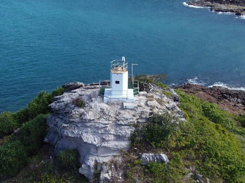
Goods Island Light
Goods Island Light, Torres Strait, May 2008
photo copyright David Denholm; used by permission

Gulf of Carpentaria Lighthouses

The Gulf of Carpentaria is a shallow sea roughly 600 km (375 mi) in diameter enclosed between the Cape York Peninsula of Queensland on the east and Arnhem Land of the Northern Territory on the west. On the north it is open to the Arafura Sea.

Mornington Shire Lighthouse
Mornington Island (Kunhanhaa) is a large island off the southern end of the Gulf of Carpentaria. The island is about 80 km (50 mi) long southwest to northeast and as much as 25 km (15 mi) wide. It has a populaton of about 1150.

*
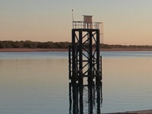
Mornington Island
Date unknown. Active; focal plane about 9 m (30 ft); white light, pattern unknown. Approx. 9 m (30 ft) square skeletal tower painted black. Jai Joseph has a photo (a portion is seen at right), Steven Foot has a photo and a second photo showing the light in action and Google has a satellite view. Located just off the Mornington Island Jetty at Gununa, Mornington's only settlement, at the the southwestern tip of the island. Site open, tower closed. Admiralty K3304.88.

Burke Shire Lighthouse
Burketown is a village of about 250 residents located 30 km (19 mi) inland on the Albert River, which flows into the southern end of the Gulf of Carpentaria.

*
Albert River (Kangaroo Point) (2?)
Date unknown. Active; focal plane 9 m (30 ft); white flash every 6 s. 9 m (30 ft) tower. NGA describes a skeletal tower but Google's satellite view appears to show a round concrete tower. No photo available. Located on the beach about 1500 m (0.9 mi) east of the river mouth. Site open, tower closed. Site manager: Finucane Island National Park. Admiralty K3304.8; NGA 9582.

Mornington Island Light, Mornington Island, July 2021
Google Maps photo by Jai Joseph

Carpentaria Shire (Karumba Area) Lighthouse
Karumba is a fishing port with about 500 residents located at the mouth of the Norman River in the southeastern corner of the Gulf of Carpentaria. Its port also serves the Century Zinc Mine.

Karumba Entrance Range Rear
Date unknown. Active; focal plane about 20 m (66 ft); continuous white light. Approx. 20 m (66 ft) skeletal tower mounted on a robust pile. Trabas has Michael Boucher's distant view and Bing has a satellite view. The front light is on a similar but shorter tower. Located at the edge of a shoal west of the river mouth. Accessible only by boat. Site open, tower closed. Admiralty K3304.21.

Weipa Town Lighthouses
Weipa is the largest town on the west coast of the Cape York Peninsula, with a population of about 4000. The surrounding area has large deposits of bauxite and the port of Weipa ships that mineral from the world's largest bauxite mine.
* Weipa Range Rear
Date unknown. Active; focal plane 44 m (144 ft); a continuous green light is shown at night and a continuous white light during the daytime. Approx. 35 m (115 ft) slender steel tower colored white. Google has a street view and a satellite view. Located beside a road at Evans Landing, on the south side of Weipa. Site open, tower closed. Owner/site manager: North Queensland Bulk Ports Corp. Admiralty K3298.1; NGA 9616.
* Weipa Range Front
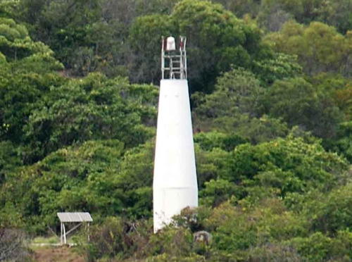
Date unknown. Active; focal plane 14 m (46 ft); a continuous green light is shown at night and a continuous white light during the daytime. 13 m (43 ft) round cylindrical metal tower painted white. A portion of Jon Morris's street view is at right, Lesley Bray has a closeup photo, and Google has an indistinct satellite view. Located at Gonbung Beach, a short spit projecting into the north side of the harbor, 2.75 km (1.7 mi) west southwest of the rear light. Site open, tower closed. Owner/site manager: North Queensland Bulk Ports Corp. Admiralty K3298; NGA 9612.
Duyfken Point (Jantzs Point) (2?)
Date unknown. Active; focal plane 49 m (161 ft); white flash every 5 s. 28 m (92 ft) steel skeletal tower. A Fresnel lens formerly used at this station is on display at the Townsville Maritime Museum, and the original lantern is on display at the Macquarie Lighthouse museum near Sydney. A distant view and another version of the same view are available, and Google has an indistinct satellite view. This is the landfall light for Weipa. Duyfken Point, on the north side of Albatross Bay, is the first point of Australia discovered by a Western explorer: the Dutch captain Willem Janszoon (or Jantzs), in his ship Duyfken, spotted this point in 1606. Located on the cape, about 35 km (22 mi) west of Weipa. Site status unknown. Admiralty K3297; NGA 9596.

Range Front Light, Weipa, January 2016
Google Maps street view by Jon Morris

Northern Peninsula Area Lightship
#Lightship CLS-3 Carpentaria
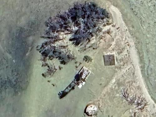
1917. Wrecked in 1979. Steel lightship; the light was displayed from a central mast. The ship was dragged from its station on the Carpentaria Shoal by Tropical Cyclone Greta in January 1979. It beached south of Vrilya Point about 100 km (60 mi) southwest of Cape York. AMSA abandoned the ship, leaving it to rust on the beach. The wreck was still upright as recently as 2008, as seen in Hubert Hofer's 2014 photo and a Lightphotos.net photo, but shortly thereafter it collapsed onto the sand, as seen in a more recent photo (photo #3). Google has a satellite view. The lightship was replaced on the shoal by a modern lightfloat (NGA 9592). Site open.

Torres Shire (Torres Strait) Lighthouses

The Torres Strait (named for the Spanish navigator Luís Vaz de Torres, who sailed through the strait in 1606) is about 150 km (93 mi) wide between Cape York and the southern coast of Papua New Guinea. Shallow and difficult to navigate, the strait is also strewn with about 275 islands, 17 of them large enough to be inhabited. Australia has sovereignty over all the islands of the strait and controls shipping through the passage. The channel used by international shipping, known as the Great Northeast Channel, passes north of Prince of Wales island off Cape York and then angles northeastward across the strait to end close to the Papuan coast. Since 2006 Australia has required that ships passing through the strait make use of Australian pilots. The Torres Pilots agency has a map of the route.

Prince of Wales Channel Lighthouses
Booby Island
1890. Active; focal plane 37 m (120 ft); white flash every 7.5 s. 18 m (59 ft) wood frame tower covered with galvanized iron sheets, with lantern and gallery, painted white; dome of lantern painted red. The original 2nd order Fresnel lens, removed in 1991, is on display at the Green Hill Fort Museum on Thursday Island. Several 1-story keeper's houses and other buildings, formerly occupied by wildlife service personnel, are now incorporated into a Torres Pilots base. A photo by J. Warnes is at right, Trabas has Smith's photo, a 2022 Instagram photo is available, Ashley Whatson has a view from the sea, Wikimedia has an aerial photo and another view from the sea, and Bing has a satellite view. Booby Island, located about 50 km (30 mi) west northwest of Cape York, marks the western entrance to the Great Northeast Channel through the Torres Strait. So many ships were wrecked here in the nineteenth century that provisions were kept stocked on the island for wrecked seamen. Located at the highest point of the island. Accessible only by boat. Site and tower closed; special permission is required to land on the island. Operator: AMSA. Site manager: Queensland National Parks (Round Island Conservation Park). . ARLHS AUS-011; Admiralty K3274; NGA 9620.
Goods (Palilag) Island Range Rear
1886. Active; focal plane 105 m (345 ft); quick-flashing white light. Approx. 10 m (33 ft) wood frame tower covered with galvanized iron sheets, with lantern and gallery. Lighthouse painted white; dome of lantern painted red. The original 4th order Fresnel lens remains in use. Keeper's houses in ruins. David Denholm's photo is at the top of this page, Trabas has Smith's photo, and Google has a distant satellite view of the station. The front range light is on a 2 m (7 ft) fiberglass tower. Located atop the rocky island, about 27 km (17 mi) northwest of Cape York and 25 km (16 mi) east of Booby Island. Accessible only by boat. Site and tower closed. Operator/site manager: AMSA. . ARLHS AUS-232; Admiralty K3270.1; NGA 9628.
Booby Island Light
Booby Island Light, Torres Strait, November 2007
Wikimedia Creative Commons photo by J. Warnes
North West Reef
Date unknown. Active; focal plane 7 m (23 ft); white light, 2.5 s on, 2.5 s off. 6 m (20 ft) white fiberglass tower. No photo available but Google has a distant satellite view. Located on a reef on the north side of the channel, northwest of Wednesday Island. Accessible only by boat. Site and tower closed. Operator/site manager: AMSA. Admiralty K3266.5; NGA 9654.
Wednesday Island (Ince Point)
Date unknown. Active; focal plane 40 m (131 ft); three flashes every 15 s, white or red depending on direction. 6 m (20 ft) round white fiberglass tower. Trabas has Smith's photo (also seen at right), a view from the sea is available, and Google has a satellite view. Located at the northeastern point of Wednesday Island, about 25 km (15 mi) northwest of Cape York. Accessible only by boat. Site and tower closed. Operator/site manager: AMSA. Admiralty K3262; NGA 9660.
East Strait Island Range Rear (3)
Date unknown. Active; focal plane 25 m (82 ft); white light, 2 s on, 8 s off. 15 m (49 ft) hexagonal cylindrical fiberglass tower colored with a red and white checkerboard pattern. No photo available but Google has a satellite view. The original lighthouse was a square pyramidal skeletal tower and the second lighthouse was a square cylindrical tower. The range guides eastbound vessels in the Prince of Wales Channel, a west-to-east reach. The front light is described as a 6 m (20 ft) white hut with concrete column. Located on a small island about 25 km (15 mi) north of Cape York. Accessible only by boat. Site and tower closed. Operator/site manager: AMSA. Admiralty K3258.1; NGA 9684.
Twin Island
Date unknown. Active; focal plane 69 m (226 ft); flash every 5 s, white or red depending on direction. 6 m (20 ft) white fiberglass tower. No photo available but Google has a distant satellite view. Located on an island on the north side of the eastern end of the Prince of Wales Channel. Accessible only by boat. Site and tower closed. Operator/site manager: AMSA. Admiralty K3260; NGA 9676.

Ince Point Light, Wednesday Island
photo copyright Jim Smith; used by permission

Great Northeast Channel Lighthouses
Arden Islet
Date unknown. Active; focal plane 16 m (52 ft); three white flashes every 15 s. 13 m (43 ft) steel skeletal tower. No photo available but Bing has a very distant satellite view. Located at the west end of a small island in the center of the Torres Strait. Accessible only by boat. Site and tower closed. Operator/site manager: AMSA. Admiralty K3285; NGA 9704.
Dalrymple Islet (Damut Island)
Date unknown. Active; focal plane 24 m (79 ft); white flash every 5 s. 21 m (69 ft) square steel skeletal tower. A distant view from the sea (2/3 the way down the page) is available but Bing has a distant satellite view. Dalrymple has a Torres Pilots base and marks the eastern end of the piloted section of the Great Northeast Channel. Located at the west end of a small island in the center of the Torres Strait. Accessible only by boat. Site and tower closed. Operator/site manager: AMSA. Admiralty K3288; NGA 9708.
Bramble Cay (2)
1954 (station established 1924). Active; focal plane 19 m (62 ft); four white flashes, separated by 2.5 s, every 15 s. 19 m (62 ft) square stainless steel skeletal tower, painted white. Ian Gynther's photo at right also shows the huge flocks of birds that nest on the cay. A sunset photo is available, there's a photo taken from atop the tower, and Bing has a very distant satellite view. The University of Queensland has a photo of the original lighthouse, a square cylindrical skeletal tower. This is Australia's northernmost aid to navigation, standing in latitude 9°08.5' S. The light tower marks the northern end of the Great Barrier Reef and the eastern entrance to the Great Northeast Channel. Located in the Gulf of Papua about 230 km (140 mi) northeast of Cape York. Accessible only by boat. Site and tower closed. Operator/site manager: AMSA. ARLHS AUS-280; Admiralty K3292; NGA 9712.

Bramble Cay Light, Torres Strait, August 2014
Wikimedia Creative Commons photo by Ian Gynther,
Queensland Department of Environment and Heritage Protection
East Cay
2000-01. Active; focal plane 32 m (105 ft); white flash every 10 s. 31 m (102 ft) structure; in NGA's description this includes a "red fiberglass tower, on metal framework tower, on 4-piled structure with helipad connected by walkway." Rob Jeffries has a 2011 photo of this unusual lighthouse and Bing has a satellite view. This light stands at the extreme northern end of the Great Barrier Reef, marking the northern end of the Outer Route, the shipping route for vessels sailing parallel to the coast outside the reef. Located on a reef about 50 km (30 mi) southeast of Bramble Cay. Accessible only by boat. Site and tower closed. Operator/site manager: AMSA. Admiralty K3290; NGA 9714.

Great Barrier Reef Beacon

[Raine Island Beacon]
1844. Never lit as a lighthouse, but the tower functions as a daybeacon. Approx. 10 m (33 ft) round 4-stage stone tower. A photo is at right, Robert Gallesio has a 2016 photo, a 2020 photo is available, and Bing has a satellite view. The oldest European structure in tropical Australia, the beacon was built by convict labor at the order of the British Admiralty. It marks a narrow and dangerous passage through the Great Barrier Reef, known as the Raine Island Passage or as the Pandora Passage after HMS Pandora, which wrecked nearby on 29 August 1791 after participating in the search for HMS Bounty. In the 19th century ships often used this passage to reach the Torres Strait from the Coral Sea. The island is the world's largest nesting site for endangered green turtles. The Raine Island Corporation, which manages research activities on the island, restored the tower in 1994. Located atop the island on the Great Barrier Reef about 120 km (75 mi) east northeast of Cape Grenville. Accessible only by boat or helicopter. Site and tower closed to the public (wildlife reserve). Owner: Queensland National Parks (Raine Island National Park). Site manager: Raine Island Corporation. . ARLHS AUS-141.

Raine Island Beacon, Great Barrier Reef
Queensland National Parks photo

East Coast (Coral Sea) Lighthouses

Torres Shire: Cape York Area Lighthouses
Named by Capt. James Cook in 1770, Cape York is the northernmost point of the Australian continent and represents the northeastern corner of the country. Although the cape is quite remote, being 750 km (470 mi) north of the paved highway at Lakeland, it is accessible to well-equipped 4WD vehicles during the dry season (May through November), and hundreds of adventurous tourists make this trek every year.
Eborac Island (Cape York) (2)
2012 (station established 1921). Active; focal plane 35 m (115 ft); two white flashes every 10 s; the light shown is white, green, or red depending on direction. 6 m (20 ft) hexagonal cylindrical white fiberglass tower. Grant Haase has a distant 2018 street view and Google has an indistinct satellite view. The original lighthouse was a square cylindrical concrete tower with lantern and gallery, painted white. John Benwell has a 2007 photo. In 2012 AMSA replaced the deteriorated Eborac Island and Albany Rock lighthouses with hexagonal fiberglass towers. The lighthouse guides ships into the northern end of the protected coastal channel, inside the Great Barrier Reef. Located atop a rocky island just off Cape York. Accessible only by boat but visible from the point of Cape York, which can be reached by 4WD. Site and tower closed. Operator/site manager: AMSA. ARLHS AUS-189; Admiralty K3256; NGA 9724.
Albany Rock (2)
2012 (station establishment date unknown). Active; focal plane 26 m (85 ft); flash every 5 s, white, red, or green depending on direction. 6 m (20 ft) hexagonal cylindrical white fiberglass tower. A photo is at right, Trabas has Smith's photo, and Google has a satellite view. The two white sectors of this light guide ships in the narrow channel along the east side of Cape York. In 2012 AMSA replaced the deteriorated Eborac Island and Albany Rock lighthouses with fiberglass towers. The original lighthouse was a square cylindrical concrete tower with lantern and gallery, painted white. A distant view is available (a little more than halfway down the page) and the University of Queensboro has a closeup historic photo. Located about 10 km (6 mi) southeast of Cape York. Accessible only by boat. Site and tower closed. Operator/site manager: AMSA. ARLHS AUS-002; Admiralty K3254; NGA 9728.

Albany Rock Light, Cape York, 2012
photo copyright CivilPlus Constructions
Wyborn Reef (2)
Date unknown. Active; focal plane 21 m (70 ft); four flashes every 20 s, white or red depending on direction. 21 m (70 ft) square stainless steel skeletal tower with lantern and gallery, mounted on four concrete piles. Lantern painted white. Pilings of a former lighthouse are nearby. Trabas has Smith's photo, Wikimedia has an aerial photo by J. Warnes, Lightphotos.net has a wider version of the same photo, and Google has a satellite view. Located on a reef about 16 km (10 mi) southeast of Albany Rock. Accessible only by boat. Site and tower closed. Operator/site manager: AMSA. ARLHS AUS-283; Admiralty K3252; NGA 9732.

Cook Shire: Inside Passage Lighthouses, Cape York to Cape Weymouth
Cairncross Islets
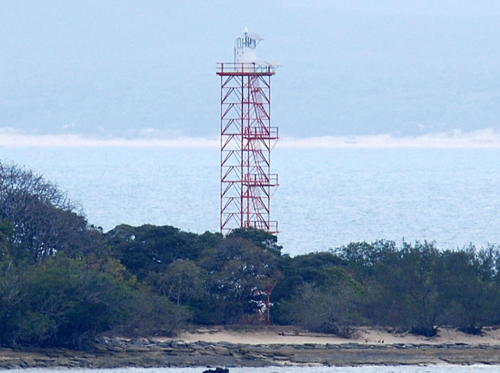
Date unknown. Active; focal plane 27 m (89 ft); three white flashes every 15 s. 21 m (69 ft) square cylindrical skeletal tower, painted red; the small lantern is painted white. Trabas has Smith's photo (also seen at right) and Google has a satellite view. Cairncross is a small island about 15 km (9 mi) offshore and 100 km (60 mi) southeast of Cape York. The light marks the north end of a narrow passage close to the coast of the Cape York Peninsula between Cape York and Cape Grenville. Located on the northwestern tip of the island. Accessible only by boat. Site and tower closed. Operator/site manager: AMSA. Admiralty K3250; NGA 9736.
Hannibal Islands
Date unknown. Active; focal plane 26 m (85 ft); two white flashes every 8 s. 22 m (72 ft) square cylindrical skeletal tower, painted red. Identical to the Cairncross Islets Light. Trabas has Smith's photo and Bing has a distant satellite view. The light marks the south end of a narrow passage close to the coast of the Cape York Peninsula between Cape York and Cape Grenville. Located on an island at the northeastern corner of the Hannibal Reef, about 50 km (30 mi) north of Cape Grenville. Accessible only by boat. Site and tower closed. Operator/site manager: AMSA. Admiralty K3248; NGA 9740.
 

Cairncros Islets Light, Cape York
photo copyright Jim Smith; used by permission
Clerke Island (Cape Grenville) (2)
2006 (station established 1990) . Active; focal plane 21 m (69 ft); flash every 2.5 s, white or red depending on direction. 21 m (69 ft) hexagonal cylindrical fiberglass tower, painted with red and white horizontal bands. AMSA's photo is at right, Trabas has Smith's photo, and Google has a satellite view. This light marks a sharp (60°) turn in the inside passage along the coast of the peninsula. The new lighthouse replaced a skeletal tower. Located on a reef off the easternmost of the Home Islands, a group of islands lying just off the point of Cape Grenville. Accessible only by boat. Site open, tower closed. Operator/site manager: AMSA. Admiralty K3244; NGA 9744.
Piper Reef
Date unknown (lightship station established 1876). Active; focal plane 12 m (39 ft); four white flashes every 20 s. 12 m (39 ft) square pyramidal skeletal tower with lantern and gallery, painted red and mounted on concrete piles. Trabas has Smith's photo and Google has a satellite view. This light marks the very narrow passage between Piper Reef and Inset Reef on the inside passage along the coast. Located at the east end of Piper Reef about 30 km (19 mi) south of Cape Grenville. Accessible only by boat. Site open, tower closed. Operator/site manager: AMSA. Admiralty K3242; NGA 9756.
[Restoration Rock]
Date unknown. Active; focal plane 38 m (125 ft); two white flashes every 8 s. 5 m (16 ft) white fiberglass tower. Trabas has Smith's photo, Irene Young has a photo, and Google has a distant satellite view. This light guides ships past the headland of Cape Weymouth. Accessible only by boat. Site open, tower closed. Operator/site manager: AMSA. Admiralty K3240; NGA 9768.

Lockhart River Shire: Inside Passage, Cape Direction Area Lighthouses
This section of the Inside Passage swings well offshore along the inside edge of the Great Barrier Reef.

Chapman Island (2)
Date unknown. Active; focal plane 18 m (59 ft); flash every 5 s, white or red depending on direction. 14 m (46 ft) stainless steel skeletal tower mounted on a concrete platform supported by piles. A helipad is on an adjoining platform. No photo available but Bing has a satellite view. The original lighthouse was nearly identical to the present one. Located on a reef off Cape Direction about 12 km (7.5 mi) southeast of Lockhart River, the northernmost town on the east coast of Queensland. Accessible only by boat. Site open, tower closed. Operator/site manager: AMSA. Admiralty K3236; NGA 9776.
Clerke Island Light
Clerke Island Light, Cape Grenville, 2006
Australian Maritime Safety Authority photo (no longer online)
Robin Reef
Date unknown. Active; focal plane 21 m (69 ft); two flashes every 8 s, white or red depending on direction. 20 m (66 ft) skeletal tower mounted on a concrete platform supported by piles. No photo available but Bing has a satellite view. Located on a reef about 11 km (7 mi) east of Chapman Island. Accessible only by boat. Site open, tower closed. Operator/site manager: AMSA. Admiralty K3235.575; NGA 9774.
Waterwitch Reef
Date unknown. Active; focal plane 18 m (59 ft); four white flashes every 20 s. 19 m (62 ft) skeletal tower mounted on a concrete platform supported by piles. A helipad is on an adjoining platform. No photo available but Google has a satellite view. Located on a reef about 16 km (10 mi) south of Chapman Island. Accessible only by boat. Site open, tower closed. Operator/site manager: AMSA. Admiralty K3234; NGA 9780.
Diamond Reign Reefs
Date unknown. Active; focal plane 22 m (72 ft); two flashes every 8 s, white, red or green depending on direction. 20 m (66 ft) white fiberglass tower mounted on a square platform. No photo available but Bing has a distant satellite view. Two narrow white sectors guide vessels past a large area of dangerous reefs. Accessible only by boat. Site open, tower closed. Operator/site manager: AMSA. Admiralty K3235.05; NGA 9781.

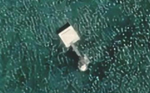
Waterwitch Reef Light, Inside Passage
Google Maps satellite view

Cook Shire: Princess Charlotte Bay and Cape Melville Area Lighthouses
Hannah Island (?)
Date unknown. Inactive since 2015 and posibly removd. This was a 23 m (75 ft) skeletal tower, painted red. No photo available; Bing has a satellite view but the tower is not seen in Google's indistinct satellite view. The tower may have been removed. Located on an island at the northwestern entrance to Princess Charlotte Bay. Accessible only by boat. Site open, tower closed. Operator/site manager: AMSA. ex-Admiralty K3228; ex-NGA 9800.
Corbett Reef (2?)
Date unknown. Active; focal plane 21 m (69 ft); white flash every 7.5 s. 21 m (69 ft) post with a square fiberglass cabinet and double gallery. No photo available but Bing has a fuzzy satellite view. This light marks a narrow passage between reefs about 50 km (30 mi) northwest of Cape Melville. Accessible only by boat. Site open, tower closed. Operator/site manager: AMSA. Admiralty K3223.2; NGA 9801.
Wharton Reef (2)
1990. Active; focal plane 14 m (46 ft); flash every 5 s. 12 m (39 ft) fiberglass tower standing on a platform supported by four robust concete piles. No photo available but Bing has an indistinct satellite view. The platform originally supported a 15 m (49 ft) skeletal tower with lantern and gallery; the upper portion of that tower was relocated to Townsville (see the Northern and Central Queensland page). Located at the east end of a reef about 60 km (37 mi) west of Cape Melville. Accessible only by boat. Site open, tower closed. Operator/site manager: AMSA. Admiralty K3226; NGA 9812.
Pipon Island (2)
Date unknown (station established 1901). Active; focal plane 26 m (85 ft); three flashes every 15 s, white or red depending on direction. 25 m (82 ft) square skeletal tower, painted white, mounted on a square concrete pier. No photo available but Google has a satellite view (a portion is seen at right). Robin Jeffries climbed the tower in 2016 and has a photo showing its shadow. There is a 1970 photo showing the earlier lighthouse, a red pentagonal skeletal tower with lantern and gallery. This lighthouse guides vessels through a narrow passage around the point of Cape Melville. Located on the southwest side of the Pipon Reef, about 5 km (3 mi) northwest of the cape. Accessible only by boat. Site open, tower closed. Operator/site manager: AMSA. Admiralty K3224; NGA 9820.
Coquet Island
Date unknown. Active; focal plane 26 m (85 ft); white flash every 5 s. 22 m (72 ft) skeletal tower, painted red. No photo available but Google has a satellite view. Located on an island about 80 km (50 mi) southeast of Cape Melville. Accessible only by boat. Site open, tower closed. Operator/site manager: AMSA. Admiralty K3219; NGA 9840.

Pipon Island Light, Cape Melville
Google Maps satellite view
Palfrey Island
Date unknown. Active; focal plane 80 m (262 ft); four white flashes, separated by 2 s, every 16 s. 9 m (30 ft) square white concrete tower. A distant aerial view is available and Google has an indistinct satellite view. Located on a small island off the southwest side of the larger Lizard Island, about 30 km (19 mi) off the mainland. Site status unknown. Operator: AMSA. Site manager: Queensland National Parks (Lizard Island National Park). Admiralty K3216; NGA 9848.

Cook Shire: Cooktown Area Lighthouses
Except for the aboriginal village of Lockhart River Cooktown is the northernmost town on the Pacific coast of Queensland. It is named for Capt. James Cook, who spent seven weeks here in 1770 repairing his ship Endeavour after it grounded on what is now called the Endeavour Reef. The town was founded after gold was discovered nearby in 1872. It is the administrative center for Cook Shire, which includes a large part of the Cape York Peninsula. The current population is about 2600.

Three Isles
Date unknown. Active; focal plane 27 m (89 ft); three white flashes every 15 s. 24 m (79 ft) square skeletal tower, painted red. No photo available but Google has a satellite view. Located at the northeastern tip of a small island about 16 km (10 mi) off the coast and 50 km (30 mi) north northeast of Cooktown. Accessible only by boat. Site open, tower closed. Operator: AMSA. Site manager: Queensland National Parks (Three Islands Group National Park). Admiralty K3214; NGA 9864.
* Grassy Hill (Cooktown)
1886. Active; focal plane 162 m (530 ft); two white flashes every 6 s. 6 m (20 ft) wood frame tower covered with galvanized iron sheets, with lantern and gallery. Lighthouse painted white; lantern dome is red. The keeper's houses where demolished after the lighthouse was automated in 1927. Bill Dutfield's photo is at right, Beck Lee has a 2008 photo, a 2018 photo and a 2022 Instagram photo are available, Sheri Bain has a closeup, and Google has a 2015 street view and a satellite view. The lighthouse may have been deactivated for a time around 1990 before being restored through efforts of the Cooktown Lions Club. It was repainted and refurbished in 2010. Grassy Hill is a municipal park including the lighthouse and a monument to Captain James Cook, who beached his ship Endeavour here in 1770 for repairs after it was damaged on the Great Barrier Reef. It was on Grassy Hill that Captain Cook's crew had the first European encounter with kangaroos. Located on the south side of the entrance to the Endeavour River in Cooktown, the northernmost port of the Queensland coast. Accessible by road; parking provided. Site open, tower closed. Operator: Maritime Safety Queensland. Site manager: Cook Shire Council. . ARLHS AUS-083; Admiralty K3208; NGA 9868.
Grassy Hill Light, Cooktown
Grassy Hill Light, Cooktown, October 2011
Flickr photo copyright Bill Dutfield; used by permission
* Archer Point (Range Rear) (2)
1979 (station established 1883). Active; focal plane 65 m (213 ft); four flashes, separated by 2 s, every 20 s; flashes are red, white, or green depending on direction. 6 m (19 ft) square concrete equipment room with lantern. Building unpainted; lantern painted white. Bryce Purden has the street view seen at right, Lighthouses of Australia has a page for the lighthouse, Trabas has a closeup photo, Mark Maupin also has a closeup, and Google has a satellite view. The original lighthouse was one of the many galvanized iron towers similar to the Low Isles lighthouse (see below). The original lens is on display at the Queensland Maritime Museum in Brisbane. Until 1996 the light also served as the rear light of a range with the Rocky Islet lighthouse (next entry) as the front light; the range guided vessels past the Cairns Reef. The leading light installed in 1996 provides a more accurate heading. Located on a headland about 14 km (9 mi) southeast of Cooktown. Accessible by a gravel road 12 km (7.5 km) off the main road to Cooktown. Site open, tower closed. Operator/site manager: AMSA. . ARLHS AUS-182; Admiralty K3200; NGA 9888.
Rocky Islet (Archer Point Range Front) (2) (?)
1979(?) (station established 1883). Inactive since 1996 and possibly removed. 6 m (19 ft) square concrete equipment room with lantern. Building unpainted; lantern painted white. Lesley Bray has a 2013 photo but the lighthouse is not seen in Google's satellite view. The original lighthouse was a round tower with lantern and gallery. Located on a small island about 1.5 km (1 mi) southeast of the Archer Point Lighthouse. Accessible only by boat. Site open, tower closed.
 

Archer Point Light, Cooktown, July 2016
Google Maps street view by Bryce Purden
 

Douglas Shire (Port Douglas Area) Lighthouses
Port Douglas is a town about 70 km (40 mi) north of Cairns; its population is about 3700 .
Low Isles
1878 (W.P. Clark). Active; focal plane 20 m (65 ft); white flash every 10 s; also a directional light displayed to the southeast, white, red or green depending on direction, 1 s on, 1 s off. 18 m (60 ft) wood frame tower covered by galvanized iron sheets, with lantern and gallery; solar-powered lens. Lighthouse painted white; lantern dome is red. The original 3rd order Chance Brothers Fresnel lens is on display at the Port Douglas Court House Museum. Two modern keeper's houses (1960s). For a number of years the assistant keeper's house was occupied by the Low Isles Research Station of the University of Queensland, but this station has been closed. A portion of Robert Linsdell's 2012 view from the sea is at right, Steve Stringer has a good photo, another photo and a closeup are available, Peter Nijenhuis has a view from the sea, Trabas has Douglas Cameron's very distant view from the sea, and Google has a satellite view. Steve Irwin (the Crocodile Hunter), Australia's famous wildlife expert and television personality, was killed on a dive just off the Low Isles in September 2006. The Low Isles Preservation Society works for preservation of the light station. The interior and exterior of the lighthouse were painted in early 2018. Located on a small island inside the Great Barrier Reef, about 13 km (8.5 mi) northeast of Port Douglas, marking the shipping channel to the port. Accessible only by boat; tours from Cairns and Port Douglas are available. Site open, tower closed. Operator: AMSA. Site managers: Queensland Marine Parks (Great Barrier Reef Coast Marine Park). . ARLHS AUS-102; Admiralty K3194; NGA 9896.
Island Point (Port Douglas, Flagstaff Hill) (2)
1911 (?) (station established 1879. Inactive since 1997. Approx. 7 m (23 ft) square cylindrical tower with lantern, painted white; lantern roof is red. A 2020 photo is avalable, Köhler has a 2015 closeup photo, Tom Silva has a 2022 photo, Lightphotos.net has a closeup photo, and Google has a satellite view. The original lighthouse, a small square wood tower, was blown over by a tropical cyclone in 1911. The 3rd order Fresnel lens from that lighthouse is on display at the Port Douglas Court House Museum. Located on the headland on the east side of the harbor entrance in Port Douglas. Site and tower closed (private property). Site manager unknown. ARLHS AUS-191.
* Island Point (Port Douglas) (3)
1997 (station established 1879). Active; focal plane 90 m (295 ft); four flashes, white or red depending on direction, every 20 s. 26 m (85 ft) skeletal communications tower. Trabas has Douglas Cameron's photo, Lightphotos.net has Köhler's photo, and Google has a street view and a satellite view. Located on Island Point Road near the Trinity Bay Lookout. Site open, tower closed. Admiralty K3186; NGA 9900

Low Isles Light, Great Barrier Reef, November 2012
Flickr Creative Commons photo by Robert Linsdell

Cairns Region Lighthouses
Cairns is the metropolis of northern Queensland, with a population of about 170,000. Founded in 1876, the city was a major Allied base during World War II and has become an important center of tourism in recent years.
Euston Reef
Date unknown. Active; focal plane 17 m (56 ft); four white flashes every 20 s. 16 m (52 ft) square pyramidal skeletal tower, painted white. A photo is available and Google has a satellite view. This light marks the Grafton Passage, an entrance through the Great Barrier Reef for vessels bound for Cairns. Located on a reef just outside the main line of the barrier, about 120 km (75 mi) east northeast of Cairns. Accessible only by boat. Site open, tower closed. Operator/site manager: AMSA. Admiralty K3166; NGA 9948.
* Fitzroy Island (2)
1973 (station established 1943). Inactive since 1992. 17 m (56 ft) octagonal tile-covered tower with lantern and gallery. Several keeper's houses and other buildings are preserved. A 2020 photo is at right, Lighthouses of Australia has a page for the lighthouse, Lightphotos.net has Köhler's photo, Tom Silva has a 2022 closeup, Brent Roberts has a distant view, Bel Roach has a closeup street view, and Google has a satellite view. A light station was established on nearby Little Fitzroy Island in 1929. During World War II this light was supplemented by a light on Fitzroy Island. The Little Fitzroy light was deactivated when the present lighthouse was built in 1973, but then in 1992 it was decided to retire the lighthouse and move the active light back to Little Fitzroy once again. The lighthouse is now a national park visitor center. Syd Pipe has a historic photo of the light when it was in service. Located atop one of the summits of a rugged island about 6 km (4 mi) off the coast of Cape Grafton, east of Cairns. The island is accessible by ferry from Cairns; the lighthouse is accessible by a hike of 3.6 km (2.25 mi) round trip. Site open, tower closed. Owner/site manager: Queensland National Parks (Fitzroy Island National Park). . ARLHS AUS-074; ex-Admiralty K3168.
[Little Fitzroy Island (2)]
1992 (station established 1929 but inactive 1973-1992). Active; focal plane 33 m (108 ft); three flashes every 15 s, white, red or green depending on direction. 4 m (13 ft) round cylindrical white fiberglass tower. Paul Lew has a photo and Google has a satellite view. See the previous entry for the history of the station. A photo of the original lighthouse, a square skeletal tower with lantern and gallery, is also available. This directional light guide vessels to Cairns through the Grafton Passage opening in the Great Barrier Reef. Located on a much smaller island off the northeastern tip of Fitzroy Island. Site status unknown. Admiralty K3168; NGA 9956.
Russell Island
Date unknown. Active; focal plane 76 m (249 ft); two white flashes every 10 s. 17 m (56 ft) square skeletal tower, painted red. No photo available but Google has a satellite view. Located atop the highest of the Frankland Islands a small group about 40 km (25 mi) north of Innisfail. There is a campground on the island, and transportation is available. Accessible only by boat. Site open, tower closed. Operator: AMSA. Site manager:Queensland National Parks (Frankland Group National Park). Admiralty K3162; NGA 9964.

Fitzroy Island Light, June 2020
Instagram photo by theland_downunder

Cassowary Coast Region Lighthouses
Kent Island
Date unknown. Active; focal plane 91 m (298 ft); white flash every 5 s. 11 m (36 ft) square white concrete tower. No photo available but Google has a satellite view. Located on a small island about 20 km (13 mi) southeast of Innisfail. Accessible only by boat. Site status unknown. Operator/site manager: AMSA. Admiralty K3138; NGA 9988.
Brook Islands (South Island)
Date unknown. Active; focal plane 52 m (171 ft); four white flashes every 16 s. 15 m (49 ft) skeletal tower. No photo available but Google has a satellite view. The light guides vessels around Cape Sandwich. Located on the southeasternmost of a short chain of islands off the north coast of Hinchinbrook Island, about 50 km (30 mi) northeast of Cardwell. Accessible only by boat. Site status unknown. Operator/site manager: AMSA. Admiralty K3132; NGA 10000.

Information available on lost lighthouses:

Notable faux lighthouses:

Adjoining pages: North: Southern Papua New Guinea | South: Northern and Central Queensland | West: Northern Territory

Return to the Lighthouse Directory index | Ratings key

Posted July 6, 2004; checked and revised January 11, 2024. Lighthouses: 45; lightships: 1. Site copyright 2024 Russ Rowlett and the University of North Carolina at Chapel Hill.