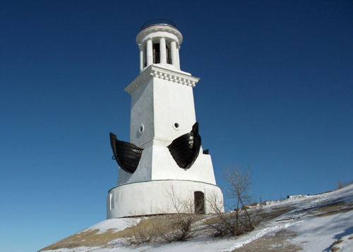
Lighthouses of Russia: Volga, Kama and Don Waterways

Russia (Россия, Rossiya in Russian) is by far the world's largest country, spanning a little over 150° in longitude. It is organized as the Russian Federation (Rossiyskaya Federatsiya) with members known as federal subjects (sub'yekty federatsii). Russia is primarily a continental nation but it has important coastlines on the Baltic, Black, and Caspian Seas and very long coastlines on the Arctic Ocean and North Pacific Oceans. To guard these coasts it operates hundreds of lighthouses, many of them historic.

Russia also has an extensive network of inland waterways called the Unified Deepwater System. The Volga River, Europe's longest river, forms the backbone of this system as it drains southward into the landlocked Caspian Sea. The lower portion of the river is connected to the Don River and the Black Sea by the Volga-Don Canal, while the Volga-Baltic Waterway connects the upper part of the river to St. Petersburg (via Lakes Onega and Ladoga) and to the White Sea and Arctic Ocean (via Lake Onega and the White Sea-Baltic Sea Canal). In addition the Moscow Canal connects the Volga to the Moscow River and the national capital while the Kama River, a major tributary of the Volga, extends the waterway system to the northeast.

During the Soviet era a number of large dams and hydroelectric generating plants were built on the Volga, Don, and Kama Rivers. Each dam has large double locks for ships and lighthouses were built at some of the lock entrances. These lighthouses may have had a navigational purpose but they were also for show, since the dams were promoted as triumphs of Soviet engineering.

The Russian word for a lighthouse is mayak (маяк); ostrov is an island, rif is a reef, mys is a cape, bukhta is a bay, zaliv is a larger bay or gulf, proliv is a strait, reka is a river, and gavan' is a harbor.

Aids to navigation on the rivers are presumably maintained by Rosmorrechflot, the Federal Agency for Maritime and River Transport.

Lighthouses of these inland waterways are not included in the international light lists, and currently none of them are listed by ARLHS.

General Sources
World of Lighthouses - Russian Inland Waterways
Photos by various photographers available from Lightphotos.net.
Russische Leuchttürme auf historischen Postkarten
Historic postcard images posted by Klaus Huelse.
GPSNauticalCharts
Navigational chart information for the Russian rivers.
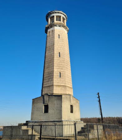
Bol'shoy Volzhskiy Light
Bol'shoy Volzhskiy Light, Dubna, July 2008
ex-Panoramio Creative Commons photo by Andrey Zakharov

Moskva Oblast (Moscow River and Dubna Locks) Lighthouses

The Moscow Canal was built with prison labor in 1932-37. The waterway is 128 km (80 mi) long, extending from Tushino near Moscow to Dubna on the upper Volga. The canal passes through several reservoirs that provide the water supply for the city.

Moscow City Lighthouses
Moskva Shluzy
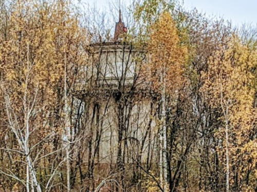
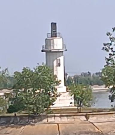
Date unknown. Active (?); focal plane about 16 m (52 ft); continuous green light. Approx. 12 m (39 ft) round cylindrical concrete tower. The light is (or was) probably shown through a rectangular opening near the top of the tower. Dim Federov has a closeup photo, Aleksey Lukhmenev has a 2020 view from the river, Mitriy Pankratov has the view from the river seen at right, another photo (halfway down the page) is available, and Google has a satellite view. Shluzy ("gateway") is the name given by Google to an island in the Moscow River on the south side of Moscow. The lighthouse carried a directional light guiding vessels headed downstream to a lock gate just north of the tower. It is now hidden in vegetation. Located at the west end of the island. Site status unknown.
* Alye Parusa (Scarlet Sails) Yacht Club
Date unknown. Active; focal plane about 22 m (72 ft); light characteristic unknown. Approx. 23 m (75 ft) round brick (?) tower with lantern and gallery. The tower is white with narrow red horizontal bands. Lantern painted black. Andrei Mischouk has a 2016 photo and Google has a street view and a satellite view. The lighthouse is part of a large condo development. Located on the east side of the Moscow River just below the Stroginskiy boulevard bridge in the Shchukino district of northwest Moscow. Site open, tower status unknown. Owner/site manager: Yaht-Klub Alye Parusa.

Moskva Shluzy Light, Moscow, April 2007
Google Maps photo by Mitriy Pankratov

Dubna Area Lighthouses
The Dubna Dam on the upper Volga, completed in 1937, created the large Ivankovo Reservoir, known informally as the Moscow Sea (Moskovskoe More). The reservoir is the principal source of water for the Moscow metropolitan area. The Moscow Canal and Volga Waterway have a joint entrance at the south end of the dam, about 1 km (0.6 mi) west of the Dubna Lock on the Volga.
* Bol'shoy Volzhskiy (Great Volga) (Range Rear)
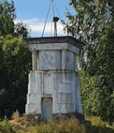
Date unknown (1937?). Active; flashing red light. 20 m (66 ft) octagonal stone tower with gallery, mounted on a square stone base. The lighthouse is unpainted. Andrey Zakharov's photo is at the top of this page, Lightphotos.net has a photo by Alexandr Melnikov, Pavel Dergachev has a 2017 photo, Natalia Pinchukova has a nice photo, and Google has a street view and a satellite view. This lighthouse is a rear range light for vessels crossing the Ivankova Reservoir; the Mal'yy Volzhskiy light (next entry) is the front light. Located on the east side of the Moscow Canal about 700 m (0.4 mi) south of the entrance. Site open, tower closed.
* Mal'yy Volzhskiy (Little Volga) (Range Front)
Date unknown (1937?). Active; focal plane about 11 m (36 ft); continuous red light. Approx. 6 m (20 ft) square masonry tower. Andrey Larin has a 2020 photo and Google has a satellite view and a very distant street view. Located at the end of an earthen jetty on the west side of the entrance to the Moscow Canal and Volga waterway from the Ivankovo Reservoir. Site apparently open, tower closed.
* Dubna Lock Upper Entrance North
Date unknown (1937?). Active; flashing green light. Approx. 7 m (23 ft) octagonal tower mounted on a large square concrete base. Andrey Zakharov's photo is at right, Maria Shchelkunova has a closeup 2021 photo, Oleg Smirnov has a street view, and Google has a satellite view. Mikhail Kobzar's 2018 closeup shows that the actual light is a neon panel. This lighthouse stands at the end of the north jetty at the entrance to the Moscow Canal and Volga waterway from the Ivankovo Reservoir, near the Dubna Dam. Site apparently open, tower closed.
Dubna Lock Upper Entrance South
Date unknown (1937?). Active; flashing red light. Approx. 7 m (23 ft) hexagonal tower mounted on a large square concrete base. Alexander Kuznetsov has a distant view across the entrance and Google has a satellite view. This lighthouse stands at the end of the south jetty at the junction of the Moscow Canal and Volga waterway. May be accessible only by boat. Site status unknown.
* Dubna Lock Lower Entrance
Date unknown (1937?). Inactive. Ruined octagonal tower mounted on a large square brick base. No photo available but Bing has a satellite view. This light is a twin of the Upper Entrance North Light. Located on the south side of the Volga Waterway about 1 km (0.6 mi) east (below) the Dubna Lock.
Dubna North Light
Dubna Lock Upper Entrance North Light, August 2009
ex-Panoramio Creative Commons photo by Andrey Zakharov

Upper Volga River Lighthouses

Nizhny Novgorod Oblast Lighthouses
Completed in 1957, the Gorky Dam continues to bear the Soviet-era name of the city of Nizhny Novgorod, which is located about 50 km (30 mi) downstream from the dam. The dam is actually at the city of Gorodets. The lake it creates extends 430 km (267 mi) upstream to Rybinsk. Two locks are required for ships to bypass the dam.

Gorodets (Gorky, Nizhny Novgorod) Locks Upper Entrance North
1957. Active; continuous green light. 10 m (33 ft) square concrete tower, wider at the top, with a lantern/observation room. Tower painted white, observation room brown. A distant 2018 photo (this light is in the right distance) shows the lighthouse nicely restored, Andreas Hofer has a distant street view and Google has a satellite view. Located at the end of the north mole sheltering the locks, at the city of Gorodets. Accessible only by boat (the mole is detached from shore). Site status unknown.
Gorodets (Gorky, Nizhny Novgorod) Locks Upper Entrance South
1957. Active; continuous red light. 10 m (33 ft) square concrete tower, wider at the top, with a lantern/observation room. Tower painted white, observation room brown. Lightphotos.net has a photo by Dmitry Shchukin, Andreas Hofer has a distant street view, and Google has a satellite view. A 2018 photo and Alena Romanicheva's 2019 photo (also seen at right) show the lighthouse nicely restored. Located at the end of the south mole sheltering the locks, at the city of Gorodets. This mole does not appear to be walkable. Site status unknown.
* Gorodets (Gorky, Nizhny Novgorod) Locks Lower Entrance
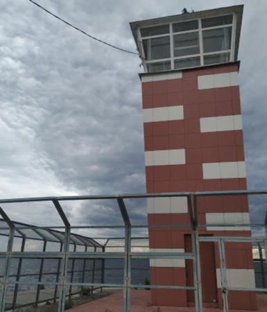
1957. Active; continuous red light. 10 m (33 ft) square concrete tower, wider at the top, with a lantern/observation room. Tower painted red with white trim. A 2014 street view by Sergey Zamudryakov shows the lighthouse restored and with its new red color. Google has a satellite view. Located on the west side of the entrance to the channel leading to the locks. This site appears to be accessible. Site probably open, tower closed.

Chuvash Republic Lighthouses
Cheboksary Locks Upper Entrance North
Mid 1980s. Active (?); continuous green light. Round cylindrical tower painted with black and white horizontal bands. Lightphotos.net has Alexandr Melnikov's photo and Google has a satellite view and a distant street view. Completed in 1986, the Cheboksary Dam is the last of the great Soviet hydroelectric projects on the river. The lighthouse is at the end of the mole on the west (upstream) end of the entrance to the locks at Novocheboksarsk. Site status unknown.

Gorodets Locks Upper Entrance South Light, June 2019
Google Maps photo by Alena Romanicheva
* Cheboksary Locks Upper Entrance South
Mid 1980s. Inactive. Round cylindrical tower painted with black and white horizontal bands. Google has a street view and an indistinct satellite view. Located onshore on the south side of the entrance to the locks at Novocheboksarsk. Site apparently open, tower closed.
Cheboksary Locks Lower Entrance North
Mid 1980s. Active(?); continuous white light. Round cylindrical tower painted with black and white horizontal bands. Mikhail Muravyev has a distant street view and Google has a satellite view. The lighthouse is at the end of the mole on the east (downstream) end of the entrance to the locks at Novocheboksarsk. Site status unknown.
 

Kama River Lighthouses

The Kama River is the largest tributary on the east side of the Volga and a major river in its own right; in fact, at the confluence of the two rivers the Kama has the greater flow.

Permskiy Krai Lighthouses
Perm Locks Upper Entrance
1956(?). Active; flashing red light. Approx. 9 m (30 ft) square concrete tower painted white. No photo available but Google has a satellite view. Located at the end of the main (west) breakwater protecting the entrance to the locks from the Kama (Perm) Reservoir at Perm. Site status unknown.
* Perm Locks Lower Entrance
1956(?). Active; flashing red light. Approx. 6 m (20 ft) octagonal concrete tower painted white with a red band at the top. Lightphotos.net has a photo and Google has a satellite view and a distant street view. Located on the west side of the lower entrance to the locks at Perm. Site open, tower closed.
Chaykovskiy Lock Upper Entrance
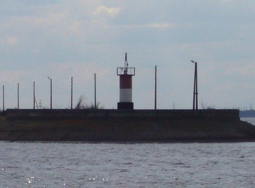
1964. Active; flashing red light. Approx. 5 m (17 ft) round cylindrical concrete tower. Upper half of the tower painted red (possibly black), lower half white. Tanya Dedyukhina's 2010 photo is at right and Google has a satellite view. Located in Chaykovskiy at the end of a long curved breakwater protecting the entrance to the lock from the Votkinsk Reservoir. Site status unknown.
Chaykovskiy Lock Lower Entrance
1964(?). Active; flashing red light. Approx. 5 m (17 ft) round cylindrical concrete tower. Upper half of the tower painted red (possibly black), lower half white. No photo available but Google has an indistinct satellite view. Located in Chaykovskiy on the east side of the lower entrance to the lock. Site status unknown.

Tatarstan Republic Lighthouses
Naberezhnye Chelny Lock Upper Entrance
Around 1980. Active; flashing red light. Approx. 8 m (26 ft) round strongly conical six-legged white concrete tower. Lightphotos.net has a photo by Evgeny Kuibyshev and Google has a satellite view and a very distant street view. Located at the east (upstream) end of the breakwater protecting the lock entrance at the Nizhnekamsk (Lower Kama) dam near Naberezhnye Chelny. Site status unknown.

Chaykovskiy Lock Upper Entrance Light, May 2010
ex-Panoramio Creative Commons photo by Tanya Dedyukhina
Naberezhnye Chelny Lock Lower Entrance
Around 1980. Active; flashing red light. Approx. 8 m (26 ft) round strongly conical six-legged white concrete tower. No photo available but Google has a satellite view and a distant street view. The locks carry vessels around the Nizhnekamsk (Lower Kama) Dam. Located at the west (downstream) end of the breakwater protecting the lock entrance at Naberezhnye Chelny. Site status unknown.

Lower Volga River Lighthouses

Samara Oblast Lighthouses
The Kuybyshev Dam, completed in 1957, pools the largest reservoir in Europe, known informally as the Kuybyshev Sea. The dam is actually located between the cities of Zhigulovsk and Tol'yatti (Togliatti). The two pairs of locks are located on the north side of the river in Tol'yatti.

Zhiguli (Kuybyshev, Tol'yatti) Outer Breakwater (1)
1957. Inactive. Approx. 15 m (49 ft) square white concrete tower. Lightphotos.net has Konstantin Poddybnyy's photo; it shows that the light (flashing green light) was moved to a post painted with black and white bands. Google has a fuzzy satellite view. Located at the south end of a detached breakwater. Accessible only by boat. Site probably open, tower closed.
* Zhiguli (Kuybyshev, Tol'yatti) Locks Upper Entrance (Volnolom)
1957. Active (?); flashing red light. Approx. 17 m (56 ft) round unpainted tower with gallery, upper half concrete and lower portion brick, mounted on a square 2-story red brick base. Aleksey Kouzmenko's photo is at right, Lightphotos.net has Dmitry Shchukin's photo, a 2023 view from the lake is available, and Google has an indistinct satellite view. Formerly in very poor condition, this lighthouse has been restored in recent years and may be back in service. Located at the end of the mole sheltering the lock entrance at Tol'yatti. Accessible by walking the mole; there are also excellent views from shore and from ships navigating the river. Site open, tower closed.

Saratov Oblast Lighthouse
* Balakovo Locks Upper Entrance
Late 1960s. Active; continuous green light. Round cylindrical tower mounted on a square concrete base. The tower also carries a square daymark panel. A photo is available, Kirill Mikheev has a closeup street view, and Google has a satellite view. Completed in 1967, the Saratov Dam is one of the last of the great hydroelectric projects on the river. The locks are not at the dam but on a side channel of the river. The lighthouse is at the end of the mole on the north side of the entrance to this channel, on the north side of the city of Balakovo. Accessible by walking the mole (the adjoining area appears to be a park). Site open, tower closed.

Tol'yatti Locks Upper Entrance Light, March 2018
Google Maps photo by Aleksey Kouzmenko

Volgograd Oblast Lighthouses
The Volgograd Dam forms a huge reservoir north of the city of Volgograd (known as Tsaritsyn under the tsars and as Stalingrad from 1925 to 1961 during the Soviet era). Ordered by Stalin in 1950, it is one of the largest public works projects of the Soviet era. Completed in 1961, the dam is nearly 4 km (2.5 mi) long and has a height of 47 m (154 ft). As at all the dams on the Volga, the dam is equipped with double locks with a length of 290 m (950 ft).

* Volgograd Locks Upper Entrance East
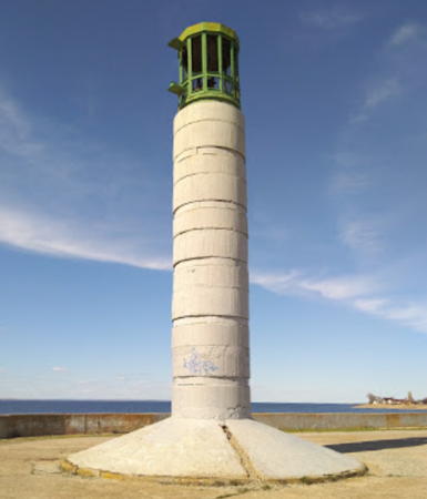
1960 (?). Active; flashing green light. Approx. 20 m (66 ft) round concrete tower with lantern. The lighthouse is unpainted with narrow green bands, and the lantern is green metallic. Nikita Bobrovsky has a closeup photo, Sergey Teshov also has a closeup, and Google has a satellite view. The lighthouse is at the end of the east mole, one of two moles sheltering the lock basin at the southeastern corner of the reservoir. Site open, tower closed.
Volgograd Locks Upper Entrance West
1960 (?). Active; flashing red light. Approx. 20 m (66 ft) round concrete tower with lantern. The lighthouse is unpainted with narrow red bands, and the lantern is red metallic. Aleksey Seykin's photo is at right, a 2021 photo is available, Ilya Petrin has a view from the lake, and Google has a satellite view. The lighthouse is at the end of the west mole. Site status unknown; there are excellent views from shore and from ships navigating the river.
* Volgograd Locks Lower Entrance
1960(?). Active (?); continuous red light. Approx. 12 m (39 ft) square skeletal tower mounted atop a round concrete tower. The lighthouse is unpainted; lantern is red metallic. Sergey Khristoforov has a photo, Sergey Lato has a 2018 photo, Evgeny Lokhmatov has a closeup street view, and Google has a satellite view. Located on the west side of the entrance to the canal leading to the locks on the downstream side of Volgograd Dam. Site open, tower closed.
Volgograd Locks Upper Entrance West Light
Volgograd Locks Upper Entrance West Light, July 2006
ex-Panoramio photo copyright Aleksey Seykin; used by permission

Volga-Don Canal Lighthouses

Completed in 1952, the Volga-Don Canal is 101 km (63 mi) long. It links the long Volga River waterway to the lower Don River, which flows into the Black Sea; in this way it provides a connection between the Mediterranean and Black Seas and the landlocked Caspian Sea. A large part of the waterway runs through the Tsimlyansk Reservoir, created by damming the Don River. The waterway has a design depth of 3.5 m (11.5 ft) and has 13 single-chamber locks.

Volgograd Oblast Lighthouses
* Volga-Don Canal East Entrance
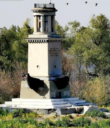
1953 (R. Yakubov). Inactive. 26 m (85 ft) square concrete tower with a round, colonnaded chamber topped by a gallery. The lighthouse is unpainted concrete. The photo at right is from a Russian article on the canal, a 2008 photo is available, Lightphotos.net has a photo, a Soviet postage stamp featured the lighthouse when it was completed in 1953, Alexey Chebotarev has a midwinter lake view, and Google has a satellite view. The tower was built to honor Volga sailors who fought to protect the city during the Russian Revolution in 1918-19 and during the epic Battle of Stalingrad in 1942-43 during World War II. Located at the tip of a forested peninsula on the south side of Volgograd and the west side of the entrance from the Volga to the Volga-Don Canal. Site open; it is not known if the tower is ever open.
* Chervlenoye
1953. Active; flashing green light. Approx. 7 m (23 ft) square unpainted concrete block tower. No photo available but Google has a satellite view. Located on the south side of the canal at the junction with a creek at Chervlenoye, about 30 km (19 mi) east of the eastern entrance to the canal. Site open, tower closed.
Gornyy Lock Upper Entrance
1953. Active; flashing red light. Approx. 7 m (23 ft) square unpainted concrete block tower. No photo available but Google has a satellite view. Located on the east side of the canal entrance to the locks of the Varavarovsk Dam near Gornyy. Site status unknown.
Gornyy Lock Lower Entrance North
1953. Active; flashing red light. Approx. 7 m (23 ft) square unpainted concrete block tower. No photo available but Google has a satellite view. This light and the next one frame the eastbound exit of the canal from the Bereslavsk Reservoir. Located on the north side of the canal near Gornyy. Site status unknown.
Gornyy Lock Lower Entrance South
1953. Active; flashing green light. Approx. 7 m (23 ft) square unpainted concrete block tower. No photo available but Google has a satellite view. Located on the south side of the canal near Gornyy. Site status unknown.
* Bereslavka North
1953. Active (?); flashing red light. Approx. 7 m (23 ft) square unpainted concrete block tower. No photo available but Google has a satellite view. This light and the next one frame the westbound exit of the canal from the Bereslavsk Reservoir. Located on the north side of the canal near the Bereslavsk Dam. Site open, tower closed.

Volga-Don Canal East Entrance Light
photo copyright vetert.ru
non-commerical use permitted with attribution
* Bereslavka South
1953. Active (?); flashing green light. Approx. 7 m (23 ft) square unpainted concrete block tower. No photo available but Google has a satellite view. Located on the south side of the canal near the Bereslavsk Dam. Site open, tower closed.
* Oktyabrskiy Range Front
1953. Active; continuous red light. Approx. 7 m (23 ft) square unpainted concrete block tower. Yuri Medvedev has a closeup photo and Google has a satellite view. The range guides vessels across the upper portion of the Tsimlyansk Reservoir. Located on the north side of the canal at a bend of the river a short distance west of a lock at Oktyabrskiy, near the midpoint of the canal. Site open, tower closed.
Oktyabrskiy Range Rear
1953. Active; continuous red light. Approx. 20 m (66 ft) skeletal tower carrying a large rectangular daymark. No photo available but Google has an indistinct satellite view. Located about 2 km (1.25 mi) east of the front light. Site status unknown.
Karpovka Locks Upper Entrance
1953. Active; flashing green light. Approx. 15 m (49 ft) square concrete tower. The lighthouse is unpainted concrete. Alex Hrom has a photo and Google has a satellite view. Located on the south side of the entrance to the locks from the Karpovka reservoir, about 5 km (3 mi) east of the Karpovskoe Dam. Site status unknown.
Volga-Don Canal West Entrance North
1953. Active; flashing red light. Approx. 18 m (59 ft) square concrete tower with a round, colonnaded chamber topped by a gallery. The lighthouse is unpainted concrete. Lightphotos.net has Alexandr Melnikov's photo, Vladimir Zhukov has a closeup photo, and Google has a satellite view. This tower marks the place where eastbound vessels leave the Tsimlyansk Reservoir and enter the canal to the Volga. Located at the end of the long north mole of the lower entrance channel to the locks, south of the town of Kalach-na-Donu. Site status unknown.
Volga-Don Canal West Entrance South
1953. Active; flashing green light. Approx. 18 m (59 ft) square concrete tower with a round, colonnaded chamber topped by a gallery. The lighthouse is unpainted concrete. Vladimir Zhukov has a photo, Roman Kobylkin has a 2017 view from the lake, and Google has a satellite view. This tower is located on the east side of the Tsimlyansk Reservoir about 1.2 km (3/4 mi) south of the north light (previous entry); it serves as a leading light for vessels approaching the canal. Site status unknown.

Oktyabrskiy Range Front Light, Oktyabrskiy, April 2013
Google Maps photo by Yuri Medvedev

Don River Lighthouses

Rostov Oblast Lighthouses
Volgodonsk Breakwater East
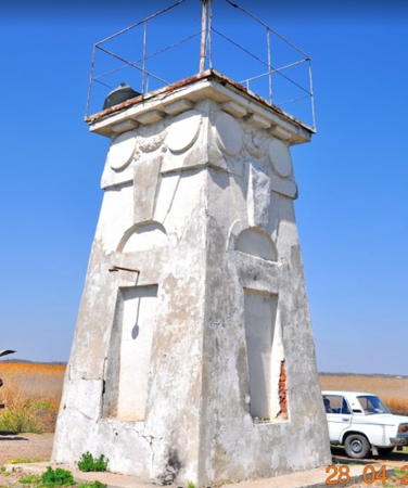
1953. Active; flashing green light. Approx. 26 m (85 ft) square concrete tower with a round, colonnaded chamber topped by a gallery. The lighthouse is unpainted concrete. Aleksey Litovchenko's photo is at right, a 2018 photo is available, Huelse has a historic postcard view, and Google has a satellite view. Located at the north end of the detached breakwater sheltering the upper entrance to the locks of the Tsimlyansk Dam at Volgodonsk. Accessible only by boat. Site open, tower closed.
Volgodonsk Breakwater West
1953. Active; flashing red light. Approx. 6 m (20 ft) square cylindrical concrete tower with red pyramidal roof. The lighthouse is unpainted concrete. Sergey Artyukhov has a photo, Andrey Overin has a closeup, and Google has a satellite view. Located at the east end of the west breakwater sheltering the upper entrance to the locks of the Tsimlyansk Dam at Volgodonsk. Accessible only by boat. Site open, tower closed.
Volgodonsk Locks Lower Entrance
1953. Active; flashing red light. Approx. 26 m (85 ft) square concrete tower with a round, colonnaded chamber topped by a gallery. The lighthouse is unpainted concrete. Nikolay Martynov has a 2021 photo, a view from the river is available, and Google has a satellite view. Located on the north side of the lower entrance to the channel leading to the locks of the Tsimlyansk Dam at Volgodonsk. Site status unknown.
Nikolayevsk Locks Upper Entrance
Date unknown. Active; flashing green light. Approx. 5 m (17 ft) round cylindrical white concrete tower centered on a round concrete pier. No photo available but Google has a satellite view. Located in the river just off the entrance to the lock channel at Nikolaevskaya. Accessible only by boat. Site open, tower closed.

Volgodonsk Locks Breakwater East Light, September 2011
ex-Panoramio Creative Commons photo by Aleksey Litovchenko
Nikolayevsk Locks Lower Entrance
Date unknown. Active; flashing green light. Approx. 7 m (23 ft) 2-stage round cylindrical white concrete tower. Andrey Gubachev has a photo and Bing has a distant satellite view. Located on the south side of the entrance to the lock at Nikolaevskaya. Site and tower closed.
Konstantinovsk Locks Upper Entrance
Date unknown. Active; continuous green light. Approx. 6 m (39 ft) white concrete tower. No photo available but Bing has a satellite view. Located at the on the south side of the upper entrance to the lock channel at Konstantinovsk. Site open, tower closed.
* Konstantinovsk Locks Lower Entrance
Date unknown. Active; continuous green light. Approx. 12 m (39 ft) round cylindrical unpainted stone tower. No photo available but Bing has a satellite view. Located the south side of the the lower entrance to the lock channel at Konstantinovsk. Site open, tower closed.

Information available on lost lighthouses:

Notable faux lighthouses:

Adjoining pages: North: Lake Onega | Southeast: Russia Caspian Sea | South: Russia Eastern Black Sea

Return to the Lighthouse Directory index | Ratings key

Posted February 26, 2007. Checked and revised August 9, 2023. Lighthouses: 43. Site copyright 2023 Russ Rowlett and the University of North Carolina at Chapel Hill.