Lighthouses of Western Saudi Arabia

The Kingdom of Saudi Arabia occupies the majority of the Arabian Peninsula and has two coastlines: a long west coast on the Red Sea and a shorter east coast on the Persian Gulf. Following the collapse of the Ottoman (Turkish) Empire at the end of World War I, a complicated series of wars led in 1932 to the unification of the country, named for its founder King Abdul Aziz ibn Saud.

Saudi Arabia is divided into 13 regions. This page describes lighthouses in the six regions facing the west coast. Jeddah, on the central portion of the coast, is the most important port and the gateway to the holy city of Mecca. Other ports include Dhiba, Yanbu and Jīzān.

Very little Internet information is available on the navigational aids of the kingdom. Jeddah has a light on the spectacular harbor control tower shown at right, but most of the other known lights are on islands or reefs offshore.

The Arabic word for a lighthouse is mnarh or manara (منارة). Ra's is a cape, jazīrat is an island, minā is a harbor, and shi'b is a reef.

Lighthouses in Saudi Arabia are maintained by the Saudi Ports Authority.

ARLHS numbers are from the ARLHS World List of Lights. Lights of the Red Sea were formerly included in volume E of the Admiralty List of Lights & Fog Signals, but in 2013 they were moved to volume D with new numbers. U.S. NGA List numbers are from Publication 112.

General Sources
Lightphotos.net - Saudi Arabia
Photos by various photographers available from Lightphotos.net.
Lighthouses in Saudi Arabia
Photos by various photographers available from Wikimedia.
Online List of Lights - Saudi Arabia
Photos by various photographers posted by Alexander Trabas.
GPSNauticalCharts
Navigational chart information for the Red Sea.
Navionics Charts
Navigation chart for the Red Sea.

Jeddah Light
Jeddah Light, Jeddah, August 2010
photo by Vadym Gavrykov (no longer online)

Jīzān Region Lighthouses
South Mazarkiff (Mazakif, Masaqif)
Date unknown. Active; focal plane about 20 m (66 ft); three white flashes every 12 s. Approx. 20 m (66 ft) post with a "red tripod daymark," according to NGA, mounted on a triangular platform supported by piles. No photo available but Bing has a satellite view of the platform. South Mazarkiff is a small island near the southern end of Farasān Island, the largest island of the Farasān group. Located just off the south end of the island, about 40 km (25 mi) southwest of Jīzān. Accessible only by boat. Site open, tower closed. Admiralty D7299.6 (ex-E6138.6); NGA 30788.
Jīzān (Jazan) Harbor Range Front
Date unknown. Active; focal plane about 13 m (46 ft); quick-flashing red light. Approx. 11 m (36 ft) tripod tower painted wth red and white horizontal bands and carrying a triangular slatted daymark, point up. Youssef Zaki has a distant view (tower is just to the left of the cranes), Salem Ahmed has a street view, and Google has a satellite view. Located at the base of the breakwater in Jīzān. Site open, tower closed. Admiralty D7299.74 (ex-E6138.7); NGA 30756.
* Jīzān (Jazan) Harbor Range Rear
Date unknown. Active; focal plane about 22 m (72 ft); red flash every 2 s. Approx. 15 m (49 ft) tripod tower, painted wth red and white horizontal bands and carrying a triangular slatted daymark, point down. Y. Rahal has the street view seen at right and Google has a satellite view. Located in Jīzān beside King Fahad Road, 300 m (0.2 mi) east of the front light. Site open, tower closed. Admiralty D7299.741 (ex-E6138.71); NGA 30760.
Jīzān (Jazan) Commercial Port Range Front
2018. Active; focal plane unknown; flashing blue light. Approx. 15 m (49 ft) skeletal tower carrying a large daymark. No photo available but Google has a satellite view. Located in a new port north of the traditional port. Site status unknown. Admiralty D7299.577.
Jīzān (Jazan) Commercial Port Range Rear
2018. Active; focal plane unknown; flashing blue light. Approx. 30 m (98 ft) skeletal tower carrying a large daymark. No photo available but Google has a satellite view. Located 300 m (0.2 mi) east of the front light. Site status unknown. Admiralty D7299.578.
Ghurāb (North Ghurāb)
Date unknown. Inactive since 2019. Described by NGA as a "red beacon." No photo available; Bing's satellite view shows a large tripod structure. Note: There is a much better known Ghurāb Island south of Jeddah. Located off the south side of an island at the northern end of the Farasān group, about 65 km (40 mi) northwest of Jīzān. Accessible only by boat. Site open, tower closed. ex-Admiralty D7299.58 (ex-E6138.4); NGA 30752.

Jīzān Harbor Light, Jīzān, January 2021
Google Maps street view by Y. Rahal
Al Baghlah
Date unknown. Active; focal plane 12 m (39 ft); white flash every 4 s. 12 m (39 ft) tripod tower mounted on a triangular platform. Lighthouse painted white. No photo available but Google has a satellite view. This light marks the northeastern corner of the dangerous Farasān reef complex. Located about 120 km (75 mi) west northwest of Jīzān. Accessible only by boat. Site and tower closed. Admiralty D7299.56 (ex-E6138.1); NGA 30744.

Makkah (Mecca) Region: Jeddah Area Lighthouses
Shi'b Mismārī (Mismari Reef)
Date unknown. Active; focal plane 14 m (46 ft); three flashes every 15 s, white or red depending on direction. 14 m (46 ft) skeletal (?) tower, painted white, mounted on a triangular concrete pier. The tower carries a black rectangular daymark. No photo available but Google has a satellite view. A 1922 sailing guide for the Red Sea mentions a beacon on this reef. Located on a dangerous reef about 30 km (19 mi) southwest of Jeddah. Accessible only by boat. Site and tower closed. Admiralty D7299.55 (ex-E6057); NGA 30548.
Shi'b Qaham (Gaham Reef)
Date unknown. Active; focal plane 14 m (46 ft); flash every 2.5 s, white, red or green depending on direction. 14 m (46 ft) "structure" carrying a black rectangular daymark and mounted on a square platform. No photo available but Google has a satellite view. A 1900 sailing guide for the Red Sea describes a "white stone beacon surmounted with a staff and globe" on this reef. Located on the north point of a reef about 4 km (2.5 mi) southwest of the Jeddah control tower (next entry). Accessible only by boat. Site and tower closed. Admiralty D7299.504 (ex-E6055.2); NGA 30572.
Jeddah (Jedda, Jiddah)
Date unknown. Active; focal plane 137 m (450 ft); three white flashes every 20 s. Approx. 133 m (436 ft) concrete and steel tower with gallery, carrying a large, spherical building. Entire lighthouse is white. Vadym Gavrykov's photo appears at the top of this page, Priyankara Bamunu Arachchi has a 2023 photo, Lightphotos.net has a photo, Praba Karan has a closeup of the tower at night, the lighthouse also appears in the background of Wikimedia's photo of Jeddah Harbor, and Google has an excellent satellite view. This remarkable and beautiful tower is the harbor control tower for Jeddah. Although it is not a lighthouse in the traditional sense of having been built primarily as an aid to navigation, it has a credible claim to be the world's tallest light tower. It dwarfs the 106 m (348 ft) Yokohama Marine Tower in Japan, which is widely claimed to be the world's tallest. It is located at the end of the outer pier on the north side of the entrance to Jeddah's modern harbor (south of the traditional harbor). Site status unknown. ARLHS SAU-003; Admiralty D7299.509 (ex-E6054.5); NGA 30554.
Shi'b Jahân
Date unknown. Active; focal plane 14 m (46 ft); flash every 5 s, white, red or green depending on direction. 14 m (46 ft) "structure" carrying a red rectangular daymark and mounted on a square platform. No photo available but Google has an indistinct satellite view. Located on the south point of a reef about 2.5 km (1.5 mi) northeast of the Jeddah control tower (previous entry). Accessible only by boat. Site and tower closed. Admiralty D7299.503 (ex-E6054.6); NGA 30576.
Shi'b al Kabīr (Eliza Shoals Southwest)
Date unknown. Active; focal plane 14 m (46 ft); flash every 10 s, white, red or green depending on direction. 14 m (46 ft) tripod tower, painted white with a red horizontal band and mounted on a square platform. No photo available but Bing has a satellite view. Located on a reef in the Red Sea about 40 km (25 mi) northwest of Jeddah. Accessible only by boat. Site and tower closed. Admiralty D7299.42 (ex-E6054); NGA 30604.

Makkah (Mecca) Region: King Abdullah City Lighthouse
Shi'b Nazar
Date unknown. Active; focal plane probably about 20 m (66 ft); white flash every 7 s. Approx. 20 m (66 ft) skeletal tower mounted on a platform. No photo available but Bing's indistinct satellite view probably shows the light. This light guides ships toward the King Abdullah Economic City, a development being built about 100 km (60 mi) north of Jeddah. Located at the south end of a long reef about 50 km (30 mi) southwest of the new city. Accessible only by boat. Site and tower closed. Admiralty D7299.194; NGA 30545.9.
Qita' al Kirsh
Date unknown. Active; focal plane unknown; green flash every 10 s. No description available but Bing has a distant satellite view of the platform of the tower. Located on the east side of a reef about 25 km (15 mi) southwest of the new city. Accessible only by boat. Site and tower closed. Admiralty D7299.199 (ex-E6053.69); NGA 30545.93.

Makkah (Mecca) Region: Rabigh Area Lighthouses
Shi'b al Khamsa
Date unknown. Active; focal plane 20 m (66 ft); white flash every 5 s. 20 m (66 ft) tower, upper half painted yellow, lower half black. No photo available but Bing's fuzzy satellite view probably shows the light. This light guides ships toward Rabigh, a city 170 km (105 mi) north of Jeddah that includes an oil refinery and petrochemical complex. Located on a reef in the Red Sea about 175 km (110 mi) north of Jeddah and a similar distance south of Yanbu. Accessible only by boat. Site and tower closed. Admiralty D7299 (ex-E6053); NGA 30536.
Shi'b al Bayda (al Abiyadh)
Date unknown. Active; focal plane 12 m (39 ft); six quick white flashes followed by one long white flash every 15 s. 12 m (39 ft) "column," upper half painted yellow, lower half black. No photo available but Bing's fuzzy satellite view shows the light. Located at the south end of a dangerous reef about 15 km (9 mi) west of Rabigh. Accessible only by boat. Site and tower closed. Admiralty D7299.01 (ex-E6053.2); NGA 30540.

Madinah (Medina) Region Lighthouses
Yanbu South
Date unknown. Active; focal plane 32 m (105 ft); flash every 10 s, white or red depending on direction. 32 m (105 ft) round metal tower, painted with red and white horizontal bands. No photo available but Google has a satellite view. This lighthouse marks the start of a long southern approach channel to the port of Yanbu. Located on a reef in the Red Sea about 13 km (8 mi) offshore and about 65 km (40 mi) south southeast of Yanbu. Accessible only by boat. Site and tower closed. Admiralty D7298.995 (ex-E6052.5); NGA 30512.
King Fahd (Yanbu Industrial) Port Range Rear
Date unknown. Active; focal plane about 16 m (52 ft); white light, 3.5 s on, 3.5 s off. Approx. 16 m (52 ft) robust post with a lower gallery and a slatted daymark. Daymark painted black with a white vertical stripe. Lightphotos.net has a photo and Google has a satellite view. This is a final approach range for Yanbu's general cargo port. The front light is on a similar, shorter tower. Located on a reef about 400 m (1/4 mi) off the waterfront. Accessible only by boat. Site status unknown. Admiralty D7298.651 (ex-E6049.61); NGA 30511.2.
Shi'b ash-Sharm (Schermo Reef)
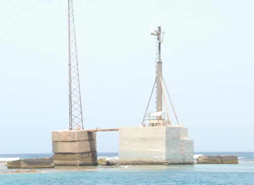
Date unknown. Active; focal plane 10 m (33 ft); white flash every 5 s. Fog horn (4 s blast every 20 s). 10 m (33 ft) mast and a small equipment building mounted on a concrete base. Entire lighthouse is white. A photo is at right and Google has a satellite view. This light marks the northern entrance to Yanbu. Located on a dangerous reef about 25 km (15 mi) west of Yanbu. Accessible only by boat. Site and tower closed. Admiralty D7298.45 (ex-E6048.8); NGA 30496.
Shi'b ash-Sharm Light
Shi'b ash-Sharm Light, September 2007
ex-Panoramio photo copyright blend buena; used by permission

Tabuk Region Lighthouses
Jazā'ir Şila (Sila Islands)
Date unknown. Active; focal plane 15 m (49 ft); white flash every 12 s. Approx. 13 m (43 ft) concrete post with gallery, mounted on a concrete base. No photo available but Google has a satellite view. Located on a reef in the northern Red Sea, about 25 km (15 mi) west of Al Muwaylih and 150 km (90 mi) east of Sharm el-Sheikh at the southern tip of the Sinai Peninsula. Accessible only by boat. Site status unknown. Admiralty D7298.33 (ex-E6046.5); NGA 30470.
Ash Sharma Range Rear
Date unknown. Active; focal plane unknown; quick-flashing white light. Approx. 20 m (66 ft) square or triangular cylindrical skeletal tower carrying a slatted daymark. No photo available but Google has a satellite view. Ash Sharma is a small petroleum port in on the northwestern Saudi coast. The front light is apparently on the pier of the port. Located about 300 m (0.2 mi) northwest of the pier. Site status unknown. Admiralty D7298.321 (ex-E6046.1); NGA 30469.7.

Strait of Tīrān Lighthouses
The Strait of Tīrān is the entrance to the Gulf of Aqaba. Tīrān Island, a large island partly blocking the entrance, was administered by Egypt from 1906 but in 2016 Egypt agreed to transfer the island to Saudi Arabia. Although a judge ruled against the transfer it was ratified by the Egyptian parliament in June 2017 and the transfer took place in July. Egypt and Saudi Arabia have also agreed to the construction of a causeway and bridge across the Strait.

Chisholm Point
Date unknown. Active; focal plane 12 m (39 ft); three white flashes, in a 2+1 pattern, every 20 s. 10 m (33 ft) round hourglass-shaped fiberglass tower mounted on a square concrete base. Entire lighthouse is white. No photo available but Google has a satellite view. Located on the southwestern tip of Tīrān Island, a large island partly blocking the entrance to the Strait of Tīrān and the Gulf of Aqaba. The island had been administered by Egypt since 1906, but in 2016 Egypt agreed to transfer the island to Saudi Arabia. Although a judge ruled against the transfer, it was ratified by the Egyptian parliament in June 2017 and implemented in July 2017. Accessible only by boat. Site open, tower closed. Admiralty D7297.65 (ex-E6040.3); NGA 30422.
Johnson Point
Date unknown. Active; focal plane 9 m (30 ft); two green flashes every 5 s. 9 m (30 ft) round hourglass-shaped green fiberglass tower mounted on a square concrete base. Ophir Baer has a 2023 photo and Google has a satellite view. This light marks the east side of the entrance to the Grafton Passage. Note: This light and the next one are now in Saudi waters following the transfer of Tīrān Island but they were maintained historically by Egypt. Located at the edge of the reefs off Johnson Point, the western tip of Tīrān Island. Accessible only by boat. Site open, tower closed. Admiralty D7297.71 (ex-E6040.74); NGA 30424.4.
Jackson Reef
Date unknown. Active; focal plane 9 m (30 ft); two red flashes every 5 s. 9 m (30 ft) round hourglass-shaped red fiberglass tower mounted on a square concrete base. Alexey Svetlichny has a photo, Martin Skulínek has a more distant photo, the light is at the far right in Anton Shustov's distant view, and Google has a satellite view. The Strait of Tīrān is about 5 km (3 mi) wide between the Sinai mainland and Tīrān Island, but a series of reefs arranged diagonally, southwest to northeast, block a large part of the strait. Northbound vessels use the Grafton Passage, a narrow channel between the reefs and Tīrān Island. This light is located at the northeast end of the reefs, marking the west side of the exit from the Grafton Passage. Accessible only by boat. Site open, tower closed. Admiralty D7297.72 (ex-E6040.72); NGA 30424.2.
 

Johnson Point Light, Strait of Tīrān, August 2023
Google Maps photo by Ophir Baer

Information available on lost lighthouses:

Notable faux lighthouses:

Adjoining pages: North: Jordan | South: Yemen

Return to the Lighthouse Directory index | Ratings key

Posted January 5, 2008. Checked and revised October 30, 2023. Lighthouses: 24. Site copyright 2023 Russ Rowlett and the University of North Carolina at Chapel Hill.