Lighthouses of Yemen

The Republic of Yemen (al Yaman in Arabic), is located in the southwestern corner of the Arabian Peninsula, commanding the junction of the Red Sea and the Gulf of Aden. To help secure this crucial passage Britain colonized the port of Aden in 1839 and gradually expanded its rule to include all of the southern region of the country. The northern part, known in North Yemen, became independent in 1918 following the collapse of the Ottoman Empire in World War I, while South Yemen achieved independence from Britain in 1967. The two halves of Yemen were merged into a single nation in 1990.

Yemen has been torn by civil war intermittantly since 1993 and continuously since 2014. Shifts in control by the various factions are difficult to track.

Officially Yemen is divided into twenty governorates (muhafazat).

The Arabic word for a lighthouse is mnarh or manara (منارة). Ra's is the word for a cape or headland, jazīrat is an island, and minā is a harbor.

Aids to navigation in Yemen are supposed to be maintained by the Yemen Ports Authority, an expansion of the Port of Aden.

Special thanks to Jürgen Klinksiek, a retired merchant seaman who took several of the photos below from ships passing through the narrow waters of the southern Red Sea.

ARLHS numbers are from the ARLHS World List of Lights. Admiralty numbers are from volume D of the Admiralty List of Lights & Fog Signals (Red Sea lights were formerly in volume E but they were moved to Volume D with new numbers in 2013). U.S. NGA List numbers are from Publication 112.

General Sources
World of Lighthouses - Yemen
Photos by various photographers available from Lightphotos.net.
Lighthouses in Yemen
Photos by various photographers available from Wikimedia.
Online List of Lights - Yemen
Photos by various photographers posted by Alexander Trabas.
Leuchttürme Asiens auf historischen Postkarten
Historic postcard images posted by Klaus Huelse.
GPSNauticalCharts
Navigational chart information for Yemen.
Navigation Charts
Navigation chart for Yemen.

Mayyūn (Perim) High Light, Bab el Mendab, December 2012
ex-Panoramio photo copyright Bashar Allswas; used by permission
Al Mahrah (Mahra) Governorate Lighthouse
Al Mahrah is the easternmost governorate of Yemen, adjoining the border with the Dhofar region of Oman. Since 2017 the governate has been controlled by Saudi-appointed officials; in particular the Saudis are reported to control the port of Nishtun.

Nishtūn
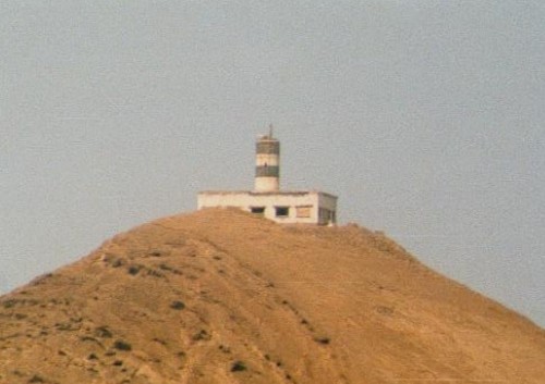
Date unknown. Active; focal plane 42 m (138 ft); white flash every 9 s. 11 m (36 ft) tower painted white with a red horizontal band. The light is barely visible near the left edge of Hussein Al-Mahri's view (zoom in) and Google has a satellite view. Founded in 1984, Nishtūn is a a small port about 240 km (150 mi) southwest of the Omani border. Located on a ridge on the east side of the harbor. Site status unknown. Admiralty D7313; NGA 30904.

Ḥaḍramawt (Hadhramaut) Governorate Lighthouses
Al Mukallā is the capital and principal port of the Ḥaḍramawt (Hadhramaut) governorate, a former British protectorate in eastern Yemen. The city was the capital of Al Qaeda in Yemen in 2015-16, but the Al Qaeda forces were driven out in bloody fighting by forces of the Aden-based Southern Transitional Council backed by the United Arab Emirates.

Al Mukallā (South Breakwater)
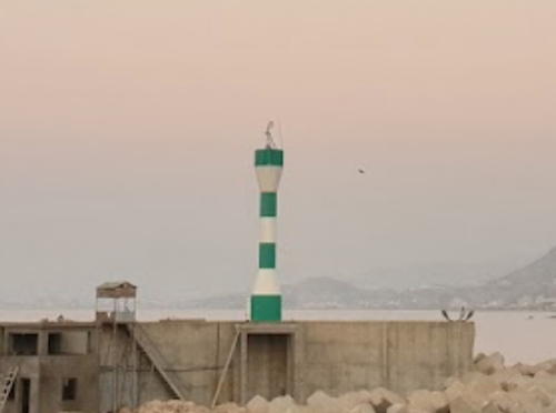
Date unknown (at least by 2003). Active; focal plane about 17 m (56 ft); white flash every 5 s. Approx. 12 m (39 ft) round barbell-shaped fiberglass tower, colored with green and white horizontal bands. A portion of a distant view by Marko Stankovic is at right, Ahmed Shalabi has another distant view, and Google has a satellite view. Located on the main breakwater in Al Mukallā. Site status unknown. ARLHS YEM-006; Admiralty D7312; NGA 30920.
#Al Mukallā North Breakwater
Date unknown. Removed in 2013. Approx. 5 m (17 ft) 1-story square concrete or masonry tower. No photo available but Bing has a satellite view. The lighthouse was apparently replaced by a post light (focal plane about 8 m (26 ft); one long red flash every 10 s). Google has a more recent satellite view. Located at the end of the north breakwater in Al Mukallā. Site status unknown. Active light: Admiralty D7312.2; NGA 30921.

Šabwa (Shabwah) Governorate Lighthouse
Balḩāf
Date unknown. Active (?); focal plane 90 m (295 ft); white flash every 5 s. Light mounted on a tall communications tower. No photo available but Google has a satellite view. Balḩāf is a former fishing port, now the location of a large liquid natural gas processing and shipment facility. The facility operated from 2009 to 2015, when operations were stopped by the civil war. Located on a hilltop above the port. Site status unknown. Admiralty D7311.23; NGA 30923.

South Breakwater Light, Al Mukallā, October 2018
Google Maps photo by Marko Stankovic

'Adin (Aden) Governorate Lighthouses

The magnificent harbor of 'Adin (Aden), on the south coast of Yemen, was a British colony and a major base for the British Royal Navy ffrom 1839 to 1963. The University of Texas Library has a nautical chart of the harbor. The city is the capital of the Southern Transitional Council, a secessionist group backed by the United Arab Emirates and Saudi Arabia.
Ra's Marshaq (Ra's Marshag)
1867. Active; focal plane 74 m (243 ft); white light, 3 s on, 2 s off. 26 m (85 ft) stone tower with lantern and gallery, painted white with one black horizontal band. Zaid Alzomor's 2016 photo is at right, Osan Boairan has a 2015 photo, and Google has a satellite view. Michel Forand has a 1960s aerial view and Huelse has a historic postcard view. Ra's Marshaq is the southeastern point of the peninsula enclosing the east side of Aden Harbour. Located at the tip of the point, a very sharp promontory overlooking the Gulf of Aden southwest of Aden. ARLHS YEM-005; Admiralty D7304; NGA 30936.
Elephant's Back
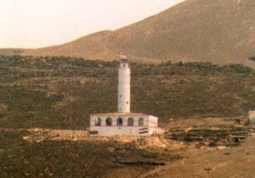
1909. Active; focal plane 57 m (187 ft); flash every 2.5 s, white or red depending on direction. 7.5 m (25 ft) round stone tower with lantern and galley, painted white. Abdulraheem Ali Muthanna Saleh has a distant 2023 view and Google has a satellite view. The Elephant's Back is a dark ridge of volcanic rock on the east side of Aden Harbour. The light is atop the ridge. Site status unknown. ARLHS YEM-002; Admiralty D7308; NGA 30940.
Ra's Marbut (Aden Peninsula) Breakwater
Date unknown. Active; focal plane about 20 m (66 ft); green light, 2 s on, 3 s off. Approx. 16 m (52 ft) round hourglass-shaped fiberglass tower. Entire lighthouse is green. Amer Nadem has a closeup photo, Ayman Abdullah Al Bahloul also has a photo, and Google has a satellite view. Located at the end of a breakwater on the south side of the entrance to Aden harbor. Site status unknown; may be accessible by walking the pier. Admiralty D7309; NGA 30944.
Aden Oil Harbor Range Front
Date unknown. Active; focal plane 10 m (33 ft); green light, 1 s on, 1 s off. 8 m (26 ft) square tower. No photo available but Google has a satellite view. Located on the west side of Aden Harbour. Site status unknown. Admiralty D7302; NGA 30950.

Ra's Marshaq Light, Aden, October 2016
photo by Zaid Alzomor from Instagram: @yemenfans
Aden Oil Harbor Range Rear
Date unknown. Active; focal plane 26 m (85 ft); green light, 1 s on, 1 s off. 26 m (85 ft) square skeletal tower, painted with black and white horizontal bands and carrying two diamond-shaped daymarks. No photo available but Bing has a satellite view. Located on the west side of Aden Harbour. Site status unknown. Admiralty D7302.1; NGA 30951.
Jazīrat Salīl
Date unknown. Active; focal plane 20 m (66 ft); two red flashes every 15 s. 5 m (17 ft) round hourglass-shaped tower, painted white. No photo available but Google has a satellite view. Located on a small island on the west side of the entrance to the harbor. Accessible only by boat. Site status unknown. Admiralty D7301; NGA 30948.

Ta'izz Governorate: Perim (Barim, Mayyūn) Island Lighthouses
Perim (now called Mayyūn or Barīm) is a small island in a very strategic location at the southern entrance to the Bab el Mendab strait connecting the Red Sea and Gulf of Aden. Britain occupied the island in 1857 to protect its sea connections to India, and subsequently attached the island to its Aden Protectorate. For many years the island was a coaling station for ships bound to or from the Orient. During the current Yemeni civil war the island was occupied for a time by Houthi rebels who removed the residents of the island. The island was recaptured by al-Hadi government forces backed by the United Arab Emirates and most of the residents have returned.

Mayyūn (Perim) High (2)
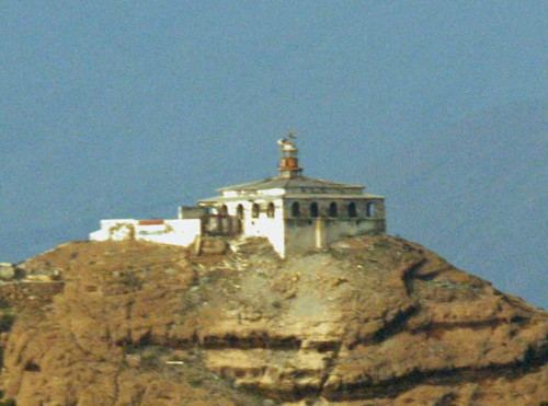
1912 (station established 1861). Active; focal plane 85 m (279 ft); four white flashes every 15 s. 25 m (82 ft) round stone tower with lantern and gallery. The tower is unpainted; lantern painted white. A 2013 photo by Bashar Allswas is at the top of this page, a more recent photo (dated 2020) is available, and Google has a good satellite view. The original lighthouse was a 12 m (39 ft) tower on a keeper's house; Wikimedia has a distant view from the sea taken in 1883. Located on the highest point of the island. Accessible only by boat. Site and tower closed. ARLHS YEM-004; Admiralty D7300.95 (ex-E6150); NGA 30900.
Balfe Point
1888. Active; focal plane 13 m (43 ft); white flash every 4 s. 8 m (26 ft) square cylindrical stone tower, unpainted except for horizontal red, white and blue bands (Yemeni colors) at the top. A 2023 photo by Saber Fares is at right and Google has a satellite view. Located on the western point of the island. Accessible only by boat. Site and tower closed. ARLHS YEM-007; Admiralty D7300.9 (ex-E6152); NGA 30896.

Ta'izz Goverorate: Mocha Lighthouse
Al Mukhā (Mocha, Mokha) Range Rear
Date unknown. Active; focal plane unknown; white light, 1 s on, 1 s off. Approx. 25 m (82 ft) square skeletal tower carrying a large rectangular daymark. No photo available, but Google has an indistinct satellite view. The front light is on a shorter tower. Mocha, near the southern end of Yemen's Red Sea coast, was famous for centuries for its coffee. The city was held by Houthi rebels for two years before being recaptured by the al-Hadi governement in 2017. Located on the peninsula sheltering the port. Site status unknown. Admiralty D7300.861 (ex-E6149.1); NGA 30848.


Balfe Point Light, May 2023
Google Maps photo by Saber Fares


Al Hudaydah Governorate: Red Sea Islands Lighthouses
These lighthouses are built on volcanic islands a little east of the centerline of the southern Red Sea, between Yemen and Eritrea. The original lighthouses were built by a French company under a concession granted by the Ottoman Turkish Emperor. The islands were occupied by British forces in December 1914, early in World War I. Following the war, the European powers decided not to decide who should own the islands, leaving sovereignty undetermined. Yemen claimed the islands after the end of the colonial period, as did Eritrea after it became independent of Ethiopia in 1993. The two countries agreed to binding arbitration and in 1999 the Permanent Court of Arbitration at The Hague awarded the lighthouse islands to Yemen.
Jazīrat al Ḩanīsh al Kabīr Southwest
2005. Active (?); focal plane 200 m (656 ft); white flash every 5 s. 6 m (20 ft) round hourglass-shaped fiberglass tower, painted with red and white horizontal bands. No photo available but Google has an indistinct satellite view. The light failed shortly after installation, was relit in 2007, but was again out of service in late 2008. Located near the southwest tip of Ḩanīsh al Kabīr, the largest of the Ḩanīsh Islands. Accessible only by boat. Site and tower closed. Admiralty D7300.84 (ex-E6142.92).
Jazīrat al Ḩanīsh al Kabīr Northeast
Date unknown. Active (?); focal plane unknown; two white flashes every 12 s. 10 m (33 ft) square skeletal tower, painted red with a white top. No photo available but Google has an indistinct satellite view. Located on the northeast tip of Ḩanīsh al Kabīr. Accessible only by boat. Site and tower closed. Admiralty D7300.83 (ex-E6142.9); NGA 30842.
Abū 'Alī (Abu Ali, Quoin Island) (2)
1903. Active (?); focal plane 104 m (341 ft); two white flashes every 10 s. 9 m (30 ft) round cylindrical tower with lantern and gallery, centered on the roof of a square 1-story keeper's house. It appears that the light may have been moved to a mast atop the lantern. Lighthouse painted white. A photo by Jerrye and Roy Klotz is at right, Alain Guyomard and Robert Carceller have posted photos by Alain Faron, Lightphotos.net also has a distant view, and Google has a satellite view. The original light was taller, with a focal plane of 117 m (384 ft); we do not know when the light tower was rebuilt to its present height. This lighthouse marks the northern entrance to the eastern passage between the Ḩanīsh Islands and the Yemeni coast. Its history parallels that of the Jabal al-Tayr lighthouse described below: built by a private French company, seized by the British in 1915, operated under contract by the French company and then by two British companies until, in 1990, the British ceded control of the lighthouses to Yemen. Located on a steep island at the northern end of the Ḩanīsh Islands. Accessible only by boat. Site and tower closed. ARLHS YEM-001; Admiralty D7300.8 (ex-E6142); NGA 30892.

Abu Ail Light
Abu Ail Light, March 2007
Wikimedia Creative Commons photo by Jerrye and Roy Klotz

#Jazā'ir az Zubayr (Zubair Islands, Centre Peak) (1)
1903. Inactive since 1939 and since destroyed, probably by earthquakes associated with volcanic activity in the Zubair Islands in 2011-12. Yahya Asiri has a 2018 photo of the ruins. This was a 20 m (66 ft) cylindrical tower. The original light was built by a private French company like the Jabal al-Tayr and Abū 'Alī Lights. The British deactivated it in 1932 but the Italians (then in control of Eritrea) sent a crew and put it back in service the following year. The British did not reactivate it after World War II. Klinksiek's 1997 photo of the intact lighthouse appears at right and Google has a satellite view. Yemen built a new light here in 1987 as the start of its project to occupy and light the Red Sea islands. The new light has focal plane 154 m (505 ft); white flash every 10 s. Since no photo is available and light lists continue to describe the original tower, the form of the new light is not known. Google has only an indistinct satellite view of the listed location. Zubair is the southernmost peak of a string of volcanic islands about 80 km (50 mi) off the Yemeni coast and 100 km (62 mi) west northwest of Al Hudaydan (Hodeida). Located on the crater rim of the island. Accessible only by boat. Site and tower closed. Active light: Admiralty D7300.61 (ex-E6141); NGA 30829.
Jabal al Yaman (Jabal Yemen, Kamarān)
Date unknown (around 1970?). Active; focal plane 40 m (131 ft); three white flashes every 15 s. 18 m (59 ft) tripod tower with a small gallery. Alexey Bobkov has a 2009 photo and Bing has a satellite view showing the foundation pads of the three legs. A ruined fort is adjacent to the lighthouse. Kamarān is the largest island of Yemen's Red Sea coast. Occupied by British troops in 1915, it was attached to Britain's Aden colony and was inherited by South Yemen in 1967. North Yemen seized the island in 1972, but the two countries merged in 1990. Located on Jabal (Mount) Yaman, a hill near the south end of the island. Site status unknown. Admiralty D7300.58 (ex-E6144); NGA 30800.
Zubair Islands Lighthouse
Zubair Islands (Centre Peak) Light (destroyed about 2012), September 1997
photo copyright Jürgen Klinksiek; used by permission
'Uqbān
Date unknown. Active; focal plane 26 m (85 ft); two white flashes every 10 s. Approx. 6 m (20 ft) round white concrete tower. No photo available but Bing has a s distant satellite view. Located on 'Uqbān, an island about 25 km (15 mi) northwest of Kamarān. Accessible only by boat. Site status unknown. Admiralty D7300.5 (ex-E6144.2); NGA 30796.
#Jazīrat Jabal aṭ-Ṭayr (Jabal at Tair) (2 )
1989 (station established 1903). Inactive since 2007 and presumably destroyed. 20 m (66 ft) round cylindrical tower with lantern and gallery, centered on a 1-story keeper's house. Lighthouse painted white. Klinksiek's photo appears at right. This lighthouse was located on a high island of Jabal aṭ-Ṭayr in the eastern half of the Red Sea off Yemen's northwestern coast. The original lighthouse, a black and white checkered tower on a square keeper's house, was built by a private French company. After World War I the British negotiated an operating agreement with the French company, which remained in control until World War II. After that war Britain hired the Savon and Ries Company to operate the Jabal at Tair and Abu Ail lighthouses. In 1980 the contract was terminated and the Red Sea Lights Company was organized to manage the lighthouses. In 1990 the British formally ceded control of the lighthouses to Yemen. Yemen issued a notice to mariners in late 1989 concerning construction of a new lighthouse. In October 2007 the island was rocked by a severe volcanic eruption. The lighthouse survived but was heavily damaged; Google's satellite view shows the ruins with heavy lava flows in the area of the station. The light was deleted from the Admiralty list in early 2012. Located on the western flank of an island about 80 km (50 mi) west of Al Luyhayyah. Accessible only by boat. Site and tower closed. ARLHS YEM-003; ex-Admiralty E6140; ex-NGA 30792.
Jabal at Tair Lighthouse
Jabal aṭ-Ṭayr Light (destroyed in 2007), Red Sea, September 1997
photo copyright Jürgen Klinksiek; used by permission
Dawharāb (Daw Harab)
Date unknown. Active; focal plane 15 m (49 ft); white flash every 5 s. 15 m (49 ft) skeletal tower mounted on a triangular platform supported by piles. The tower carries a green daymark. No photo available but Bing has a satellite view. Dawharāb is a small island near the southern end of the Farasan Islands, a large group of islands and coral reefs. The light marks the Saudi-Yemeni border and the beginning of an approach to the Saudi port of Jīzān from the south. Located just off the northern end of the island. Accessible only by boat. Site open, tower closed. Admiralty D7300 (ex-E6139.5); NGA 30784.

Information available on lost lighthouses:

Notable faux lighthouses:

Adjoining pages: North: Western Saudi Arabia | East: Oman

Return to the Lighthouse Directory index | Ratings key

Posted February 16, 2006. Checked and revised October 23, 2023. Lighthouses: 21. Site copyright 2023 Russ Rowlett and the University of North Carolina at Chapel Hill.