Lighthouses of Western Türkiye

Prior to World War I (1914-18) the Ottoman (Turkish) Empire had for centuries controlled most of the Middle East and (for varying amounts of time) North Africa and Southeast Europe. Following the war the Empire was partitioned by the 1920 Treaty of Sèvres and after a period of turmoil and warfare the Republic of Türkiye (Türkiye Cumhuriyeti in Turkish) was established in 1923. The country was historically called Turkey but in 2022 the Turkish government informed the United Nations that it prefers the official spelling Türkiye to be used in English. The Directory uses the spelling Türkiye in its descriptions but retains Turkish as the adjective form and preserves the more familiar spelling Turkey on the index page.

Most of Türkiye (97%) occupies the broad peninsula of Anatolia (Asia Minor) between the Black Sea and the Mediterranean Sea; the remaining 3% is the region of East Thrace at the southeastern corner of Europe.

Türkiye is divided into 81 provinces (iller). This page includes Anatolian Türkiye's lighthouses on the Aegean coasts of İzmir, Balıkesir, and Çanakkale provinces. Northern coasts of Balıkesir and Çanakkale provinces facing the Dardanelles and Sea of Marmara are covered on the Northwestern Turkey page.

Since the 1920s the Turkish language has been written in a Latin script; a distinctive feature of the alphabet is that the dotted (İ and i) and dotless (I and ı) forms of the letter I are different letters. The Turkish phrase for a lighthouse is fener (plural fenerler) or deniz feneri ("sea lantern"). Ada or adası is an island, yarımada is a peninsula, kaya is a rock or reef, burnu is a cape, burun ("nose") is a headland, körfez is a gulf, koy is a bay or inlet, boğaz is a strait, nehir is a river, and liman is a harbor. In Turkish the Aegean Sea is called Ege Denizi.

Lighthouses in Türkiye are operated by the Directorate General of Coastal Safety (Kıyı Emniyeti Genel Müdürlüğü, KEGM).

ARLHS numbers are from the ARLHS World List of Lights. Admiralty numbers are from volume N of the Admiralty List of Lights & Fog Signals. U.S. NGA List numbers are from Publication 113.

General Sources
Seyir Yardımcıları (Navigational Aids)
Information on major lighthouses posted by the Directorate General.
Online List of Lights - Turkey
Photos by various photographers posted by Alexander Trabas. Many photos for this coast are by Eckhard Meyer.
Deniz Fenerleri
Photos of 22 lighthouses by Haluk Özözlü.
Leuchtfeuer an der türkischen Mittelmeerküste
Photos of 17 Mediterranean coast lighthouses posted by Bernd Claußen.
Lighthouses in Turkey
Photos by various photographers available from Wikimedia.
World of Lighthouses - Turkey
Photos by various photographers available from Lightphotos.net.
Lighthouses R Us - Turkey South and Turkey West
This site by C.W. Bash preserves a series of small photos formerly posted on the Directorate General's web site.
Europäische Leuchttürme auf historischen Postkarten
Historic postcard images posted by Klaus Huelse (Asiatic Türkiye is included on this page of European lighthouses).
GPSNauticalCharts
Navigational chart information for the eastern Aegean Sea.
Navionics Charts
Navigation chart for the Turkish coast.

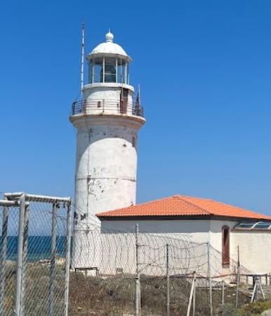
Sivrice Light, Ayvacık, July 2019
Instagram photo by gezgicler

İzmir (Smyrna) Province Lighthouses

Seferihisar District Lighthouse
* Sığacık Limanı
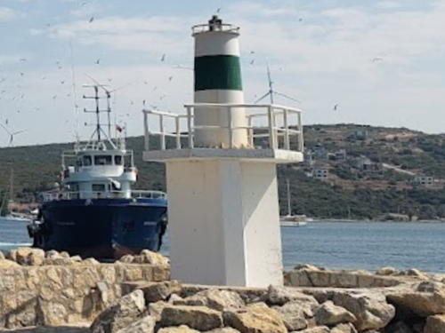
Date unknown. Active (privately maintained?); focal plane about 12 m (39 ft); green light, pattern unknown. Approx. 9 m (30 ft) round tower atop a square concete tower. Lighthouse painted white with one narrow green horizontal band. Selim Ay's 2022 photo is at right, Serkan İgüs has a distant view, the light is at the far right in Yilmaz Kokcu's photo and Google has a distant satellite view. NGA has confused this light with another light in the harbor. Located on the main breakwater at Sığacık. Accessible by walking the pier. Admiralty N4661.55; NGA 19998.5.

Urla District Lighthouse
[Teke Burnu]
Date unknown. Active; focal plane 38 m (125 ft); three white flashes every 15 s. 8 m (26 ft) square pyramidal skeletal tower, painted white, standing next to a small concrete equipment shelter. Trabas has a distant and fuzzy view and Google has only an indistinct satellite view. Located on a promontory on the south side of the Karaburan Peninsula. Site status unknown. Admiralty N4661; NGA 19996.

Çeşme District Lighthouses
[Bozalan Burnu]
Date unknown. Active; focal plane 33 m (108 ft); two white flashes every 5 s. 8 m (26 ft) square pyramidal skeletal tower, painted white, standing next to a small concrete equipment shelter. Trabas has a distant view and Google has an indistinct satellite view. Located on a promontory on the east side of the entrance to the bay of Alaçatı. Site status unknown. Admiralty N4659; NGA 19988.

Sığacık Limanı Light, Sığacık, June 2022
Google Maps photo by Selim Ay
Sügünkaya (Fener Adası, Pasha Islet) (1)
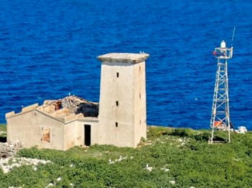
1863(?). Inactive. 8 m (26 ft) square masonry tower attached to a 1-story masonry keeper's house. The keeper's house is unroofed and in ruins. Entire lighthouse painted white. The tower appears to have been covered with concrete or stucco. The active light (focal plane 43 m (141 ft); red flash every 5 s) is on a 9 m (30 ft) square skeletal tower. Christos Kazantzoglou's photo is at right, Trabas has a photo, Warren Pollock has a view from the sea, another view from the sea is available, and Google has a satellite view. Located on an island in the narrowest passage of the strait between the Turkish mainland and the Greek island of Chios, about 8 km (5 mi) southwest of Çeşme. Accessible only by boat. Site open, tower closed. Active light: Admiralty N4658; NGA 19984.
Keleyeri (Kaloyeri) (2)
Date unknown. Active; focal plane 9 m (30 ft); white flash every 5 s. 9 m (30 ft) round barbell-shaped tower, upper half painted black and lower half yellow, mounted on a round concrete base. Google has a satellite view. Trabas has a view of the former light, a round cylindrical concrete tower with gallery mounted on a square stone pier, and Ahiles Rodriges has a closeup. Located on a reef off the entrance to Çeşme. Accessible only by boat. Site open, tower closed. Admiralty N4656; NGA 19980.
* Çeşme Körfezi (Fener Burnu)
Date unknown. Active; focal plane 10 m (33 ft); white flash every 3 s. 4 m (14 ft) round cylindrical concrete tower painted white with a narrow black horizontal band. Trabas has a photo, a closeup is available, and Google has a satellite view. Located on a promontory sheltering the west side of Çeşme harbor. Site appears open, tower closed. Admiralty N4657; NGA 19976.
Ufak Ada
Date unknown. Active; focal plane 14 m (46 ft); two white flashes every 10 s. 10 m (33 ft) square white skeletal tower. Google has a satellite view. Located on an island in the center of Ildır Bay north of the Çeşme peninsula. Accessible only by boat. Site open, tower closed. Admiralty N4655.5 NGA 19970.

Old and new Sügünkaya Lights, Alaçatı, March 2020
Google Maps photo by Christos Kazantzoglou

Karaburun District Lighthouses
* Sarpıncık Karaburun (Kara Burnu)
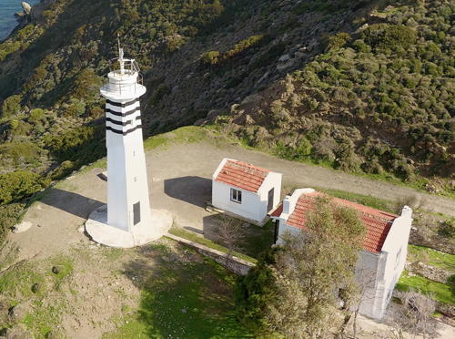
1938. Active; focal plane 97 m (318 ft); four white flashes every 20 s. 13 m (46 ft) round cylindrical concrete tower with gallery and four large ribs. Lighthouse painted white with four narrow black horizontal bands. 1-story masonry keeper's house, painted white with a red tile roof. A portion of Burak Büyükbayraktar's drone view is at right, Ali İhsan Eren has a 2017 photo, a 2018 closeup is available, Trabas has a distant view from the sea, Berk Öncü has a closeup street view, and Google has a satellite view. Very similar to Sivrice Feneri (see below). This Karaburun (Black Cape) is the tip of the peninsula projecting into the Aegean northeast of the Greek island of Chios. Located on a steep bluff at the end of the peninsula, 4 km (2.5 mi) west of Sarpıncık. Accessible by road. Site open, tower closed. . Admiralty N4630; NGA 19896.
Saip Adası (Eski Saip)
Date unknown. Active; focal plane 25 m (82 ft); two white flashes every 10 s. 10 m (33 ft) square pyramidal white skeletal tower mounted on a concrete base. Google has a satellite view. Located on a small island off the northwest corner of the Karaburan peninsula. Accessible only by boat. Site open, tower closed. Admiralty N4621; NGA 19836.
* Mordoğan East Breakwater (2)
Date unknown. Active; focal plane 8 m (26 ft); red flash every 5 s. 6 m (20 ft) round barbell-shaped white tower with a narrow red horizontal band. Google has a satellite view. Engin Almali has a 2018 photo of the earlier light, a cylindrical white concrete tower, Göztepeli Serdar also has a photo, and the older light is in the center of a photo of both breakwater lighthouses. Located at the end of the main breakwater of Mordoğan, a fishing port on the east side of the Karaburun Peninsula. Accessible by walking the pier. Site open, tower closed. Admiralty N4621.45; NGA 19837.3.

Karaburan Light, Sarpıncık, February 2019
Google Maps drone view by Burak Büyükbayraktar'
* Mordoğan West Breakwater (2)
Date unknown. Active; focal plane 8 m (26 ft); green flash every 5 s. 6 m (20 ft) round barbell-shaped white tower with a narrow green horizontal band. round cylindrical white concrete tower. Google has a satellite view. The earlier light is at the far left of a photo of both breakwater lighthouses. Located at the end of the west (inner) breakwater of Mordoğan. Accessible by walking the pier. Site open, tower closed. Admiralty N4621.4; NGA 19837.2.

İzmir City Lighthouses
Turkey's largest city on its Aegean coast, İzmir has a population approaching 3 million. The city is built in a semicircle around the narrow head of the Gulf of İzmir. The easiest and most pleasant way to travel from one side of the city to the other is by ferry across the bay. Modern İzmir is the successor to the ancient Greek city of Smyrna.
* Guzelbahçe (Güzelbaçe)
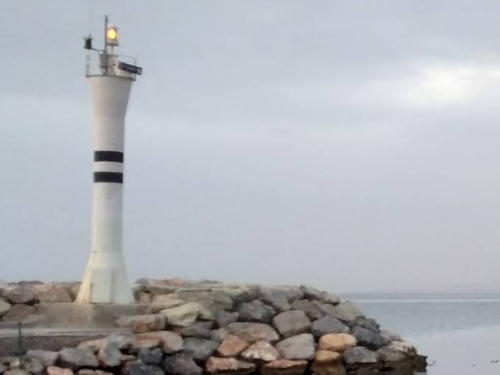
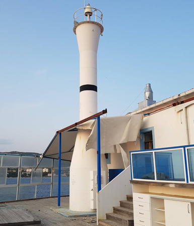
1992. Active; focal plane 14 m (46 ft); two white flashes every 10 s. 10 m (33 ft) round barbell-shaped metal or fiberglass tower, painted white with two narrow black horizontal bands. Cenk Ozcan's photo is at right, Gökçe Mutlu has a closeup photo, and Google has a satellite view. Located at the end of the breakwater mole of Güzelbahçe, a town on the south side of the Gulf of İzmir about 25 km (15 mi) west of downtown İzmir. Site open, tower closed. Admiralty N4622.7; NGA 19871.
* Üçkuyular Pier
Date unknown. Active (privately maintained); focal plane 13 m (43 ft); two red flashes every 5 s. Light mounted on a pierhead building. Google has a satellite view of the building but the light is not seen in Arslan Karadakovan's 2016 photo. Located on the Üçkuyular ferry pier on the south side of the Gulf of İzmir. Site open, tower closed. Admiralty N4625.6; NGA 19874.1.
* Konak Pier
Date unknown. Active (privately maintained); focal plane 12 m (39 ft); two yellow flashes every 5 s. Light mounted on a pierhead building. Trabas has a photo and Google has a satellite view of the building. The first floor of the building is a café. Located on the Konak pier on the south side of the Gulf of İzmir. Site open, tower closed. Admiralty N4627.3; NGA 19875.
* Karşıyaka Pier
Date unknown. Active (privately maintained); focal plane 10 m (33 ft); two yellow flashes every 5 s. Light mounted on the Karşıyaka Ferry Terminal on the İzmir waterfront. Trabas has a photo, César Villarreal has a photo, and Google has a satellite view of the building. Located on the Karşıyaka pier on the north side of the Gulf of İzmir. Site open, tower closed. Admiralty N4628.58; NGA 19893.
* Aksoy East Pier (Bostanlı)
Date unknown. Active; focal plane 21 m (69 ft); two red flashes every 5 s. Light mounted on the Bostanlı Ferry Terminal on the İzmir waterfront. The light is probably perched atop the building in Kubilay Yıldız's photo and Google has a satellite view of the building. Located on the Bostanlı pier on the north side of the Gulf of İzmir. Site open, tower closed. Admiralty N4628.57; NGA 19894.1.

Guzelbahçe Light, Guzelbahçe, February 2016
Google Maps photo by Cenk Ozcan

Foça District Lighthouses
** Değirmen Burnu (Foça) (2)
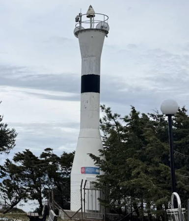
Date unknown (station established 1887). Active; focal plane 17 m (56 ft); white flash every 5 s. 9 m (30 ft) round hourglass-shaped metal or fiberglass tower, painted white with a narrow black horizontal band. A 1-story masonry keeper's house, painted white with a red tile roof, has been incorporated into a restaurant. Christian Bosman has a 2017 closeup photo (also seen at right), Trabas has Meyer's photo, Ferhat Safran has a 2021 photo and a view from the sea, and Google has a satellite view. The modern city of Foça is built near the ruins of the ancient Greek city of Phocaea. Located at the tip of a peninsula sheltering the west side of the harbor of Foça. Site open, tower closed. Site manager: Foça Fener Restaurant . ARLHS TUR-006; Admiralty N4620; NGA 19844.
Oğlak Adası (2)
Date unknown (station established 1887). Active; focal plane 25 m (82 ft); white flash every 5 s. 6 m (20 ft) round concrete tower painted white with one narrow black horizontal band. The current light and the ruins of the historic light station can be seen in Google's satellite view. Located at the western end of a small island at the northern entrance to the bay of Foça. Accessible only by boat. Site status unknown. Admiralty N4618; NGA 19840.
Aslan Burnu
1992. Active; focal plane 40 m (131 ft); two white flashes every 10 s. 8 m (26 ft) round hourglass-shaped metal or fiberglass tower, painted white. Trabas has Meyer's photo and Bing has a satellite view. Located on a prominent cape on the east side of the entrance to the Gulf of İzmir, about 7 km (4.5 mi) north of Foça. Site status unknown. Admiralty N4617.9; NGA 19838.

Aliağa District Lighthouses
Ilıca Burnu (Aliağa) (2)
Date unknown (station established 1984). Active; focal plane 50 m (164 ft); white flash every 5 s. 8 m (26 ft) round concrete tower, painted white with a narrow black horizontal band. Google has a satellite view. A huge wind turbine dwarfs the lighthouse. NGA lists a framework tower at this station. Located on a prominent cape about 9 km (5.5 mi) northwest of Aliağa. Site status unknown. Admiralty N4616.3; NGA 19822.
Tuzla Burnu (Aliağa East Entrance) (2)
Date unknown. Active; focal plane 8 m (26 ft); very quick white flash every 1 s. 6 m (20 ft) round barbell-shaped tower colored white with a narrow red horizontal band. Google has a satellite view. NGA lists a skeletal tower with a green flashing light. Located on the east side of the entrance to the bay of Aliağa. Site status unknown. Admiralty N4616.6; NGA 19824.1.

Değirmen Burnu Light, Foça, August 2017
Google Maps photo by Christian Bosman

Dikili District Lighthouse
* Bademli Burnu (Adatepe Burnu)
Date unknown. Active; focal plane 31 m (102 ft); nine quick flashes every 15 s, white or red depending on direction. 7 m (23 ft) round barbell-shaped metal or fiberglass tower, painted white. Izzettin Ağcayazı has a closeup photo, Nazım Alagöz has a photo, and Bing has a satellite view. This light marks the southern entrance to the Midilli (Mytilini) Strait separating the Turkish mainland from the Greek island of Lesvos. Located on a cape about 3 km (2 mi) southwest of Bademli. Site open, tower closed. Admiralty N4615.6; NGA 19808.

Balıkesir Province West Coast Lighthouses

Balıkesir Province also has a north coast facing the Sea of Marmara. For lighthouses of that coast, see the Northwestern Anatolia page.

Ayvalık District Lighthouses
* Madra Çayı (2)
Date unknown. Active; focal plane 11 m (36 ft); four white flashes every 15 s. 10 m (33 ft) round barbell-shaped fiberglass tower. Entire lighthouse is white. Google has a street view and a satellite view. NGA lists a skeletal tower at this station. Located on a sandy point at Madra Çayı, just north of the border of İzmir province. Site open, tower closed. Admiralty N4615.4; NGA 19800.
[Çiplak Adası (Ciplakada, Fener Burnu)]
Date unknown. Active; focal plane 18 m (59 ft); red flash every 3 s. 4 m (13 ft) enclosed square skeletal tower, white with one black horizontal band, standing beside the ruins of a stone keeper's house. Mehmet Tokgöz has a very distant view from the sea and Google has a satellite view. Çiplak Adası ("bare island") is a small island just off the Turkish shore of the Mytilene Strait separating Turkey from the Greek island of Lésvos. Located on the eastern point of island, guiding vessels in the narrow passage between the Greek island of Lésvos and the mainland. Accessible only by boat. Site open, tower closed. Admiralty N4612; NGA 19788.
* Ayvalık Marina North Breakwater
Date unknown. Active; focal plane 10 m (33 ft); green flash every 5 s. 7 m (23 ft) round concrete tower painted white with a narrow green horizontal band. Cam Graves has a photo, Nedret Cemal Sasmaz has a photo of both lighthouses, and Google has a satellite view. Trabas has Meyer's photo showing the former daymark: the upper third painted black and the lower 2/3 painted with black and white vertical stripes. NGA lists the light as "Yat Limani." Located on the south (inner) breakwater of the marina. Accessible by walking the pier. Site open, tower closed. Admiralty N4615.24; NGA 19799.3.
* Ayvalık Marina South Breakwater
Date unknown. Active; focal plane 10 m (33 ft); red flash every 5 s. 7 m (23 ft) round concrete tower painted white with a narrow red horizontal band. Nedret Cemal Sasmaz has a photo of both lighthouses and Google has a satellite view. Trabas has Meyer's photo showing the former daymark: the upper third painted red and the lower 2/3 painted with black and white vertical stripes. Located on the south (inner) breakwater of the marina. Accessible by walking the pier. Site open, tower closed. Admiralty N4615.26; NGA 19799.5.
Güneş Adası (3?)
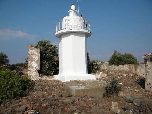
Date unknown (station established 1863). Active; focal plane 66 m (217 ft); white flash every 3 s. 5 m (17 ft) octagonal cylindrical concrete tower with gallery. Entire lighthouse is white. In the photo from KEGM's page it appears that this tower was built amid the ruins of a historic lighthouse. NGA formerly listed the light as a "white tripod." Google has a satellite view of the station. The lighthouse stands atop an island at the northern entrance to the Mytilene Strait. Located about 13 km (8 mi) west of Ayvalik and 10 km (6 mi) east of the Korakas lighthouse on Lesvos. Accessible only by boat. Site status unknown. Admiralty N4610; NGA 19780.

Gunes Adası Light, Ayvalık
Turkish Coastal Safety Directorate photo

Gömeç District Lighthouses
Edremit Bozburun
1965. Active; focal plane 35 m (115 ft); white flash every 5 s. 10 m (33 ft) round bottle-shaped metal or fiberglass tower, colored white and formerly with one narrow black horizontal band. Halil Özdemir has a 2024 photo, Mehmet Sarıtepe has a 2013 photo, Trabas has Meyer's photo, and Google has a satellite view. Entire lighthouse is white. Bozburun ("Gray Cape") is very common name on the Turkish coast, so it usually modified by the name of a nearby town. Located on a prominent cape about 20 km (13 mi) northeast of Ayvalik. Site status unknown. Admiralty N4592; NGA 19708.

Burhaniye District Lighthouses
* Burhaniye (Yeniköy) West Breakwater (2)
Date unknown. Active; focal plane about 10 m (33 ft); green flash every 5 s. Approx. 8 m (26 ft) round cylindrical white concrete tower painted white with one narrow green horizontal band. Trabas has Meyer's photo, Metin Mert has a 2013 photo, Süleyan Alantuğ has a distant street view from shore, and Google has an indistinct satellite view. Located on the west (main) breakwater at Burhaniye, a town north of Yeniköy at the southeast corner of Edremit Bay. Accessible by walking the pier. Site open, tower closed. Admiralty N4591.5; NGA 19706.
* Burhaniye (Yeniköy) East Breakwater (2)
Date unknown. Active; focal plane about 10 m (33 ft); red flash every 5 s. Approx. 8 m (26 ft) round cylindrical white concrete tower painted white with one narrow red horizontal band. Oğuz Arslan has a 2020 photo, Trabas has Meyer's photo, Süleyan Alantuğ has a distant street view from shore, and Google has a satellite view. Located on the east (inner) breakwater at Burhaniye. Accessible by walking the pier. Site open, tower closed. Admiralty N4591.51.

Edremit District Lighthouse
* Edremit Karaburun
1937. Active; focal plane 13 m (43 ft); three white flashes every 10 s. 12 m (39 ft) round cylindrical concrete tower. Entire lighthouse is white. A 2024 photo is at right, Trabas has Meyer's photo, Fulya Bilgiç has a 2017 photo, and Google has a satellite view. This little lighthouse seems endangered; it stands unprotected on the beach. Karaburun ("Black Cape") is another very common place name on the Turkish coast. Located on the beach at the point of the cape in Edremit Karaburun, about 15 km (9 mi) west of the city of Edremit. Site open, tower closed. Admiralty N4591; NGA 19704.

Edremit Karaburan Light, Edremit, May 2024
Google Maps photo by ERREON 999

Çanakkale Province: Aegean Sea Lighthouses

Çanakkale Province includes both sides of the Dardanelles, the strait known in Türkiye as the Çanakkale Boğazı. For Çanakkale Province lighthouses on the east side of the Dardanelles and the south coast of the Sea of Marmara see the Northwestern Turkey page. Lighthouses on the north side of the Dardanelles are covered on the European Turkey page.

Ayvacık District Lighthouses
* Küçükkuyu
Date unknown. Active; focal plane 13 m (43 ft); continuous red light. 10 m (33 ft) round white concrete tower with double gallery. Amanda Yesilbursa has a closeup photo, D. Süleyman has a closeup street view, and Google has an indistinct satellite view. Located at the end of the west (main) breakwater of Küçükkuyu. Accessible by walking the pier. Site open, tower closed. Admiralty N4590.2; NGA 19702.
* Sivrice (Sivrice Burnu, Sivriji) (2?)
2009 (station established 1863). Active; focal plane 16 m (52 ft); two white flashes every 10 s. 10 m (33 ft) round cylindrical concrete tower with gallery and four large ribs. Lighthouse painted white , originally with two narrow black horizontal bands although the black paint has faded away. 1-story masonry keeper's house, painted white with a red tile roof. A 2019 photo is at the top of this page, several photos are available, Trabas has Meyer's photo, Boğaç Kökbaş has a photo, and Google has a satellite view. The light station was renovated in 2009; the keeper's houses were expanded and rededicated as a public library. An article (no longer online) documented the dedication of the building in October 2009. This light guides vessels through the Midilli (Mytilini) Strait, about 10 km (6 mi) wide, separating the Turkish mainland from the north coast of the Greek island of Mytilene. The original light, still listed in 1904, was on a mast mounted on the keeper's house. Located on a prominent cape about 15 km (9 mi) east of Babakale. Site apparently open, tower closed. . ARLHS TUR-047; Admiralty N4590; NGA 19700.
* Babakale (Baba Burnu)
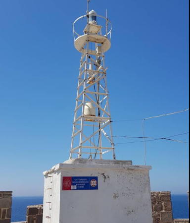
1937. Active; focal plane 32 m (105 ft); four white flashes every 20 s. 10 m (33 ft) square pyramidal skeletal tower mounted atop a square 1-story concrete equipment room. Entire lighthouse painted white. Yalçın Özdemir's 2020 photo is at right, Ramil Akhmetov has a 2017 street view, Trabas has Meyer's photo, Gerhard Schindzielorz has a photo, Oguzkan Ozden has a 2021 closeup, Özözlü has a panoramic view (first thumbnail in fifth row), and Google has a satellite view. The fort, Baba Kalesi or Babakale, was built by Sultan Ahmed II in the late 1720s to guard against pirates. Baba Burnu is the westernmost point of the Anatolian mainland, which makes it also the extreme western tip of the Asian continent. The lighthouse also marks the north side of the entrance to the strait between Turkey and the Greek island of Lésvos. Located atop the fortress at the point of the cape in Babakale. Site open, tower closed. Admiralty N4588; NGA 19696.
* Gülpınar (Main Breakwater)
Date unknown, Active; focal plane 10 m (33 ft); green flash every 5 s. 8 m (26 ft) round cylindrical concrete tower with gallery painted white with a narrow green horizontal band. Levent Özcan has a distant view showing both breakwater lights and Google has a distant satellite view. Located on the main breakwater of Gülpınar, a fishing port about 15 km (9 mi) north northwest of Babakale. Accessible by walking the pier. Site open, tower closed. Admiralty N4568.3; NGA 16861.

Baba Burnu Light, Babakale, September 2020
Google Maps photo by Yalçın Özdemir
* Gülpınar Auxiliary Breakwater
Date unknown, Active; focal plane 10 m (33 ft); red flash every 5 s. 8 m (26 ft) round cylindrical concrete tower with gallery painted white with a narrow red horizontal band. Levent Özcan has a distant view showing both breakwater lights and Google has a distant satellite view. Located on an inner breakwater of Gülpınar. Accessible by walking the pier. Site open, tower closed. Admiralty N4568.31; NGA 16861.1.

Bozcaada (Tenedos) District Lighthouses
The 1923 Treaty of Lausanne between the victorious World War I allies and Türkiye confirmed Turkish ownership of all of the Anatolian mainland and Greek ownership of all of the Aegean islands except Gökçeada (Imbros or İmroz) and Bozcaada (Tenedos). These two islands were placed under Turkish administration because they flank the entrance to the Dardanelles. The islands are administered as part of Çanakkale Province. Bozcaada has a population of about 2400 and is accessible by ferry from Yükyeri or a fast passenger ferry from Çanakkale. A lighthouse of Gökçeada is listed on the European Turkey page.
* Mermer Burnu (Tuzburnu) (2)
Date unknown. Active; focal plane 35 m (115 ft); white flash every 5 s. 9 m (30 ft) round barbell-shaped tower painted white with one narrow black horizontal band. İsmail Open has 2019 closeup photo, Erdal Yılmaz has a photo, Sercan Paran has a street view, and Google has an indistinct satellite view. Mehmet Gülhan Yurdunkulu has a photo of the earlier tower. Located at the southeastern tip of Bozcaada, where it guides vessels through the strait between the island and the mainland. Site open, tower closed. Admiralty N4568; NGA 16864.
* Batı Burnu (Bozcaada)
1861. Active; focal plane 32 m (105 ft); two white flashes every 15 s. 20 m (66 ft) round cylindrical masonry tower with lantern and gallery, painted white. The tower was formerly attached to a 1-story masonry keeper's house, but only ruins of the house remain. Mehmetcan Deveci's 2022 photo is at right, Mehmet Gülhan Yurdunkulu has a 2014 photo, Trabas has a view from the sea by Capt. Peter Mosselberger, and Google has a satellite view. This lighthouse appears to be gravely endangered by poor maintenance. Located on the western tip of the island. Site and tower closed, but according to Ad. Hovestadt the guard at the windfarm may allow lighthouse fans to enter to take photos. ARLHS TUR-001; Admiralty N4564; NGA 16870.
Tavşan Adası (1)
Date unknown. Inactive. 9 m (30 ft) tower with gallery; lantern removed. Square 2-story abandoned keeper's house. Trabas has a view from the sea by Capt. Peter, a more distant view from the sea is available, and Google has a distant satellite view of the station. Tavşan Adası (Rabbit Island) is an 325 hectare (800 acre) island about 5 km (3 mi) from the mainland and 12 km (7.5 mi) north of Bozcaada. In 2014 the island was for sale for $20 million. Located at the western end of the island. Accessible only by boat. Site status unknown. ARLHS TUR-050.
Tavşan Adası (2)
Date unknown. Active; focal plane 45 m (148 ft); red flash every 5 s. 9 m (30 ft) skeletal tower mounted on the roof of a 1-story service building. Trabas has a view from the sea by Capt. Peter, a more distant view from the sea is available, and Google has a distant satellite view of the station. The light is about 15 km (9 mi) southwest of the entrance to the Dardanelles, so it is an important guide to vessels approaching the strait. Located at the western end of the island. Accessible only by boat. Site status unknown. Admiralty N4560; NGA 16884.

Batı Burnu Light, Bozcaada, July 2022
Google Maps photo by Mehmetcan Deveci

Information available on lost lighthouses:

Notable faux lighthouses:

Adjoining pages: North: Northwestern Türkiye | South: Southwestern Türkiye | West: Greece Aegean Islands

Return to the Lighthouse Directory index | Ratings key

Posted May 5, 2007. Checked and revised June 14, 2024. Lighthouses: 40. Site copyright 2024 Russ Rowlett and the University of North Carolina at Chapel Hill.