Lighthouses of Ukraine: Mykolaiv Area

The Directory's pages for Ukraine describe the lighthouses as they existed before the start of the current conflict between Ukraine and Russia. No changes will be made until there is a stable agreement that stops the fighting.

Ukraine (officially Україна, Ukraina) is a large country on the north side of the Black Sea, bordering Russia. Except for a brief period of independence during the Russian Revolution (1917-20), Ukraine was part of Russian or Soviet empires from the mid seventeenth century until the collapse of the Soviet Union in 1991. However, the coastline of the Black Sea was mostly under the control of the Ottoman (Turkish) Empire until it was taken by Russia during a series of wars in the second half of the 1700s.

The Black Sea's northern coast is in several sections. In the west is the Bight of Odessa, named for Ukraine's largest port. In the center is the diamond shaped peninsula of Crimea. To the east is the Sea of Azov, connected to the rest of the Black Sea by the narrow Kerch Strait at the eastern end of Crimea.

Ukraine is divided into provinces called oblasts (область), and the oblasts are divided into county-level districts called raions (райони). This page includes the lighthouses of Mykolaiv Oblast including the Bug River, the lower Dnipro-Bug estuary, and a short section of the Bight of Odessa coast.

The Ukrainian word for a lighthouse is mayak (маяк); ostriv (острів) is an island, mys (мис) is a cape, richka (річка) is a river, and havan' (гавань) is a harbor.

Lighthouses in Ukraine are maintained by Derzhhidrohrafiyu, the hydrography and navigation service of the Ministry of Transport and Communications. Most of Ukraine's lighthouses were destroyed or heavily damaged during World War II (known in Ukraine and Russia as the Great Patriotic War), but most of them were restored to their original design and appearance after the war.

ARLHS numbers are from the ARLHS World List of Lights. UA numbers are the Ukrainian light list numbers as reported by Ukrainian Lighthouses on the Air. Admiralty numbers are from volume N of the Admiralty List of Lights & Fog Signals. U.S. NGA List numbers are from Publication 113. The Ukrainian light list, Вогні і знаки Чорного та Азовського морів (Lights and Signs of the Black and Azov Seas), is not available online.

General Sources
Derzhhidrohrafiyu - Lighthouses
Photos and historical information on the Ukrainian State Hydrography web site.
Online List of Lights - Ukraine
Photos by various photographers posted by Alexander Trabas. The photos from this area are by Capt. Peter Mosselberger or by Douglas Cameron.
ARLHS - Lighthouses in Ukraine
The ARLHS Ukraine listing; photos contributed by Ukrainian amateur radio operators are available for many of the lighthouses.
Wikimedia - Lighthouses in Ukraine
Photos available from Wikimedia.
World of Lighthouses - Ukraine
Photos available from Lightphotos.net.
Lighthouses of Ukraine and Crimea
Historic postcard images posted by Michel Forand.
Navionics Charts
Navigation chart for Ukraine.

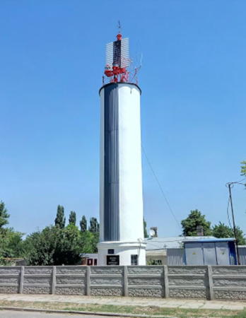
Kislyakovskiy Range Rear Light
Kislyakovskiy Range Rear Light, Lymany
Derzhhidrohrafiyu photo
Bug Estuary East Side Lighthouses
The Bug (Буг) River, known in English as the Southern Bug, flows southeastward through western and southern Ukraine. The river is navigable for 160 km (99.5 mi) to the grain terminal in the village of Prybuzhany. A series of range lighthouses guide large vessels bound to and from Mykolaiv (Nikolayev), a port and shipbuilding center on the lower Buh Estuary.
Limanoozharskiy Southbound Range Rear
Date unknown. Active; focal plane about 15 m (49 ft); white light, 2 s on, 2 s off. 15 m (49 ft) square cylindrical skeletal tower mounted atop a square concrete base. Lighthouse painted white with red vertical stripes. Trabas has Capt. Peter's distant view and Bing has a satellite view. This is the main southbound range in the lower Bug River. Located in the entrance to the Bug estuary about 1.6 km (1 mi) south of the front light (next entry). Accessible only by boat. Site open, tower closed. ARLHS UKR-012; Admiralty N5185.1.
Khablivskiy (Limanoozharskiy) Common Range Front
Date unknown. Active; focal plane 11 m (36 ft); quick-flashing white light. 11 m (36 ft) square cylindrical concrete tower. Lighthouse painted white with an red vertical stripe on the range line. Trabas has Capt. Peter's photo and Bing has a satellite view. This lighthouse serves as the front light of the upstream Khablovskiy Range and the downstream Limanoozharskiy Range. Located in the entrance to the Bug estuary about 2 km (1.2 mi) east of Dneprovske. Accessible only by boat. Site open, tower closed. ARLHS UKR-046; UA-0744; Admiralty N5181.9; NGA 18095.
Khablivskiy Range Middle (Mys Khablovskiy)
1902 (rebuilt 1952). Active; focal plane 34 m (112 ft); red light, 3 s on, 3 s off. 11 m (36 ft) square cylindrical concrete tower with gallery; the light is shown through a rectangular window. Lighthouse painted white with an red vertical stripe on the range line. Maksym Ivannikov has a 2018 photo, Zet Zverev has a photo, ARLHS has a photo by UR7GW, and Google has a satellite view. This was originally the front light of the range, the approach range for the Bug estuary; the offshore light (previous entry) was added later. The lighthouse was rebuilt after being heavily damaged in World War II. Located on Mys Khablovskiy, the east side of the entrance to the Bug estuary, about 6 km (3.5 mi) south of Lupareve. Site status unknown. ARLHS UKR-047; UA-0745; Admiralty N5182; NGA 18096.
* Khablivskiy Range Rear
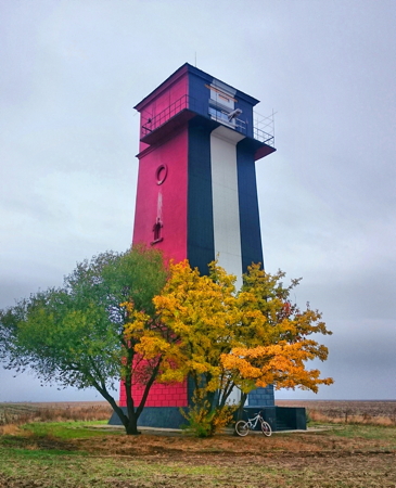
1902 (rebuilt 1952). Active; focal plane 58 m (190 ft); continuous white light. 24 m (79 ft) square concrete tower with gallery, mounted on a 1-story masonry base; the light is shown through a rectangular window. Three sides of the tower are painted red, but the front face is black with a vertical stripe. Zet Zverev's photo is at right, Maksym Ivannikov has a 2018 photo, Oren Grey has a closeup 2020 street view, and Google has a satellite view. The lighthouse was rebuilt after being heavily damaged in World War II. Located 3.8 km (2.4 mi) northeast of the middle light, and just east of the road between Lymany and Oleksandrivka. Site open, tower closed. ARLHS UKR-048; UA-0746; Admiralty N5182.1; NGA 18100.

Khablovskiy Range Rear Light, Lupareve, October 2017
ex-Google Plus photo by Zet Zverev
* Lupareve (Luparevskiy, Kislyakovskiy Range Front)
1906 (rebuilt 1955). Active; focal plane unknown; continuous red light. Approx. 10 m (33 ft) square masonry tower with lantern and gallery. Lighthouse painted white; the front face is painted red with a white vertical stripe on the range line. The light is now shown from a locomotive-style lamp mounted on the gallery. Zet Zverev has a good 2017 photo, Oleksandr Fedotov has a closeup, and Google has a satellite view. This is the second range for vessels bound upstream (north) in the estuary. The lighthouse suffered only light damage in World War II but was rebuilt anyway in 1955. Located on the east coast of the Bug on the south side of Lupareve. Site open, tower closed. ARLHS UKR-112; UA-0765; Admiralty N5184.
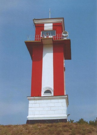
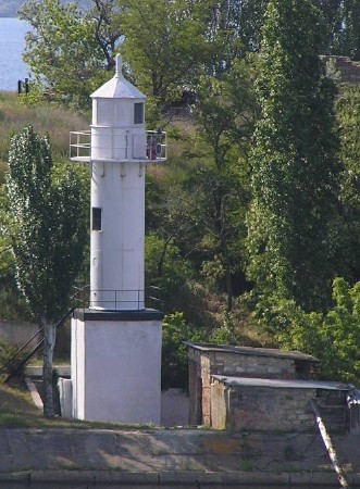
* Kislyakovskiy Range Rear (4)
1906 (rebuilt 1955, station established 1862). Active; focal plane 57 m (187 ft); continuous red (?) light. 12 m (39 ft) square masonry tower with lantern and gallery. Lighthouse painted white; the front face is painted red with a white vertical stripe on the range line. The light is now shown from a locomotive-style lamp mounted on the gallery. Although listed as red, the light is white in one photo (no longer online). A photo is at the top of this page, Alexander Ivanov has a photo, a 2018 photo is available, Svet Lessa has a closeup, and Google has a satellite view. A wood beacon built in 1862 was replaced by a stone beacon in 1872. The 1906 tower was destroyed in World War II and the present lighthouse is a copy. Located about 4 km (2.5 mi) east of Lymany and 5 km (3 mi) northeast of the front (Lupareve) light. Site open, tower closed. ARLHS UKR-114; UA-0766; Admiralty N5184.1.
Limanoozharskiy Northbound Range Front
Date unknown. Active; focal plane unknown; red flash every 2.2 s. 7 m (23 ft) square cylindrical concrete tower with gallery, painted white with a red vertical stripe. Trabas has Capt. Peter's photo and Bing has a satellite view. This is the main northbound range in the lower Bug River. The lighthouse is similar to the Khablivskiy Range Front light. Located in the center of the estuary about 2 km (1.25 mi) west northwest of Lymany. Accessible only by boat. Site open, tower closed. Admiralty N5188.
* Russkaya Kosa (Limanoozharskiy Northbound Range Rear) (4)
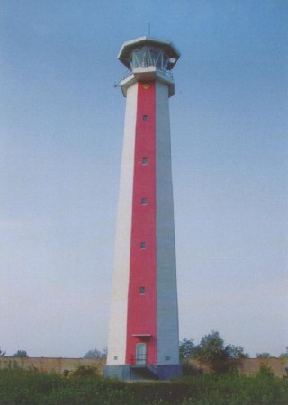
1985 (station established 1863). Active; focal plane 32 m (105 ft); red light, 2 s on, 2 s off. 32 m (105 ft) octagonal concrete tower with lantern and gallery. Lighthouse painted white with a red vertical stripe on the range line. A photo is at right, Zet Zverev has a 2017 photo, Trabas has Capt. Peter's photo, Vladimir Krepets has a 2021 photo, Dima Batareiko has a distant street view, and Google has a good satellite view. This is by far the best known lighthouse of the estuary. The original light was on piles at the point of the spit. It was replaced with a 17.5 m (58 ft) tower that was destroyed in World War II and rebuilt in 1955. The present lighthouse is a good example of late Soviet design. It has an elevator and includes staff living quarters. Located on a promontory on the east side of the Bug about 3 km (1.75 mi) northwest of Lymany. Site open, tower closed. ARLHS UKR-113; UA-0780; Admiralty N5188.1.
Port Dnepro-Bugskiy Range Front
Date unknown. Active; focal plane 14 m (46 ft); red light, 1.5 s on, 1.5 s off. Approx. 9 m (30 ft) square cylindrical skeletal tower carrying a daymark colored white with a black vertical stripe. No photo available but Google has a satellite view. Located in an industrial terminal on the east side of the estuary. Site and tower closed. Admiralty N5192; NGA 18110.
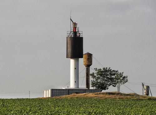
Russkaya Kosa Light
Russkaya Kosa Light, Lymany
Derzhhidrohrafiyu photo
Port Dnepro-Bugskiy Range Rear
Date unknown. Active; focal plane 17 m (56 ft); red light occulting once every 6 s. Approx. 14 m (46 ft) square cylindrical skeletal tower carrying a daymark colored white with a black vertical stripe. No photo available but Google has a satellite view. Located about 300 m (1000 ft) northeast of the front light. Site and tower closed. Admiralty N5192.1; NGA 18110.1.
* Siversov Upstream Range Front (4?)
1950s (station established 1866). Active; focal plane 16 m (52 ft); continuous red light. 18 m (59 ft) octagonal concrete or masonry tower with lantern room and gallery; the light is shown through a small window of the lantern room. Lighthouse painted with red and white vertical stripes. Zet Zverev has a 2017 photo, Andrei Dronov has a drone view, and Google has a satellite view. Changes in the channel and erosion of the bank required several changes in this light. Located on a promontory on the east side of the Bug at the southern edge of the city of Mykolaiv. Site open, tower closed. ARLHS UKR-130; UA-0838; Admiralty N5202.
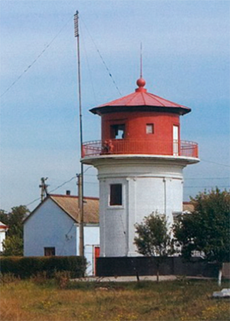
* Siversov/Konstantinovskiy Common Range Rear (4?)
1950s (station established 1866). Active; focal plane 45 m (148 ft); continuous red light; also a continuous white light as the rear light for the Konstantinovskiy Southbound Range. 10 m (33 ft) round cylindrical concrete tower with gallery, painted red above the gallery and white below. A Derzhhidrohrafiyu photo is at right, Zet Zverev has a 2017 photo and Google has a satellite view. Located in a field at the southern edge of the city of Mykolaiv, about 2.5 km (1.5 mi) northeast of the front light. Site and tower closed, but there should be a good view from a nearby road. Admiralty N5202.1 (northbound range) and N5202.15 (southbound range).
Konstantinovskiy Range Common Front
Date unknown. Active; focal plane 16 m (52 ft); white flash every 2.5 s. Approx. 12 m (39 ft) square cylindrical skeletal tower. A photo is available, Alexander Gran has a distant view, and Bing has a satellite view. Located on a jetty at a sharp bend in the estuary. Site and tower probably closed. ARLHS UKR-070; Admiralty N5203.
Konstantinovskiy Northbound Range Rear
Date unknown. Active; focal plane 40 m (131 ft); continuous red light. Approx. 25 m (82 ft) square cylindrical skeletal tower. Valery Malaschenko has a distant street view, and Bing has a satellite view. Located about 500 m (0.3 mi) north northeast of the front light. Site and tower probably closed. ARLHS UKR-071; Admiralty N5203.1; NGA 18178.

Siversov Common Range Rear Light, Mykolaiv
Derzhhidrohrafiyu photo

Bug Estuary West Side Lighthouses
* Korenys'kyy (Korenikhskiy) Range Front
Date unknown. Active; focal plane about 36 m (118 ft); quick-flashing green light. 11 m (43 ft) square skeletal tower carrying a slatted daymark. Google has a street view and a satellite view. The range guides southbound vessels. Located at the foot of Izmailska Street on the west bank of the river, opposite downtown Mykolaiv. Site appears open, tower closed. Admiralty N5210; NGA 18179.5.
* Korenys'kyy (Korenikhskiy) Range Rear
Date unknown. Active; focal plane 43 m (141 ft) ; green light, 2 s on, 2 s off. 13 m (43 ft) square skeletal tower carrying a slatted daymark. Google has a street view but the tower is inconspicuous in Google's satellite view. Located in a cemetery about 300 m (1/5 mi) southwest of the front light. Site appears open, tower closed. Admiralty N5210.1; NGA 18179.6.
Korenikhskiy
Date unknown. Active; focal plane 23 m (75 ft); red flash every 5 s. Approx. 19 m (62 ft) square skeletal tower extended by a skeletal mast. Three sides of the skeletal tower carry a slatted daymark colored white with a black vertical stripe. Google has a street view and a satellite view. Located in a right-angled bend of the estuary in Mala Korenykha, a neighborhood across from downtown Mykolaiv. Site status unknown but the tower can be seen from nearby streets. Admiralty N5205.
* Stara Bohdanivka (Stara Bogdanovka, Port Oktyabrsk) Range Front
Date unknown. Active; focal plane 22 m (72 ft); green flash every 1.5 s. Approx. 6 m (20 ft) square skeletal tower with lantern and gallery. Tower painted black; lantern white; the tower also carries a slatted daymark painted white with a black vertical stripe on the range line. Trabas has Capt. Peter's photo and Bing has a satellite view. Located on the west bank of the Bug in the village of Stara Bohdanivka. Site open, tower closed. ARLHS UKR-127; UA-0853; Admiralty N5199.
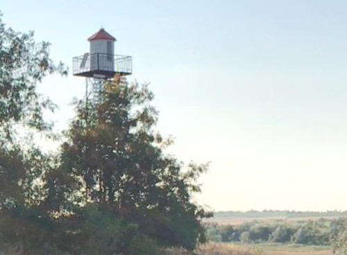
* Stara Bohdanivka (Stara Bogdanovka, Port Oktyabrsk) Range Rear
Date unknown. Active; focal plane 35 m (115 ft); green light occulting once every 3 s. Approx. 10 m (33 ft) square skeletal tower with lantern and gallery. Tower painted black; lantern white; the tower also carries a slatted daymark painted white with a black vertical stripe on the range line. John Kavura has the street view seen at right, Trabas has Capt. Peter's distant view, and Bing has a satellite view. Located beside a reservoir about 1.2 km (3/4 mi) northwest of the front light. Site open, tower closed. ARLHS UKR-128; UA-0854; Admiralty N5199.1.

Stara Bohdanivka Range Rear Light, Stara Bohdanivka, August 2017
Google Maps street view by John Kavura
* Kozyrsky Range Rear
Date unknown. Active; focal plane 46 m (151 ft); continuous red light. Approx. 10 m (33 ft) round cylindrical concrete tower with gallery. The height of the light has been increased by placing a pyramidal skeletal tower on the gallery. Lighthouse painted white with a black vertical stripe on the range line. Trabas has Capt. Peter's distant view and Google has a satellite view. This is a northbound (upstream range). Located at the north end of the village of Kozyrka. Site open, tower closed. ARLHS UKR-126; UA-0826; Admiralty N5197.1.
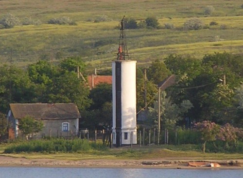
* Kozyrsky Range Front
Date unknown. Active; focal plane 14 m (46 ft); red light, 2 s on, 2 s off. Approx. 12 m (39 ft) round cylindrical concrete tower. The height of the light has been increased by placing a pyramidal skeletal tower on the gallery. Lighthouse painted white with a black vertical stripe on the range line. Trabas has Capt. Peter's photo (also seen at right) and Google has a satellite view. The satellite view indicates that a slatted daymark painted white with a black vertical stripe has been attached to the front of the tower. Located on the west bank of the Bug in the village of Kozyrka. Site open, tower closed. ARLHS UKR-125; UA-0825; Admiralty N5197.
Siversov Downstream Range Front
Date unknown. Active; focal plane 32 m (105 ft); red flash every 3 s. Approx. 20 m (66 ft) square cylindrical skeletal tower painted red. The tower carries a slatted daymark painted white with a black vertical stripe. Trabas has Capt. Peter's photo and Bing has an indistinct satellite view. This is a southbound (downstream) range, the reverse of the Siversov Upstream Range (see above). NGA misspells the name as Silversov. Located on the west bank of the Bug about 500 m (0.3 mi) northeast of the rear light. Site and tower closed. ARLHS UKR-129; UA-0839; Admiralty N5195; NGA 18177.
Kozyrsky Range Front Light
Kozyrsky Range Front Light, Kozyrka, May 2009
photo copyright Capt. Peter Mosselberger; used by permission
Siversov Downstream Range Rear
Date unknown. Active; focal plane 66 m (217 ft); white light occulting once every 5 s. Approx. 25 m (82 ft) square cylindrical skeletal tower with gallery; the height of the light has been increased by placing a pyramidal skeletal tower on the gallery. The tower carries a slatted daymark. Trabas has Capt. Peter's distant view and Bing has a satellite view. NGA misspells the name as Silversov. Located in a farm field on the west bank of the Bug about 2.5 km (1.5 mi) south of Kozyrka. Site and tower closed. ARLHS UKR-118; UA-0839.1; Admiralty N5195.1; 18177.1.
* Katalinye (Katalino) Range Rear (2)
1957 (station established 1915). Active; focal plane 55 m (180 ft); continuous green light. Approx. 30 m (98 ft) square cylindrical skeletal tower with gallery; the height of the light has been increased by placing a pyramidal skeletal tower on the gallery. The tower carries a slatted daymark painted red with a white vertical stripe. Pavlo Shkilny has a closeup photo, Trabas has Capt. Peter's distant view and Google has a satellite view. This is a northbound (upstream) range guiding vessels on a northwest jog past the Russkaya Kosa promontory. Located in a village on the west bank of the Bug about 500 m (0.3 mi) northwest of the front light. Site open, tower closed. ARLHS UKR-123; UA-0791; Admiralty N5190.1.
Katalinye (Katalino) Range Front (2)
1957 (station established 1915). Active; focal plane 16 m (52 ft); green flash every 2 s. 18 m (59 ft) square skeletal tower, painted black. The tower carries a slatted daymark painted white with a black vertical stripe on the range line. Trabas has Capt. Peter's photo and Google has a satellite view. Located on the west bank of the Bug about 4 km (2.5 mi) north of Parutyne. Site status unknown. ARLHS UKR-124; UA-0790; Admiralty N5190.
Dnipro-Bugskiy Reverse Range Front
Date unknown. Active; focal plane 50 m (164 ft); green light occulting once every 3 s. Approx. 10 m (30 ft) square cylindrical skeletal tower with lantern and gallery, painted black. The tower carries a slatted daymark painted white with a black vertical stripe on the range line. Trabas has Capt. Peter's photo (also seen at right), and Google has a satellite view. This range guides vessels departing the Dnipro-Bugskiy Port on the opposite side of the estuary. Located near the shore on the west side of the Bug about 1 km (0.6 mi) northeast of the rear light. Site status unknown. ARLHS UKR-121; UA-0810; Admiralty N5189.
* Dnipro-Bugskiy Reverse Range Rear
Date unknown. Active; focal plane 67 m (220 ft); red light, 2 s on, 2 s off. Approx. 27 m (89 ft) square skeletal tower, painted black. The upper half of the tower carries a slatted daymark painted white with a black vertical stripe on the range line. Trabas has Capt. Peter's distant view and Google has a satellite view. This is a "reverse" (downstream) range guiding vessels southbound in the estuary. Located on the west side of the Bug opposite Lymany and about 3 km (1.8 mi) north of Parutyne. Site status unknown, but the lighthouse can be seen from a nearby road. ARLHS UKR-122; UA-0811; Admiralty N5189.1.
Dnipro-Buhskiy Range Front Light
Dnipro-Bug skiy Range Front Light, Parutyne, May 2009
photo copyright Capt. Peter Mosselberger; used by permission
Sary-Kamyshskiy Range Front
Date unknown. Active; focal plane 23 m (75 ft); quick-flashing red light. Approx. 8 m (26 ft) square skeletal tower carrying a slatted daymark painted black with a white vertical stripe. Trabas has Capt. Peter's photo and Bing has a fuzzy satellite view. The purpose of this range is to locate the place where vessels bound for Mykolaiv should turn from the Khablivskiy Range to the Lupareve Range; when the two lights are aligned vessels have reached this turning point. Located atop a steep bluff at Mys Sary-Kamyshskiy, the headland at the western entrance to the Bug estuary. Site status unknown. Admiralty N5183.
Sary-Kamyshskiy Range Rear
Date unknown. Active; focal plane 29 m (95 ft); white light occulting once every 5 s. Approx. 15 m (49 ft) square skeletal tower. Trabas has Capt. Peter's photo and Bing has a satellite view. Located about 200 m (1/8 mi) northwest of the front light. Site status unknown. Admiralty N5183.1.

Lower Dniprovska Bay Lighthouses
Dniprovska Bay, the Dnipro (Dnieper) River estuary, extends eastward from Ochakiv for about 60 km (38 mi) to the delta of the river. The bay is about 15-20 km (9-13 mi) wide over most of its length. The Bug River estuary enters the Dnipro estuary from the north at about the halfway point of the bay. Lighthouse of the Upper Dniprovska Bay (east of the Bug River estuary) are described on the Dnipro Basin page.
Vostochniy (Eastern) Range Rear
Date unknown. Active; focal plane 27 m (89 ft); white light, 1.5 s on, 1.5 s off. 32 m (105 ft) square skeletal tower, mounted on a concrete pier. The tower carries a rectangular daymark, painted black with a white vertical stripe on the range line. Trabas has Capt. Peter's distant view (also seen at right) and Bing has a satellite view. This is the main eastbound range for vessels in Dniprovska Bay. Located in the bay about 3.5 km (2.2 mi) due east of the front light. Accessible only by boat. Site open, tower closed. ARLHS UKR-104; UA-0691; Admiralty N5137.1; NGA 18064.
Vostochniy (Eastern) Range Front
Date unknown. Active; focal plane 11 m (36 ft); quick-flashing white light. 16 m (52 ft) skeletal tower, mounted on a concrete pier. The tower carries a rectangular daymark, painted black with a white vertical stripe on the range line. Trabas has Capt. Peter's photo and Bing has a satellite view. Located in the bay about 6 m (3.5 mi) southwest of Dniprovske. Accessible only by boat. Site open, tower closed. ARLHS UKR-103; UA-0690; Admiralty N5137; NGA 18060.
Adzhigolskaya Kosa Range Front
Date unknown. Active; focal plane 8 m (26 ft); red flash every 2.5 s. 7 m (23 ft) square cylindrical tower painted white; the front face is painted black with a white vertical stripe. Trabas has Capt. Peter's photo and Bing has a satellite view. The purpose of this range is to locate the place where the channels leading to the upper Dniprovska Bay and the Bug estuary diverge; when the two lights are aligned vessels have reached this divergence. Located on Adzhigolskaya Kosa, a low point of land on the north side of the bay. Site status unknown. Admiralty N5146; NGA 18080.

Vostochniy Range Rear Light, Dniprovska Bay
photo copyright Capt. Peter Mosselberger; used by permission
Adzhigolskaya Kosa Range Rear
Date unknown. Active; focal plane 10 m (33 ft); white flash every 4 s. 9 m (30 ft) square cylindrical tower painted white; the front face is painted black with a white vertical stripe. Trabas has Capt. Peter's photo and Bing has a satellite view. Located about 150 m (500 ft) north of the front light. Site status unknown. Admiralty N5146.1; NGA 18084.
Stanislaus-Adzhygolskyy Westbound Range Front
Date unknown. Active; focal plane about 9 m (30 ft); light characteristic unknown. 9 m (30 ft) mast atop a square equipment building, all mounted on a platform supported by a concrete pier. Lighthouse painted black with a white vertical stripe. Trabas has Capt. Peter's closeup photo and Bing has a satellite view. This range guides vessels departing the upper Dnipro estuary; lighthouses of the eastbound range are described on the Dnipro Basin page. The rear light of this range is carried on the Adzhygolskyy Range Middle Light (see below). Located about 1200 m (3/4 mi) off Adzhygolska Kosa. Accessible only by boat. Site open, tower closed. Admiralty N5148.
* Adzhygolskyy Range Rear (2)
1960s (station established 1866). Active; focal plane 67 m (220 ft); continuous white light visible only on the range line. 24 m (79 ft) square cylindrical steel skeletal tower with gallery, painted red. The upper 3/4 of the tower is covered by a red slatted daymark. A 1-story white building adjoining the tower may be an administration and equipment building. No photo available but Bing has a satellite view. This is an eastbound range for vessels entering Dniprovska Bay. Located on a hill about 2 km (1.2 mi) east of Dmytrivka. Site status unknown, but the lighthouse can at least be seen from nearby. ARLHS UKR-042; UA-0672; Admiralty N5130.2; NGA 18076.
Adzhygolskyy Range Middle (2)
1960s (station established 1866). Active; focal plane 34 m (111 ft); white light, 2 s on, 2s off, visible only on the range line. 34 m (111 ft) square cylindrical steel skeletal tower with a 2-story concrete equipment building at the base, all mounted on a square concrete platform. The upper 3/4 of the tower is covered by a red slatted daymark. Trabas has Cameron's photo (also seen at right) and Bing has a satellite view. Located in the bay 5.2 km (3.2 mi) east northeast of the front light, about 2.5 km (1.5 mi) offshore, and 3 km (1.8 mi) southwest of Dmytrivka. Accessible only by boat, but there should be good views from shore. Site open, tower closed. ARLHS UKR-055; UA-0671; Admiralty N5130.1; NGA 18072.

Adzhygolskyy Range Middle Light, Dniprovska Bay
photo copyright Douglas Cameron; used by permission
Adzhygolskyy Range Front
1960s. Active; focal plane 17 m (56 ft); quick-flashing red light. 15 m (49 ft) square cylindrical concrete tower with gallery, mounted on a square concrete platform with a second gallery. Tower painted red. Trabas has Capt. Peter's photo and Bing has a satellite view. Located in the bay about 7 km (4 mi) east of Ochakiv. Accessible only by boat. Site open, tower closed. ARLHS UKR-054; UA-0670; Admiralty N5130; NGA 18068.
Zapadnyy (Western) Range Front
Date unknown. Active; focal plane 11 m (36 ft); quick-flashing white light. 11 m (36 ft) tower mounted on an octagonal pier. No photo available, but Bing has a satellite view. This is the main westbound range for vessels in Dniprovska Bay. Located about 2.5 km (1.5 mi) southeast of Ochakiv. Accessible only by boat. Site open, tower closed. Admiralty N5136.
Dnipro-Limanskiy (Fort Mykolaiv, Pervomayskiy) Range Front (3)
1926 (station established 1876). Active; focal plane 14 m (46 ft); continuous red light. 12 m (39 ft) round cylindrical cast iron tower with lantern and gallery, painted white. Trabas has Capt. Peter's photo (also seen at right), Dennis Ochkin has a closeup, a 2017 photo of the island and both lights is available, and Google has an indistinct satellite view. This range guides eastbound vessels on a short reach before turning to the Adzhygolskyy Range. A small beacon built in 1876 was replaced by front and rear skeletal towers in 1884. Fort Mykolaiv is located on an island a short distance inside the entrance to the bay. Located at the northern end of the island 3 km (1.8 mi) southwest of Ochakiv. Accessible only by boat. Site status unknown. ARLHS UKR-038; Admiralty N5128; NGA 18044.
Dnipro-Limanskiy (Fort Mykolaiv, Pervomayskiy) Range Rear (3)
1955 (station established 1884). Active; focal plane 24 m (79 ft); continuous light, white, red or green depending on direction. 26 m (85 ft) square cylindrical skeletal tower with gallery, painted black. The front of the tower is covered by a slatted daymark, painted black with a white vertical stripe on the range line. Trabas has Capt. Peter's photo, Egor Maristo has a closeup, a 2017 photo of the island and both lights is available, and Google has an indistinct satellite view. Located on the northeast point of the island, 73 m (240 ft) east of the front light. Accessible only by boat. Site status unknown. ARLHS UKR-039; Admiralty N5128.1; NGA 18048.
Zapadnyy (Western) Range Rear
1956. Active; focal plane 28 m (92 ft); white light, 1.5 s on, 1.5 s off. 28 m (92 ft) square cylindrical steel skeletal tower with gallery, all mounted on a square concrete platform. The upper 3/4 of the tower is covered by an orange slatted daymark with a black vertical stripe. A 1-story equipment shelter is built within the base of the tower. Trabas has Capt. Peter's photo and Google has a distant satellite view. Listed by NGA as Fifth Reach West. Located in the bay about 1.5 km (1 mi) south of Ochakiv. Accessible only by boat. Site open, tower closed. ARLHS UKR-029; Admiralty N5136.1; NGA 18056.

Dnipro-Limanskiy Range Front Light, Ochakiv
photo copyright Capt. Peter Mosselberger
used by permission

Ochakiv Lighthouses
The city of Ochakiv (Ochakov) is built on a promontory on the north side of the entrance to Dniprovska Bay. The entrance to the bay is quite narrow, only 3.6 km (2.2 mi) from Ochakiv to the Kinburn Spit. The city has a population of about 15,000 and is the site of a famous Ottoman fortress (Özü Cale) that was captured by Russia after a bitter six-month siege in 1788.
* Berezan-Ochakiv Range Front (2)
1932 (station established 1826). Active; focal plane 38 m (125 ft); red light, 1.5 s on, 1.5 s off. 19 m (62 ft) round masonry tower, painted white with a black vertical stripe on the range line. In addition to the light, a short skeletal tower with meteorological instruments is mounted atop the tower. The Derzhhidrohrafiyu has a photo and Google has a fuzzy satellite view. This is an approach range for vessels entering Dniprovska Bay. The present range towers replaced much smaller stone lighthouses. Located near the waterfront in Ochakiv. Site open, tower closed. ARLHS UKR-044; UA-0615; Admiralty N5118; NGA 18016.
* Berezan-Ochakiv Range Rear (2)
1932 (station established 1826). Active; focal plane 49 m (161 ft); red light occulting once every 6 s. 20 m (66 ft) round masonry tower, painted white with a black vertical stripe on the range line. Oleksii Palnikov has the 2017 photo seen at right, Valery Krasko has a photo, the Derzhhidrohrafiyu has a closeup photo, and the tower is seen in the center of an indistinct Google satellite view. Located in the center of Ochakiv off Torgova Street, east of Spas'ka Street, and 820 m (1/2 mi) east northeast of the front light. Site open, tower closed. ARLHS UKR-036; UA-0616; Admiralty N5118.1; NGA 18020.

Berezan Island and Berezanskiy Bay Area Lighthouses
* Viktorivskiy (Viktorovka) Range Front (5?)
1969 (station established 1856). Active; focal plane 19 m (62 ft); continuous red light. 17 m (56 ft) round cylindrical concrete tower with a larger upper section and gallery. Upper section painted orange, lower section white. Pavlo Shkilny has a 2021 closeup photo, the Derzhhidrohrafiyu has a photo and Google has a satellite view. This range guides ships departing from the entrance to Dniprovska Bay. A series of lights were built during the 19th century to track changes in the channel. This lighthouse stands on the narrow Laherna Spit that nearly encloses the east side of the entrance to Berezanskiy Bay about 8 km (5 mi) southeast of Cernomorka. Accessible by road. Site open, tower closed. ARLHS UKR-040; UA-0650; Admiralty N5126; NGA 18024.
Viktorivskiy (Viktorovka) Range Rear (5?)
1951 (station established 1856). Active; focal plane 41 m (135 ft); continuous white light. 16 m (52 ft) square skeletal tower with gallery, painted white. The upper portion of the tower is covered by an orange slatted daymark. Pavlo Shkilny has a 2021 photo, the Derzhhidrohrafiyu has a photo of the light in action and Google has a satellite view. Located on a hillside on the west side of Viktorovka; this is on the west side of the entrance to Berezanskiy Bay. Site status unknown. ARLHS UKR-037; UA-0651; Admiralty N5126.1; NGA 18028.

Berezan-Ochakiv Range Rear Light, Ochakiv, July 2017
Google Maps photo by Oleksii Palnikov
Berezan (Ostrov Berezan) (2)
Date unknown (station established 1862). Active; focal plane 32 m (105 ft); green flash every 3.5 s. 11 m (36 ft) square cylindrical steel skeletal tower with lantern and gallery. Tower painted black, lantern red. ARLHS has a photo, a drone view is available, Trabas has Capt. Peter's distant view, Sasha Shvaiko has a closeup street view, and Google has an indistinct satellite view of the station. NGA describes a "masonry pillar," so it appears that the present tower stands beside the stone foundation of the older one. Berezan is an uninhabited island, about 1 km (0.6 mi) in length, off the entrance to the Berezanskiy Bay estuary. A tall monument at the southern tip of the island is an additional daymark. Located near the center of the island, about 4 km (2.5 mi) east southeast of Rybakivka. Accessible only by boat. Site status unknown. ARLHS UKR-035; UA-0510; Admiralty N5116; NGA 18008.
Karabush (Mys Karabush) (2)
1972 (station established 1955). Active; focal plane 55 m (180 ft); white light, 3 s on, 2 s off. 16 m (52 ft) round cylindrical concrete tower with a larger upper section and gallery. Upper section painted black, lower section white. Javier Ortuño's photo is at right and Google has a satellite view. The lighthouse is a sibling of the 1969 Viktorivskiy Range Front Light (see above). The lighthouse is located in the middle of a field about 800 m (1/2 mi) from the coast at Mys Karabush, a headland about 4 km (2.5 mi) southeast of Kobleve. The area is accessible by road. Site status unknown, tower closed. ARLHS UKR-011; UA-0480; Admiralty N5110; NGA 18000.

Karabush Light, Kobleve, May 2019
contributed photo copyright Javier Ortuño; used by permission

Information available on lost lighthouses:

Notable faux lighthouses:

Adjoining pages: East: Ukraine: Dnipro Basin | West: Odessa Area

Return to the Lighthouse Directory index | Ratings key

Posted February 19, 2007. Checked and revised September 15, 2021. Lighthouses: 47. Site copyright 2021 Russ Rowlett and the University of North Carolina at Chapel Hill.