Lighthouses of Italy: Toscana (Tuscany)

Most of Italy (officially the Italian Republic, Repubblica Italiana in Italian) occupies a long peninsula in the Mediterranean Sea, with the Adriatic and Ionian Seas on the east and the Ligurian and Tyrrhenian Seas to the west; the country also includes the Mediterranean's two largest islands, Sicily and Sardinia, and many smaller islands. With this geography Italy has a very long coastline reckoned by geographers at about 7600 km (4722 mi). Guarding this coast are many lighthouses; the Directory lists more than 400.

Italy is divided into 20 regions (regioni), many of them well known outside the country in their own right; the regions are subdivided into provinces. The Italian region of Toscana (better known in English as Tuscany) is located in the northwestern part of the country bordering the Ligurian Sea to the northwest and the Tyrrhenian Sea to the southwest. The region also includes the island of Elba and a number of other islands known collectively as the Tuscan Islands (Arcipelago Toscano). Livorno (Leghorn) is the only major Tuscan port, although there are many smaller ports.

Tuscany was an independent grand duchy until it joined in the formation of Italy in 1859-60. Several of its lighthouses were built by the Grand Duchy before unification.

The Italian word for a lighthouse is faro, plural fari. This name is usually reserved for the larger coastal lights; smaller beacons are called fanali. In Italian isola is an island, isolotto is an islet, secca is a shoal, cabo is a cape, punta is a point of land, baia is a bay, stretto is a strait, fiume is a river, and porto is a harbor.

Aids to navigation in Italy are operated and maintained by the Italian Navy's Servizio dei Fari e del Segnalamento Marittimo (Lighthouse and Maritime Signal Service). Lighthouse properties are naval reservations, generally fenced and closed to the public.

ARLHS numbers are from the ARLHS World List of Lights. EF numbers are from the Italian Navy's light list, Elenco Fari. Admiralty numbers are from volume E of the Admiralty List of Lights & Fog Signals. U.S. NGA List numbers are from Publication 113.

General Sources
Fari e Segnalamenti
Lighthouse information from the Italian Navy's Servizio dei Fari.
Online List of Lights - Italy
Photos by verious photographers posted by Alexander Trabas. Some of the photos for this area are by Capt. Peter Mosselberger ("Capt. Peter").
Cyberlights Lighthouses - Italy - Toscana
Photos of Tuscan lighthouses by Egidio Ferrighi, posted by Gary Richardson and Anna Klein.
Lighthouses in Italy
Aerial photos posted by Marinas.com.
Wikimedia: Lighthouses in Italy
Photos by various photographers available in Wikimedia Commons.
World of Lighthouses - Italy
Photos by various photographers available from Lightphotos.net.
Italienische Leuchttürme auf Historischen Postkarten
Historic postcard images posted by Klaus Huelse.
GPSNauticalCharts
Navigational chart information for the Ligurian Sea.
Navionics Charts
Navigational chart for Tuscany.


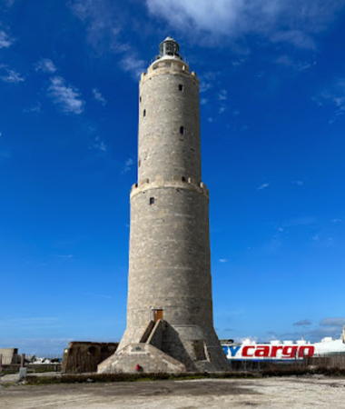
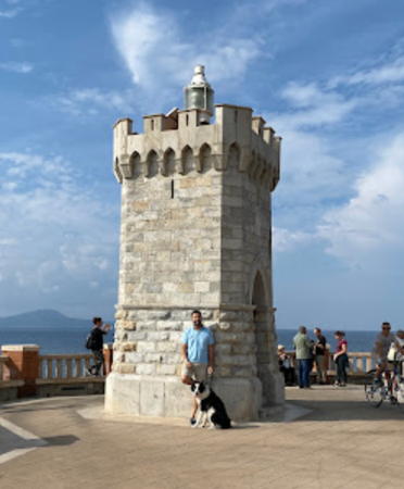
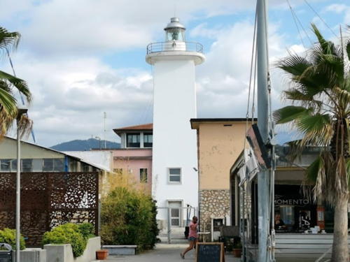
Livorno Light, Livorno, March 2023
Google Maps photo by Chionne Tonson
Grosseto Province Lighthouses

Giannutri Lighthouse
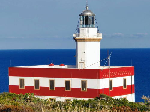
* Giannutri (Punta Rossa, Capel Rosso)
1883. Active; focal plane 61 m (200 ft); white flash every 5 s. Approx. 8 m (26 ft) round cylindrical masonry tower with lantern and gallery, attached to the front of a 1-story keeper's house. Both tower and house are painted with red and white horizontal bands; lantern dome is gray metallic. Wikimedia has a photo by Simone Franci, Trabas has Roberto Vongher's photo, Cosimo D'Auria has a 2023 photo, Dante Consonni has a 2019 closeup, Marinas.com has aerial photos, and Google has a satellite view. Recent photos show the lighthouse in need of restoration. The southernmost of the Tuscan Islands, Giannutri is a small island about 10 km (6 mi) south of the Monte Argentario peninsula and the same distance southeast of Giglio. The island is accessible by ferries from Porto Santo Stefano on Monte Argentario. The lighthouse is said to have been built in 1861, but it stood inactive for many years. Located on Punta Rossa, the south point of the island, apparently accessible by road and perhaps a short hike. Site open, tower closed. Site manager: Parco Nazionale Arcipelago Toscano. . ARLHS ITA-209; EF-2184; Admiralty E1496; NGA 9108.

Giglio Lighthouses
Giglio is an island about 8 km (5 mi) long north to south, located about 18 km (11 mi) west of Monte Argentario. Most of the island is included in the Parco Nazionale Arcipelago Toscano; the permanent population is only about 1700. The island is accessible by ferries from Porto Santo Stefano on Monte Argentario. In January 2012 the cruise ship Costa Concordia wrecked off the island's harbor and the lighthouses were seen in countless photos of the wreck. The ship was winched upright in September 2013 and towed to Genoa for dismantling in July 2014.

*
Giglio Porto Molo di Ponente (West Mole) (2)
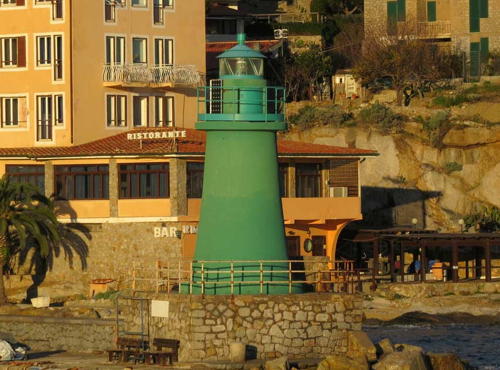
Date unknown. Active; focal plane 9 m (30 ft); green flash every 3 s. 6 m (20 ft) round masonry tower with a small lantern and gallery, painted green. Egidio Ferrighi's photo is seen at right, Trabas has Capt. Peter's closeup, Aldo Ferretto has a photo, Dan Hodgson has a photo of the shipwreck and the lighthouse, and Google has a street view and a satellite view. Located on the west mole of Giglio Porto. Accessible by walking the mole; there are also excellent views from ferries arriving at the harbor. Site open, tower closed. ARLHS ITA-205; EF-2164; Admiralty E1490; NGA 9100.
* Giglio Porto Molo di Levante (East Mole) (2)
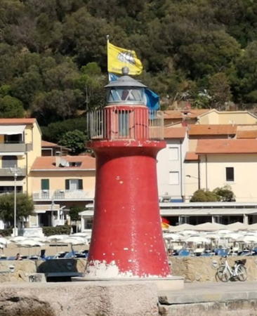
Date unknown. Active; focal plane 9 m (30 ft); red flash every 3 s. 6 m (20 ft) round masonry tower with a small lantern and gallery, painted red. Emanuela Zibordi has a 2009 closeup photo, Trabas has Capt. Peter's photo, Giorgio Paneck has the view from an arriving ferry, and Google has a street view and a satellite view. The first mole light at Giglio Porto was built in 1865; by the 1930s there were lights on both moles. Located on the east mole of Giglio Porto. Accessible by walking the mole; there are also excellent views from ferries arriving at the harbor. Site open, tower closed. ARLHS ITA-204; EF-2160; Admiralty E1488; NGA 9096.

Molo di Ponente Light, Giglio
photo copyright Egidio Ferrighi; used by permission
* Capel Rosso (Punta di Capel Rosso)
1883. Active; focal plane 90 m (295 ft); four white flashes every 30 s. 20 m (66 ft) octagonal cylindrical masonry tower with lantern and gallery, attached to the front of a 2-story keeper's house. Lighthouse painted white; lantern dome is gray metallic; the house is painted with red and white horizontal bands. Fabio La Rosa's photo is at right, Maurizio Manetti has a photo and a closeup, Federico Lucchini has a photo, Alberto Ghiro has a 2021 photo, Arturo Azzurro has a 2023 photo, Trabas has Capt. Peter's photo, Marinas.com has aerial photos, Carlo Maceroni has a street view, and Google has a satellite view. Located on the southern tip of Giglio; accessible by a hiking trail (about 2.5 km (1.5 mi) round trip) from the end of a national park road. Limited parking available. Site open, tower closed. Site manager: Parco Nazionale Arcipelago Toscano. . ARLHS ITA-126; Admiralty E1492; EF-2168; NGA 9104.
Giglio (Faro Antico, Faro delle Vaccarecce)
1850. Inactive since 1883. 21 m (69 ft) octagonal cylindrical masonry tower with gallery, attached to the front of a 3-story masonry keeper's house. Lantern removed. The lighthouse is unpainted. Vinicio Cavallini has a closeup photo, Giulio Branchetti has a 2022 photo, a distant view is available, and Google has a good satellite view and a distant street view. This lighthouse was built as the sole light for the island but its focal plane of 310 m (1017 ft) was much too high; the light was often obscured by low clouds or fog. The abandoned lighthouse was purchased in 2015 by Gherardo Felloni, who has restored and furnished the building as a private residence. Located on the heights in the northern part of Giglio, about 2 km (1.25 mi) southeast of Punta Fenaio. Site and tower closed (private property). . ARLHS ITA-281.
Punta Fenaio
1883. Active; focal plane 39 m (128 ft); three white flashes every 15 s. 10 m (33 ft) octagonal cylindrical masonry tower with lantern and gallery, attached to the front of a 2-story keeper's house. Lighthouse painted white with one red horizontal band; keeper's house painted bright red. Trabas has Capt. Peter's photo, Patrik Tschudin has a photo, Daniela Busnelli has a closeup photo, Paolo Cominetti has an October 2018 street view, and Google has a satellite view. The lighthouse has been leased as a resort. Located on the northern tip of Giglio. Access is by a hike of about 2.5 km (1.5 mi) from the end of the nearest road. Parking available. Resort guests are conveyed to the light station by 4WD pickup. Site open, tower closed. Lessee/site manager: Resort Faro di Punta Fenaio . ARLHS ITA-246; EF-2156; Admiralty E1486; NGA 9092.

Capel Rosso Light, Giglio, June 2021
Instagram photo by Fabio La Rosa

Monte Argentario and Orbetello Lighthouses
* Porto Ercole (Forte della Rocca)
1862. Active; focal plane 91 m (299 ft); white or red light, depending on direction, 2 s on, 5 s off. 19 m (62 ft) round cylindrical masonry tower with lantern and gallery rising from the ramparts of the Forte della Rocca Spagnola. 3rd order Fresnel lens in use. Lighthouse painted white. Trabas has a good photo, Ferrighi also has a photo, and Google has a street view and a satellite view. This lighthouse stands on the southeastern tip of Monte Argentario, a mountainous almost-island connected tenuously to the mainland by sandbars and a causeway. Located at the end of the Via della Rocca in Porto Ercole. Site and tower closed (private property) but the light can be seen from nearby. Parking available. Site manager: Comune di Monte Argentario. ARLHS ITA-115; EF-2172; Admiralty E1500; NGA 9112.
Punta Lividonia (2)
1926 (station established 1883). Active; focal plane 47 m (154 ft); white flash every 5 s. 12 m (39 ft) octagonal cylindrical masonry tower with lantern and gallery set into the front of a 2-story masonry keeper's house. 2nd order Fresnel lens in use. Lighthouse painted white; the house is painted a dark red-brown. Trabas has Capt. Peter's photo, Sara Pennisi has a 2021 closeup, Mauro Boscolo has a view from the sea, and Google has a satellite view. This lighthouse marks the northwestern tip of Monte Argentario. Located off the spectacular coastal road, the Via Panoramica, about 2.5 km (1.5 mi) northwest of the town of Monte Argentario. Probably accessible by hiking the access road but there's no parking at the unmarked entrance. Site open, tower closed. ARLHS ITA-134; EF-2144; Admiralty E1480; NGA 9076.
* Talamone (2)
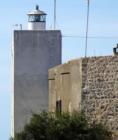
1947 (station established 1865). Active; focal plane 30 m (98 ft); two white flashes every 10 s. 18 m (59 ft) square cylindrical tower with lantern and gallery, attached to the seaward wall of an ancient fortress. Lighthouse painted white. The keeper's house survives and is in use as the clubhouse of a sailing club. Andreas Köhler's photo is at right, Trabas has a closeup photo by Capt. Peter, Paolo Cardoni has a photo, a view from the sea is available, Mirko Mangione has a street view, and Google has a satellite view. The present lighthouse is a copy of the original, which was heavily damaged in World War II. Located at the end of the Via dei Mille, at the tip of a sharp promontory sheltering the harbor of Talamone, about 10 km (6 mi) northwest of Orbetello. Parking provided. Site open, tower closed. Site manager: Circolo della Vela Talamone. ARLHS ITA-166; EF-2140; Admiralty E1476; NGA 9060.
Formiche di Grosseto (2)
1919 (station established 1901). Active; focal plane 23 m (75 ft); white flash every 6 s. 12 m (39 ft) round cylindrical masonry tower with lantern and gallery, rising from a 1-story masonry keeper's house. A closeup is available, Enrico Falsini has a 2020 photo, Simone Boldi has a view from the sea, Federico Fischanger has a 2021 street view, and Bing has a satellite view of the station. Formiche (ants) is a term Italian sailors use for isolated rocks in the sea. Located on a small rocky islet about 20 km (13 mi) due south of Castiglione della Pescaia and a similar distance north of Giglio. Accessible only by boat. Site open, tower closed. ARLHS ITA-203; EF-2136; Admiralty E1474; NGA 9056.

Talamone Light, Talamone, September 2021
Google Maps photo by Andreas Köhler

Castiglione della Pescaia Lighthouses
* Castiglione della Pescaia Molo del Sud (2?)
Date unknown (station established 1912). Inactive. 6 m (20 ft) round iron or steel tower with lantern and gallery. The lighthouse was originally painted with black and white horizontal bands. However, recent photos show the tower painted blue. Alessandro Ruggeri has a 2020 photo, Marco Bianco has a street view, Marinas.com has aerial photos, and Google's satellite view shows the tower standing opposite the north mole light. The south mole has been extended and Trabas has Capt. Peter's photo showing a new post light (focal plane 8 m (26 ft); green flash every 3 s) at the end of the extension. Located at the end of the south breakwater at the entrance to the Bruna River in Castiglione della Pescaia. Site open, tower closed. ARLHS ITA-195. New light: Admiralty E1468; NGA 9044.
* Castiglione della Pescaia Molo del Nord (2?)
Date unknown (station established 1912). Active (privately maintained); focal plane 8 m (26 ft); red flash every 3 s. 6 m (20 ft) round iron or steel tower with lantern and gallery. Originally painted with red and white horizontal bands, but Trabas's photo shows it covered by a red tile or vinyl. Andreas Köhler's photo is at right, Marinas.com has aerial photos, Marco Bianco has a street view, and Google has a satellite view. This light is maintained by the local government or by the marina operator. Located at the end of the north breakwater at the entrance to the Bruna River in Castiglione della Pescaia. Site open, tower closed. ARLHS ITA-194; Admiralty E1470; NGA 9048.
* Punta Ala
Date unknown. Active (privately maintained); focal plane 12 m (39 ft); white flash every 2 s. 7 m (23 ft) hexagonal cylindrical concrete tower, painted white with red trim. Trabas has Capt. Peter's photo, Marinas.com has aerial photos, Davide Brandini has a street view, and Google has a satellite view. Punta Ala is a prominent cape about 15 km (9 mi) west of Castiglione della Pescaia and about 25 km (15 mi) southeast of Piombino. A large marina has been developed on the very point of the cape. Located near the west end of the breakwater at Punta Ala. Site open, tower closed. Owner/operator: Marina di Punta Ala. Admiralty E1466; NGA 9032.
* Punta Ala Entrance
Date unknown. Active (privately maintained); focal plane 10 m (33 ft); red flash every 2 s. 9 m (30 ft) hexagonal concrete tower with observation room and gallery; the light is shown from a short post on the roof. Tower painted red with a white band at the gallery level. Trabas has Capt. Peter's photo, Marinas.com has aerial photos, and Google has a satellite view. The lighthouse (probably the marina office) is at the end of the short north mole of the marina. Site open; the gallery may be accessible to visitors. Owner/operator: Marina di Punta Ala. Admiralty E1466.2; NGA 9036.

Molo del Nord, Castiglione della Pescaia, September 2021
Google Maps photo by Andreas Köhler

Follonica Lighthouse
* Marina di Scarlino (Etrusca Marina) Port Office
Date unknown. Active (privately maintained); focal plane 8 m (26 ft); two red lights, displayed one above the other. 6 m (20 ft) post light centered on an octagonal red cinder block pier house. Trabas has Capt. Peter's photo and also photos of similar but smaller lights built at the ends of the Inner Mole (Admiralty E1462.2) and Outer Mole (Admiralty E1462). Sandra Rickert has a photo and Google has a satellite view. Located at the end of the north mole at the Marina di Scarlino (formerly the Etrusca Marina), a recreational boat harbor at Portiglioni, about 5 km (3 mi) south of Follonica. Site and office open. Owner/operator: Marina di Scarlino. Admiralty E1462.5.

Livorno Province Lighthouses

Pianosa and Scoglio d'Africa Lighthouses
Scoglio d'Africa (Scoglio d'Affrica, Formiche di Montecristo) (2)
Date unknown (station established 1867). Active; focal plane 19 m (62 ft); white flash every 5 s. 16 m (52 ft) round stone tower with lantern and gallery; the tower has a bluntly conical base to resist the waves. The lighthouse is unpainted; the lantern dome is gray metallic. Roberto Gallone has a 2021 photo, Armando Feola has a 2016 photo, Trabas has a view from the sea by Capt. Theo Hinrichs, and a photo and a second photo are available, but the reef is not shown in Google's satellite view. The original light was a pile lighthouse, presumably similar to the Secche della Meloria and Secche di Vada lights. Scoglio d'Africa is a notoriously dangerous rock about 5 km (3 mi) west northwest of the island of Montecristo and 30 km (19 mi) due south of Pianosa. Accessible only by boat. Site and tower closed. ARLHS ITA-160; EF-2096; Admiralty E1454; NGA 8976.
* Pianosa
1864. Active; focal plane 42 m (138 ft); two long (1.5 s) white flashes every 10 s. 19 m (62 ft) round cylindrical masonry tower rising from a 3-story masonry building. Entire structure painted white; lantern dome is gray metallic. Trabas has Capt. Peter's photo seen at right, Francesco Nardi has a 2014 closeup, Mauro Serafini has a 2006 photo, a street view from the gallery is available, and Google has a satellite view. Pianosa is a small island about 18 km (11 mi) southwest of Elba and 35 km (22 mi) east of Sardinia. It is rather flat, unlike most Mediterranean islands. From 1858 to 1998 Pianosa was the site of Italy's most secure prison, where the dons of the Mafia and other high-risk inmates were imprisoned. The island is now a nature reserve with no permanent inhabitants. Boat transportation is available from Elba but special permits are required to land private boats on the island. Located on the east side of the island. Site open, tower closed. Site manager: Parco Nazionale Arcipelago Toscano. ARLHS ITA-261; EF-2088; Admiralty E1448; NGA 8968.

Elba Lighthouses
Elba is by far the largest of the Tuscan Islands. About 30 km (19 mi) long, it lies east to west just to the southwest of Piombino, from which it is accessible by frequent ferry service. The island made a brief appearance in world history when Napoleon was exiled there in 1814-15. Today it is a popular resort.

Scoglietto (2)
1945 (station established 1910). Active; focal plane 24 m (79 ft); two white flashes every 8 s. 8 m (26 ft) round cylindrical stone tower with lantern and gallery, rising from one corner of a small square stone keeper's cottage. The lighthouse is unpainted gray stone; lantern painted white with a gray metallic dome. Trabas has Capt. Peter's photo, Angela and Roberto Stocco have a photo, Ferrighi has a distant view, Marinas.com has aerial photos, and Google has a satellite view and a closeup street view. This little lighthouse, a reconstruction of a historic light destroyed during World War II, stands atop an islet about 1 km (0.6 mi) north of Portoferraio. Accessible only by boat, but passengers arriving on ferries to Portoferraio have an excellent view. Site status open, tower closed. ARLHS ITA-257; EF-2068; Admiralty E1410; NGA 8892.

Pianosa Light, Pianosa
photo copyright Capt. Peter Mosselberger; used by permission
* Forte Stella (Portoferraio, Elba) (2)
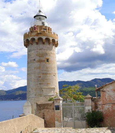
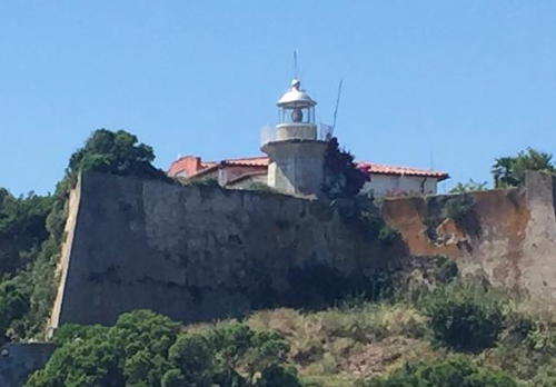
1915 (station established 1789). Active; focal plane 63 m (207 ft); three white flashes every 14 s; also a continuous red light, mounted on the gallery at 60 m (197 ft), to warn ships away from shoals that extend from Capo Bianco. 25 m (82 ft) round stone tower with lantern and double gallery. The tower is unpainted stone, and the lantern is unpainted gray metallic. A 2023 photo is at right, Giacomo Bartalesi has a photo, Trabas has Capt. Peter's closeup photo, Wikimedia has photos including a panoramic view, a good 2009 photo is available, Marinas.com has aerial photos, Enrico Rinero has a street view, and Google has a satellite view. The first lighthouse was ordered by Grand Duke Leopold II of Tuscany. The lighthouse is built on a northern rampart of Forte Falcone, a fortress built in the mid-16th century by Cosimo I de' Medici; the star-shaped fort is known locally as Forte Stella. Located above the tip of Capo Bianco, which shelters the harbor of Portoferraio. Site open, tower closed. . ARLHS ITA-083; EF-2072; Admiralty E1412; NGA 8896.
* Portoferraio Molo del Gallo (Molleto della Sanità)
1902. Active; 7 m (23 ft); two continuous red lights, one above the other. 5 m (17 ft) square stone building with gallery. Trabas has Capt. Peter's photo and Google has a satellite view and a closeup street view of the rear of the building. Located at the end of a short mole on the west side of the entrance to the pleasure boat harbor at Portoferraio. Site open, tower closed. EF-2076; Admiralty E1415; NGA 8900.
Palmaiola
1844. Active; focal plane 42 m (138 ft); two long (1.5 s) white flashes every 10 s. 14 m (46 ft) square cylindrical stone tower with lantern and gallery, rising from a 1-story stone keeper's house. Tower painted white. Trabas has Capt. Peter's photo, Wikimedia also has a photo, a good closeup is available, Campanaro Ligure has a 2020 photo, Marinas.com has aerial photos, and Google has a satellite view. Palmaiola is a small, very steep island in the Piombino Channel about 4 km (2.5 mi) east of Cavo, Elba, and 8 km (5 mi) southwest of Piombino on the mainland. Located at the highest point of the island. Accessible only by boat; there are distant views from the northeastern coast of Elba and from ferries crossing the strait. Site open, tower closed. ARLHS ITA-109; EF-2016; Admiralty E1446; NGA 8992.
* Rio Marina
1914. Inactive since the 1960s at least. 4.5 m (15 ft) hexagonal cylindrical masonry tower with a crenelated top. Roberto Ferrari has a good photo, Andrea Crispu has a closeup street view, and Google has a more distant street view as well as a satellite view. This light was built on a dangerous rock in the harbor of Rio Marina, but the rock is now incorporated into the breakwater pier of the harbor. Accessible by a stairway from the pier. Site open, tower closed.

Forte Stella Light, Portoferraio, August 2023
Google Maps photo by B D B
Capo Focardo
1863. Active; focal plane 32 m (105 ft); three long (1.5 s) white flashes every 15 s. Approx. 13 m (43 ft) octagonal cylindrical masonry tower with lantern and gallery. The lighthouse is painted white; the lantern dome is gray metallic. A photo is at right, Trabas has Capt. Peter's photo, Wikimedia has a view from the sea, and Google has a satellite view. Forte Focardo (or Forte Longone) is another star-shaped fort, this one built in the late 17th century by Phillip III of Spain, who was then in control of Elba. The lighthouse is built just inside the high walls of the fort, making it difficult to get a good photo. Located on a promontory at the south side of the entrance to the harbor of Porto Azzurro (Longone) near the southeastern corner of Elba. Site and tower closed (Navy property: the entrance is gated). Site manager: Parco Nazionale Arcipelago Toscano. . ARLHS ITA-022; EF-2040; Admiralty E1432; NGA 8948.
* Marina di Campo
Date unknown (station established 1901). Active; focal plane 34 m (112 ft); white flash every 3 s. White post with a small red lantern mounted atop a yellow building. Trabas has Capt. Peter's photo and Google has a satellite view. Located on the hillside above the foot of the breakwater at Campo on the south coast of Elba. Site open, tower closed. ARLHS ITA-285; EF-2056; Admiralty E1439; NGA 8956.
* Monte Poro (Capo Poro)
Date unknown. Active; focal plane 160 m (525 ft); white flash every 5 s. 7 m (23 ft) round cylindrical lantern mounted on a square 1-story concrete equipment shelter. The lantern is unpainted gray aluminum. 5th order Fresnel lens in use. Trabas has Capt. Peter's closeup photo, Wikimedia has several photos, Jochen Otters has a photo, Maurizio Lettieri has a 2019 photo, and Google has a satellite view. Located atop a steep promontory at the western entrance to the Golfo di Campo, about 2.5 km (1.5 mi) south of Campo. Accessible by a hiking trail. Site and tower closed. Site manager: Parco Nazionale Arcipelago Toscano. . ARLHS ITA-295; EF-2054; Admiralty E1438; NGA 8952.
 

Capo Focardo Light, Elba, June 2019
Instagram photo by La leggenda del faro
 
Punta Polveraia (Isola d'Elba)
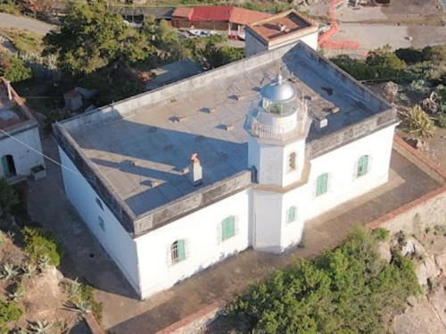
1909. Active; focal plane 52 m (171 ft); three long (2 s) white flashes every 15 s. 10 m (33 ft) octagonal cylindrical masonry tower with lantern and gallery, rising from one side of a 1-story masonry keeper's house. Entire lighthouse is white; lantern dome is gray metallic. A drone view is at right, Trabas has a photo by Ferrighi (also seen at right), Marinas.com has aerial photos, and Google has a satellite view, but a tree hides the lighthouse in Google's street view. This lighthouse marks the northwestern tip of Elba in a rather wild natural area. Located at the end of Via del Faro about 2 km (1.2 mi) west of Patresi. Accessible by a twisting mountain road, but parking is limited. Site and tower closed (Navy property). Site manager: Parco Nazionale Arcipelago Toscano. . ARLHS ITA-140; EF-2060; Admiralty E1444; NGA 8884.

Capraia Lighthouse
Capraia is an island 64 km (40 mi) southwest of Livorno and 31 km (20 mi) east of Cap Corse, Corsica. The island has an area of 19 km2 (7.3 sq mi) and is accessible by ferry from Livorno. Note: there is another Isola di Capraia, also with a lighthouse, among the Isole Tremiti in the Adriatic Sea off Puglia.

*
Punta del Ferraione (2)
1908 (station established 1868). Active; focal plane 30 m (98 ft); white light, 2 s on, 4 s off. 12 m (39 ft) square cylindrical masonry tower attached to one corner of a square 2-story masonry keeper's house. Lighthouse painted white; lantern dome is gray metallic. Trabas has Tom Chisholm's closeup photo, a more distant photo and another photo are available, Wikimedia has a fine panoramic view, Thomas Krüger has a street view, and Google has a satellite view. The original light was on a mast rising from the keeper's house. Located at the end of a peninsula sheltering the harbor of Porto di Capraia. Site open, tower closed. . ARLHS ITA-127; EF-1996; Admiralty E1400; NGA 8864.

Punta Polveraia Light, Patresi, June 2020
Google Maps drone view by sola d'Elba App

Piombino Lighthouses
* Piombino (La Rocchetta)
Date unknown. Active; focal plane 18 m (59 ft); three white flashes every 15 s. 5 m (17 ft) square castellated stone tower with gallery and a small red post light at the top. The tower is unpainted gray stone. Carmelo Tommaso Russo's photo is at right, Trabas has Capt. Peter's closeup photo, Laura Canovaro has a 2008 photo, Wikimedia has a photo, Tommaso Bogani has a street view, and Google has a satellite view. Piombino, located at the end of a blunt peninsula jutting out of the Tuscan coast, is the ferry port for Elba. Located atop a small islet (now joined to the mainland) at the tip of the peninsula. Site open, tower closed. . ARLHS ITA-288; EF-2098; Admiralty E1455; NGA 8996.
Porto Baratti
Date unknown. Active; focal plane 75 m (246 ft); white flash every 3 s. 4 m (13 ft) square concrete equipment room, painted white; the light is displayed from a short post atop the building. Trabas has a closeup photo, Davide Moroni has a 2021 photo, and Google has a satellite view. Located on a bluff above the open roads anchorage of Baratti, about 7 km (4.5 mi) north northwest of Piombino. Site status unknown; some local knowledge is needed to find this light. EF-2012; Admiralty E1390; NGA 8988.

Rosignano Marittimo Lighthouses
Secche di Vada (2)
1959 (station established 1868). Active; focal plane 18 m (59 ft); two white flashes every 10 s. 18 m (59 ft) round cylindrical tower with lantern, mounted on a round concrete base protected by riprap. Tower painted black with one red horizontal band; lantern is gray metallic. A sibling of the Secche della Meloria (South End) lighthouse (see below). The lighthouse appears in poor condition in Marco Diquattro's August 2007 photo but it appeared improved by repainting in a more recent photo. Alessandra Vignaroli has a 2021 photo, Trabas has Capt. Peter's photo, but the shoal is not shown in Google's satellite view. This waveswept light is located on a shoal about 8 km (5 mi) west southwest of Vada. The original light was a screwpile lighthouse similar to the one built around the same time on Secche della Meloria (see below). Located about 12 km (7.5 mi) off the small port of Castagneto Carducci. Accessible only by boat. Site open, tower closed. ARLHS ITA-164; EF-1975; Admiralty E1384; NGA 8980.

Piombino Light, Piombino, October 2021
Google Maps photo by Carmelo Tommaso Russo
* Vada (Torre del Faro di Vada)
Date unknown. Inactive since around 1980 (?). Approx. 25 m (82 ft) massive square pyramidal masonry tower. Wikimedia has a 2008 closeup photo and Google has a street view and a satellite view. Built in 1279, the Torre di Vada served both defensive and navigational purposes. Its history as a lighthouse is poorly known, but a modern light was installed on the tower in 1867. It was still in use during the 1930s, and some sources, including the Italian Wikipedia article, claim the light to have been active as late as 1979. When Andreas Köhler visited in 2022 he found the tower in poor condition. Located in Vada, a town about 25 km (15 mi) south of Livorno. Site open, tower closed.

Livorno (Leghorn) Lighthouses
The provincial capital of Livorno is a city of about 160,000 residents. Its port is a very popular destination for cruise ships because it serves as a convenient base for visits to other famous Tuscan destinations including Florence, Siena, and Pisa.

Diga della Vegliaia
Date unknown. Active; focal plane 18 m (59 ft); green flash every 3 s. 14 m (46 ft) slender metal tower with lantern mounted on a large octagonal stone base. Fausto Bonsignori has a photo, Trabas has Rainer Arndt's photo, and Google has a satellite view. Located at the west end of a detached breakwater on the east side of the entrance to Livorno harbor. Accessible only by boat. Site open, tower closed. EF-1916; Admiralty E1374; NGA 7924.
Livorno (Fanale di Livorno, Fanale dei Pisani) (3)
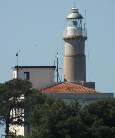
1955 (station established 1154). Active; focal plane 52 m (171 ft); four white flashes every 20 s. 52 m (171 ft) two-stage round cylindrical stone tower with lantern and gallery. The tower is unpainted stone; the lantern has a white base and a gray metallic dome. A photo by Chionne Tonson is at the top of this page, Trabas has a good photo by Capt. Peter, the Navy has a page with photos, Ferrighi has a photo, Wikimedia has many photos, a 2019 photo is available, Luca Furia has a 2009 photo, Federico Debetto has a drone view, and Google has a satellite view. This magnificent lighthouse is a faithful reconstruction of the famous tower built in 1303-05 by the sculptor and architect Giovanni Pisano. Destroyed by retreating German troops in 1944, the lighthouse was rebuilt using many of the original stones and rededicated on September 16, 1956. Located on the Livorno waterfront opposite the harbor entrance. Site and tower closed. . ARLHS ITA-097; EF-1896; Admiralty E1356; NGA 7892.
Livorno Diga Curvilinea South End
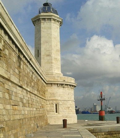
1857. Active; focal plane 22 m (72 ft); flash every 3 s, white or red depending on direction. 20 m (66 ft) octagonal cylindrical stone tower centered on a 2-story stone base. The lighthouse is unpainted. Trabas has a good photo by Capt. Peter, Ghislain Utard has a 2023 photo, Larry Myhre has a photo, Miloš Haraslín has a photo, Sara Pellegrini has a photo of the breakwater (this lighthouse is in the foreground), and Google has a satellite view. The Diga Curvilinea is the curved breakwater protecting the harbor of Livorno. Located at the south end of the Diga Curvilinea. Accessible only by boat (the breakwater does not connect to shore). Site and tower closed, but there are good views from the waterfront. . ARLHS ITA-197; EF-1911; Admiralty E1368; NGA 7888.
Livorno Diga Curvilinea North End (1)
1857. Inactive. 20 m (66 ft) octagonal cylindrical stone tower centered on a 2-story stone base. The lighthouse is unpainted. A photo is at right, Larry Myhre has a photo, Benoit Bourdin has a photo, Huelse has a historic postcard view, and Google has a satellite view. Lighthouses were built at both ends of the curved breakwater. After an extension was added at the north end, this lighthouse was replaced by a small beacon at its base (next entry). Located at the north end of the Diga Curvilinea, where the breakwater joins the straight Diga Meloria. Accessible only by boat (the breakwater does not connect to shore). Site and tower closed, but there are good views from the waterfront. ARLHS ITA-283.
[Livorno Diga Curvilinea North End (2)]
Date unknown. Active; focal plane 7 m (23 ft); flash every 3 s, red or green depending on direction. 5 m (17 ft) round "bottle" style light. Light painted with red and green horizontal bands. A photo is at right and Trabas has Eckhard Meyer's photo. Located at the base of the historic lighthouse. EF-1941; Admiralty E1370; NGA 7884.

Diga Curvilinea North End Light, Livorno, February 2016
Instagram photo by mauli65
Livorno Diga Meloria
Date unknown. Active; focal plane 12 m (39 ft); three flashes every 10 s, white or green depending on direction. 10 m (33 ft) round "bottle" style light mounted atop a stone pierhead building. Trabas has Eckhard Meyer's photo and Google has a satellite view. Located at the end of the extension of the Diga Curvilinea. Accessible only by boat. Site and tower closed. EF-1901; Admiralty E1358; NGA 7880.
Livorno Diga Marzocco
1917. Active; focal plane 12 m (39 ft); three red flashes every 10 s. 11 m (36 ft) octagonal unpainted masonry tower topped by a red beacon. Trabas has Eckhard Meyer's closeup photo and Google has a satellite view. Located at the end of the Marzocco breakwater on the north side of Livorno's traditional harbor. Site status unknown. ARLHS ITA-284; EF-1906; Admiralty E1360; NGA 7896.

Secche della Meloria Lighthouses
The Secche della Meloria is a large and very dangerous shoal extending to the northwest of Livorno. Marking this shoal has been a grave concern for many centuries.

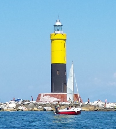
Secche della Meloria (5) (South End)
Date unknown (1950s?). Active; focal plane 18 m (59 ft); six quick white flashes followed by one long white flash, every 15 s. 20 m (66 ft) round cylindrical tower with lantern and gallery. Upper half of the lighthouse painted yellow, lower half black; the lantern is gray metallic. Alessandro Andreani's photo is at right, Trabas has Darlene Chisholm's photo, Andreani also has a photo showing this lighthouse and the Torre della Meloria, Leandro Galanti has a 2021 photo, and Google has a satellite view. Huelse has a postcard view of a screwpile lighthouse that presumably replaced a light on the Torre della Meloria in 1867 and was itself replaced by the current lighthouse sometime after World War II. Located on the shoal about 250 m (800 ft) south of the Torre della Meloria. Accessible only by boat. Site open, tower closed. ARLHS ITA-291 (?); EF-1888; Admiralty E1348; NGA 7876.
Secche della Meloria (3) (Torre della Meloria)
1709 (station established 13th century). Inactive since at least 1867. Approx. 20 m (66 ft) square cylindrical white stone tower on an arched base. Wikimedia has a photo by Filippo Gini and a photo by Alessandro Andreani, and Google has a satellite view. The first tower was built by Genoa, which controlled this coast until a decisive naval battle in 1284, within sight of the shoal, established Pisa's independence. A second tower was built in 1598, and the third was ordered in 1709 by Cosimo III de' Medici, Grand Duke of Tuscany. However, it is not clear whether any of these towers actually carried a light. Located on the shoal about 6 km (4 mi) west of Livorno. Accessible only by boat. Site open, tower status unknown. ARLHS ITA-290.
Secche della Meloria North End
Date unknown (1950s or 1960s). Active; focal plane 18 m (59 ft); two white flashes every 10 s. 20 m (66 ft) round cylindrical white concrete tower with lantern and gallery. Trabas has Capt. Peter's photo, Gra La Marca has a 2023 photo, and Wikimedia has several distant views but the tower is not seen in Bing's satellite view. This lighthouse is located 9 km (5.5 mi) north of the Torre della Meloria (previous entry) and 14 km (9 mi) northwest of Livorno. Accessible only by boat. Site open, tower closed. ARLHS ITA-258; EF-1884; Admiralty E1347.8; NGA 7872.

South End Light, Secche della Meloria, August 2015
Wikimedia Creative Commons photo by Alessandro Andreani

Lucca Province Lighthouses

Viareggio Lighthouses
* Viareggio Nuova Diga (New Breakwater)
Date unknown. Active; focal plane 30 m (98 ft); white flash every 5 s. 33 m (102 ft) round cylindrical concrete tower with lantern and gallery; entire lighthouse painted white. Trabas has an excellent photo, Wikimedia has several photos, Ferrighi has a photo, Rudolf Sedlaczek has a closeup photo, and Google has a street view and a good satellite view. Viareggio is a resort town and port with about 62,000 residents about 20 km (13 mi) northwest of Pisa. Located near the foot of the breakwater enclosing the harbor of Viareggio, about 600 m (3/8 mi) southwest of the older lighthouse. Site open, tower closed. . ARLHS ITA-292; EF-1868; Admiralty E1340; NGA 7856.
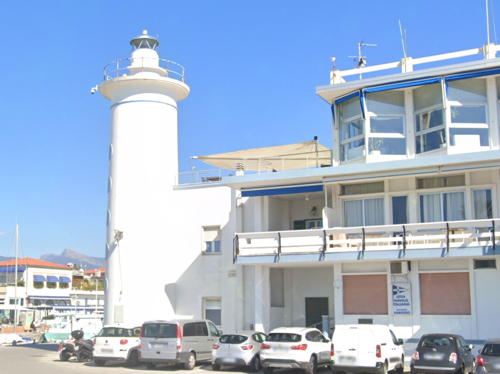
* Viareggio
Date unknown (station established 1863). Inactive. Approx. 14 m (46 ft) round tower with lantern and gallery, attached to a corner of a 2-story waterfront building now occupied by a yacht club. Lighthouse painted white with blue trim. A 2020 Google street view is at right, a closeup photo is available, Elena Torre's has a good photo, Ferrighi has a photo, Wikimedia has several photos, and Google has a satellite view. Huelse has a postcard view of the original lighthouse, which was located on the north mole nearby. This lighthouse was replaced by a taller light on the breakwater (previous entry). Located near the foot of the south mole on the waterfront of Viareggio, at the north corner of the harbor adjacent to the Burlamacca canal. Site open, tower status unknown. Site manager: Club Nautico Versilia. . ARLHS ITA-173.

Viareggio Light, Viareggio, October 2020
Google Maps street view

Massa and Carrara Province Lighthouse

Carrara Lighthouses
* Marina di Carrara
1956. Active; focal plane 22 m (72 ft); white flash every 3 s. 22 m (72 ft) square concrete tower with lantern and gallery, painted white with gray trim; lantern dome is metallic gray. Andreas Köhler's 2021 photo is at right, Trabas has Eckhard Meyer's photo, Ferrighi has a photo, and Google has a street view and a satellite view. The lighthouse is attached to the 2-story port captain's office. Marina di Carrara is the port serving the famous Carrara quarries, which produce some of the world's finest marble. The docks and breakwater are crowded with marble waiting to be shipped. Located on the west side of the waterfront in Marina di Carrara. Site and tower closed, but the lighthouse can be seen from nearby. ARLHS ITA-100; EF-1846; Admiralty E1328; NGA 7832.
* Marina di Carrara Leading
Date unknown. Active; focal plane 32 m (105 ft); continuous light, white, red or green depending on direction. 30 m (98 ft) robust steel post painted gray. Trabas has Capt. Peter's photo, Claudio Chiesa has a 2021 photo, Dario Alejandro Barletta has a street view along the pier, and Google has a satellite view. Located on the west breakwater of Carrara's harbor. Site open, tower closed. Admiralty E1328.5; NGA 7833.

Information available on lost lighthouses:

Notable faux lighthouses:


Carrara Light, Carrara, October 2021
Google Maps photo by Andreas Köhler

Adjoining pages: North: Liguria | South: Campania and Lazio

Return to the Lighthouse Directory index | Ratings key

Posted May 1, 2006. Lighthouses: 44. Checked and revised March 7, 2024. Site copyright 2024 Russ Rowlett and the University of North Carolina at Chapel Hill.