Lighthouses of Finland: Åland

Åland, also called the Åland Islands, is an archipelago lying off the southwestern corner of Finland and stretching across the entrance to the Gulf of Bothnia from the Baltic Sea. There is one large island, Fasta Åland, about 80 smaller inhabited islands, and more than 6000 islets and skerries. The great majority of the residents (more than 90%) are Swedish by language and heritage. In fact the islands were part of Sweden until 1809, when Sweden was forced to cede them to the Russian Empire along with Finland.

When Finland became independent from Russia in 1917 the Ålanders petitioned to secede from Finland. Finland declined and ultimately the Åland question was referred to the League of Nations. In 1921 the League decided that Åland should remain under Finnish sovereignty, but that the islands should be autonomous, self-governing, and demilitarized. Åland has its own parliament and national flag, issues its own postage stamps, and has a distinct ISO country code (ALA) and Internet top-level domain (.ax). However, from the Finnish perspective Åland is an autonomous province of Finland governed under international treaties by a special Act of Autonomy. The Finnish name for Åland is Ahvenanmaa.

Åland is divided into 16 townships (kommuner) and in this list the lights are grouped by township.

The Finnish word for a lighthouse is majakka (plural majakat); saari is an island, luoto is an islet or skerry, niemi is a cape or headland, niemimaa is a peninsula, lahti is a bay, salmi is a strait, joki is a river, and satama is a port or harbor. The Swedish word is fyr (plural fyrar); ö is an island, holme is an islet, skär is a skerry (a tiny island or rocky reef), sund is a strait (often between an island and the mainland), vik is a bay, hav is a sea, udde is a headland, and hamn is a harbor. Since Swedish is the language of the islands the names of the lighthouses are generally in that language.

Lighthouses in Åland, as in all of Finland, are maintained by the Waterways Section of the Finnish Transport Infrastructure Agency (Liikennevirasto).

Special thanks to Michel Forand, who researched these lighthouses extensively and provided data from the Admiralty list.

ARLHS numbers are from the ARLHS World List of Lights. SU numbers are from the official Finnish light list. Admiralty numbers are from volume C of the Admiralty List of Lights & Fog Signals. U.S. NGA List numbers are from Publication 116, but for some reason very few of the Åland lighthouses are listed in the NGA Light List.

General Sources
Lista över fyrar i Ålands skärgård
List of navigational lights in Åland posted in the Swedish Wikipedia.
Finskt fyrväsende
Photos and information posted by the Swedish Lighthouse Society.
Online List of Lights - Finland
Photos by various photographers posted by Alexander Trabas.
Lighthouses in Finland
Photos by various photographers available from Wikimedia.
World of Lighthouses - Finland
Photos by various photographers available from Lightphotos.net.
Lighthouses in Finland
Aerial photos posted by Marinas.com.
Weitere Europäische Leuchttürme auf historischen Postkarten
Historic postcard images posted by Klaus Huelse.
List of Lights
The Finnish light list is available for download in pdf format.
Finnish Lighthouse Society
The national lighthouse preservation association.
GPSNauticalCharts
Navigational chart for Åland.
Navionics Charts
Navigational chart for Åland.

Lågskär Light
Lågskär Light, Lemland, August 2009
Wikimedia Creative Commons photo by Islander

Southern Åland Lighthouses

Baltic Sea Lighthouses
These major lighthouses are located well to the south of Åland; they guide vessels in the entrances to the Gulf of Finland to the east and the Gulf of Bothnia to the northwest.

Suomen Leijona (Finska Lejonet) (2)
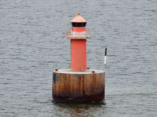
2005 (station established 1987). Active; focal plane 13 m (43 ft); two white flashes every 12 s. 13 m (43 ft) steel post painted white with an orange horizontal band and carrying a radar reflector. Wikimedia has a photo and the Swedish Lighthouse Society has a page for the lighthouse, but the light is not shown in Google's satellite view. This is Finland's southernmost lighthouse; its name means "Lion of Finland." The original lighthouse was a 20 m (66 ft) tower of unique design carrying a helipad. In 1992 (after only five years of service) the foundation of the lighthouse was undermined, causing severe damage when the tower began to list. Repairs changed the appearance of the tower somewhat. Following further ice damage in the winters of 2003 and 2004 the lighthouse had to be demolished and replaced by the present tower. Located on a shoal about 26 km (16 mi) east southeast of Bogskär and a similar distance south of Kökar, the nearest part of Åland. Accessible only by boat. Site open, tower closed. ARLHS ALA-018; SU-3161; Admiralty C4487; NGA 16094.
Bogskär (2)
1882 (greatly altered after World War I). Active; focal plane 28 m (92 ft); three white flashes, in a 2+1 pattern, every 20 s. Approx. 22 m (72 ft) two-stage tower: the lower stage is a round concrete tower incorporating keeper's quarters, and the upper stage is a hexagonal steel skeletal tower with lantern and a helipad on top. The lower half of the concrete tower is painted white and the upper half blue; the skeletal tower is painted white. The Swedish Lighthouse Society's page for the lighthouse includes Ted Rapp's photo at right, Wikipedia's article has a 2009 photo, Xavier Pastor has a 2012 photo, and Google has a very distant satellite view. Huelse has a historic postcard view of the original lighthouse, a round cast iron tower with lantern and gallery mounted on a round stone base. This tower, too weak for the conditions of the northern Baltic, was damaged by a severe winter storm in 1889 that left the keepers marooned without outside assistance for over a month. The upper portion of the lighthouse was destroyed by German naval bombardment in 1915, during World War I. After the war, as soon as Finnish sovereignty over Åland was recognized, the current upper section was installed and the lighthouse was reactivated in 1922. Keepers staffed this remote station until 1981. Painted in Finland's national colors, this lighthouse greets many travelers arriving by ship. Located on a skerry about 50 km (30 mi) south southeast of Mariehamn, Åland's capital. Accessible only by boat. Site open, tower closed. ARLHS ALA-002; SU-6116; Admiralty C4486; NGA 16092.

Bogskär Light, Baltic Sea, January 2015
Swedish Lighthouse Society Creative Commons photo by Ted Rapp

Kökar Lighthouses
Kökar is an island at the southeastern extremity of the Åland archipelago. The population in 2019 was 235.

Söderkobb
Date unknown. Active; focal plane 8 m (26 ft); flash every 6 s, white, yellow, red or green depending on direction. 6 m (20 ft) round concrete tower painted white with a red stripe. No photo available but Google has a satellite view. The light marks an obstruction in the middle of the Kökarfjärden channel east of Kökar. Located on a skerry about 10 km (6 mi) east of Kökar. Accessible only by boat. Site open, tower closed. SU-3302; Admiralty C4625.5.
[Kökarsören (Kökars Ören) (2)]
1983 (station established 1906). Active; focal plane 24 m (79 ft); white flash every 5 s. 11 m (36 ft) triangular cylindrical steel skeletal tower with gallery. There is a small equipment building adjoining the lighthouse. The upper portion of the tower also carries a slatted daymark, painted red. No photo available but Google has a satellite view. There is a postage stamp image of the original lighthouse, a square skeletal tower, and a commemorative card shows the first lighthouse being raised. The light marks the southeasternmost point of Åland, south of Kökar. Located atop a small island about 10 km (6 mi) southeast of Kökar. Accessible only by boat. Site open, tower closed. ARLHS ALA-010; SU-6343; Admiralty C4725; NGA 15804.
Hamnö (Range Rear)
Date unknown. Active; focal plane 18 m (59 ft); one long white flash every 6 s. Approx. 8 m (26 ft) square wood church bell tower, stained red with white trim. Jennifer Frederick has a closeup photo, a view from the sea is available, and Bing has a satellite view. The church, known as Sankta Anna Kyrka (St. Ann;s Church), was established in 1784, although we do not know if the bell tower is that old. The range guides vessels approaching Kökar from the north; the front light is on a skeletal tower on a nearby island. Located on Hamnö on the north side of Kökar, this church is an obvious landmark for arriving vessels. Site open, tower closed. ARLHS ALA-008; SU-6326; Admiralty C4728.1.
 

Föglö Lighthouses
Föglö is township occupying a group of closely-spaced islands in southeastern Åland east of Lemland and northwest of Kökar. The population in 2019 was 530. The lights in this group guide vessels in the sound between Lemland and Föglö.

Fästorna (Västergrundet)
1856 (unlit until 1951). Active; focal plane 19 m (62 ft); flash every 5 s, white, red or green depending on direction. 16 m (52 ft) square wooden tower, painted red. The light is displayed from a short mast atop the capped tower. Cecilia Lindström's photo is at right, Marinas.com has aerial photos, and Google has a satellite view. This is a historic daybeacon; a sector light was installed in 1951. Located on a skerry about 8 km (5 mi) south of Foglö. Accessible only by boat. Site open, tower closed. ARLHS ALA-004; SU-6312; Admiralty C4546; NGA 16158.
Flisörännan
Date unknown. Active; focal plane 10 m (33 ft); flash every 3 s, white, yellow, red or green depending on direction. 10 m (33 ft) round cylindrical concrete tower painted white with a black band at the top. Trabas has a photo and Google has an indistinct satellite view. Located about 400 m (1/4 mi) north of Rödskär off the west coast of Flisö. Accessible only by boat. Site open, tower closed. SU-6247; Admiralty C4550.
Flisösund
Date unknown. Active; focal plane 4 m (13 ft); two quick flashes every 6 s, white, red or green depending on direction. 4 m (13 ft) round rubblestone tower with an octagonal lantern. Lantern painted white. Trabas has a photo and Google has a satellite view. Located on the northwest side of Flisö about 3 km (2 mi) southwest of Ekholmssund. May be accessible only by boat. Site open, tower closed. SU-6379; Admiralty C4554.
 

Fastorna Light, Föglö, July 2018
Google Maps photo by Cecilia Lindström
Brändö Föglö Range Rear
Date unknown. Active; focal plane 37 m (121 ft); one long white flash every 6 s. Approx. 30 m (98 ft) tapered square skeletal tower carrying a large rectangular daymark colored red with a yellow vertical stripe. Trabas has a photo but the tower is difficult to locate in Google's satellite view. This range guides southbound vessels on a long reach between Lemland and Föglö. The front light is on a tall steel mast. Located on the south side of Brändö. Accessible only by boat. Site open, tower closed. SU-6262; Admiralty C4567.11.
Brändökobben
Date unknown. Active; focal plane 7 m (23 ft); flash every 3 s, white, red or green depending on direction. Approx. 6 m (20 ft) round cylindrical concrete tower with lantern and gallery, painted red. Trabas has a photo and Google has a satellite view. Located on a skerry off the west end of Brändö, an island on the east side of the passage south of Ekholmssund. Accessible only by boat. Site open, tower closed. SU-6248; Admiralty C4567.
Kalkgrund Range Front
Date unknown. Active; 11 m (36 ft); quick-flashing light, white, red or green depending on direction. 9 m (30 ft) round cylindrical concrete tower with lantern and gallery, painted white and carrying a large rectangular daymark colored red with a yellow vertical stripe. Johan Fredriksson's photo is at right, Trabas has a photo, Rinaldo Svitjod has a photo, and Google has a satellite view. This range is the reverse of the Brändö Föglö range; it guides vessels northbound in an important north-south passage through eastern Åland. Located on Kalkgrund, a tiny island about 1.2 km (3/4 mi) southwest of the rear light. Accessible only by boat. Site open, tower closed.SU-6249; Admiralty C4566.
Skötskär (Kalkgrund Range Rear)
Date unknown. Active; focal plane 25 m (82 ft); one long white flash every 6 s. Approx. 20 m (66 ft) triangular skeletal tower carrying a large rectangular daymark colored red with a yellow vertical stripe. Trabas has a photo but the tower is hard to locate in Google's satellite view. Located on Skötskär, a small island southeast of Lumparland. Accessible only by boat. Site open, tower closed. SU-6250; Admiralty C4566.1.
Granboda Range Front
Date unknown. Active; focal plane 21 m (69 ft); quick-flashing yellow light. Approx. 20 m (66 ft) square cylindrical skeletal tower carrying a large rectangular daymark colored red with a yellow vertical stripe. Trabas has a photo and Google has a satellite view. This range guides vessels eastward. The rear light is on a daymark panel supported by two masts. Located on the northwest coast of Degerö. May be accessible only by boat. Site open, tower closed. SU-6297; Admiralty C4567.5.
Kalkgrund Range Front Light
Kalkgrund Range Front Light, Föglö, June 2013
Wikimedia Creative Commons photo by Johan Fredriksson

Lumparland Lighthouses
Lumparudd
Date unknown. Active; focal plane 6 m (20 ft); two very quick flashes every 6 s, white, red or green depending on direction. 7 m (23 ft) round cylindrical tower with lantern and gallery, painted white with a single black horizontal band. Trabas has a distant view and Google has a satellite view. Located at the northern tip of Lumparland, one of the largest islands in eastern Åland. May be accessible only by boat. Site open, tower closed. SU-6140; Admiralty C4525.
Fagarvik Range Front (1)
Date unknown. Active; focal plane 6 m (20 ft); quick flash every 1 s. 6 m (20 ft) round cylindrical concrete tower with lantern and gallery, painted white with one red horizontal band. No photo available but Google has a satellite view. This range guided ferries arriving at the Långnäs terminal from Kökar and other points in eastern Åland. Located on the shoreline just south of the ferry terminal on the east coast of Lumparland. Site status unknown. SU-6147; Admiralty C4581.9.

South Åland Sea Lighthouses
The entrance to the Gulf of Bothnia, between Åland and Sweden, is called the Åland Sea or Åland Passage (Ålands Hav in Swedish and Ahvenanmeri in Finnish). Sprinkled with islands and shoals, it is a severe challenge for navigators. Lighthouses on the Swedish side of the passage are listed on the Sweden: Southern Bothnia page.
#Armbågen
Mid 1980s. Inactive since 2008. 20 m (66 ft) steel tower with a helipad on top. Tower painted with red and white horizontal bands. Kenneth Krogius has a good aerial photo. In February 2008 the lighthouse was destroyed in a collison with the Dutch merchant ship Dintelborg after the officer on watch fell asleep; the ship continued into port in Sweden with the lighthouse lying across its bow. The light has been moved to a buoy (SU-74062). Located on a shoal about 50 km (30 mi) south of Mariehamn. Accessible only by boat. Site open, tower closed. ex-Admiralty C6459.7, ex-NGA 9972.6.
Tröskeln Östra (2)
2008 (station established mid 1980s). Active; focal plane 13 m (43 ft); two very quick white flashes every 4 s. 13 m (43 ft) robust post painted with orange and white horizontal bands. No photo available and the tower is not seen in Google's satellite view. Originally this was a 20 m (66 ft) steel tower with a helipad on top, a sibling of the Armbågen and Solovjeva lighthouses. A photo is available (1/3 the way down the page). This light marks the east side of a very narrow deepwater passage through the Södra Kvarken (South Gate), the most difficult part of the entrance to the Gulf of Bothnia. This maritime bottleneck is called Tröskeln (threshold) in Swedish. In October 2006 the lighthouse was heavily damaged by a collision with the freighter Hoburgen. A week later the tanker Arctica ran over the stump of the unlit tower. Restoration of a light was announced in June 2008. Located about 2.5 km (1.5 mi) northeast of the former Armbågen lighthouse. Accessible only by boat. Site open, tower closed. SU-20219; Admiralty C6459.3; NGA 9972.2.
#Tröskeln Västra
Mid 1980s. Lighthouse destroyed in 2000. Originally this was a 20 m (66 ft) steel tower with a helipad on top, a sibling of the Armbågen and Solovjeva lighthouses. The lighthouse was essentially destroyed by a serious collison with a ship in 2000. It was demolished and replaced by a buoy (SU-6385). Located about 6.5 km (4 mi) northwest of the former Armbågen lighthouse. Accessible only by boat. Site open. ex-Admiralty C6459.5, ex-NGA 9972.4.
Flötjan (2)
1953 (station established 1908). Active; focal plane 26 m (85 ft); two white flashes every 20 s. Approx. 22 m (72 ft) round cylindrical concrete tower with lantern and double gallery. Tower painted red with one white horizontal band; lantern painted white. The original lighthouse was a small cairn, built in 1901, to which a light was attached in 1908. Stef Lerner's photo is at right Wikipedia has an article with a photo, the Swedish Lighthouse Society has a page with photos, and Benjamin de Zwart has a distant view, but the islet is not shown in Google's satellite view. Located on an isolated skerry about 18 km (11 mi) southwest of Mariehamn. Accessible only by boat. Site open, tower closed. ARLHS ALA-005; SU-6345; Admiralty C4482; NGA 16100.

Flötjan Light, Lemland, June 2019
Google Maps photo by Stef Lerner

Fasta Åland Area Lighthouses

Lemland Lighthouses
* Lågskär (4)
1920 (station established 1840). Active; focal plane 42 m (138 ft); white flash every 12 s. 23 m (75 ft) square concrete tower with lantern and gallery. Tower painted red, lantern white. 1-1/2 story keeper's house and other light station buildings. The photo at the top of this page is from Wikipedia's article, Tero Koski has a 2009 photo, Rauli Rautavuori has a 2008 photo, M.B. Jorke has a panoramic view of the station, Marinas.com has aerial photos, Mikko Ala-Kojola has the view from the gallery, and Google has a satellite view. Lågskär is a small island about 15 km (9 mi) due south of Mariehamn. A 23 m (75 ft) daybeacon was built here in 1798, replacing a cairn that had been in place for several centuries. The 1840 lighthouse, a wood tower, was replaced by a masonry lighthouse in 1859. That tower was blown up by Russian troops in World War I; it was replaced by a temporary tower and then by the present lighthouse in 1920. The lighthouse was automated in 1961 and converted to wind power in 1986. The buildings are now in use as an ornithological station. Tours to the island, popular with birders, are available from Mariehamn. Located on the northwestern tip of the island. Accessible only by boat. Site open, tower closed. ARLHS ALA-011; SU-6114; Admiralty C4480; NGA 16096.
Salkobb
Date unknown. Active; focal plane 11 m (36 ft); flash every 5 s, white, red or green depending on direction. 9 m (30 ft) tower. No photo available but Google has an indistinct satellite view. Located off the southern end of Lemland, 10 km (6 mi) northwest of Fästorna and 8 m (5 mi) northeast of Lågskär. Accessible only by boat. Site open, tower closed. SU-31999; Admiralty C4485; NGA 16106.
Storgrund (3?)
Date unknown (station established 1909). Active; focal plane 9 m (30 ft); flash every 5 s, white, red or green depending on direction. 9 m (30 ft) round cylindrical concrete tower with lantern and gallery, mounted on the round caisson of the original lighthouse. Lighthouse painted red. Johan Fredriksson's photo is at right, Trabas has a photo and Google has an indistinct satellite view. The original lighthouse was described in 1920 as an "iron tower on a white reservoir." Located on a shoal off the southeastern tip of Lemland and about 3 km (2 mi) northeast of the Ledskär beacon (see below). Accessible only by boat. Site open, tower closed. SU-6246; Admiralty C4548.
Storgrund Light
Storgrund Light, Lemland, June 2013
Wikimedia Creative Commons photo by Johan Fredriksson
Rågrund (Råggrund)
Date unknown. Active; focal plane 10 m (33 ft); white, red or green light depending on direction, 1 s on, 1 s off. 11 m (36 ft) round cylindrical concrete tower with lantern and gallery, painted with black and white horizontal bands. Trabas has a good photo, Wikimedia has Johan Fredriksson's photo, and Bing has an indistinct satellite view. Located on a shoal about 1 km (0.6 mi) east of the Ledskär beacon (next entry). Accessible only by boat. Site open, tower closed. ARLHS ALA-014; SU-6245; Admiralty C4547.
[Ledskär]
1746 daybeacon (light established 1904). Approx. 10 m (33 ft) round stone daybeacon, painted with red and white vertical stripes. There is also an active light in a small octagonal white lantern, focal plane 9 m (30 ft); two quick flashes every 5 s, white, red or green depending on direction. A fog bell is also reported nearby. A photo is available and Google has satellite view. Trabas has a photo of the active light. The daybeacon is reported to be at least the third to have stood at this site. Note: There is a better-known Ledskär lighthouse on the approach to Stockholm, Sweden. Located on a small island off the southeastern tip of Lemland. Accessible only by boat. Site open, tower closed. ARLHS ALA-012, SU-6244; Admiralty C4542, NGA 16144.
Nyhamn (Lilla Båtskär) (6)
1958 (station established 1751). Inactive since 2007. 34 m (112 ft) round cylindrical concrete tower with a large round "watch" room and a small lantern and gallery. Lighthouse painted white. Lenita Eskills has a photo, a drone view is available, Marinas.com has aerial photos, and Google has a satellite view. The original (Swedish) lighthouse was destroyed during the war between Sweden and Russia in 1808-09. It was replaced by the first of a series of small lights. The tower of the present light was built in the 1950s by a company that sank a shaft for a possible iron mine; when the company abandoned its effort, FMA moved the light to the shaft tower. This lighthouse was deactivated on 17 July 2007. Located on Lilla Båtskär, a small island about 8 km (5 mi) south of Mariehamn. Site open, tower closed. ARLHS ALA-001; ex-Admiralty C4530; ex-NGA 16124.
Stora Lökskär
Date unknown. Active; focal plane 7 m (23 ft); flash every 5 s, white, red or green depending on direction. 7 m (23 ft) octagonal cylindrical concrete tower with lantern and gallery. Tower painted white with a single black horizontal band. Trabas has a photo and Bing has a satellite view. Located on the northeastern tip of Stora Lökskär, about 16 km (10 mi) southeast of Mariehamn harbor. Accessible only by boat. Site open, tower closed. SU-6243; Admiralty C4532.

Rågrund Light, Lemland, June 2013
Wikimedia Creative Commons photo by Johan Fredriksson
Koklubb
Date unknown. Inactive. Approx. 7 m (23 ft) round cylindrical concrete tower with lantern and gallery, painted red. The Degree Confluence Project has a photo by Hermann Grebner (this lighthouse is precisely at 60°N 20°E), Paul Fox has a photo, Trabas has a distant view, and Bing has a satellite view. Located in the eastern entrance to the channel between the islands of Askö and Järsö, about 5 km (3 mi) southeast of Mariehamn harbor. Accessible only by boat. Site open, tower closed. ex-Admiralty C4515.
Fjärdhällan Range Front (?)
Date unknown. Inactive. 6 m (20 ft) round cylindrical concrete tower with lantern and gallery. Tower painted white. Matti Mänttäri has a photo, Trabas has a distant view, and Google has a fuzzy satellite view. Located off the southwestern tip of Järsö, about 3 km (2 mi) south of the Mariehamn waterfront. Accessible only by boat. Site open, tower closed. ex-Admiralty C4516.
Marhällan (2)
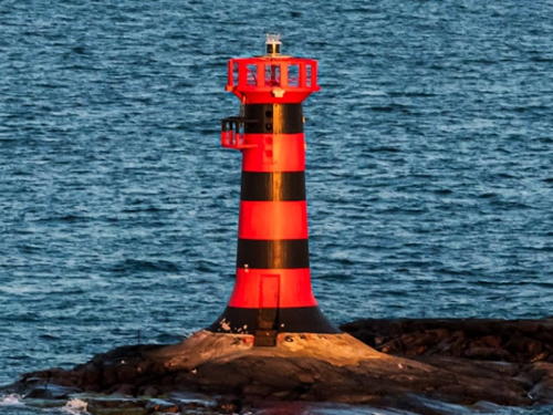
1938 (station established 1934). Active; focal plane 14 m (46 ft); three quick flashes every 6 s, white, red or green depending on direction. 12 m (36 ft) round tower with a small lantern and gallery, painted with red and black horizontal bands. Lantern removed. Joakim Barkman's photo is at right, Wikimedia also has a photo by Lennart Kjellman, Trabas has a closeup photo by Ronald Wöhrn, a commemorative postal card provides a good view, a 2008 photo is available, and Google has a satellite view. A familiar sight for travelers arriving by ferry in Mariehamn, this lighthouse is often photographed. Located on an isolated rock about 6 km (3.5 mi) southwest of Mariehamn harbor. Accessible only by boat, but there's a good view from the ferries arriving in Mariehamn from Sweden. Site open, tower closed. ARLHS ALA-013; SU-6382; Admiralty C4490; NGA 16760.
Granö (2)
Date unknown. Active; focal plane 6 m (20 ft); two quick flashes every 5 s, white, red or green depending on direction. 6 m (20 ft) round cylindrical concrete tower with lantern and gallery. Tower painted orange, lantern white. Trabas has a photo and Google has a satellite view. A small light was established here in the 1930s. Located on the east side of Granö, a small island off the southwestern tip of Swinö, about 1.6 km (1 mi) south of the Mariehamn waterfront. Site open, tower closed. SU-6354; Admiralty C4510.

Marhällan Light, Lemland, July 2023
Google Maps photo by Joakim Barkman
[Kobba Klintar (Kobbaklintarn) (pilot and fog signal station)]
1862(?). Inactive since 1972. 2-1/2 story wood pilot station, painted white. Edvard Wendelin has a good photo with the Marhällan lighthouse in the background, a 2017 photo is available, and Google has a satellite view. A fog signal was established here in 1910 in a square pyramidal wood beacon, painted red. A replica has been installed at the Sjökvarteret Museum in Mariehamn (see below), and another replica, painted white, has been placed on the island, as seen in a street view by Dennis Ahlqvist. There was also a light on a mast for many years beginning in 1936. Located on a small island close to the Marhällan lighthouse. Accessible only by boat, but there's a good view from ferries arriving in Mariehamn from Sweden. Site open, building closed.

Mariehamn City Lighthouses
The capital of Åland, Mariehamn is a town of about 12,000 permanent residents.

Lotsberget Range Front
Date unknown. Active; focal plane 34 m (112 ft); white light, 1 s on, 1 s off. Approx. 28 m (92 ft) square cylindrical skeletal tower carrying a rectangular daymark colored red with a yellow vertical stripe. Trabas has a photo and Google has an indistinct satellite view. This is an approach range for Mariehamn. Located on a bluff on the south side of the city. Site status unknown. SU-6121; Admiralty C4500.
Lotsberget Range Rear
Date unknown. Active; focal plane 56 m (184 ft); white light, 3 s on, 3 s off. Approx. 18 m (59 ft) square cylindrical skeletal tower carrying a rectangular daymark colored red with a yellow vertical stripe. Trabas has a photo and Google has a street view and an indistinct satellite view. Located on a ridge about 800 m (1/2 mi) northeast of the front light. Site status unknown. SU-6122; Admiralty C4500.1.
Kvarter (Stegskär, Mariehamn Sjökvarteret) (relocated to Mariehamn)
1898. Active (may be privately maintained); focal plane 8 m (26 ft); two quick white flashes every 6 s. 6 m (20 ft) square skeletal tower with lantern and gallery, painted white. A photo is at right, Trabas has a closeup photo, Berit Sundman has a 2011 closeup photo, Timo Koponen has a 2016 photo, and Google has a good street view but only a fuzzy satellite view. Built at Stegskär, this lighthouse was relocated to the Mariehamn waterfront for display at the Sjökvarteret (Maritime Quarter) Museum. A replica of the Kobba Klintar fog beacon is also on display. The little lighthouse remains active as a harbor light. Located on the waterfront of Mariehamn's eastern harbor. Site open, tower closed. Owner/site manager: Sjökvarteret Museum. SU-33990; Admiralty C4505.3.

Sjökvarteret (ex-Kvarter) Light, Mariehamn, June 2013
Wikimedia Creative Commons photo by Johan Fredriksson

Northwestern Åland Lighthouses

Central Åland Sea Lighthouses
Solovjeva (2)
Late 1980s. Inactive since 2019. 20 m (66 ft) steel tower carrying a large topmark structure. Tower painted white with one red horizontal band. Franz Airiman has a 2013 photo but the light is not shown in Google's satellite view. This lighthouse was altered significantly between 2003 and 2007. The light was listed as "temporarily" extinguished in 2019; we need informtion on its fate. Located in the center of the Åland Sea, about halfway between Storby and the Swedish coast. Accessible only by boat. Site open, tower closed. ex-Admiralty C4473.5, NGA 16774.
Märket
1885 (Georg Schreck). Active; focal plane 17 m (56 ft); white flash every 5 s. 14 m (46 ft) octagonal cylindrical stone tower with lantern and gallery, rising from a 2-story stone keeper's house. Entire structure painted with red and white horizontal bands. A photo is at right, a 2010 photo was taken on the 125th anniversary of the lighthouse, Wikipedia has a closeup photo by Thierry Caro as well as additional photos, Trabas has Petri Porkola's view from the sea, Stefan Norrgrann has a 2021 view from the sea, and Google has a satellite view. Märket, the westernmost land of the Åland archipelago, is a very small island, about 350 m (1150 ft) long by 150 m (490 ft) wide. However, it is a famous geographical curiosity. The 1809 Treaty of Fredrickshamn, in which Sweden ceded sovereignty over Finland to the Russian Empire, specified that the international border should run through the island of Märket, so that the sea passage to the east of the island would be Russian and that to the west would be Swedish. When the Russian administration had the lighthouse built in 1885 the builders placed it on the highest ground available, which happened to lie in the Swedish half. For a century Russia and then Finland operated the lighthouse in Swedish territory. In 1981 Sweden and Finland signed a treaty in which the ground under the lighthouse was transferred to Finland in return for an equal area of land in the Finnish half. As a result, the border now snakes across the tiny island in an intricate inverted-S curve, and the lighthouse is finally in Finland. The Finnish half of the island has a distinct radio prefix OJØ and amateur radio operators consider it a separate country. The lighthouse was automated in 1979 and fell into poor condition, so the Finnish Lighthouse Society launched a fundraising campaign for its restoration. In 2009 the lighthouse was repainted and refurbished, with much of the work done by the Society's volunteers. A September 2010 photo shows the improved appearance of the lighthouse. Märket is about 30 km (19 mi) west of Fasta Åland and almost exactly the same distance east of the Swedish coast. Transportation to the island is sometimes available from Storby on the island of Eckerö. Site open, tower closed. . ARLHS MAR-001; SU-6106; Admiralty C4472; NGA 16792.
Märket Light
Märket Light restoration, August 2009
Wikimedia Creative Commons photo by Islander

Eckerö Lighthouses
Gisslan (2)
Date unknown (station established 1910). Active; focal plane 16 m (52 ft); white flash every 5 s. Approx. 10 m (33 ft) "red tower," according to the Admiralty. No photo available but Bing has a fuzzy satellite view. There is a historic photo of the original square skeletal lighthouse. Located on an islet about 8 km (5 mi) southwest of Eckerö. Accessible only by boat. Site open, tower closed. SU-6352; Admiralty C4476.
[Högsten Båk (2)]
1845 (station established 1740). Unlit daybeacon. 16 m (52 ft) hexagonal pyramidal wood tower, painted brick red. Gittel Larsson has a good photo and Tommy Saarinen has a 2020 photo but Google has only a fuzzy satellite view. The first beacon was destroyed during the war between Russia and Sweden (1808-09). The present beacon was restored in 1981. Located on a small island about 10 km (6 mi) northwest of Storby. Site open, tower closed.

Hammarland Lighthouse
Sälskär
1868 (Axel Hampus Dahlström). Active; focal plane 44 m (144 ft); two white flashes every 12 s. 31 m (102 ft) round brick tower with lantern and gallery. Lighthouse painted white, lantern painted black with a red dome. Örjan Saether's photo appears at right, Wikimedia has a photo, Tero Koski also has a photo, Osmo Soinio has a 2017 photo, a distant view from Geta on Fasta Åland is available, Marinas.com has aerial photos, and Bing has a satellite view. Located on a small island at the northwestern corner of the Åland archipelago. Accessible only by boat. Site open, tower closed. ARLHS ALA-016; SU-6377; Admiralty C4466; NGA 16800.

Geta Lighthouses
Kallan
Date unknown. Active; focal plane 8 m (26 ft); flash every 3 s, white, red or green depending on direction. 6 m (20 ft) round cylindrical concrete tower, painted white. John Österlund has a closeup photo and Bing has an indistinct satellite view. This small light marks one of the northernmost of the Åland Islands. Located on a small island about 5 km (3 mi) north of Lökö. Accessible only by boat. Site open, tower closed. SU-6104; Admiralty C4465.4, NGA 16808.
Koksnan (Koxnan)
Date unknown. Active; focal plane 17 m (56 ft); white flash every 5 s. 15 m (49 ft) triangular cylindrical skeletal tower covered by a daymark colored with red and white horizontal bands. Kenneth Björklund has a photo and Bing has a satellite view. Located on a small island about 15 km (9 mi) east of the Kallan light. Accessible only by boat. Site open, tower closed. SU-6101; Admiralty C4465, NGA 16812.

Saltvik Lighthouse
Rannö
1962. Active; focal plane 20 m (66 ft); two quick white flashes every 5 s. 6 m (20 ft) square pyramidal skeletal tower with slatted daymarks on two sides. The lighthouse is colored by a red-brown stain and is described in the light lists as red. Kenneth Björklund has a closeup photo, a blogger has another photo, the beacon appears on a postage stamp, and Google has an indistinct satellite view. Located on a small island on the north side of the Åland archipelago. Accessible only by boat. Site open, tower closed. ARLHS ALA-015; SU-6099; Admiralty C4464.4; NGA 16814.

Sälskär Light, Geta, June 2020
Google Maps photo by Örjan Saether

Northeastern Åland Lighthouses

Vårdö Lighthouse
Between Fasta Åland and the Finnish mainland is a maze of islands embedded in the Archipelago Sea (Skärgardshavet in Swedish, Saaristomeri in Finnish). Curiously, NGA has no listings for lights in this region. Thanks to Michel Forand for providing data for these lights from Volume C of the Admiralty list.

Mellanklubb
Date unknown. Active; focal plane 6 m (20 ft); flash every 3 s, white, red or green depending on direction. 6 m (20 ft) octagonal concrete tower with lantern and gallery, painted white. Trabas has a photo and Google has an indistinct satellite view. Located on the north point of Mellanklubb, a small island about 10 km (6 mi) east of Vårdö. Accessible only by boat. Site open, tower closed. SU-6372; Admiralty C4638.

Kumlinge Lighthouse
Långören
Date unknown. Active; focal plane 10 m (33 ft); flash every 3 s, white, red or green depending on direction. 4 m (13 ft) wood shed, stained light brown. A photo is available and Google has a satellite view. Located on a skerry about 8 km (5 mi) northwest of Fiskö. Accessible only by boat. Site open, tower closed. SU-6097; Admiralty C4462.8.

Brändö Lighthouses
Båden
Date unknown. Active; focal plane 6 m (20 ft); flash every 5 s, white, red or green depending on direction. 7 m (23 ft) round cylindrical concrete tower with lantern and gallery. Tower painted white, lantern and gallery black. Trabas has a photo and Bing has an indistinct satellite view. This light and the next one guide vessels in the channel between Åland and the islands of Southwest Finland Province. Located on a skerry in the Skiftet (the channel separating Åland from the mainland) southeast of Jurmo. Accessible only by boat; there should be a view from ferries between Åva and Osnäs. Site open, tower closed. SU-3560; Admiralty C4650.5.
Torsholmakobben
Date unknown. Active; focal plane 8 m (26 ft); flash every 3 s, white, red or green depending on direction. 8 m (26 ft) round cylindrical concrete tower with lantern and gallery. Lighthouse painted with orange and black horizontal bands. Trabas has a photo and Bing has an indistinct satellite view. Located on a skerry in the Skiftet off the southeastern tip of Torsholma. Accessible only by boat. Site open, tower closed. SU-6192; Admiralty C4649.2.
Bärökobben
Date unknown. Active; focal plane 7 m (23 ft); flash every 3 s, white, red or green depending on direction. 5 m (17 ft) round cylindrical concrete tower with lantern and gallery, painted white with one red horizontal band. Trabas has a photo, a view from the sea is available, and Bing has a satellite view. Located on a skerry northeast of Barö. Accessible only by boat. Site open, tower closed. SU-6190; Admiralty C4648.6.
Notö (Nottö)
1953. Active; focal plane 7 m (23 ft); flash every 3 s, white, red or green depending on direction. 5 m (17 ft) round cylindrical concrete tower with lantern and gallery. Tower painted orange, lantern white. A photo is at right, Trabas has a photo and Google has a satellite view. Located at the northern end of Notö, just north of Asterholma and about 4 km (2.5 mi) east of Lappo. Accessible only by boat. Site open, tower closed. SU-6359; Admiralty C4647.

Notö Light, Brändö, June 2009
Wikimedia Creative Commons photo by Vellari


Sottunga Lighthouses
Sottunga is a municipality north of Föglö and south of Kumlinge. Consisting of small islands, it has a population of less than 100. The lights in this group guide vessels in a channel leading to Åland from Turku in Southwest Finland.

Kihti
1938. Active; focal plane 11 m (36 ft); three quick flashes every 6 s, white, red or green depending on direction. 11 m (36 ft) round cylindrical concrete tower with lantern and gallery. Tower painted black, lantern white. Trabas has a photo and Bing has a satellite view. Located on a shoal about 16 km (10 mi) east of Husö and 12 km (7.5 mi) northeast of Hellsö. Accessible only by boat. Site open, tower closed. SU-3169; Admiralty C4630, NGA 16480
Gustaf Dalén (Rödakon)
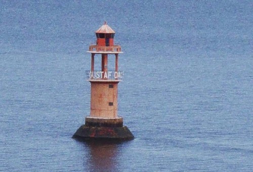
1947. Active; focal plane 12 m (39 ft); two quick flashes every 6 s, white, red or green depending on direction. 12 m (39 ft) round cylindrical concrete tower with gallery, topped by a skeletal extension with lantern and a second gallery. Entire lighthouse painted red. A photo is at right, Trabas has a photo, and Google has a satellite view. According to Seppo Laurell's book on Finnish lighthouses, the Swedish company AGA gave Finland the optics for this light in honor of the 250th anniversary of the Swedish lighthouse service, and FMA decided to use this gift to replace a buoy at this location with a lighthouse named for the Swedish lighthouse engineer Nils Gustaf Dalén (1869-1937). Located on the Rödakon shoal about 8 km (5 mi) north of Kökar and the same distance east of Husö. Accessible only by boat. Site open, tower closed. ARLHS ALA-007; SU-6291; Admiralty C4629.
Bogskär Båk (2)
1824 (daybeacon established 1798). Active; focal plane 17 m (56 ft); flash every 5 s, white, red or green depending on direction. 10 m (33 ft) square wood building with the light mounted at the peak of the pyramidal roof. Trabas has a photo and Google has a satellite view. There was a tiny apartment for the keeper inside the building. The lighthouse was restored in 1980. Located on a small island about 6 km (3.5 mi) east of Husö. Accessible only by boat. Site open, tower closed. SU-6292; Admiralty C4628.
Sälsö
Date unknown. Active; focal plane 29 m (95 ft); white, red or green light depending on direction, 3 s on, 3 s off. Approx. 10 m (33 ft) square skeletal tower with lantern and gallery. Tower painted red, lantern white. Trabas has a photo and Google has a satellite view. This was originally the rear light of a range, but a slight change in alignment made it necessary to move the range light to a smaller tower nearby. Located on the highest point of Sälsö, an island between Sottunga and Husö. Accessible only by boat. Site status unknown. SU-6285; Admiralty C4615.1.
Gustav Dalén Light
Gustaf Dalén Light, August 2009
Wikimedia public domain photo by Zejo
Sottunga Rödgrund (3?)
Date unknown. Active; focal plane 14 m (46 ft); flash every 3 s, white, red or green depending on direction. 12 m (39 ft) round cylindrical concrete tower with lantern and gallery, painted white with one black horizontal band. Trabas has a photo and Google has a satellite view. Located on a small island about 2.5 km (1.5 mi) northwest of Husö. Accessible only by boat. Site open, tower closed. SU-6284; Admiralty C4613.
Tjurgrund
Date unknown. Active; focal plane 8 m (26 ft); two flashes every 6 s, white, red or green depending on direction. 6 m (20 ft) octagonal cylindrical white concrete tower. Trabas has a photo and Bing has a distant satellite view. Located on the southern tip of Tjurgrund, an island off the southeastern tip of Sottunga. Accessible only by boat. Site open, tower closed. SU-6220; Admiralty C4608.
Sånökubb (2)
Date unknown. Active; focal plane 6 m (20 ft); two quick flashes every 6 s, white, red or green depending on direction. 6 m (20 ft) round cylindrical concrete tower with lantern and gallery. Tower painted red, lantern white. Trabas has a photo and Bing has a distant satellite view. Located off the southern tip of the island of Hamnö on the south side of Sottunga. Accessible only by boat. Site open, tower closed. SU-6282; Admiralty C4609.
 
Trännskär
1940. Active; focal plane 8 m (26 ft); quick-flashing white, red or green light. 7 m (23 ft) round concrete tower with lantern and gallery. Tower painted red, lantern and gallery white. Jennifer Frederick has a photo and Google has a satellite view. This light guides vessels in a channel between Kökar and Sottunga. Located at the south end of Trännskär, an island southwest of Kyrkogårdsö in southeastern Sottunga township. Accessible only by boat. Site open, tower closed. SU-6323; Admiralty C4624.

Information available on lost lighthouses:

Notable faux lighthouses:

Adjoining pages: North: Satakunta | East: Southwest Finland | West: Southern Bothnia

Return to the Lighthouse Directory index | Ratings key

Posted October 1, 2007. Checked and revised September 17, 2023. Lighthouses: 53. Site copyright 2023 Russ Rowlett and the University of North Carolina at Chapel Hill.