Lighthouses of Portugal: Azores

Facing the Atlantic Ocean at the southwestern corner of Europe, Portugal (officially the Portuguese Republic, República Portuguesa) has a very distinguished maritime history. Portuguese sailors launched and led the European age of discovery and Portuguese ships have been returning home from the far corners of the globe for about 600 years. It's not surprising that lighthouses have played an important role in Portuguese culture and that they are treasured national monuments today.

The Azores (Açores in Portuguese) are an archipelago of nine volcanic islands in the Atlantic Ocean roughly 1500 km (900 miles) west of Lisbon. The islands fall naturally into three groups: Santa Maria and São Miguel in the east; Faial, Pico, São Jorge, Graciosa, and Terceira in the center; and Corvo and Flores in the west. Corvo and Flores are peaks of the Mid-Atlantic Ridge, which reaches the surface in only a few places. Previously uninhabited, the Azores were discovered by Portuguese explorers in the 1430s and Portuguese settlers began arriving in 1439. Administratively the islands are organized as an autonomous region of Portugal.

The Portuguese word for a lighthouse is farol, plural faróis; a small lightbeacon is often called a farolim. In Portuguese ilha is an island, ilhéu is an islet, cabo is a cape, ponta is a promontory or point of land, rocha is a rock, recife is a reef, baía is a bay, estreito is a strait, rio is a river, and porto is a port or harbor.

Formerly owned by the Navy, the lighthouses in Portugal are now operated by the Lighthouse Directorate (Direção de Faróis), an agency of the National Maritime Authority (Autoridade Marítima Nacional).

ARLHS numbers are from the ARLHS World List of Lights. PT numbers are from the Portuguese Navy list as recorded by Portuguese Wikipedia. Admiralty numbers are from volume D of the Admiralty List of Lights & Fog Signals. U.S. NGA List numbers are from Publication 113.

General Sources
Faroís
Lighthouse information from the Direção de Faróis.
Les Sentinelles des Mer - Portugal
Data, historical information and photos posted by Guy Detienne.
Online List of Lights - Portugal - Azores
Photos by various photographers posted by Alexander Trabas. The Azores photos are by Rainer Arndt, Werner Seiler, Thomas Philipp, and Capt. Peter Mosselberger ("Capt. Peter").
Lighthouses in the Azores
Photos by various photographers available from Wikimedia. These photos are from the Portuguese edition of Wikipedia; see its index of articles Faróis de Portugal - Açores.
World of Lighthouses - Portugal
Photos by various photographers available from Lightphotos.net.
Leuchttürme Portugals auf historischen Postkarten
Historic postcard images collected by Klaus Huelse.
GPSNauticalCharts
Navigational chart for the Azores.
Navionics Charts
Navigational chart for the Azores.


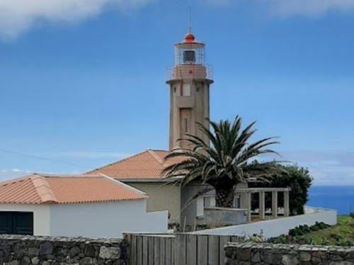
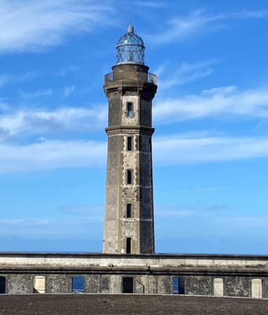
Ponta da Barca Light, Graciosa, September 2021
Instagram photo by Visitazores
Ilha de Santa Maria Lighthouses
Santa Maria is the southernmost island of the Azores. Geologically the oldest of the islands, it is less mountainous than the others. The permanent population is about 5500, most living in Vila do Porto.
Ilhéus Formigas
1948. Active; focal plane 22 m (72 ft); two white flashes every 12 s. 19 m (62 ft) round masonry tower with lantern and gallery, painted white. Pedro Almeida has a photo, Víctor Ramón Piñeiro has a drone view, Tim Bergman has a distant view, and Google has a satellite view. The Ilhéus Formigas are small rocky islets located about 45 km (28 mi) northeast of the Ilha de Santa Maria (formigas, "ants" in Portuguese, is sailor slang for rocks at sea). A lighthouse was proposed as early as 1883 but the difficulties of building on these remote rocks was too great. The task was finally done in a remarkable 36-day project in the summer of 1948. Located on the largest of the islets, a rock about 180 m by 40 m (roughly 200 yd by 40 yd). Inaccessible. Site and tower closed. ARLHS AZO-001; PT-670; Admiralty D2638; NGA 23704.
** Gonçalo Velho (Ponta do Castelo)
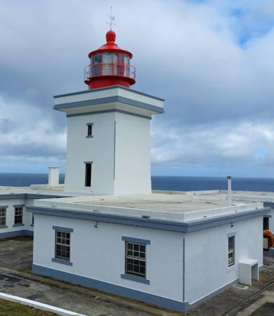
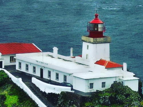
1927. Active; focal plane 114 m (374 ft); three white flashes every 13.5 s. 14 m (46 ft) square cylindrical masonry tower with lantern and gallery, attached to a 1-story keeper's house. Building painted white, lantern red. A 2019 photo is at right, Trabas has Philipp's photo, Lightphotos.net has a good photo, Wikimedia has several photos, Christian Dietrich has a distant street view from the shore below the lighthouse, Huelse has a historic postcard view, and Google has a satellite view. The keeper's complex was expanded in 1934 and again in 1955. Gonçalo Velho Cabral, one of the explorers dispatched by Prince Henry the Navigator, spotted the Formigas rocks in 1431 and returned in 1432 to discover the Ilha de Santa Maria at this spot. He has long been celebrated as the discoverer of the Azores, although recently historians have confirmed that Santa Maria was spotted in 1427 by Diogo de Silves. Located atop the Ponta do Castelo, a spectacular promontory at the southeastern tip of the Ilha de Santa Maria. Site and tower generally closed, but open on Wednesday afternoons. . ARLHS AZO-009; PT-680; Admiralty D2632; NGA 23664.

Gonçalo Velho Light, Santa Maria, January 2019
Instagram photo by Azores Island Girl
* Vila do Porto (Molehead)
Date unknown. Active; focal plane 15 m (49 ft); red light, 2 s on, 3 s off. 8 m (26 ft) round concrete tower, painted with red and white horizontal bands. Trabas has Philipp's photo, Rie De Cock has a photo, and Google has a satellite view. Vila do Porto, on the southwestern side of the Ilha de Santa Maria, is the only protected harbor on the island. Located at the end of the breakwater mole of Vila do Porto. Accessible by walking the pier. Site open, tower closed. ARLHS AZO-030; Admiralty D2635.3; NGA 23670.
Ponta do Malmerendo
Date unknown. Active; focal plane 50 m (164 ft); two white flashes every 10 s. 6 m (20 ft) square tower painted white with red trim. Trabas has Philipp's photo, Nuno Sousa has a photo, Armando Fraga Pacheco has a 2017 photo, Armando Fraga Pacheco has a closeup photo, and Google has a satellite view. Located atop a promontory on the west side of the entrance to the harbor. Site status unknown. Admiralty D2636; NGA 23668.
Ponta do Norte
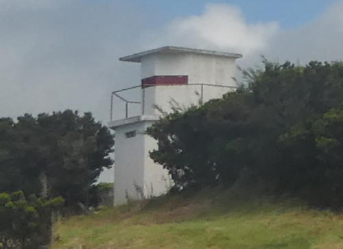
Date unknown. Active; focal plane 139 m (456 ft); four white flashes every 15 s. 4 m (13 ft) pentagonal tower painted white with a red band at the base. A closeup 2022 photo is available, Trabas has Capt. Peter's photo, and Google has a distant satellite view. Located atop a cliff at the northern tip of the island. Site status unknown. dmiralty D2633; NGA 23692.

Ilha de São Miguel Lighthouses
The Ilha de São Miguel is the largest and most populous island of the Azores, roughly 90 km (56 mi) long and 15 km (9 mi) wide. Ponta Delgada, the site of the regional government of the Azores, is also the largest city in the islands with a population of nearly 70,000. The population of the island is about 135,000.

**
Ponta do Arnel
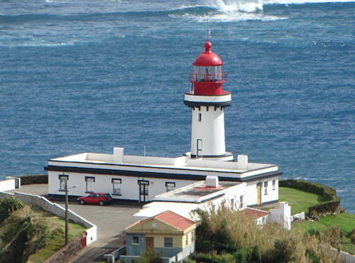
1876. Active; focal plane 66 m (217 ft); white light, 2 s on, 2 s off, 2 s on, 4 s off. 15 m (49 ft) octagonal cylindrical stone tower rising from the center of a 1-story keeper's house. 3rd order Fresnel lens installed in November 2018. Building painted white; lantern painted red. A 2021 photo is at right, Lightphotos.net has a closeup, Trabas has Arndt's closeup, Luís Ferreira has also posted a fine closeup, Carlos Bettencourt has an excellent view of the light station, Wikimedia has additional photos, Detienne has a page for the lighthouse, and Google has a street view and a satellite view. This was the first lighthouse built in the Azores; it is the traditional landfall light for ships arriving from mainland Portugal. The keeper's complex was greatly expanded in 1929. Located at the eastern tip of the Ilha de São Miguel; accessible by a paved but challenging road. Site open, lighthouse open on Wednesday afternoons. . ARLHS AZO-004; PT-604; Admiralty D2640; NGA 23636.

Ponta do Arnel Light, São Miguel, May 2021
Wikimedia Creative Commons photo by Jules Verne Times Two
** Ponta Garça
1957. Active; focal plane 101 m (331 ft); light 2 s on, 3 s off, white or red depending on direction. 14 m (46 ft) round concrete tower with eight ribs, lantern and gallery, attached to a 1-story keeper's complex. The tower is unpainted white concrete; lantern dome painted red. Fernando Coelho's 2022 photo is at right, J. Fernando has a photo, Trabas has Arndt's photo, Wikimedia has Marco Abreu's photo, Lightphotos.net has a closeup, Detienne has a page for the lighthouse, and Google has a street view and a satellite view. Located at Ponta Garça on the south side of the island, about 40 km (25 mi) east of Ponta Delgada. Accessible by road. Site open, lighthouse open on Wednesday afternoons. . ARLHS AZO-012; PT-606; Admiralty D2642; NGA 23628.
* Varadouro (Vila Franca do Campo)
Date unknown. Inactive since 2007. Round cylindrical tower mounted on a waterfront building. The light is at the right in a photo of the waterfront and Google has a street view and a distant satellite view. Located directly on the waterfront of Vila Franca do Campo, a village about 32 km (20 mi) east of Ponta Delgada. Site open, tower closed. ARLHS AZO-023; ex-Admiralty D2643.4; ex-NGA 23616.
* Ponta Delgada Breakwater (2)
Date unknown (station established 1900). Active; focal plane 17 m (56 ft); red light, 2 s on, 1 s off. 7 m (23 ft) round concrete tower, painted with horizontal red and white bands. Duarte Sousa has a good closeup, Trabas has Arndt's photo, and Google has a satellite view and a distant street view. Huelse has a historic postcard view of the original lighthouse, a cast iron tourelle; it was destroyed by a storm in 1942. Located at the end of the breakwater at Ponta Delgada. Accessible by walking the pier. Site open, tower closed. ARLHS AZO-029; Admiralty D2647; NGA 23584.

Ponta Garça Light, São Miguel, May 2022
Google Maps photo by Fernando Coelho
* Santa Clara
1945 (with an 1886 lantern). Active; focal plane 27 m (88 ft); white light, 2 s on, 3 s off. 8 m (26 ft) square skeletal tower with lantern and gallery, mounted atop a 1-story white concrete equipment building. Lighthouse painted red. Filipe Franco has a good photo, Wikimedia has numerous photos, Trabas has Arndt's closeup, Detienne has a page for the lighthouse, Lightphotos.net has a photo, the light is featured on a 1996 postage stamp, and Google has a 2021 street view and a satellite view. After the original Ponta Delgada light was destroyed (see previous entry), this lantern was brought from the 1886 Torre de Belem lighthouse in Lisbon (see the Central Portugal page). Huelse has a historic postcard view of the lantern in Lisbon. Located inside a square concrete enclosure on a promontory 800 m (1/2 mi) west of the Ponta Delgada waterfront. Site open, tower closed. . ARLHS AZO-021; PT-717; Admiralty D2654; NGA 23580.
** Ferraria (Ponta da Ferraria)
1901. Active; focal plane 107 m (351 ft); three white flashes every 20 s. 18 m (59 ft) square cylindrical stone tower with lantern and gallery, attached to the front of a 2-story keeper's house. Building painted white with unpainted stone trim; lantern dome painted red. Marcos Casimiro has the 2023 photo at right, Detienne has a page for the lighthouse, Trabas has Arndt's photo, Wikimedia has several photos, Huelse has a historic postcard view, Ronald Sekkel has a closeup street view, and Google has a 2021 street view and a satellite view. This handsome lighthouse stands at the western tip of the Ilha de São Miguel. Located atop a cliff near Ginetes; accessible by road. Site open, lighthouse open on Wednesday afternoons. . ARLHS AZO-008; PT-719; Admiralty D2655; NGA 23568.
* Rabo de Peixe (1)
Date unknown. Inactive since 2013; charted as a landmark. 28 m (92 ft) square masonry tower of a church, the Igreja do Bom Jesus. The light can be seen on the gallery railing at the top of the tower in Vitor Oliveira's closeup, and Google has a street view and a satellite view. Trabas has Arndt's photo of a new light on the north pier of the harbor which has been assigned the Admiralty number D2657 (focal plane 10 m (33 ft); red flash every 5 s). Located overlooking the sea in the village of Rabo de Peixe about 5 km (3 mi) west of Ribeira Grande on the north coast of the island. Site open, tower closed. ex-Admiralty D2657; ex-NGA 23652.
** Ponta do Cintrão
1957. Active; focal plane 118 m (387 ft); two white flashes every 10 s. 14 m (46 ft) round concrete tower with eight ribs, lantern and gallery, attached to a 1-story keeper's complex. Tower is unpainted white concrete; lantern dome painted red. Sibling of the Ponta Garça Light (see above). Trabas has Arndt's photo, Gilda Pontes has posted a good photo, Detienne has a page for the lighthouse, Wikimedia has Luís Silveira's closeup photo, and Google has a street view and a satellite view. A sibling of the Ponta Garça lighthouse pictured above. Located at the end of a peninsula on the central north coast of the island, about 4 km (2.5 mi) northeast of Ribeira Grande. Site open, lighthouse open on Wednesday afternoons. . ARLHS AZO-017; PT-726; Admiralty D2659; NGA 23640.

Ferraria Light, São Miguel, February 2023
Google Maps photo by Marcos Casimiro

Ilha Terceira Lighthouses
Terceira ("Third") is thought to have been the third island to be discovered. Many Americans know it as the location of Lajes Field, a Portuguese/NATO/U.S. Air Force Base. The island has a permanent population of about 56,000.

Praia da Vitória South Mole
Date unknown. Active; focal plane 17 m (56 ft); red flash every 3 s. 16 m (52 ft) round cylindrical concrete tower with eight ribs, lantern and gallery, painted white with narrow horizontal red bands; lantern painted red. Trabas has Seiler's photo, Andreas Köhler has a 2023 photo, an aerial view is available, and Google has a satellite view and a distant street view across the harbor. Located at the end of the rubblestone south mole at Praia da Vitória on the east side of the Ilha de Terceira. Accessible only by boat, but there are good views from shore. Site and tower closed. ARLHS AZO-027; Admiralty D2662.5; NGA 23525.
** Ponta das Contendas
1934. Active; focal plane 53 m (174 ft); four flashes every 15 s, white or red depending on direction. 13 m (43 ft) square masonry tower with lantern and gallery, rising from the center of a 1-story keeper's complex. Lighthouse painted white; lantern painted red. Stephan Barthelme has the 2022 photo at right, Detienne has a page for the lighthouse, Edyta Morawska also has a 2022 photo, Trabas has Seiler's closeup photo, a 2008 photo is available, the light is featured on a 1996 postage stamp, and Google has a street view and a satellite view. The 75th anniversary of the light station was celebrated in 2009. Located at the southeastern tip of the Ilha de Terceira. Site open, lighthouse open on Wednesday afternoons. . ARLHS AZO-007; PT-745; Admiralty D2664; NGA 23532.
* Angra do Heroísmo Range Front (1)
Date unknown. Inactive since 2015. 20 m (66 ft) square church tower, painted light blue and white. As late as 2015 the light was listed by NGA as being on the east tower of the Igreja (church) da Misericórdia. Maria Ferreira has a 2009 photo and Google has a street view and a satellite view. Since 2016 NGA has listed the light as moved to a "red post" (focal plane 21 m (69 ft); red flash every 4 s). Google has another street view showing this post atop a 2-story building across the street on the east side of the church. Trabas has Hartmut Knape's photo of the new light. He also has Knape's photo of the rear light on a small round tower 540 m (0.34 mi) northwest; it is barely visible in Google's satellite view. Located in downtown Angra do Heroísmo, on the central southern coast of the island. Site open, tower closed. Admiralty D2666.2; NGA 23544.

Ponta das Contendas Light, Terceira, June 2022
Google Maps photo by Stephan Barthelme
* Serrata (Ponta da Queimado, Ponta da Serrata) (3)
2009 (?) (station established 1908 and inactive 2004-2009). Active; focal plane 95 m (312 ft); white flash every 6 s. 14 m (46 ft) round barbell-shaped fiberglass tower colored with red and white horizontal bands. Wadim Mieszajkin has a 2021 photo, Detienne's page for the lighthouse has two photos, Paul Hollinghurst has a street view, and Google has a satellite view of the station. Lighthouse Digest has a photo by Jim Crockett of the original lighthouse at Serrata, which was was destroyed by an earthquake in 1980. The Navy then relocated to this station a historic cast iron tourelle from Cacilhas, across the Tagus from Lisbon (see the Central Portugal page). A 2002 photo shows the relocated lighthouse, and Wikipedia has a 2007 photo. Residents of Cacilhas stubbornly protested the removal of their lighthouse and their requests took hold after the lighthouse was deactivated in 2004. In 2007 the Navy agreed to return the lighthouse and on 18 July 2009 ceremonies were held celebrating its reinstallation in Cacilhas. Located on the Ponta da Queimado, a steep promontory at the northwestern tip of the island. Site status unknown, probably open; tower closed. ARLHS AZO-022; PT-760; Admiralty D2668; NGA 23504.

Ilha Graciosa Lighthouses
Graciosa is the northernmost and smallest of the central group of islands. Only 10 km (6 mi) long and 7 km (4.4 mi) wide, it has a population of about 4000.
** Carapacho (Ponta do Carapacho, Ponta da Restinga)
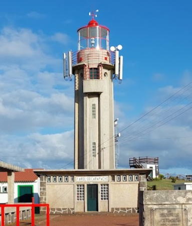
1956. Active; focal plane 191 m (627 ft); two white flashes every 10 s. 14 m (46 ft) round concrete tower with eight ribs, lantern and gallery, attached to a 1-story keeper's complex. Tower is unpainted white concrete; lantern dome painted red. Ari Reen's 2023 photo is at right, Julia Danilova has a 2021 closeup photo, Detienne has a page for the lighthouse, Tony Ventura also has a closeup photo, Paul Hollinghurst has a street view, and Google has a distant satellite view. Sibling of the Ponta Garça and Ponta do Cintrão Lights on the Ilha de São Miguel. Located on the Ponta do Carapacho, the southeastern tip of the island. Accessible by road. Site open, lighthouse open on Wednesday afternoons. . ARLHS AZO-006; PT-792; Admiralty D2670; NGA 23484.
** Ponta da Barca
1930. Active; focal plane 71 m (233 ft); white flash every 7 s. 23 m (75 ft) round concrete (?) tower with lantern and gallery, rising from a 1-story keeper's complex. Lighthouse painted with horizontal black and white bands, lantern painted red. A 2021 photo is at the top of this page, Rui Silva has a 2021 photo, Wikimedia has Luís Silveira's more distant view, Detienne has a page for the lighthouse,Paul Hollinghurst has a closeup street view, and Google has a satellite view. This is the tallest lighthouse of the Azores. The light station was repaired after being damaged by a severe thunderstorm in 1978. Located on a sharp rocky promontory at the northwestern tip of the island, about 7 km (4.5 mi) west of Santa Cruz da Graciosa. Site open, lighthouse open on Wednesday afternoons. . ARLHS AZO-011; PT-797; Admiralty D2676; NGA 23500.
* Fort do Santo (Santa Cruz da Graciosa)
Date unknown. Active; focal plane 14 m (46 ft); red flash every 4 s. 6 m (20 ft) ladder-like skeletal tower attached to the front of a small equipment shed. Entire structure painted red. 1-story stone building, presumably used as a keeper's house. Wikimedia has Luís Silveira's photo, João Gonçalves has a closeup, Bruno Vieira has a 2021 photo, and the lighthouse is centered in a Google satellite view. Located in Santa Cruz da Graciosa, on the north coast of the island. Site probably open, tower closed. Admiralty D2674; NGA 23488.
* [Vila do Praia Molehead (Ponta da Rochela)]
Date unknown. Active; focal plane 15 m (49 ft); green flash every 3 s. 4 m (13 ft) round cylindrical concrete tower, painted with green and white horizontal bands. Mimmo Feminò has a photo, Ben Kraan has a view from the sea, and Google has a satellite view. Located at the end of the breakwater mole at Vila do Praia, a picturesque village on the east coast of Graciosa. Accessible by walking the mole. Site open, tower closed. Admiralty D2672.5; NGA 23490.

Carapacho Light, Ilha Graciosa, September 2023
Google Maps photo by Ari Reen

Ilha de São Jorge Lighthouses
Located in the middle of the central group of islands, São Jorge is long and narrow, 53 km (33 mi) long but only 8 km (5 mi) wide, with rugged coasts. Its population is about 10,500.

**
Ponta do Topo
1927. Active; focal plane 58 m (190 ft); three white flashes every 20 s. 16 m (52 ft) round cylindrical tower with lantern and gallery, attached to a 1-story keeper's house. Building painted white with black trim, lantern red. The original 3rd order Fresnel lens was removed after being damaged in an earthquake in 1980. Nuno Pessoa has the fine 2019 photo at right, Monica Zullo has a 2021 photo, Wikimedia has a good photo, a 2021 drone view is available, Paul Hollinghurst has a distant street view, and Google has a satellite view. A Fresnel lens from this lighthouse is on display at the Museu do Marinha (Navy Museum) in Lisbon. Located at the eastern tip of the island; accessible by road. Site open, lighthouse open on Wednesday afternoons. . ARLHS AZO-018; PT-772; Admiralty D2680; NGA 23480.
* #Calheta Pierhead (1)
Date unknown. Replaced. Formerly a 6 m (20 ft) round cylindrical concrete tower, painted with horizontal red and white bands. Paul Hollinghurst's street view reveals that the active light (focal plane 10 m (33 ft); red flash every 3 s) is on a post; that light is inconspicuous in a Google satellite view. The replacement appears to have been in connection with reconstruction of the breakwater. Located on the waterfront of Calheta, on the south coast of the island. Site open, tower closed. Admiralty D2681.2; NGA 23477.
* Cais das Velas (Velas Wharf) (2?)
Date unknown. Active; focal plane 14 m (43 ft); red flash every 5 s. 7 m (23 ft) round concrete tower painted with horizontal red and white bands. Trabas has Andreas Köhler's photo, David Pavlicek has a 2015 photo, Valter Ventura has a 2017 photo of the lighthouse painted all white, and João Paulino has a 2018 photo showing the wharf under construction and the light on the pier waiting to be reinstalled. It's not clear if the current light is the old one reinstalled or a new, very similar tower. Google has a satellite view of the wharf. Located at the end of the main pier on the waterfront of Velas, on the southwest coast of the island. Admiralty D2682.2.
* Velas Anchorage Range Rear
Date unknown. Active; focal plane 50 m (164 ft); red light occulting once every 6 s. 8 m (26 ft) chapel, the Ermida do Livramento; the light is mounted near the peak of the facade. The chapel is painted white with black trim. Ana Simões has a photo and Google has a satellite view. The front light is on a red and white post seen at the right in Davor Đulabić's photo. Located on the west side of Velas. Admiralty D2682.5.
* Ponta dos Rosais
1958. Reactivated (inactive 1982-2005); focal plane 283 m (928 ft); two white flashes every 10 s. 27 m (89 ft) round cylindrical concrete tower with eight ribs and gallery, attached to a 1-story keeper's complex. Lantern removed. The building is unpainted white concrete. Sergey Kupriyanov's 2021 photo is at right, Wikimedia has several photos, Ana Simões has a 2019 photo, Google has a street view, and Bing has a satellite view. Several older photos are captioned "Farol Inactivo dos Rosais." However, the Admiralty Notices to Mariners for 10 January 2006 announced a light at Ponta dos Rosais. According to the Portuguese Wikipedia article, the light station was abandoned for a short time after a great earthquake in 1964. It was automated in 1980, but left inactive after being knocked out of service by a lightning strike in 1982. The new light is shown from a short mast atop the tower. Located atop the Ponta dos Rosais, a spectacular, needle-sharp point at the western end of the island. Site open, tower closed. . ARLHS AZO-019; Admiralty D2683; NGA 23448.


Ponta do Topo Light, São Jorge, October 2019
Google Maps photo by Nuno Pessoa


Ponta dos Rosais Light, São Jorge,September 2021
Instagram photo by Sergey Kupriyanov


Ilha do Pico Lighthouses
Pico is dominated by (and named for) a beautiful conical volcano that last erupted in 1720. The volcano has an elevation of 2351 m (7713 ft). It is the highest point in Portugal and the highest elevation of the Mid-Atlantic Ridge. The island, known for its vineyards, has a population of about 15,000. It is sometimes called Ilha Preta ("Black Island") for its black volcanic soils,

**
Ponta da Ilha
1946. Active; focal plane 29 m (95 ft); three white flashes every 15 s. 19 m (62 ft) robust square masonry tower with lantern and gallery, rising from the center of a 1-story keeper's house complex. Building painted white with dark brown trim; lantern painted red. A 2022 photo is at right, Detienne has a page for the lighthouse, João Maximao has a closeup photo, Giulia Parenti has a more distant view, a 2022 photo is available, there is a closeup of the lantern, Arnold Olivier has a street view, and Google has a satellite view. Located on the eastern tip of the island. Site open, lighthouse open on Wednesday afternoons. . ARLHS AZO-013; PT-814; Admiralty D2690; NGA 23404.
Ponta do São Mateus
Date unknown. Active; focal plane 33 m (108 ft); white flash every 5 s. 13 m (43 ft) round concrete (?) tower with gallery, mounted on a circular concrete base. The lantern has been removed. Lighthouse painted white; lantern roof is red. Felipe Brandão has a closeup photo, Thomas Stelter has a 2022 photo, Guy Detienne has a page for the lighthouse, Wilfried Stuckmann has a street view, and Google has a good satellite view. Amateur radio operator CS5E has posted a small photo showing the former lantern. Located on a promontory about 1.2 km (3/4 mi) southeast of São Mateus on the southwest coast of the island. Site status unknown. . ARLHS AZO-024; Admiralty D2691; NGA 23380.
* Madalena North Mole
Date unknown. Active; focal plane 12 m (39 ft); red light occulting once every 3 s. 8 m (26 ft) round cylindrical concrete tower, painted with horizontal red and white bands. Brian Richards has a closeup photo, Lightphotos.net has a closeup photo, Trabas has Andreas Köhler's view from the sea, Duarte Sousa has a nice view, Miguel Lourenço has a street view, and Google has a distant satellite view. Located at the end of the north breakwater on the waterfront of Madalena, near the northwestern tip of the island. Good view from ferries arriving from Horta on Faial. Site open, tower closed. ARLHS AZO-028; Admiralty D2687.2; NGA 23360.

Ponta da Ilha Light, Pico, September 2022
Instagram photo by pico.island.azores

Ilha do Faial Lighthouses
The island of Faial (often spelled Fayal in English) is the top of an active volcano and has been the site of many earthquakes. Both of the traditional light stations on the island have been destroyed by this restless geology. The population of the island is a little over 14,000.

* Ribeirinha (1)
1919. Inactive since 1998. 14 m (46 ft) ruined square masonry tower with gallery, formerly attached to a 1-story keeper's house. Lantern removed. The building was painted white with unpainted stone trim; the base of the former lantern is still painted red. Guy Detienne has a fine page with many photos, João Gandra has an excellent closeup, a second photo is available, and Google has a satellite view. Gravely endangered. Damaged by an earthquake in 1973 and then severely damaged by another earthquake on 9 July 1998 the lighthouse now stands uneasily amid the ruins of the keeper's house. Wikimedia has a 1996 photo showing the lighthouse before the 1998 earthquake. The active light (three white flashes every 20 s) is on a metal post at a focal plane of 132 m (433 ft); a Google street view is available. A preservation group, Amigos do Farol da Ribeirinha, is working for restoration and reactivation of the lighthouse, and there was some work in 2009 to clear some of the debris from the site. A more complete restoration project was announced in 2017 but an August 2021 photo shows that no work had been carried out. Artifacts from the lighthouse, including portions of the Fresnel lens, are on display at the Ribeirinha town hall. Located about 3 km (2 mi) east of Ribeirinha at the northeastern tip of the island. Site open, tower closed. . ARLHS AZO-020. Active light: PT-854; Admiralty D2692; NGA 23344.
* Horta Breakwater
Date unknown. Active; focal plane 21 m (69 ft); red flash every 3 s. 15 m (49 ft) square skeletal tower with enclosed watch room, lantern, and gallery, mounted a large circular concrete pier at the end of the breakwater. Tower painted white, lantern red. Trabas has Seiler's photo, Pedro Fonseca has a photo, Irmãos Bicudo has a photo, Steve Arnold has a nice panoramic view with Pico in the background, Daniel Duarte has a distant street view across the harbor, and Bing has a satellite view. Located at the end of the breakwater at Horta, the principal port of Faial, near the southeastern tip of the island. Site open, tower closed. ARLHS AZO-026; Admiralty D2694; NGA 23320.
* Vale Formoso
1957. Active; focal plane 114 m (374 ft); two long (2 s) white flashes every 10 s. 14 m (46 ft) round concrete tower with gallery and a small modern lantern. Lighthouse painted white; lantern and gallery rail are red. João Melo has a 2023 photo, Detienne has a page with photos, a 2012 photo is available, Trabas has Andreas Köhler's distant view, and Google has a distant satellite view. This plain modern lighthouse was built to replace the destroyed Capelinhos lighthouse, which is about 2.5 km (1.5 mi) northwest. Located near Capelo on the south side of the island's western peninsula. Site open, tower closed. ARLHS AZO-025; PT-868; Admiralty D2699; NGA 23348.

Ponta dos Capelinhos Light, Faial, October 2021
Google Maps photo by D10s
**** Capelinhos (Ponta dos Capelinhos)
1903. Inactive since 1957. Approx. 20 m (66 ft) octagonal stone tower with lantern and gallery, rising from a 2-story keeper's house. Lantern removed. A 2021 photo is above right, Ulrich Thumult has a photo, Detienne has a page for the lighthouse, Wikimedia has several additional photos, Huelse has a historic postcard view, and Google has a satellite view and a closeup street view at the base of the tower. Built to mark the western tip of Faial, the lighthouse was swamped by volcanic ash in a volcanic eruption that began on 16 September 1957. The eruption began offshore and eventually extended the island westward about 1 km (0.6 m). The first floor of the building remains buried in ash. In 2005 the Azores government announced plans to develop a visitor center and museum at the abandoned light station. The replica lantern was installed early in 2006 and in August 2008 a modern visitor center opened in a new building near the lighthouse. The eruption area is protected as a regional natural monument. Located about 2 km (1.2 mi) northwest of Capelo. Site open, visitor center open daily year around, tower open to guided tours. Site manager: Parque Natural do Faial . ARLHS AZO-033.
Ponta dos Cedros (1)
Date unknown. Inactive since 2001. Approx. 6 m (20 ft) 2-stage white concrete tower, lower portion rectangular and upper portion pentagonal with a red horizontal stripe. The active light (focal plane 149 m (489 ft); white flash every 7 s) is on a 3 m (10 ft) pentagonal white concrete tower similar to the upper stage of the older tower. It's not clear why the light was moved to a new tower. Harm Carrette's photo of the older tower is at right, both tower are visible in Hugo Duarte's 2021 drone view, and Google's satellite view shows both towers (older tower to the upper right of the newer one). Located atop a steep slope near the northern tip of Faial. Site open but difficult to reach, tower closed. Admiralty D2700; NGA 23346.

Ponta dos Cedros Light, Faial, July 2021
photo copyright Harm Carrette; used by permission

Ilha das Flores Lighthouses
Roughly 250 km (150 mi) west of the other islands, Flores and Corvo are actually located on the North American Plate, so geologically they are part of North America rather than Europe. Flores is much the larger of the two. Named and known for its flowers, the island has a population of about 3400.

**
Lajes (Ponta das Lajes)
1910. Active; focal plane 99 m (325 ft); four white flashes every 28 s. 16 m (52 ft) square cylindrical masonry tower with lantern and gallery, rising from the center of a long 1-story keeper's house. 2nd order (?) Fresnel lens. Building painted white with a red tile roof; lantern painted red. A 2020 photo is at right, Telma Silva has a closeup 2021 photo, Detienne has a page for the lighthouse, João Jaques has a 2018 photo, another good photo is available, and Google has a satellite view. Detienne has interior photos from a 2019 visit. This is the landfall light for ships arriving in Flores from Portugal. Located atop a vertical cliff at the southeastern point of the island, about 1 km (0.6 mi) south of Lajes das Flores. Site open, lighthouse open on Wednesday afternoons. . ARLHS AZO-015; PT-877; Admiralty D2704; NGA 23288.
* [Fajã Grande]
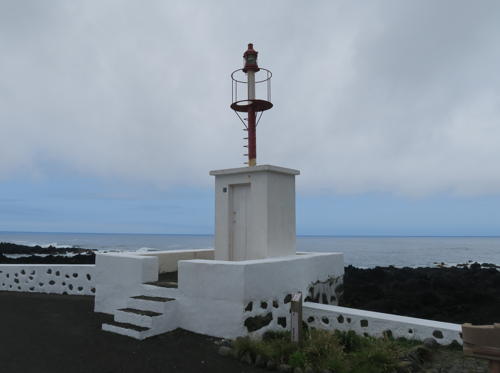
Date unknown. Active; focal 8 m (26 ft); three white flashes every 10 s. 5 m (16 ft) mast, painted with red and white horizontal bands, adjacent to a small square equipment cabinet and mounted on a square concrete base. Harm Carrette's photo is below right, Fernando Almeida has a photo, Daniel Baily has a photo of the light in action, and Google has a distant satellite view. Located on the waterfront of Fajã Grande, the wsternmost village of the Azores, on the central west coast of Flores. Admiralty. D2706; NGA 23292.
** Ponta do Albarnaz
1925. Active; focal plane 104 m (341 ft); white flash every 5 s. 15 m (49 ft) round masonry tower with lantern and gallery, attached to a 1-story keeper's house. 2nd order Fresnel lens. Building painted white; lantern painted red. Jernej Trtnik has a 2022 photo, Detienne has a page for the lighthouse, Trabas has Eckhard Meyer's closeup photo, Fernando Almeida has a closeup photo, Francisco M.S. Botelho has a closeup of the lantern, Huelse has a historic photo, Dario Mauri has a street view, and Google has a satellite view. Detienne has interior photos from a 2019 visit. Located atop a vertical cliff at the northwestern point of the island, about 2.5 km (1.5 mi) west of Ponta Delgada. Site open, lighthouse open on Wednesday afternoons. . ARLHS AZO-016; PT-878; Admiralty D2708; NGA 23316.

Ilha do Corvo Lighthouses
Smallest and northernmost of the Azores, Corvo is about 35 km (22 mi) north northeast of Flores. The population of this rarely-visited island is a little less than 400.

*
Ponta Negra
1910. Active; focal plane 22 m (72 ft); white flash every 5 s. 4 m (13 ft) hexagonal cylindrical concrete tower, painted white. João Jaques has a 2018 photo, Rui Medeiros has a 2020 photo, and Google has a satellite view. There are two old windmills (moinhos) near the lighthouse. Located at the southern point of the island, adjacent to the island's airstrip. Site open, tower closed. Admiralty D2712; NGA 23280.
Canto da Carneira (2)
2002 (station established 1965). Active; focal plane 238 m (781 ft); white flash every 6 s. 8 m (26 ft) round tower with lantern and gallery, painted with horizontal red and white bands. A photo is available, Moses Palermo has a drone view, Trabas has Capt. Peter's very distant view, and Bing has a fuzzy satellite view. Amateur radio operator CT1BWW has posted a small photo of the earlier light. Located at the northeastern point of the island. Site status unknown. ARLHS AZO-005; Admiralty D2714; NGA 23284.


Ponta das Lajes Light, Flores, May 2020
Instagram photo by bitaportfolio


Fajã Grande Light, Flores, July 2021
photo copyright Harm Carrette; used by permission

Information available on lost lighthouses:

Notable faux lighthouses:

Adjoining pages: East: Southern Portugal | South: Madeira

Return to the Lighthouse Directory index | Ratings key

Posted December 29, 2005. Checked and revised July 18, 2024. Lighthouses: 37. Site copyright 2024 Russ Rowlett and the University of North Carolina at Chapel Hill.