Lighthouses of Northeastern Brazil

The Federative Republic of Brazil, the largest country in South America and fifth largest in the world, has a lengthy coastline, a large number of lighthouses, and a distinguished lighthouse history. Colonized by Portugal, Brazil declared its independence in 1822. Uniquely among American nations it was a monarchy as the Empire of Brazil until 1889.

Brazil is a federation of 26 states and a federal district. This page covers lighthouses of the northeastern "corner" of Brazil, including the states of Rio Grande do Norte, Paraíba, Pernambuco, Alagoas, and Sergipe, five of the nine states in Brazil's Northeast Region. Lighthouses of Bahia have a separate page and the North Northeast Coast page lists lighthouses of Maranhão, Piauí, and Ceará. This tropical coastline faces across the South Atlantic Ocean towards Africa and includes the easternmost lighthouses of the Americas. The largest port is Recife in Pernambuco but there are several other important ports. Tourism has increased in the region in recent years, and some of the major lighthouses are becoming better known.

The Portuguese word for a lighthouse is farol, plural faróis. In Brazilian use the word farol generally applies to all light towers, regardless of size and whether they are enclosed structures or not. In Portuguese ilha is an island, ilhéu is an islet, cabo is a cape, ponta is a promontory or point of land, rocha is a rock, recife is a reef, baía is a bay, estreito is a strait, rio is a river, and porto is a port or harbor.

Active lighthouses in Brazil are owned by the navy (Marinha do Brasil) and maintained by the Centro de Auxílios à Navegação Almirante Moraes Rego (CAMR) in the Diretoria de Hidrografia e Navegacão (DHN). Many of the larger lighthouses are staffed by resident keepers or by rotating crews of naval personnel. Only a small number of Brazilian lighthouses are open to the public.

ARLHS numbers are from the ARLHS World List of Lights. BR numbers are from the official Brazilian Lista de Faroís. Admiralty numbers are from volume G of the Admiralty List of Lights & Fog Signals. U.S. NGA numbers are from Publication 110.

General Sources
Faroís Brasileiros
This web site for Brazilian lighthouses has small photos and historical information for many of the major lights.
Online List of Lights - Brazil
Photos by various photographers posted by Alexander Trabas.
Lista de Faróis do Brasil
Index to articles on Brazilian lighthouses in the Portuguese edition of Wikipedia.
Lighthouses in Brazil
Photos various photographers available from Wikimedia.
World of Lighthouses - Brazil
Photos by various photographers available from Lighthouses.net.
Lista de Faróis
Online version of the official Brazilian light list.
Leuchttürme Südamerikas auf historischen Postkarten
Historic postcard views posted by Klaus Huelse.
Navionics Charts
Navigation chart for Brazil.

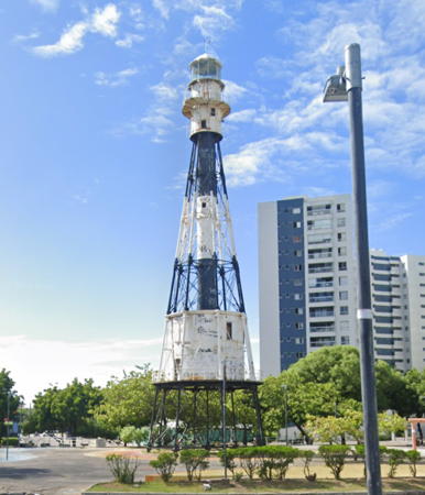
Farol de Olinda
Olinda Light, Olinda, Pernambuco, April 2008
Wikimedia Creative Commons photo by Prefeitura de Olinda

Lighthouses of Rio Grande do Norte

Rio Grande do Norte occupies the northeastern corner of Brazil. Natal is the state capital, the largest city in the state, and the largest port. The name of the state, literally "Great River of the North," refers to the Rio Potenji, which enters the Atlantic at Natal. The islands of the Atol das Rocas are attached administratively to Rio Grande do Norte state; lighthouses of the atoll are listed on the page for Brazil's Atlantic Islands.

North Coast (Macau Area) Lighthouses
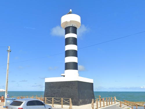
* Pontal (Areia Branca)
Date unknown. Active; focal plane 10 m (33 ft); white flash every 6 s. 8 m (26 ft) round cylindrical fiberglass tower, colored with black and white horizontal bands. Wikimedia has a 2006 view from the sea by Allan Patrick. Using Google Historical Images Jim Smith found that this light was moved about 100 m (330 ft) northeast around 2014 to escape beach erosion. Bing has a satellite view of the old location (the new location is in the upper right corner) and Google has a satellite view of the new one. Emilio Dioley has a 2022 photo of the relocated light. Areia Branca means "white sand," and the area is well known for its magnificent beaches. Located just off the beach on the east side of the entrance to the Rio Apodi and Areia Branca. Site open, tower closed. BR-0946; Admiralty G0152.5; NGA 17810.
* [Areia Branca (Ponta Upanema)]
Date unknown. Active; focal plane 14 m (46 ft); three red flashes every 15 s. 11 m (36 ft) white post. Google has a street view and Bing has a satellite view. Located at the intersection of the Rua da Praia and Rua do Farol on the Areia Branca beachfront. Site open, tower closed. BR-0948; Admiralty G0152; NGA 17812.
* Ponta do Mel
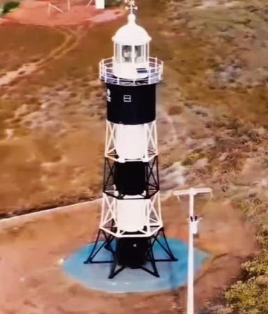
1898. Active; focal plane 106 m (348 ft); white light, on 3.5 s once every 30 s. 14 m (46 ft) cast iron skeletal tower with central cylinder, painted with black and white horizontal bands. The light station has a resident keeper. Kênia Castro's photo appears at right, Eilano Silva has a 2018 photo, an April 2007 photo is available, Elizama Oliveira has a 2023 photo, and Google has a street view and a satellite view. This lighthouse was prefabricated in France. Accessible by an unpaved road, but the entrance from the RN 404 highway is unmarked. Located about 650 m (0.4 mi) back from the beach on a headland about 80 km (50 mi) east of Areia Branca in western Rio Grande do Norte. Site open, tower closed. ARLHS BRA-174; BR-0960; Admiralty G0154; NGA 17816.
* Macau
Date unknown. Active; focal plane 18 m (59 ft); white flash every 6 s. 17 m (56 ft) square pyramidal concrete tower with gallery, carrying a round water tank and the lightbeacon on a post. The tower is white concrete; the tank is blue. This light is part of a sea salt production facility. No photo available but Google has a satellite view. Located at Macau. Site open, tower closed. Site manager: Salinas do Noreste, S.A. ARLHS BRA-149; BR-0976; Admiralty G0156; NGA 17824.
Farol do Mel
Ponta do Mel Light, Areia Branca, November 2006
Flickr Creative Commons photo by Kênia Castro
Alagamar
Date unknown. Active; focal plane 10 m (33 ft); whte flash every 6 s. 8 m (26 ft) square cylindrical masonry tower painted with black and white horizontal bands. Alef Kennedy has a 2020 photo, Ribamar Couto has a 2021 photo, and Google has a distant satellite view. Located on the west side of an inlet a short distance east of Macau. Site status unknown. BR-0977; Admiralty G0156.2.
* Galinhos
Date unknown (station established 1931). Active (?); focal plane 14 m (46 ft); white flash every 10 s. 13 m (43 ft) round cylindrical concrete tower with gallery, painted with horizontal red and white bands. No lantern. Carla Salgueiro has a photo, Alex Uchôa has a photo, Wikimedia has Mariana Othon's photo, Claudio Molina has a street view from the beach, and Google has a satellite view. This endangered lighthouse is in the water at high tide. It is still standing in Amarildo Varela's 2023 photo. No solar panels are seen in the photo. Located on the beach on a sandy point north of Galinhos and about 25 km (15 mi) west of Caiçara. Site open, tower closed. ARLHS BRA-036; BR-0980; Admiralty G0158; NGA 17828.
* Santo Alberto (Caiçara) (2)
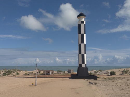
Date unknown (station established 1908). Active; focal plane 42 m (138 ft); two white flashes every 15 s. 38 m (125 ft) octagonal concrete tower with gallery, painted in a black and white checkerboard pattern. A photo is at right, Jacira A. C. Ramos has a 2017 view of the lighthouse, Lousiane Melo has a photo, and Google has a street view and a satellite view. Located on the beach at Caiçara do Norte, about 160 km (100 mi) northwest of Natal. Site open, tower closed. . ARLHS BRA-189; BR-0984; Admiralty G0162; NGA 17832.

Santo Alberto Light, Caiçara do Norte, March 2018
Google Maps photo by Careca Weve


Cabo de São Roque Lighthouses

The Cabo de São Roque, the northeastern tip of South America, does not have a sharp point. It is instead a gentle curve about 25 km (15 mi) long starting north of Touros and extending south of Rio do Fogo. For Europeans the cape was discovered by André Gonçalves and Amerigo Vespucci in 1501.
*** Calcanhar (Touros) (3)
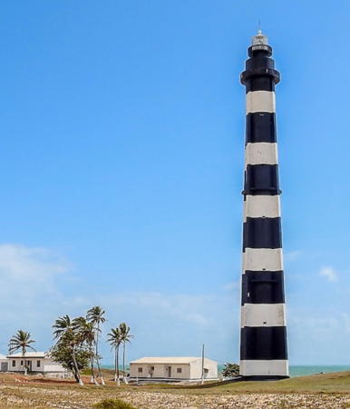
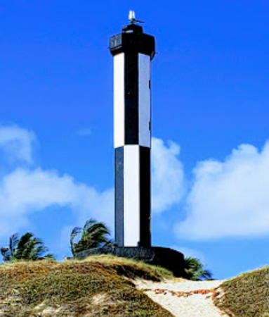
1943 (station established 1912). Active; focal plane 74 m (243 ft); white flash every 10 s. 62 m (203 ft) round cylindrical concrete tower with four ribs and lantern, painted with black and white horizontal bands. Several 1-story keeper's houses; the light station has a resident keeper. A photo by Thyrone Domingos is at right, Vicki Harris also has a photo, Marcos Delmar has a 2010 photo, Claudio Landim has a 2022 photo, Alex Uchôa has a portfolio of photos, and Google has a street view and a satellite view. This great lighthouse deserves to be better known: until the completion of the new Mucuripe lighthouse (see the North Northeast Coast page) it was Brazil's tallest traditional lighthouse and one of the tallest concrete lighthouses in the world. It marks a headland near the northern end of the great curve of the Cabo de São Roque, the northeastern shoulder of South America. The original 50 m (164 ft) cast iron lighthouse was replaced by a 52 m (171 ft) cast iron tower in 1937. This tower suffered from "excessive vibration" and was replaced after only a few years. Located on the beach of the Ponta de Calcanhar at Touros, 105 km (65 mi) north of Natal. Site open, tower open daily 9 am to 11 am. . ARLHS BRA-258; BR-1100; Admiralty G0164; NGA 17836.
* [Punta Gameleira]
Date unknown. Active; focal plane 27 m (89 ft); flash every 6 s, white or red depending on direction. 6 m (20 ft) square cylindrical concrete tower, painted black with one white horizontal band. Marcos Santos has a 2018 photo and Google has a satellite view and a distant street view. This light guides vessels entering the Canal (Channel) de São Roque, a channel around the cape protected by offshore reefs. Located about 5 km (3 mi) southeast of Touros. Site open, tower closed. ARLHS BRA-133; BR-1120; Admiralty G0166; NGA 17840.
Baixio de Rio do Fogo (2?)
Date unknown (station established 1932). Active; focal plane 12 m (39 ft); red flash every 6 s. 12 m (39 ft) square cylindrical concrete tower, painted with red and white horizontal bands. No lantern. Victor Azevedo has a photo and Laramy Costa has a photo but the light is not shown in Bing's satellite view. The stump of an older beacon is next to the present lighthouse. Located on a shoal (baixio) about 5 km (3 mi) off Rio do Fogo and about 15 km (10 mi) southeast of Touros. Site open, tower closed. ARLHS BRA-256; BR-1124; Admiralty G0168; NGA 17844.
Baixio de Teresa Pança (Maracajaú)
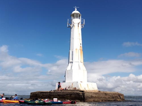
1940. Active; focal plane 20 m (67 ft); white flash every 6 s. 10 m (33 ft) round cylindrical concrete tower with gallery but no lantern, painted with black and white horizontal bands. Xóstenes Medeiros has a closeup photo, Thyrone Domingos has a view from the shore, and Google has a satellite view. Located on a shoal 2 km (1.2 mi) offshore from Maracajaú at the southern end of the Canal (Channel) de São Roque. Accessible only by boat. Site status unknown. ARLHS BRA-201; BR-1128; Admiralty G0170; NGA 17848.
Farol de Calcanhar
Calcanhar Light, Touros, March 2008
Wikimedia Creative Commons photo by Thyrone Domingos
* São Roque (2)
Date unknown (station established 1911). Active; focal plane 50 m (164 ft); three white flashes every 10 s. 32 m (105 ft) square cylindrical concrete skeletal tower, lowest section enclosed, painted with red and white horizontal bands. No lantern. Marcos André Madeira has a closeup photo, Aóstenes Medeiros has a 2018 photo, Wagner Pereira has a nice 2013 view, Fabiano Chiarella has a 2022 photo, and Google has a satellite view. The original lighthouse was a 12 m (39 ft) cast iron tower. Located at the southern end of the Cabo de São Roque about 30 km (20 mi) north of Natal. Site open, tower closed. . ARLHS BRA-017; BR-1132; Admiralty G0172; NGA 17852.

East Coast (Natal Area) Lighthouses
Natal is the capital and largest city of Rio Grande do Norte, with a population approaching one million. Its port is known for shipping seafood.
* [Pedra Baixinha]
Date unknown. Active; focal plane 8 m (26 ft); red flash every 6 s. 6 m (20 ft) concrete tripod tower. Entire tower is red. A 2019 photo is available, Wikimedia has two photos and Google has a street view and a satellite view. Located just off the end of the west breakwater to the Rio Potenji estuary, Natal's harbor. Accessible by walking or biking the pier. Site open, tower closed. Admiralty G0180; BR-1136; NGA 17864.
* [Potengi (Pedra do Rosário)]
Date unknown. Active; focal plane 7 m (23 ft); green flash every 3 s. 5 m (16 ft) square concrete tower painted with green and white horizontal bands. Adjacent to the light is a tall column carrying a statue of Nossa Senhora da Apresentação (Our Lady of Presentation), traditional patron saint of Natal. Laercio Sousa has a photo and Google has a satellite view. Located on a plaza (the Pedra do Rosário or Rosario Stone) overlooking the Rio Potengi in downdown Natal. Site open, tower closed. BR-1164; Admiralty G0180.6; NGA 17872.
Recife de Natal
Date unknown. Active; focal plane 13 m (43 ft); green flash every 5 s. 10 m (33 ft) square cylindrical concrete tower rising from a small 1-story concrete equipment room. Entire lighthouse painted green. Wikimedia has a photo, Claudemir Souza has a photo, Adriana Nascimento has a distant view, and Google has a satellite view and a distant street view. This light replaced a tower built on the ramparts of the nearby Forte dos Reis Magos in 1872. Located on a reef (recife) that serves as the natural east breakwater at the entrance to Natal's harbor. Accessible only by boat. Site open, tower closed. BR-1140; Admiralty G0178; NGA 17860.
** Natal (Mãe Luíza)
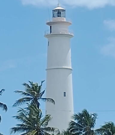
1922. Active; focal plane 87 m (285 ft); five white flashes, separated by 2 s, every 25 s. 37 m (121 ft) round brick tower with lantern and double gallery; entire lighthouse painted white. Light station staffed by navy crews. 3rd order Fresnel lens in use. Lluis Caipirinhobo's photo is at right, Wikimedia has several photos, Wagner Pereira has a 2022 photo, another good photo is available, and Google has a street view and a satellite view. This is a powerful light with a range of 39 nautical miles (72 km, 45 mi). Mãe Luíza (Mother Louise) was a parteira (midwife) who ministered to the poor of Natal in the early 1900s. Her name was applied first to the neighborhood in which she lived, and then to the lighthouse in that neighborhood. Located on a bluff in the city of Natal, capital of Rio Grande do Norte. Site normally closed (gated) but site and tower open Sunday afternoons 2 pm to 5 pm. . ARLHS BRA-161; BR-1176; Admiralty G0177; NGA 17856.

Mãe Luiza Light, Natal, February 2011
Google Maps photo by Lluis Caipirinhobo
* Ponta da Tabatinga
Date unknown. Active; focal plane 96 m (315 ft); five white flashes every 60 s. 81 m (266 ft) round cylindrical white concrete communications tower. Leonardo Vianna has a view from the sea and Google has a closeup street view and a satellite view. This interesting structure is Brazil's tallest light tower, but it appears to have been built primarily as a communications tower rather than as a lighthouse. Located atop dunes on a promontory about 35 km (22 mi) south of Natal. Site open, tower closed. BR-1190; Admiralty G0183; NGA 17882.
* Bacopari
Date unknown (station established 1919). Active; focal plane 30 m (98 ft); two white flashes every 10 s. 17 m (56 ft) octagonal cylindrical stone tower with gallery, painted in a black and white checkerboard pattern. Tarciso Balthazar De Oliveira's photo is at right, Wikimedia has a photo, Mauricio Alves has a photo, José Duarte has a closeup, a view from the beach is available, Rafael Araujo has a street view, and Google has a satellite view. Located on the beach of the Cabo de Bacopari in Baía Formosa, about 100 km (60 mi) south of Natal. Site open, tower closed. . ARLHS BRA-014; BR-1192; Admiralty G0184; NGA 17884.

Lighthouses of Paraíba

Paraíba is named for the river of the same name, which means "hard to navigate" in the Tupi language. The state has only a short coastline north and south of the river.

Baía de Traição
1923. Active; focal plane 12 m (39 ft); white flash every 6 s. 10 m (33 ft) square pyramidal concrete tower. Luidivan Maximo has a closeup photo, Rosário Martins has a photo, Giovanna Gaspari has a distant view, and Google has a satellite view and a distant street view from the beach. Located on the reef that shelters the harbor of Baía de Traição. Accessible only by boat. Site open, tower closed. ARLHS BRA-204; BR-1196; Admiralty G0186; NGA 17888.

Bacopari Light, Baía Formosa, November 2019
Google Maps photo by Tarciso Balthazar De Oliveira
Pedra Seca
1873. Active; focal plane 16 m (52 ft); three white flashes every 10 s. 15 m (49 ft) octagonal cast iron tower on a square concrete base. Faroís Brasileiros has a page for the lighthouse, Trabas has Capt. Peter Mosselberger's photo, Wikimedia has photos, Lando Gomes has a 2015 closeup photo, José Leite has a 2021 photo, and Google has a satellite view. The survival of this historic lighthouse, one of nine cast iron lighthouses prefabricated for Brazil by P & W McLellan of Glasgow, Scotland, is remarkable. Originally built on land some 400 m (1300 ft) from the water, the tower is now 1500 m (0.9 mi) offshore. In 2003 the lighthouse was restored by the Paraíba Port Captain's office. Located off the Ponta de Mato at the mouth of the Rio Paraíba, marking the entrance to the port of Cabedelo, about 32 km (20 mi) north of João Passoa. Accessible only by boat but easily visible from the beach. Site open, tower closed. . ARLHS BRA-165; BR-1236; Admiralty G0188; NGA 17892.
* Cabo Branco
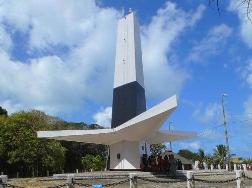
1972. Active; focal plane 46 m (151 ft); one long (1.3 s) white flash every 10 s. 18 m (59 ft) triangular concrete tower with three pointed, wing-like projections about 3.5 m (12 ft) above the ground. No lantern. Lighthouse painted white with a horizontal black band just above the wings. A photo by Enio Prado is at right, Faroís Brasileiros has a page for the lighthouse, Wikimedia has several photos, a 2017 photo is available, Angela Silva has a 2018 photo, and Google has a street view and a satellite view. This modern tower is as much sculpture as lighthouse; it was designed by Pedro Abraão Dieb to resemble a sisal plant, one of Paraíba's most important plants. Standing in longitude 34° 47' 38" W, it marks the easternmost point on the mainland of the Americas. Surrounded by a municipal park, the lighthouse is one of the best known tourist attractions of Paraíba, with parking and souvenir shops. Unfortunately the lighthouse is now endangered by erosion of the shoreline. Located atop a steep bluff on the Ponta de Seixas, the easternmost point of Cabo Branco, about 15 km (10 mi) east of João Pessoa, the capital of Paraíba. Site open, tower closed. . ARLHS BRA-015; BR-1256; Admiralty G0190; NGA 17904.

Cabo Branco Light, João Pessoa, November 2020
Wikimedia Creative Commons photo by enipprado

Lighthouses of Pernambuco

The coastline of Pernambuco is about 190 km (120 mi) in length, much of it being sandy beaches. Recife is the major port in the state and the fourth largest city of Brazil with more than four million residents. The islands of Fernando de Noronha and the St. Peter and St. Paul Rocks are also attached administratively to Pernambuco state; lighthouses of these islands are listed on the page for Brazil's Atlantic Islands.

* [Ponta de Pedras]
Date unknown. Active; focal plane 56 m (184 ft); three white flashes every 15 s. 7 m (23 ft) triangular skeletal tower, upper 2/3 enclosed by a white metal daymark. Pedro Rocha has a 2019 closeup photo, Cícero Oliveira has another closeup, Marcus Paiva has a 2022 photo, and Google has a satellite view. Despite its small size this is considered to be a major coastal light. Located on a hillside above the town of Ponta de Pedras about 30 km (19 mi) north of Olinda. Site open, tower closed. BR-1264; Admiralty G0192; NGA 17908.
** Olinda (2)
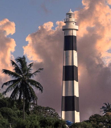
1941 (station established 1872). Active; focal plane 90 m (295 ft); two white flashes, separated by 7.5 s, every 35 s. 42 m (138 ft) round concrete tower buttressed with four ribs. Lighthouse painted with black and white horizontal bands; lantern is white. This lighthouse is one of the best known landmarks of Olinda and one of the few Brazilian lighthouses open to tourists. The city's photo appears at the top of this page, Dennis Knake has a photo, Silva de Medeiros has a 2018 photo, Lidiane Fernandes has a nice photo, Trabas has Rainer Arndt's fuzzy photo, and Google has a street view and a satellite view. The original lighthouse was a 12.5 m (41 ft) wrought iron tower built in the fortress of São Francisco de Olinda. Located on a steep bluff north of the commercial center of Olinda, about 7 km (4.5 mi) north of Recife. Site open; tower open 2-5 pm on Saturdays, Sundays, and holidays. . ARLHS BRA-068; BR-1272; Admiralty G0202; NGA 17912.
Recife Banco Inglês Breakwater North Head
Date unknown. Active; focal plane 12 m (39 ft); green flash every 6 s. 7 m (23 ft) square concrete tower. Entire lighthouse is green. No photo available but Google has a satellite view. Located at the north end of the deatched Banco Inglês Breakwater protecting the entrance to Recife. Accessible only by boat. Site open, tower closed. BR-1284; Admiralty G0205; NGA 17932.
Recife Banco Inglês Breakwater South Head
Date unknown. Active; focal plane 12 m (39 ft); red flash every 6 s. 7 m (23 ft) square concrete tower painted with red and white horizontal bands. Robson Alexandre da Silva has a closeup photo and Google has a satellite view. Located at the south end of the deatched Banco Inglês Breakwater protecting the entrance to Recife. Accessible only by boat. Site open, tower closed. BR-1288; Admiralty G0205.4; NGA 17936.
Recife North Breakwater
Date unknown. Active; focal plane 12 m (39 ft); red light, 2 s on, 6 s off. 9 m (30 ft) round concrete tower, painted red. A stairway spirals around the tower. Pedro Valadares has a photo, Eronnunes Soares has a photo, and Google has a satellite view. Located at the end of the north breakwater of Recife harbor. Accessible only by boat. Site status unknown. BR-1296; Admiralty G0208; NGA 17944.
* Recife South Breakwater
Date unknown. Active; focal plane 12 m (39 ft); green light, 2 s on, 6 s off. 11 m (36 ft) round concrete tower, painted green. A stairway spirals around the tower. Beatriz Barbosa has a closeup photo, Glimaldo Penaforte Chaves has another photo, Zaca Arruda has a 2020 street view, and Google has a satellite view. Located at the end of the south breakwater of Recife harbor, about 1.2 km (3/4 mi) north of the historic lighthouse (next entry). It's possible to drive half the length of this pier and walk the rest of the way. Site open, tower closed. BR-1300; Admiralty G0206; NGA 17948.
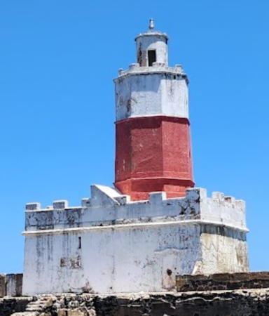
* Recife
1821. Reactivated (inactive 1931-32 and 1938-45); focal plane 20 m (66 ft); two flashes, one white and one red, every 12 s. 18 m (59 ft) octagonal castellated masonry tower on a square concrete base, upper half painted white and lower half red. Rodrigo Cantarelli's photo is at right, Faroís Brasileiros has a page for the lighthouse, an excellent closeup is available, Trabas has Rainer Arndt's photo, Alcimar Veríssimo has a photo, Zaca Arruda has a 2020 closeup street view, and Google has a satellite view. The lighthouse was built on the ruins of a Portuguese fort built in the 1590s. The light was deactivated in 1931 but reactivated the following year with a new lantern and lens. In 1938 the light was moved to the port captain's office, but it was returned to the historic tower in 1945. Located near the end of a natural breakwater on the north side of the city, close to a sculpture park. It's possible to drive half the length of this pier and walk the rest of the way. Site open, tower closed. . ARLHS BRA-087; BR-1304; Admiralty G0204; NGA 17920.
* [Cabo de Santo Agostinho (Nazaré) (1)]
1884. Inactive since the early 1940s. The lighthouse, a cast iron tripod tower similar to the surviving Faro Cabo San Antonio in Argentina, was demolished, but the ruined 2-story stone keeper's quarters is barely standing. André Gadelha has a photo and Google has a satellite view. Located on the point of the cape near the town of Nazaré about 40 km (25 mi) south of Recife. Site appears open. ARLHS BRA-265.

Farol de Recife
Recife Light, Recife, February 2009
Wikimedia Creative Commons photo by Rodrigo Cantarelli

* Cabo de Santo Agostinho (Nazaré) (2)
Early 1940s (station established 1884). Active; focal plane 91 m (299 ft); white flash every 10 s. 15 m (49 ft) round cylindrical concrete tower with gallery, painted white. Fernando Verçosa has a good photo, Pedro Valadares also has a photo, Jackson Godoy has a 2019 photo, and Google has a street view and a satellite view. Located on the heights above the original light station, near the town of Nazaré about 40 km (25 mi) south of Recife. Site open, tower closed. ARLHS BRA-016; BR-1328; Admiralty G0212; NGA 17960.
* Tamandaré (Santo Inácio) (2)
1933 (station established 1902). Active; focal plane 27 m (89 ft); three white flashes every 10 s. 22 m (72 ft) round cylindrical concrete tower with lantern and gallery, painted white. Renan Cavichi has a 2009 photo, another photo is available, and Google has a street view and a satellite view. The lighthouse stands at the southwest corner of the historic Forte do Santo Inácio; Wikimedia has a photo of the fort and lighthouse. The original lighthouse was a cast iron tower. Located at Tamandaré, about 50 km (30 mi) southwest of Cabo de Santo Agostinho. Accessible by road. Site open, tower closed. ARLHS BRA-102; BR-1348; Admiralty G0214; NGA 17964.

Lighthouses of Alagoas

Alagoas is a relatively small state known for its fine beaches. The state capital Maceió, with a population of about one million, is the largest city and the only major port.

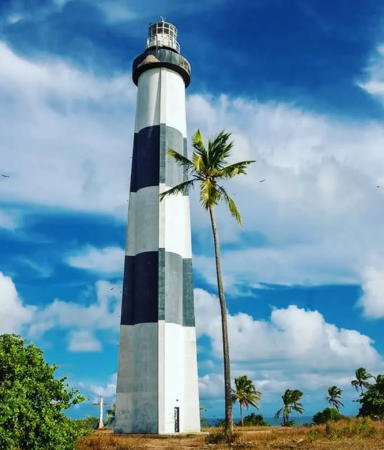
* Porto de Pedras (2)
1940 (station established 1933). Active; focal plane 90 m (295 ft); two white flashes every 15 s. 36 m (118 ft) round cylindrical concrete tower with lantern and gallery, buttressed with four ribs. Lighthouse painted with black and white horizontal bands; lantern is white. A 2022 photo is at right, another good photo is available, Isis Alves has another good photo, Valdir Pedrosa has a photo, Kahyo Lavoisier has a 2022 photo, Trabas has Captain Theo Hinrich's view from the sea, Renan Souza has a street view, and Google has a more distant street view and a satellite view. Sibling of Farol Olinda (see above). Ruins of the base of the original lighthouse are at the foot of the tower. Located on a steep hill, back from the beach, in Porto de Pedras in northern Alagoas, about 65 miles northeast of Maceió. Site open, tower closed. . ARLHS BRA-083; BR-1352; Admiralty G0218; NGA 17968.


Porto de Pedras Light, Porto de Pedras, November 2022
Instagram photo by agenciatripdosmilagres

* Ponta Verde
1949(?) (station established 1922). Active; focal plane 13 m (43 ft); long (2 s) white flash every 10 s. 11 m (36 ft) round masonry tower with gallery but no lantern, mounted on a concrete base. Lighthouse painted with red and white horizontal bands. Trabas has Capt. Peter Mosselberger's closeup photo, Wikimedia has photos, Paulo Cesar has a closeup 2022 street view, and Google has a satellite view. Ponta Verde is a point of land in the city of Maceió; the lighthouse is located in the surf off the point. Accessible only by boat. Site and tower closed. ARLHS BRA-178; BR-1360; Admiralty G0220; NGA 17972.
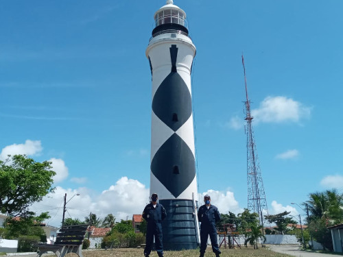
* Maceió (2)
1951 (station established 1857). Active; focal plane 68 m (223 ft); flash every 10 s, alternating red and white. 26 m (85 ft) round masonry tower with lantern and gallery, painted in a black and white diamond pattern; lantern painted black with a white roof. The photo at right was taken by a team from the Alagoas Port Captain's office carried out preventive maintenance on the lighthouse. Sergio Falcetti has a photo, Wikimedia has a photo, Trabas has a photo by Capt. Theo Hinrichs, and Google has a street view and a satellite view. The original lighthouse was a 22 m (72 ft) round stone tower with lantern and gallery. Located on the Alta da Boa Vista, a prominent hill in Maceió, the capital of Alagoas. Site open, tower closed. ARLHS BRA-063; BR-1364; Admiralty G0222; NGA 17976.
Porto de Maceió
Date unknown. Active; focal plane 20 m (66 ft); three white flashes every 12 s. 15 m (49 ft) round barbell-shaped fiberglass tower with a small lantern and mounted on a square concrete base. Upper half of the tower painted white, lower half red. Trabas has Capt. Peter Mosselberger's photo, a drone view is available, and Bing has a satellite view. Located on an elbow of the main quay at Maceió. Site status unknown. BR-1378; Admiralty G0222.7.

Maceió Light, Maceió, November 2020
Capitania dos Portos de Alagoas photo
Ponta de Molhe
Date unknown. Active; focal plane 10 m (33 ft); red flash every 5 s. 10 m (33 ft) round cylindrical concrete tower. Trabas has a photo by Capt. Theo Hinrichs and Bing has a satellite view. Located at the end of the main quay at Maceió. Site status unknown. BR-1380; Admiralty G0223; NGA 17984..
Rio São Miguel (Praia do Gunga)
1936. Active; focal plane 15 m (49 ft); white flash every 3 s. 13 m (43 ft) tower: square steel skeletal tower atop a square pyramidal concrete tower with gallery, mounted on a square concrete base. Tower painted white; square base painted red. Alisson Sousa has a 2017 photo, Vany Nascimento da Silva has a beach view, and Google has a satellite view. Located off the Praia do Gunga, a beach south of the mouth of the Rio São Miguel about 8 km (5 mi) south of Barra da São Miguel. Site status unknown. ARLHS BRA-193; BR-1392; Admiralty G0224; NGA 17992.
* Coruripe
1948. Active; focal plane 66 ft; two whte flashes every 15 s. 10 m (33 ft) round cylindrical concrete tower mounted on a square concrete base. The lighthouse, painted with black and white horizontal bands, has a gallery but no lantern. This light is typical of many small, modern Brazilian lighthouses. Tissiana Sousa's photo is at right, Sandra Freire Franco has a 2018 photo, Carlos Nascimento has a 2019 closeup, and Google has a street view and a satellite view. Located on the beach at Ponta Coruripe, about 50 miles southwest of Maceió near the town of Coruripe (sometimes spelled Coruípe). Parking available. ARLHS BRA-030; BR-1396; Admiralty G0226; NGA 17996.
* Peba (São Francisco do Norte) (2) (?)
Date unknown. Active; focal plane 141 ft; white light, 2 s on, 13 s off. 40 m (131 ft) square pyramidal skeletal tower, painted white with a red horizontal band. Felipe Seidi has a distant view, Eliane Silva has a very distant view, Victor Varela has a photo of the base of the tower, and Bing has a satellite view. However Google's satellite view shows this location to be in the surf, so we need information on the fate or status of the lighthouse. Peba is a well-known protected natural area, with a magnificent beach and an extensive dune system, on the north side of the entrance to the Rio São Francisco southeast of Piaçabuçu at the southern edge of Alagoas. Site probably open, tower closed. ARLHS BRA-254; BR-1399.4; Admiralty G0227; NGA 18000.

Coruripe Light, Pontal do Coruripe, January 2006
Wikimedia Creative Commons photo by Tissiana Sousa

Lighthouses of Sergipe

Sergipe is the smallest state in the Brazilian union. Its capital Aracaju is the largest city and only major port in the state.

Peba (São Francisco do Norte, Cabeço) (1)
1856. Inactive, although still listed by the Admiralty. 16 m (52 ft) octagonal tower with lantern and gallery. Gravely endangered: this lighthouse has gone to sea. Already in December 2004 it was leaning and seemed about to fall, as seen in Alberto Gambardella's photo. But it was still standing in a December 2010 photo and in an August 2013 Lightphotos.net photo. Vincent Valentine's 2017 photo shows it standing with a 25° lean and it still standing in a March 2019 photo. Bing has a satellite view. The lighthouse was built in the village of Cabeço on the south (Sergipe) side of the Rio São Francisco. Rapid beach erosion, probably accelerated by the construction of dams on the upper course of the river, destroyed the village in the late 1990s and put the lighthouse in the water. Accessible only by boat, if it still stands. Site open, tower closed. ARLHS BRA-255; Admiralty G0228.
Santa Izabel
Date unknown. Active; focal plane 38 m (125 ft); flash every 10 s, two white flashes followed by one red flash. 31 m (102 ft) round concrete tower carrying a yellow daymark. No lantern; the light is displayed from a short tripod structure atop the building. Trabas has Capt. Peter Mosselberger's photo and Google has a satellite view The building is part of an industrial terminal the ships bulk commodities including wheat, cement, and fertilizer. The light guides ships arriving at a long wharf that extends from in front of the building. The surrounding area of Santa Izabel, near the northern border of Sergipe, is a biological reserve. Site and tower closed. Site manager: Terminal Maritimo Inácio Barbosa. ARLHS BRA-240; BR-1402; Admiralty G0229.5; NGA 18004.
* Aracaju (Sergipe) (2) (Farol Velho)
1888 (station established 1861). Inactive. Approx. 35 m (115 ft) octagonal pyramidal cast iron skeletal tower with central cylinder, lantern, enclosed watchroom, and gallery, incorporating 2-story keeper's quarters. Lighthouse painted with black and white horizontal bands. A photo is at right, Tadeu Cordeiro has a 2009 photo, Ramon Suzart has a photo, Cleber Pereira Jordão has a 2021 photo with a rainbow behind the lighthouse, Huelse has a historic postcard view, and Google has a street view and a satellite view. The original lighthouse, a wood tower, burned in 1884. This tower was prefabricated in France and built under direction of the French engineer Victor Alinquant. Deactivated when its light was blocked by modern skyscrapers, the historic lighthouse was abandoned and became gravely endangered. Rodrigo Brito Soares has a March 2005 photo showing advanced deterioration and Tiago Melo's February 2006 photo shows rusting of the central structure. In September 2007 the city of Aracaju and state of Sergipe agreed on a restoration plan and the work was carried out during 2008-09. Located in a traffic roundabout in the Farolândia district of Aracaju, the capital of Sergipe, about 3 km (1.8 mi) west of the new lighthouse (next entry). Site open, tower closed. . ARLHS BRA-282.


Original Sergipe Light, Aracaju, January 2010
unattributed Google Maps photo

* Aracaju (Sergipe, Coroa do Meio) (3)
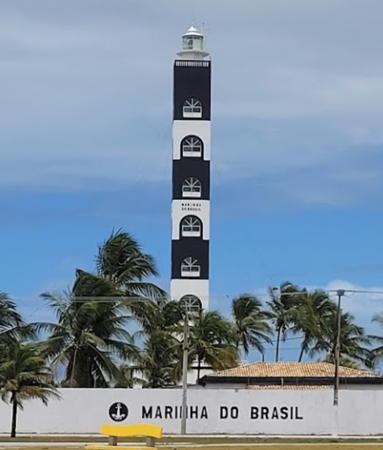
1991 (station established 1861). Active; focal plane 41 m (135 ft); white light, on 30 s, then five long (2.4 s) flashes at intervals of 6 s. 40 m (131 ft) square cylindrical concrete tower mounted on 2-story square concrete base. Tower painted with black and white horizontal bands. Henrique Vicente's photo is at right, Paula Barros has a good photo, Wikimedia has photos, Gisele Rocha has a 2021 photo, Trabas has Capt. Hinrichs's view from the sea, and Google has a street view and a satellite view. Located facing the beach on the Av. Santos Dumont in Coroa de Meio, the seaside district of Aracaju. Site open, tower closed. ARLHS BRA-090; BR-1428; Admiralty G0230; NGA 18010.
* São Cristóvão
Date unknown. Active; focal plane 42 m (138 ft); white light, 2 s on, 18 s off. 40 m (131 ft) square cylindrical concrete tower, painted with white with two narrow red horizontal bands. Alberto Vasconcellos has a 2022 photo, William Franklyn has a 2017 photo, Éder Santos has a photo, and Google has a satellite view. São Cristóvão is a port about 25 km (15 mi) southwest of Aracaju at the mouth of the Rio Vasa Barris. Located at the end of the beachfront road on the north side of the harbor entrance; this road was closed for several years due to beach erosion but it appears to have reopened with a crooked detour. Site open, tower closed. ARLHS BRA-266; BR-1438; Admiralty G0233; NGA 18011.

Information available on lost lighthouses:

  • Natal (Rio Grande do Norte, Forte dos Reis Magos) (1872-1951). This was the original light at Natal, a beacon placed on the wall of the Forte dos Reis Magos (Fort of the Three Kings), the fortress on the south side of the harbor entrance. The Faroís Brasileiros website has a historic photo.The tower was extended by adding a skeletal tower at the top. During World War II the beacon helped guide seaplanes landing in Natal for refueling before or after crossing the Atlantic. The tower was removed but a plaque marks its location on the wall of the fortress.
  • Rio Real (1885-?), north side of the entrance to the river forming the southern border of Sergipe. Described in 1904 as a square tower on four iron columns. The modern light, Mangue Seco, is across the river in Bahia.

Notable faux lighthouses:

Newer Aracaju Light
Newer Sergipe Light, Aracaju, October 2006
Flickr public domain photo by Henrique Pinto

Adjoining pages: North: North Northeast Coast | East: Brazil's Atlantic Islands | South: Bahia

Return to the Lighthouse Directory index | Ratings key

Posted February 16, 2004. Checked and revised May 24, 2023. Lighthouses: 39. Site copyright 2023 Russ Rowlett and the University of North Carolina at Chapel Hill.